
Mostly Mild Through Mid-September
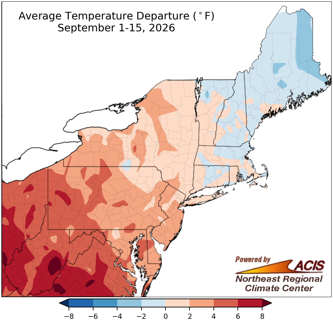
September 1-15 average temperatures ranged from 4°F below normal to more than 8°F above normal.
Parts of New England had a cool start to September, with sections of Maine being as much as 4°F below normal. However, a large portion of the Northeast experienced a warmer-than-normal first half of September, with the greatest departures above normal of over 8°F in portions of West Virginia. In fact, Huntington and Beckley, WV, had their warmest September 1-15 period on record. Twenty-eight of the Northeast's 35 major sites had a warmer-than-normal start to September, with this September 1-15 period ranking among the 20 warmest such periods on record for 18 of the sites. Overall, average temperatures for the period at all the sites ranged from 3.0°F below normal in Caribou, ME, to 8.1°F above normal in Huntington, WV.
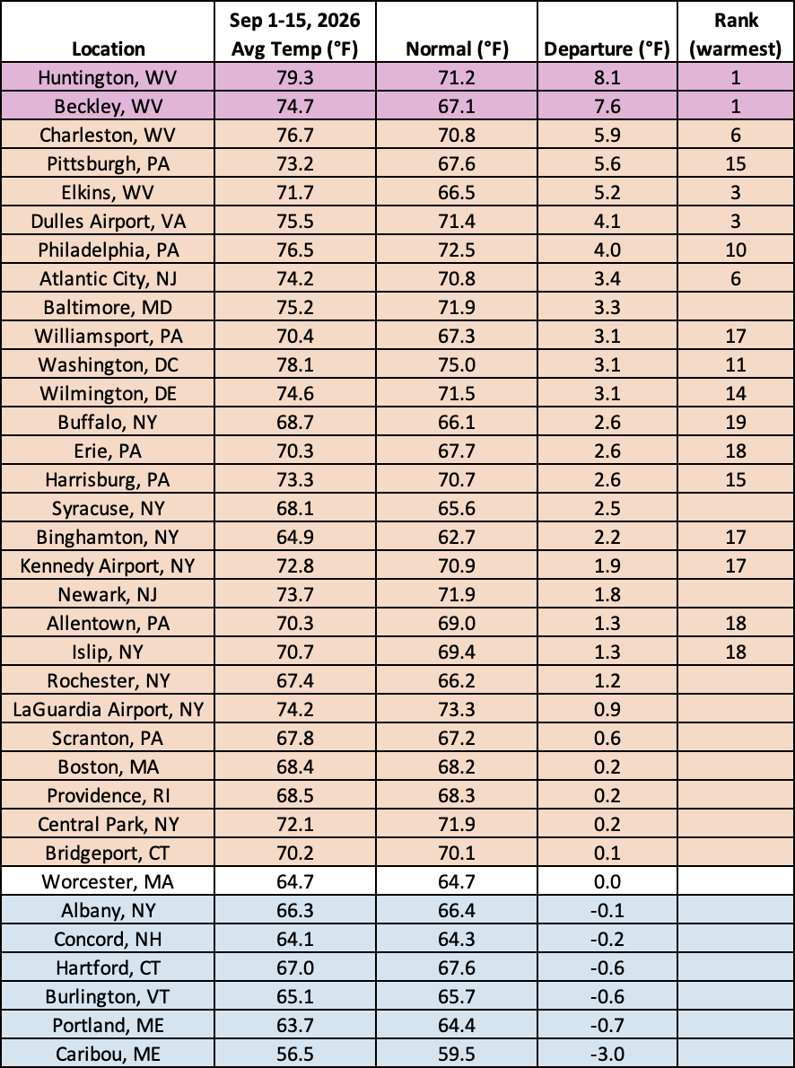
This September 1-15 period was record warm for Huntington and Beckley, WV, and among the 20 warmest for another 16 major sites.
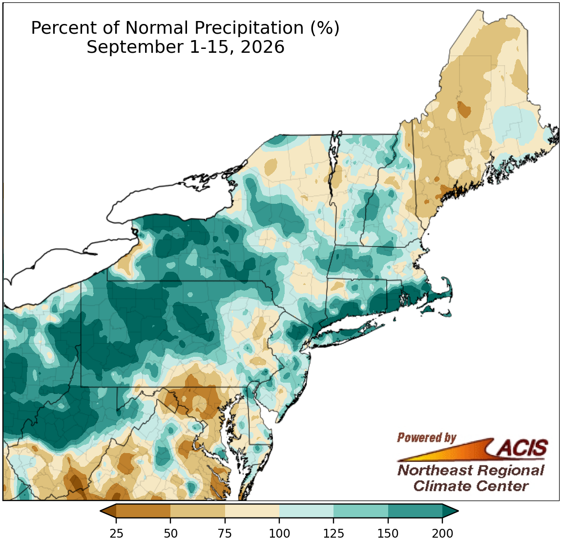
September 1-15 precipitation ranged less than 25% of normal to over 200% of normal.
There was a wide range of precipitation amount during the first half of September, from less than 25% of normal in parts of southern West Virginia to over 200% of normal in multiple locations throughout the Northeast. At the region's 35 major sites, September 1-15 precipitation ranged from 24% of normal in Charleston, WV, to 319% of normal in Bridgeport, CT, with 20 sites being on the wet side of normal. In fact, this first half of September ranked among the 20 wettest such periods for 11 major sites. The wet weather helped chip away at drought in multiple parts of the Northeast. However, drier conditions in Maine allowed drought to intensify there.
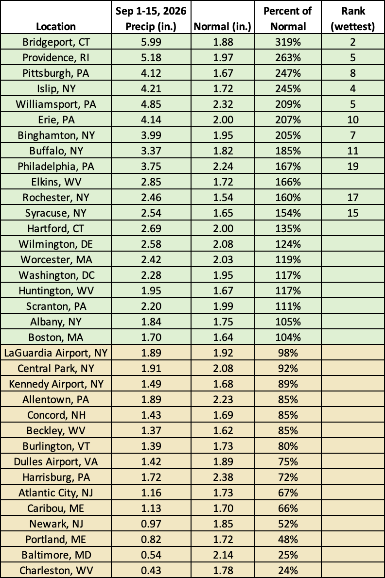
This September 1-15 period ranked among the 20 wettest such periods on record for 11 major sites.