
A Bone-Dry End to October
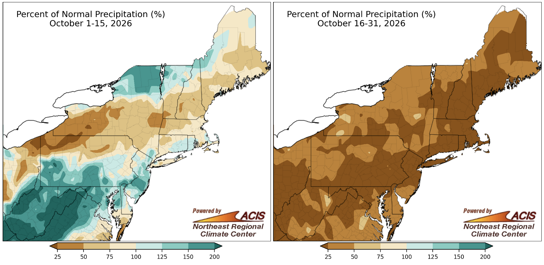
Most of October's precipitation fell during the first half of the month, with a notable dry spell during the second half. Click to enlarge.
The first half of October featured a range of precipitation amounts, from less than 25% of normal in places like northwestern Pennsylvania to over 200% of normal in sections of West Virginia. However, the second half of the month was drier than normal for the entire Northeast, with a large portion of the region seeing less than 25% of normal precipitation. In fact, 27 of the Northeast's 35 major sites did not see measurable precipitation (at least 0.01 inches) from October 18-31. For seven of the sites, it was the first time on record without measurable precipitation for that period. The October 18-31 period was record dry at 26 major sites and ranked among the seven driest such periods for the remaining nine sites.
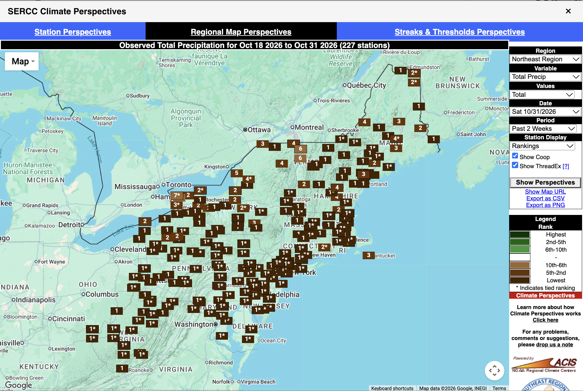
Multiple sites in the Northeast had their driest October 18-31 period on record. Click to enlarge.
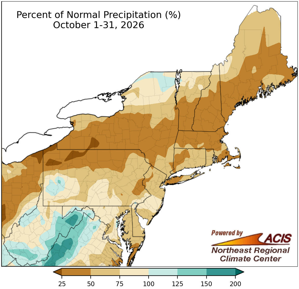
October precipitation ranged from less than 25% of normal to 200% of normal.
Driven by the dry stretch of weather during the second half of October, much of the Northeast wrapped up the month on the dry side of normal. The driest locations, including northwestern Pennsylvania and western New York, saw less than 25% of normal precipitation. However, driven by soaking rains during the first half of October, a few areas, particularly portions of West Virginia, saw up to 200% of normal precipitation. October precipitation at the Northeast's major sites ranged from 25% of normal in Concord, NH, to 124% of normal in Elkins, WV, with most being drier than normal. This October ranked among the 20 driest Octobers for five major sites.
The number of days without measurable precipitation was notable in some areas, ranking among the 10 greatest for October at 15 major sites. For example, Allentown, PA, had 29 days without measurable precipitation during October, tying as its second-greatest number of such days for any month on record. Drought and/or abnormally dry conditions expanded or intensified in places like Maine, western and central New York, and northwestern Pennsylvania, but improved in areas like Connecticut, Massachusetts, and New Hampshire.
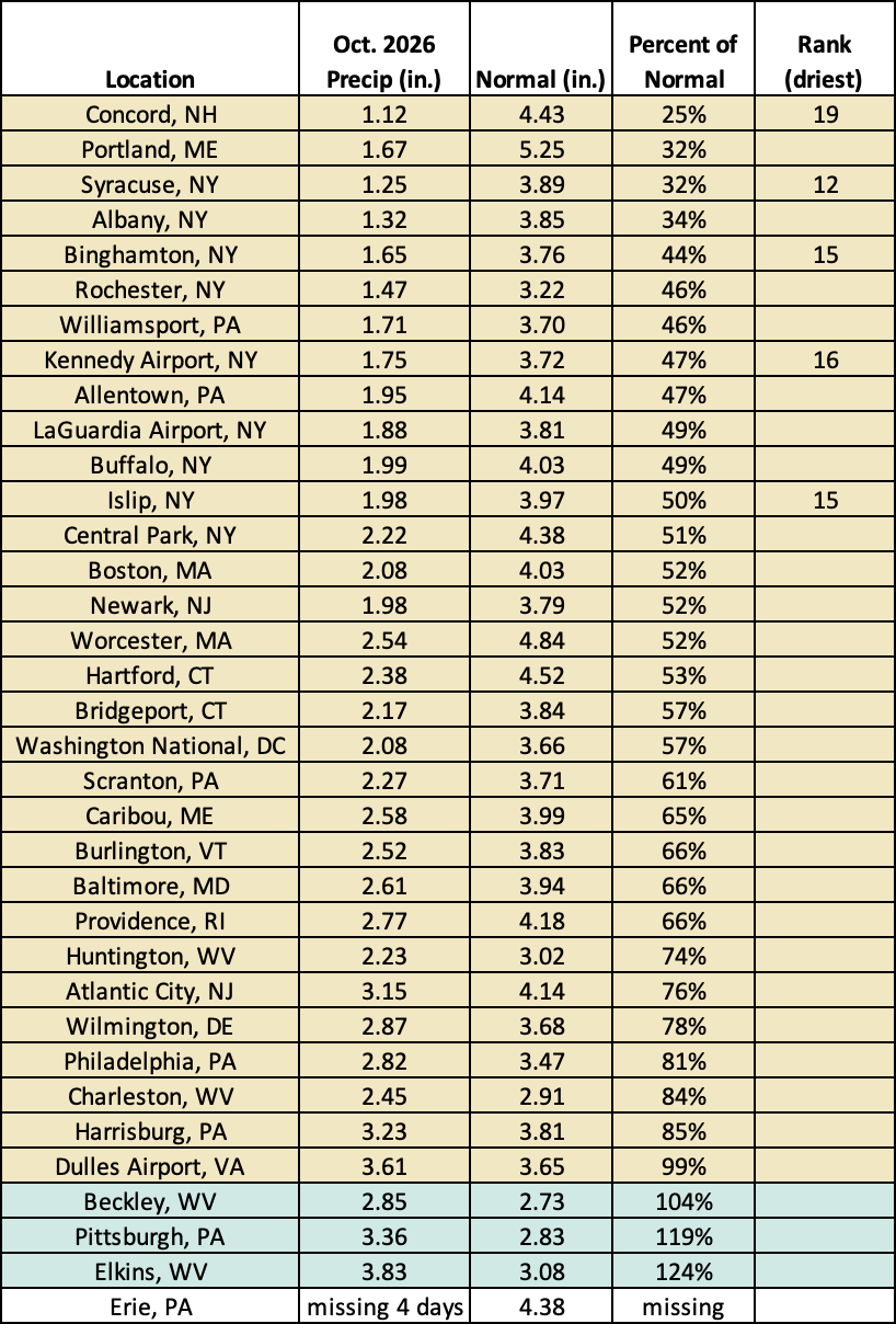
This October ranked among the 20 driest Octobers for five major sites.
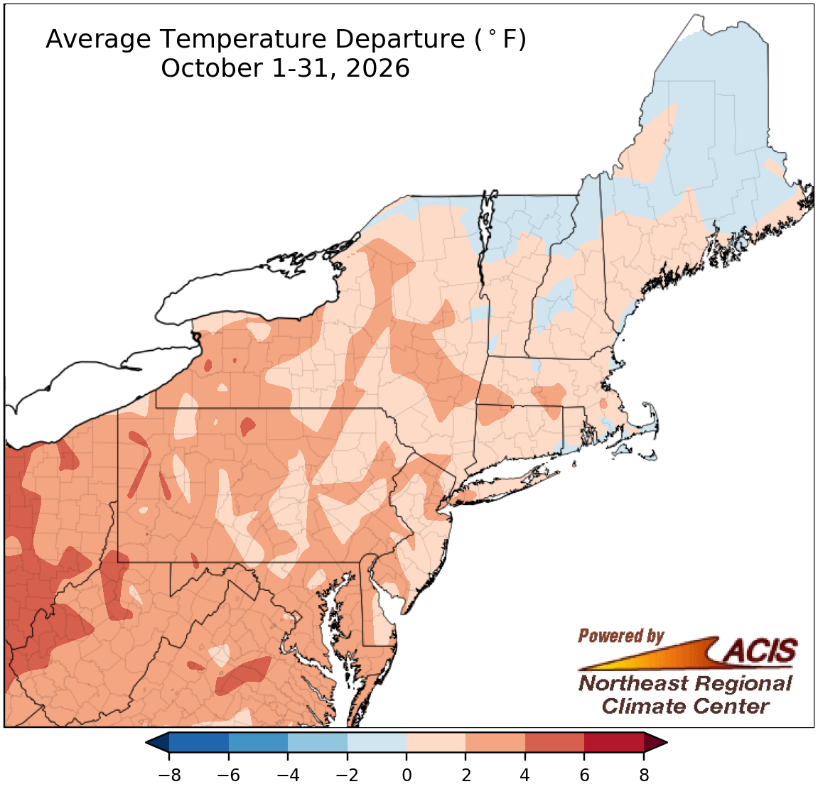
October temperatures ranged from 2°F below normal to 6°F above normal.
Most of the Northeast experienced a warmer-than-normal October, with the greatest departures above normal of over 4°F in places like West Virginia and western Pennsylvania. However, some New England and northern New York locations were as much as 2°F cooler than normal. October average temperatures at the Northeast's 35 major sites ranged from 1.7°F below normal in Caribou, ME, to 4.7°F above normal in Huntington, WV, with 32 of the sites being warmer than normal. This October ranked among the 20 warmest Octobers on record for 14 major sites.
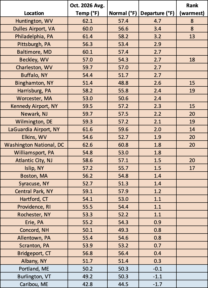
This October ranked among the 20 warmest Octobers on record for 14 major sites.
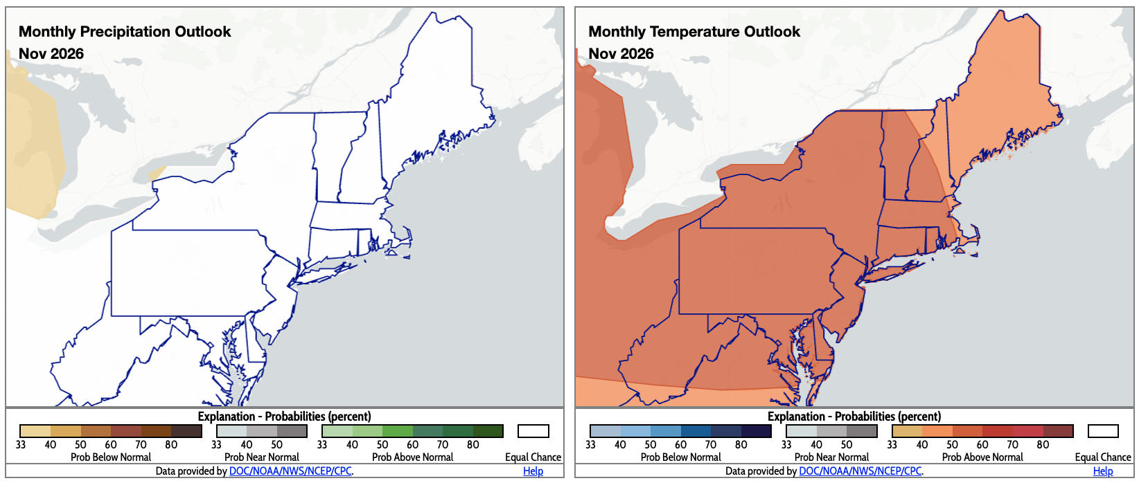
The entire Northeast falls into the equal chances category for precipitation and above normal category for temperatures for November. Click to enlarge.
The November precipitation outlook from NOAA's Climate Prediction Center shows equal chances of below-, near-, or above-normal precipitation for the entire Northeast. Above-normal temperatures are favored for the entire region for November.