
NRCC Blog
Climate summaries, outlooks, and news for the Northeast — 533 posts.
2026
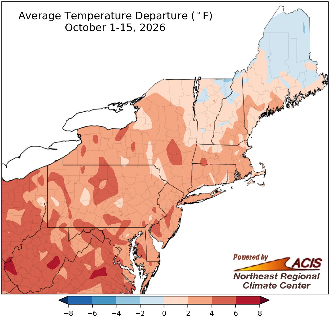 October 16, 2026 October Kicks Off with Warm Weather Temperatures were warmer than normal during the first half of October for most of the Northeast, ranking among the 20 warmest such periods on record for 20 major sites. Precipitation amounts ranged from less than 25% of normal to over 200% of normal, allowing drought to intensify in some areas and improve in others. It was among the 20 wettest starts to October for seven major sites.
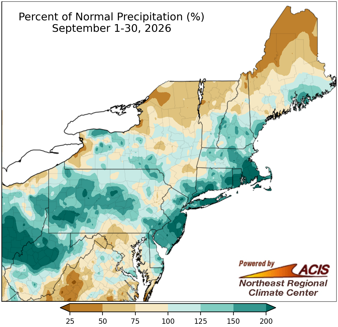 October 1, 2026 The ABCs of September It was quite wet for portions of the Mid-Atlantic, southeastern New York, and southern New England, with Islip, NY, having its wettest September on record. This wetness allowed drought to improve. However, parts of northern New England and upstate New York were drier, with Caribou, ME, having its fifth-driest September. This dryness allowed drought and abnormal dryness to expand. While New England was cooler than normal by as much as 2°F, much of the rest of the Northeast was warmer than normal, with the greatest departures approaching 6°F above normal.
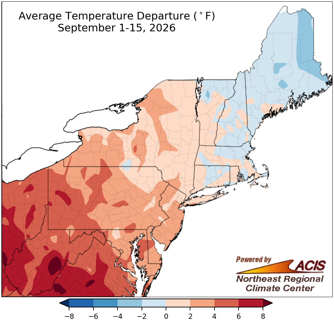 September 16, 2026 Mostly Mild Through Mid-September A large portion of the Northeast experienced warmer-than-normal temperatures during the first half of September. In fact, Huntington and Beckley, WV, had their warmest September 1-15 period on record. Meanwhile, precipitation totals varied, from less than 25% of normal in spots such as Charleston, WV, to over 300% of normal in locations like Bridgeport, CT.
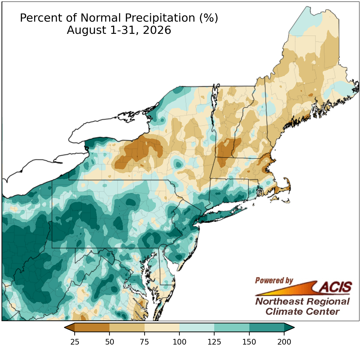 September 1, 2026 The Sun Sets on the Summer Season While precipitation amounts during August and summer varied, a few locations like Charleston, WV, and Bridgeport, CT, experienced record-setting wetness. At the Northeast's 35 major sites, it was among the 20 wettest Augusts on record for 15 major sites and among the 20 wettest summers on record for 14 major sites. Average temperatures for August and summer were on the hot side of normal for much of the Northeast, ranking among the 20 hottest Augusts for 15 major sites and among the 20 hottest summers for 22 major sites.
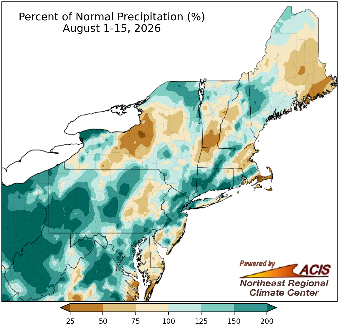 August 17, 2026 First Half of August - Heavy Rain and Hot Weather Multiple parts of the Northeast saw over 200% of normal precipitation during the first half of August, with the period ranking among the 20 wettest such periods on record for 11 of the region's 35 major sites. The region experienced hotter-than-normal weather, with some locations being up to 6°F above normal. It ranked among the 20 hottest starts to August on record for 20 major sites.
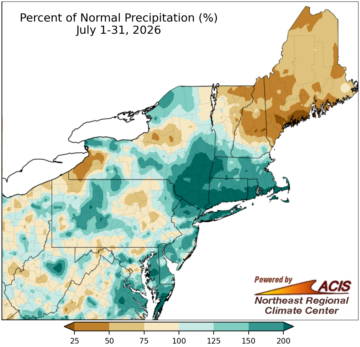 August 3, 2026 A Super Soggy July for Some July rainfall was excessive in portions of southern New England and southeastern New York, with Bridgeport, CT, and Albany, NY, experiencing one of their five all-time wettest months on record. Conversely, raindrops were scarce in Portland, ME, which had its second-driest July since its records began in 1871. Meanwhile, an early-month heat wave pushed July average temperatures to be near- or above-normal for many areas, with this July ranking among the 20 all-time hottest months on record for seven major sites.
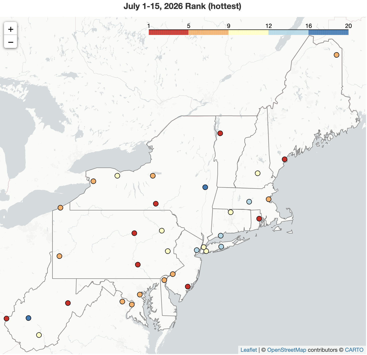 July 16, 2026 A Record Hot, Record Dry Start to July The first half of July was hotter than normal for the entire Northeast, with Elkins, WV, and Atlantic City, NJ, having their hottest such period on record. There were precipitation extremes across the region for the July 1-15 period - from record dry with 1% of normal in Portland, ME, to second wettest with 355% of normal in Bridgeport, CT.
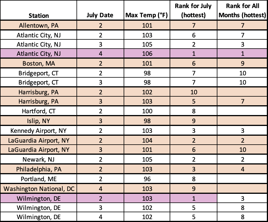 July 8, 2026 Extreme Heat and Severe Storms Usher in July A prolonged heat wave kicked off July, setting records such as all-time hottest temperature, longest streak of days with a high of at least 100°F, and all-time hottest low temperature. Daily severe thunderstorms produced significant wind damage, particularly on July 4 in the Mid-Atlantic.
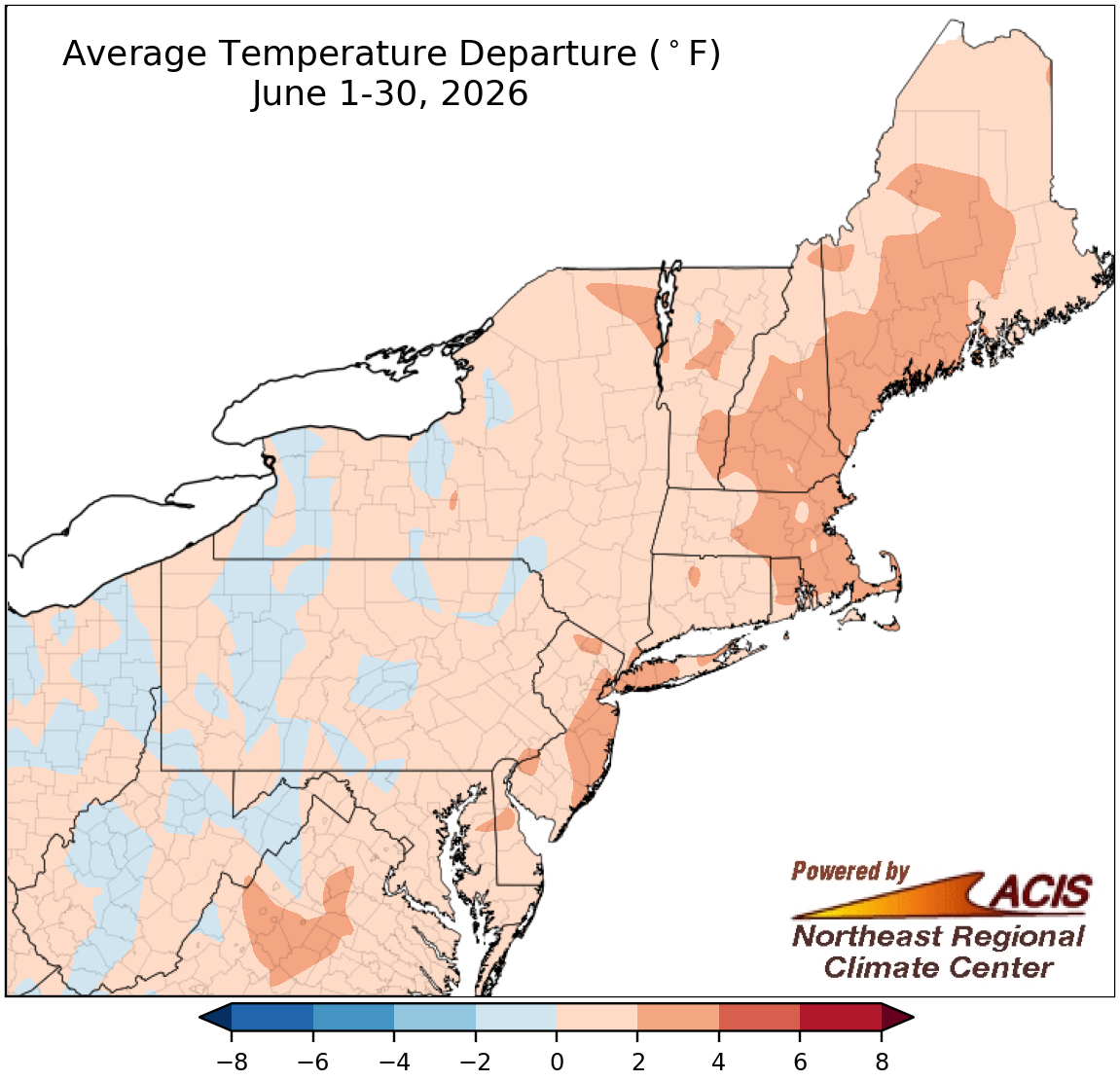 July 1, 2026 Summer Starts off Warm for Most The first month of the summer season wrapped up on the warm side of normal for a large portion of the Northeast. In fact, this June ranked among the 20 hottest Junes on record for 18 of the region's 35 major sites. Precipitation amounts varied, with the month ranking among the 20 driest Junes for seven major sites but among the 20 wettest for four others.
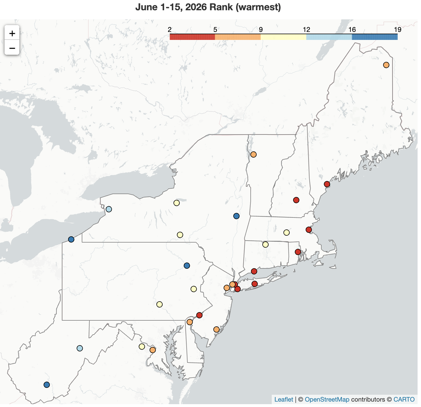 June 16, 2026 A Warm Welcome to Summer The start of the summer season was warmer than normal for the Northeast, with multiple sites experiencing one of their 20 warmest June 1-15 periods. Precipitation amounts varied during the first half of June, ranking among the 20 driest such periods for eight major sites but as the 13th wettest for one other.
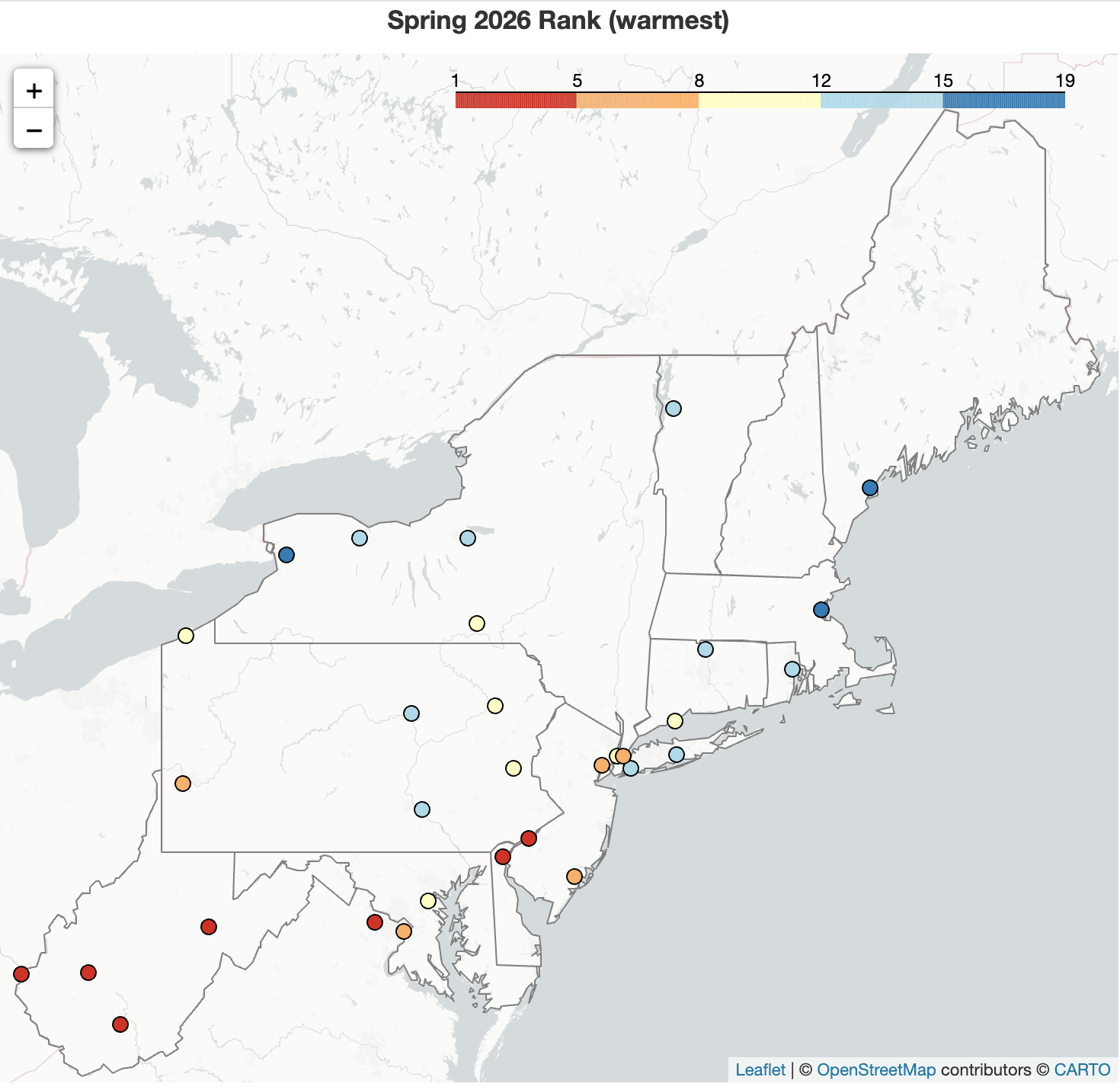 June 1, 2026 Spring - Plenty of Warmth and Little Snow A heat event that featured near record or record temperatures during the second half of May could not compensate for an unusually cool start to the month, leading May to be cooler than normal for many areas. However, March and April were unusually warm, pushing the spring season to be warmer than normal for the Northeast. In fact, it was the warmest spring on record for Huntington and Elkins, WV, and among the 20 warmest springs for another 29 of the region's 35 major sites. There was a wide range of precipitation amounts in May and spring, but the entire region had a snowfall deficit this spring.
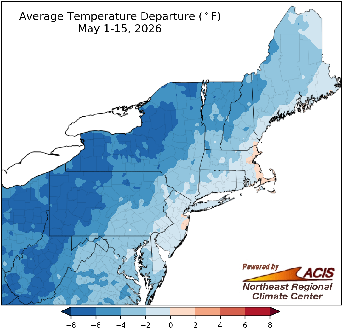 May 18, 2026 May Plays It Cool...So Far In contrast to March and April, the first half of May was cooler than normal for most of the Northeast. However, the precipitation pattern during the first half of May has been a somewhat familiar one this spring - wet weather in an area from northwestern Pennsylvania to northern New York but dry conditions in an area from the southern half of West Virginia to the southern half of New Jersey.
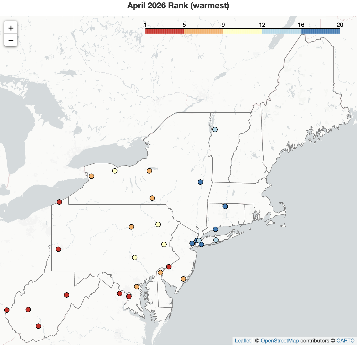 May 1, 2026 Record Warmth in April April 2026 became the warmest April on record for five of the Northeast's major sites and was among the 20 warmest for another 24 of the sites. While some southern and coastal locations saw limited precipitation and intensifying drought conditions, some northern and interior locations saw beneficial precipitation and improving drought conditions. April snowfall was below- to near-normal for almost the entire region.
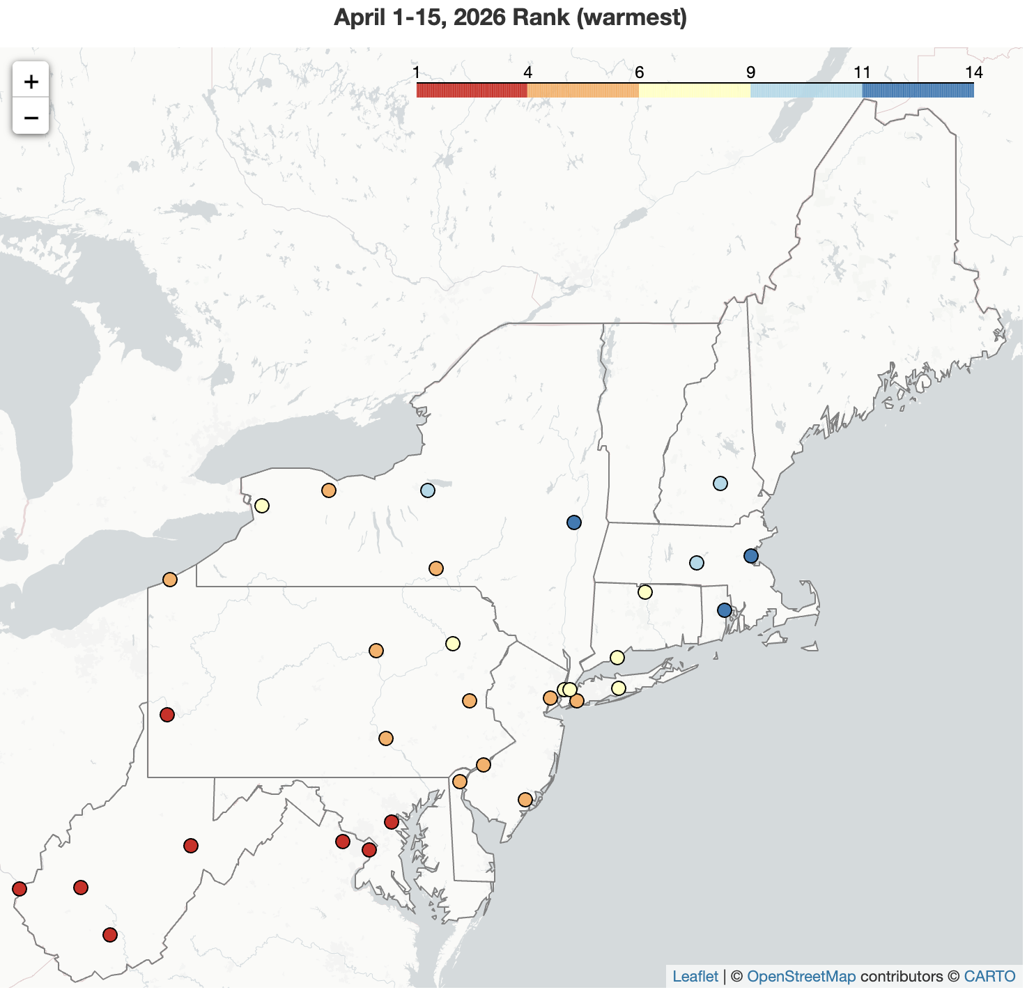 April 16, 2026 April Came in Hot The first half of April featured record- to near record-setting warmth for many parts of the Northeast. In fact, Huntington, Charleston, and Elkins, WV, and Pittsburgh, PA, had their warmest start to April on record. Precipitation was below normal in areas closer to the coast but abundant in interior locations, leading to a mix of drought deterioration and improvement across the region. Snowfall during the period was limited.
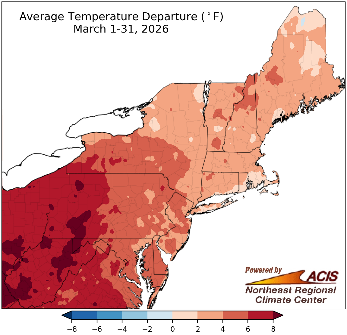 April 1, 2026 Marching Through Spring March featured above-normal temperatures and below-normal snowfall across much of the Northeast, ranking among the 20 warmest Marches for 26 of the region's 35 major sites. Precipitation amounts varied, from as little as 25% of normal to over 200% of normal. Pittsburgh, PA, had its wettest March on record. This March ranked among the 20 wettest for another nine major sites but among the 20 driest for three others.
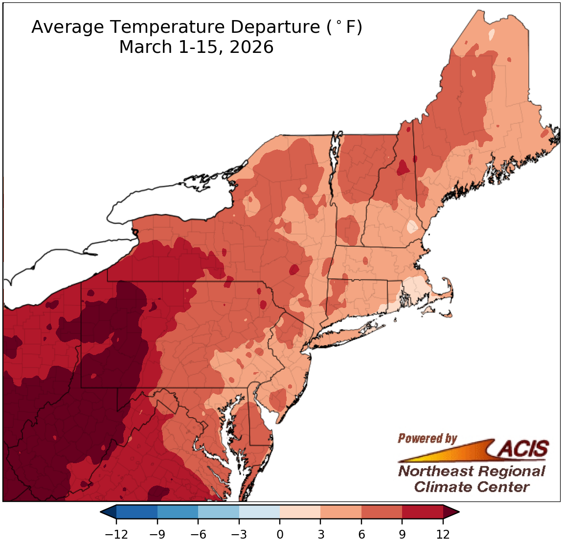 March 16, 2026 Warm Start to March March kicked off with above-normal temperatures across the Northeast. In fact, this March 1-15 period ranked among the 20 warmest such periods for 27 of the region's 35 major sites. Precipitation amounts varied, with the period ranking among the 20 driest for three major sites but among the 20 wettest for seven others. With above-normal temperatures, most areas had a snowfall deficit, even in spots that saw above-normal precipitation.
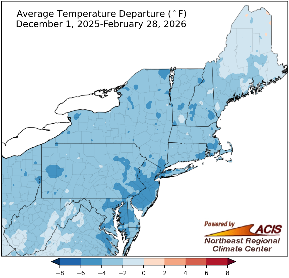 March 1, 2026 A Cold, Snowy Winter for Most This winter was record snowy for Providence, RI, and Islip, NY, and among the 20 snowiest winters for another 16 of the Northeast's 35 major sites. A record-setting blizzard pushed February to be Providence's all-time snowiest month and among the 20 all-time snowiest months for six additional major sites. Despite this, February and winter were drier than normal for most areas. For several areas, this February and winter were the coldest in about a decade.
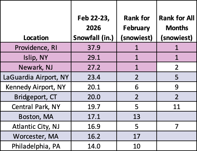 February 24, 2026 February 22-23 Blizzard A record-setting nor'easter hit coastal areas from Maryland to Maine from February 22 to 23. Preliminary data indicates a possible state snowfall record was set in Rhode Island, while Islip, NY, likely had its largest two-day snowfall event on record. Wind gusts led to blizzard conditions in multiple locations.
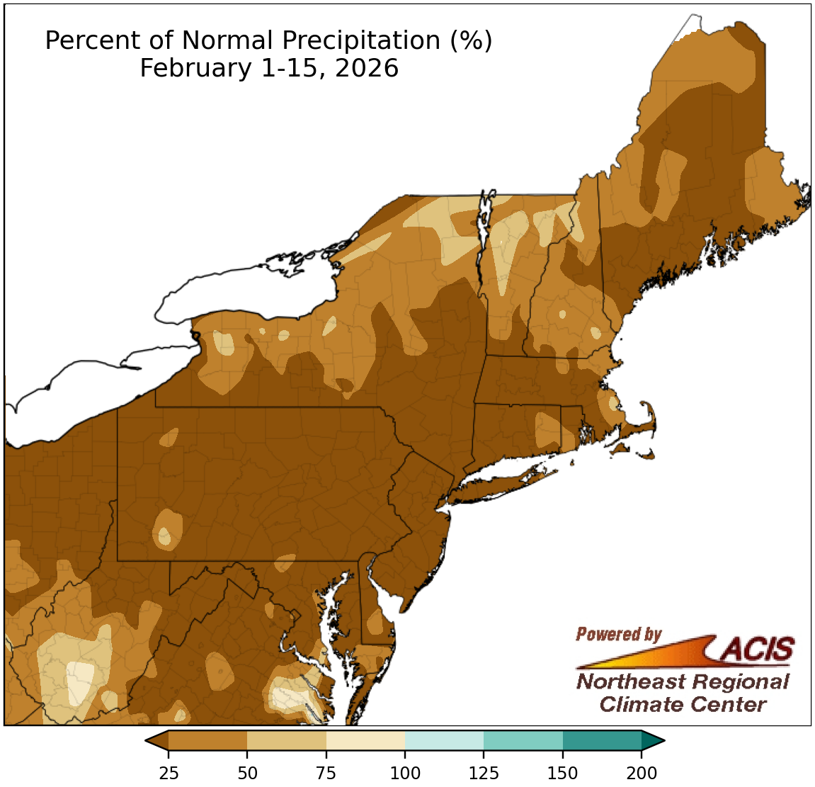 February 16, 2026 A Cold, Dry Start to Fe-brrr-uary A large portion of the Northeast saw less than 25% of normal precipitation during the first half of February. In fact, it ranked among the 10 driest February 1-15 periods on record for 22 of the region's 35 major sites. The period was also over 6°F below normal for much of the region, ranking among the 20 coldest starts to February for 20 major sites. Most areas wrapped up the first two weeks of the month with a snowfall deficit.
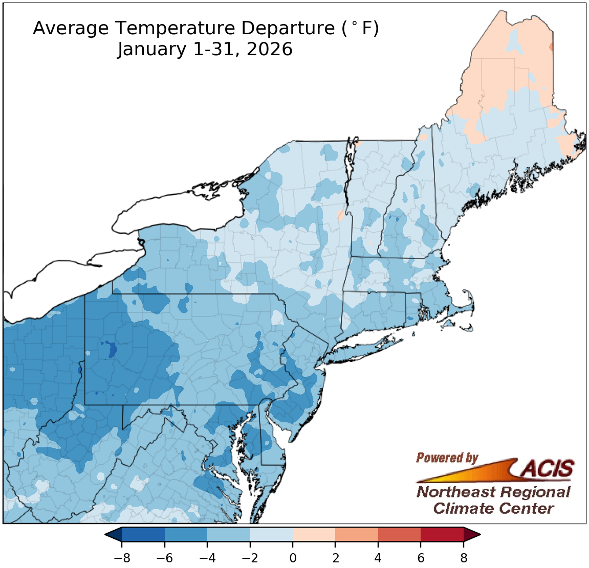 February 2, 2026 A Wintry Second Half of January After a warmer-than-normal first half of January, the second half featured a prolonged period of well below-normal temperatures. Multiple major sites experienced one of their 10 longest streaks of days with a high less than 20°F or 25°F. In terms of snow, January was an overachiever, either from multiple lake-effect events or a major late-month snowstorm. The month ranked among the 20 snowiest Januaries on record for 12 of the region's 35 major sites.
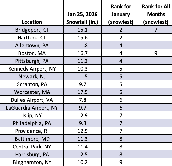 January 28, 2026 January 24-26 Winter Storm Recap A major winter storm affected an area from New Mexico to Maine, producing snow, ice, and rain. Daily snowfall totals on January 25 ranked among the 10 greatest for January at 18 of the Northeast's 35 major sites. In addition, the number of hours with freezing rain or sleet was among the 10 greatest for January at a few sites in the Mid-Atlantic.
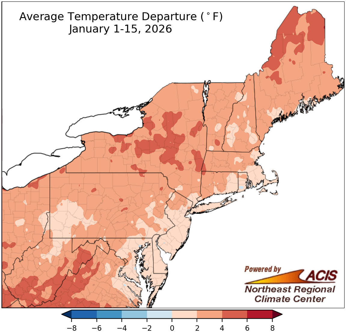 January 20, 2026 Mid-January Status Update The first half of January was warmer than normal across the Northeast, ranking among the 20 warmest such periods for several major climate sites. Much of the region was also drier than normal, with below-normal snowfall. In fact, the period ranked among the 20 driest on record for eight major sites and among the 20 least snowy for two of the sites. However, a few locations, particularly in parts of New York, were wetter and/or snowier.
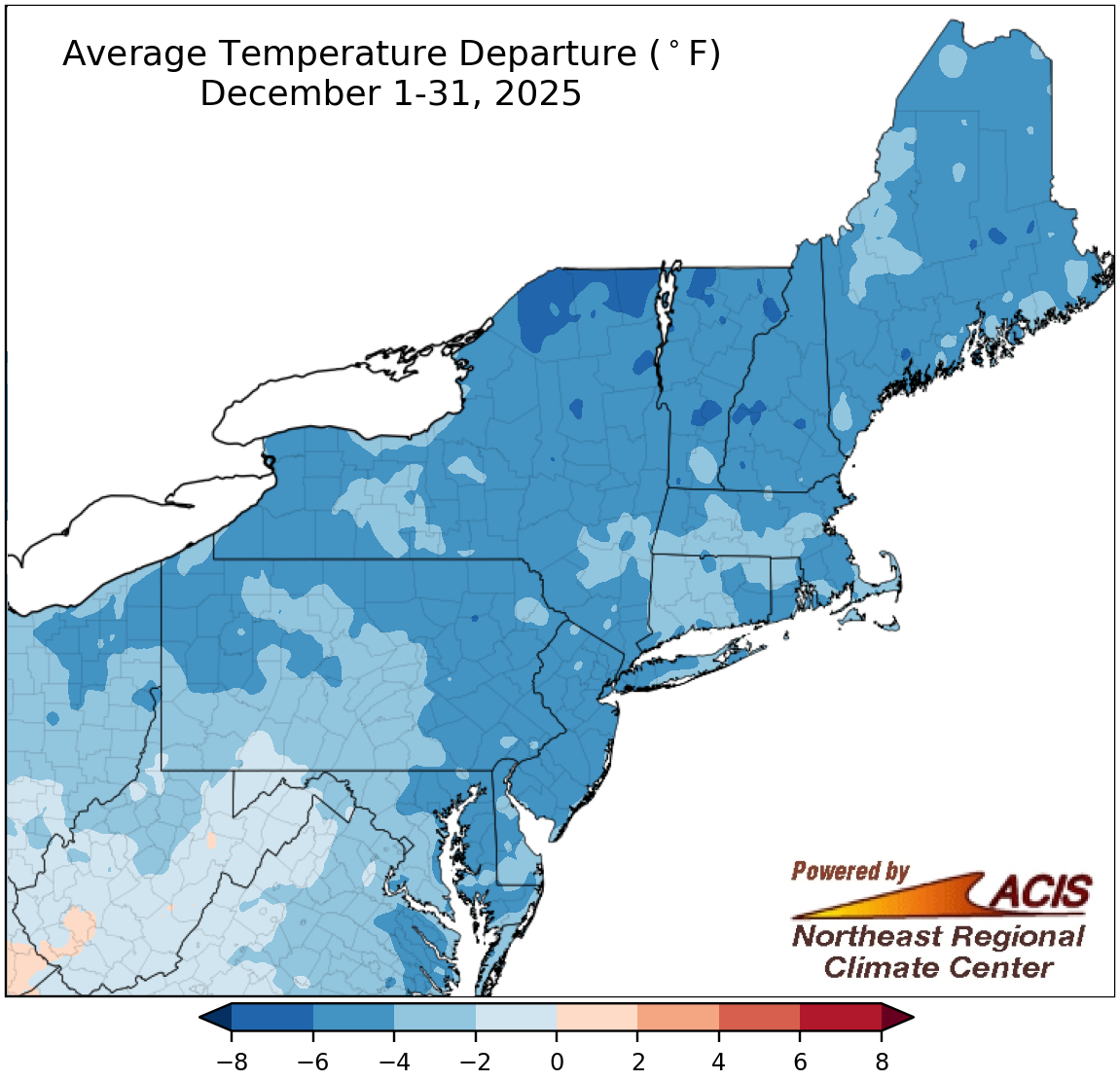 January 5, 2026 Wrapping Up 2025 December was a cold, dry, and snowy month for a large portion of the Northeast. In fact, it was the coldest and/or snowiest December in 15 years for several sites. Additionally, Syracuse, NY, had its snowiest December day with over two feet of snow. Meanwhile, 2025 came to a close with near- to above-normal temperatures and below-to near- normal precipitation for many parts of the Northeast. It was among the 20 warmest and/or driest years on record for several locations.
2025
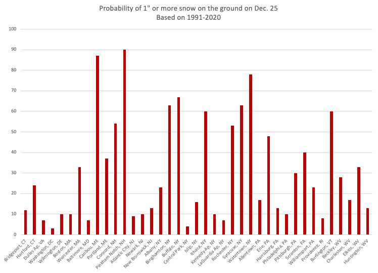 December 16, 2025 White Christmas (2025) What are our chances of a white Christmas? We’ve calculated the probabilities for an inch of snow on the ground on December 25th, based on data from 1991-2020, for select Northeast cities.
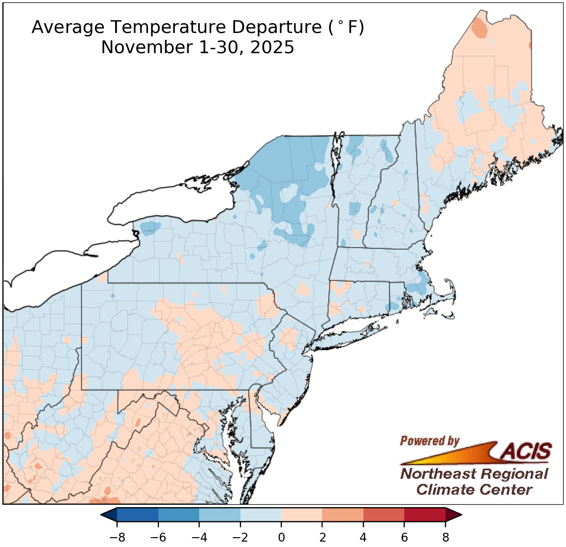 December 1, 2025 Fall's Finale November was cooler than normal for multiple Northeast locations, in contrast to the warmer temperatures of September and October. Those two months helped push the fall season to be warmer than normal for much of the region. While October and November leaned dry for many areas, there were a few places that were quite wet; however, September was drier for a broader portion of the region. With that, the fall season also wrapped up to be drier than normal for many locations.
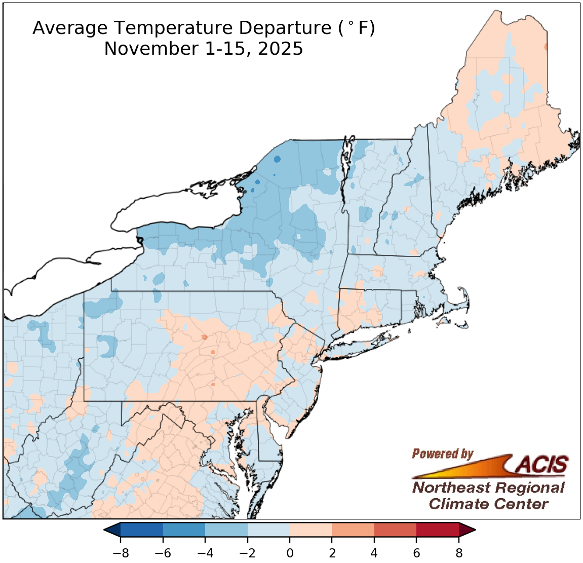 November 16, 2025 A Transition to Winter November so far has served as a transition from the warmer conditions experienced this past October to the more typically wintery conditions of December. As such, many areas have been cooler than normal and seen at least a few snowflakes. Meanwhile, much-needed precipitation chipped away at drought in northern areas, but southern areas have seen reduced precipitation amounts.
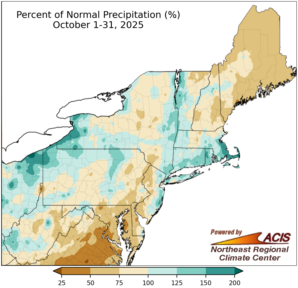 November 1, 2025 The Curtain Comes Down on October October's final act featured a heavy rainfall event that boosted monthly precipitation totals for many spots. Even so, precipitation amounts varied, allowing drought to intensify in some areas but improve in others. Much of the Northeast wrapped up the month on the warm side of normal.
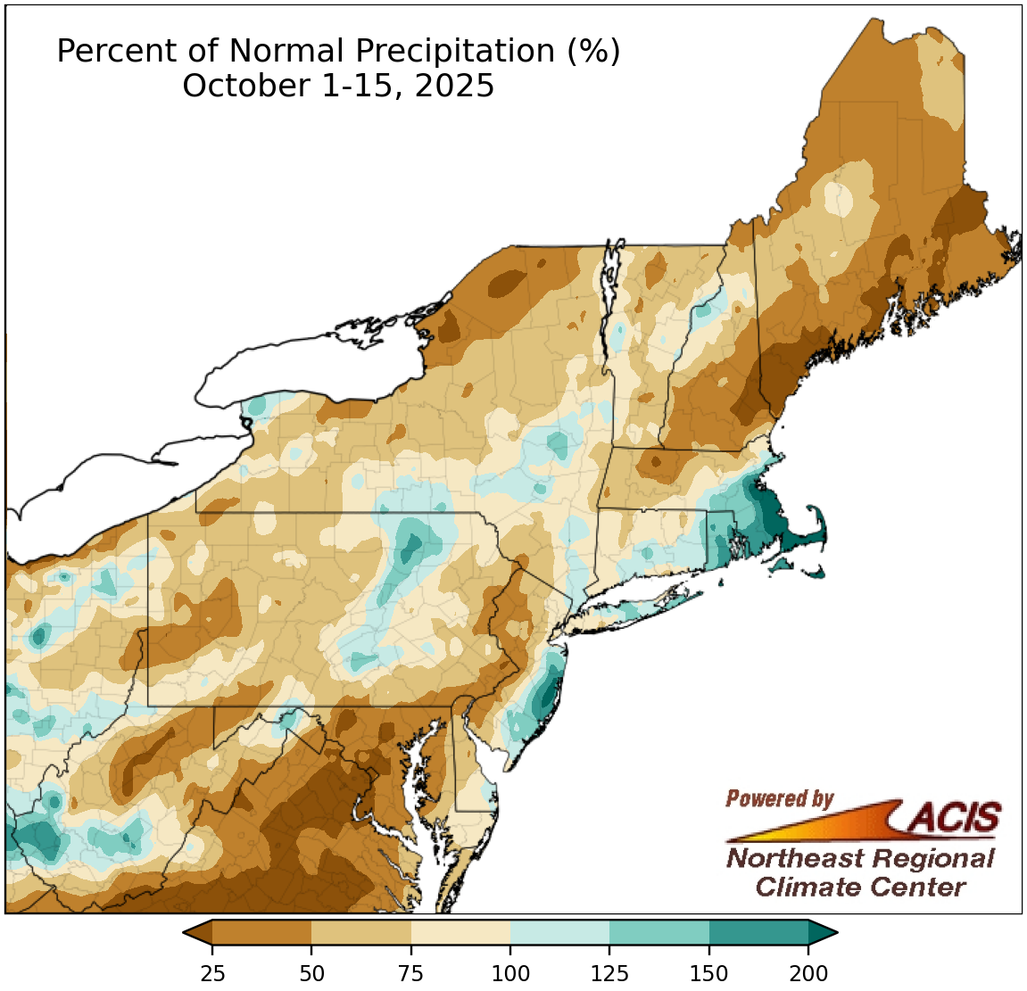 October 16, 2025 Mid-October - Leaning Dry and Warm for Most During the first half of October, many parts of the Northeast were drier than normal, particularly northern New England and northern New York, allowing drought conditions to intensify. However, a few locally wetter spots saw drought conditions improve. Meanwhile, the first half of October was warmer than normal for almost the entire region.
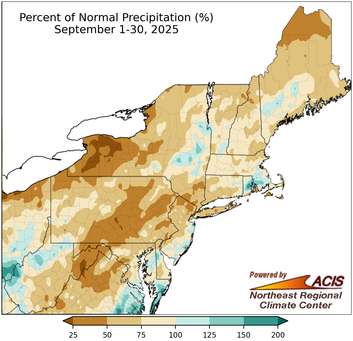 October 1, 2025 Missing Precipitation in September Much of the Northeast experienced a drier-than-normal September, allowing drought to expand and intensify. September temperatures were warmer than normal in most locations, with this September ranking among the 20 warmest on record for 17 of the region's 35 major sites.
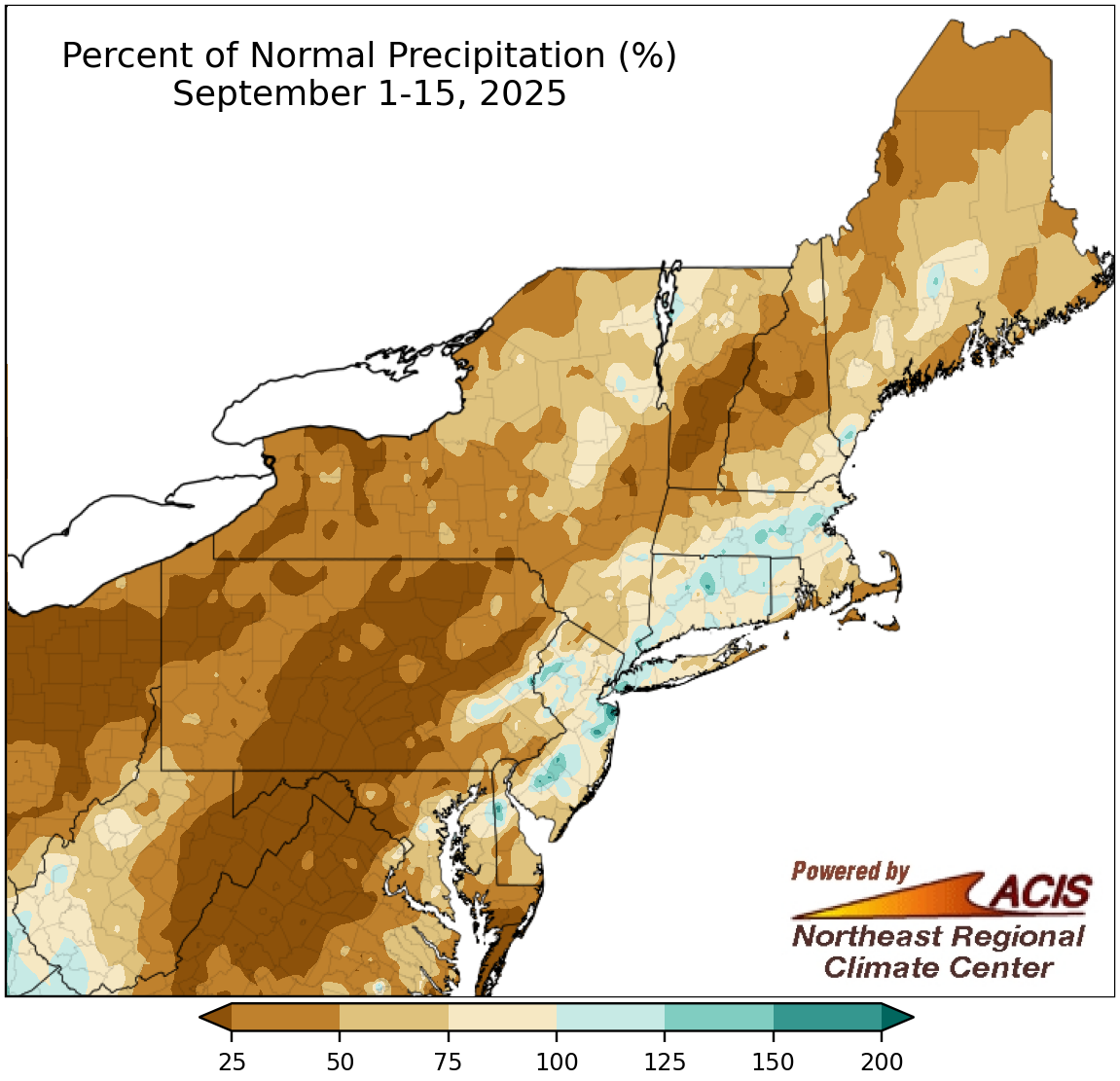 September 16, 2025 A Dry but Cool Start to September The first half of September was predominately drier than normal, with multiple areas seeing less than 25% of normal precipitation. Cooler-than-normal temperatures were observed across most of the region, with some southern and interior spots being as much as 6°F below normal. While drought expanded and intensified in the region, these cooler temperatures were helpful at slightly tempering the deterioration.
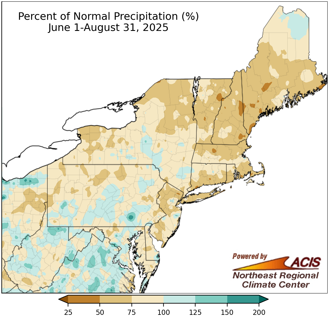 September 1, 2025 A Dry, Cool End to Summer August wrapped up with drier- and cooler-than-normal conditions for much of the Northeast. For instance, Washington, D.C., had its driest August on record, while some sites had their coolest August in over a decade. Summer was also drier than normal for most places but wrapped up on the warm side of normal, driven by hot weather in June and July. In fact, summer 2025 ranked among the 20 hottest summers for 21 major sites.
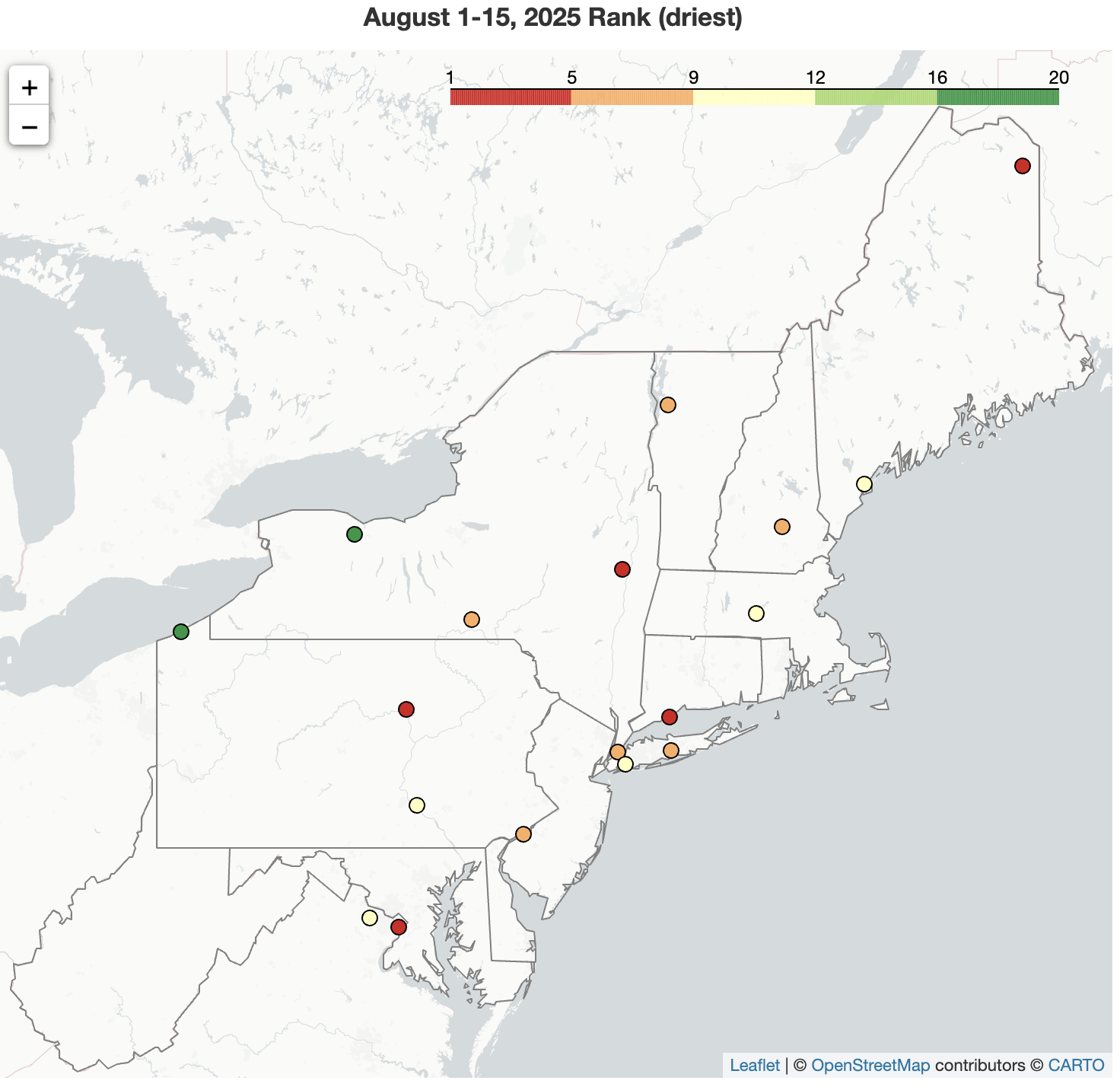 August 16, 2025 Parched Start to August Much of the Northeast saw little rainfall during the first half of August, with Williamsport, PA, being record dry with only a trace. In northern parts of the region, this lack of rainfall combined with hotter-than-normal temperatures led to a notable expansion of drought and abnormal dryness. Caribou, ME, saw a record-tying four straight days with a high of at least 90°F.
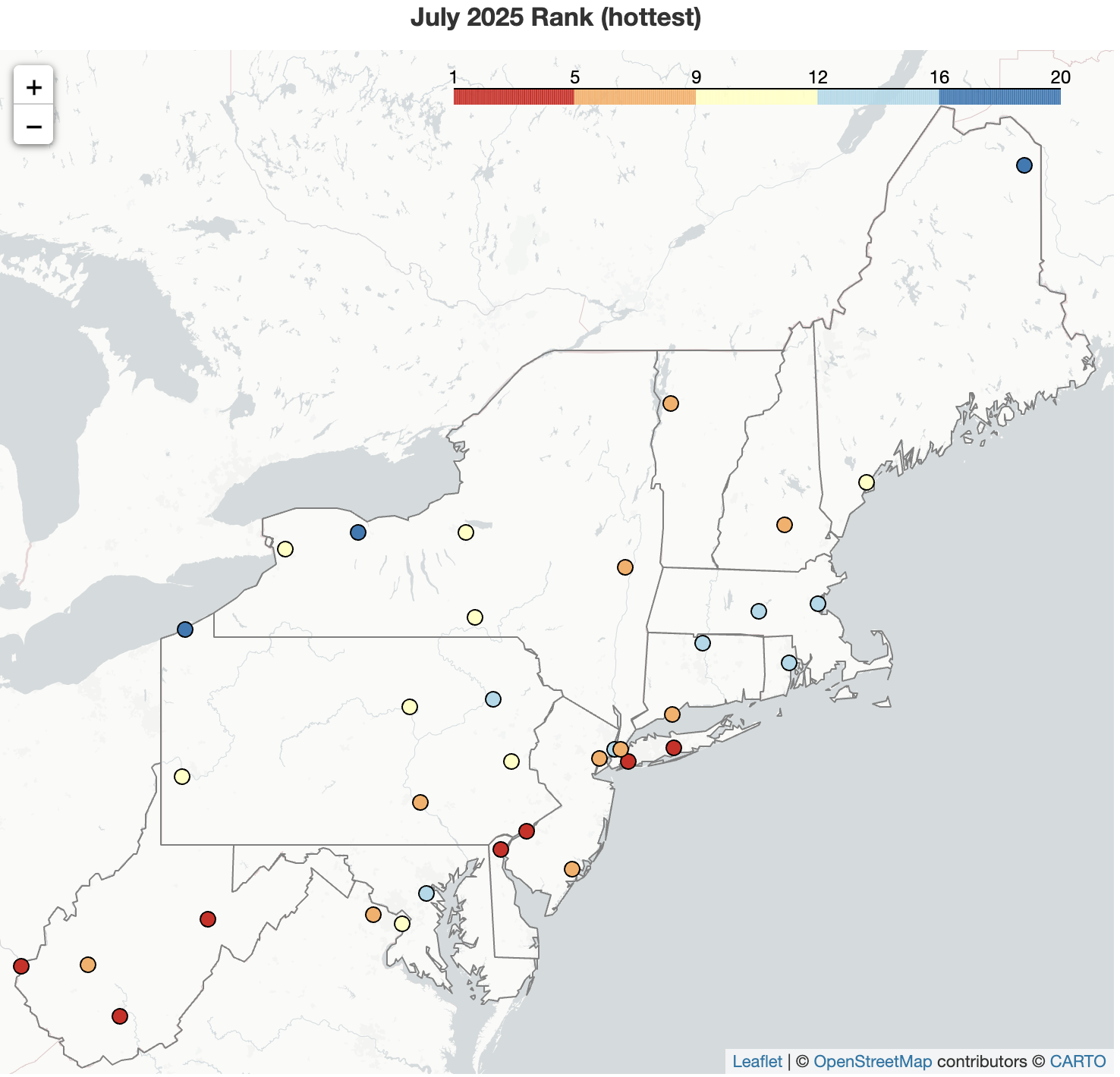 August 1, 2025 July - Exceeding Expectations The hottest month of the year outperformed itself, with this July ranking among the 20 hottest Julys on record for all 35 major sites. In fact, Elkins, WV, experienced its all-time hottest month on record, while Philadelphia, PA, saw a record-tying number of 90°F days. Precipitation was hit or miss, though, with some spots like Buffalo, NY, seeing one of their 20 driest Julys and other spots such as Hartford, CT, seeing one of their 20 wettest.
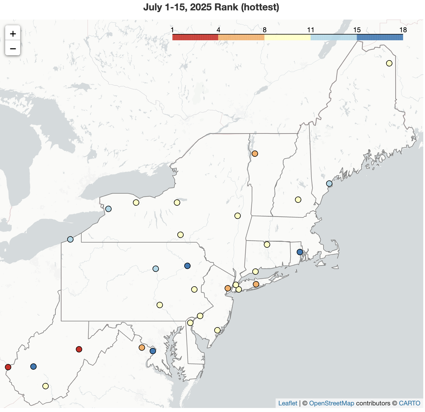 July 16, 2025 A Toasty Start to July The first half of July was hotter than normal for the Northeast, with Elkins, WV, having its hottest July 1-15 period on record. The period ranked among the 20 hottest for most other major sites. Precipitation during the first half of July was variable, ranging from 7% of normal in Rochester, NY, its 11th driest such period, to 234% of normal in Harrisburg, PA, its third wettest.
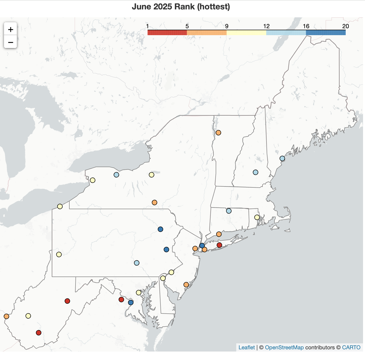 July 1, 2025 Another June in the Record Books A record-setting heat wave during the second half of June pushed the Northeast to the warm side of normal for the month. In fact, Islip, NY, had its hottest June on record, while another 28 major sites experienced one of their 20 hottest Junes. Summertime convection produced a hodgepodge of precipitation amounts, from 19% in Worcester, MA, (its fifth-driest June) to 177% in Rochester, NY (its 12th-wettest June).
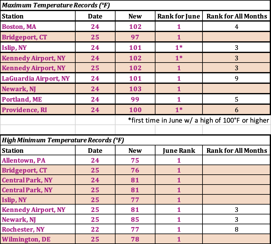 June 26, 2025 Northeast Bakes Under a Heat Dome Blazing hot temperatures settled across the Northeast starting around June 22, with several sites setting new temperature records for the month of June. For instance, Islip, NY; Kennedy Airport; NY; and Providence, RI, hit the 100°F mark for the first time in June. Meanwhile, Central Park, NY, had three consecutive days with a low of 80°F or higher, tying its longest such streak for any month since its records began in 1869.
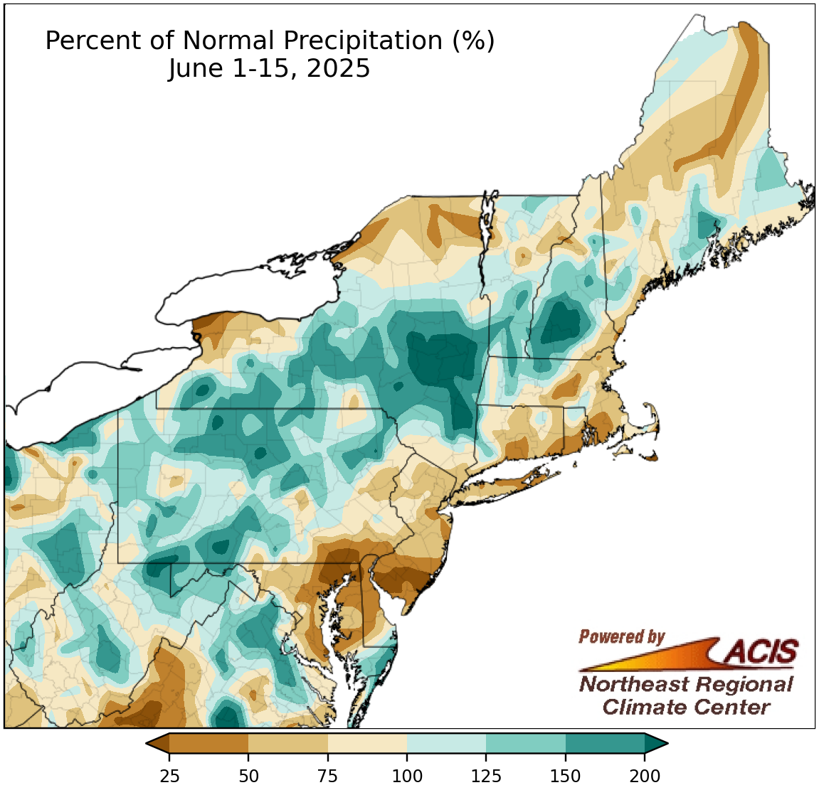 June 16, 2025 Mid-June - Parched or Soaked Precipitation during the first half of June featured extremes, with some areas seeing too little and other areas seeing too much. This June 1-15 period was among the 20 driest for four major sites but among the 20 wettest for four others. Temperatures, though, have been a bit humdrum, averaging out to be close to normal and with no notable hot or cold spells. Only two sites notched one of their 20 warmest starts to June.
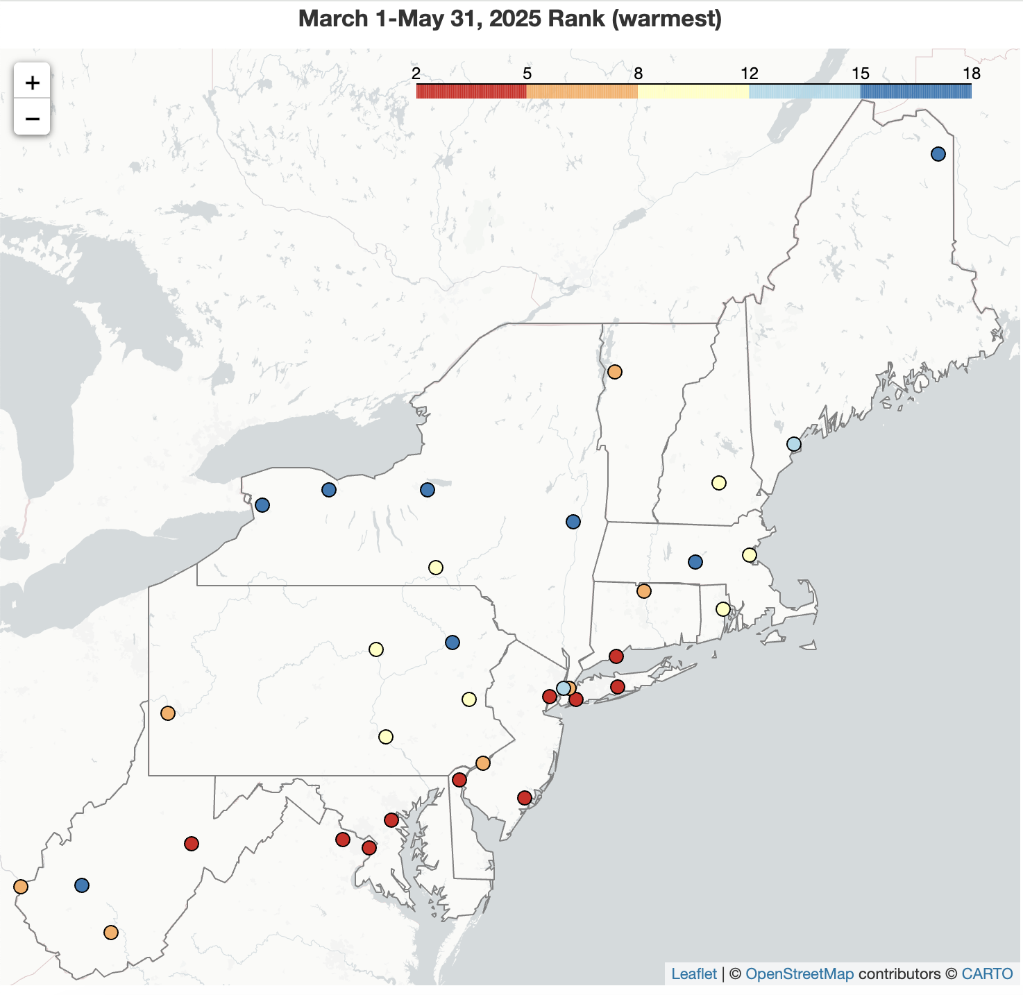 June 1, 2025 A Soggy May Closes Out a Warm Spring A record- to near record-wet May overpowered March and April to make the spring season wetter than normal for many parts of the Northeast. A cool end to May couldn't compete with warm weather during the rest of the season, with this spring being one of the 20 warmest on record for much of the region. This warmth contributed to below-normal spring snowfall for almost the entire Northeast.
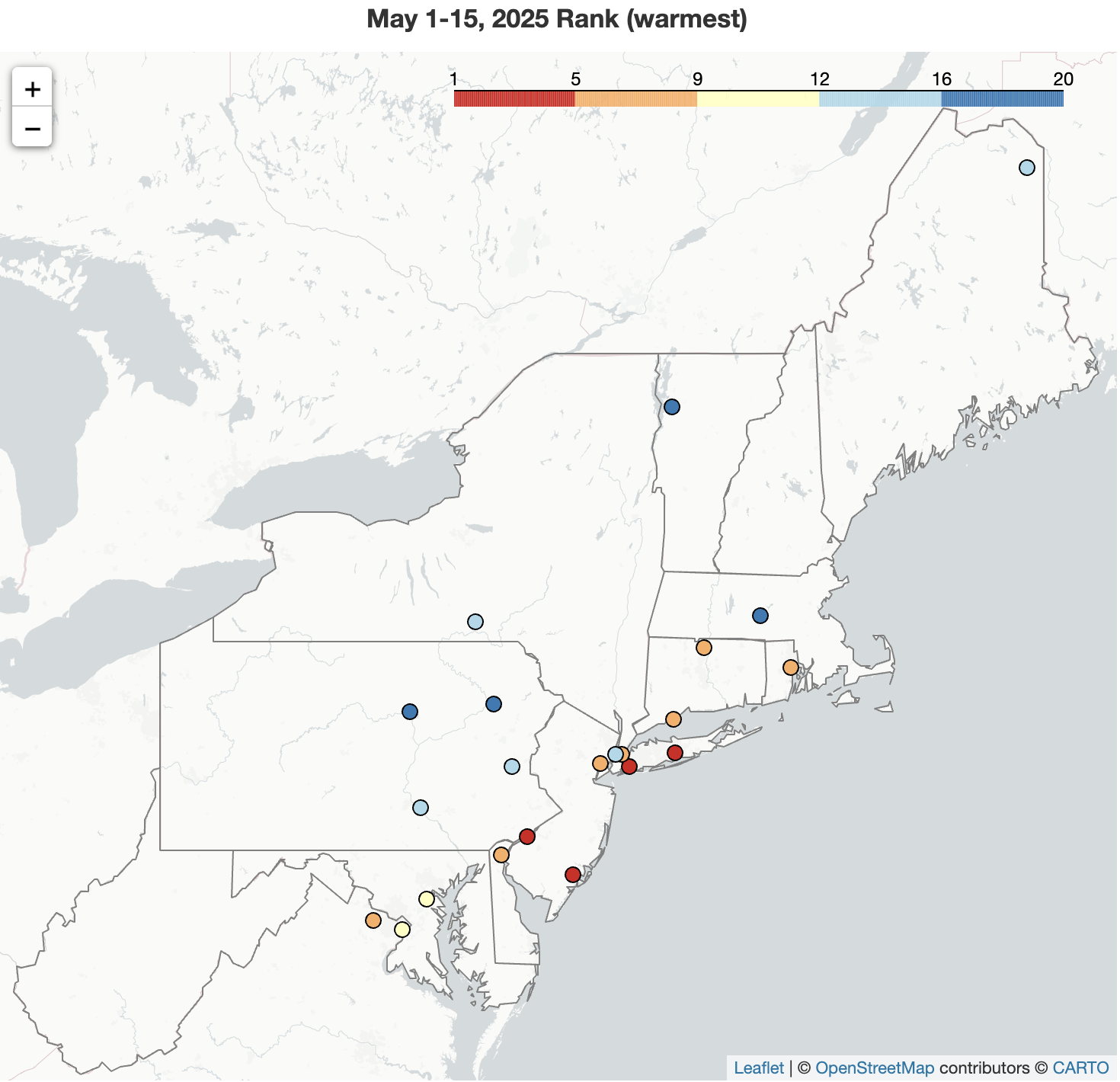 May 19, 2025 Mid-May - Record Warm, Record Wet The first half of May was up to 8°F warmer than normal in the Northeast, with Islip, NY, having its warmest May 1-15 period on record. A large swath of the region saw more than double its normal May 1-15 precipitation, including 15 of the region's 35 major sites. In fact, this first half of May was record wet for Allentown, PA, and Worcester, MA.
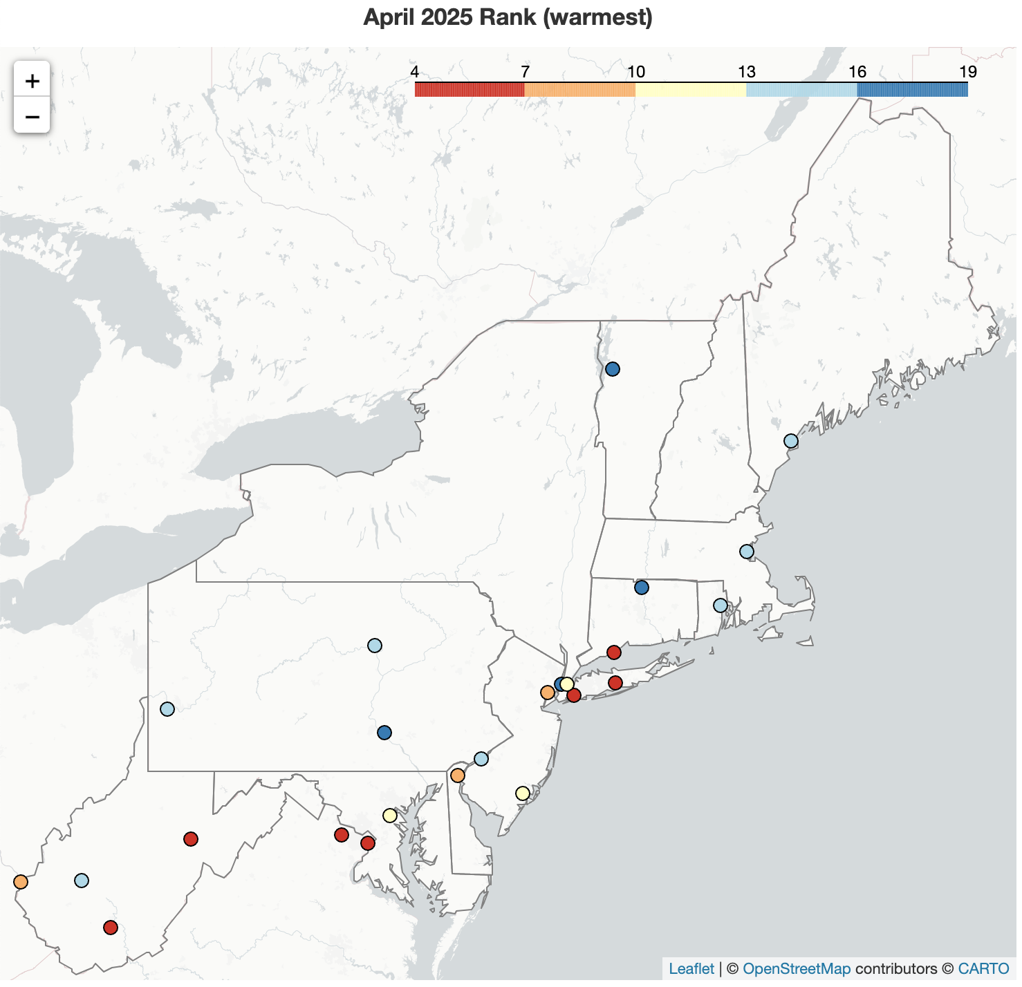 May 2, 2025 The Dual Nature of April The two halves of April were like night and day, generally with cool, wet conditions kicking off the month but warm, dry conditions wrapping up the month. Ultimately, the warmth won out for April temperatures, with the month ranking among the 20 warmest Aprils for 24 of the region's 35 major sites. However, monthly precipitation and snowfall totals varied.
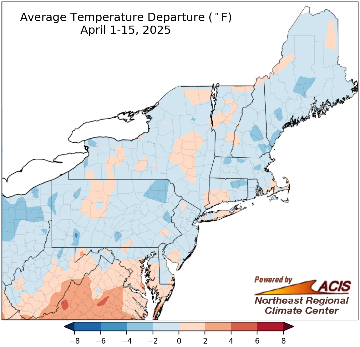 April 16, 2025 April Brings the Showers but Not the Heat On the heels of a warm March, the first two weeks of April averaged out to be cooler than normal for much of the Northeast. April showers were plentiful, with many areas being wetter than normal. This did not necessarily translate to snow, though, as most spots had either deficits or near-normal amounts.
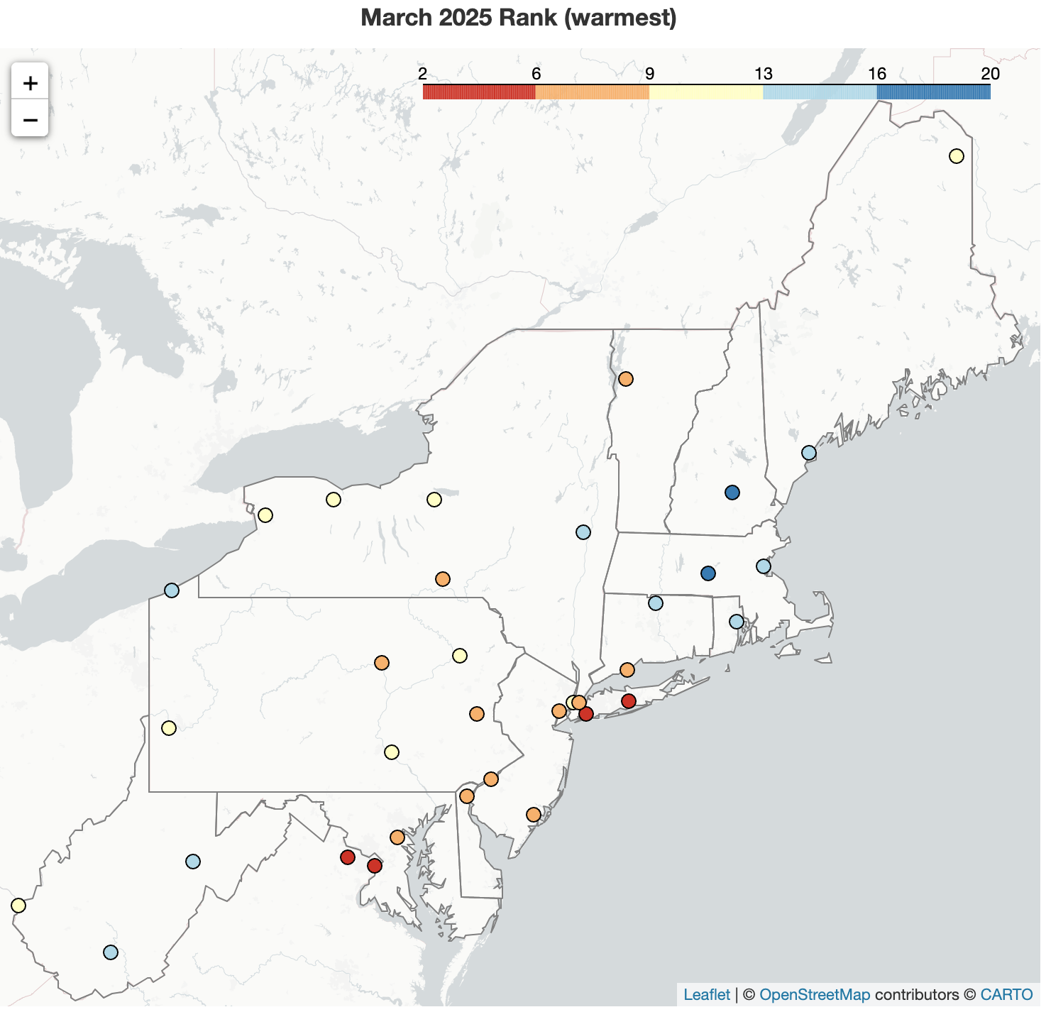 April 1, 2025 March - Mild and Missing Snow March 2025 ranked among the 20 warmest Marches for 34 of the Northeast's 35 major sites. While overall precipitation varied, ranging from as little as 25% of normal in interior areas to over 150% of normal in some coastal and northern areas, almost the entire region saw snowfall deficits, the greatest of which exceeded 12 inches. It was the least snowy March on record (tying multiple other years) for 16 major sites and among the 20 least snowy for another 12 of the sites.
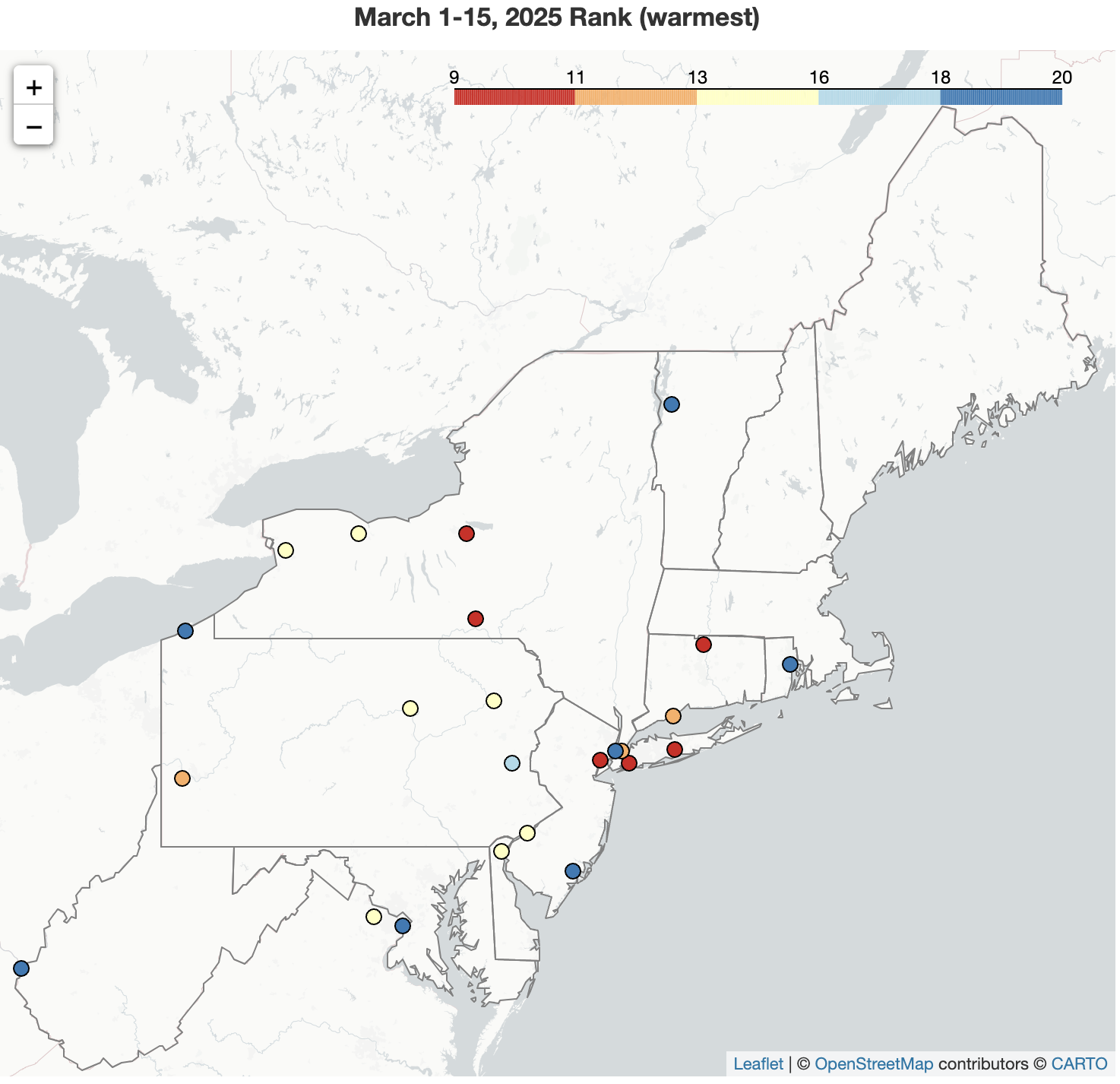 March 17, 2025 A Warm, Dry Start to March The first half of March wrapped up with above-normal temperatures across the Northeast, ranking among the 20 warmest March 1-15 periods for 24 of the region's 35 major sites. For much of the region, the first half of March was also drier than normal, with parts of West Virginia seeing less than 25% of normal, and featured below-normal snowfall, with deficits of over 6 inches in parts of New York and New England.
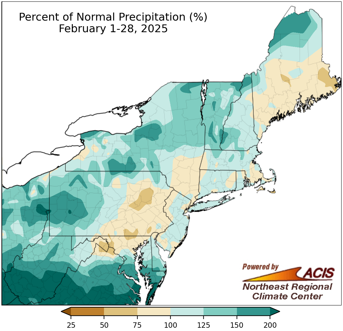 March 1, 2025 That's a Wrap on Winter February was quite wet for multiple parts of the Northeast, particularly Beckley, WV, which had its wettest February on record. Despite February's wetness, many areas wrapped up winter on the dry side of normal. February and winter snowfall were generally boom or bust, with a significant surplus in lake-effect areas of New York and notable deficits in places like Pennsylvania. Meanwhile, temperatures were within 2°F of normal in many areas for both time periods.
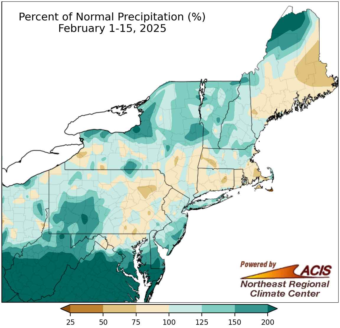 February 16, 2025 Record Precipitation in Mid-February The February 1-15 period was record wet for Beckley and Charleston, WV, and when February 16 is included, Beckley has already topped its record for wettest February, as well. In fact, much of the Northeast has been wetter than normal so far this February. Meanwhile, there has been a wide range of temperatures and snowfall amounts across the region for the period.
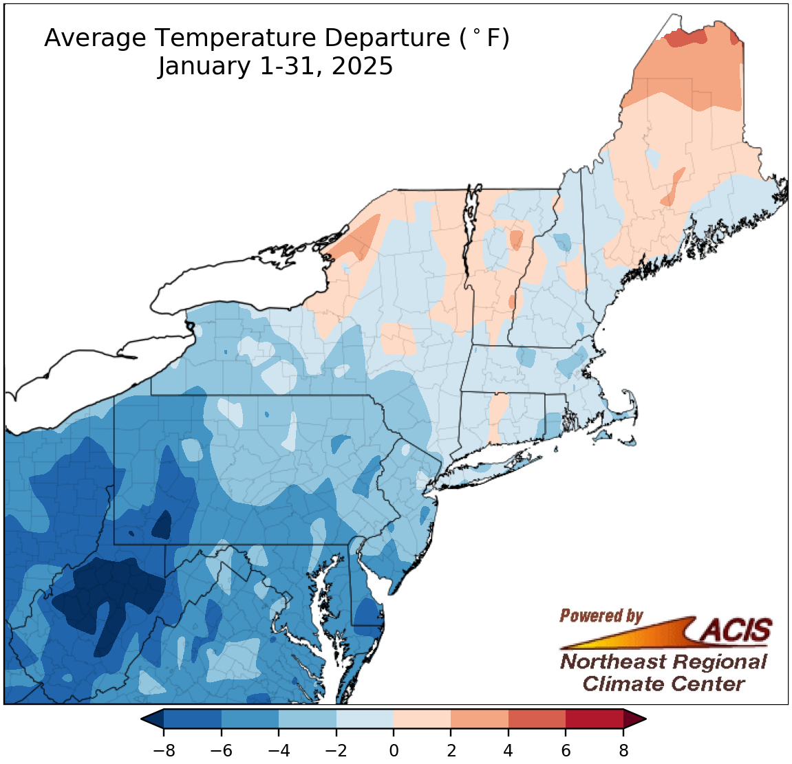 February 1, 2025 January Brings Cold, Dry Conditions Much of the Northeast experienced colder-than-normal and drier-than-normal conditions during January. In fact, this January tied as the driest on record for LaGuardia Airport and was among the 20 driest on record for another 18 of the region's 35 major climate sites. Snowfall, however, varied, with notable deficits in places like Maine but a significant surplus in places like West Virginia.
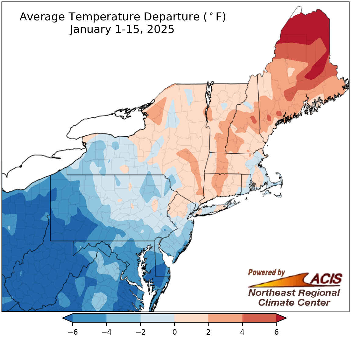 January 17, 2025 A Topsy-Turvy Start to January Some of the weather conditions in the Northeast during the first half of January were turned head over heels. For instance, Caribou, ME, and Elkins, WV, averaged out to be nearly the same temperature despite their normal temperatures for the period being roughly 18°F apart. Or, each of the West Virginia sites saw more snow during the January 1-15 period than Caribou, Portland, and Concord combined. The one common theme for most sites - it was drier than normal.
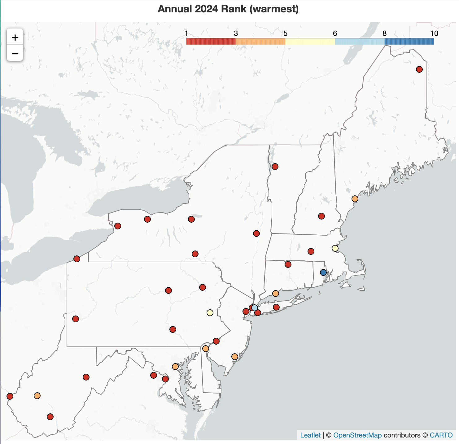 January 2, 2025 An Unsettled End to a Record Warm Year 2024 was the warmest year on record for 22 of the Northeast's 35 major climate sites. While December featured variable temperatures, months such as February, June, July, and November featured record warmth. As with temperatures, during December there was a wide range of precipitation totals and snowfall amounts. 2024 had both record wetness, like in March, and record dryness, like in September and October, causing annual precipitation to be within 25% of normal for many areas.
2024
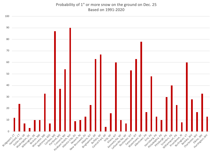 December 17, 2024 White Christmas (2024) What are our chances of a white Christmas? We’ve calculated the probabilities for an inch of snow on the ground on December 25th, based on data from 1991-2020, for select Northeast cities.
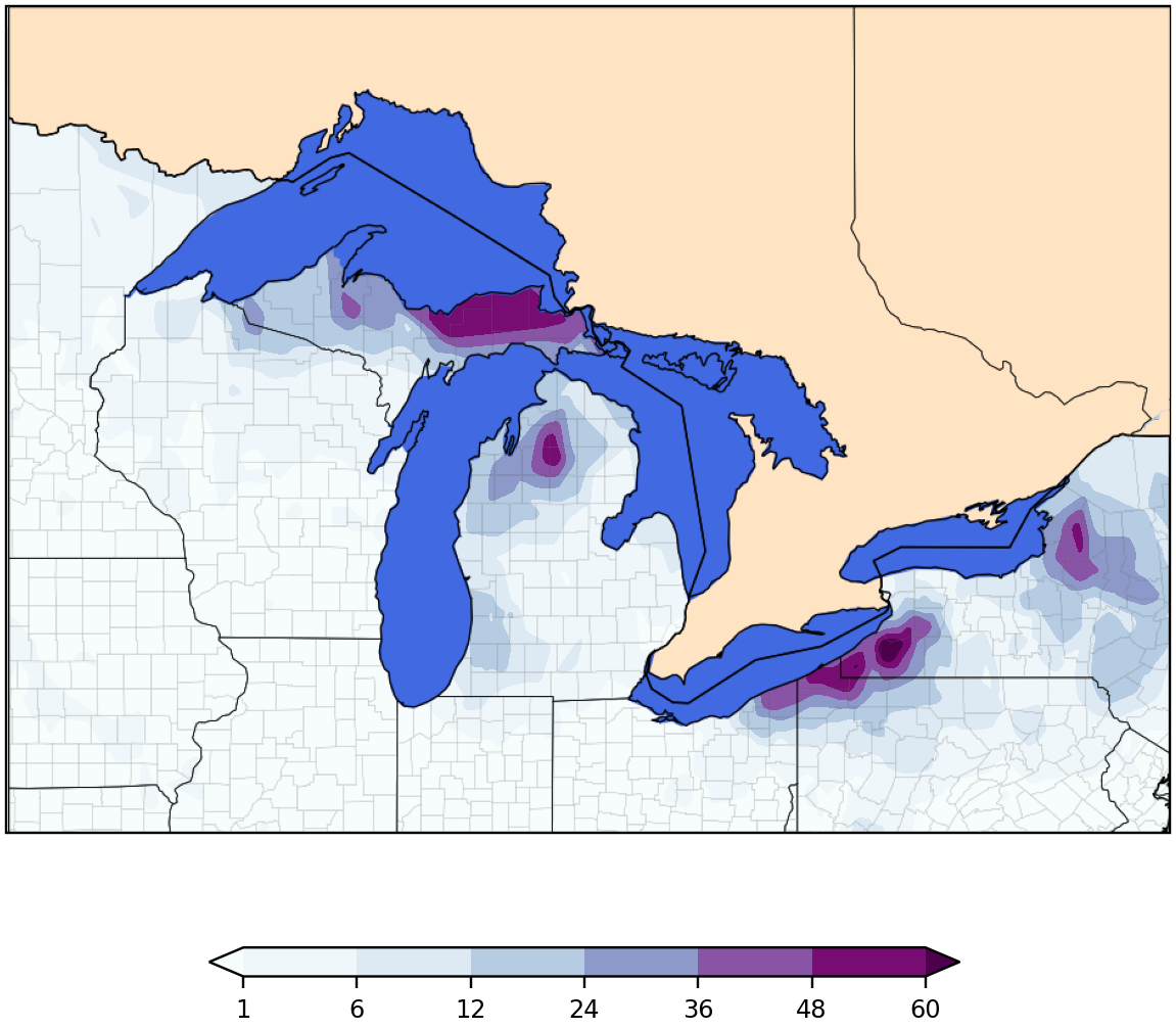 December 10, 2024 Record-Breaking Lake Effect Snow Arrives as Winter Starts Back-to-back lake effect events produced significant snowfall across the Great Lakes region, with multiple locations seeing over 5 feet and Erie, PA, setting a record for its all-time snowiest day.
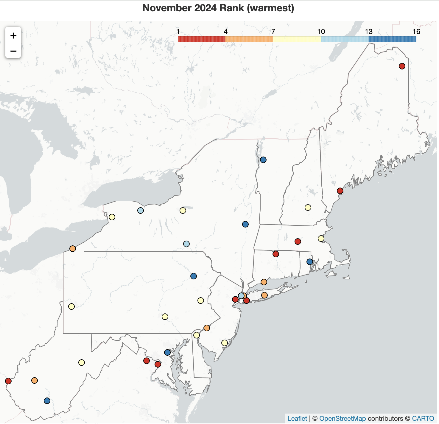 December 1, 2024 Records Tumble as Fall Wraps Up November and fall both featured record-setting warm temperatures. Meanwhile, the second half of November finally brought some notable precipitation to many areas. However, it was not enough to overcome major deficits that accrued during the rest of fall, with the season being record dry for a handful of sites. While some areas saw locally heavy snowfall in November, most areas saw below- or near-normal snowfall including Rochester, NY, which did not record even a trace of snowfall during the month (or season) for the first time since its records began in 1871.
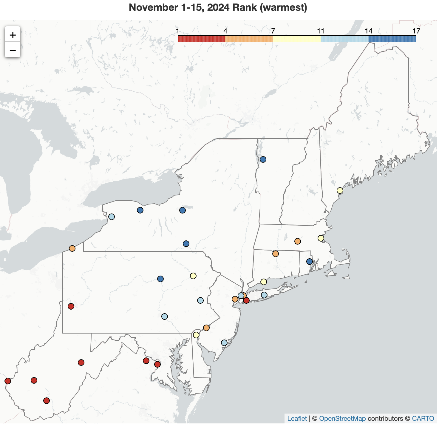 November 16, 2024 Stuck on Repeat The Northeast has been stuck in a warm, dry pattern that continued through the first half of November. Several major climate sites saw their warmest high temperatures for November, while Huntington, WV, had its warmest November 1-15 period. The record long streak of days without measurable precipitation ended at most sites, but the first half of November still wrapped up among the 20 driest for 19 major climate sites.
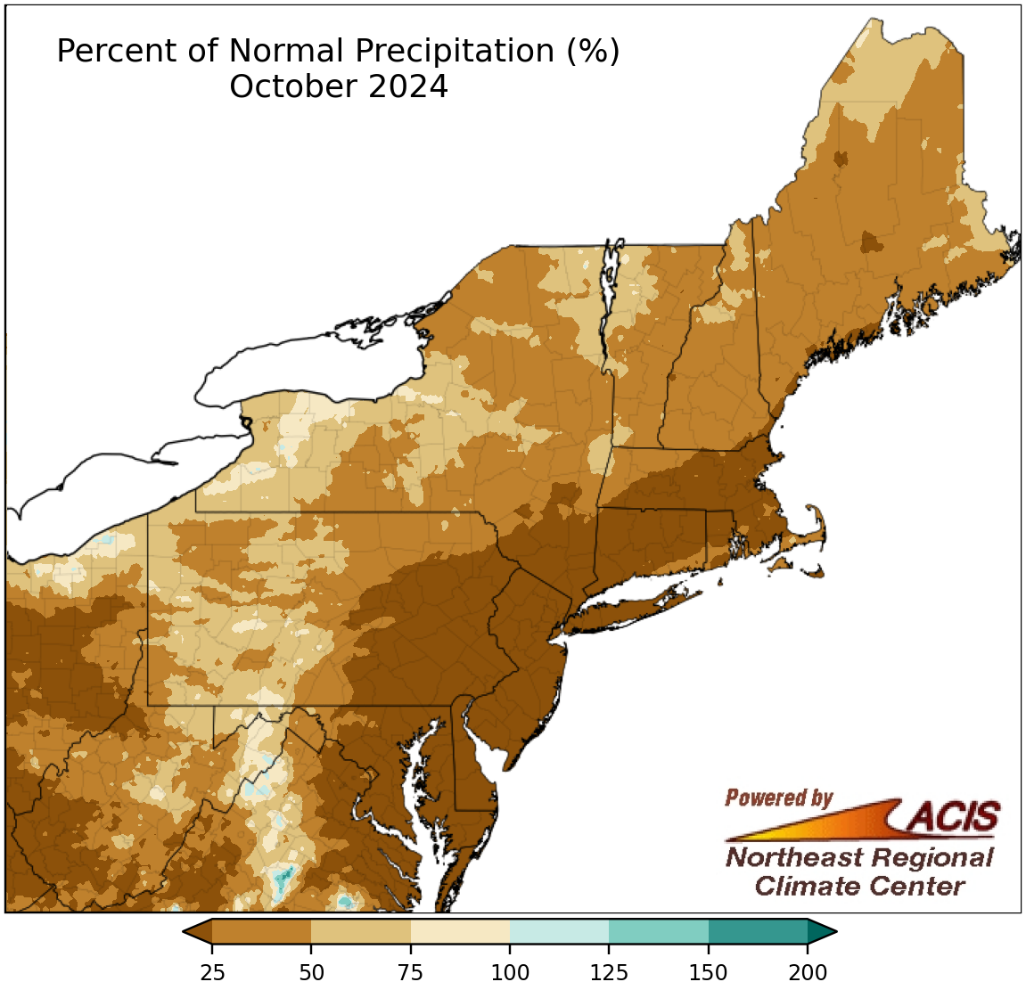 November 1, 2024 Dry, Dry October! October 2024 ranked as the all-time driest month on record for eight of the Northeast's 35 major climate sites. It was the first month on record that Newark, Philadelphia, and Wilmington did not see measurable precipitation. This October ranked as the driest October on record for two sites. Dryness stretched back to September, with Wilmington and Islip having back-to-back record dry months for the first time on record. Additionally, Newark and Philadelphia saw their longest streak of days without measurable precipitation, which could continue to grow in November.
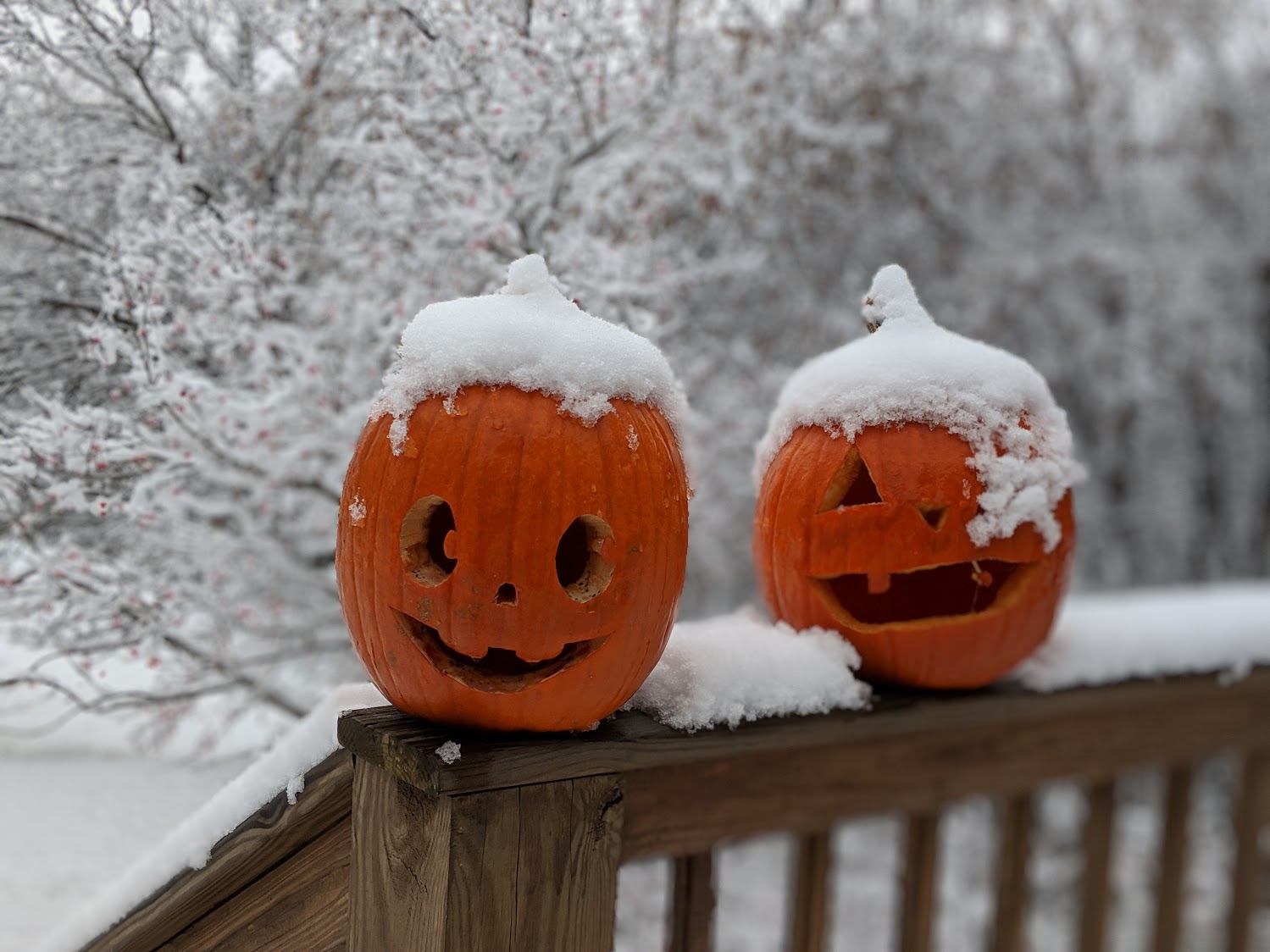 October 29, 2024 Monster Mashup of Halloween Stats Some Halloweens have been creepy and kooky, like when Beckley had 15 inches of snow on the ground, while other Halloweens have been thrillers, such as Charleston's high of 86°F. Wondering if there could be some strange weather in your neighborhood on Halloween? This is (an average) Halloween at the 35 major climate sites based on each station's period of record.
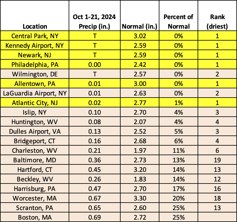 October 22, 2024 Waiting for the Rain Several locations in the Northeast have seen little, if any, precipitation so far this October, with sites like Philadelphia, Allentown, Kennedy Airport, Central Park, Newark, and Atlantic City being record dry. In fact, it was the first time since Philadelphia's records began in 1872 that the site saw no precipitation during the October 1-21 period. Several locations also set/tied records for fewest number of days with measurable precipitation during the same period.
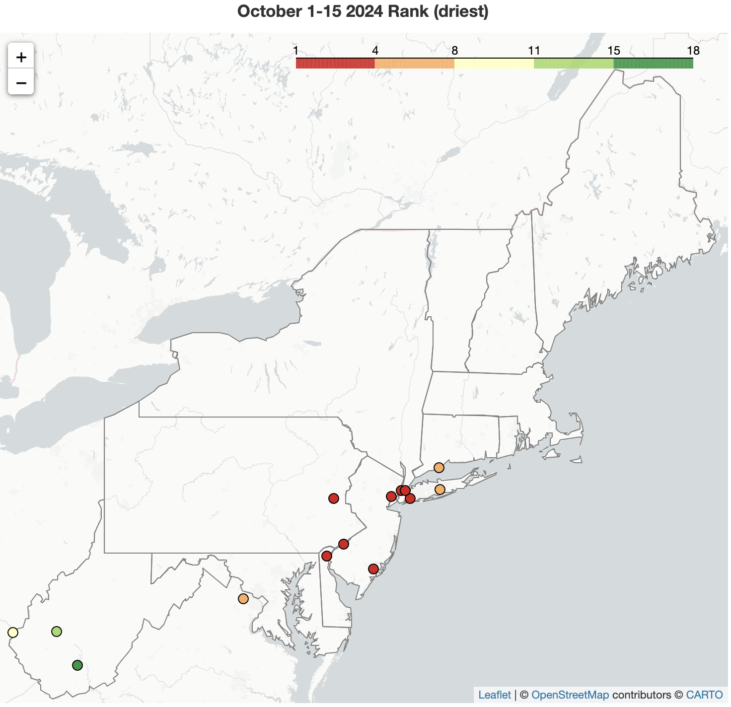 October 16, 2024 A Bone-Dry Start to October The first half of October was record dry for five of the Northeast's 35 major climate sites, with four of those sites not seeing measurable precipitation. It was among the 20 driest starts to October for another nine major climate sites. The driest locations, which saw less than 25% of normal precipitation, included southwestern West Virginia and an area stretching from southern Maryland to western Massachusetts. Meanwhile, a large portion of the Northeast saw warmer-than-normal temperatures during the October 1-15 period.
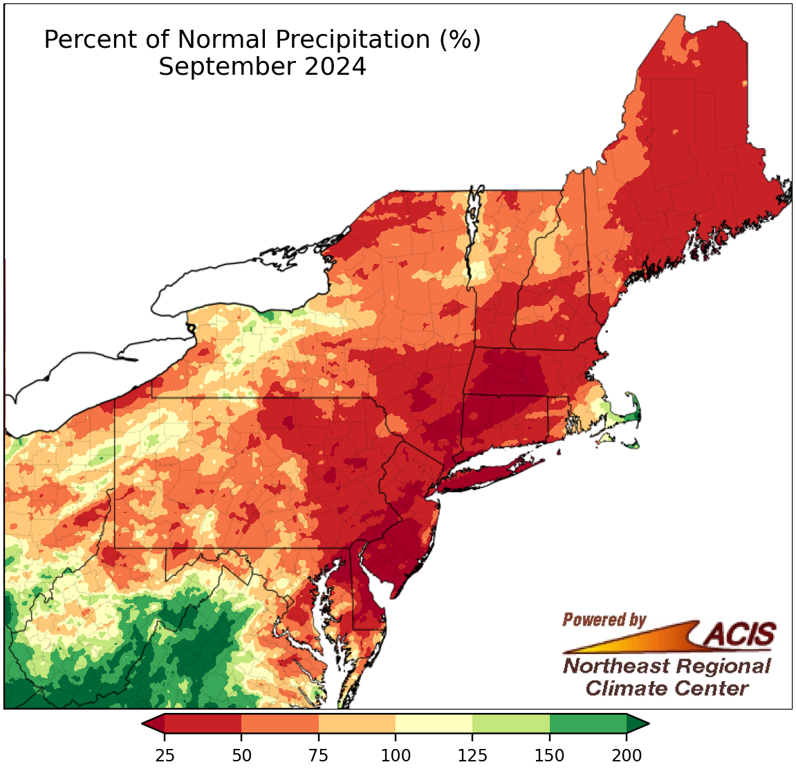 October 1, 2024 Record Dryness in September Precipitation was missing in many places this September, with 20 of the Northeast's 35 major climate sites seeing less than 50% of normal. In fact, Islip, NY, and Wilmington, DE, were record dry, seeing less than 10% of their normal September precipitation. Exceptions to this dryness included parts of southern/eastern West Virginia which saw notable rainfall during the last few days of the month due in part to the remnants of Hurricane Helene. Meanwhile, many areas saw near or above-normal temperatures, with northern/interior locations having the largest departures above normal and southeastern/coastal areas being slightly cooler than normal.
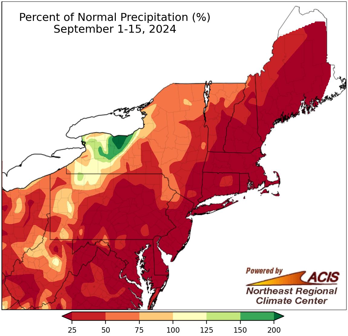 September 16, 2024 A Dry, Cool Start to September Much of the Northeast was very dry during the first half of September, with 26 of the region's 35 major climate sites seeing less than 25% of normal precipitation. This unusual dryness was somewhat balanced by cooler-than-normal temperatures, which were experienced by 29 of the major climate sites.
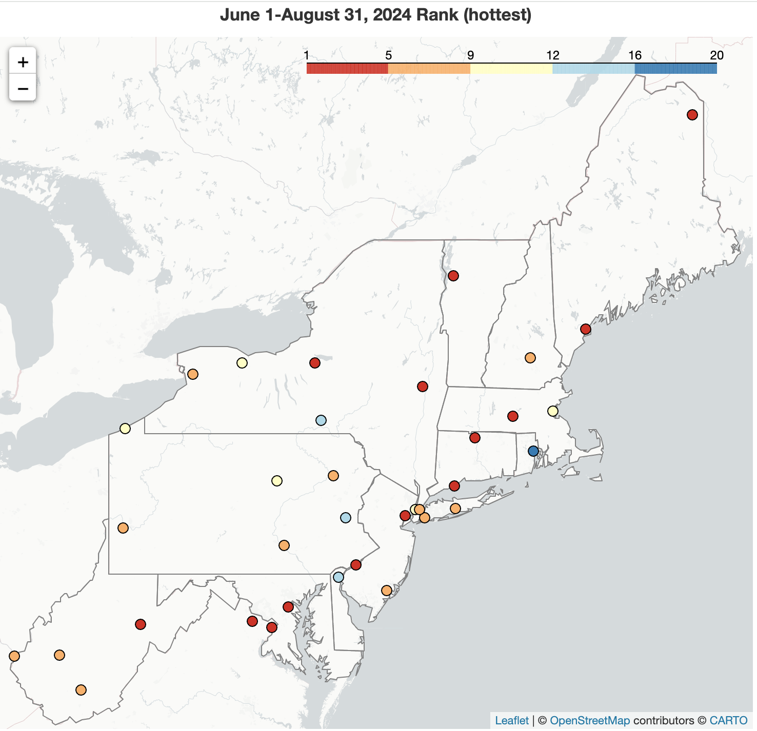 September 1, 2024 Summer 2024 - Mostly Hot with Precipitation Extremes Summer 2024 was the hottest summer on record for three major climate sites and ranked among the 20 hottest for the rest of the Northeast's 35 major climate sites. This was driven in large part by unusually hot weather in June and July as August averaged out to be closer to normal in multiple locations. Summer featured precipitation extremes - from West Virginia's first exceptional drought to double-digit rainfall and devastating flash flooding.
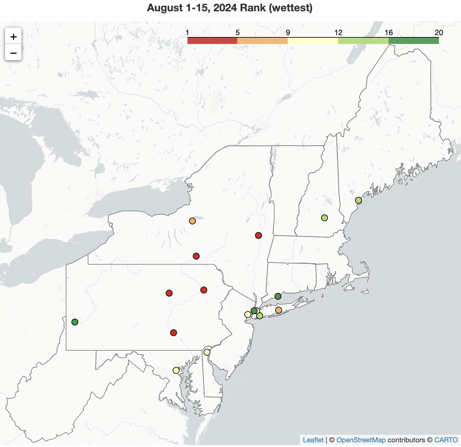 August 16, 2024 Soggy Start to August The remnants of Hurricane Debby dropped excessive rainfall on parts of the Northeast, propelling the August 1-15 period to be record wet for Albany, NY, and among the 20 wettest for 16 other major climate sites. The trend this summer of warmer-than-normal temperatures continued into the first half of August for most areas, with outlooks also favoring above-normal temperatures for September.
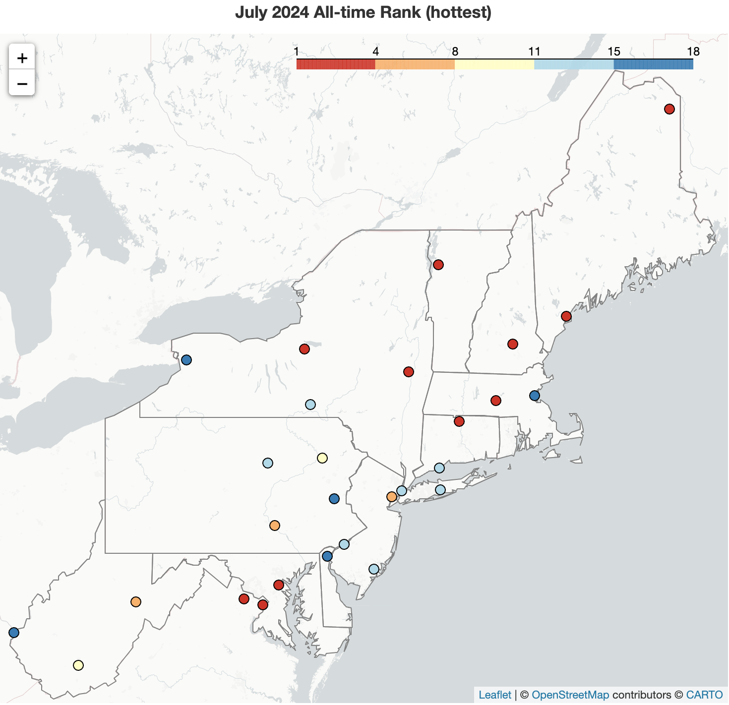 August 1, 2024 July - To the Extreme July went to the extreme - extreme temperatures, extreme rainfall, extreme drought. It wasn't just hot, it was the all-time hottest. It wasn't just dry, it was the first extreme drought in over a decade (for certain spots). It wasn't just wet, it was the all-time wettest. And that's not all! It also featured a record number of tornadoes in New York and a reminder that wildfires are still raging in the western U.S. and Canada.
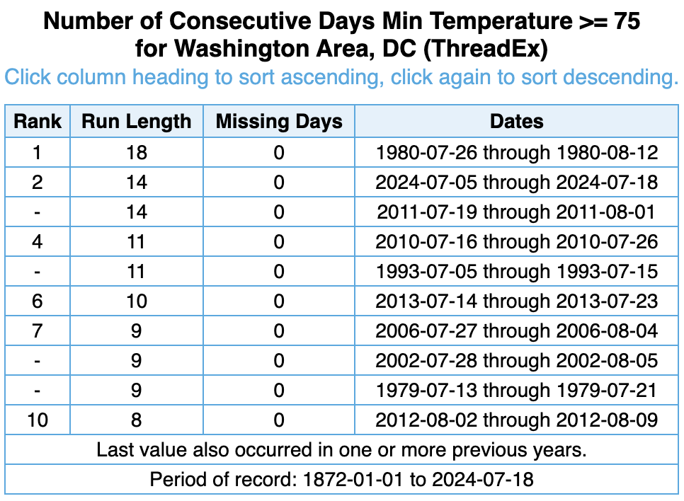 July 19, 2024 Extreme Weather in the Northeast The Northeast has seen multiple types of extreme weather this July. Parts of the Mid-Atlantic are experiencing extreme drought for the first time in over a decade. Temperatures, particularly low temperatures, have been record or near-record hot. Preliminary data indicates that New York has likely seen its most tornadoes in a single month on record. Areas of Vermont, northern New Hampshire, and northern New York saw significant flash flooding. These extreme events have caused a multitude of impacts and contributed to several deaths.
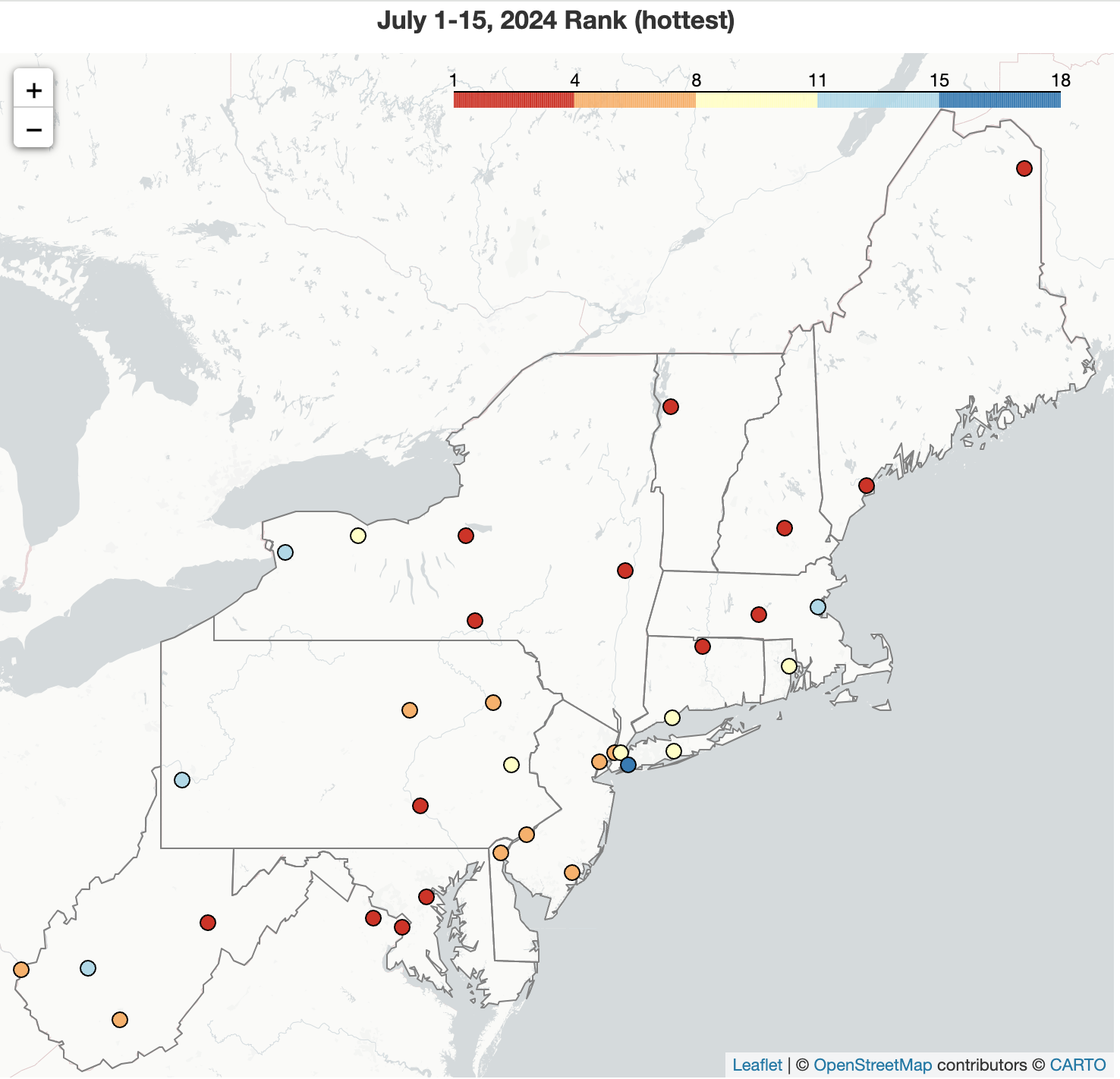 July 16, 2024 Summer Swelter The summer swelter started in June and continued into the first half of July, which was record hot for three major climate sites and among the 20 hottest for another 31 of the sites. The sporadic precipitation pattern of June was also noted during the first half of July. The period was record dry Harrisburg, PA, and among the 20 driest for five additional major climate sites, with drought expanding and intensifying in parts of the Mid-Atlantic. Conversely, the period ranked among the 20 wettest for four other major climate sites, due in large part to the remnants of Hurricane Beryl which produced damaging flash flooding and multiple tornadoes.
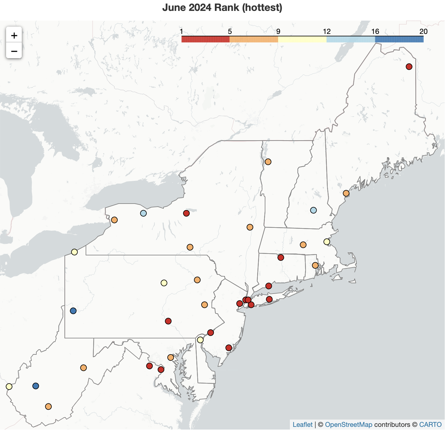 July 1, 2024 A Sizzling Start to Summer The first month of summer brought the heat, with several locations experiencing record warm temperatures. For instance, four major climate sites had their hottest June on record, and Caribou, ME, and Burlington, VT, tied their all-time warmest low temperatures on record during a mid-month hot spell. The month featured multiple rounds of severe weather, with some storms producing highly-localized intense rainfall that pushed monthly totals to the wet side of normal. At the opposite extreme, areas like southern Maryland and eastern West Virginia saw little rainfall, allowing drought and abnormal dryness to expand rapidly.
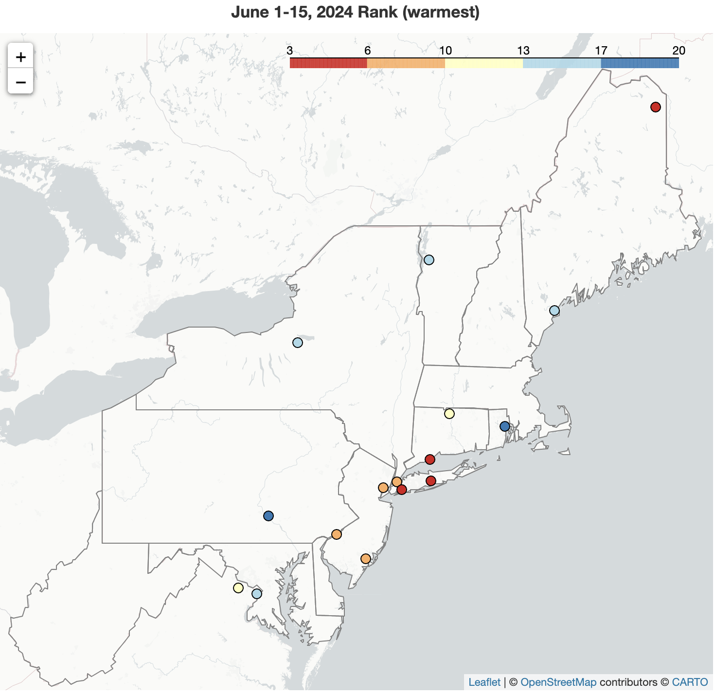 June 16, 2024 Start of Summer While interior locations saw a cooler-than-normal start to June, the rest of the Northeast experienced above-normal temperatures. In fact, this June 1-15 period ranked among the 20 warmest on record for 16 of the region's major climate sites. The first half of June featured drier-than-normal conditions for much of the Northeast, ranking among the 20 driest June 1-15 periods at nine major climate sites.
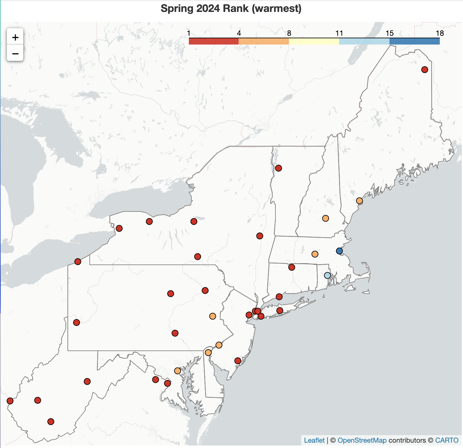 June 1, 2024 A Warm, Wet Spring Spring was record warm for three major climate sites and featured above-normal temperatures for the entire Northeast. All three months of the season featured near- or above-normal temperatures. Meanwhile, May precipitation was variable, but March and April featured excessively soggy conditions in some locations, sending spring to the wet side of normal for most areas. Spring snowfall was below normal for many locations, with parts eastern New York and northern New England being the snowy exceptions. However, almost the entire Northeast had deficits for the snowfall season, which runs from October through May. For instance, Erie, PA, was missing 79.5 inches, or 6.6 feet, of snow this season.
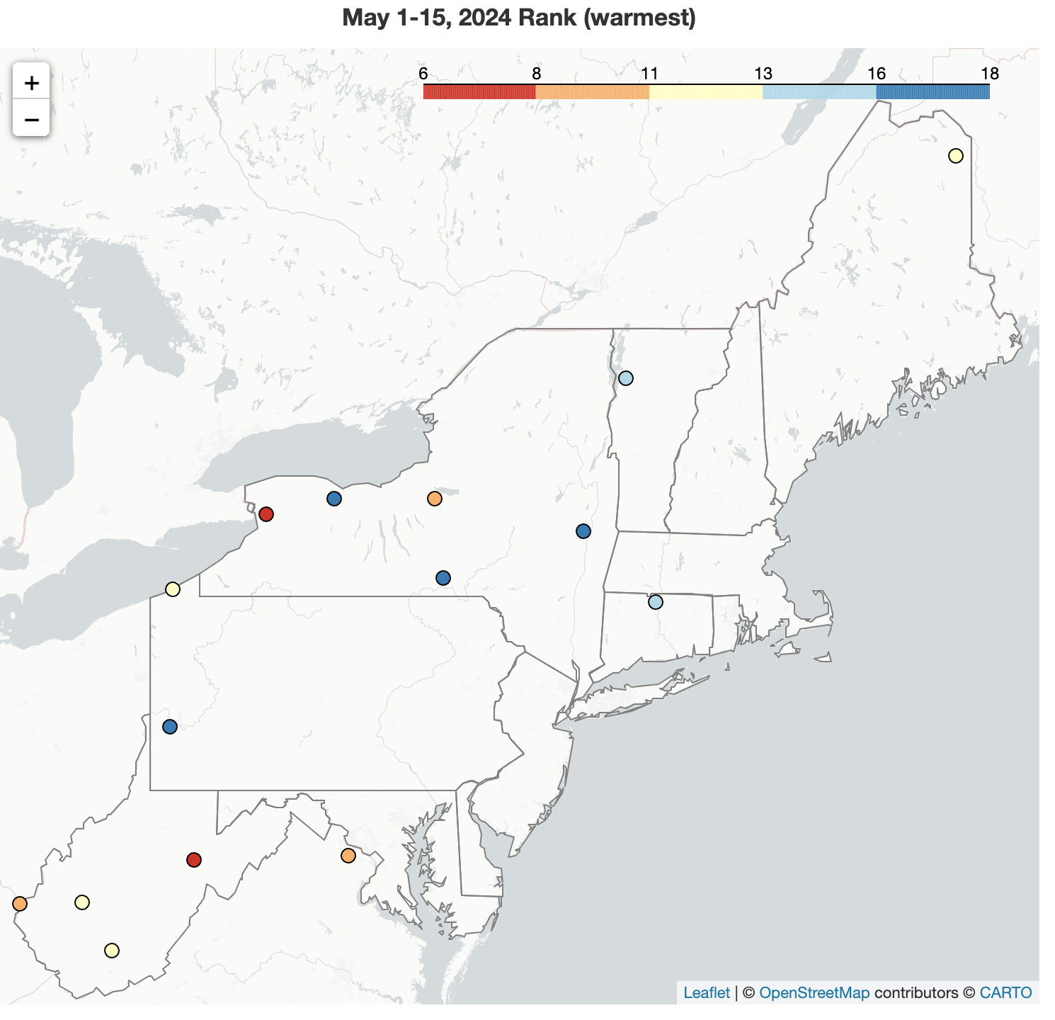 May 16, 2024 The Middle of May Average temperatures were near or above normal for much of the Northeast during the first half of May, with the period ranking among the 20 warmest on record for 15 major climate sites. May 1-15 precipitation varied, ranging from less than 50% of normal in places like Caribou, ME, which had its 13th driest such period, to over 200% of normal in places like Williamsport, PA, one of several sites where the period ranked among their 20 wettest.
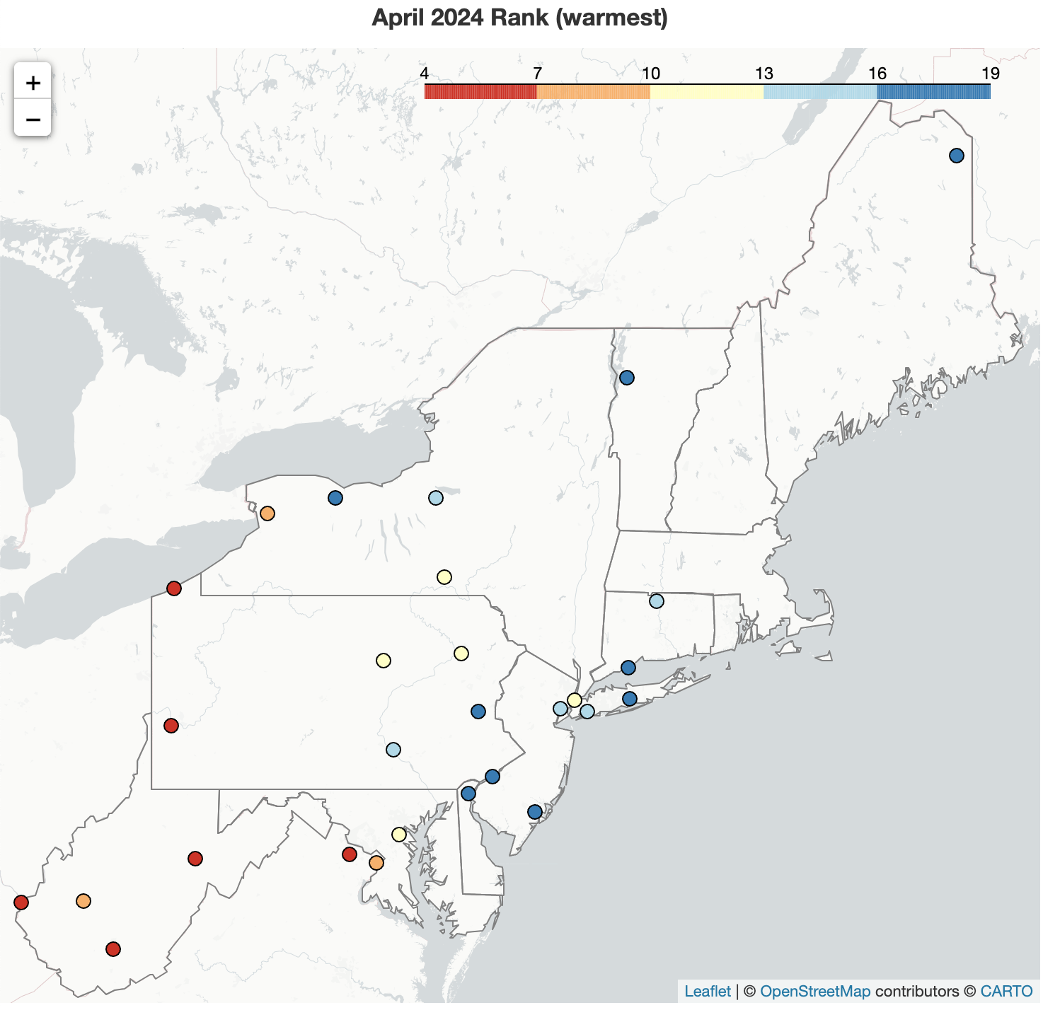 May 2, 2024 Abundant April Showers For Some April was yet another warmer-than-normal month for much of the Northeast, ranking among the 20 warmest Aprils on record for 28 of 35 major climate sites. While some interior parts of the Northeast were saturated, the extreme ends of the region were much drier. An early month storm gave some northern locations a snowfall surplus; however, much of the region saw below- or near-normal monthly snowfall.
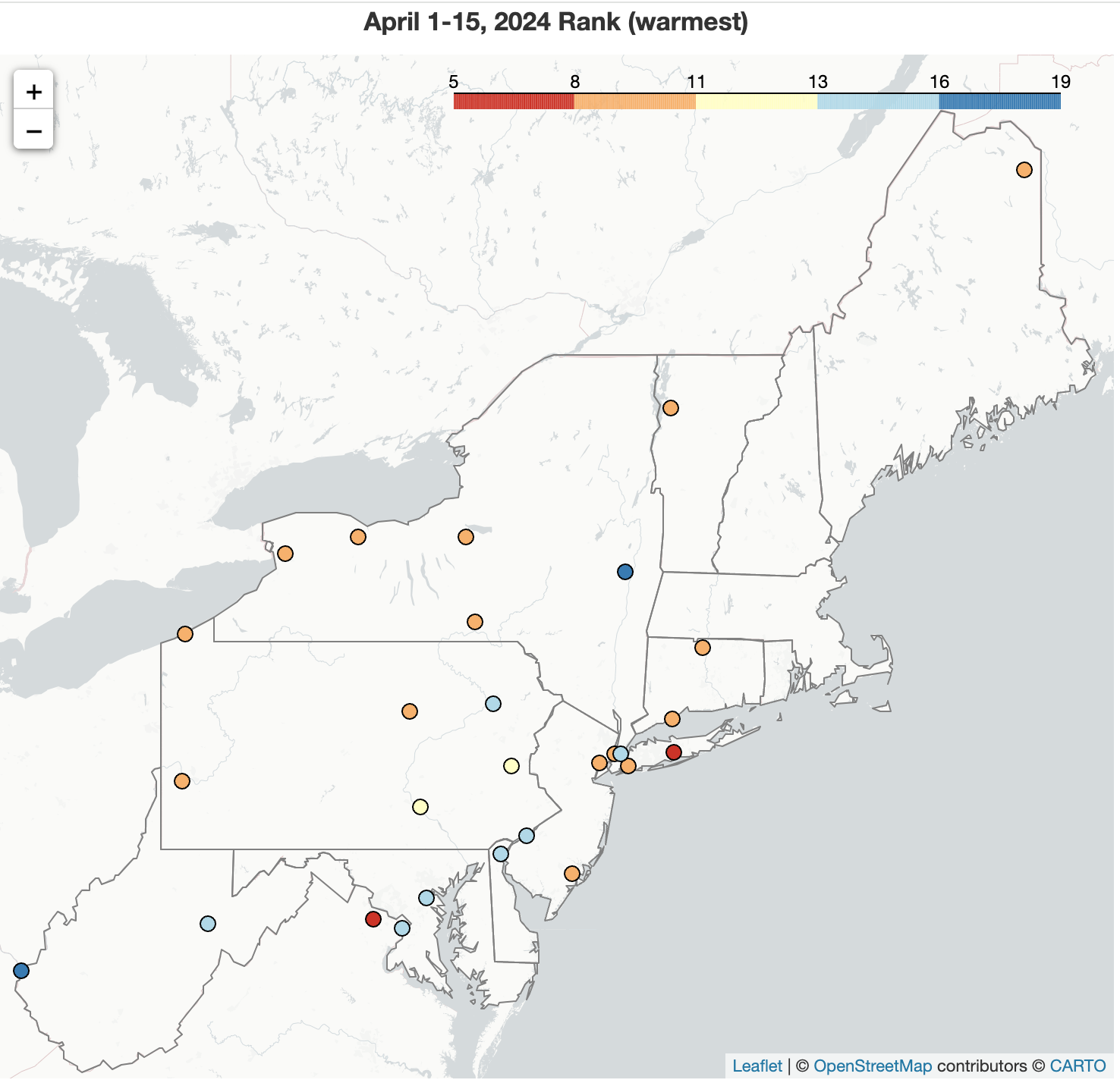 April 16, 2024 Mid-April - Mostly More of the Same Above-normal temperatures continued through the first half of April across the Northeast, with this April 1-15 period ranking among the 20 warmest on record at 28 major climate sites. Almost the entire region was wetter than normal during the first half of April. In fact, four major climate sites were record wet and another 22 of the sites experienced one of their 20 wettest April 1-15 periods. Snowfall was near-normal for many areas; however, portions of New England and New York saw a snowfall surplus that resulted in one of the 20 snowiest April 1-15 periods for a few sites.
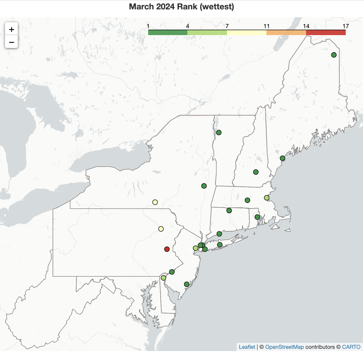 April 1, 2024 March - Sopping Wet for Some March was a wet month for much of the Northeast, with seven major climate sites (that are closer to the coast) including Bridgeport, CT, and Atlantic City, NJ, being record wet. March also continued in the footsteps of previous months by featuring unusually warm temperatures, ranking among the 20 warmest Marches on record for all but one major climate site. While this March was the least snowy on record (tying several other years in most cases) for eight major climate sites including Philadelphia, PA, and Boston, MA, much of northern New England saw a snowfall surplus.
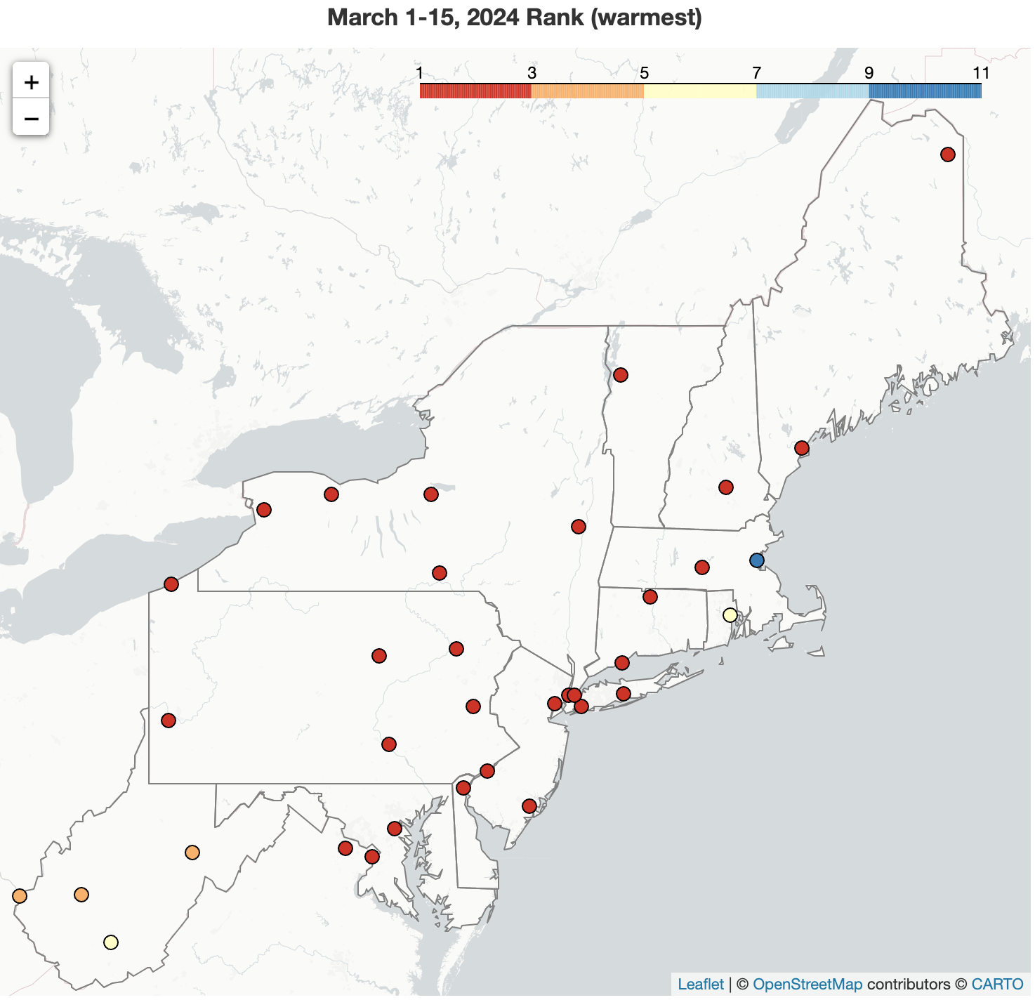 March 19, 2024 A Record-Setting Start to March On the heels of an exceptionally warm winter, the first half of March was record warm for 17 major climate sites. The March 1-15 period was also quite wet but featured little snowfall. In fact, five major climate sites were record wet and five had their least snowy start to March.
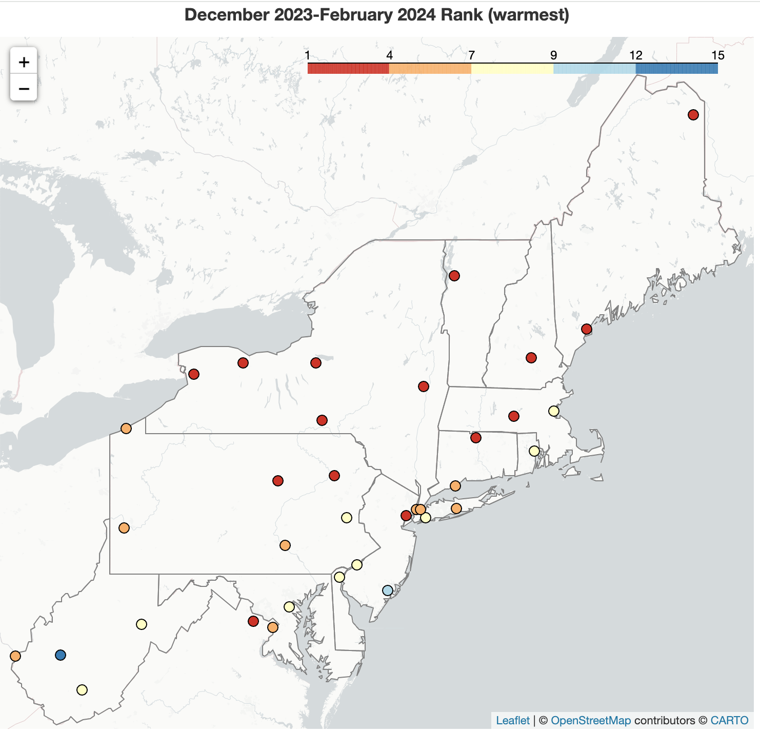 March 1, 2024 Warm Winter In line with climate trends in the Northeast (and boosted by atmospheric teleconnections like a positive North Atlantic Oscillation), winter 2023-24 was unusually warm, with six major climate sites experiencing their warmest winter on record. Each month of the season was also warmer than normal, with record-setting temperatures for three New York sites - Syracuse, Buffalo, and Albany. The generally wet conditions of December and January overrode February's dryness to make the winter season wetter-than-normal for much of the region. In fact, four major climate sites had a record wet winter. This wetness did not translate into snowfall, though, as most areas wrapped up winter with a snowfall deficit. Limited snowfall, record low in a few cases, in December and February were the primary drivers.
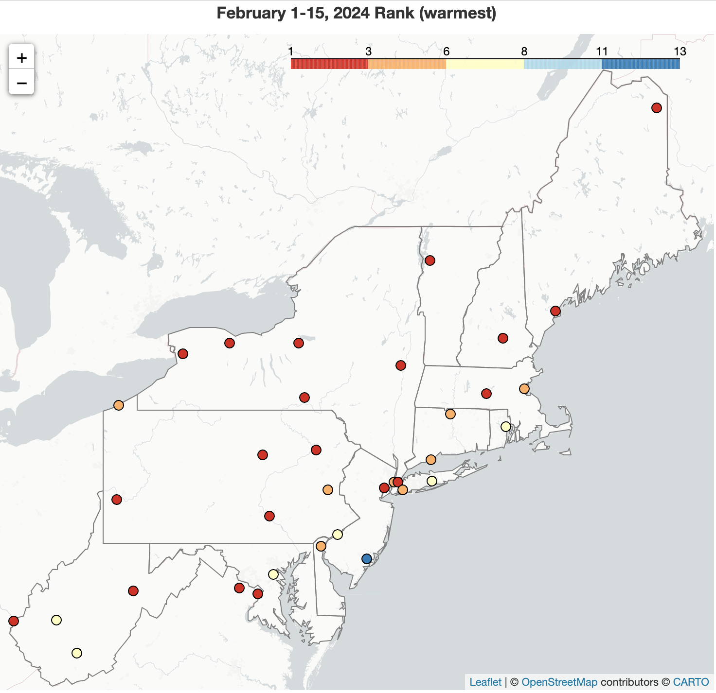 February 16, 2024 Fallen Records Multiple long-standing records for the February 1-15 period fell as the Northeast experienced exceptionally warm and dry weather, with limited snowfall. Nine major climate sites registered their warmest first half of February on record. Meanwhile, Pittsburgh, PA, had its driest and least snowy start to February. Erie, PA, also had its least snowy February 1-15 period, with no measurable snow. Interestingly, a few sites, like Harrisburg, PA, were snowier than typically snowy sites, like Caribou, ME, thanks to a mid-month storm.
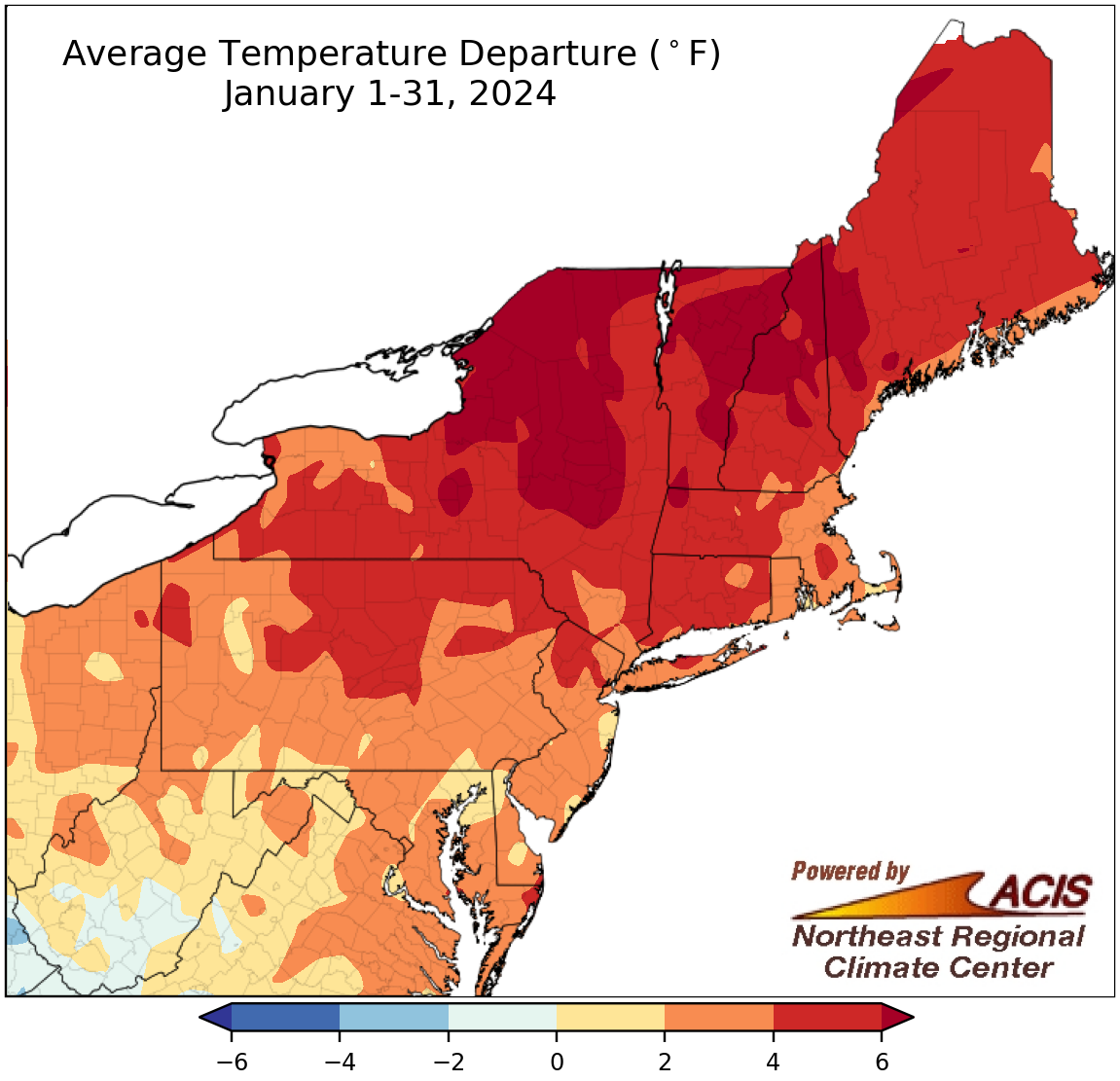 February 1, 2024 January - Warm and Soggy Much of the Northeast experienced a warmer-than-normal January, ranking among the 20 warmest Januarys on record for 15 major climate sites. The month was also soggy for most locations and ranked among the 20 wettest Januarys on record for 29 major climate sites. Despite the wet conditions, above-normal temperatures meant variable snowfall.
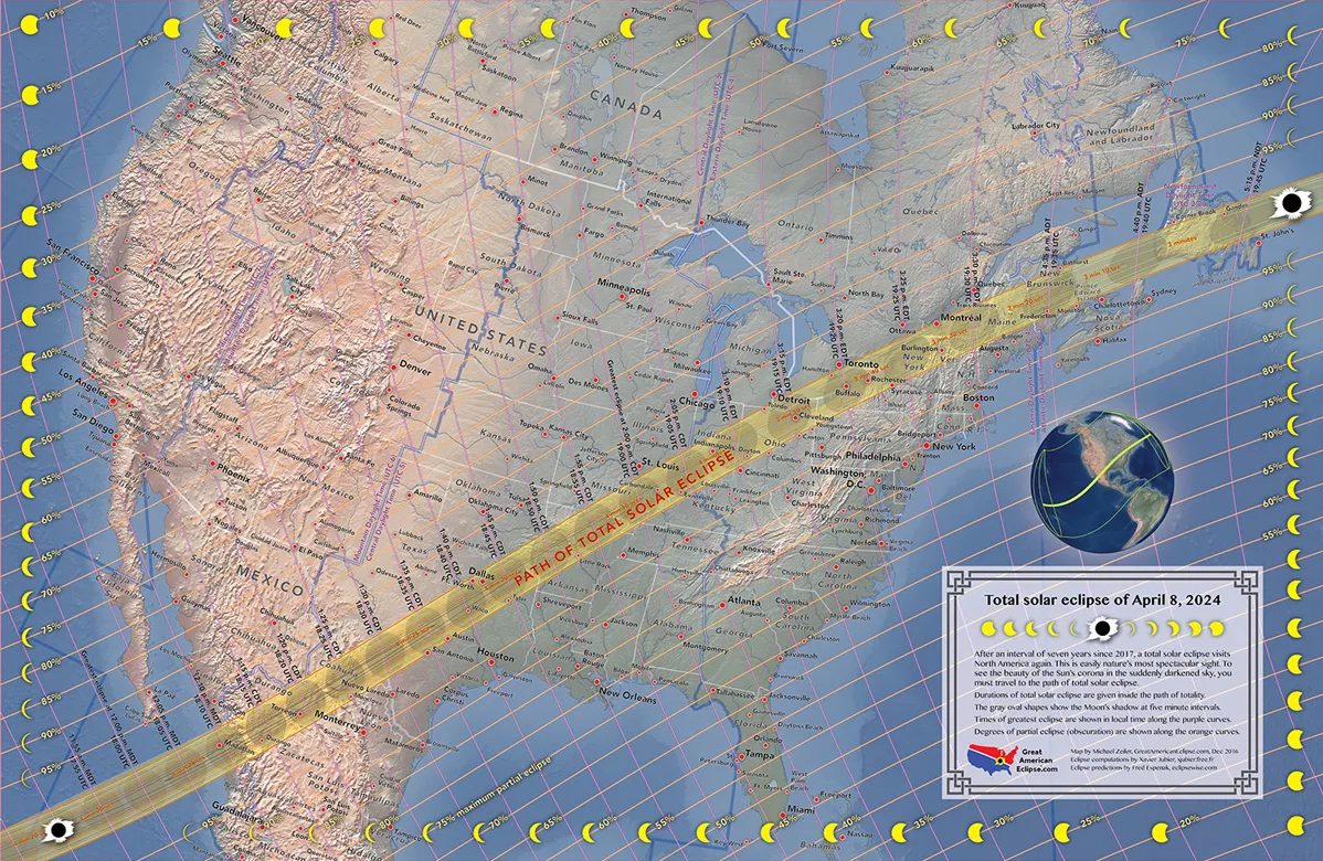 January 16, 2024 Solar Eclipse The U.S. will get to experience a total solar eclipse on April 8th this year. This special event will be visible along the path of totality if skies are clear. Historical sky cover data was analyzed to understand these chances.
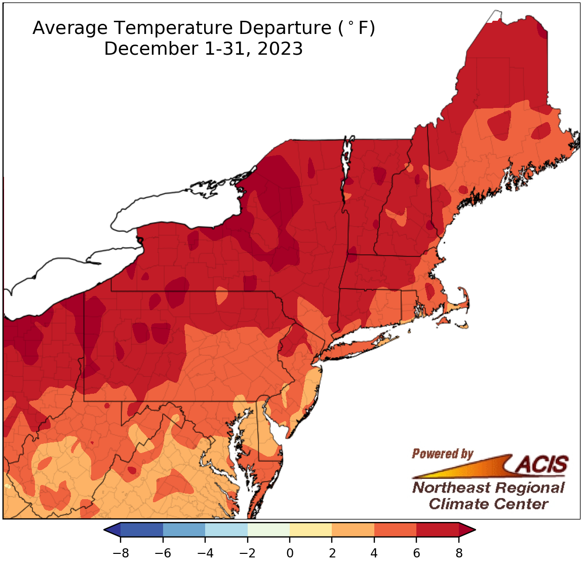 January 2, 2024 Broken Records - December and 2023 December featured record amounts of precipitation in spots close to the coast but was drier in interior areas - a familiar pattern during El Niño winters. However, unusually warm temperatures meant limited snowfall, including record low snowfall in a few spots. This warmth fit into the larger pattern of above-normal temperatures during 2023, now the warmest year on record for 13 major climate sites.
2023
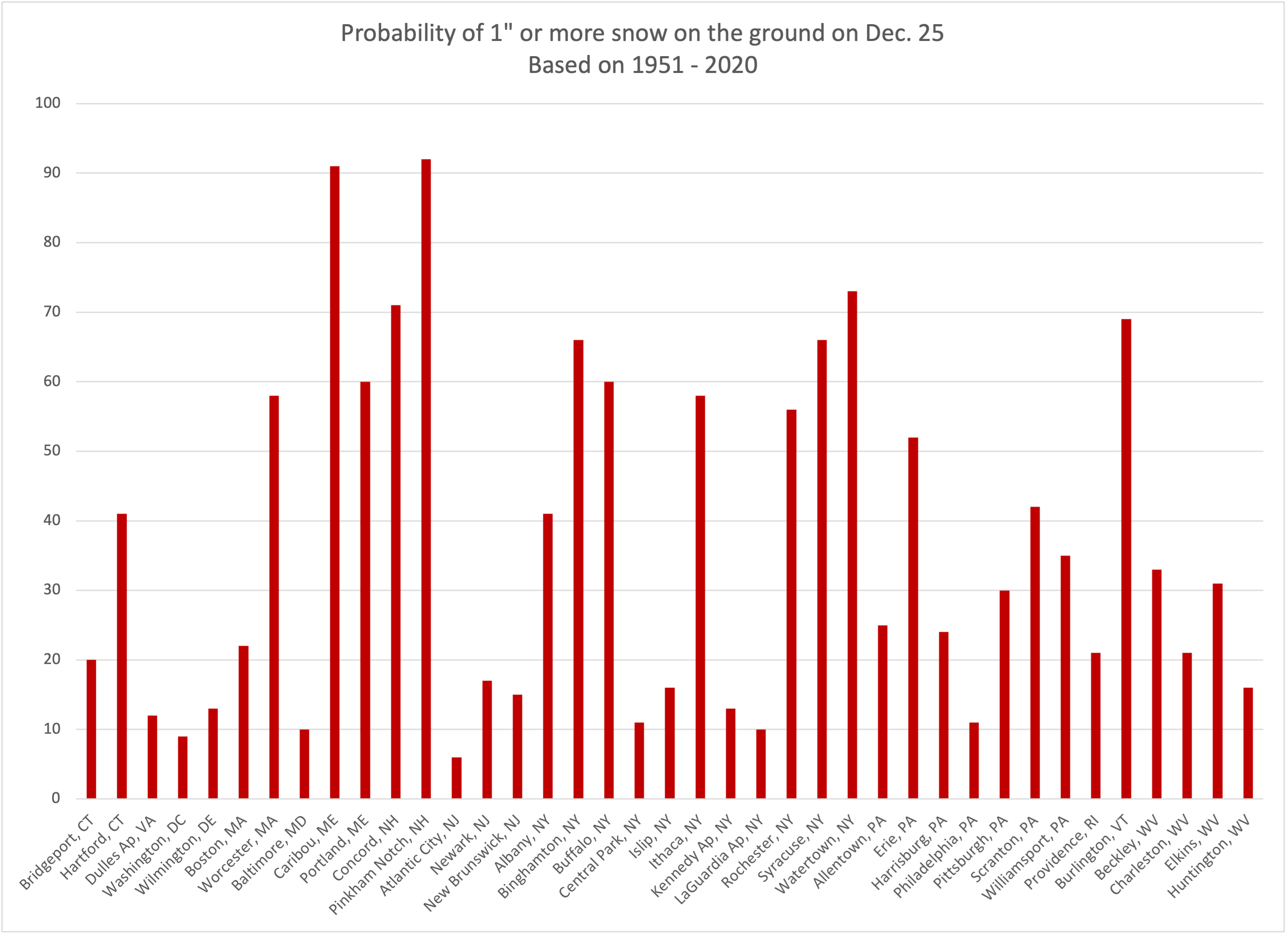 December 14, 2023 White? El Niño Christmas (2023) A not-so-white El Niño Christmas. Typically, we like to look at a long-term average to determine the probability of a white Christmas (years with at least an inch of snow on the ground). But this year we have a strong El Niño event to guide us.
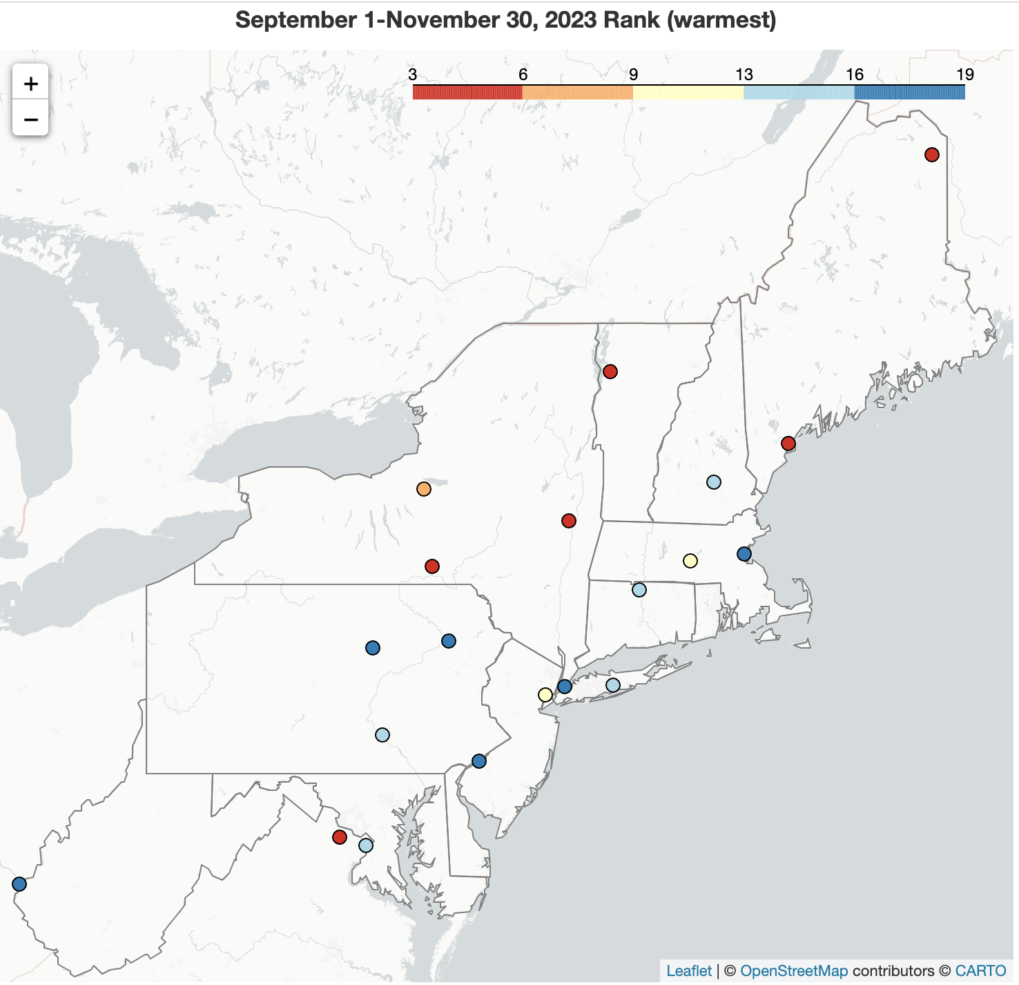 December 1, 2023 Fall Ends on a Cool, Dry Note Much of the Northeast saw below- or near-normal temperatures during November, the opposite of the other fall months which helped skew the full fall season to the warm side of normal. While November, and October, were generally drier than normal for many areas, September featured precipitation extremes. Exceptional wetness in some coastal areas during that month pushed LaGuardia Airport, NY, to have its wettest fall on record. November and fall snowfall were generally limited outside of some lake-effect zones and parts of northern New England.
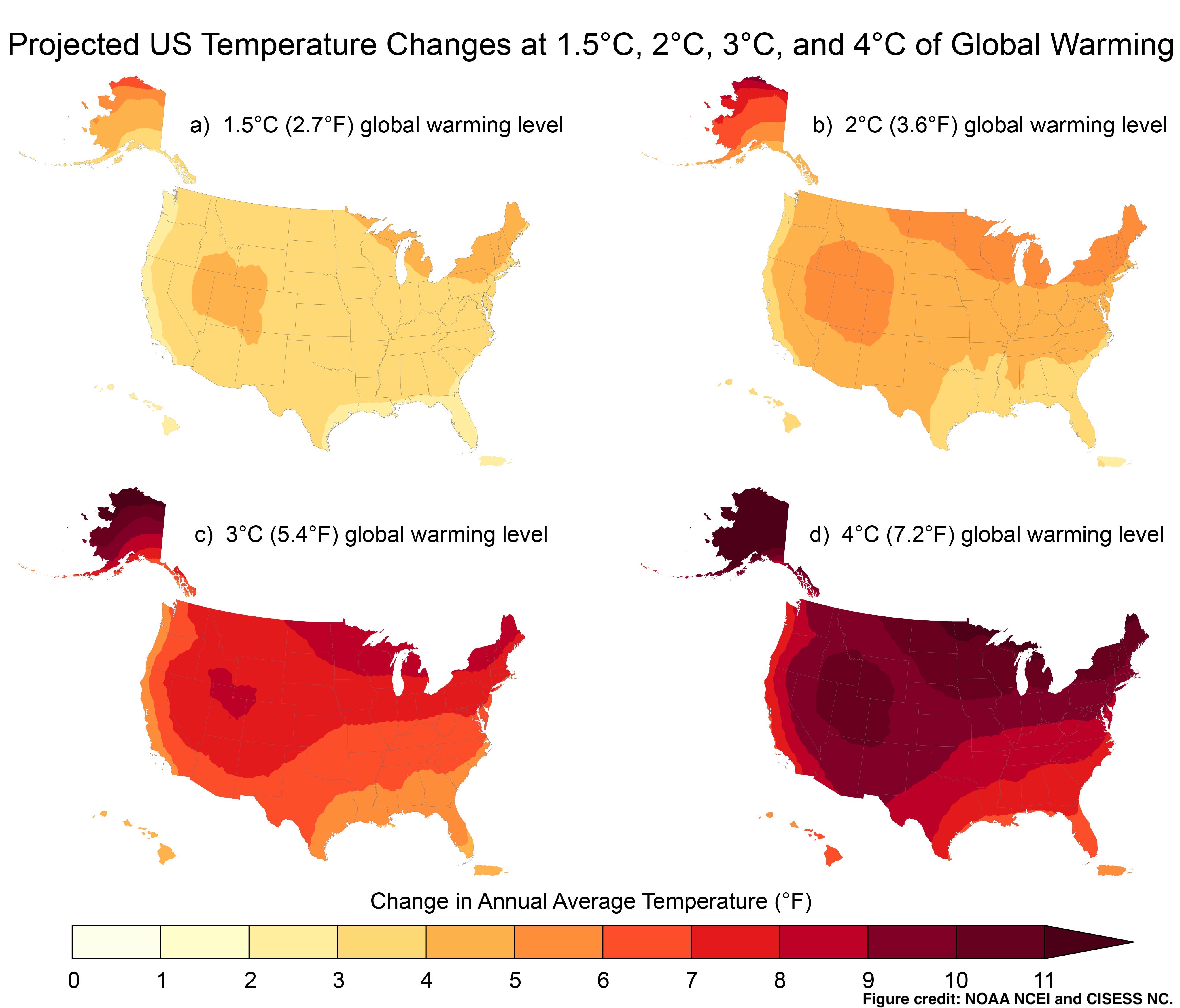 November 15, 2023 Climate Change Impacts in the Northeast The Fifth National Climate Assessment indicates the Northeast has continued to get warmer and wetter, with those trends expected to continue under future scenarios. The ocean also continues to warm, with notable impacts such as an increased flood threat and rapid intensification of tropical systems.
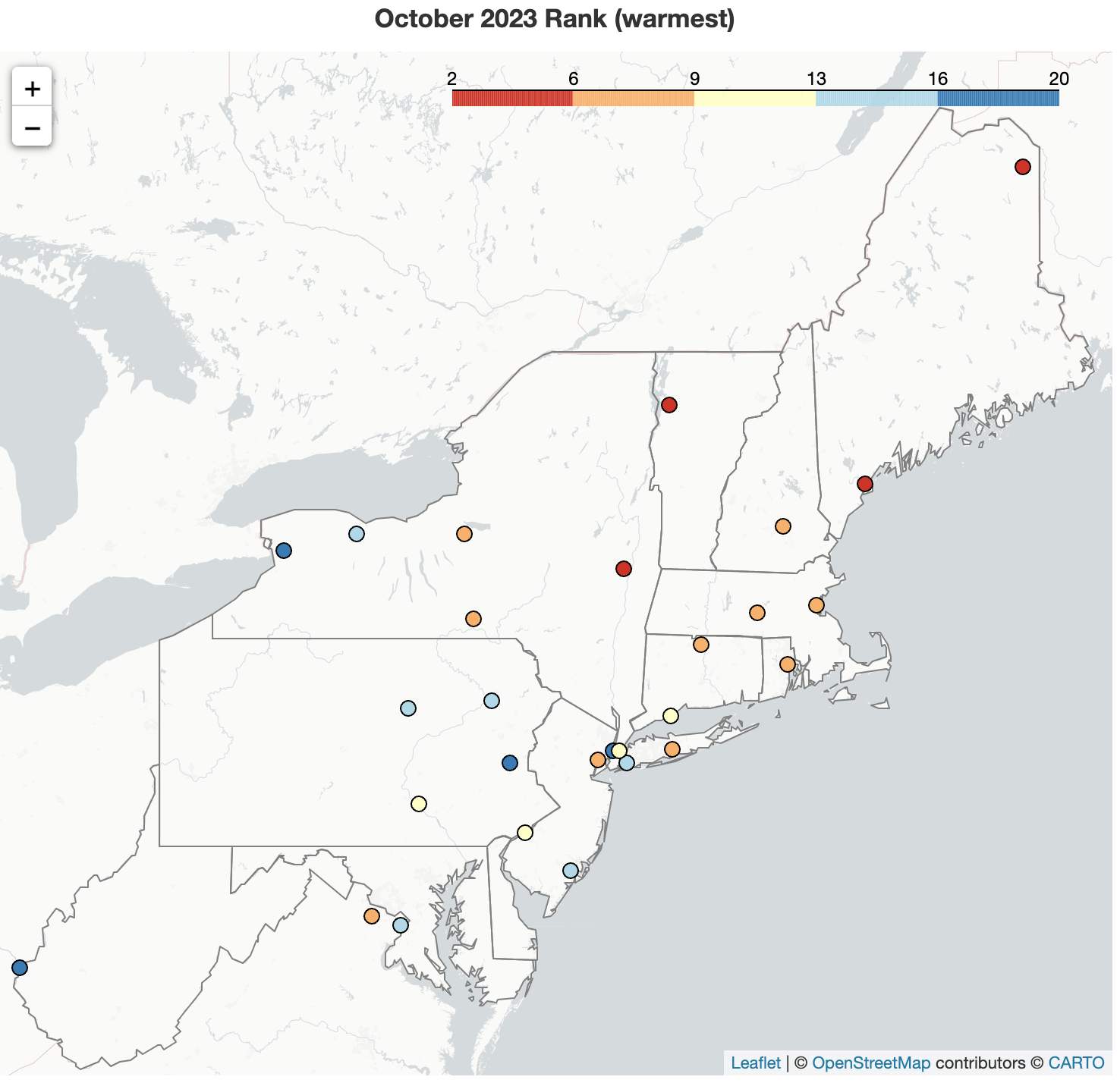 November 1, 2023 An Orange October This October ranked among the 20 warmest on record for 28 of the Northeast's 35 major climate sites. It was a drier-than-normal month for multiple areas, especially the southeastern corner of the region where some sites saw less than 25% of normal precipitation. The month ended with the first measurable snow of the season at a few locations, making it one of their 20 snowiest Octobers on record.
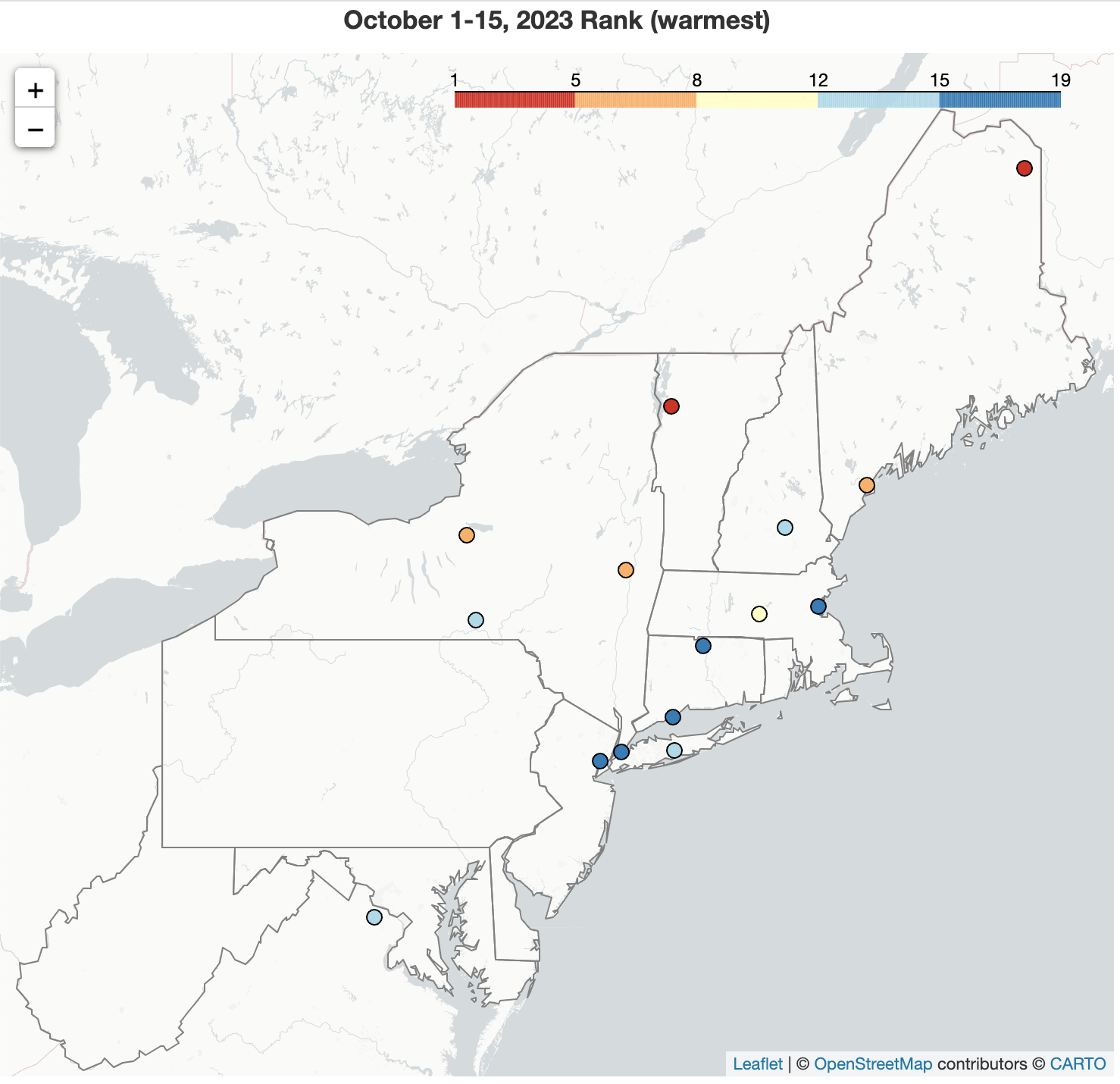 October 16, 2023 October Kicks off With Warm, Mostly Dry Conditions Portions of New York and New England saw unusually mild temperatures in early October, with Syracuse, NY, and Burlington, VT, having their warmest high temperatures for October on record. Almost the entire Northeast was warmer than normal from October 1-15, with Caribou, ME, being record warm. Many parts of the region also saw below or near-normal precipitation, particularly coastal New England where precipitation was less than 25% of normal.
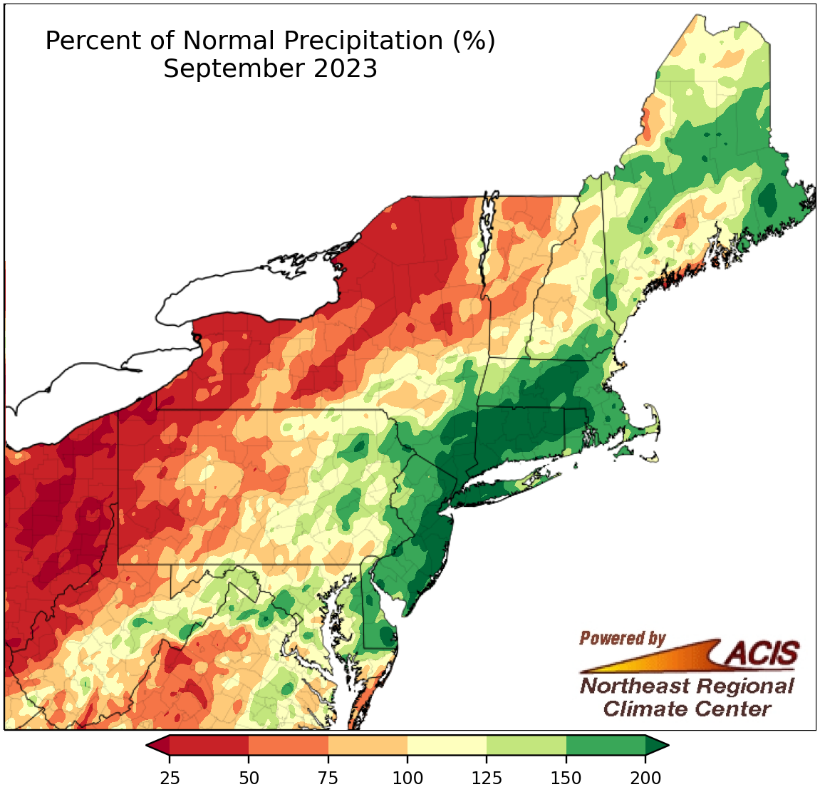 October 2, 2023 Precipitation Extremes in September A late-month deluge brought record rainfall to the New York City metro area and pushed monthly rainfall totals into record territory. While multiple coastal areas were saturated, drier-than-normal conditions in interior areas allowed abnormal dryness to expand. Meanwhile, the month featured near- or above-normal temperatures for much of the region.
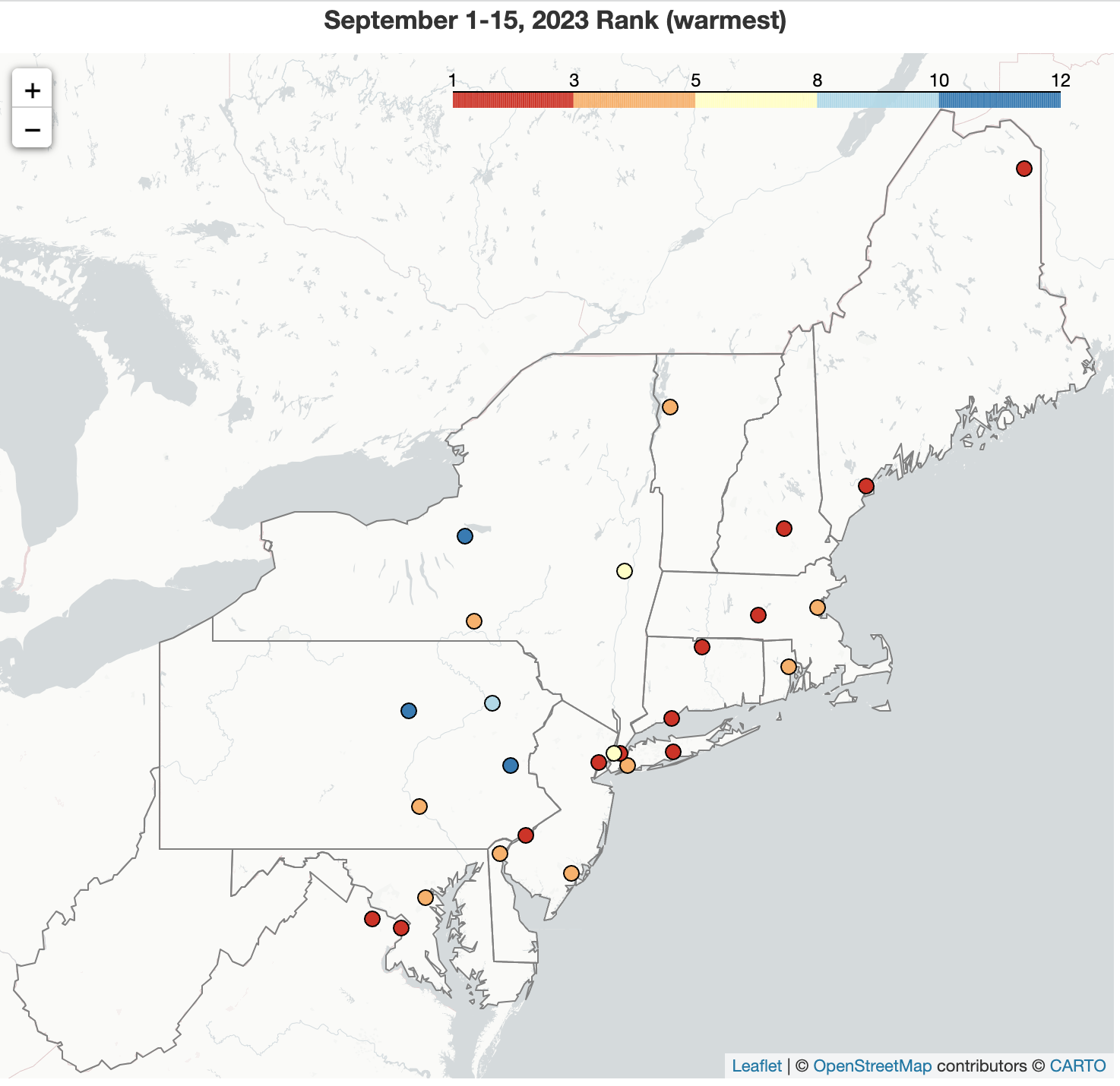 September 19, 2023 A Wicked Warm Start to September The first half of September was record warm for Worcester, MA; Dulles Airport, VA; Islip, NY; and Philadelphia, PA, and among the 10 warmest for another 20 major climate sites. This was driven by an exceptionally warm first 10 days of the month when Dulles Airport, VA, had its hottest September temperature on record and Islip, NY, and Caribou, ME, had their warmest low temperatures for September. For several other sites, their high and/or low temperatures ranked among the 10 warmest for September, in some cases on multiple days.
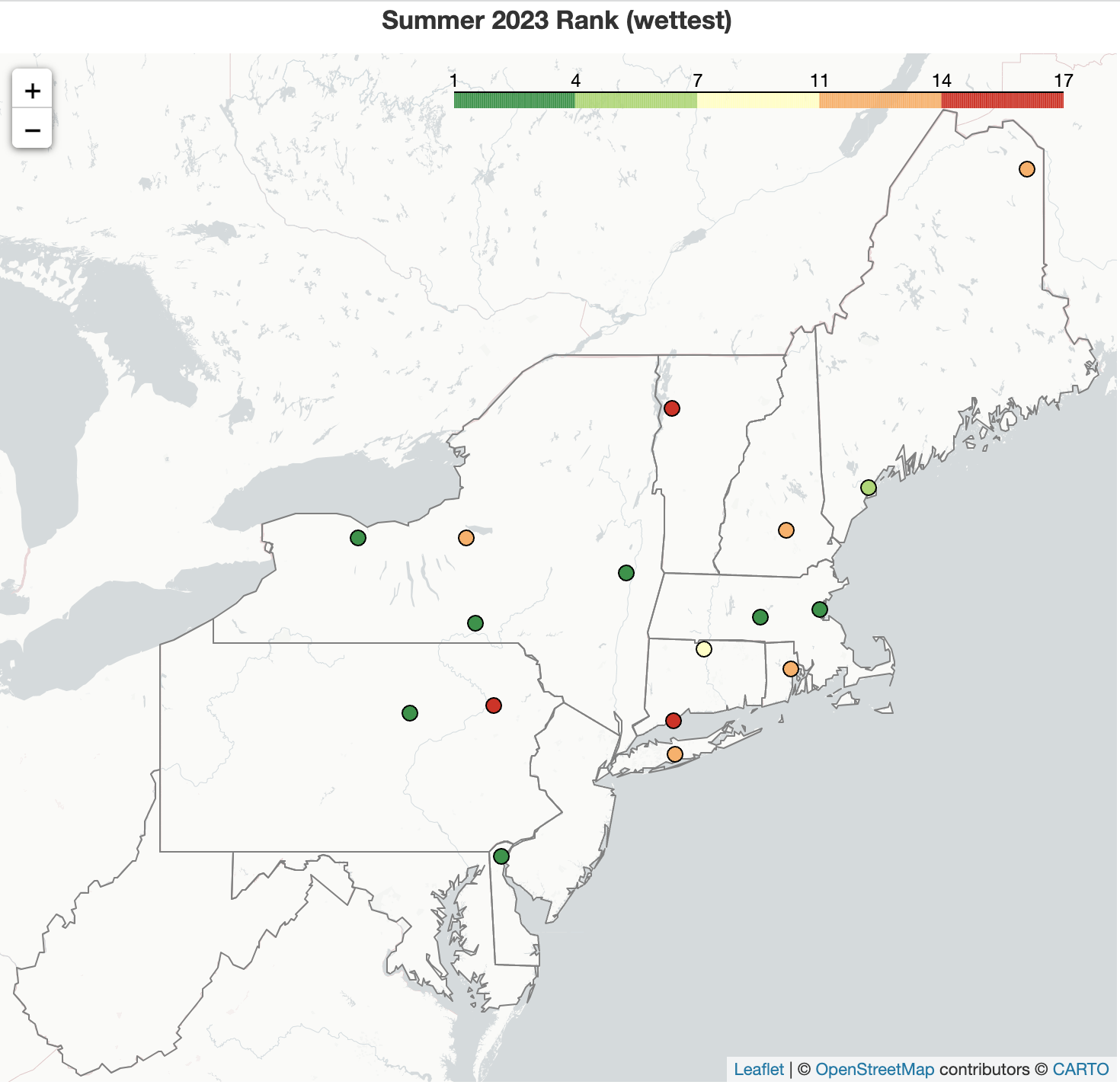 September 1, 2023 A Soggy, Cool Summer for Many Albany, NY, experienced its wettest summer on record, while another 16 major climate sites had one of their 20 wettest summers. This was driven by an exceptionally wet July, with a push from a mostly wetter-than-normal August. June was the outlier with mostly drier-than-normal conditions outside of New England. Summer was notably cooler in western parts of the region but warmer in northern areas, particularly parts of northern New England which experienced an unusually hot July. June and August trended cooler than normal for most areas.
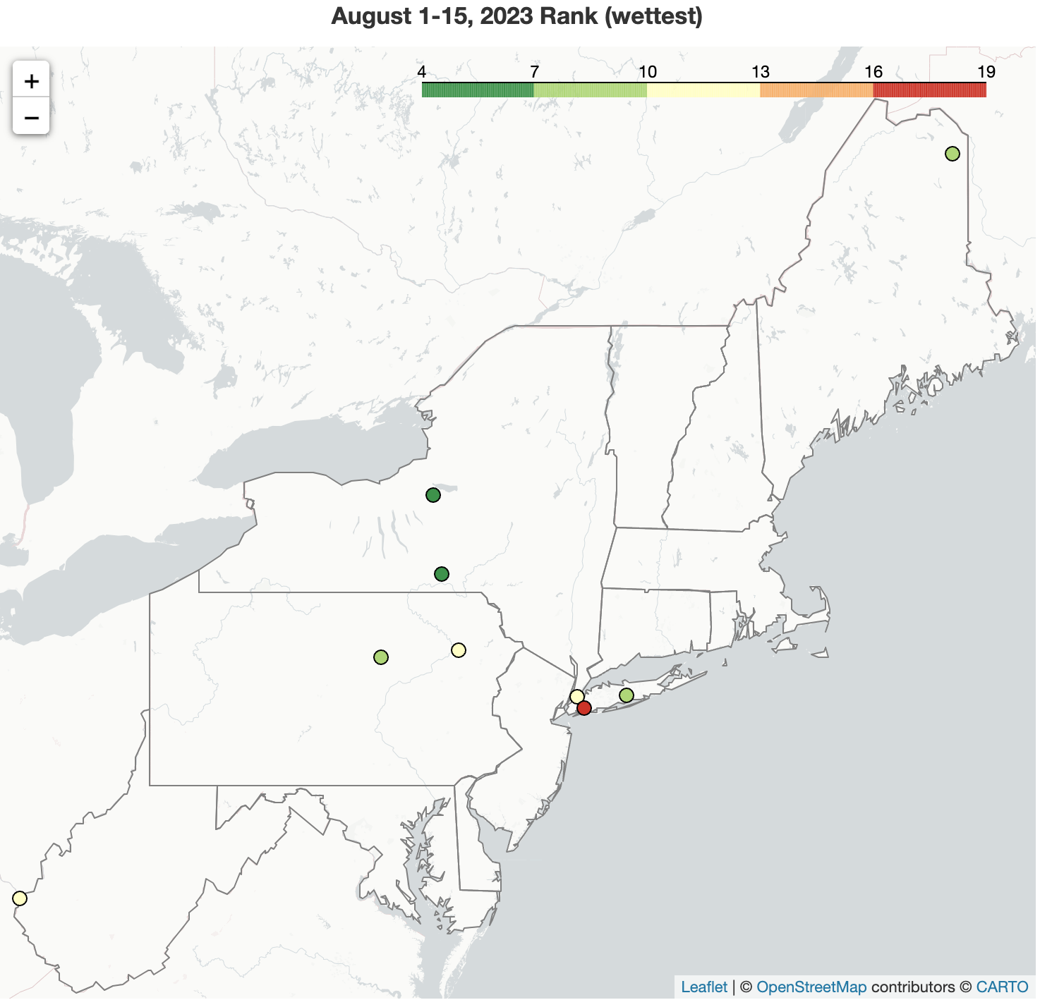 August 16, 2023 August Starts Off Wet and Cool The first half of August was wetter than normal for much of the Northeast, ranking among the 20 wettest August 1-15 periods for nine major climate sites. Average temperatures for the same period were below or near normal across the region.
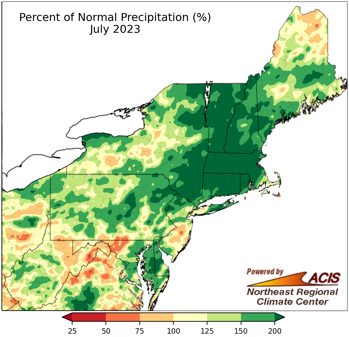 August 1, 2023 July - Record Wet, Record Warm July was a wet month that featured multiple rounds of extreme precipitation and flash flooding. Two major climate sites - Hartford, CT, and Albany, NY - recorded their wettest July since records began. The month was also warmer than normal, with Caribou, ME, experiencing its all-time warmest month on record.
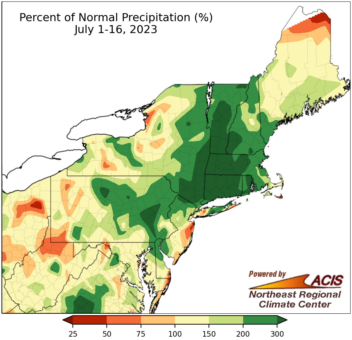 July 17, 2023 Excessive Rainfall During the First Half of July Many parts of the Northeast have seen an excess of rainfall during the first half of July, with a few major climate sites already having one of their five wettest Julys on record. Frequent bouts of heavy rainfall and wet antecedent conditions have led to flash flooding multiple times throughout the first half of July. For instance, an extreme rainfall event with amounts of 5 to 9 inches occurred from July 9 to 11, causing significant flooding in areas such as Vermont and New York's Hudson Valley. For multiple Vermont locations, two-day rainfall amounts qualified as or surpassed a 200-year storm event, with a 0.5% chance of occurring in a given year. The Northeast has seen an increase in the number and intensity of extreme rainfall events, with the trend expected to continue.
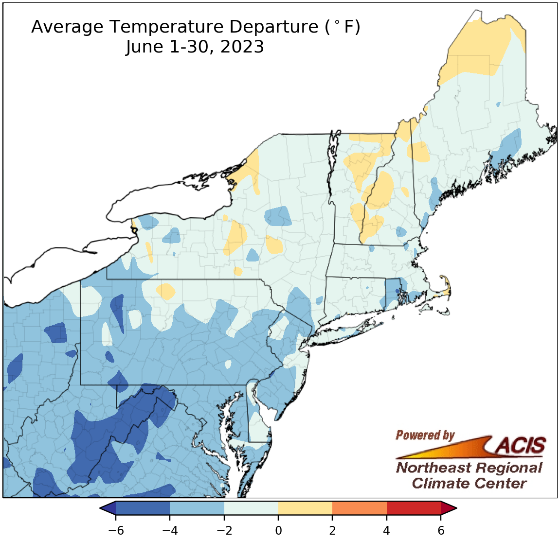 July 3, 2023 June - Mother Nature Turned on the Air Conditioner Mother Nature turned the air conditioner on over the Northeast in June, with most of the region seeing cooler than normal temperatures much of the month. This June ranked among the 20 coolest Junes on record for 13 of the 35 major climate sites. June precipitation was variable. Some of the driest locations included central Maryland, southeastern New York, and Connecticut, where drought and/or abnormal dryness were present. Meanwhile, areas such as Maine and northern Delaware were excessively wet. In fact, Wilmington, DE, had its third wettest June, its 10th all-time wettest month, and two of its 10 wettest June days on record.
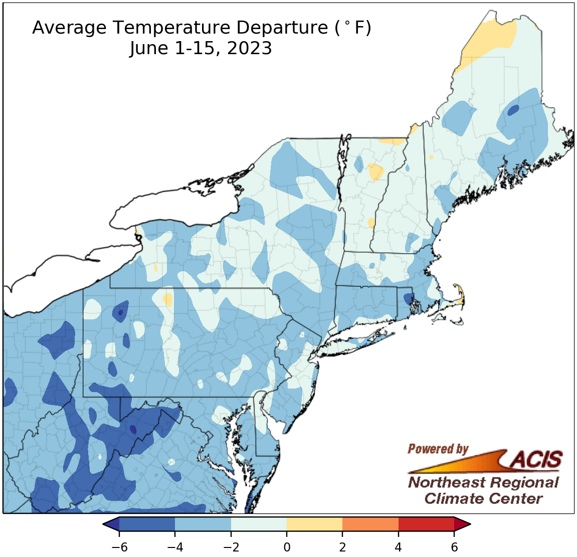 June 16, 2023 A Cool Start to Summer A stalled low pressure system kept conditions cool (and smoky) during the first half of June. While precipitation varied across the region, there was a broad expansion of moderate drought and abnormal dryness.
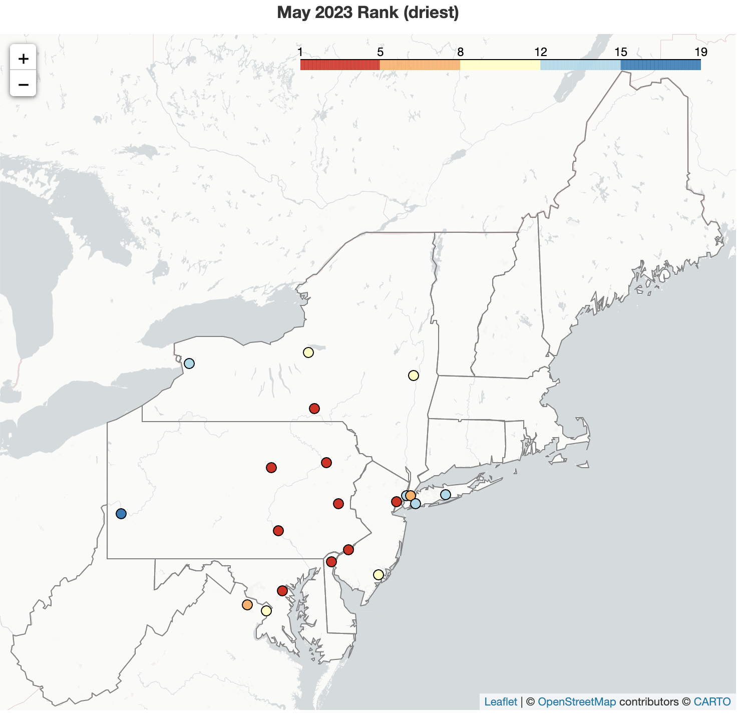 June 1, 2023 A Cool, Dry May Wraps Up Spring May was somewhat of an outlier compared to March and April. The month featured record or near-record dry conditions, leading to the widespread expansion of abnormal dryness in the Northeast. In fact, five major climate sites - Philadelphia, Harrisburg, and Williamport, PA; Wilmington, DE; and Binghamton, NY - had their driest May on record. May was also notably cool, the first such month (for some areas) since December 2022. May brought an end to the 2022-23 snow season, which was notably lacking snow. This snow season was the least snowy on record at six major climate sites - Beckley, WV; Bridgeport, CT; Central Park, NY; Dulles Airport, VA; Baltimore, MD; and Atlantic City, NJ - and among the 10 least snowy for multiple additional sites.
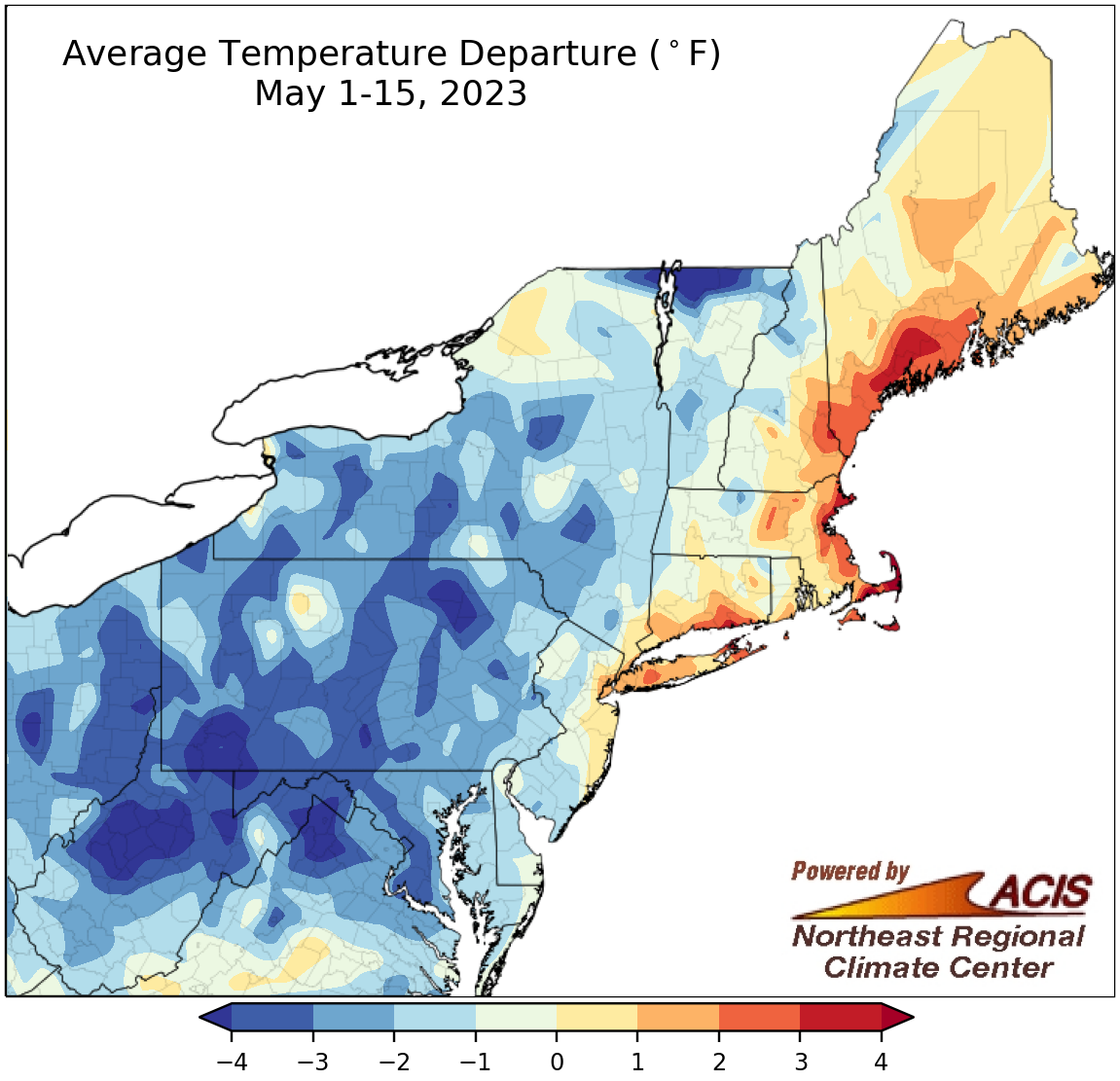 May 16, 2023 A Conflicted May-to-Date The first half of May featured a little bit of everything. While many areas saw below-normal temperatures, several places, including six major climate sites, had one of their 20 warmest May 1-15 periods. Meanwhile, this May 1-15 period ranked among the 20 driest on record for 18 major climate sites; however, a handful of locations, including Beckley, WV, were quite wet.
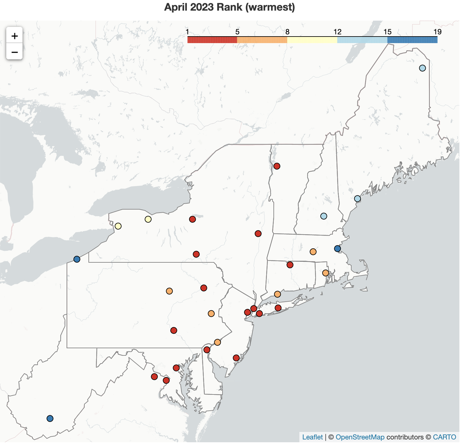 May 2, 2023 Wrapping Up a Warm April April was warmer than normal in the Northeast, with Wilmington, Burlington, and Newark having their warmest April on record. April showers were lacking to start the month but showed up during the second half, pushing some sites to one of their 10 wettest Aprils on record. April snowfall was limited, with only two major climate sites - Caribou and Binghamton - reporting measurable snowfall.
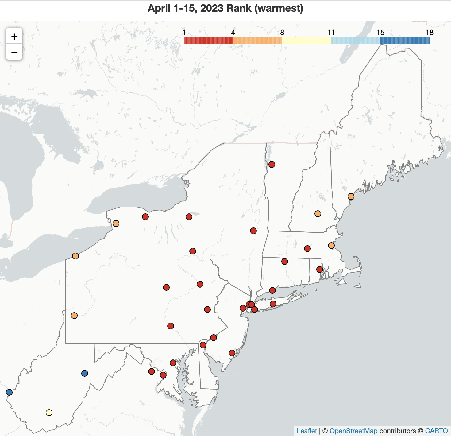 April 17, 2023 April So Far - Lots of Warmth but Limited Showers Both April to-date and spring to-date have been similar for many locations - warmer than normal, drier than normal, and lacking snow. The first half of April was record warm for Baltimore, MD; Wilmington, DE; and Washington, D.C., and among the five warmest for another 24 of the 35 major climate sites. In addition, Hartford, CT, tied its warmest April temperature with a high of 96°F on April 14. Meanwhile, with below-normal precipitation, moderate drought and abnormal dryness expanded in some southern and coastal parts of the region.
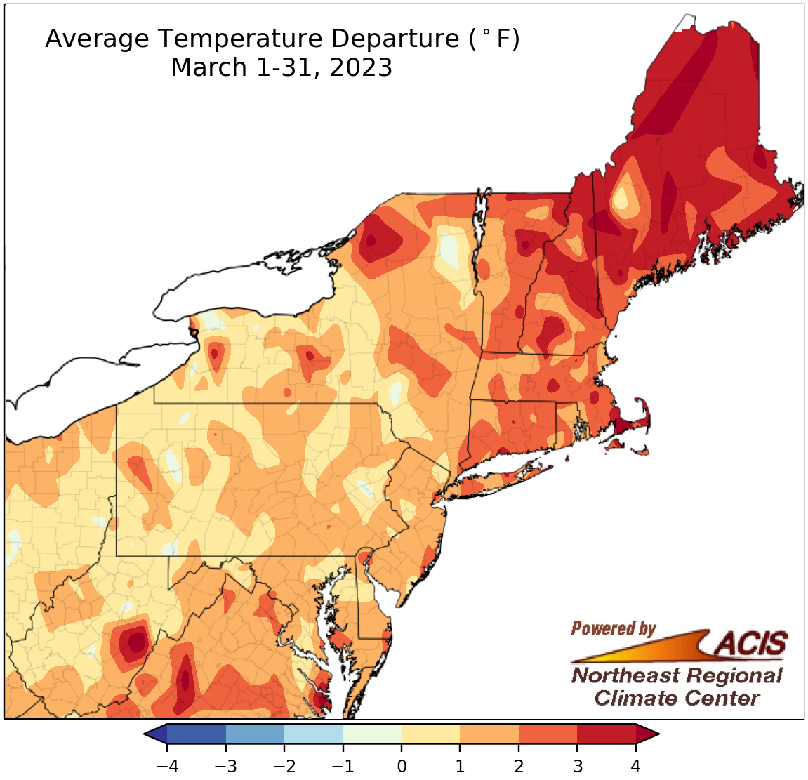 April 1, 2023 Marching on to April March temperatures were near or above normal for a majority of the Northeast. Southern parts of the region tended to see below normal snowfall and precipitation, with moderate drought introduced in Maryland and abnormal dryness expanding in some locations. Meanwhile, some northern areas saw above-normal snowfall thanks to a mid-month nor'easter, with some sites also seeing above-normal precipitation.
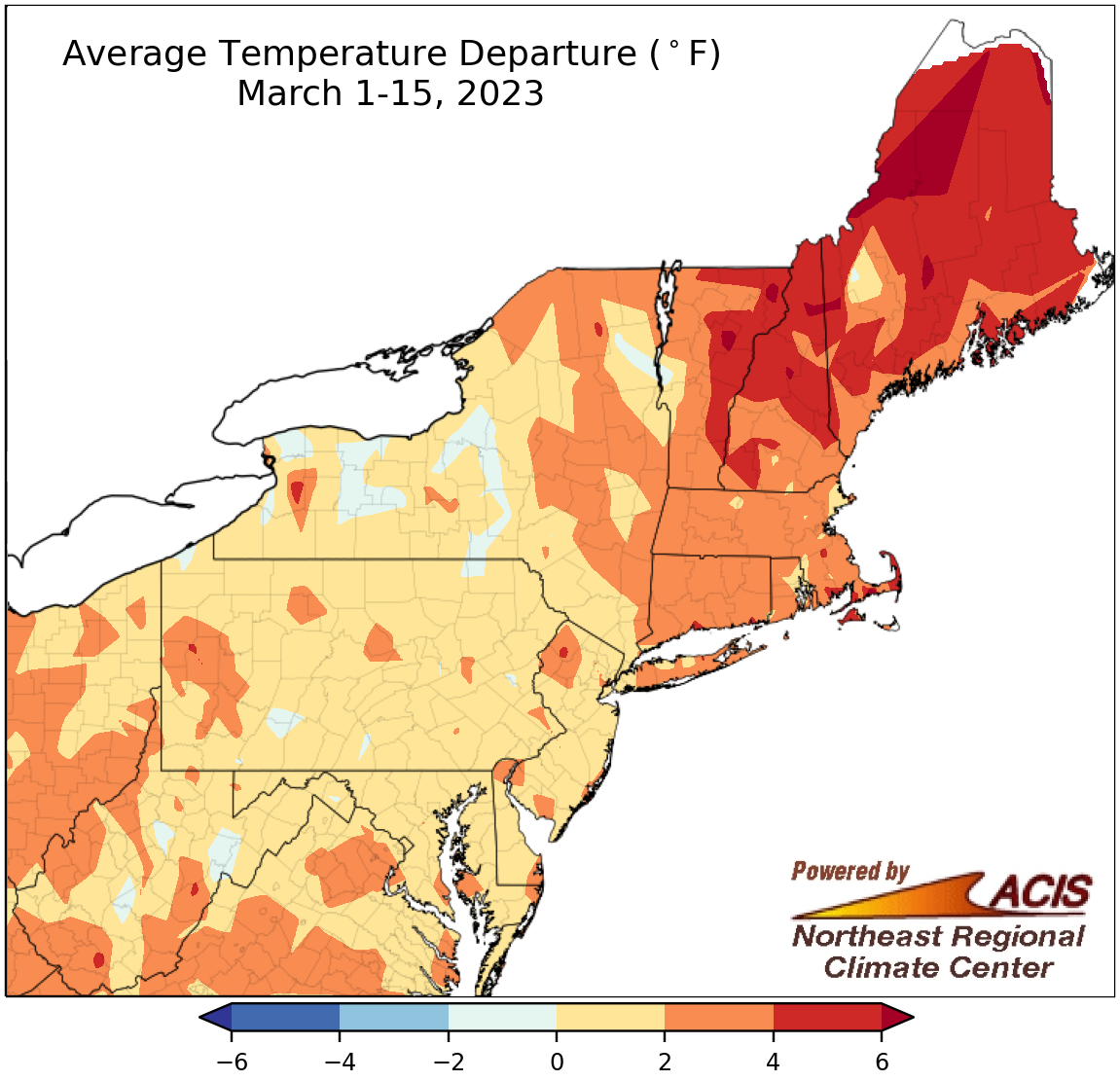 March 16, 2023 More Warmth but More Snow (For Some) Much of the Northeast saw above-normal temperatures during the first half of March. Despite that, portions of Pennsylvania, New York, and New England were snowier than normal, particularly due to a mid-month nor'easter that deposited feet of snow in some areas. Many of those same areas tended to see a wetter-than-normal first half of March.
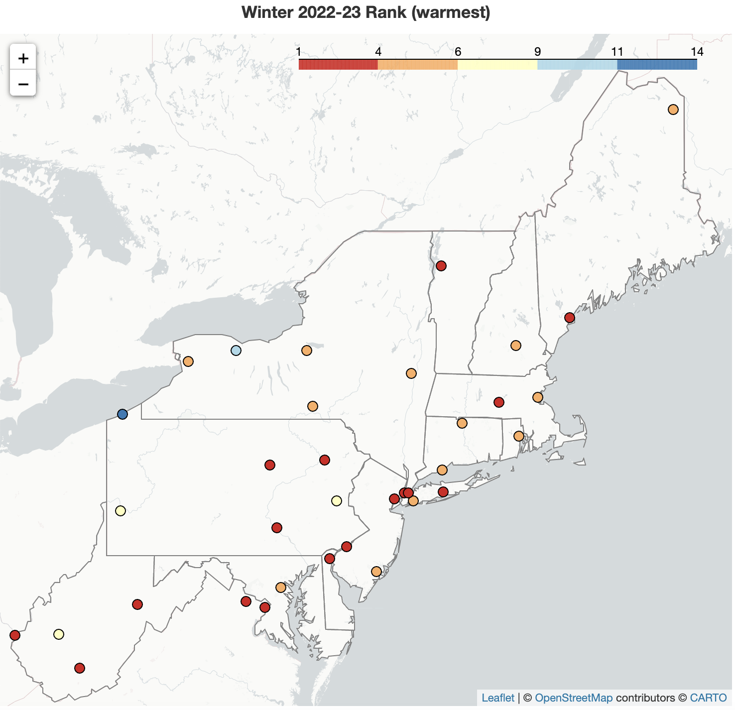 March 1, 2023 The Winter That Wasn't The Northeast experienced a warm winter that was punctuated by a few brief visits from Arctic air, wrapping up at 2°F to 8°F above normal for most areas. Winter 2022-23 was among the 10 warmest winters on record for 34 of the 35 major climate sites, with Worcester, MA, and Dulles Airport, VA, being record warm. The season featured paltry snowfall amounts for much of the Northeast, with deficits of over 36 inches in several locations. Baltimore, MD, and Atlantic City, NJ, recorded their least snowy winters on record, while another 27 major climate sites had one of their 20 least snowy. February was similar, with record or near-record warmth for multiple areas and an overall lack of snowfall that set records at a couple of sites.
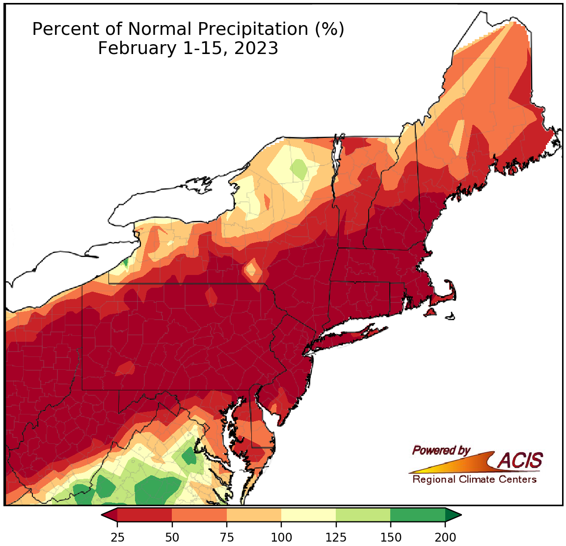 February 16, 2023 Mid-February - In The Red February 1-15 precipitation and snowfall were in the red, with most of the Northeast posting deficits. Of the 35 major climate sites, 25 sites picked up less than 25% of normal precipitation and 28 sites saw less than a half-inch of snowfall. In fact, a handful of major climate sites recorded their driest and/or least snowy first half of February. The temperature map also showed a lot of red, indicating warmer-than-normal conditions. Thirty major climate sites were at least 4°F warmer than normal.
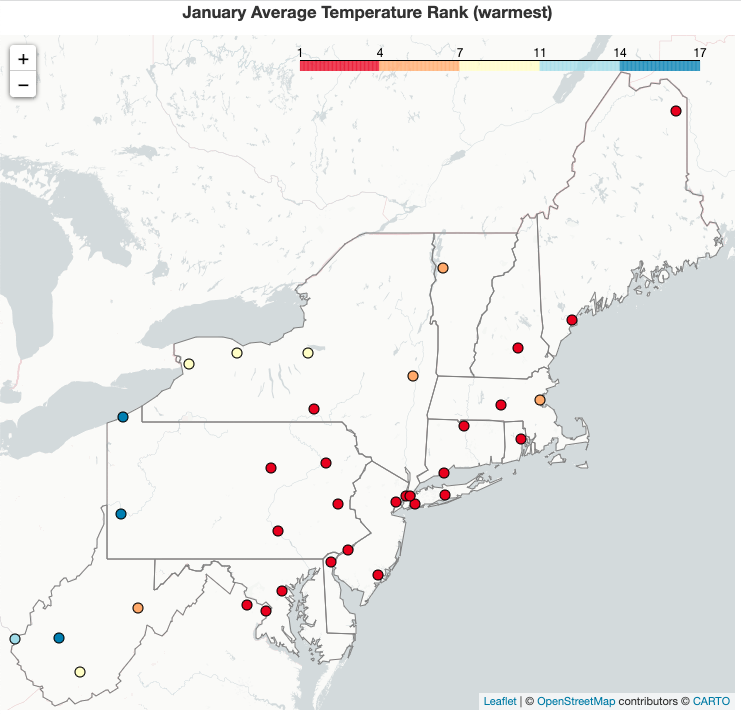 February 1, 2023 A Record-Setting January This January was record-setting in several ways. Temperatures were unusually warm with 10 major climate sites having their warmest January on record and Philadelphia and Central Park continuing their longest streak of days with above-normal average temperatures. Meanwhile, much of the region saw limited snowfall, with 10 major climate sites seeing their least snowy January on record. Several locations such as Central Park and Dulles Airport have yet to see measurable snow this season, the latest on record.
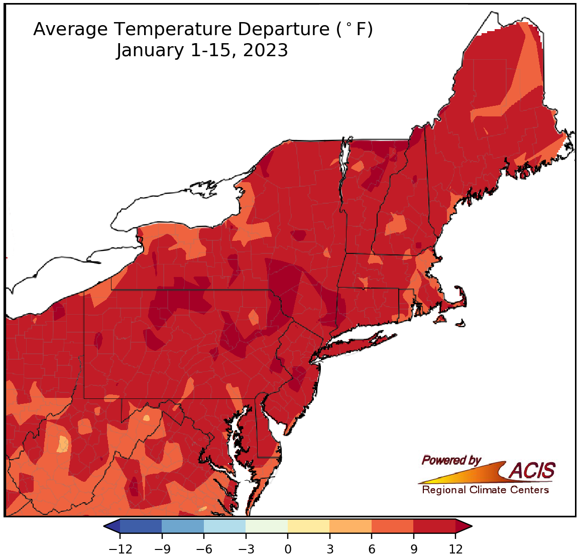 January 17, 2023 Mid-January - A Lot of Warmth and Little Snow The first halves of January and winter were much warmer than normal for the Northeast. Multiple sites experienced one of their five warmest January 1-15 periods on record, including Newark, NJ, which was 12°F above normal and had its second warmest January 1-15 period. Snowfall was lacking during the first half of January as well as the first half of winter, with only one of the 35 major climates sites seeing a surplus during either time period. For the December 1-January 15 period, Erie, PA, had a snowfall deficit of 33.9 inches, making it the site's eighth least snowy first half of winter.
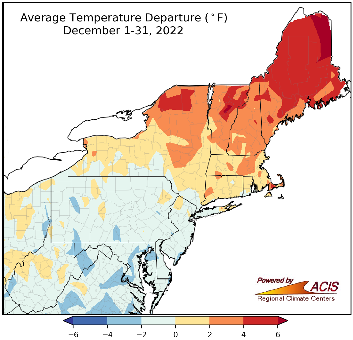 January 6, 2023 Closing Out 2022 December featured a wide range of temperatures and precipitation amounts. While most of the Northeast saw below-normal December snowfall, localized parts of New York saw an excess. For instance, Rochester, NY, had its ninth least snowy December with a snowfall deficit of 17.5 inches while Buffalo, NY, roughly 55 miles away, had its third snowiest December with a snowfall surplus of 39.4 inches. 2022 came to a close with a variety of precipitation amounts but much of the Northeast saw near- to above-normal temperatures. In fact, 2022 ranked among the 20 warmest years on record for 26 of the region's 35 major climate sites.
2022
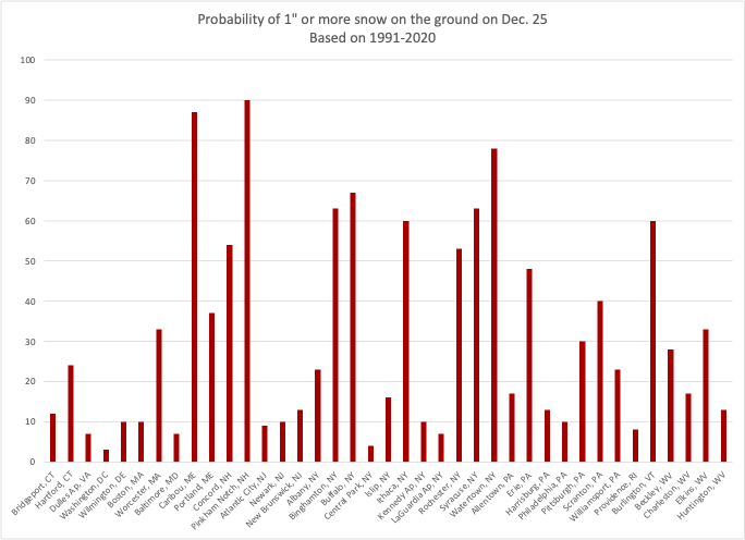 December 19, 2022 White La Niña Christmas (2022) We are experiencing our third consecutive La Niña winter. Could that affect our chances of a white Christmas?
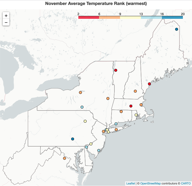 December 1, 2022 A Warm November Closes Out Fall November and fall ranked among the 20 warmest for over 15 major climate sites. Monthly and seasonal precipitation varied, with Islip, NY, having its 20th driest November but Erie, PA, having its fifth wettest. Snowfall was generally below- or near-normal; however, areas that saw major lake-effect snowfall had notable surpluses that launched the month and season into one of the 10 snowiest on record.
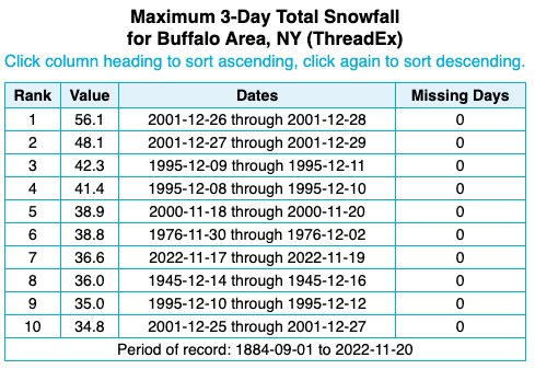 November 22, 2022 Western New York Lake-Effect Snowfall Western New York experienced an extreme lake-effect snow event last week, with the greatest storm snowfall totals hovering around 80 inches. Folks are curious if any snowfall records were set. So, let's take a look at the current (preliminary) data and explore how a record becomes official.
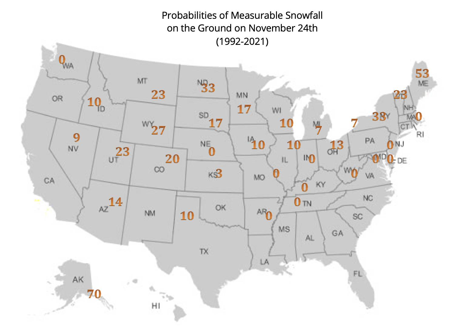 November 18, 2022 White Thanksgiving (2022) November certainly has been a month of change. What does this all mean for Thanksgiving?
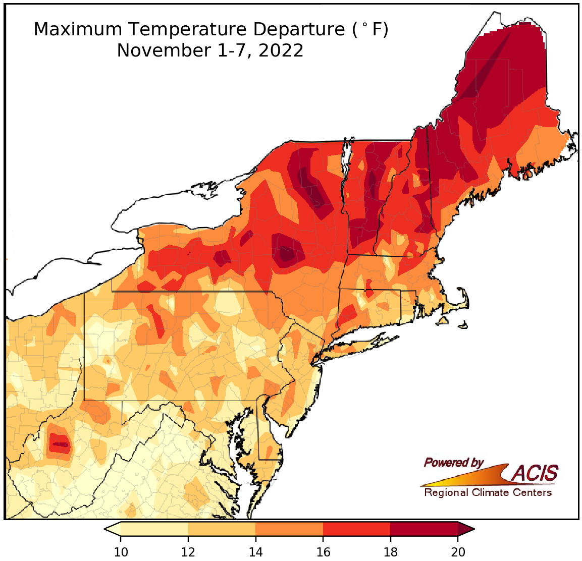 November 8, 2022 A Record Warm Start to November This year's November 1-7 period ranked as the warmest on record for multiple sites. Five (of the 35) major climate sites saw their warmest November day on record, while nearly half of the major climate sites recorded their warmest low temperature for November.
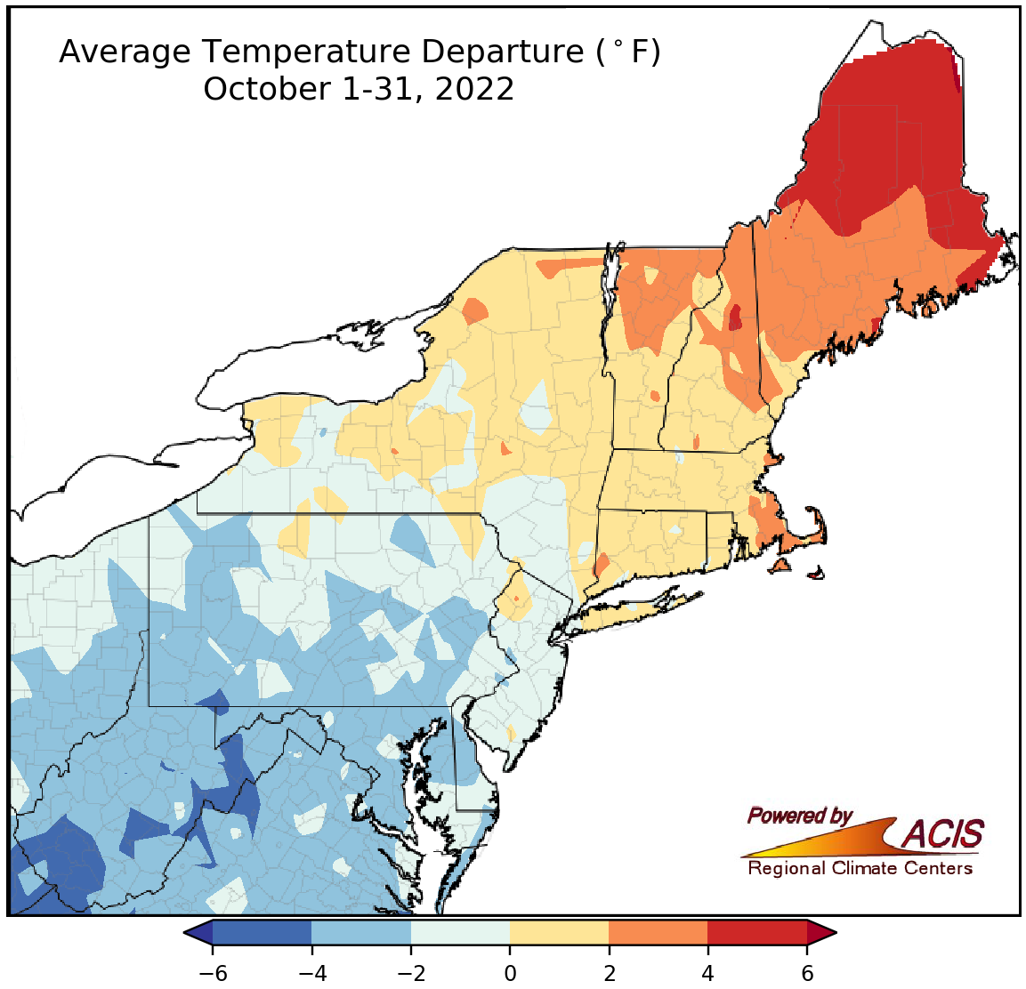 November 3, 2022 October Opposites Portions of the Northeast experienced completely opposite conditions during October. For instance, Charleston, WV, had its 12th coolest October but Caribou, ME, had its eighth warmest. Similarly, Syracuse, NY, had its 10th driest October but Atlantic City, NJ, had its fourth wettest.
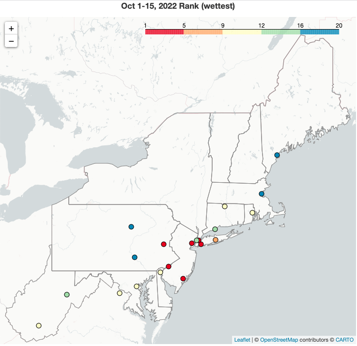 October 16, 2022 A Soggy, Cool Start to October for Many This first half of October was record wet for Atlantic City, NJ, and among the 20 wettest on record for another 19 major climate sites. The remnants of Hurricane Ian were a major contributor to above-normal rainfall totals for coastal areas from Maryland to New York's Long Island and helped chip away at drought conditions. Temperatures landed on the cool side of normal for many locations, particularly West Virginia where all four major climate sites had one of their 20 coolest October 1-15 periods.
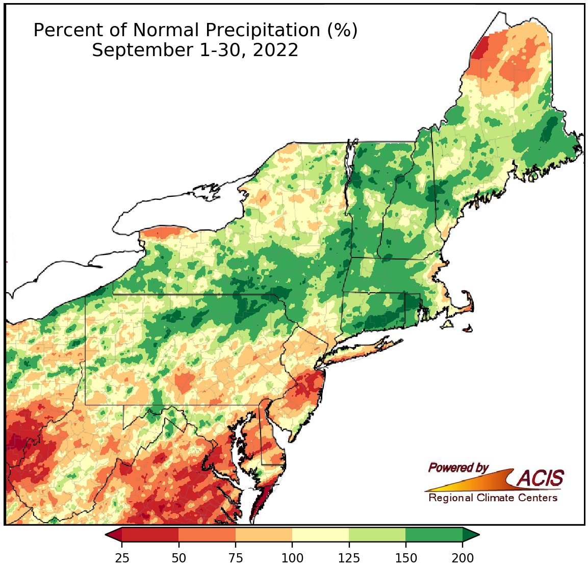 October 3, 2022 A Medley of Conditions in September September featured a mix of conditions. For instance, Charleston, WV, saw 40% of normal September precipitation but Erie, PA, saw 192% of normal and had its 5th wettest September. Similarly, Beckley, WV, was 2.0°F cooler than normal this September but Philadelphia, PA, had its 14th warmest September at 2.2°F above normal.
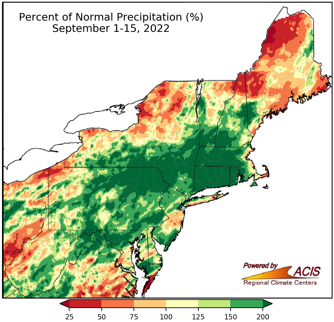 September 16, 2022 A Slight Shift in the Pattern In a change from the past two months, some previously dry areas were quite wet while a few previously wet areas were much drier. For instance, Bridgeport, CT, had its third driest August but its fifth wettest September 1-15 period. Average temperatures mostly continued where August left off - warmer than normal. For example, Philadelphia, PA, had a record hot August followed by its 12th warmest September 1-15 period.
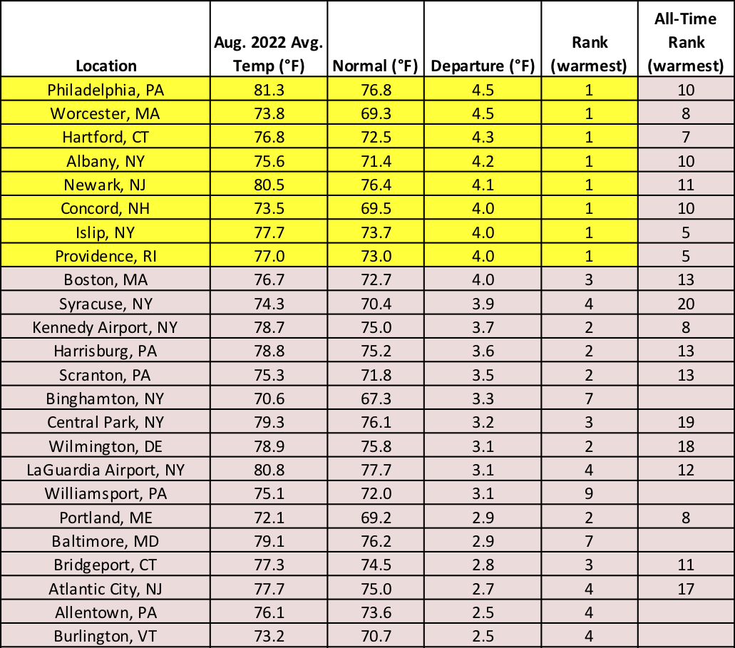 September 1, 2022 A Record Hot August Closes Out Summer Eight major climate sites had their hottest August on record, with the number of hot days and unusually warm nights also setting records. The Northeast experienced precipitation extremes with intensifying drought in parts of New England, New York, and New Jersey but record wetness and flash flooding in parts of West Virginia.
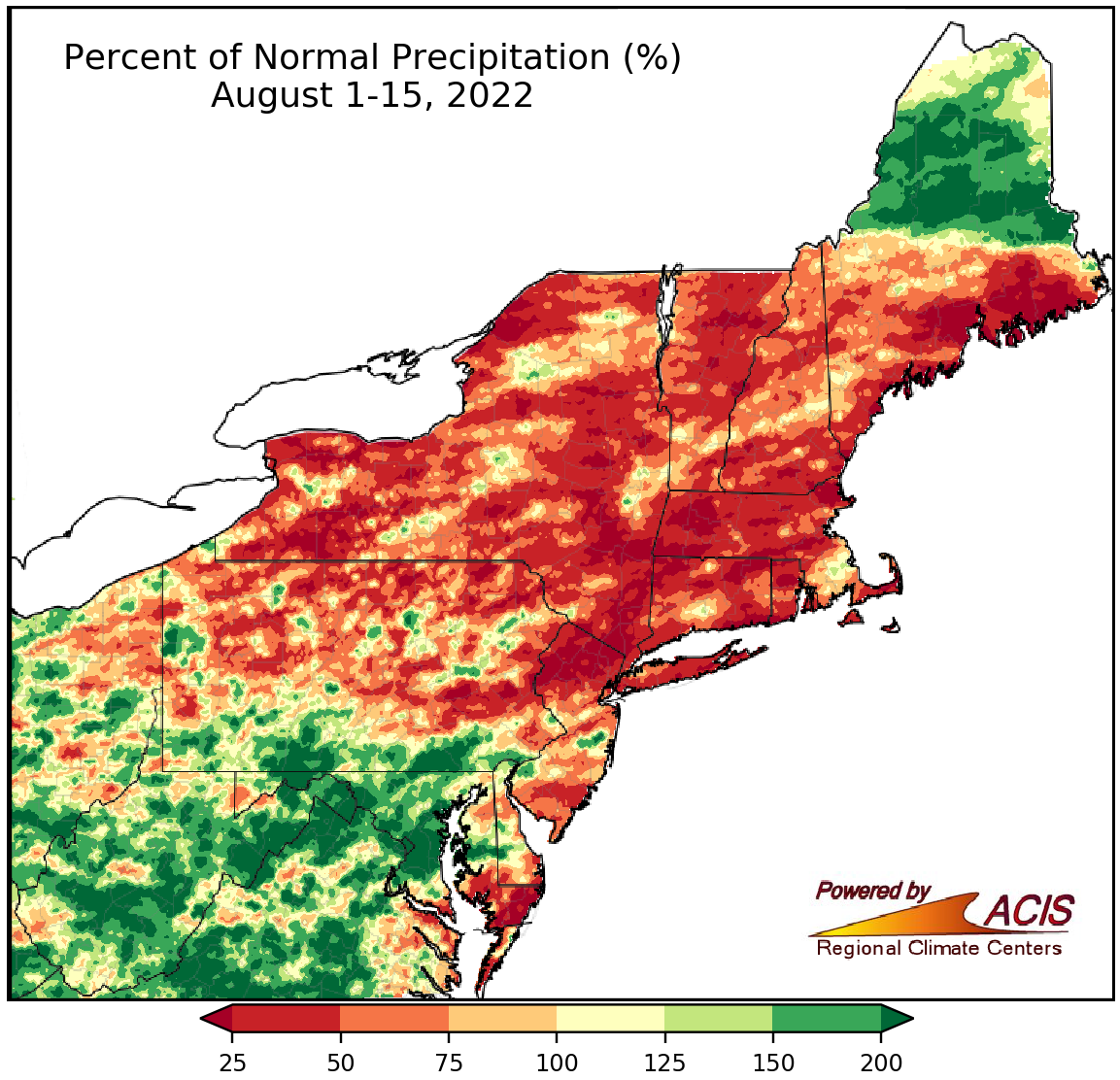 August 16, 2022 Mid-August Rainfall Extremes August-to-date rainfall ranged from 8% of normal in Allentown, PA, (third driest) to 397% of normal in Charleston, WV, (second wettest), with New England experiencing severe to extreme drought and parts of West Virginia experiencing flash flooding. August has been warmer than normal for a majority of the Northeast.
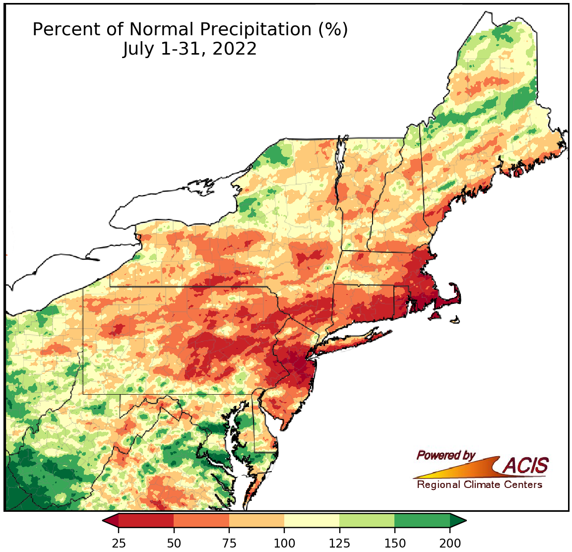 August 1, 2022 A July for the Record Books July featured record-setting heat in several parts of the Northeast including Newark, NJ; Philadelphia, PA; and JFK Airport, NY, which all saw multiple days with unusually hot high and/or low temperatures. Northern areas were generally drier than normal, with Newark having its driest July on record; however, southern West Virginia saw near-record rainfall.
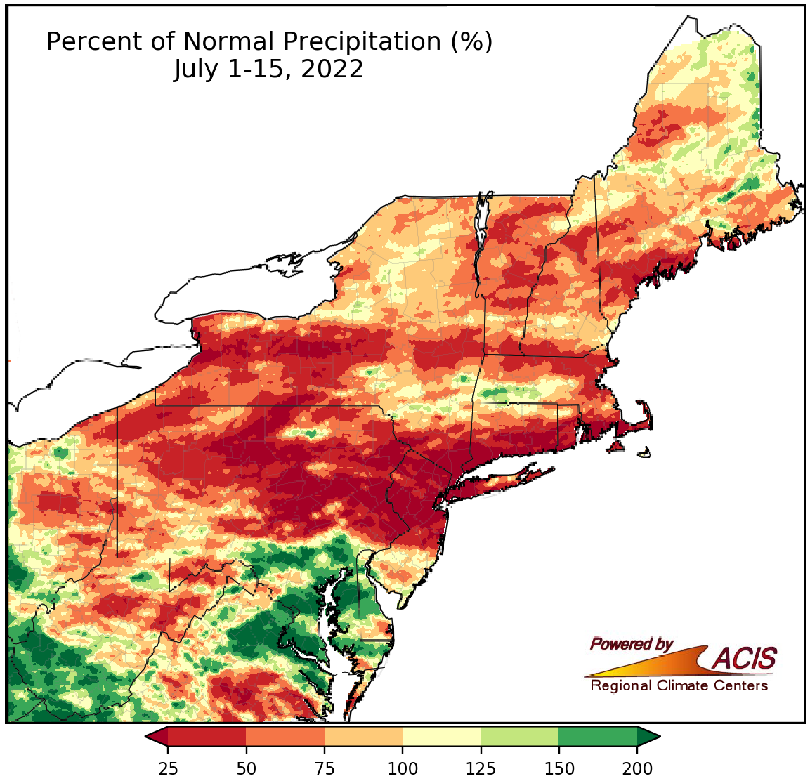 July 16, 2022 Mid-July - The Haves and the Have Nots So far this July, there have been large variations in precipitation and temperature across the Northeast. For the July 1-15 period, rainfall ranged from a record-setting 3% of normal in Bridgeport, CT, to 268% of normal in Baltimore, MD, while average temperatures ranged from 2.3°F cooler than normal in Rochester, NY, to 3.8°F warmer than normal in Newark, NJ.
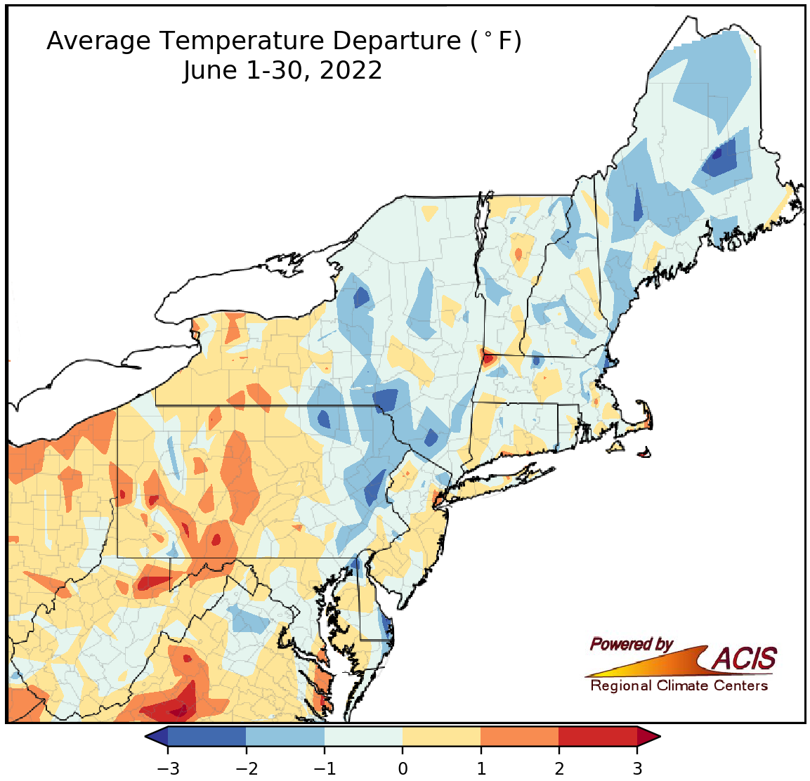 July 1, 2022 June - Leaning Cool and Dry While there was a wide range of conditions during June, the month leaned to the cool and dry side of normal.
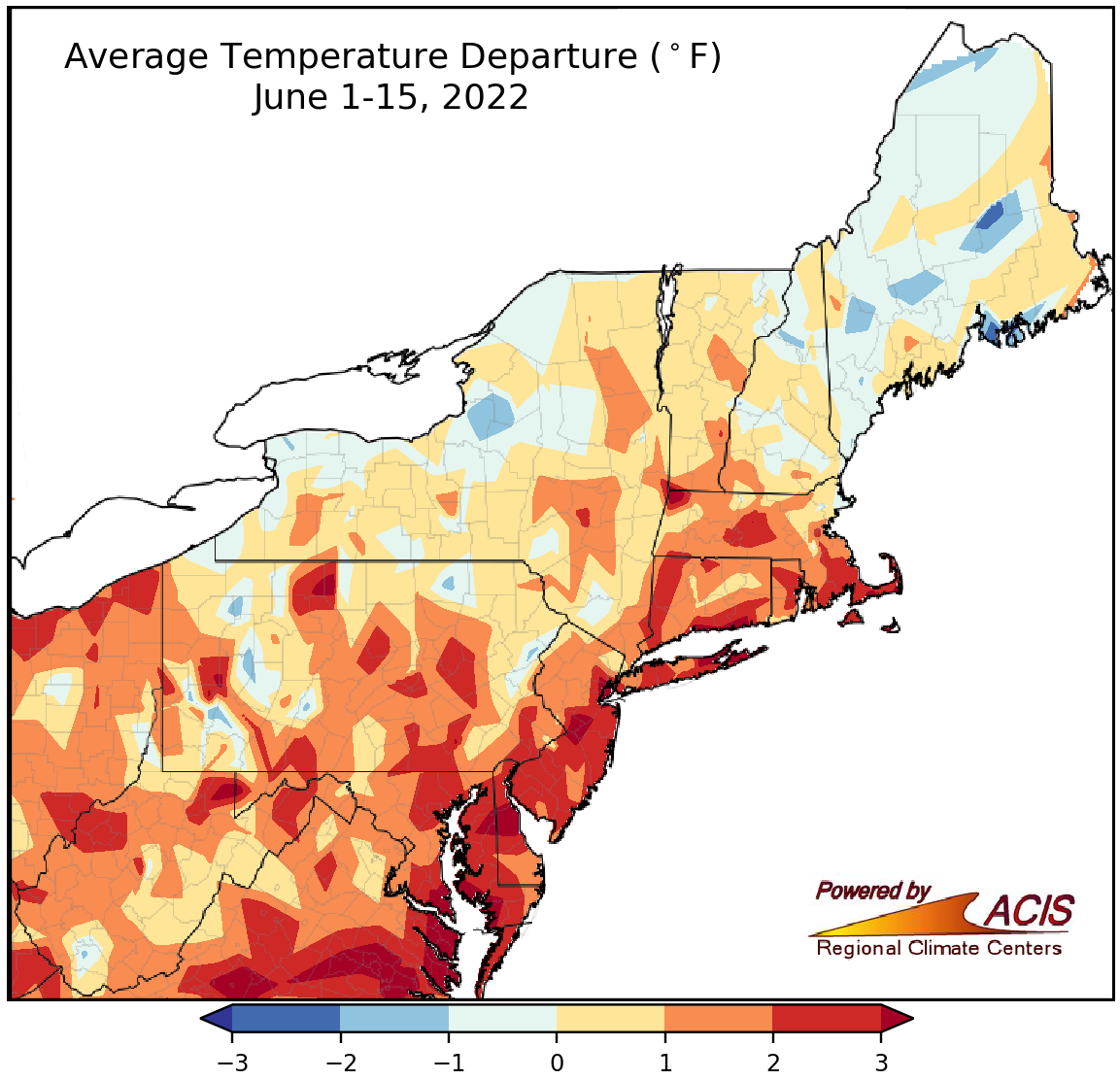 June 16, 2022 A Mixed-Up Mid-June There was a mix of conditions across the Northeast so far this June.
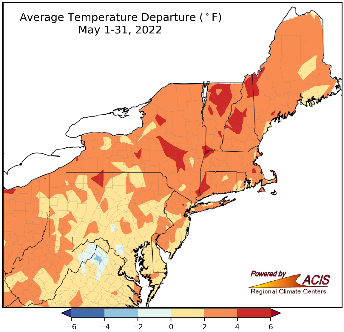 June 1, 2022 May and Spring - On the Warm Side of Normal May and spring were warmer than normal but featured variable precipitation.
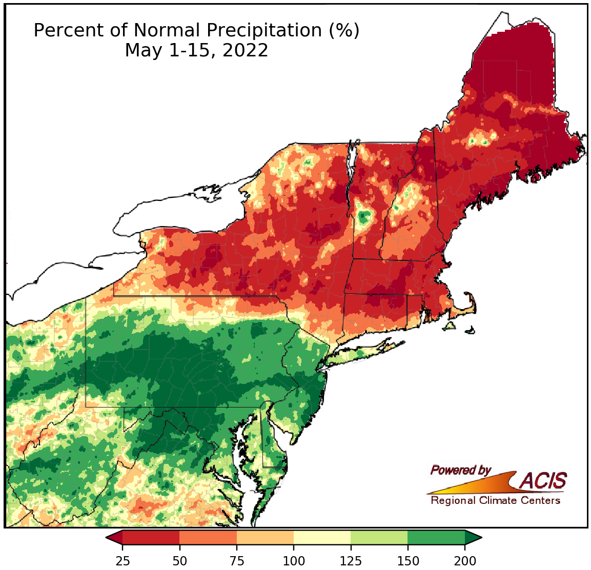 May 16, 2022 Polar Opposite Precipitation While southern parts of the Northeast saw abundant precipitation, northern parts of the region missed out.
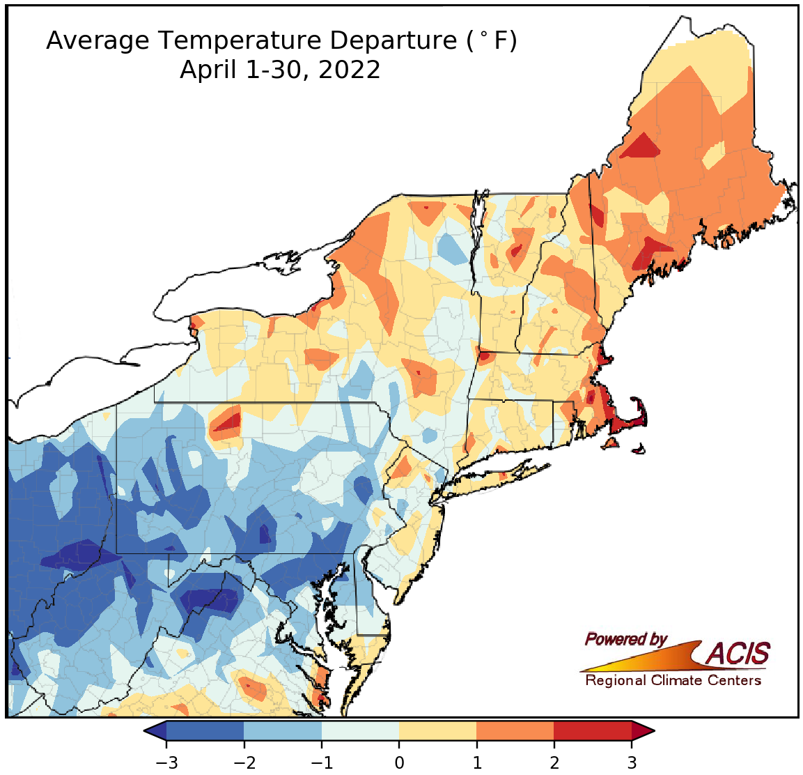 May 2, 2022 An Assortment of Conditions in April April brought a wide range of conditions to the Northeast.
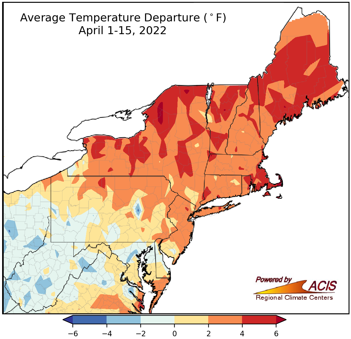 April 18, 2022 Mid-April Showers The first half of April featured above-normal temperatures and plenty of rain showers for much of the Northeast.
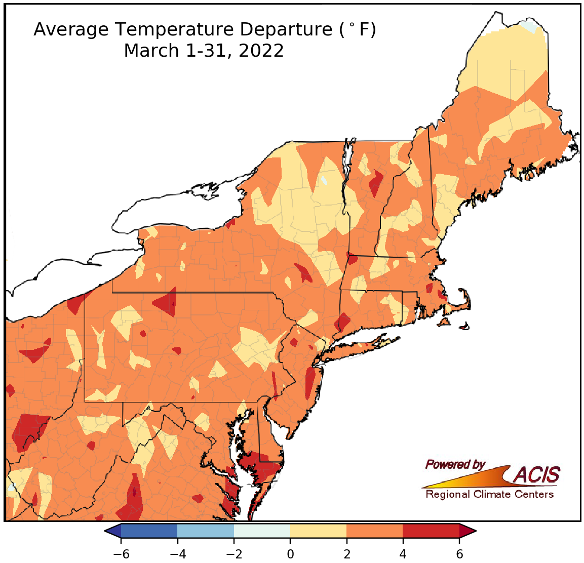 April 4, 2022 March - Warm and Dry for Many March was warmer than normal, with below-normal precipitation and snowfall for many areas.
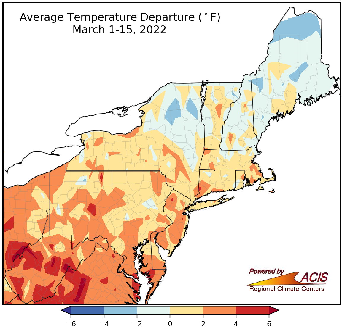 March 16, 2022 Halfway Through March Many areas were warmer than normal so far this March but there was a range of precipitation and snowfall conditions.
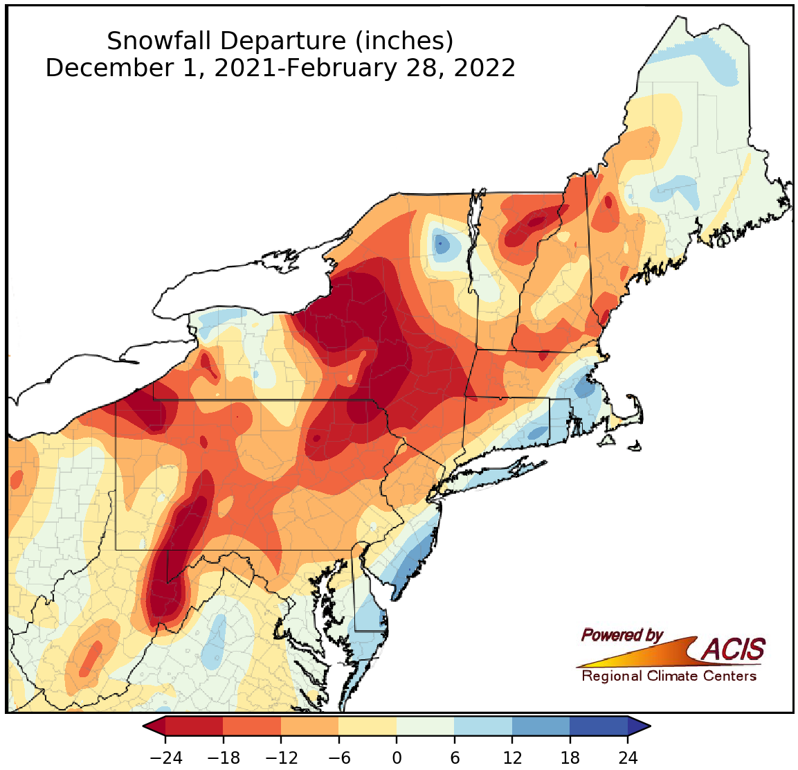 March 1, 2022 A Warm February and Winter February and winter were warmer than normal for most of the Northeast, with below-normal snowfall in many areas, too.
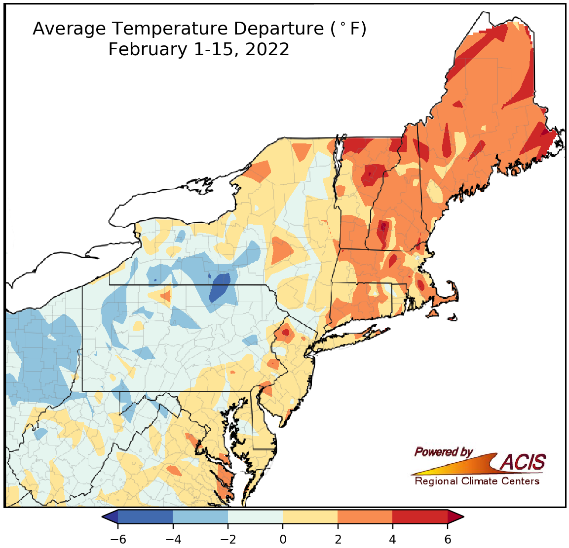 February 16, 2022 A Quick Mid-February Check-in While February so far has leaned somewhat toward the warmer, wetter, and not so snowy side of normal, there was a range of conditions across the Northeast.
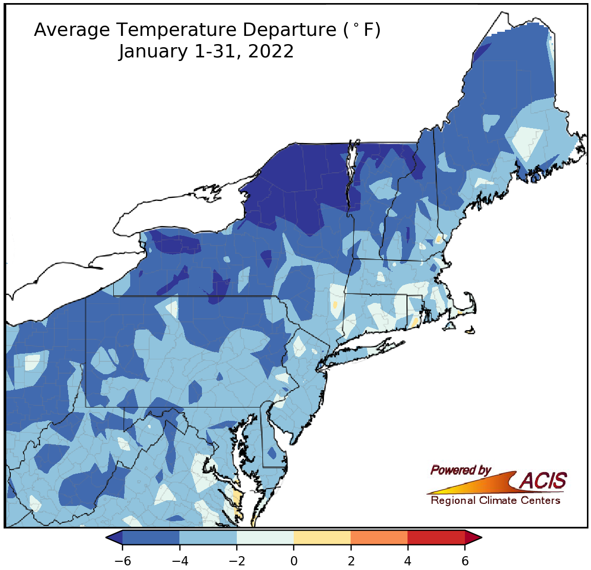 February 1, 2022 January - Winter Arrives On the heels of a not-so-wintry December, January brought cold temperatures to all and exceptionally snowy conditions to some.
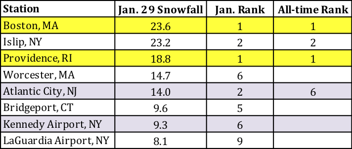 January 31, 2022 January 29 Blizzard A record-setting blizzard brought heavy snow and strong winds to coastal areas of the Northeast on January 29.
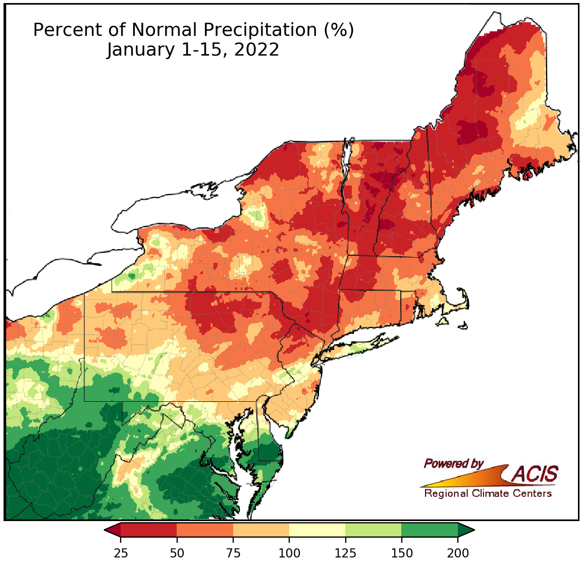 January 18, 2022 Mid-January - Spanning the Spectrum There was a wide range of temperature, precipitation, and snowfall conditions across the Northeast so far this January.
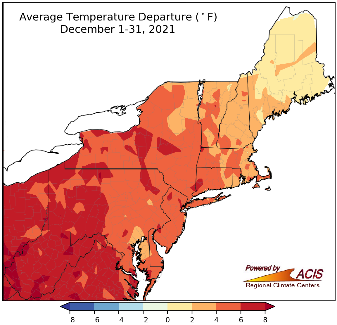 January 3, 2022 Warm December, Mild 2021 A warm, dry December closed out an unusually mild year.
2021
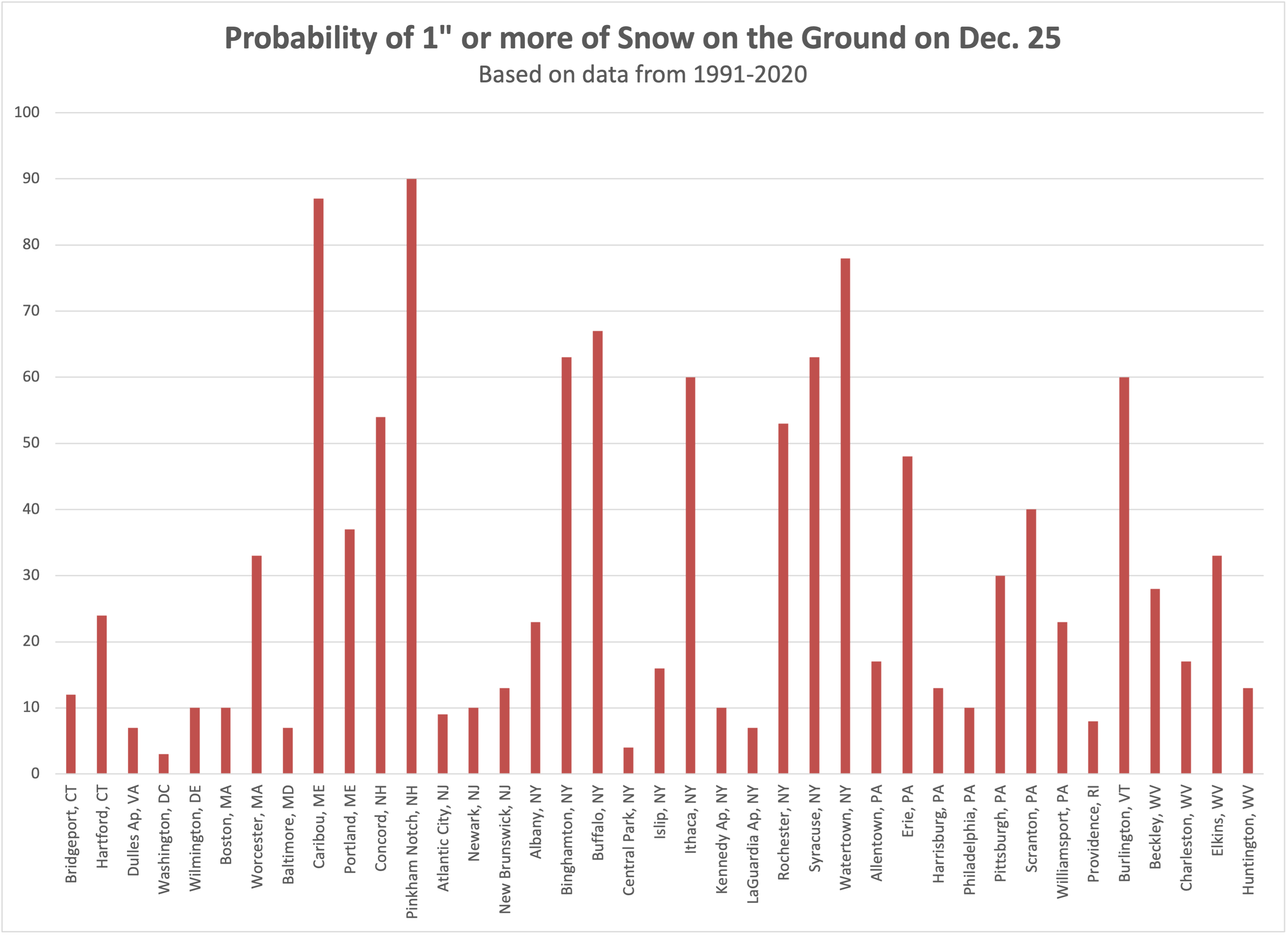 December 17, 2021 White Christmas Over the Generations (2021) Have you noticed that Christmas snow cover was different during your childhood than it is now? You may be right!
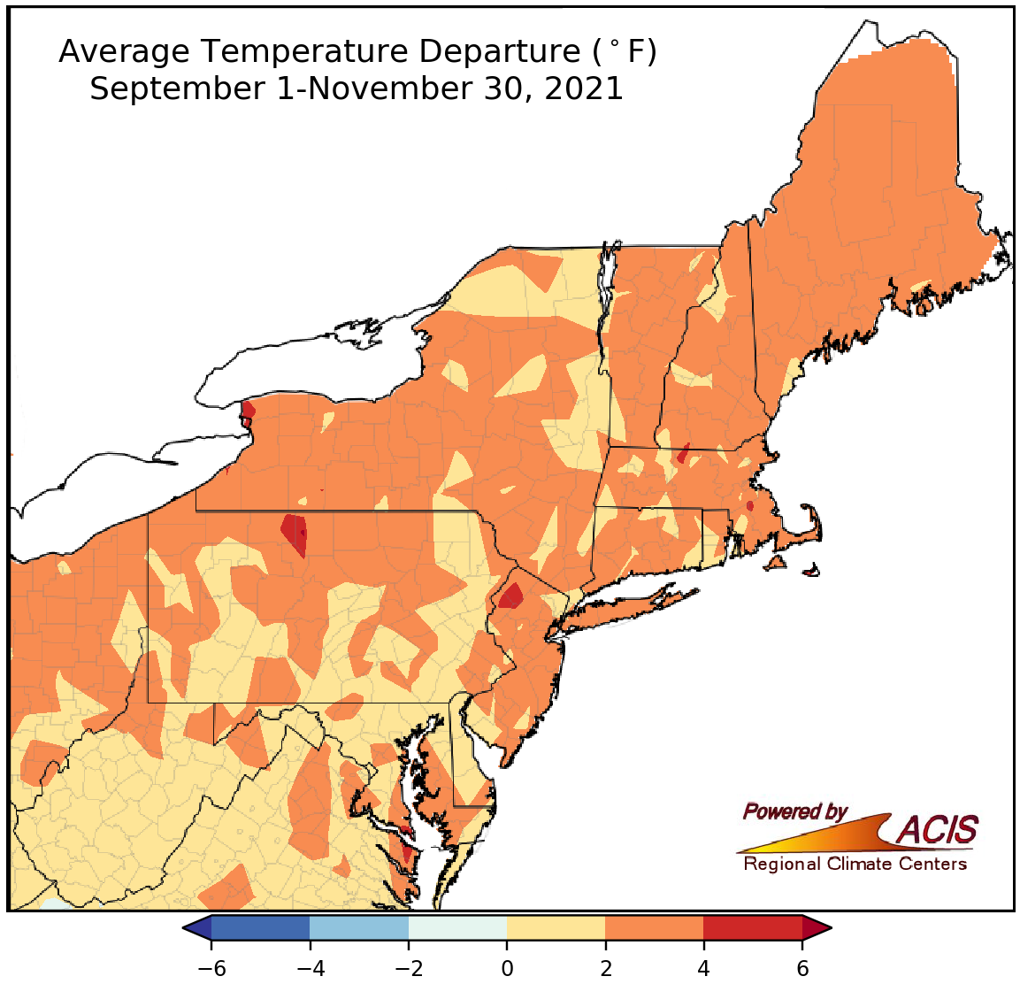 December 1, 2021 November - Not Like the Rest of Fall November was cool and dry for much of the Northeast, differing from the other two fall months.
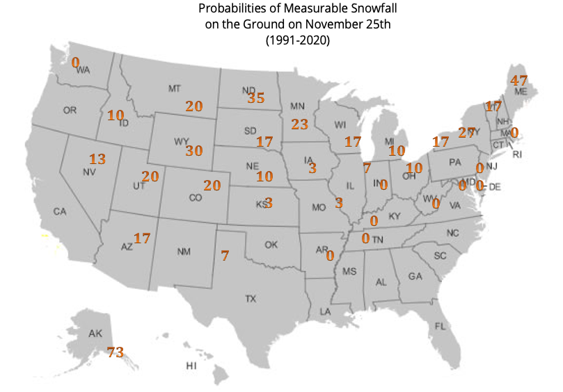 November 19, 2021 White Thanksgiving (2021) Historical white Thanksgiving probabilities.
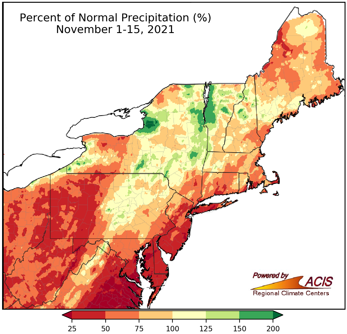 November 16, 2021 A Dry Start to November So far this November, temperatures have varied and precipitation has been lacking.
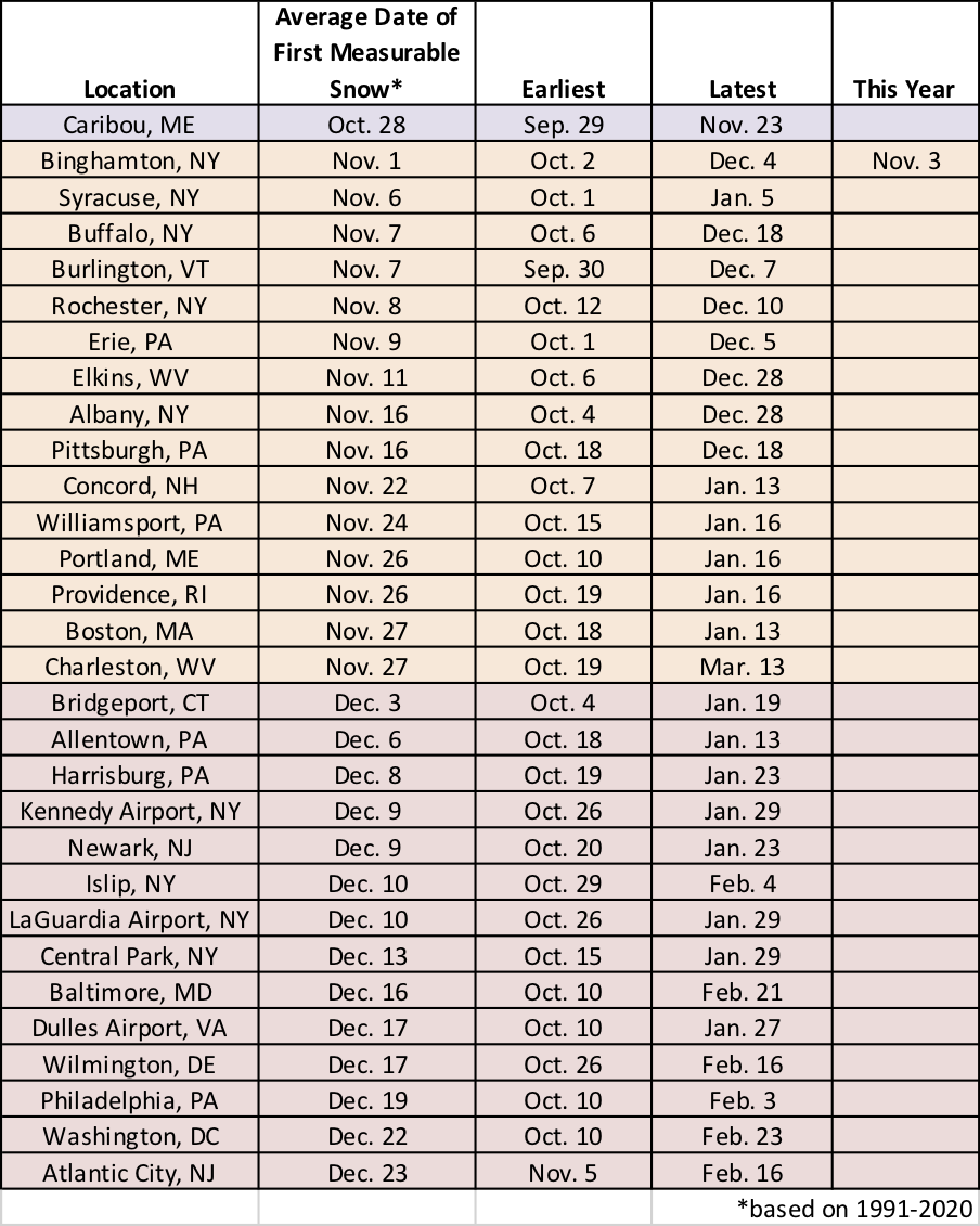 November 8, 2021 Average Date of First Snow Climatology tells us that the first snow of the season should be arriving soon but so far not many places have seen it.
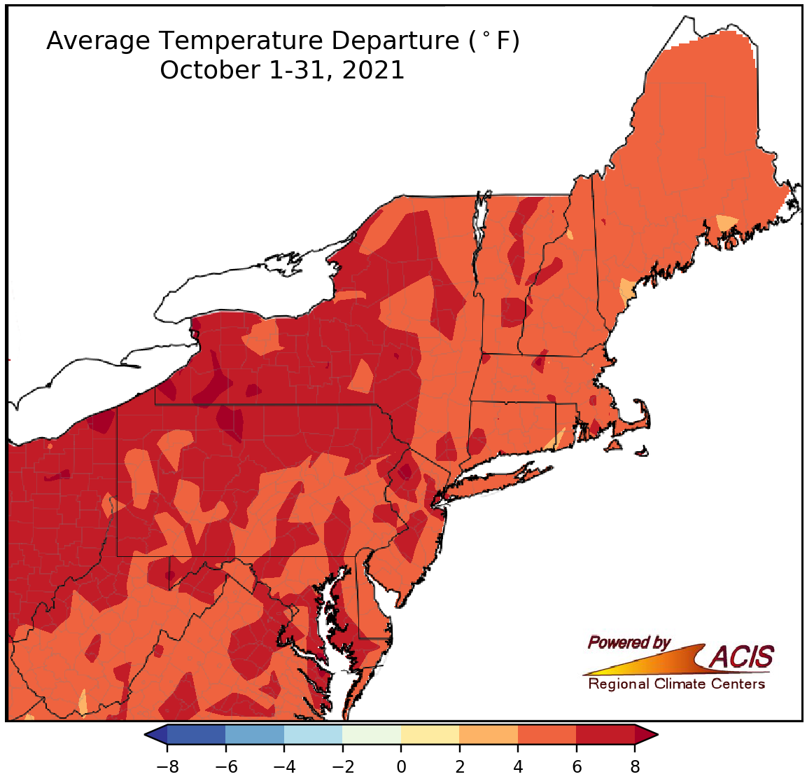 November 1, 2021 An Unusually Mild October October was quite mild, with record-setting temperatures in several locations.
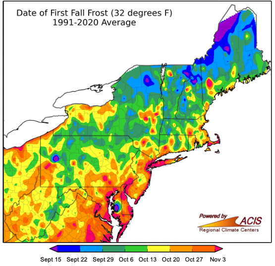 October 21, 2021 First Frost is Due Many parts of the Northeast are (over)due for their first frost.
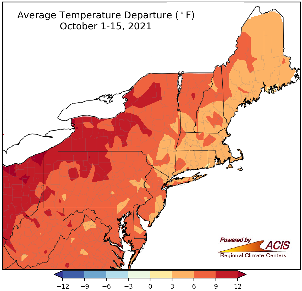 October 16, 2021 Seeing Red in Mid-October The first half of October was exceptionally warm and unusually dry for much of the Northeast.
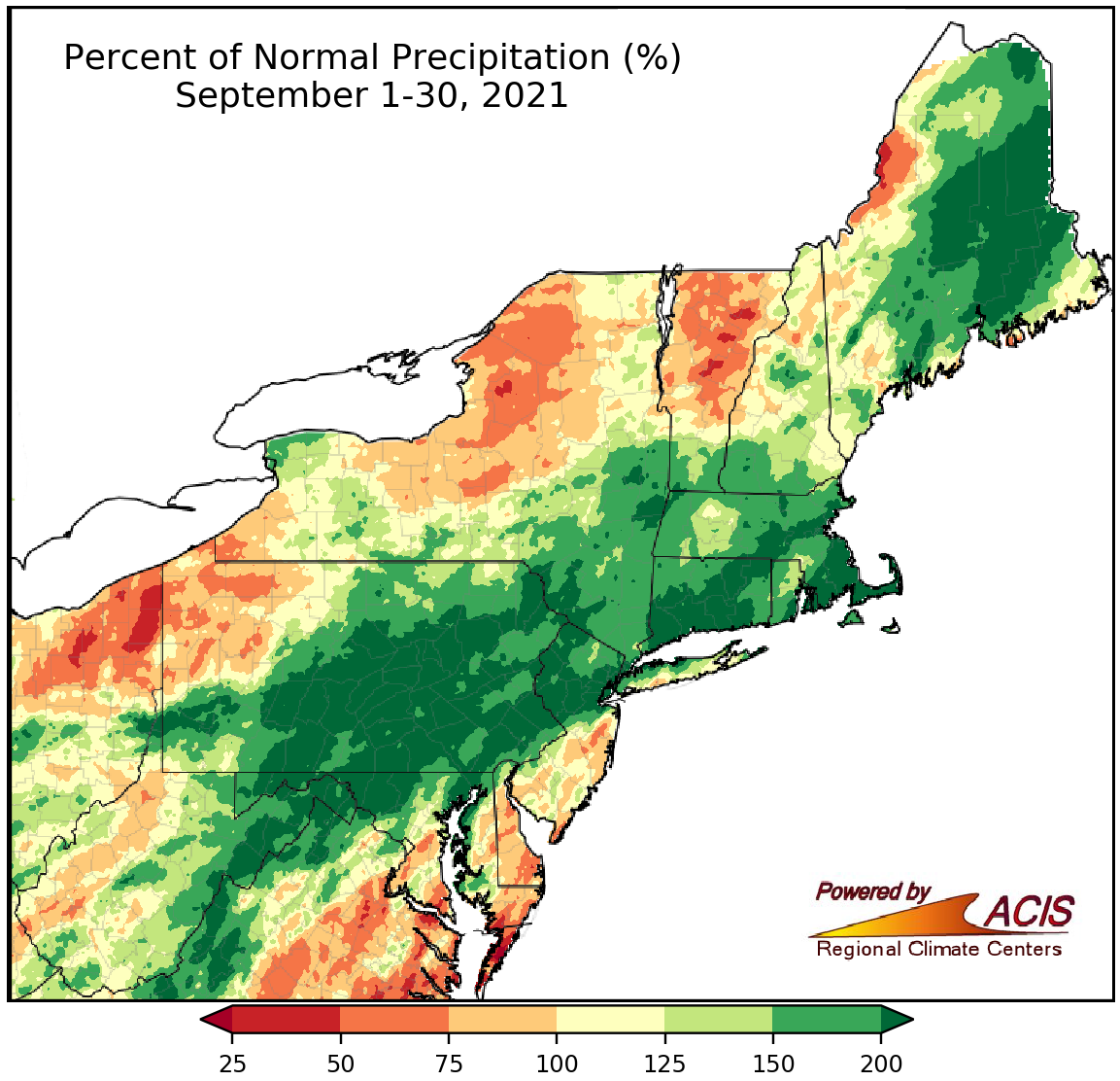 October 1, 2021 September - Wet and Warm On September 1, Tropical Depression Ida set the stage for a very wet September. Most of the Northeast was also warmer than normal.
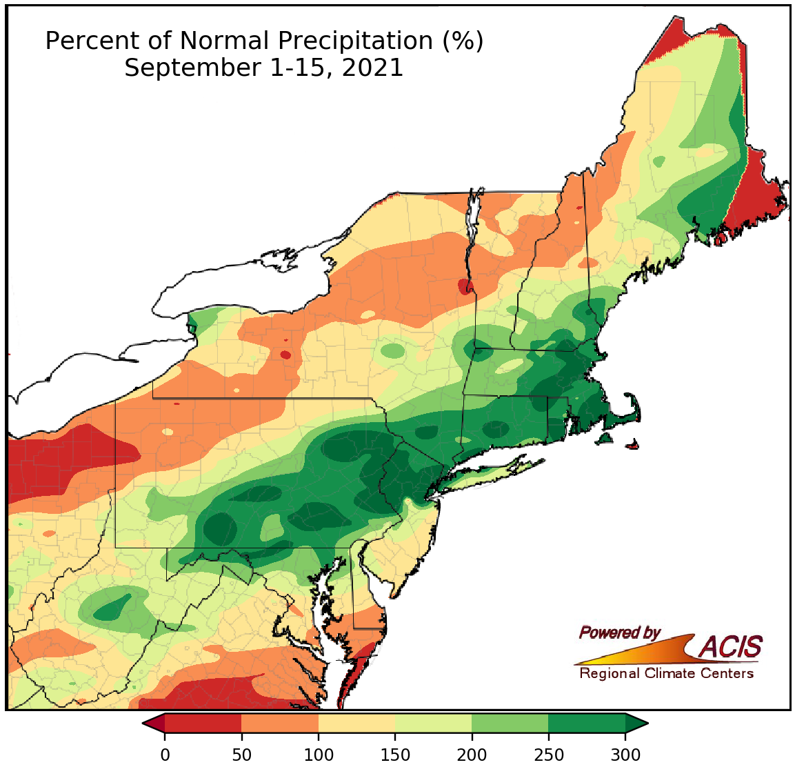 September 16, 2021 An Excessively Wet Start to September Much of the Northeast saw above-normal rainfall during the first half of September, driven by the remnants of Hurricane Ida.
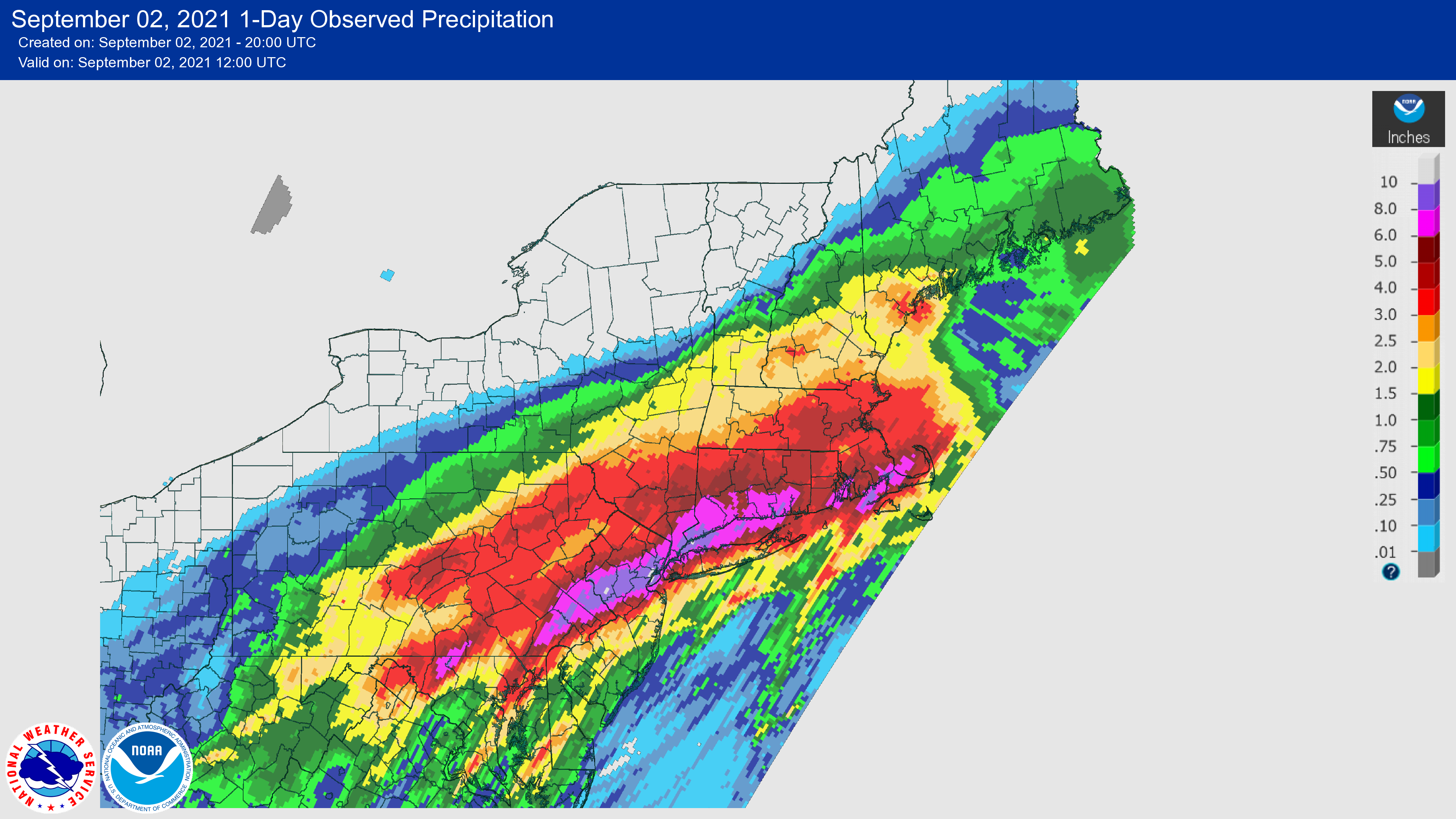 September 3, 2021 Historic Tropical Depression Ida Tropical Depression Ida produced record-setting rainfall and historic water levels in the Northeast.
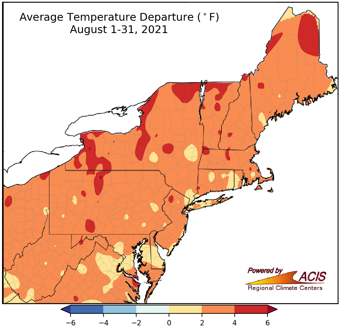 September 1, 2021 A Warm, Wet Summer August and summer were warmer and wetter than normal for many parts of the Northeast.
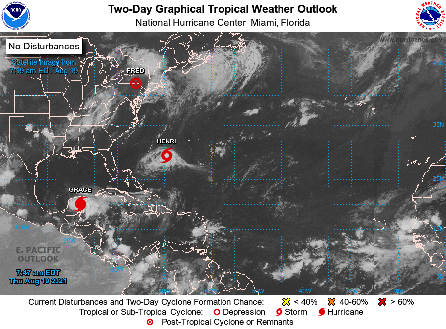 August 23, 2021 Two Tropical Systems in a Week Two tropical systems caused significant impacts in the Northeast during the past week.
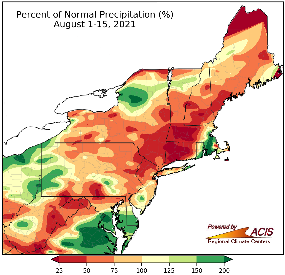 August 16, 2021 Mid-August Recap The first half of August was drier and warmer than normal for many parts of the Northeast.
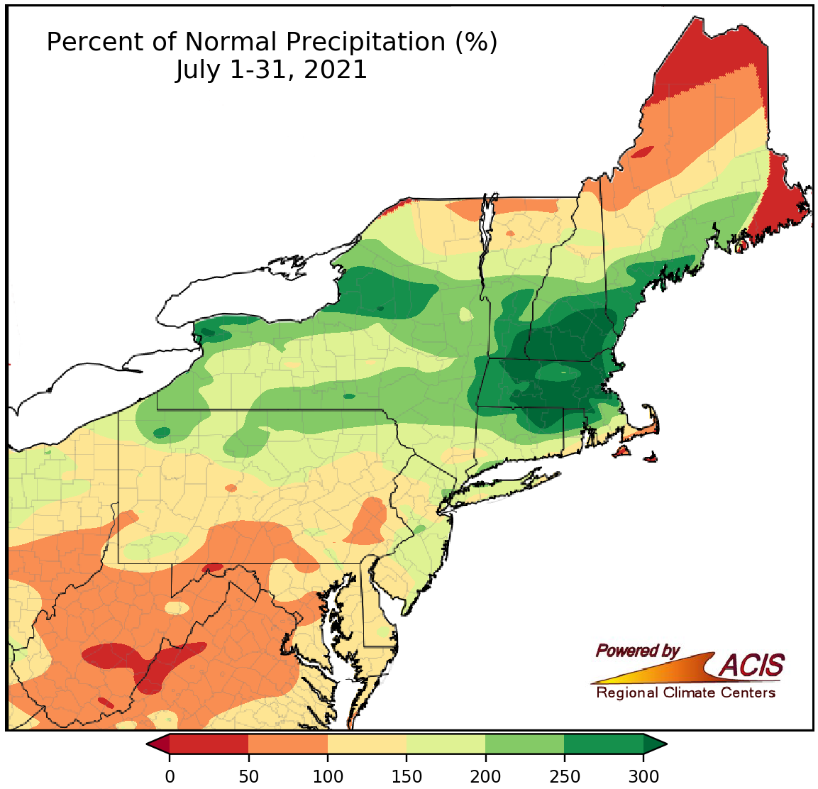 August 1, 2021 A Record Wet July July was excessively wet in several locations, setting multiple precipitation records.
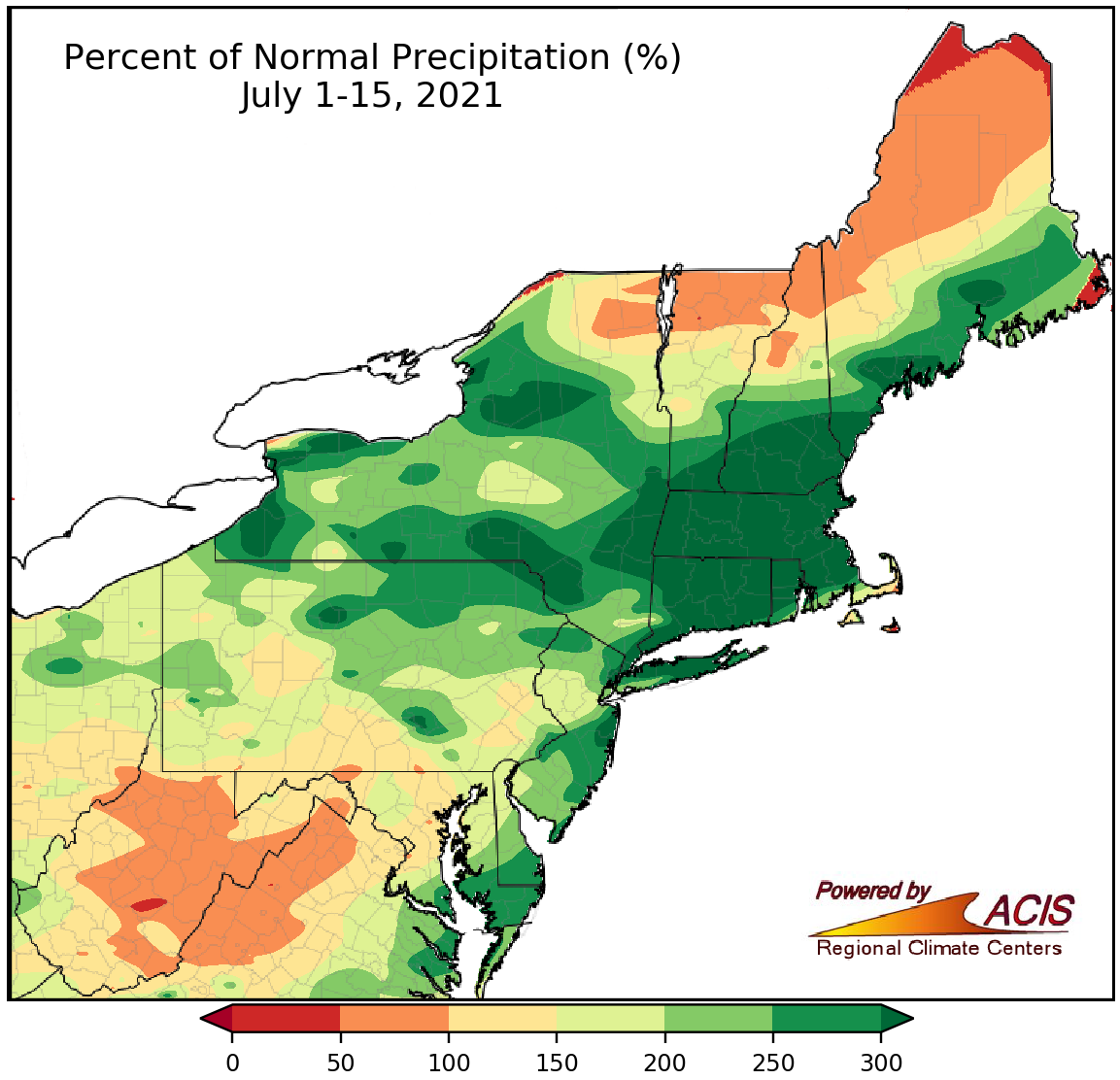 July 16, 2021 A Wet Start to July The first half of July was extremely wet for many locations, with some areas seeing more than five times their normal precipitation.
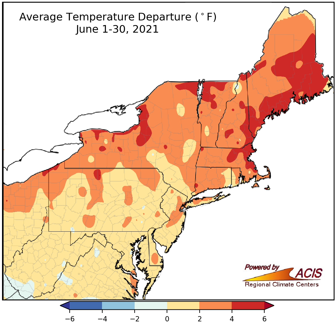 July 1, 2021 A Record Hot June Hot June temperatures set/tied several records. Plus, much of the Northeast saw below-normal rainfall, worsening drought conditions.
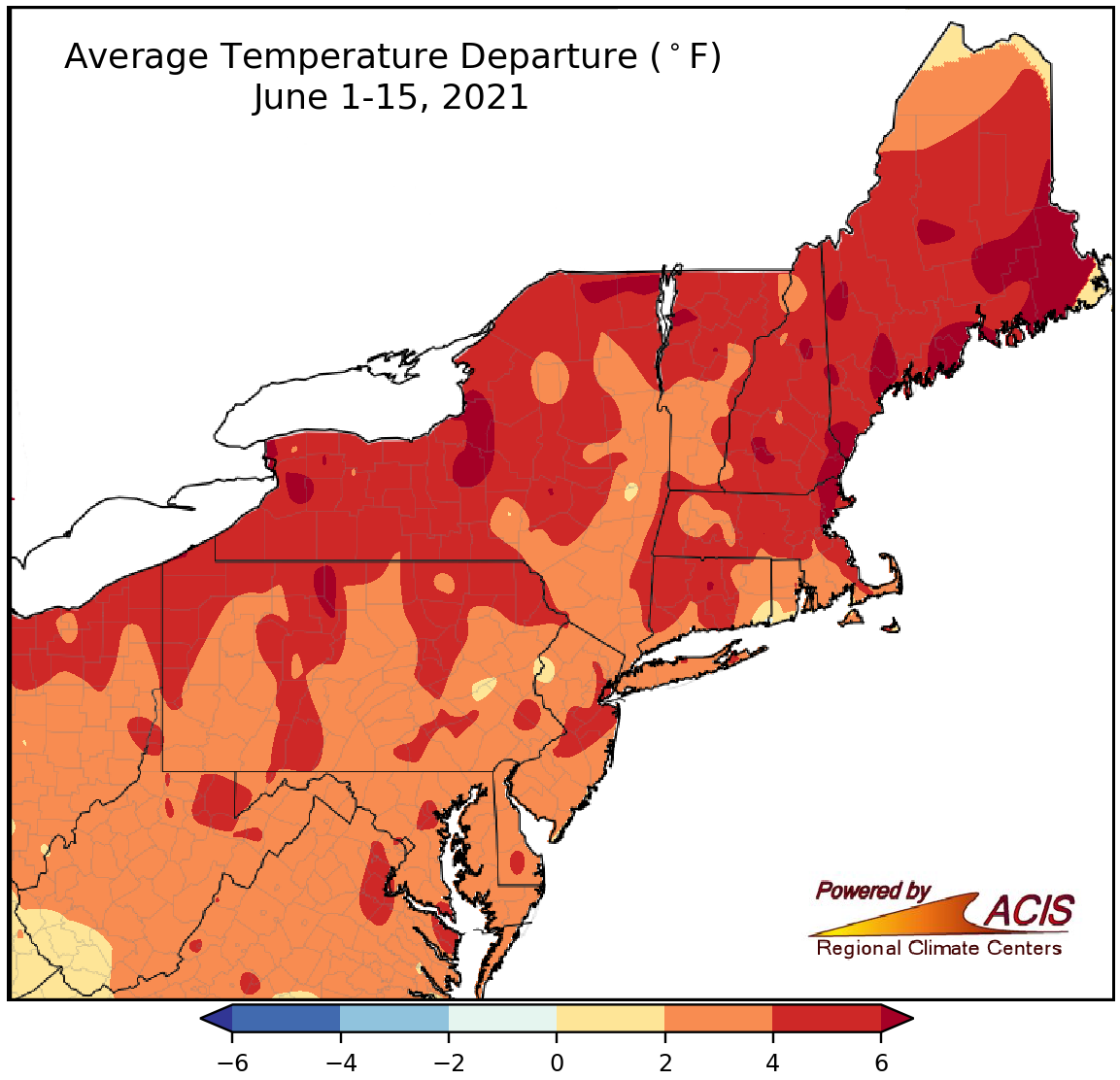 June 16, 2021 A Mild Mid-June The Northeast experienced a mild first half of June but precipitation varied.
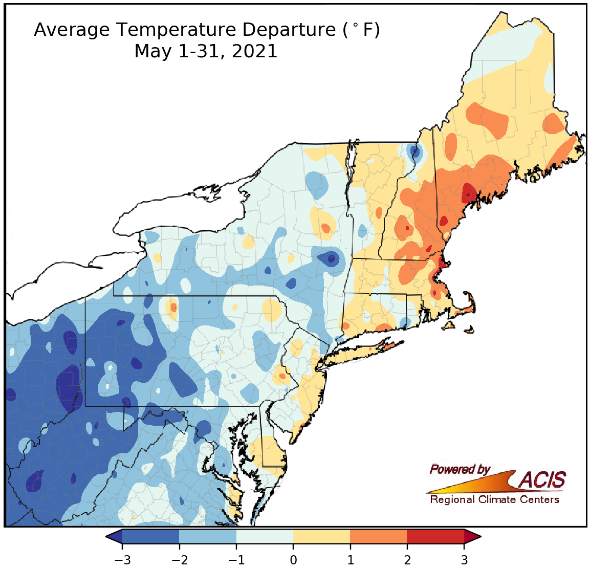 June 2, 2021 Another Season Wraps Up May featured a mix of conditions but spring tended to be warmer, drier, and less snowy than normal.
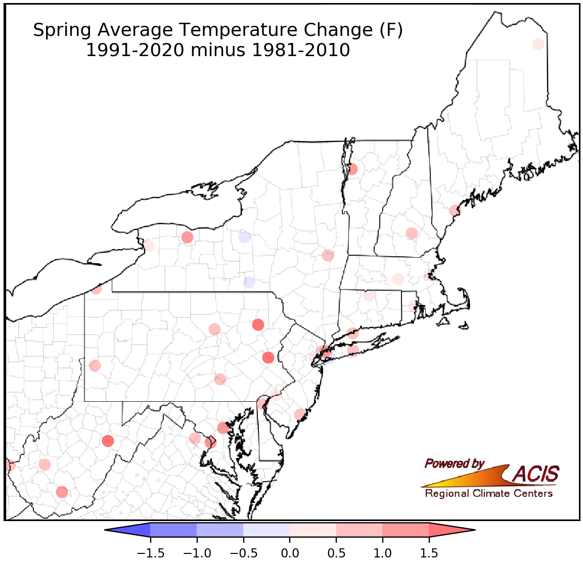 May 18, 2021 Updated Climate Normals Show Warmer, Snowier Spring Climate normals have been updated and show that spring has become warmer and snowier for most of the Northeast.
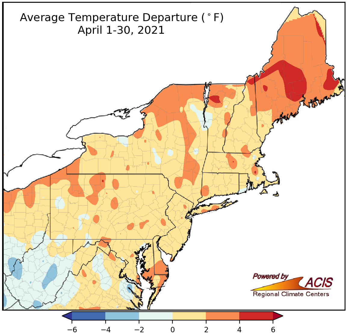 May 2, 2021 April - Above-Normal Temperatures for Most While April featured above-normal temperatures, precipitation and snowfall were below normal for many locations.
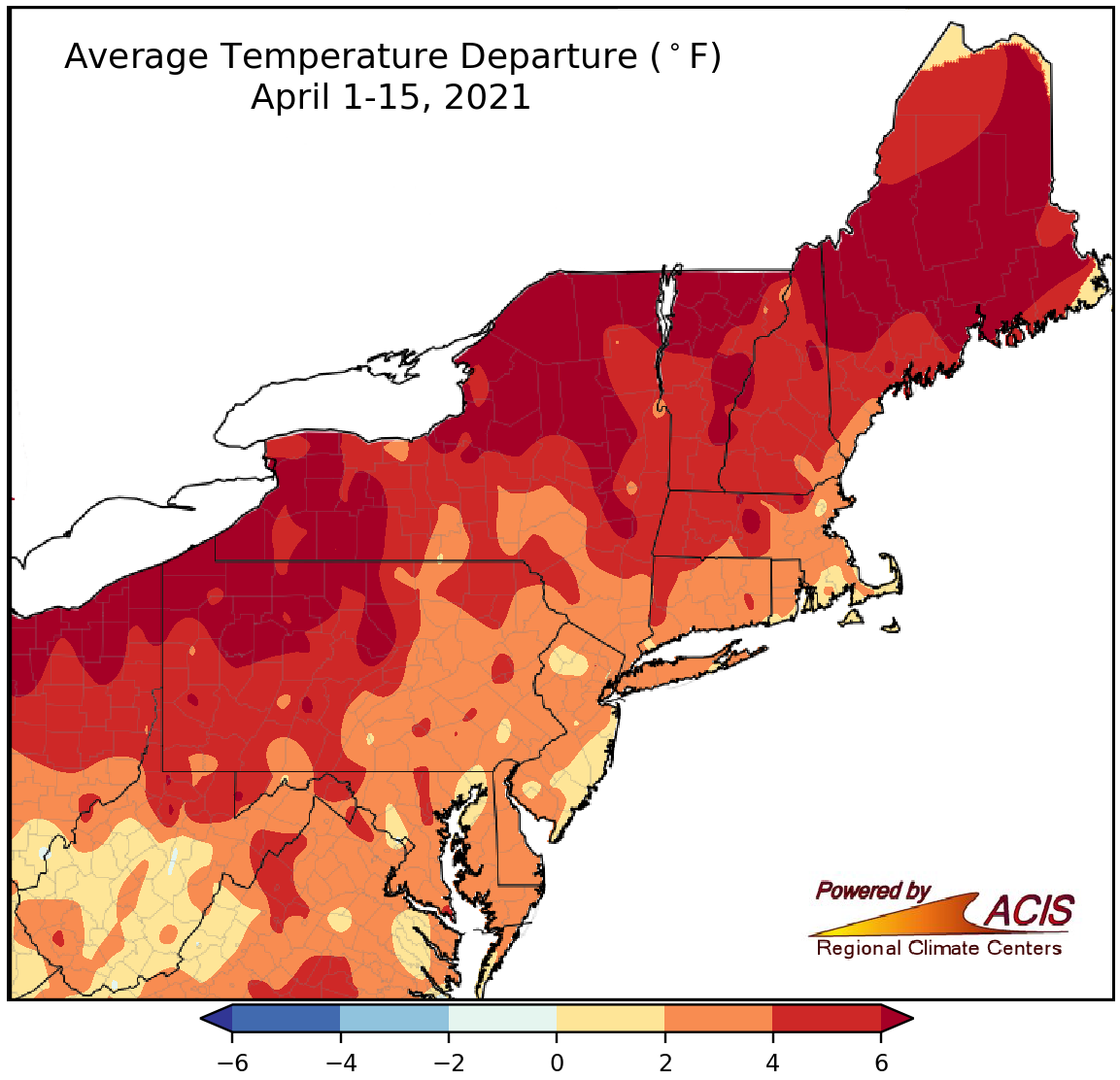 April 16, 2021 A Warm and Dry April-to-Date So far, April and spring have been warmer, drier, and less snowy than normal for much of the Northeast.
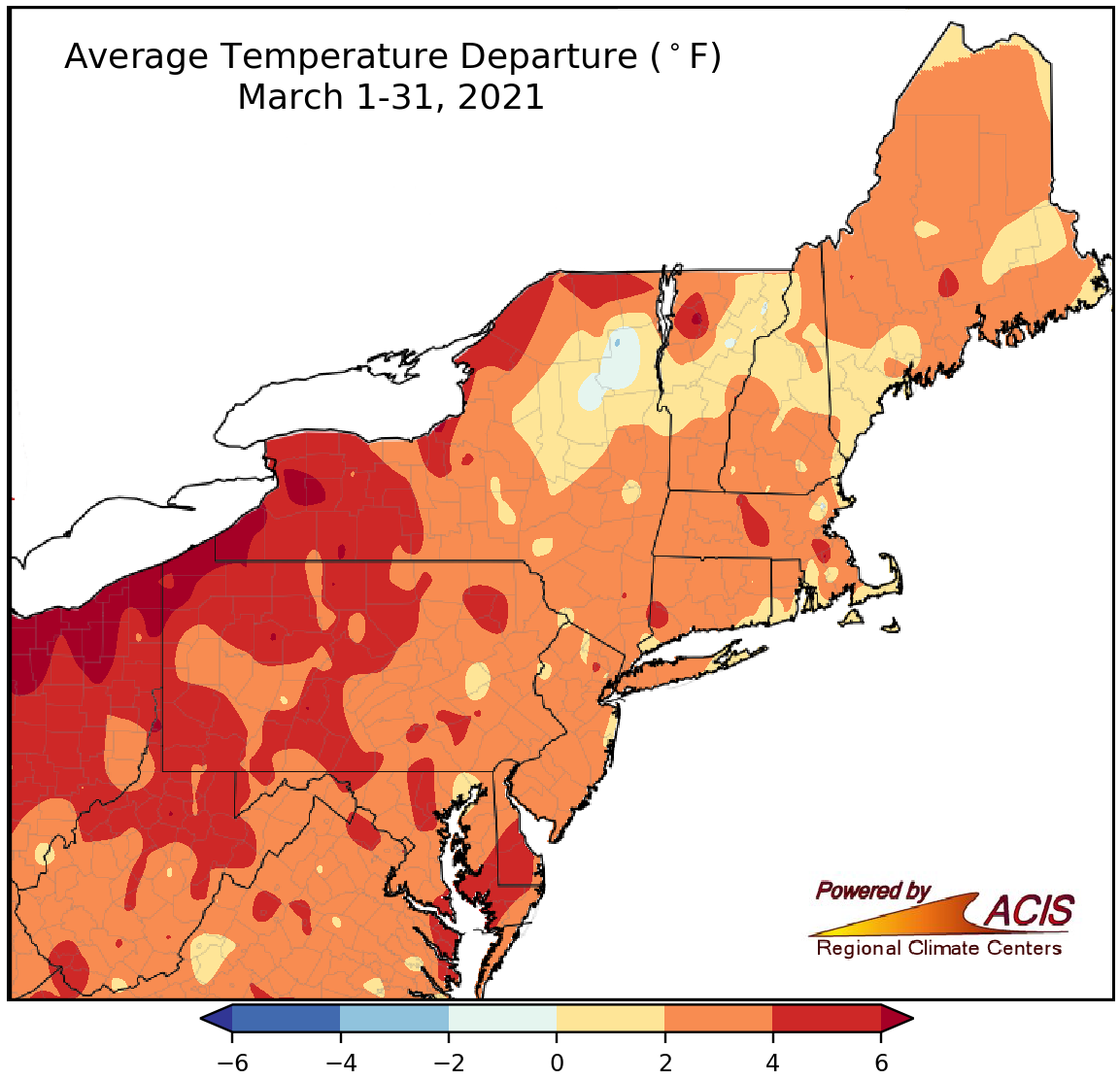 April 1, 2021 A Mild, Mostly Snowless March For much of the Northeast, March was warm, dry, and lacking snow.
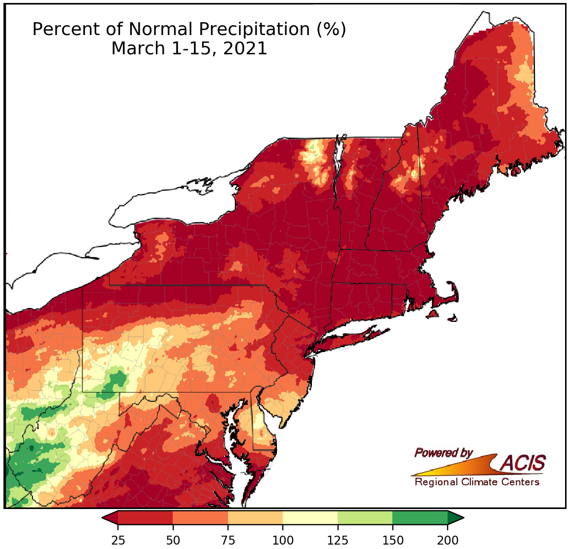 March 16, 2021 Mid-March - Lacking in Precipitation and Snowfall The first half of March was dry, with little snowfall, for much of the Northeast.
 March 1, 2021 A Cold, Snowy February Wraps Up a Warm Winter The last month of winter brought frequent storms and cooler conditions compared to the other two months of the season.
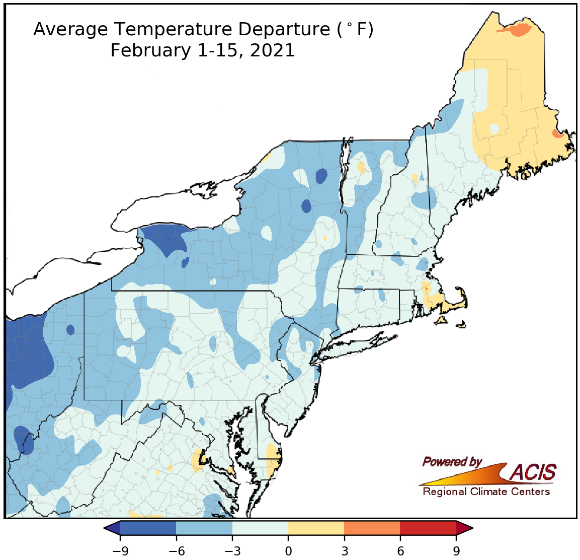 February 16, 2021 A Cold and Snowy February-to-Date The first half of February featured below-normal temperatures and above-normal snowfall for much of the Northeast.
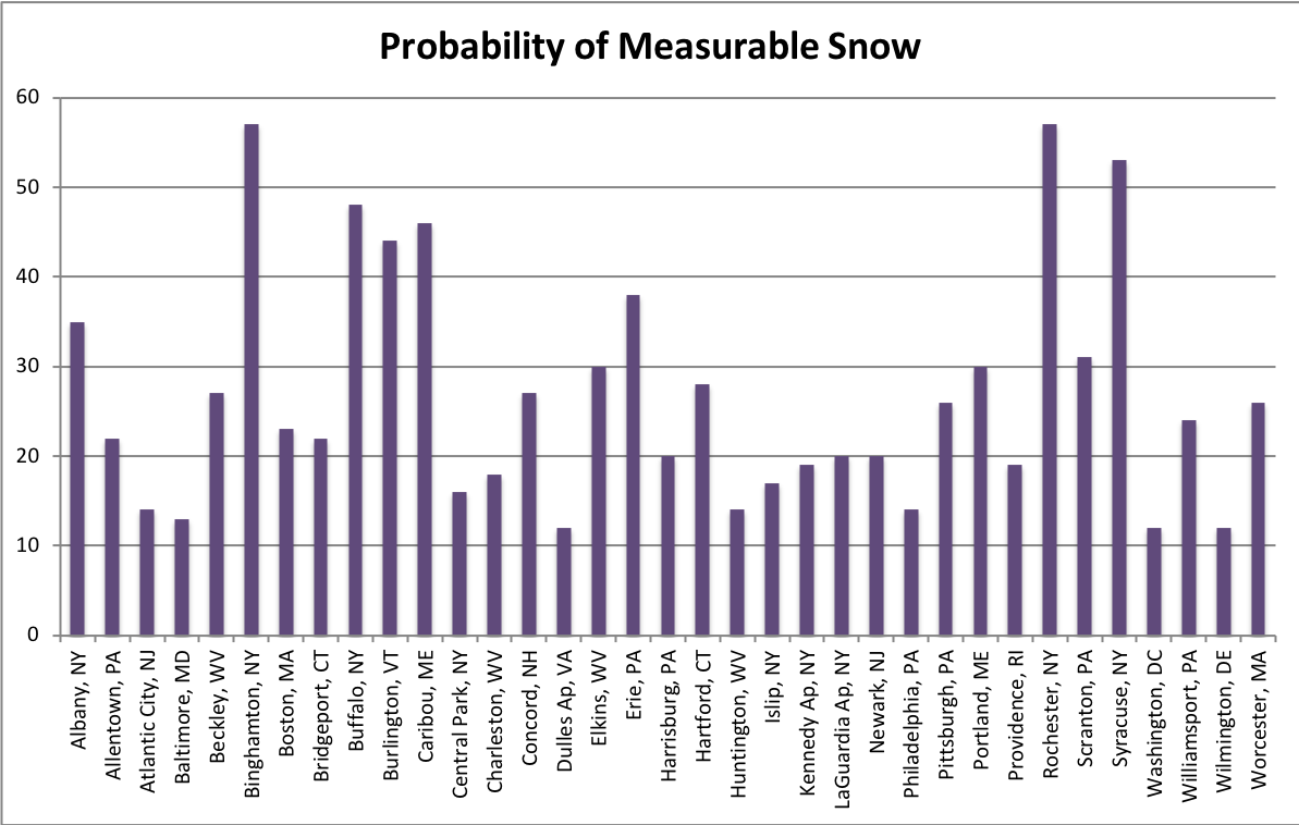 February 8, 2021 Opposites Attract Average conditions on Valentine's Day show us that, in general, New York and New England tend to be colder and snowier than the Mid-Atlantic states.
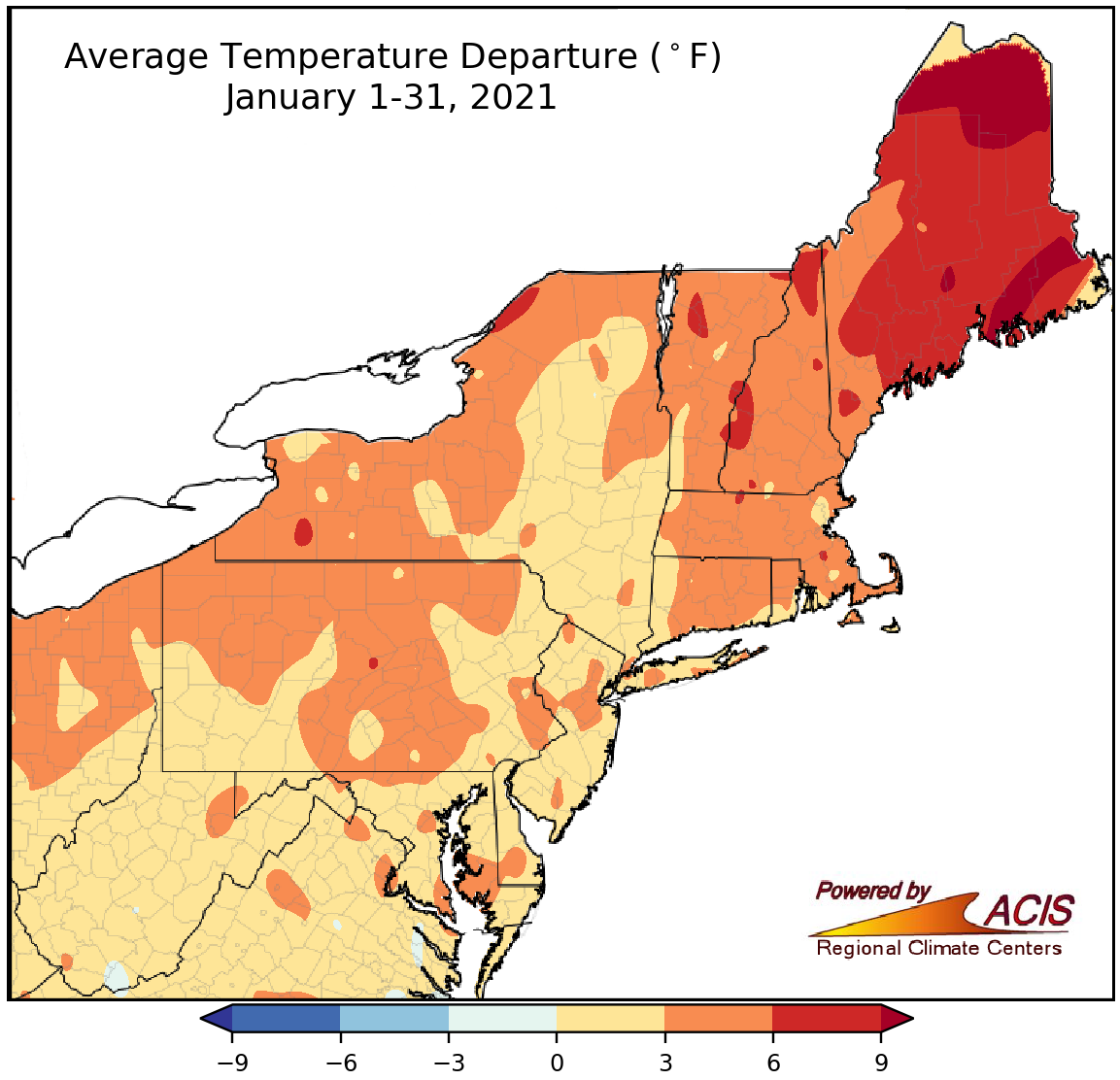 February 1, 2021 A Warm, Dry January This January featured above-normal temperatures and below-normal precipitation and snowfall.
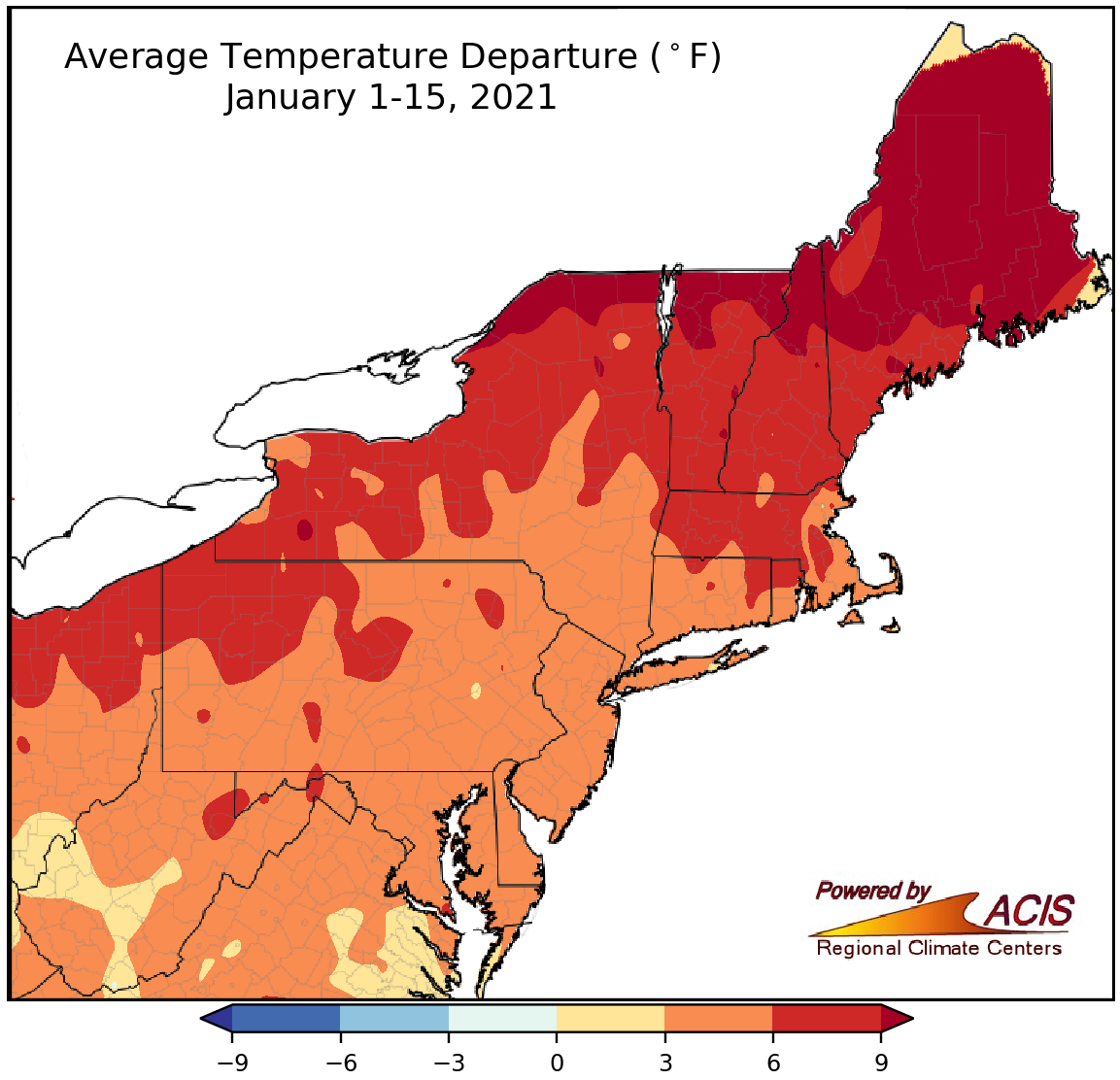 January 19, 2021 A Warm Winter-to-Date January and winter have been warmer than normal for the entire Northeast.
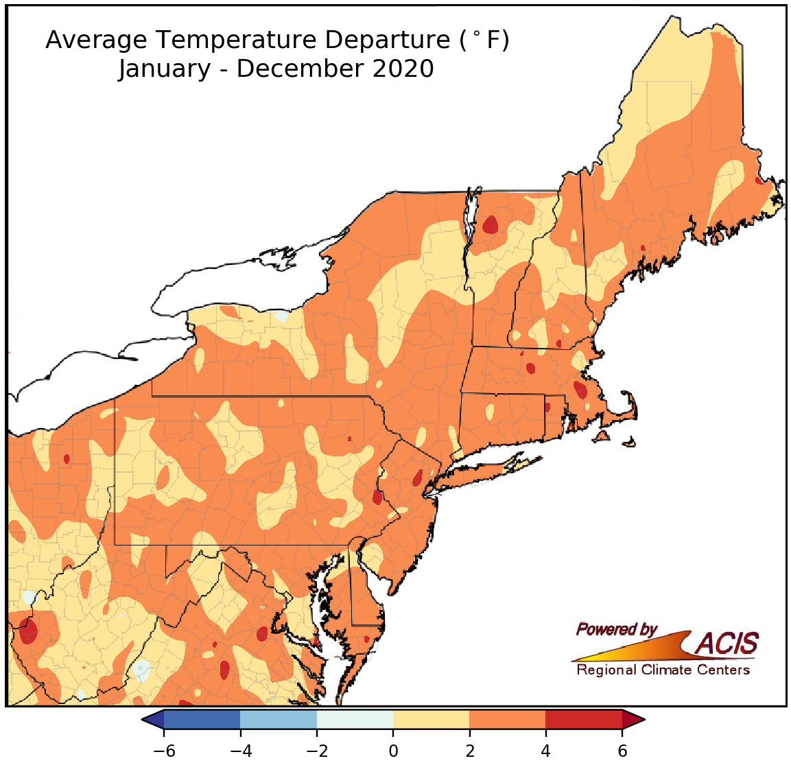 January 4, 2021 2020 - Another Warm Year in the Books While 2020 was a warm year for the entire Northeast, precipitation varied.
2020
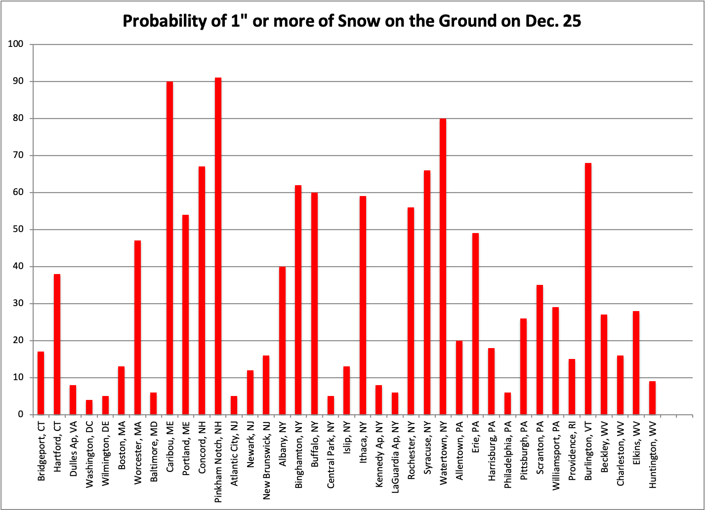 December 17, 2020 Dreaming of a White Christmas? (2020) In a year that has been anything but normal, you may be dreaming of a white Christmas to to brighten the holiday season.
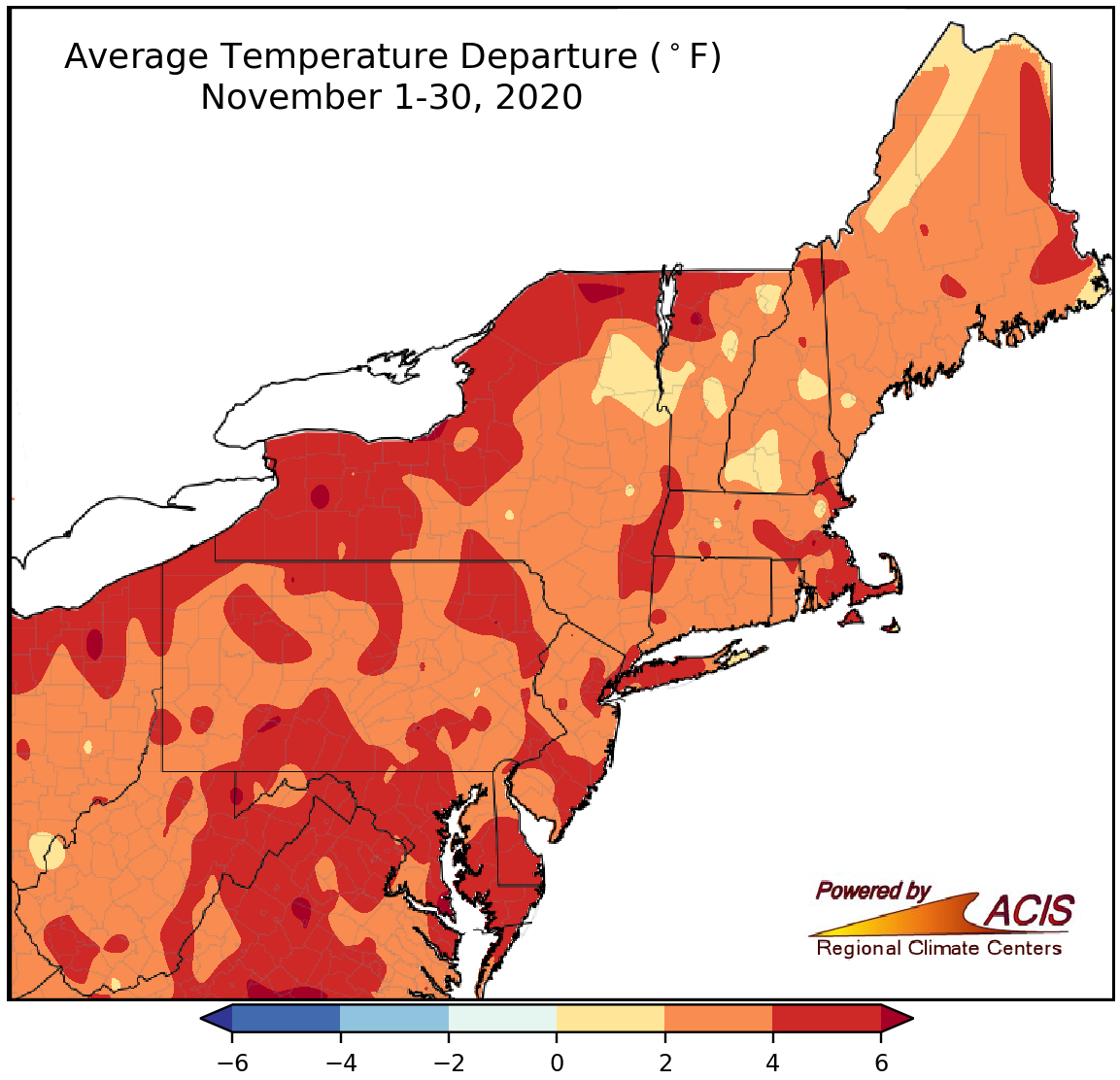 December 1, 2020 A Mild-Mannered November Mild temperatures, little snowfall, and variable precipitation were the highlights of November and fall.
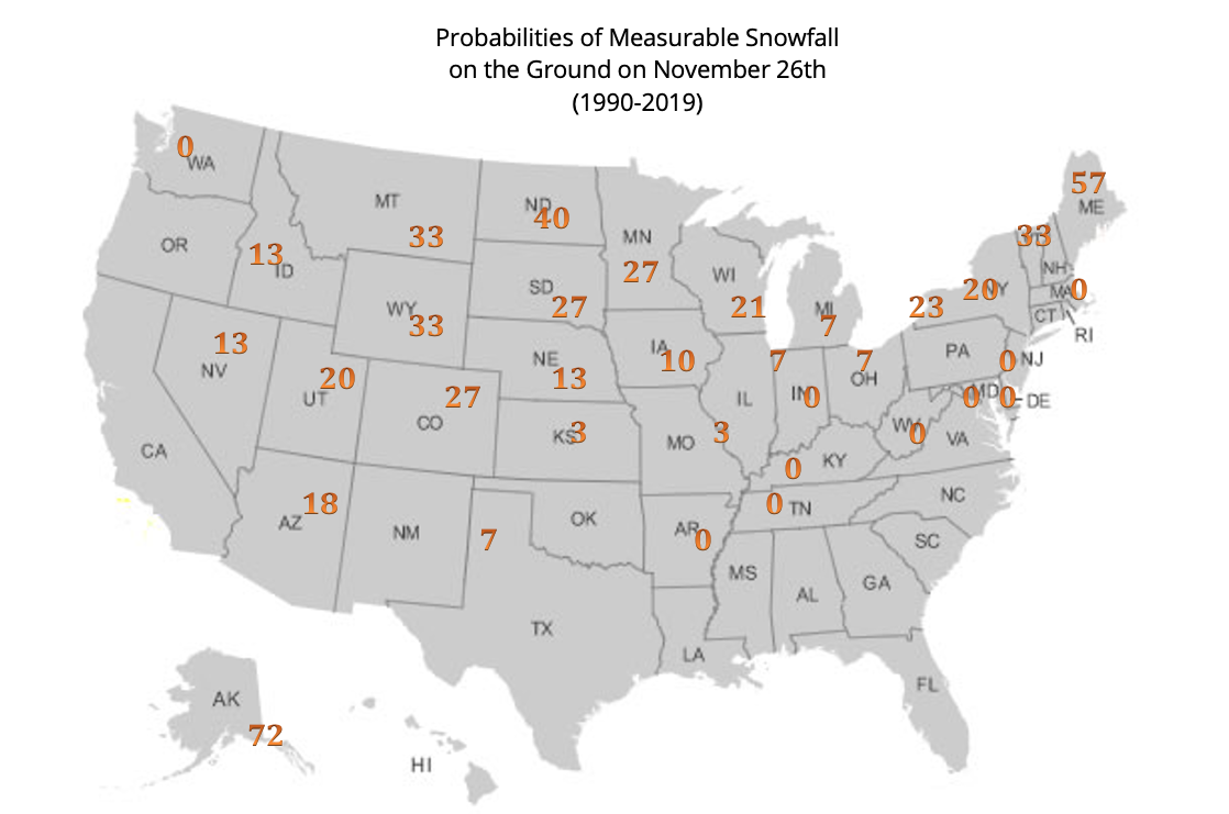 November 20, 2020 White Thanksgiving (2020) Historical white Thanksgiving probabilities.
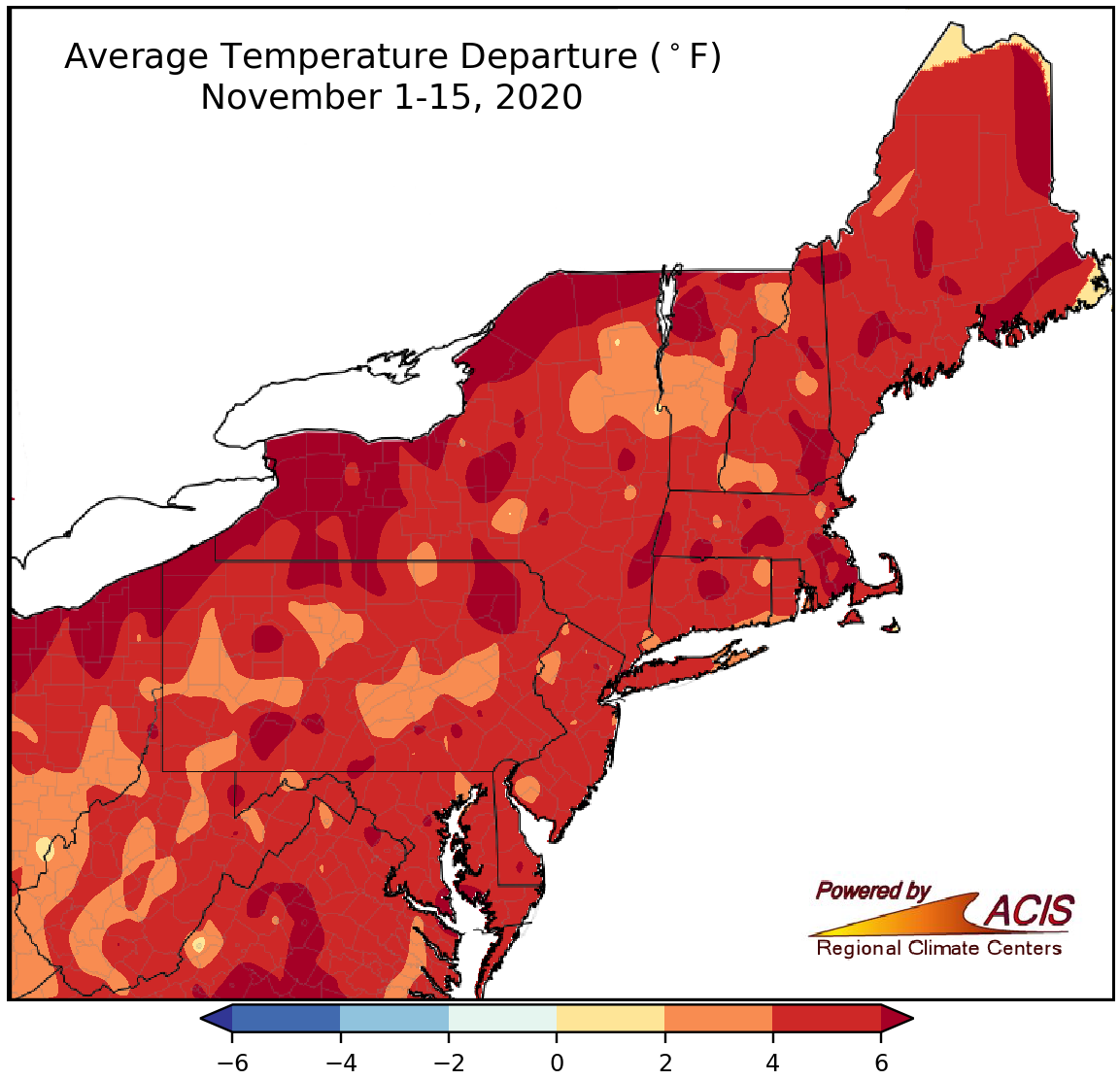 November 16, 2020 A Mild, Dry Mid-November The first two weeks of November featured above-normal temperatures and below-normal precipitation for many areas.
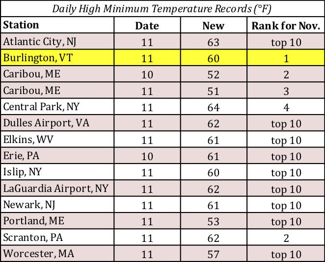 November 12, 2020 November Heats Up The Northeast experienced record or near-record warmth the past few days.
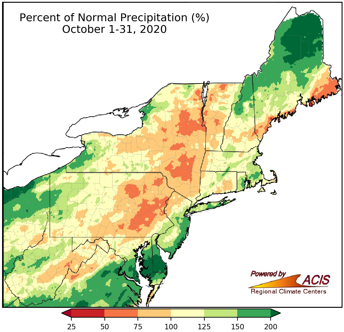 November 1, 2020 October - An Interesting Mix of Conditions While October was generally mild, the month brought a mix of conditions with respect to precipitation and snow.
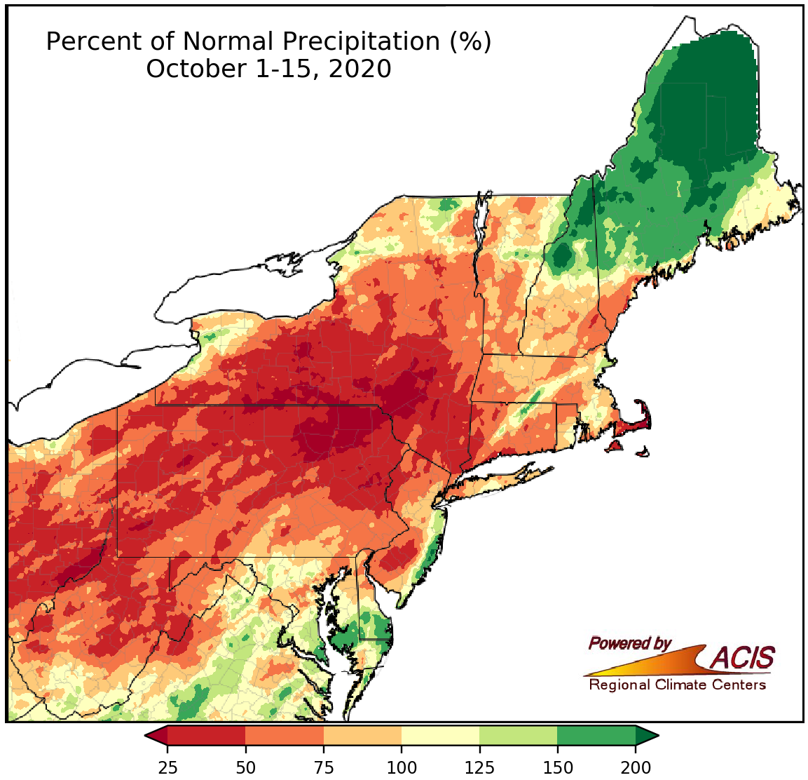 October 16, 2020 A Mostly Dry Mid-October The first half of October was drier than normal for most of the Northeast but there were some notable exceptions.
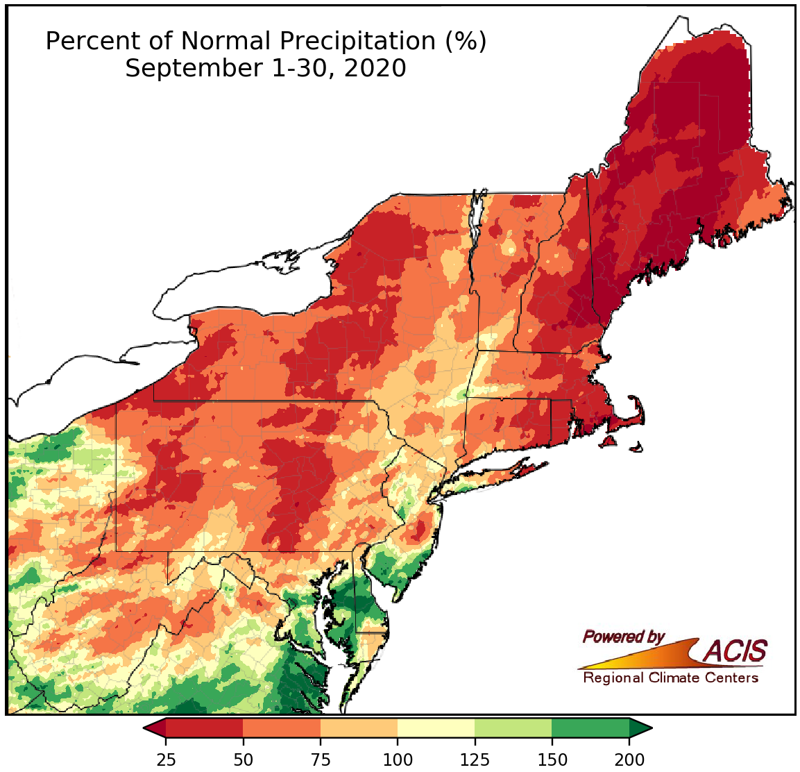 October 1, 2020 A Parched September Dry conditions were prevalent during September across the Northeast, most notably in New England.
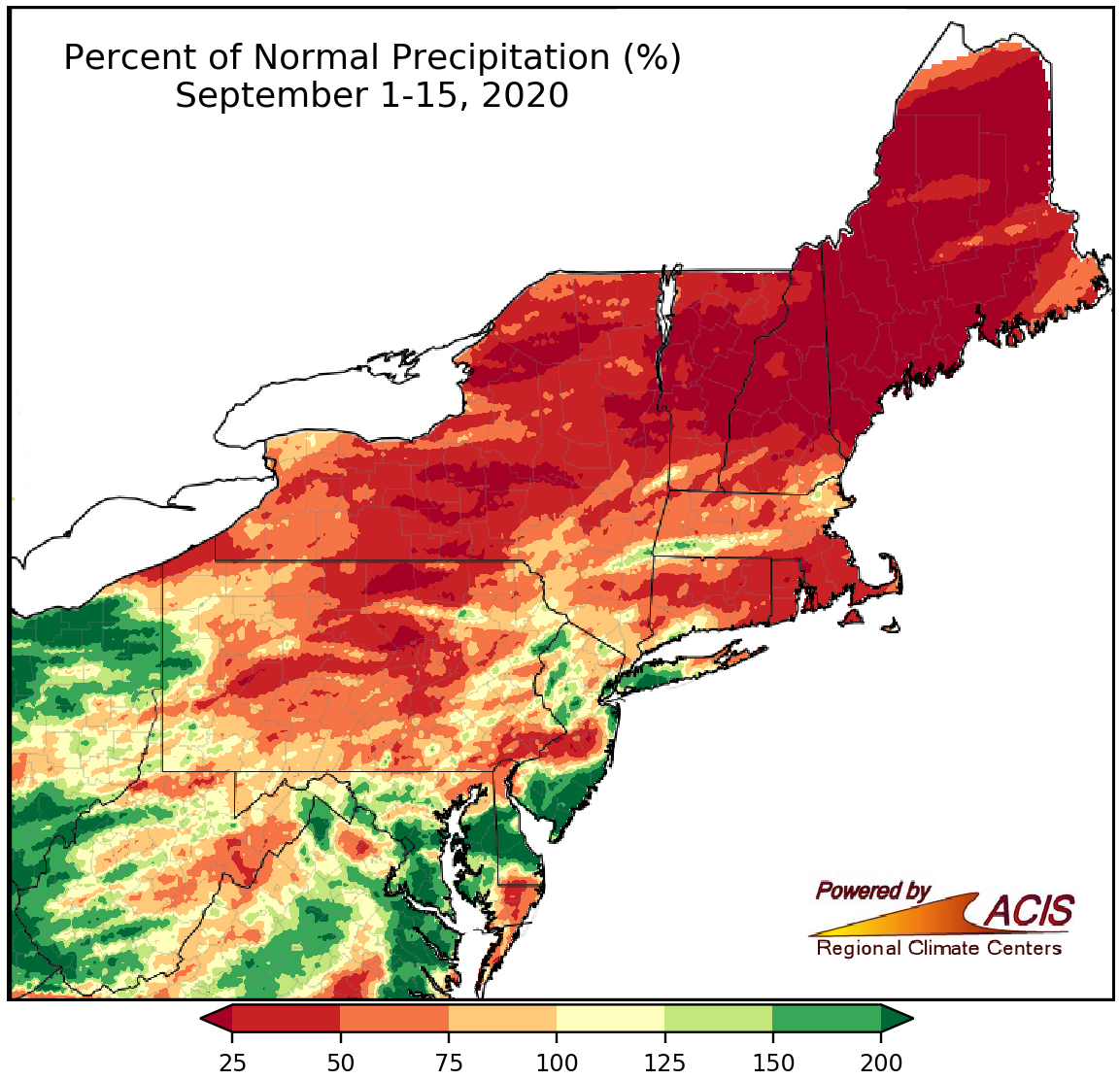 September 16, 2020 A Warm, Dry September-to-Date For Most The first half of September has been warmer and drier than normal for most of the Northeast.
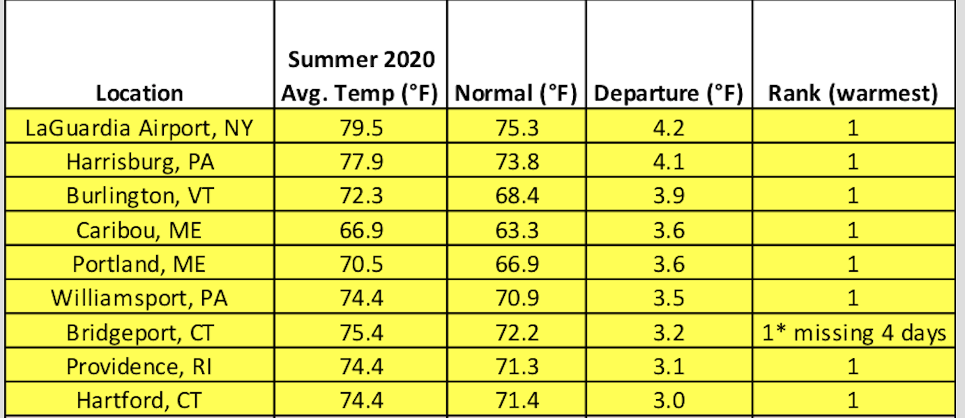 September 1, 2020 Summer Scorcher Summer 2020 was a scorcher for many locations and featured highly variable precipitation.
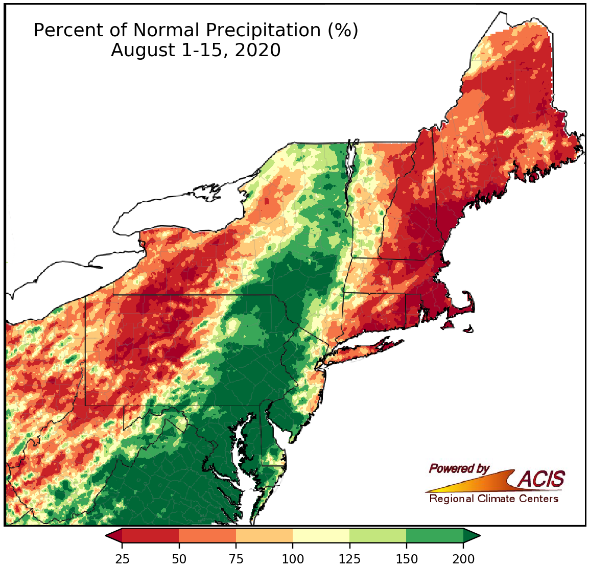 August 16, 2020 Mid-August - Too Little or Too Much Rainfall So far this August, New England has seen too little rainfall while southeastern parts of the region have seen too much.
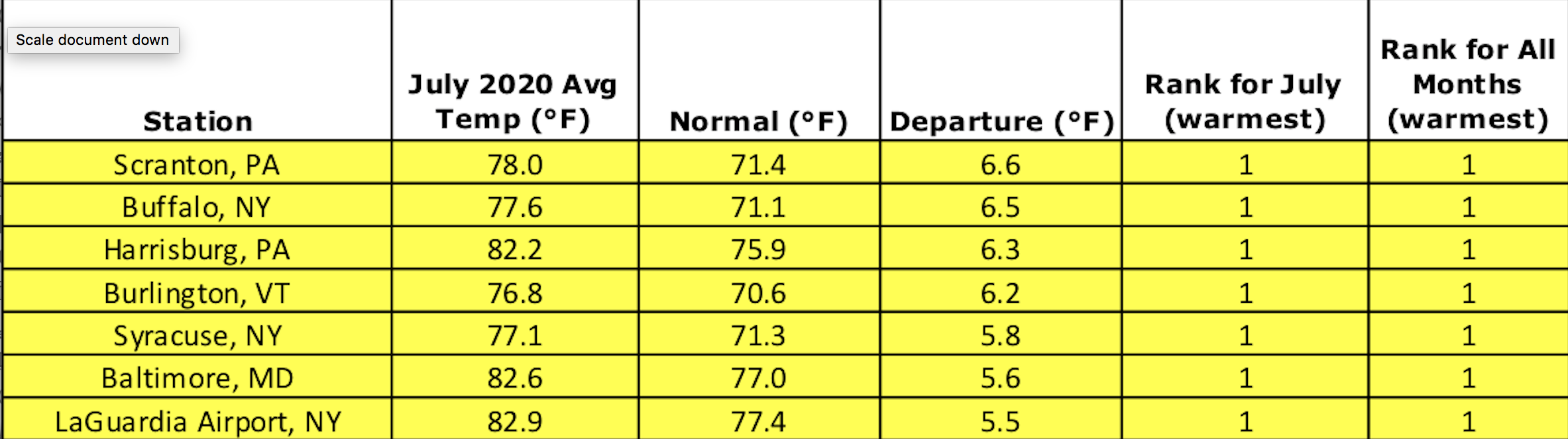 August 1, 2020 A July for the Record Books While July is typically the hottest month of the year, July 2020 was an overachiever.
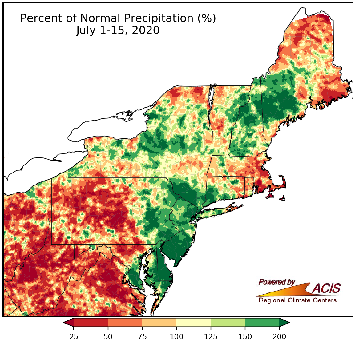 July 16, 2020 Mid-July - Variable Rainfall, Warm Temperatures While rainfall was variable during the first half of July, temperatures were warm across the Northeast.
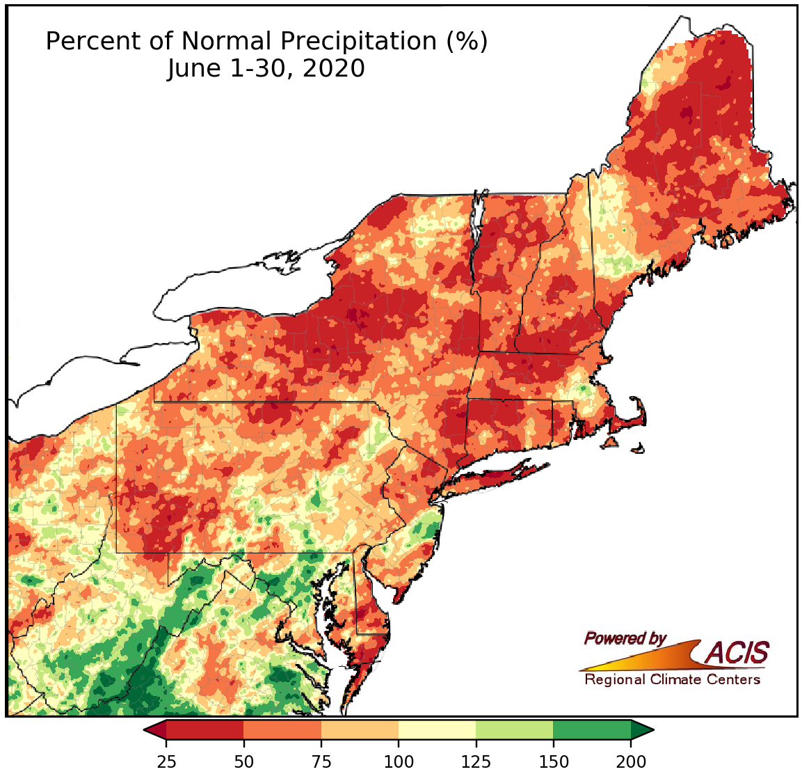 July 1, 2020 An Unusually Dry June A large portion of the Northeast saw below-normal rainfall during June.
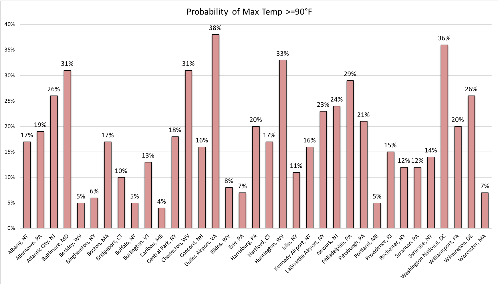 June 25, 2020 July 4th Climatology Here's a look at past weather on Independence Day in the Northeast.
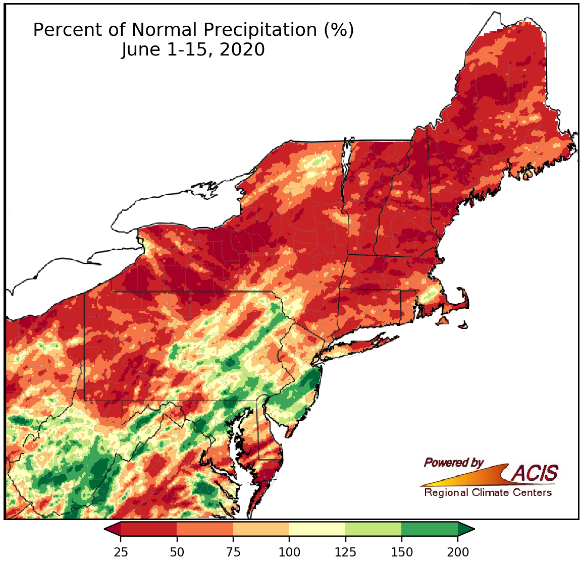 June 16, 2020 A Dry Start to June For Many Areas Many parts of the Northeast have seen below-normal precipitation so far this June.
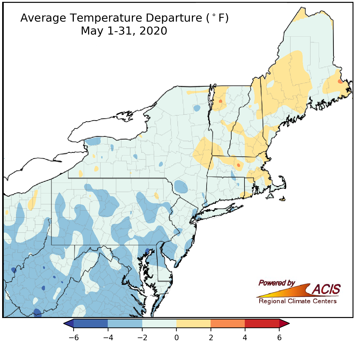 June 1, 2020 May - From Winter to Summer May started off with winter-like conditions but wrapped up with summer-like conditions. Here's a recap of May and spring.
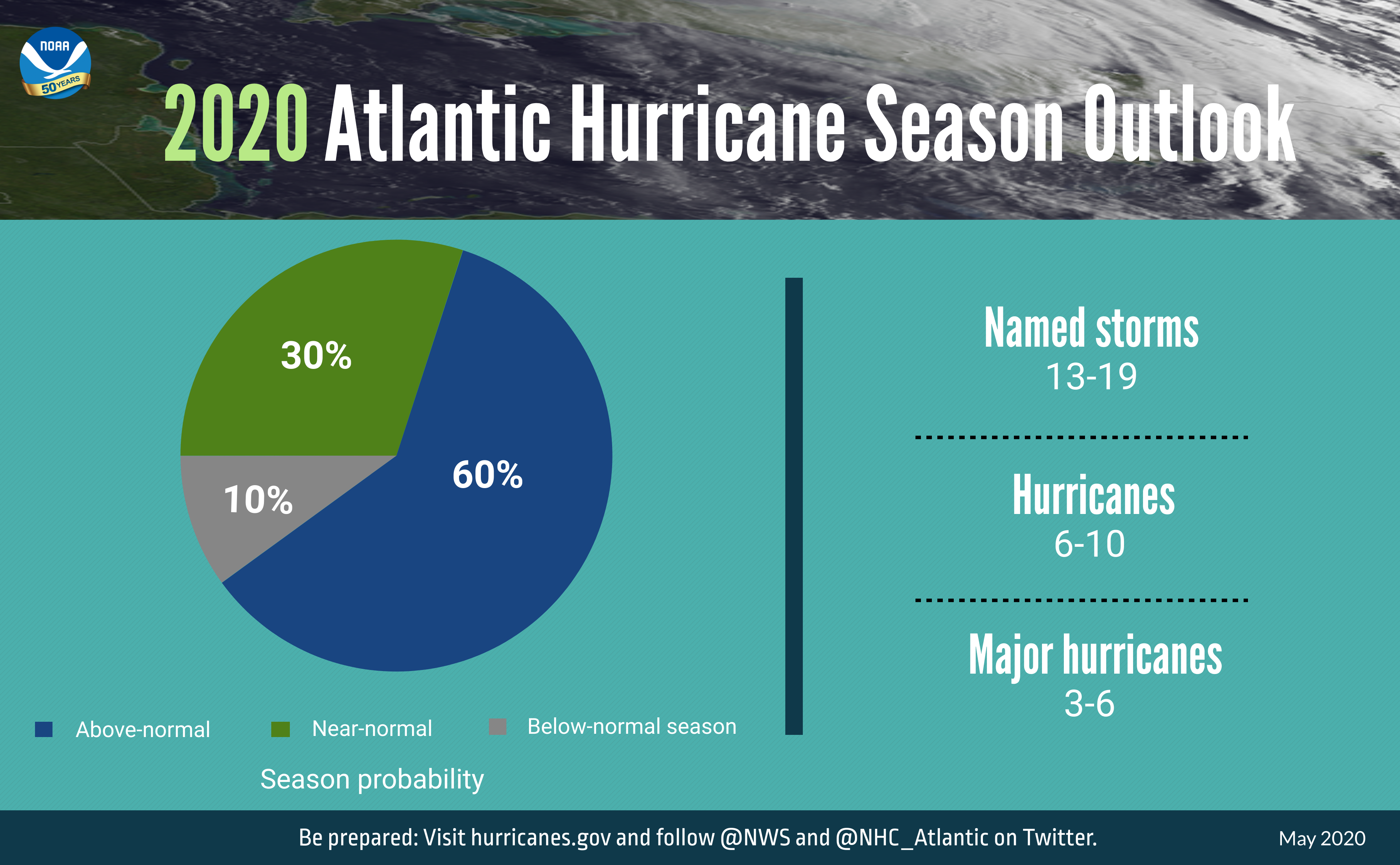 May 26, 2020 Hurricane Season (Officially) Starts Soon The Atlantic hurricane season officially starts on June 1.
 May 18, 2020 S(n)o(w) Long to a Cold First Half of May! The first half of May was cold and, in some places, snowier than usual. But, temperatures are looking more summer-like for the second half of the month!
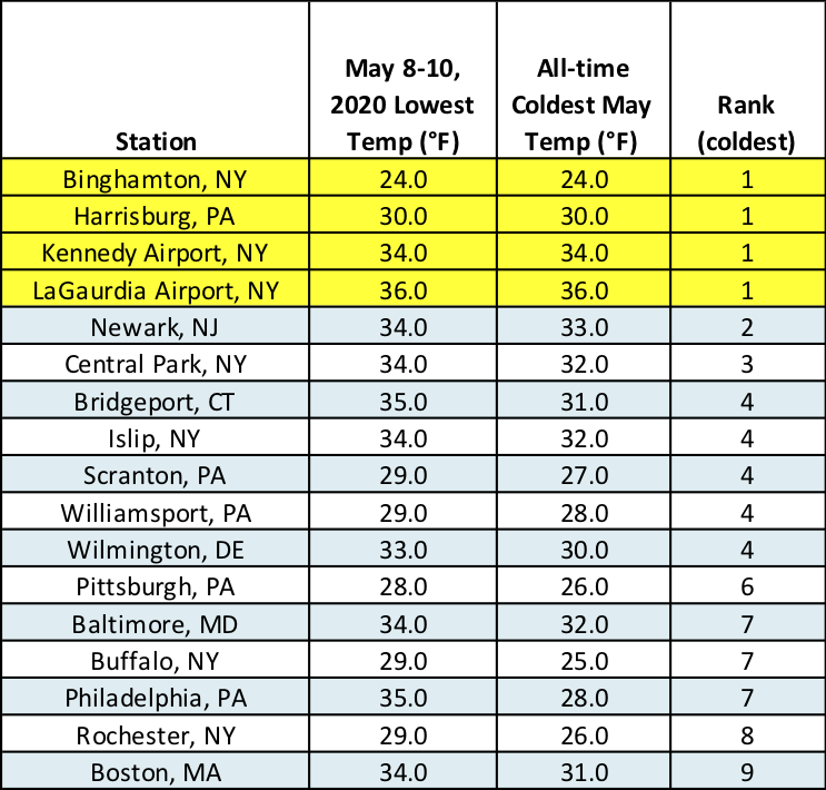 May 12, 2020 Polar Plunge As the polar jet stream plunged south this weekend, Arctic air spilled into the Northeast and temperatures took a nosedive. Oh, and there was snow...in May!
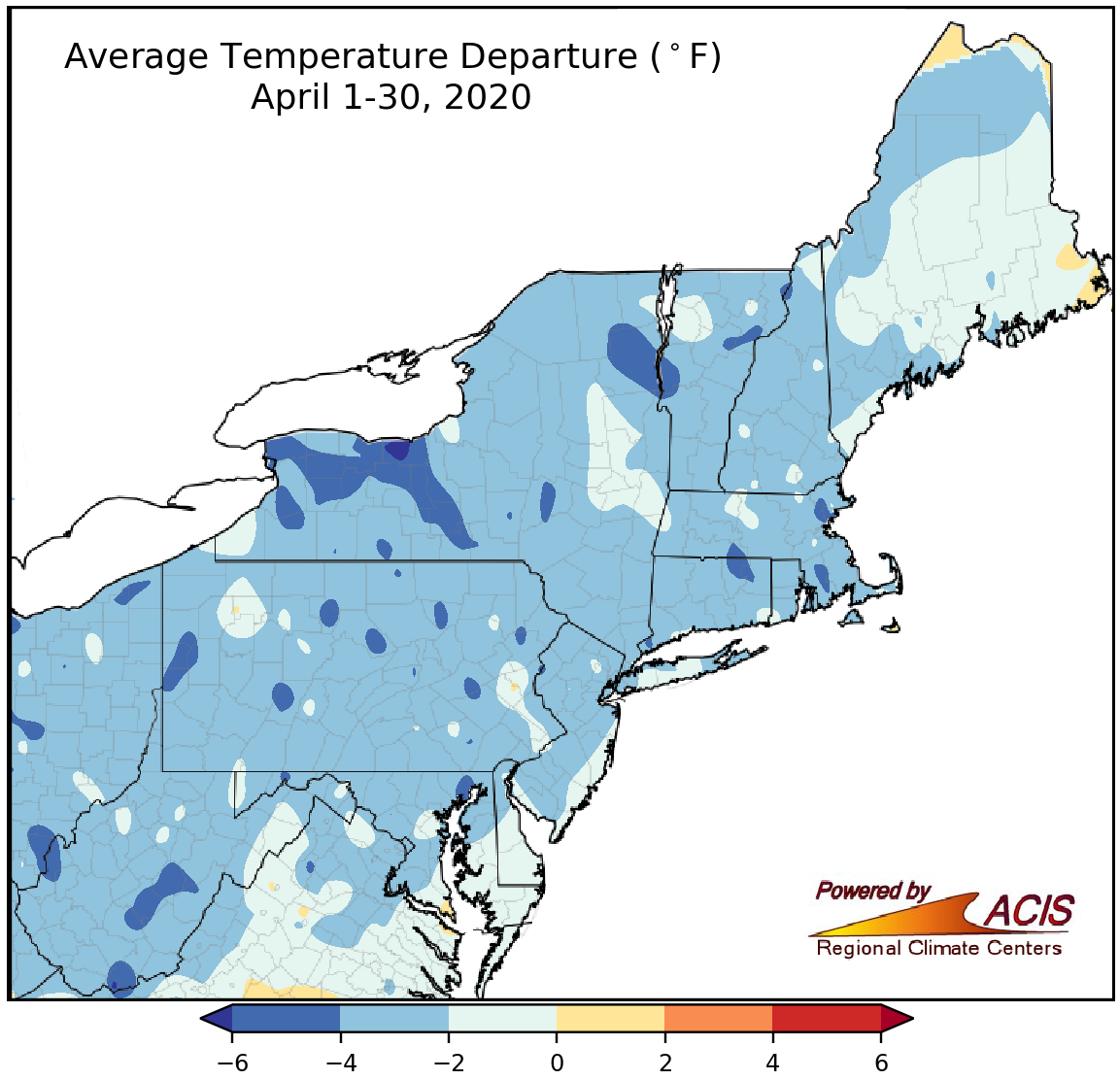 May 1, 2020 A Cool, Showery April It was a chilly April across the Northeast, with many areas seeing a surplus of April showers.
 April 22, 2020 Earth Day Turns 50 April 22, 2020 marks the 50th anniversary of Earth Day! In honor of the day, let's take a look at weather conditions at the Northeast's 35 major climate sites since Earth Day was first celebrated back in 1970.
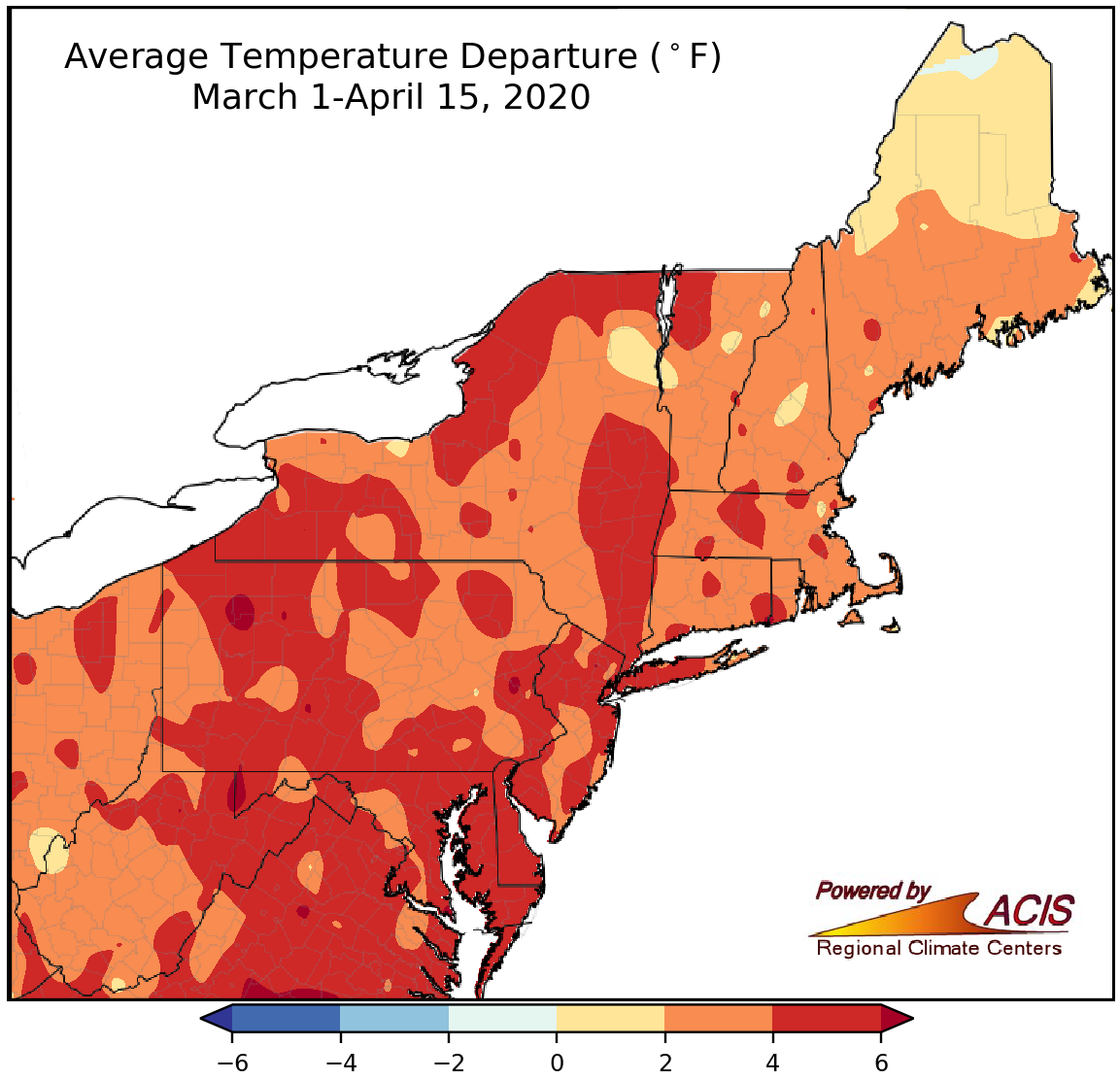 April 16, 2020 Middle of April, Middle of Spring So far, April and spring have featured above-normal temperatures and below-normal snowfall for many areas.
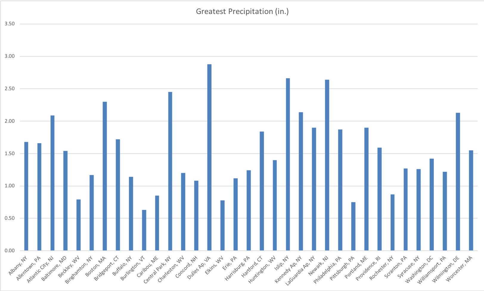
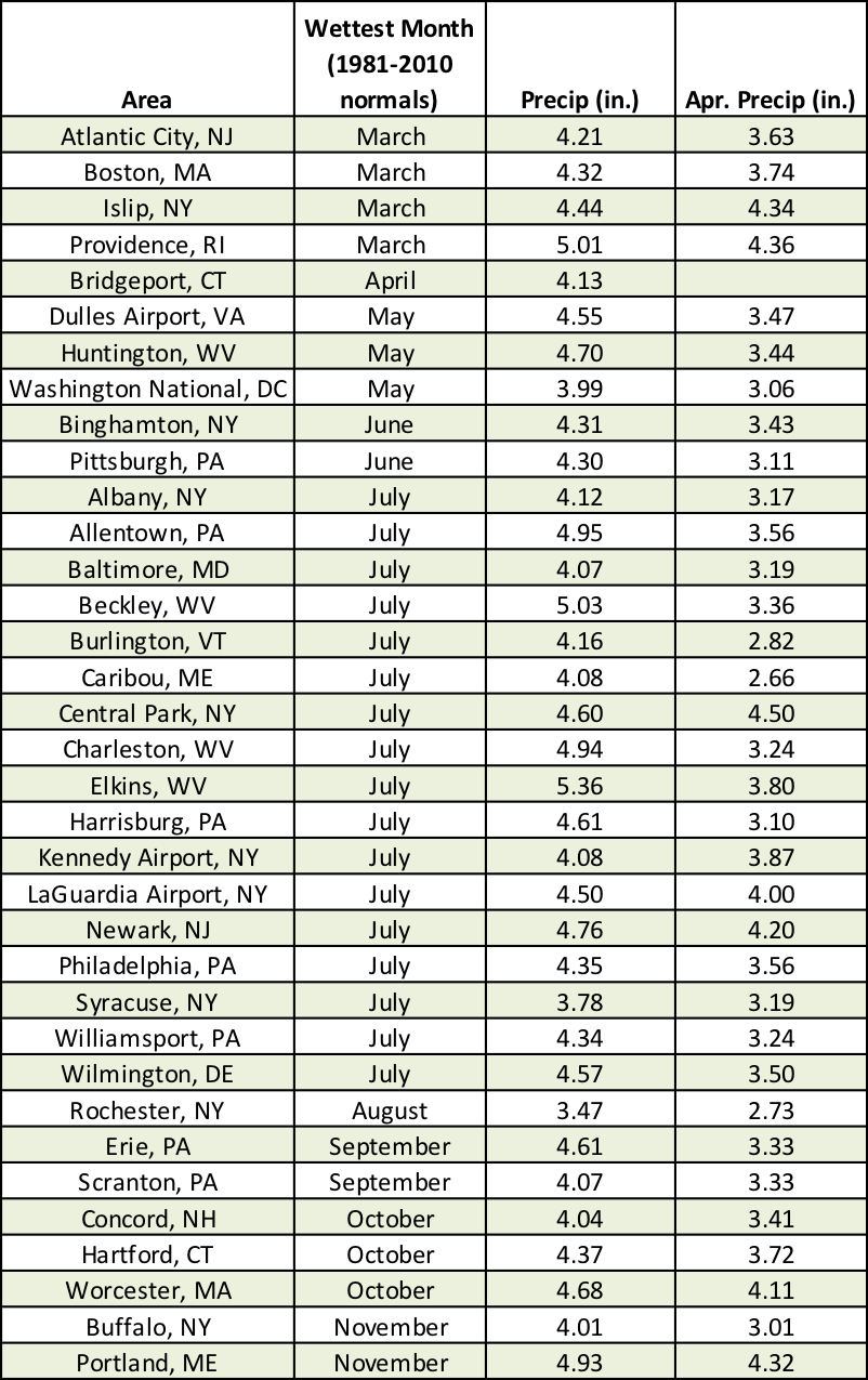 April 10, 2020 An Assortment of April Showers An interesting aspect of "April showers" is that those showers can fall in a variety of forms. Plus, how does April precipitation compare to other months?
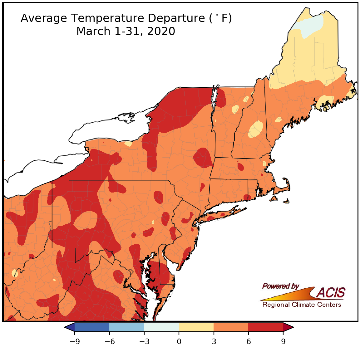 April 1, 2020 A Mostly Tame March For a month being known for "coming in like a lion and going out like a lamb," March was relatively tame.
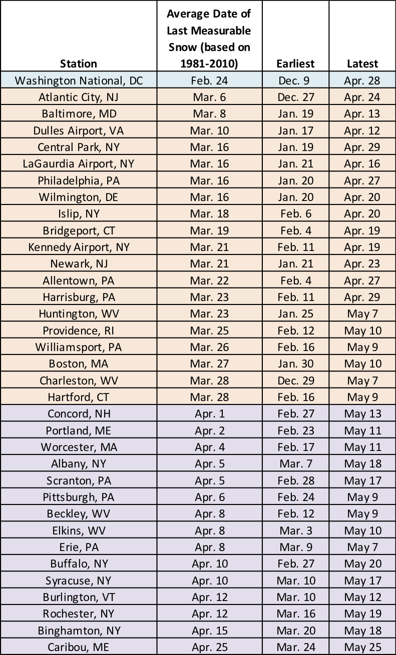 March 24, 2020 Spring's Firsts and Lasts Spring is a season of transition, featuring both winter-like and summerlike conditions.
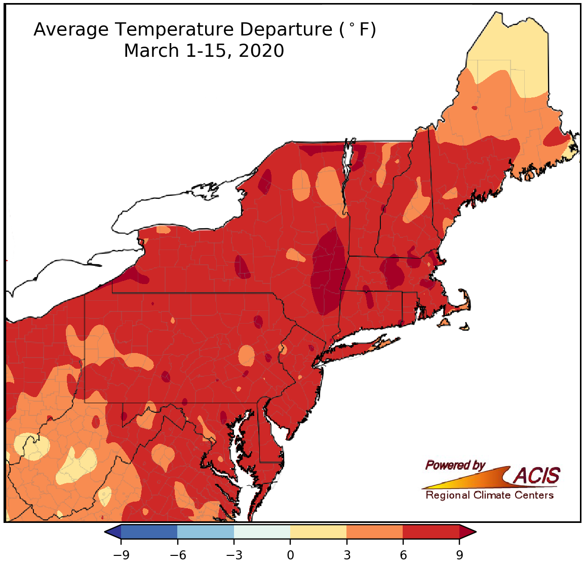 March 16, 2020 A Mild March So Far So far, March has been milder than normal in the Northeast.
 March 10, 2020 CoCoRaHS March Madness (2020) CoCoRaHS is looking for volunteers! What is CoCoRaHS, and why is it important?
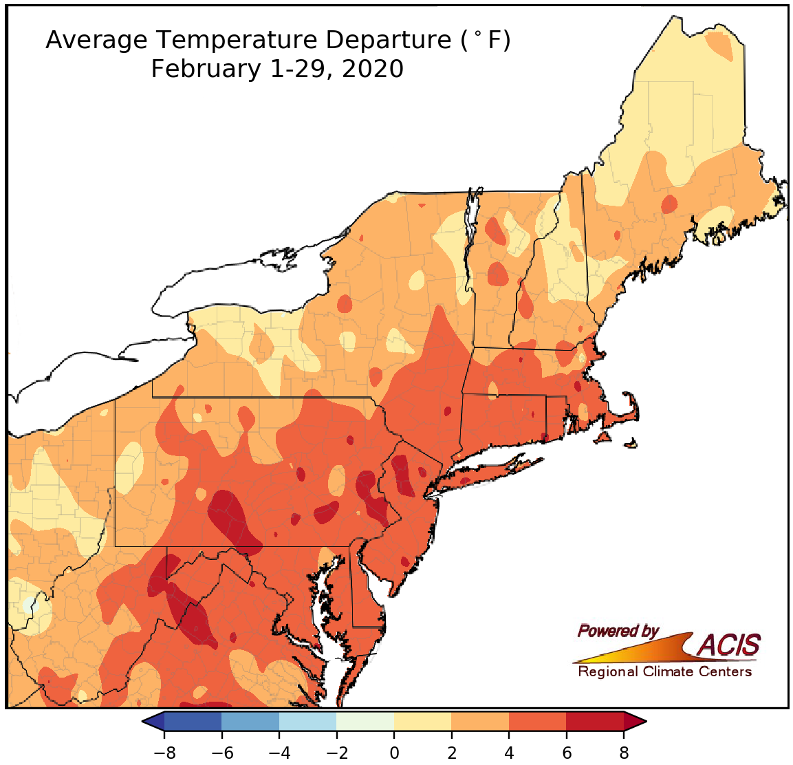 March 2, 2020 Where Was Winter? February and winter were unusually warm in the Northeast. Some areas also reported record-low snowfall.
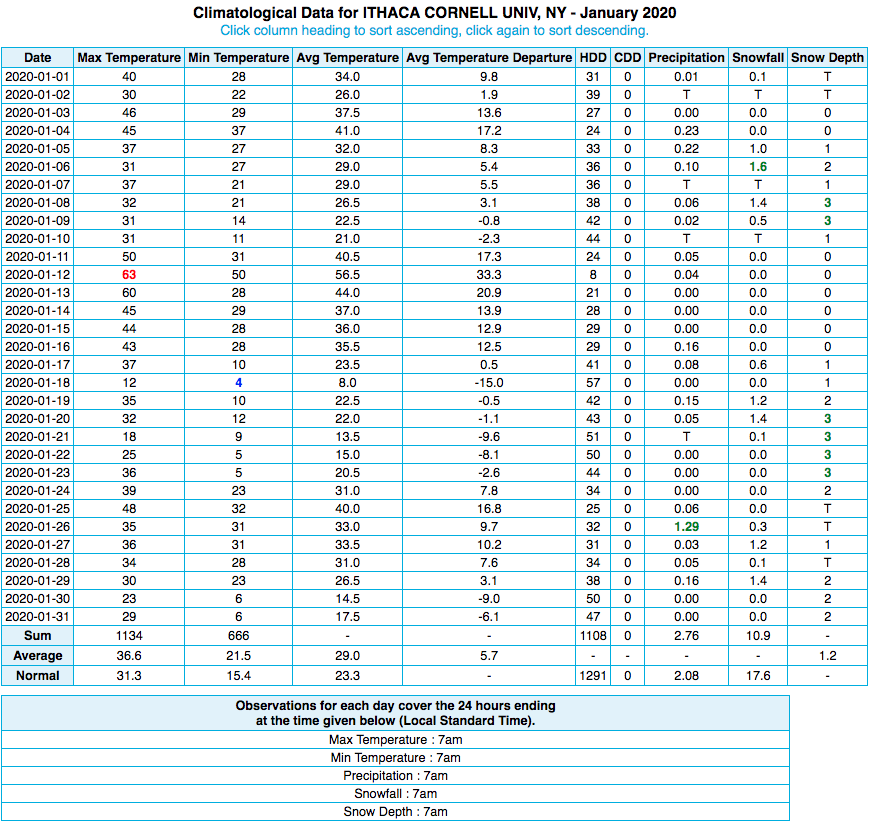 February 24, 2020 What Does It All Mean? Here's a climate data primer using our "Daily Data for a Month" product as an example.
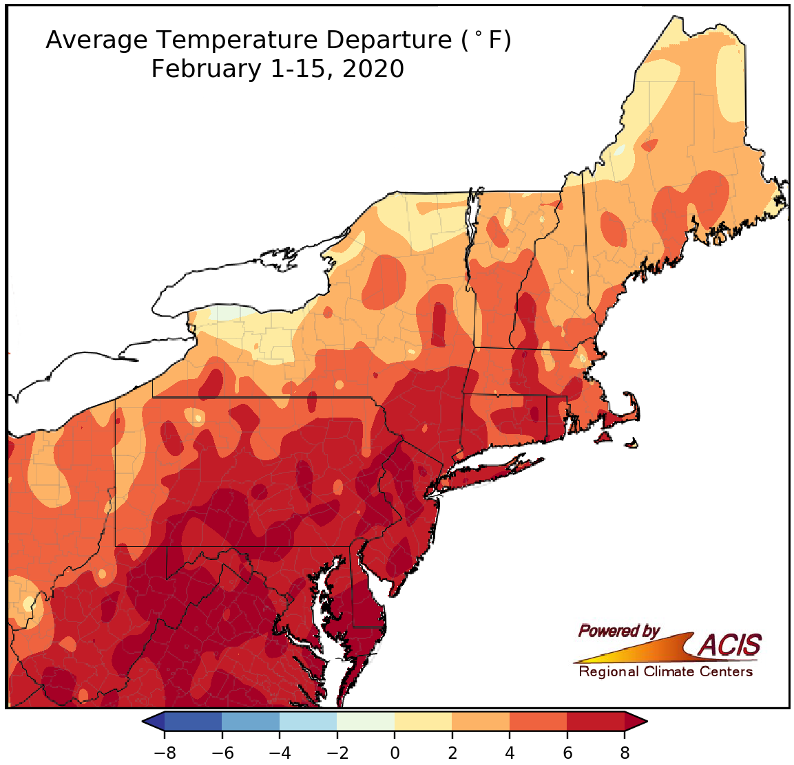 February 17, 2020 A Fascinating February-To-Date February-to-date has featured some fascinating weather, including unusual warmth, abundant precipitation, snowfall extremes, and a rare tornado outbreak.
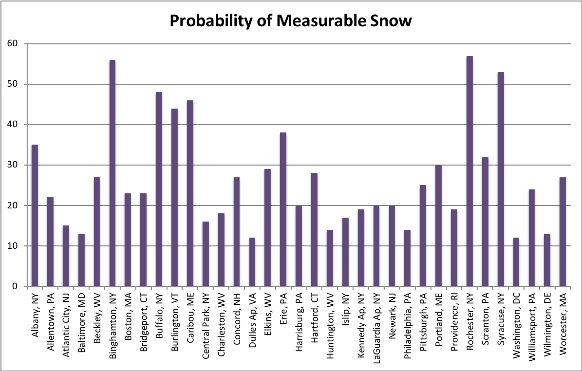 February 11, 2020 A Valentine's for Everyone! The Northeast offers a variety of weather that everyone can enjoy, even on Valentine's Day, if you know where to look!
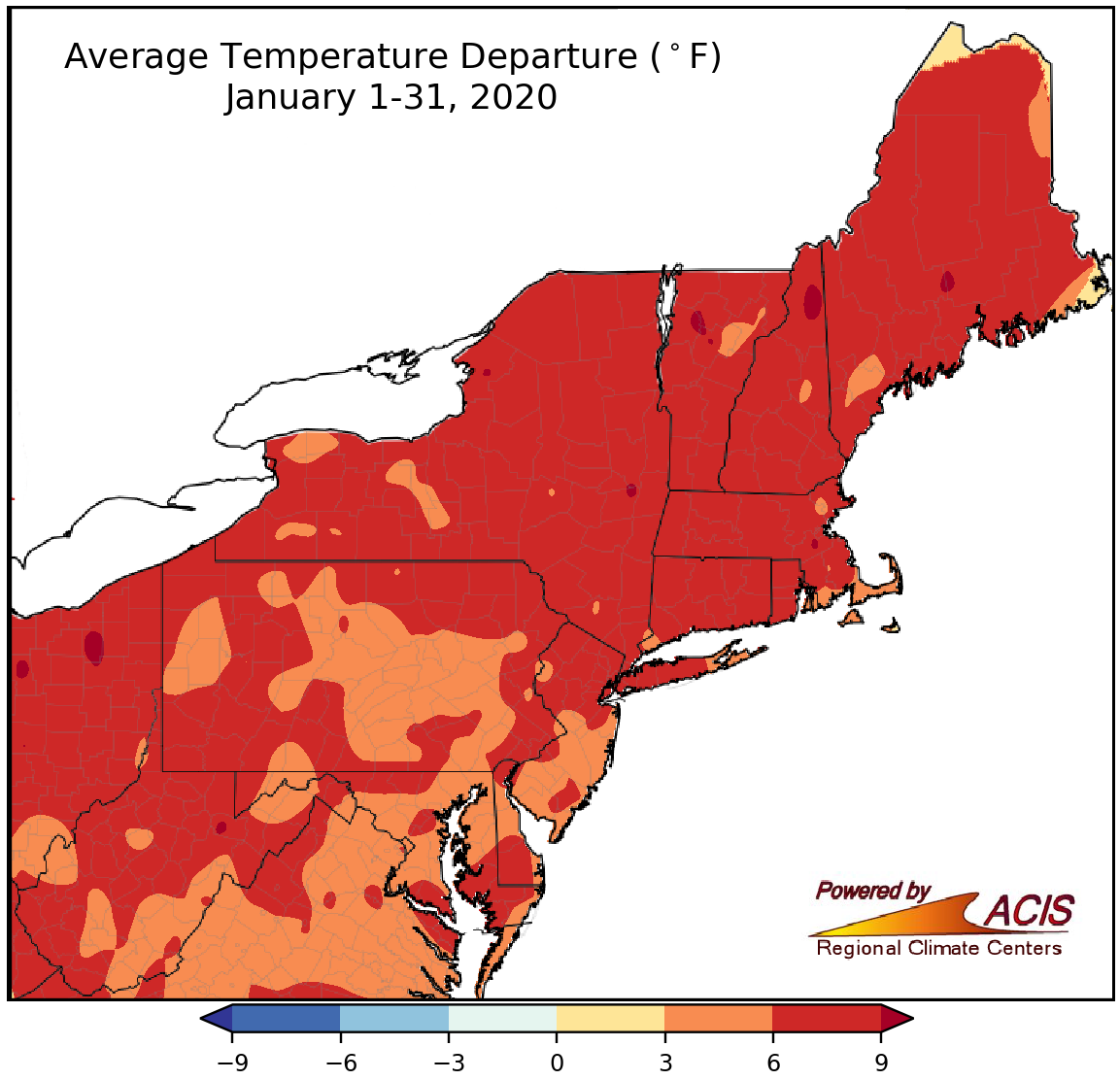 February 3, 2020 Mmmmm, January! With January over, here are the "M" words that describe the month.
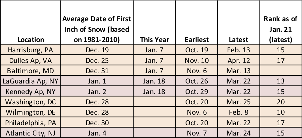 January 21, 2020 Late Snow and Record Warmth A few sites still haven't seen their first inch of snow. Plus, several locations had their warmest January day on record.
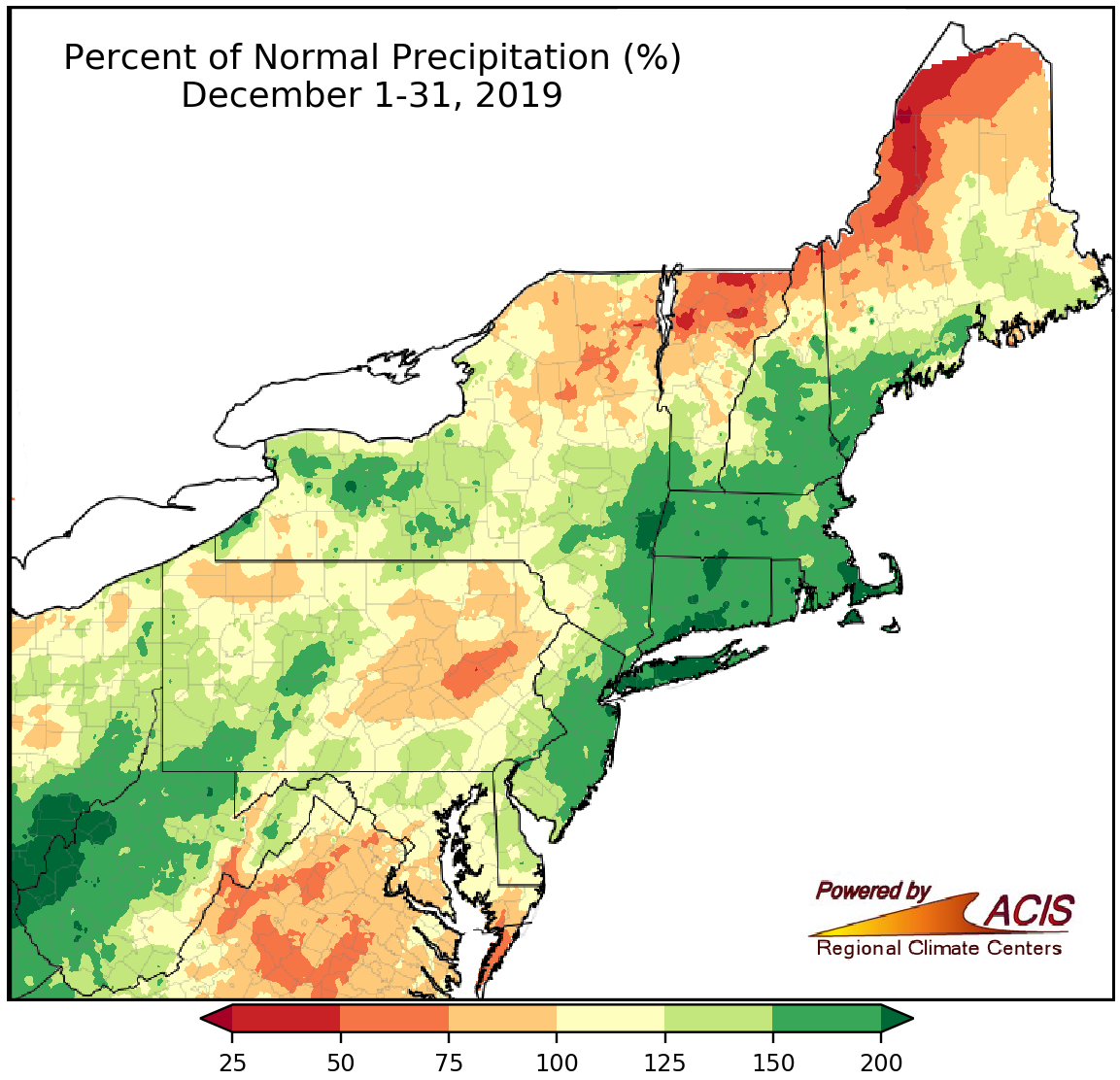 January 2, 2020 December & 2019 - Wet and Warm for Most Both December and 2019 wrapped up to be wetter than normal and warmer than normal for many parts of the Northeast.
2019
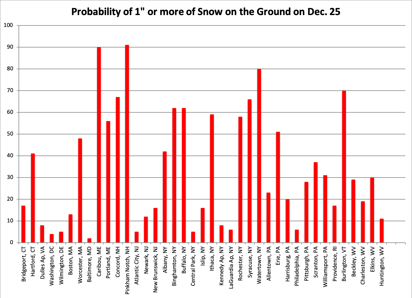 December 17, 2019 Snow of Christmas Past, Present, & Future (2019) Taking a closer look as Christmases past, not only for this year's white Christmas probabilities, but for a look into the future.
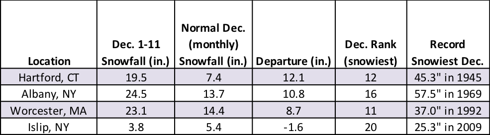 December 12, 2019 Snowfall Surplus for Some This December is already one of the 20 snowiest on record for a few sites! Plus, all of the major climate sites have seen their first measurable snow.
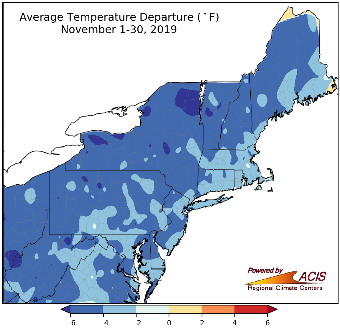 December 3, 2019 Fall Ends on a Low (Temperature) Note November was cold in the Northeast, balancing out a mild October.
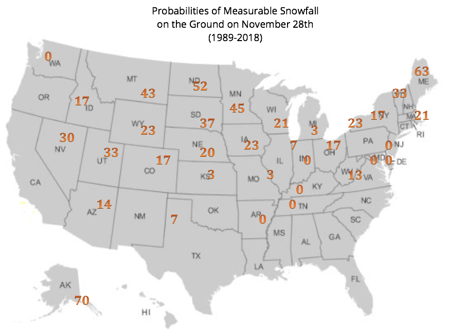 November 21, 2019 White Thanksgiving (2019) Few Northeast areas will have a white Thanksgiving this year.
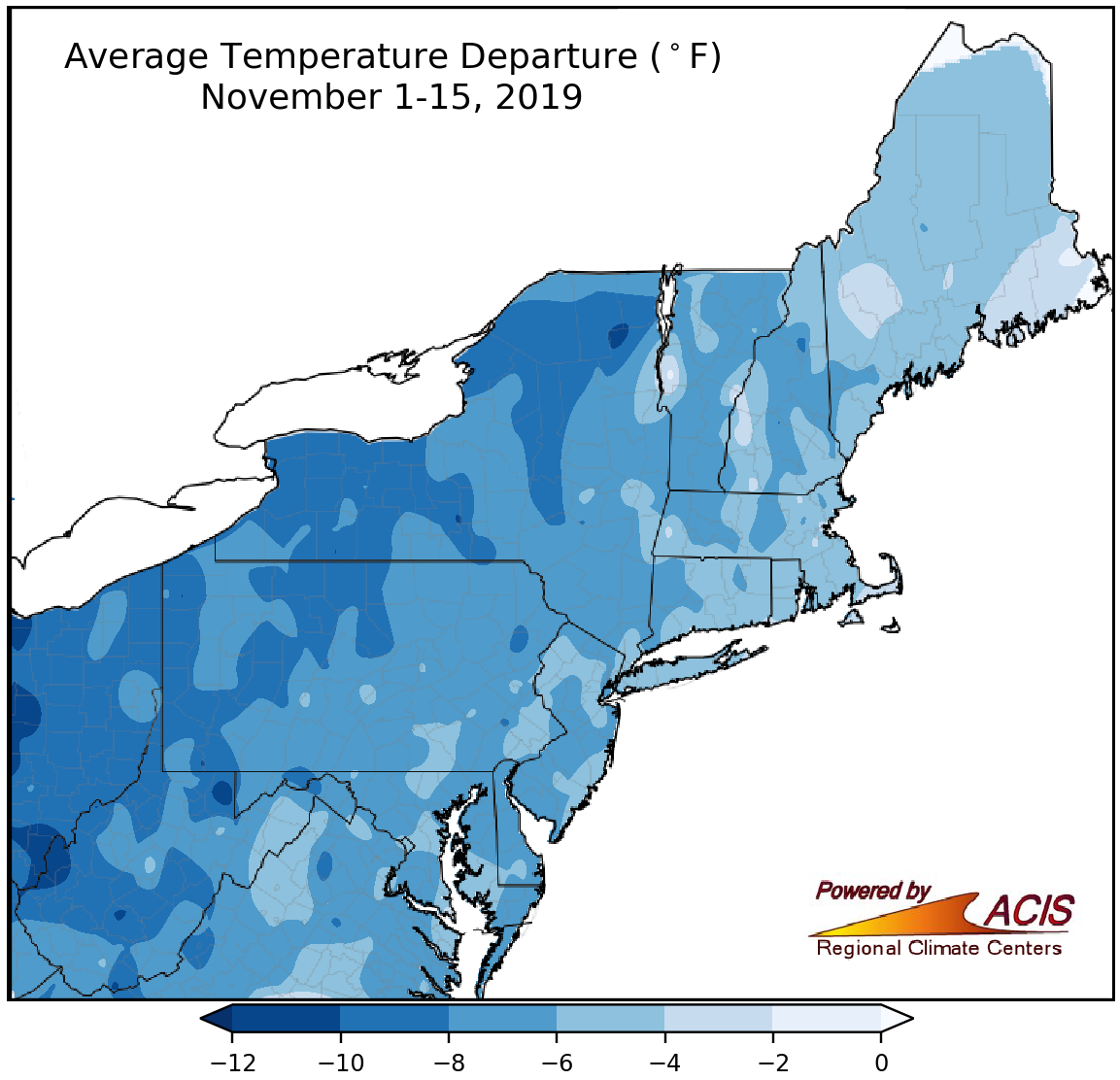 November 18, 2019 A Temperature Switcheroo September and October featured mild weather, but November pulled a temperature switcheroo.
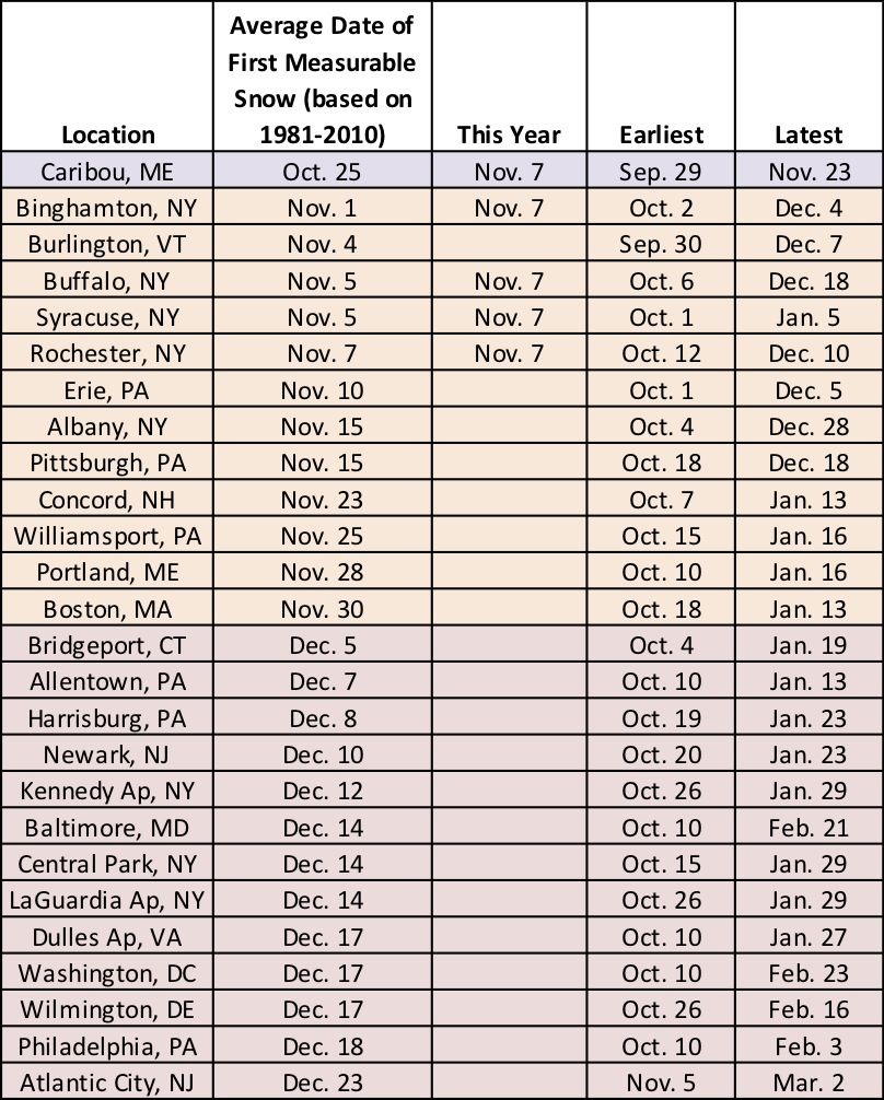 November 8, 2019 First Snow of the Season A few major climate sites picked up their first measurable snow of the season yesterday. Both climatology and a colder, wetter weather pattern tell us that additional areas could see their first snow soon.
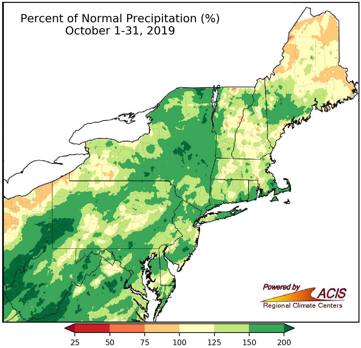 November 1, 2019 A Soggy, Mild October October was wet and warm in the Northeast.
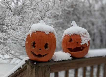 October 22, 2019 Halloween Weather - Frightful or Delightful? Is the weather in the Northeast usually frightful or delightful on Halloween?
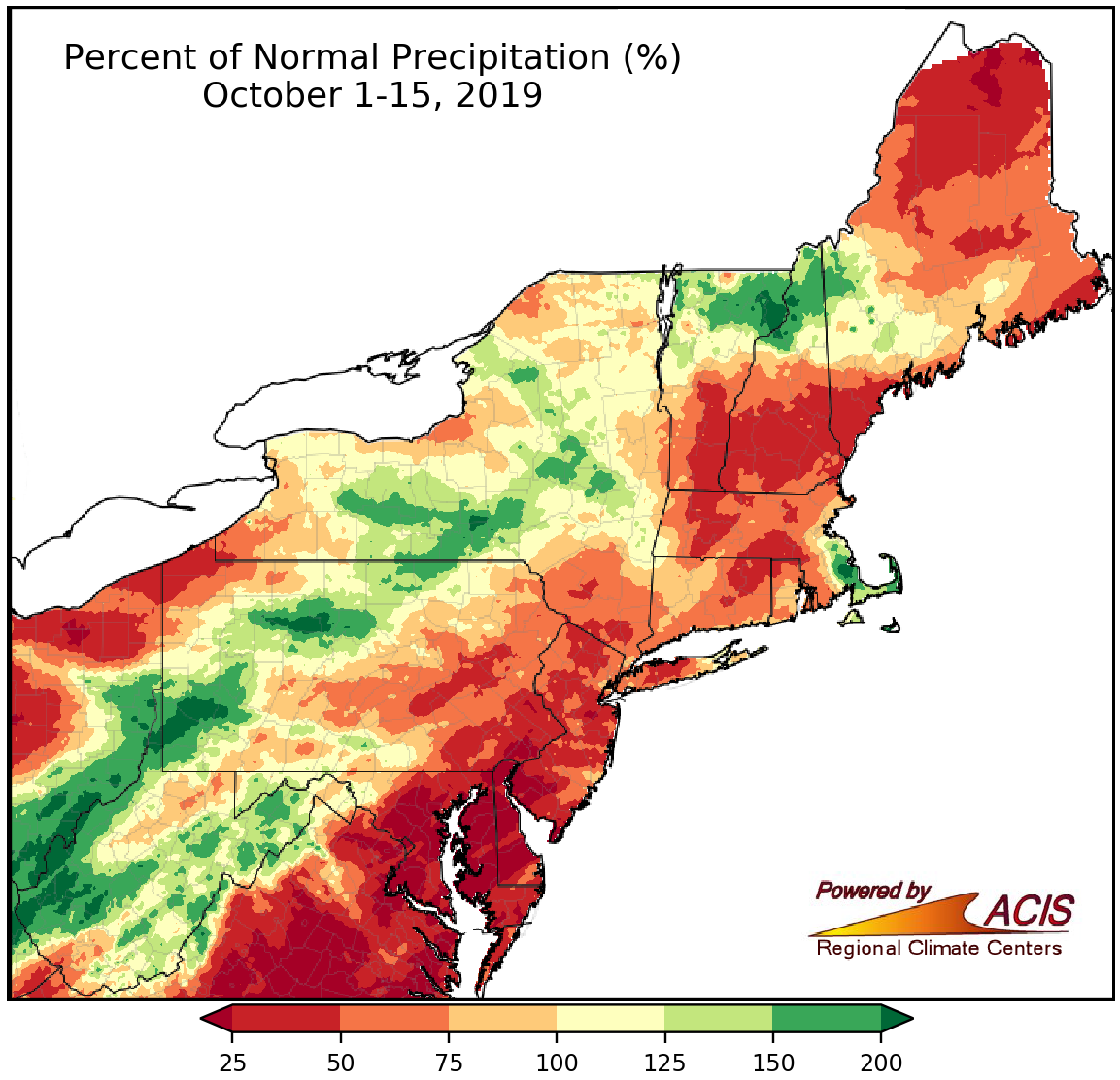 October 16, 2019 September Similarities in Mid-October Extremely dry conditions in several locations? Check. Southern parts of the region particularly warm? Yes.
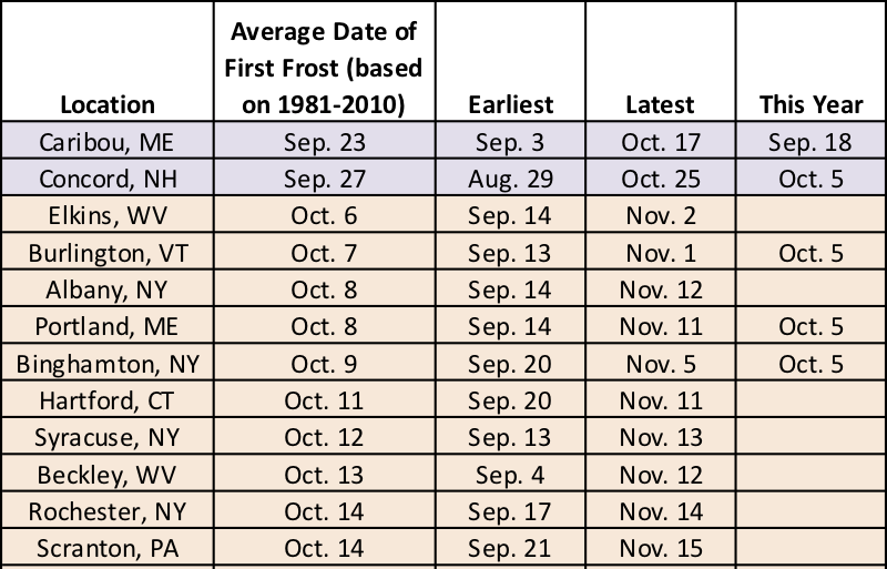 October 8, 2019 First Frost Fast Approaching After last week's unusually hot weather it may be difficult to imagine freezing temperatures but the first fall frost is scheduled to arrive within the month for many Northeast sites.
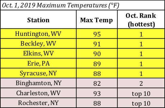 October 3, 2019 A Sizzling Start to October October picked up right where September left off, with record-setting heat.
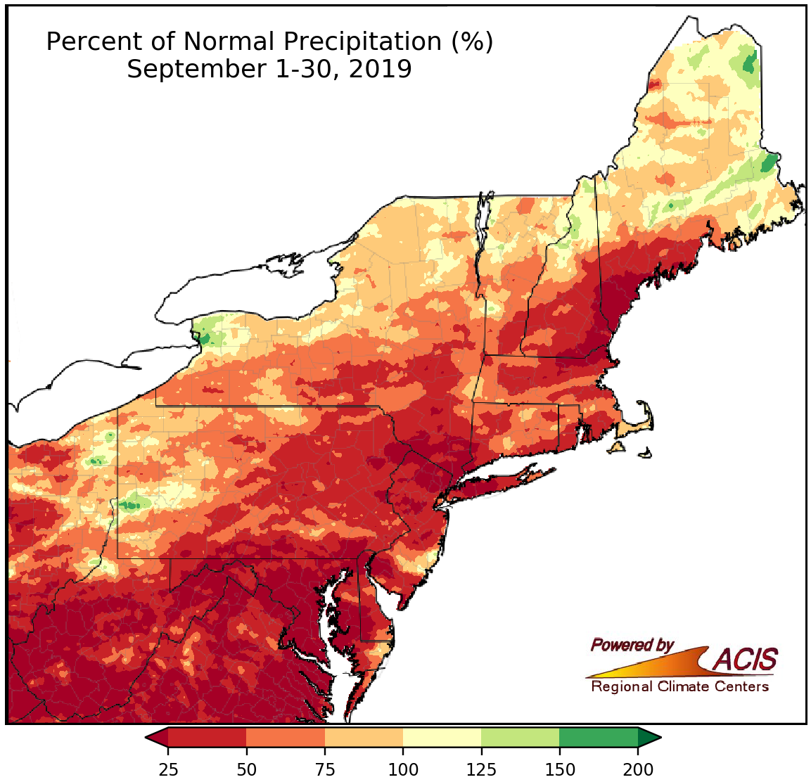 October 1, 2019 Another Record-Setting September September featured record-setting dryness and warmth in parts of the Northeast.
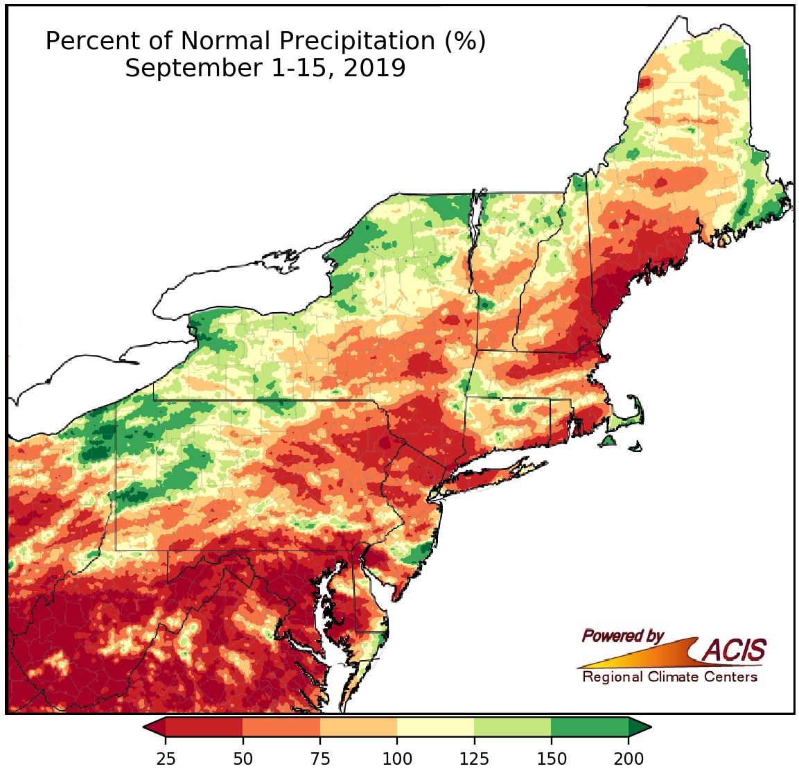 September 16, 2019 Feast or Famine September-to-date has featured extremes in both precipitation and temperature.
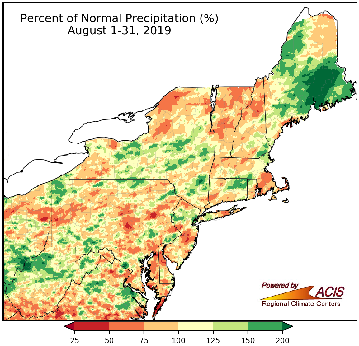 September 3, 2019 Another Summer Comes to a Close There was a mix of conditions in the Northeast this August and summer.
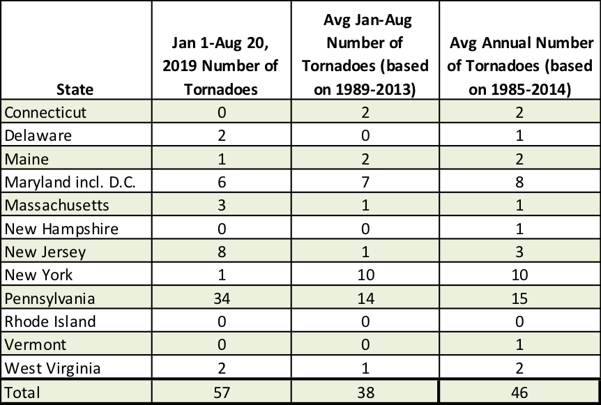 August 21, 2019 Status Update - Severe Weather Edition The number of severe thunderstorm warnings are up this year but tornado counts vary by state and month.
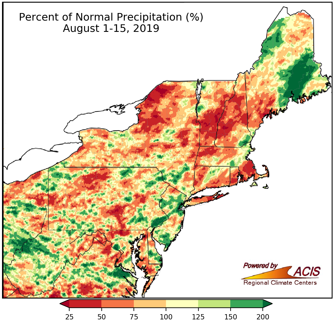 August 16, 2019 Spotty Showers Rainfall was hit-or-miss so far this August.
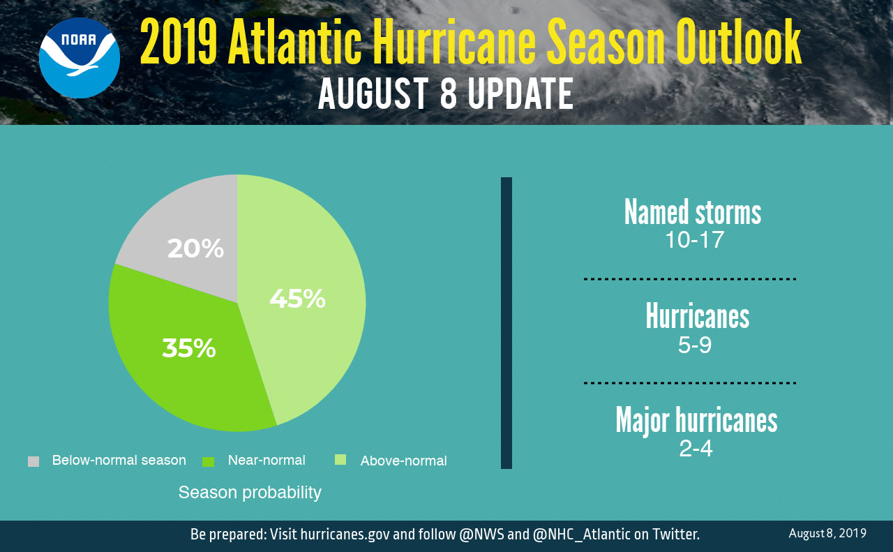 August 9, 2019 An Active Hurricane Season Now Expected NOAA's updated hurricane outlooks says it could be an active hurricane season.
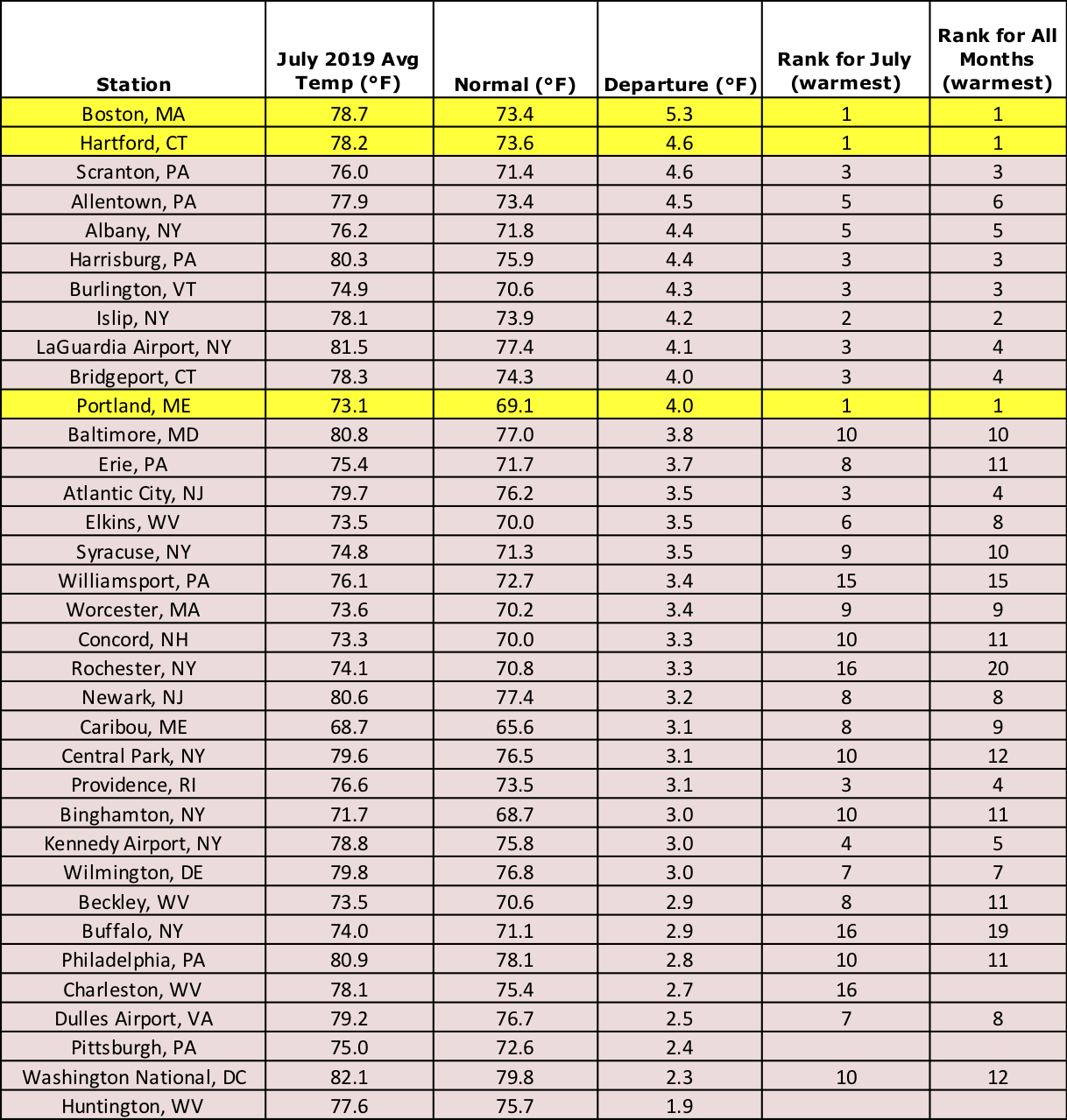 August 1, 2019 The Hottest Month Lives up to Its Title July was unusually hot across the Northeast, with a few sites setting all-time records.
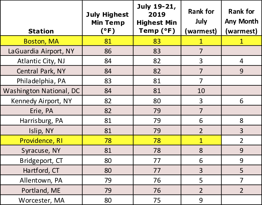 July 22, 2019 The Heat of Summer The Northeast was feeling the heat of summer the past few days, especially at night.
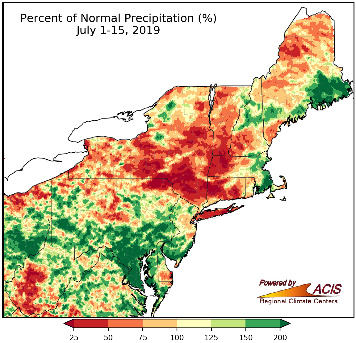 July 16, 2019 Mid-July - Hit or Miss Rainfall Rainfall has been hit or miss so far this summer.
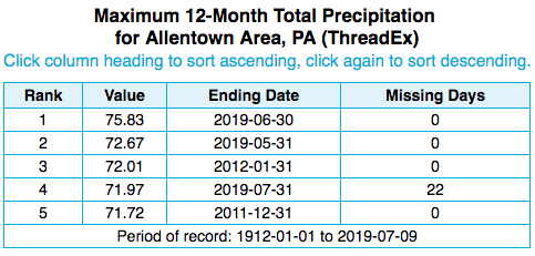 July 10, 2019 Wet Weather Wednesday On this Wednesday (July 10), let's take a look at some interesting precipitation stats!
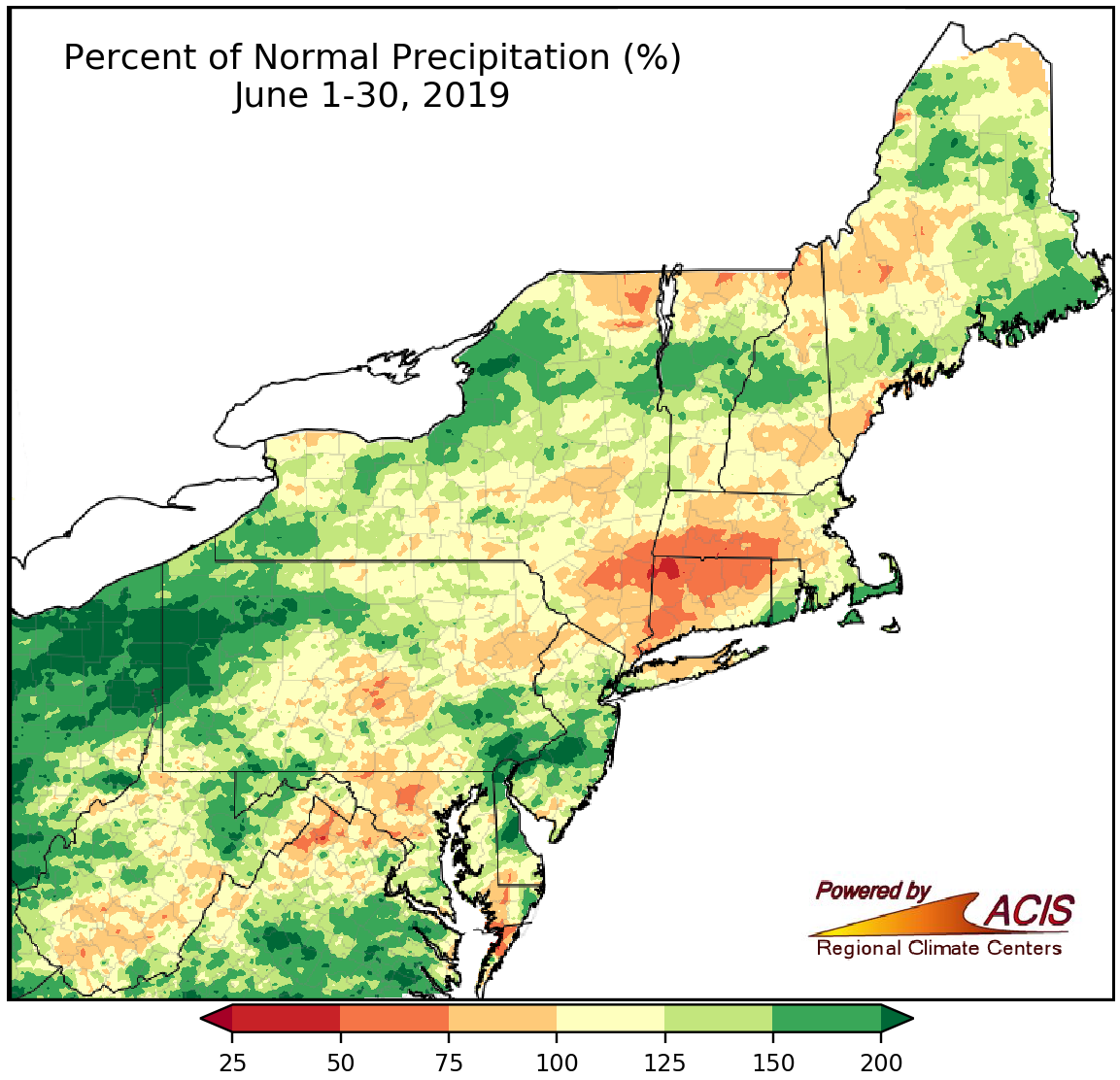 July 1, 2019 June Wraps Up June featured below- to near-normal temperatures and above-normal precipitation for many areas.
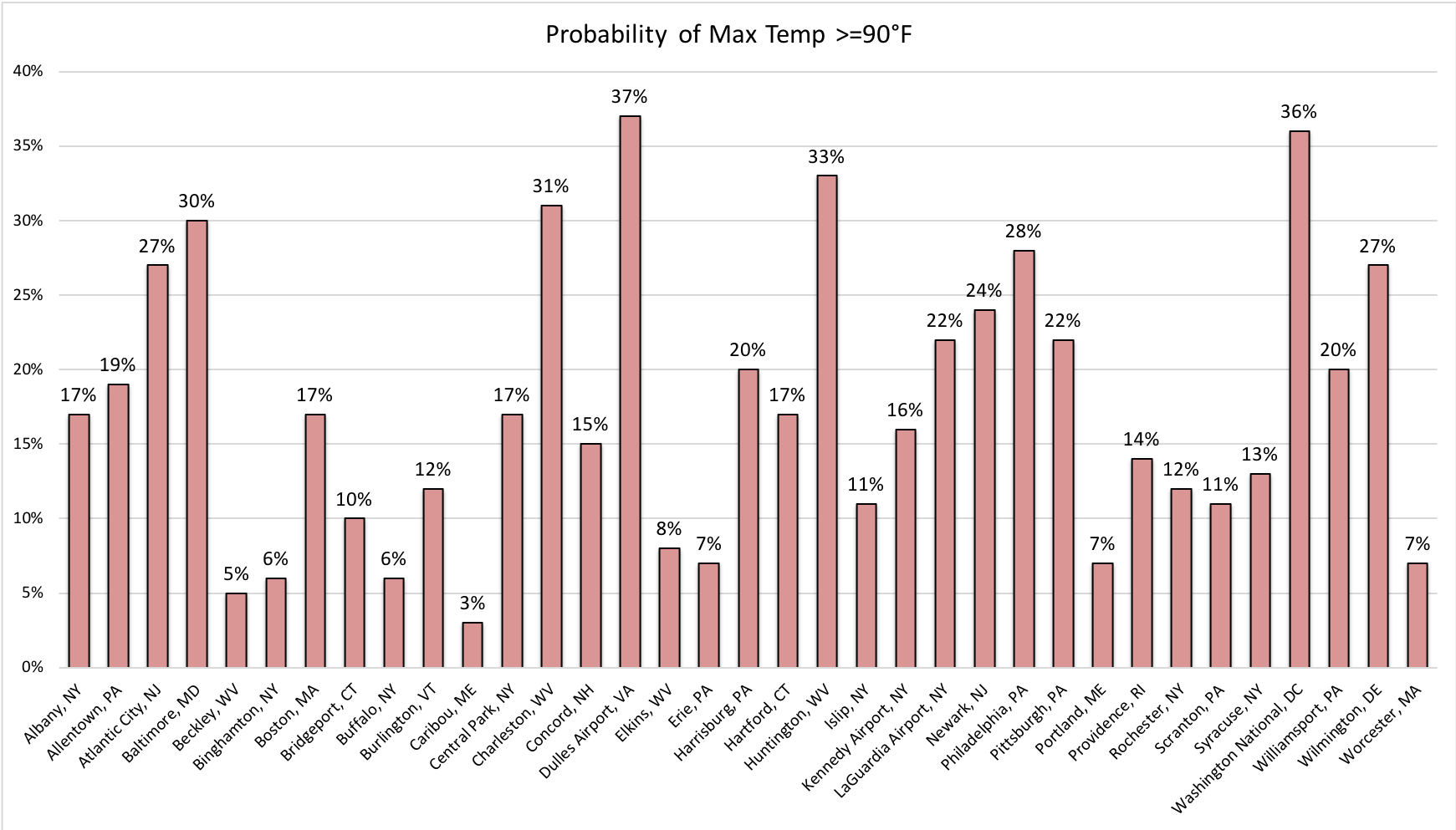 June 26, 2019 July 4th Fun Facts July 4th is fast approaching! Here's a look at past weather and interesting events on Independence Day in the Northeast.
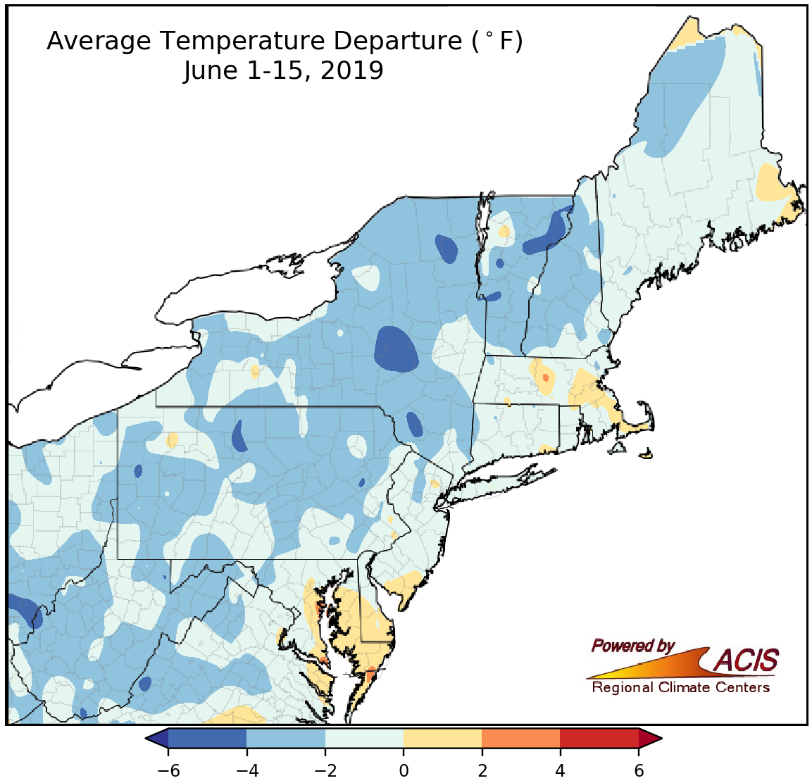 June 17, 2019 A Slow Start to Summer With colder-than-normal temperatures (and lots of rain in some places), the summer season has gotten off to a slow start!
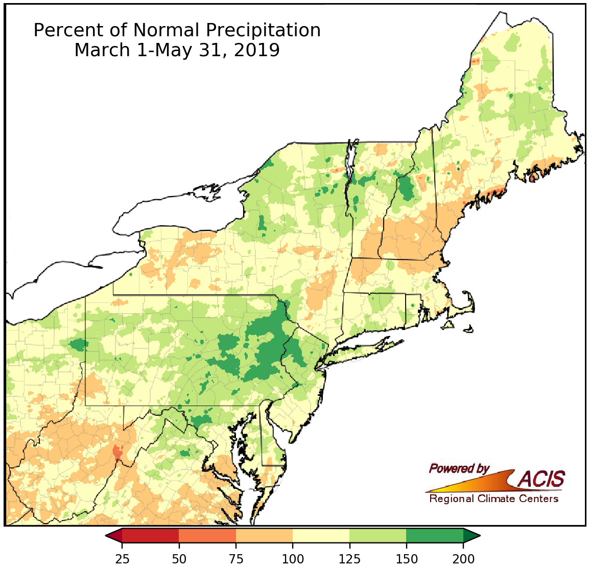 June 4, 2019 A Stormy Spring Signs Off Spring, particularly April and May, featured numerous days of severe weather and persistent precipitation.
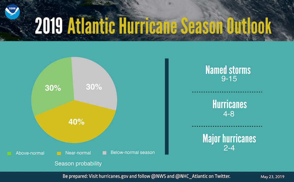 May 23, 2019 Hurricane Season on the Horizon The official start of hurricane season is June 1, and this year is expected to be near-normal.
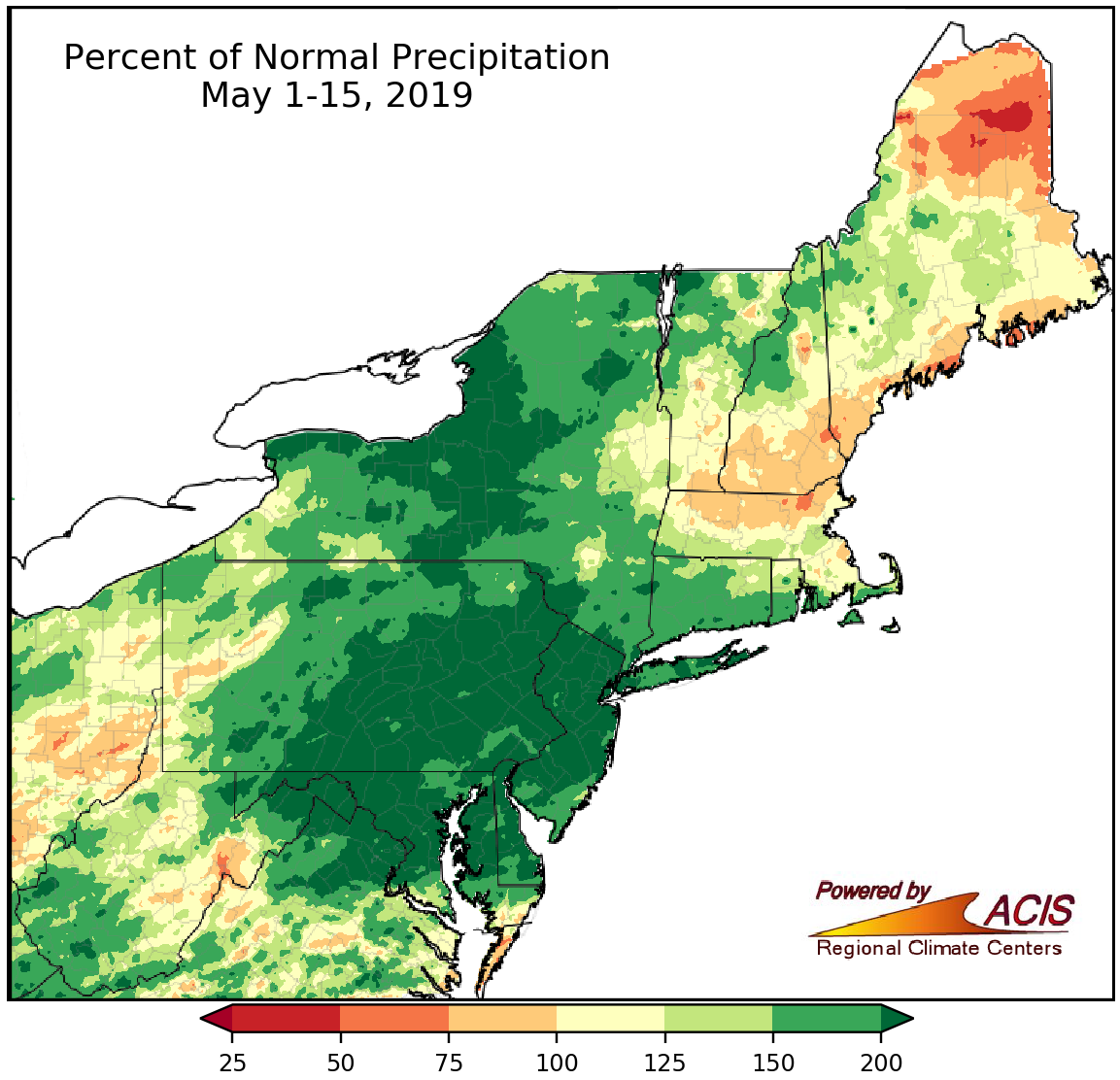 May 16, 2019 A Soggy Start to May May so far has been stormy, with variable temperatures.
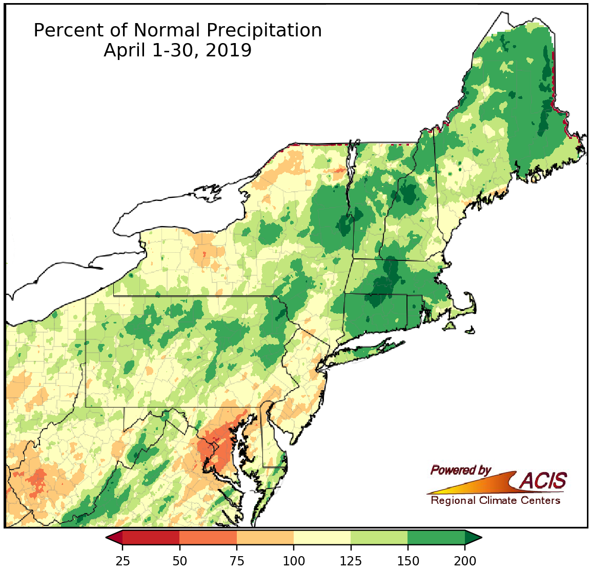 May 1, 2019 A Warm, Wet April It was a warm, wet April in the Northeast.
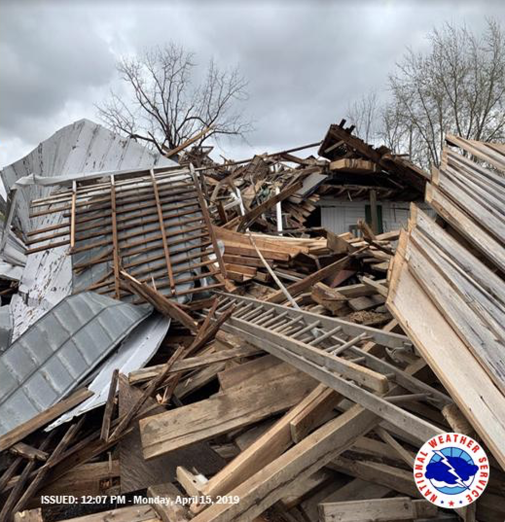 April 23, 2019 April Tornadoes April has been an active month for tornadoes in parts of the Northeast.
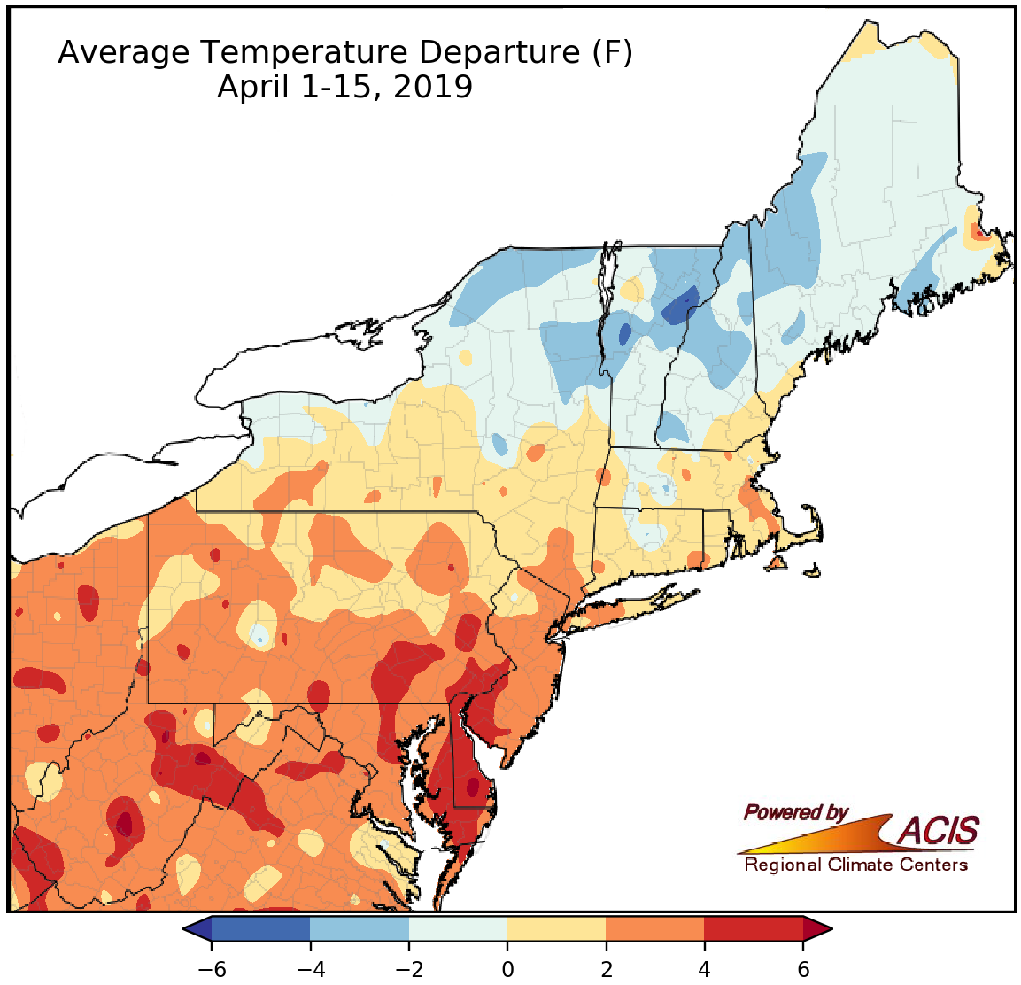 April 16, 2019 Mid-April Had It All Severe weather? Check. Warm temperatures? Yep. Snow? Sure thing! Mid-April had it all!
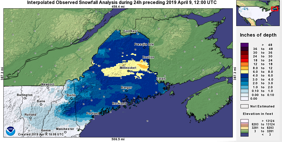 April 9, 2019 The Many Moods of Spring Spring can possess some of the attributes of winter and summer. Yesterday, the region experienced both.
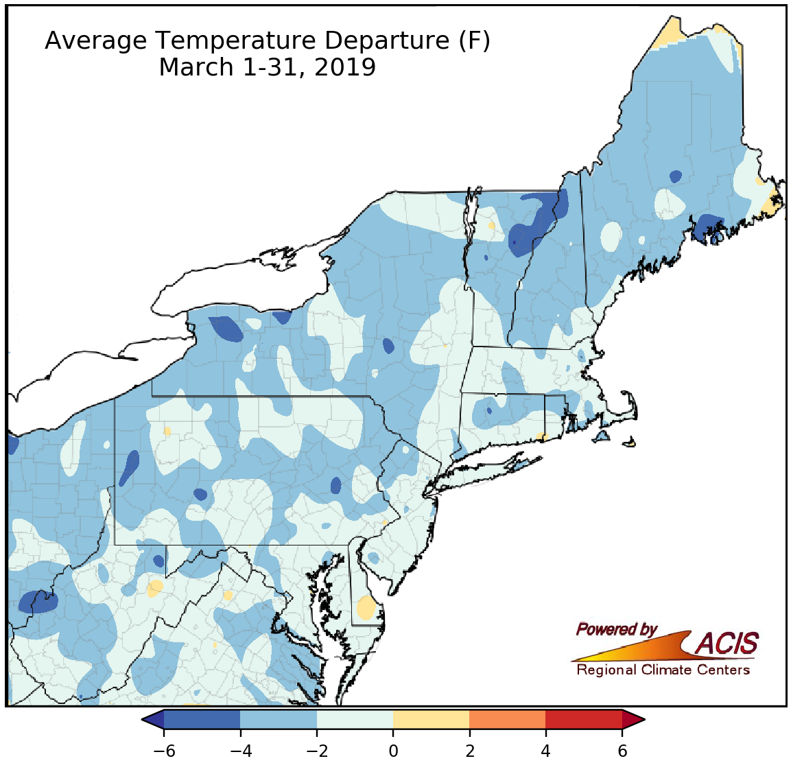 April 1, 2019 No Fooling - March Was Chilly but April May Be Warmer March wrapped up on the cold side of normal for most areas but April may be warmer!
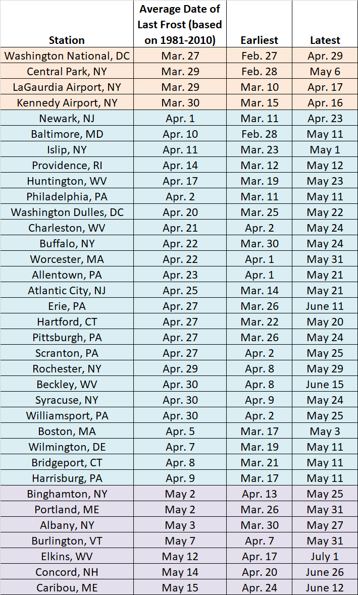 March 25, 2019 Spring Frost (2019) The last spring frost for areas in the Northeast can sometimes be challenging to predict.
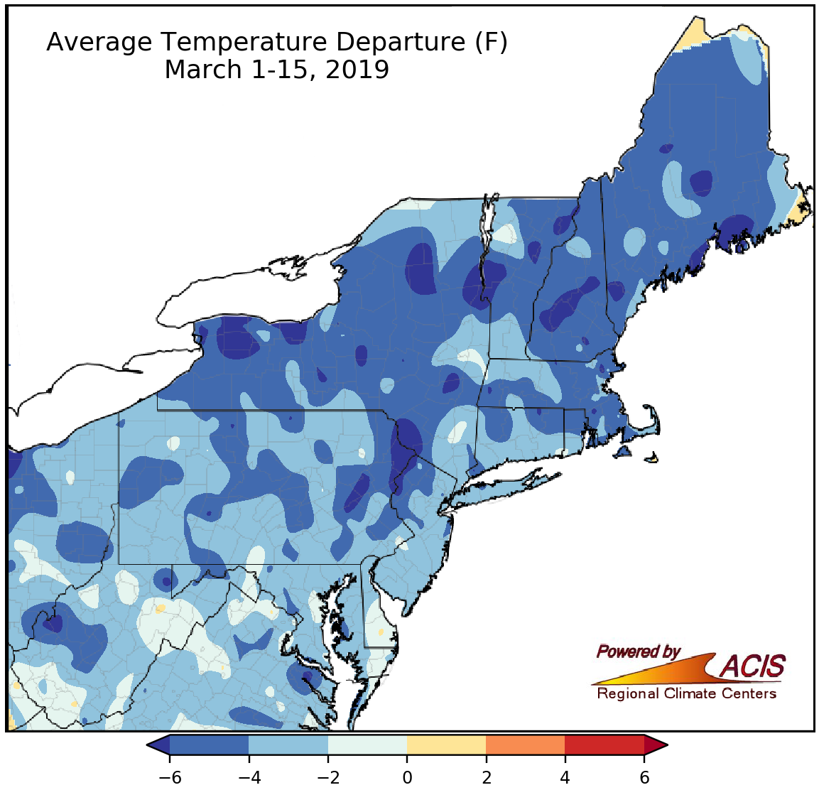 March 18, 2019 A Cold Start to March So far it's been a cold March in the Northeast.
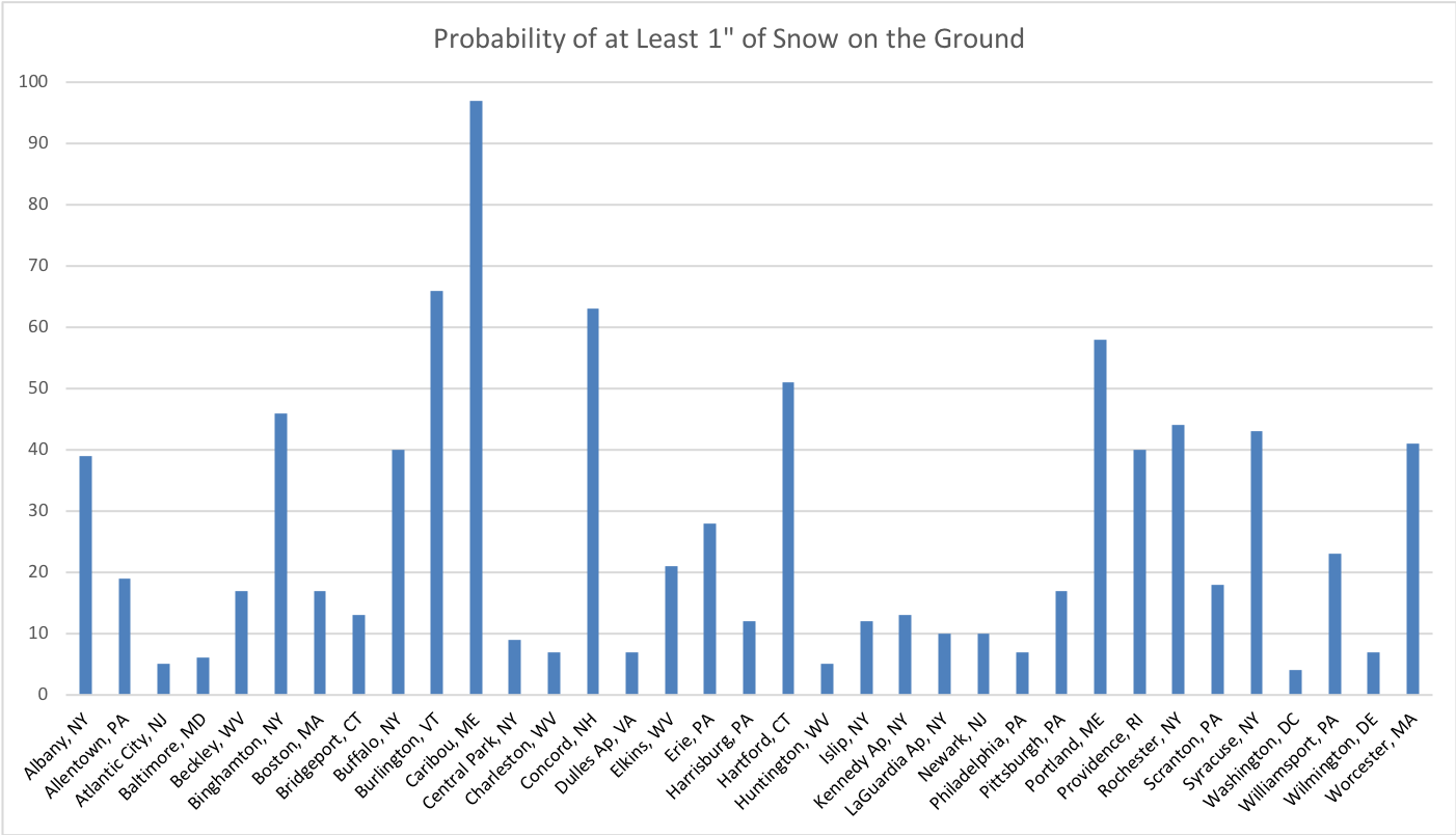 March 12, 2019 St. Patrick's Day Climatology The weather on St. Patrick's Day is a bit mischievous.
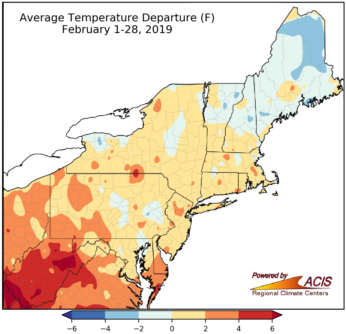 March 1, 2019 Farewell, February (and Winter) February and winter were warm, wet, and lacking snow in many parts of the Northeast.
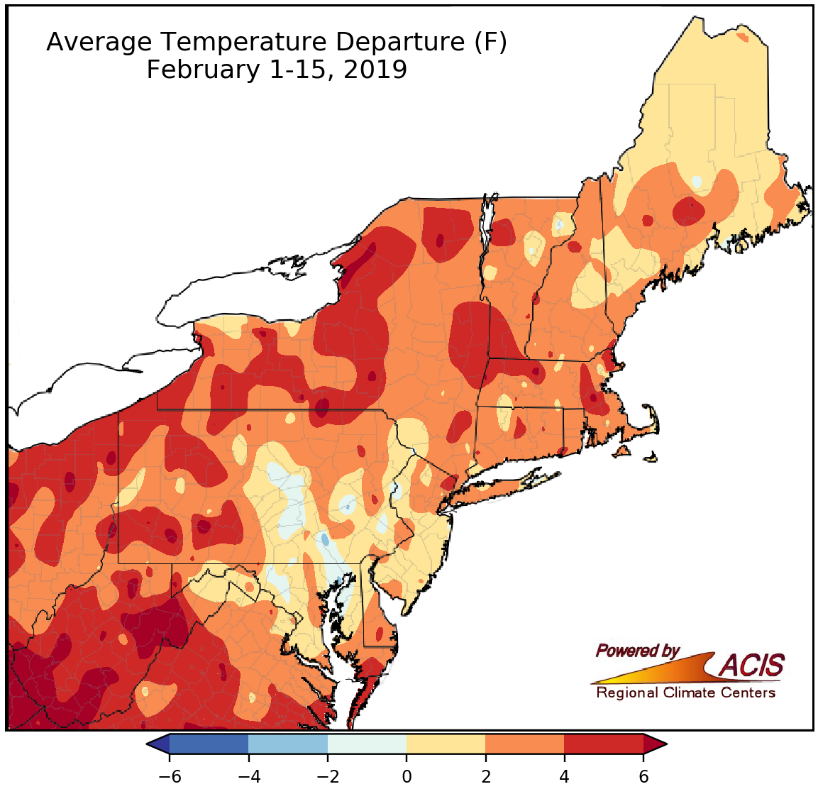 February 18, 2019 Picking up Where January Left Off February so far has been similar to January, with temperature swings and wet but not necessarily snowy conditions.
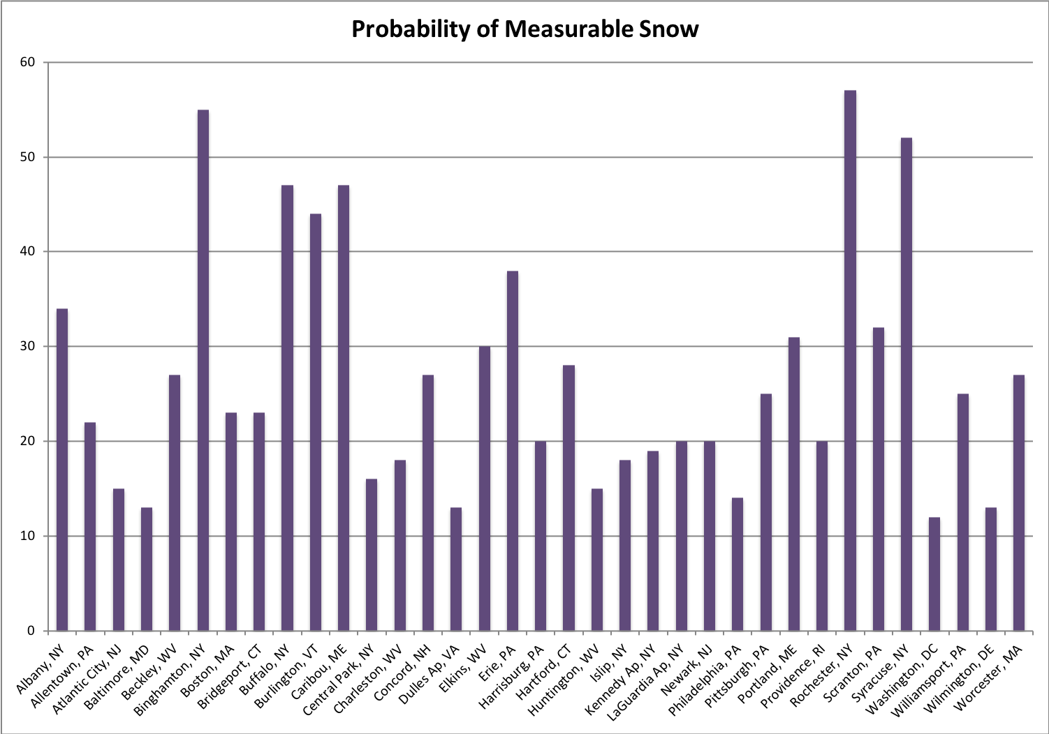 February 11, 2019 Sweet Weather for Valentine’s Day? Take a look at Valentine's Day climatology to see what conditions are typical throughout the Northeast.
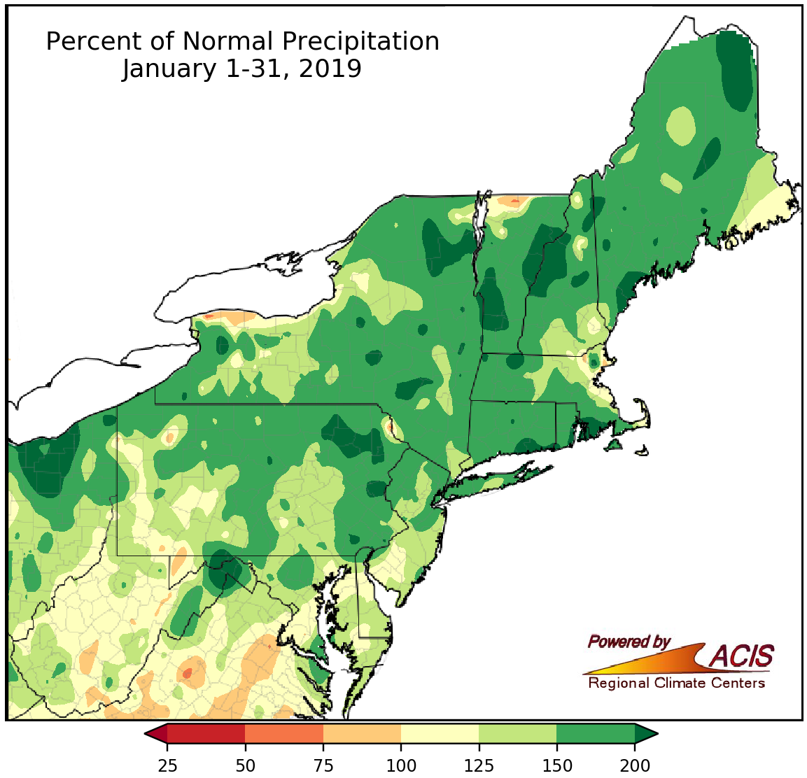 February 1, 2019 January - Wet but Not Necessarily Snowy January was wet but not necessarily snowy.
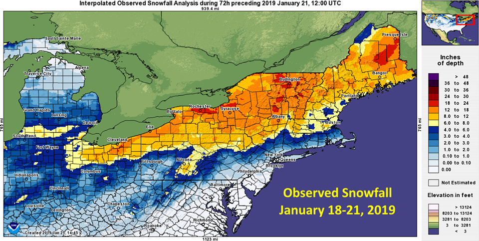 January 22, 2019 Feels Like Winter It’s feeling like true winter in the Northeast.
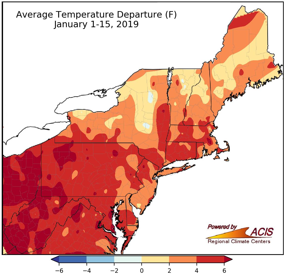 January 16, 2019 Mid-January Status Update So far this winter and January, temperatures have been above normal, but precipitation and snowfall have varied.
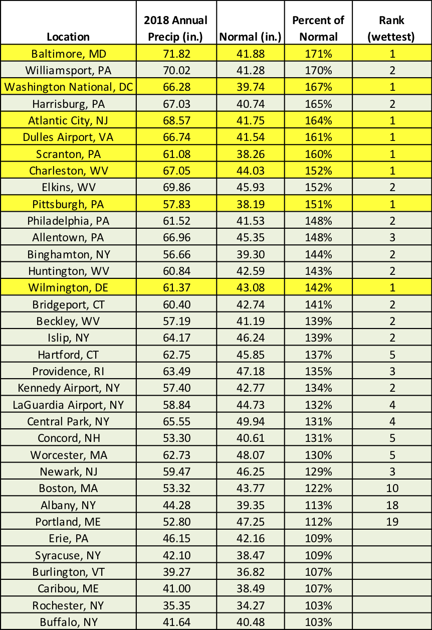 January 2, 2019 2018 - A Very Wet, Warm Year 2018 was a record wet year for several areas and warmer than normal for almost the entire Northeast.
2018
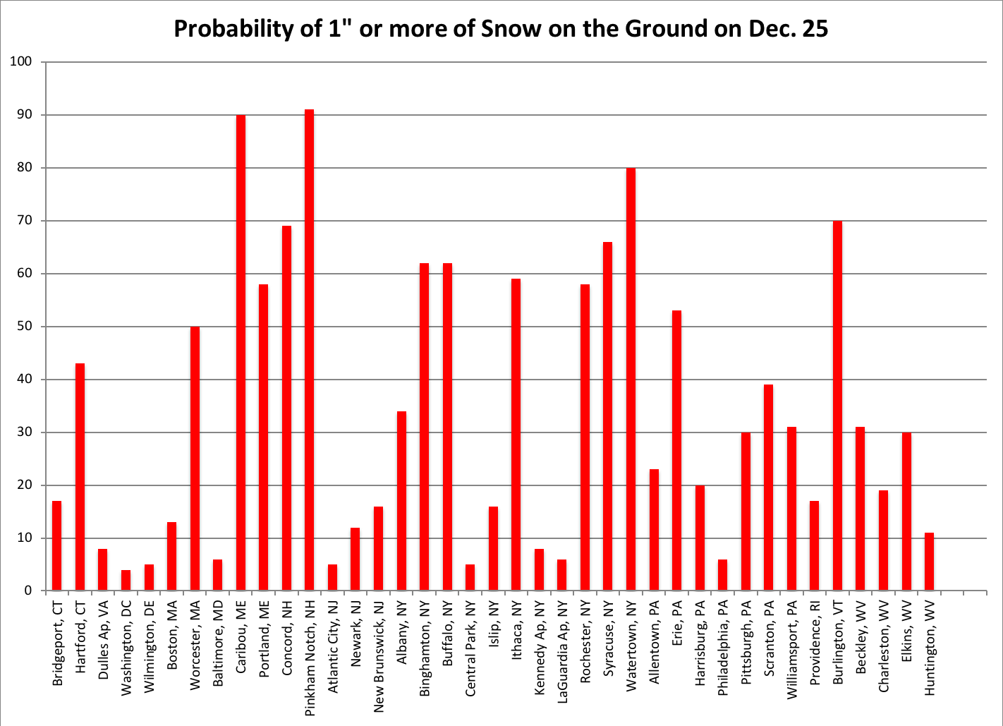 December 19, 2018 Dreaming of a White Christmas? (2018) White Christmas Probabilities
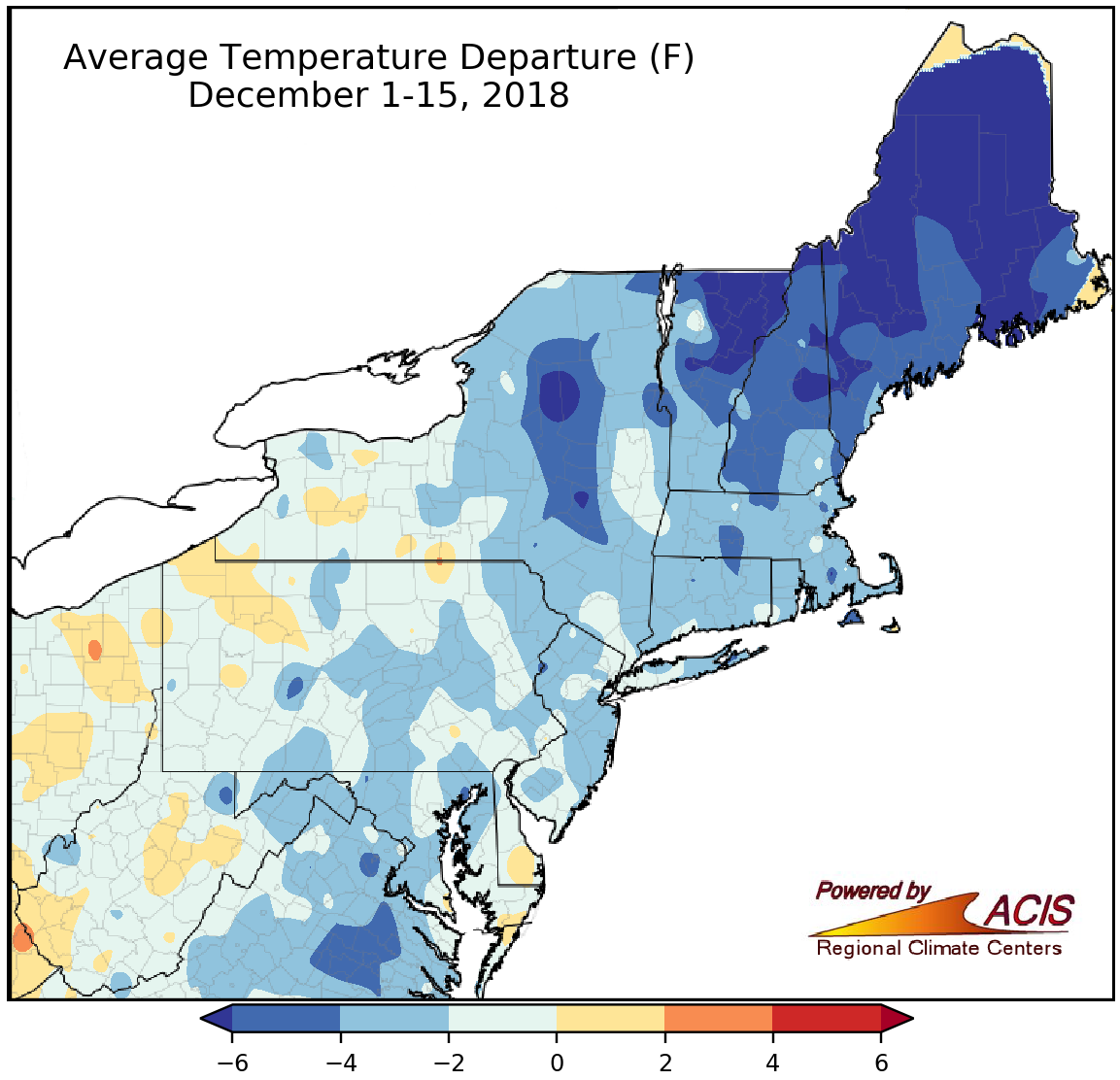 December 17, 2018 A Ho (Ho Ho) Hum December-To-Date? December-to-date has been cold, dry, and lacking snow, but not exceptionally so for most of the Northeast.
 December 11, 2018 Weather Folklore – Facts or Fiction? Weather folklore has been passed down over time, but is there science behind some of these sayings?
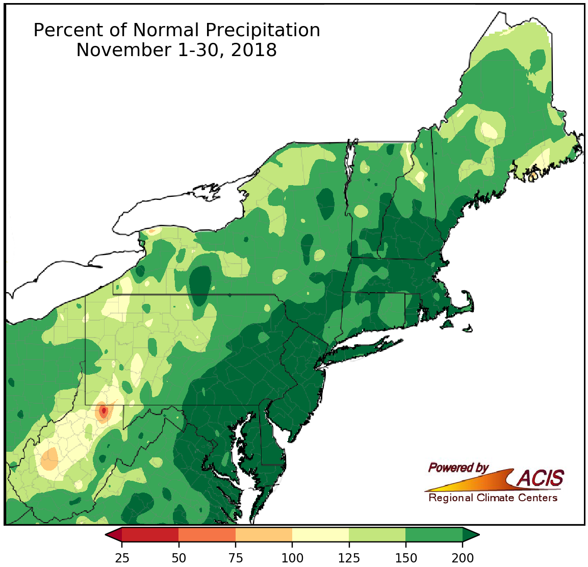 December 3, 2018 A Wet, Cold, Snowy November It was a wet, cold, snowy November.
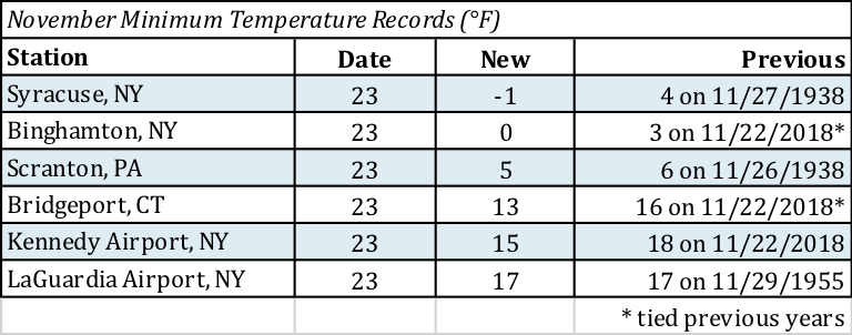 November 26, 2018 All-Time Coldest November Temperatures Temperatures during the Thanksgiving holiday were record cold in the Northeast, with lows dipping below zero and highs in the single digits in the coldest areas.
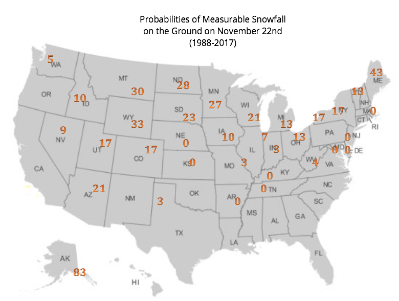 November 20, 2018 White Thanksgiving (2018) A white Thanksgiving is likely for much of the Northeast.
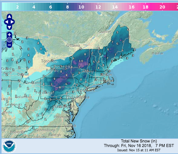 November 15, 2018 A Mid-November Winter Wonderland Here's a look at how forecasted snowfall from the ongoing winter storm stacks up, as well as a quick look at month-to-date conditions.
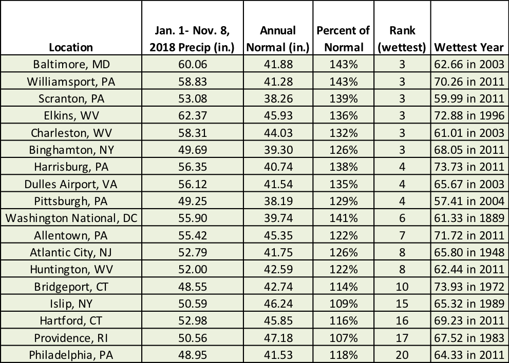 November 9, 2018 On the Road to a Record Wet Year? It's been a wetter-than-normal year for much of the Northeast, with two major sites closing in on their record wettest years.
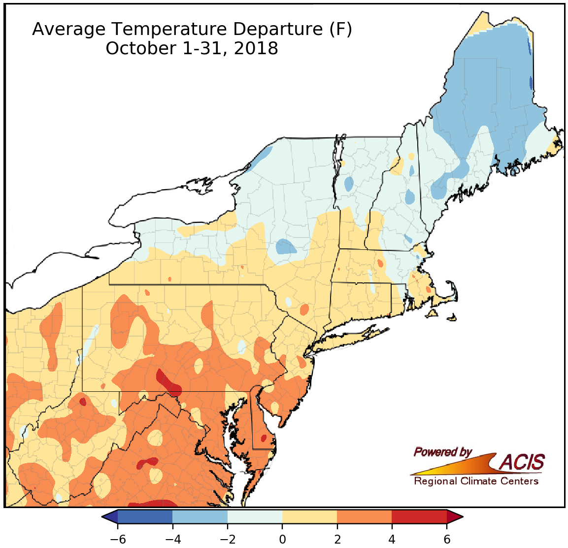 November 1, 2018 An Interesting October! October featured some interesting weather, from record warmth and a dramatic temperature shift to heavy rain and tornadoes.
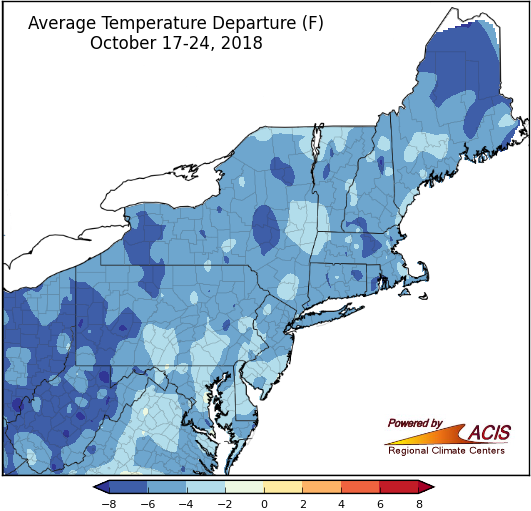 October 24, 2018 Frost, but Waiting for Flakes Several major climate sites experienced their first fall frost last week. With cooler temperatures, when can we expect the first snow?
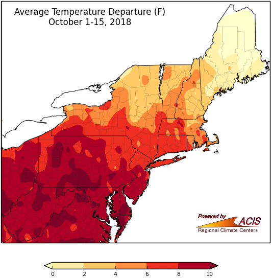 October 16, 2018 A Warm, (Mostly) Wet Fall-to-Date So far, October and fall have been warm and wet for many areas.
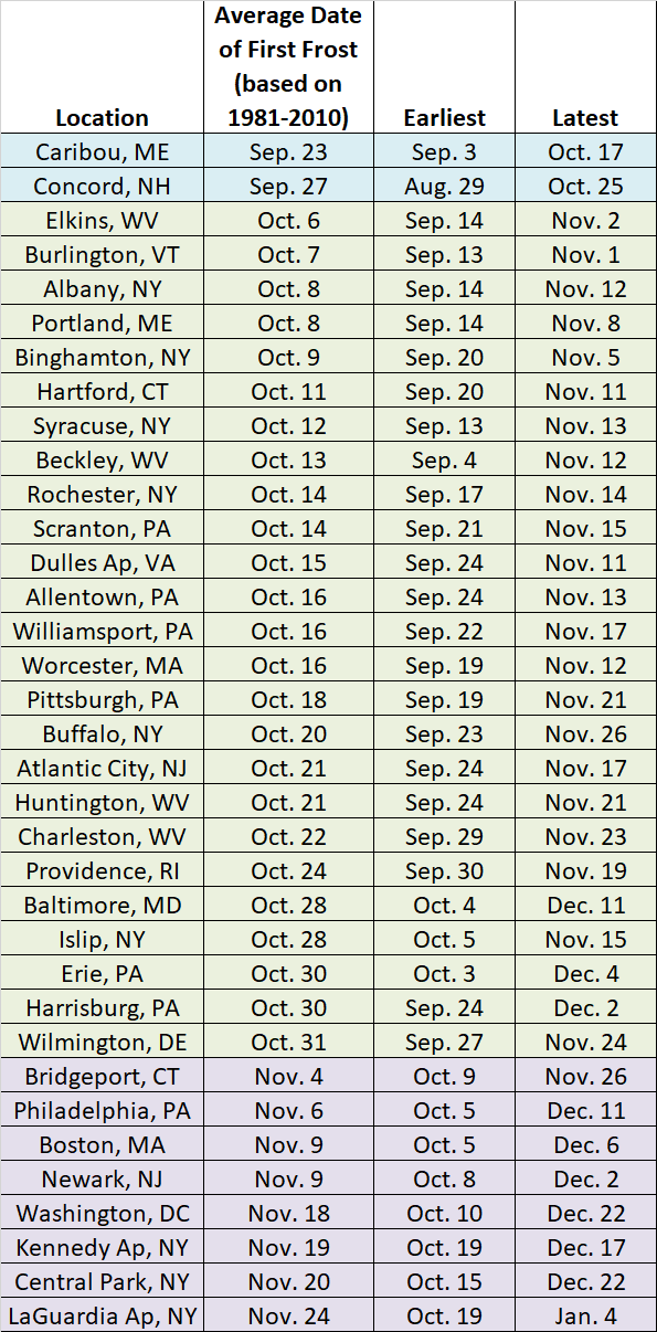 October 8, 2018 First Frost is in our Future Many areas in the Northeast usually experience their first frost of the season during October.
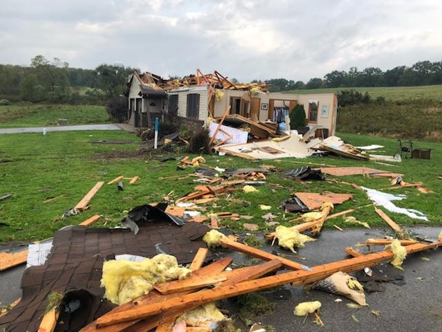 October 4, 2018 A Rare October Tornado Outbreak Pennsylvania experienced its largest single-day tornado outbreak since June 2, 1998.
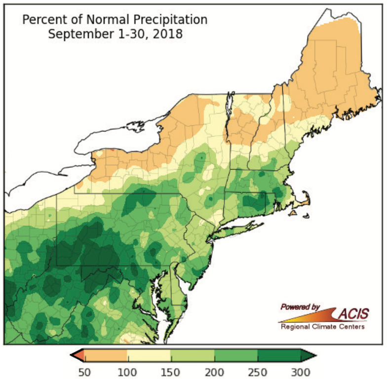 October 1, 2018 A Soaking Wet September September was record wet for some areas and warmer than normal for the entire region.
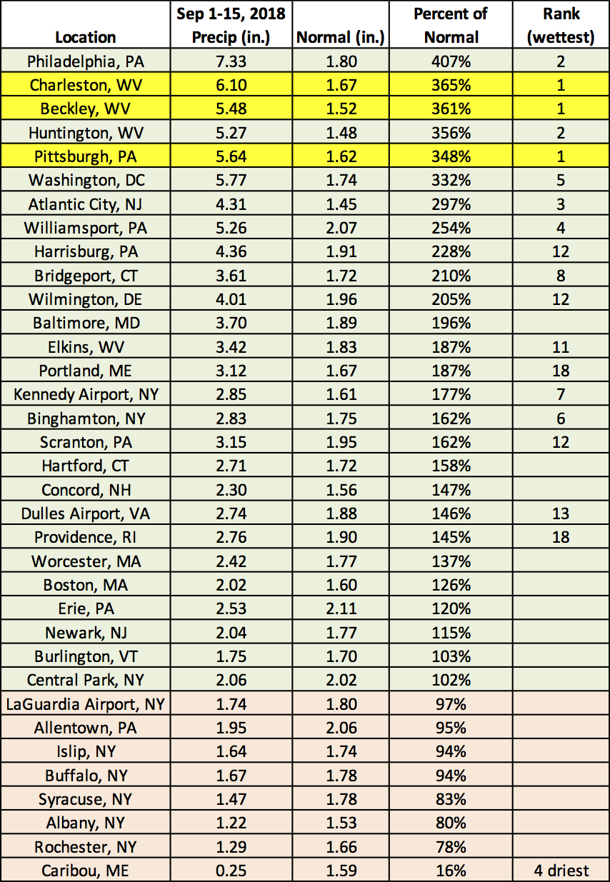 September 17, 2018 September So Far - Soggy for Some, Warm for All While some southern areas dealt with flooding during the first half of September, some northern areas dealt with drought. Meanwhile, all of the Northeast experienced above-normal temperatures.
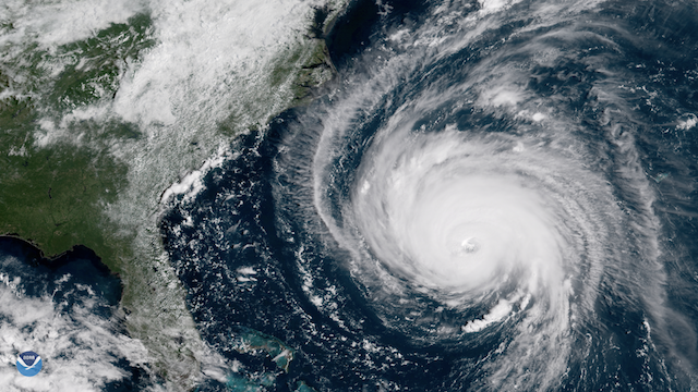 September 13, 2018 What Hurricane Florence Could Mean for the Northeast Impacts from Hurricane Florence will be felt in locations well beyond its predicted path.
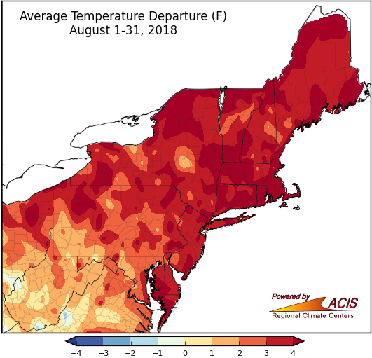 September 4, 2018 Hot and Humid August and Summer Many hot and humid days led August and summer to be warmer than normal.
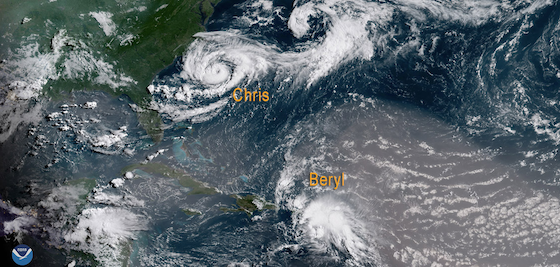 August 31, 2018 Updated Hurricane Outlook The National Hurricane Center updated an outlook they issued at the beginning of the hurricane season.
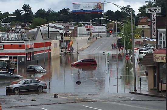 August 24, 2018 August Flooding Many areas in the Northeast have experienced unusual flooding so far this month.
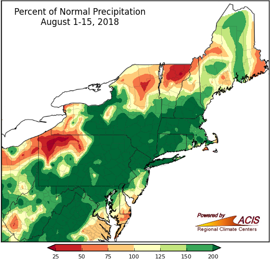 August 17, 2018 Rainy and Warm Start to August August has been off to a warm and wet start for many in the Northeast.
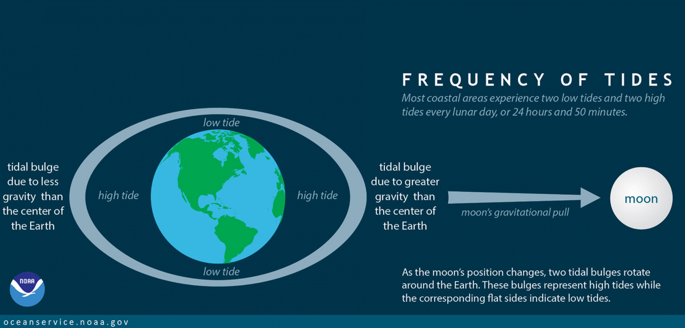 August 9, 2018 Ocean Tides Tidal patterns are predictable yet mysterious to many unfamiliar with the sea.
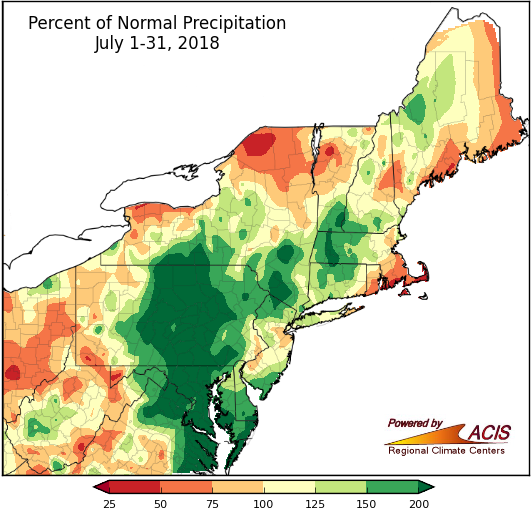 August 2, 2018 Warm and Wild July Drought conditions, a heat wave, and heavy rain in some areas made for an active July.
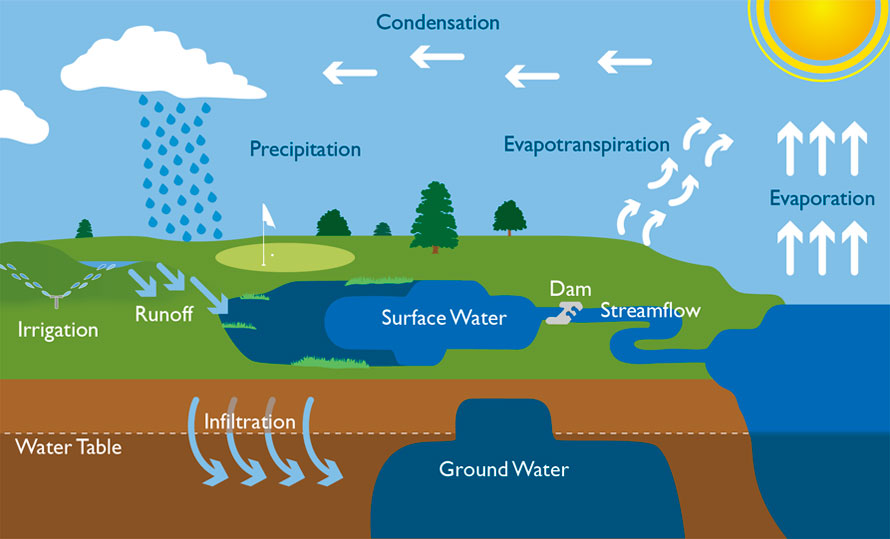 July 26, 2018 What Happens to Water Underground? Groundwater and stream flow are often talked about, but what really are they?
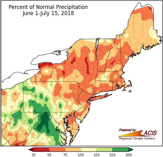 July 17, 2018 Warm and Dry Start to Summer and July A warm July and dry first half of summer has been record-setting for some areas in the Northeast.
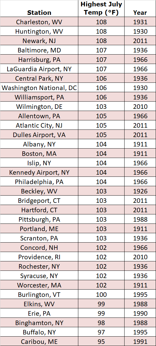 July 12, 2018 Sizzling Summer The Fourth of July brought record warm temperatures to many areas within the Northeast.
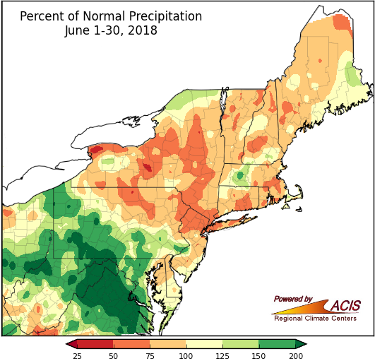 July 5, 2018 Spring to Summer June brought dry conditions to much of the Northeast.
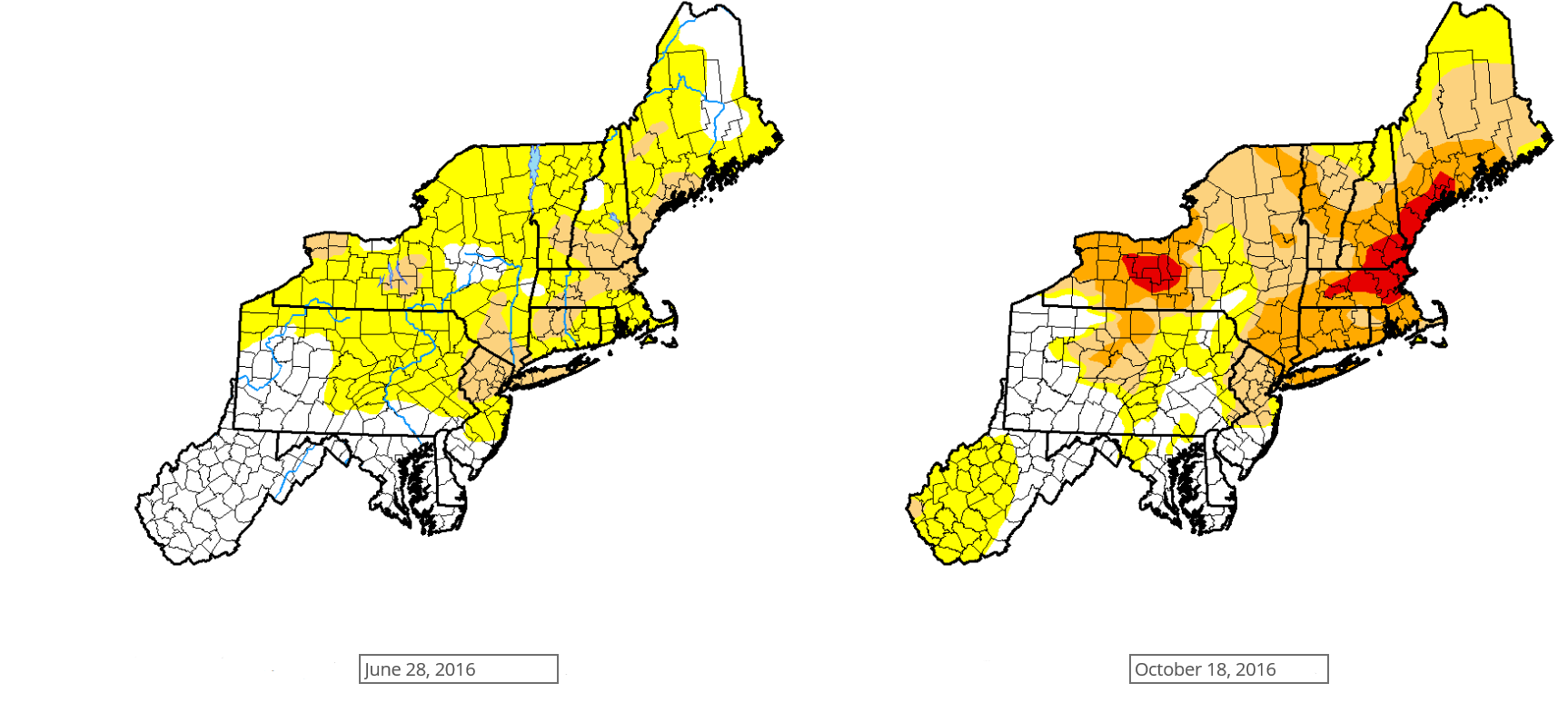 June 28, 2018 How are Drought Conditions Classified? The U.S. Drought Monitor gathers a lot of data prior to releasing weekly maps depicting areas experiencing drought.
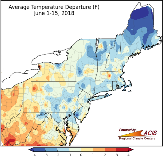 June 18, 2018 Mid-Spring or Mid-June? June has been off to a cool and dry start for many in the Northeast.
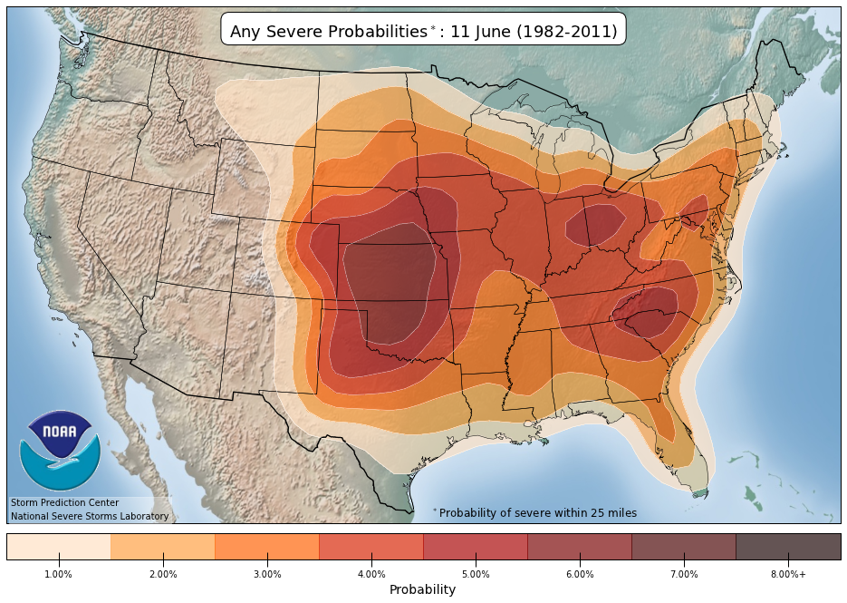 June 12, 2018 Severe Weather Climatology (2018) The Northeast experiences severe weather at all times of the year, but more so during summer.
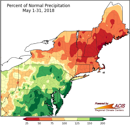 June 4, 2018 Snowy Spring Transitioned into a Warm May A snowy spring led to a warm and rainy May.
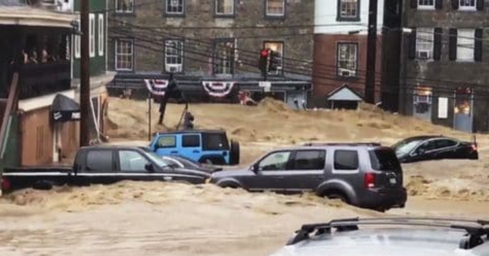 May 30, 2018 Recent Rains Bring Flooding to Maryland Heavy rain has brought significant flooding to central Maryland.
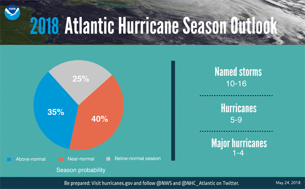 May 24, 2018 Hurricane Season is about to Begin The NOAA outlook for the Atlantic hurricane season was just released.
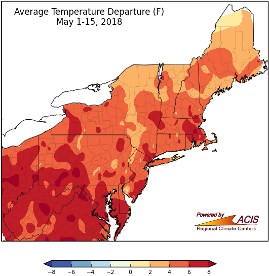 May 16, 2018 Mid-May Warm start to May!
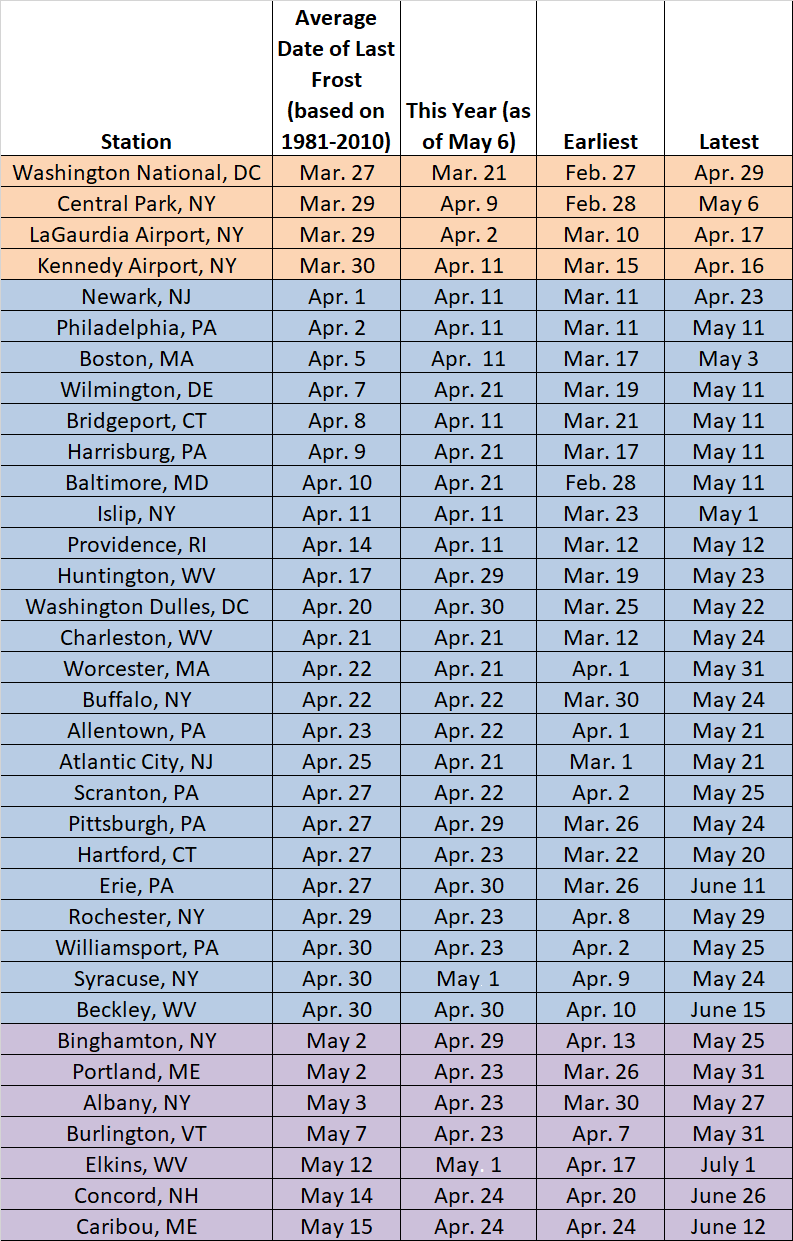 May 10, 2018 Spring Frost (2018) Recent warm temperatures make the last spring frost seem like long ago.
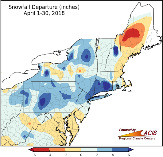 May 2, 2018 Cold and Wet April Colder than normal temperatures made for a chilly and wet April across much of the region.
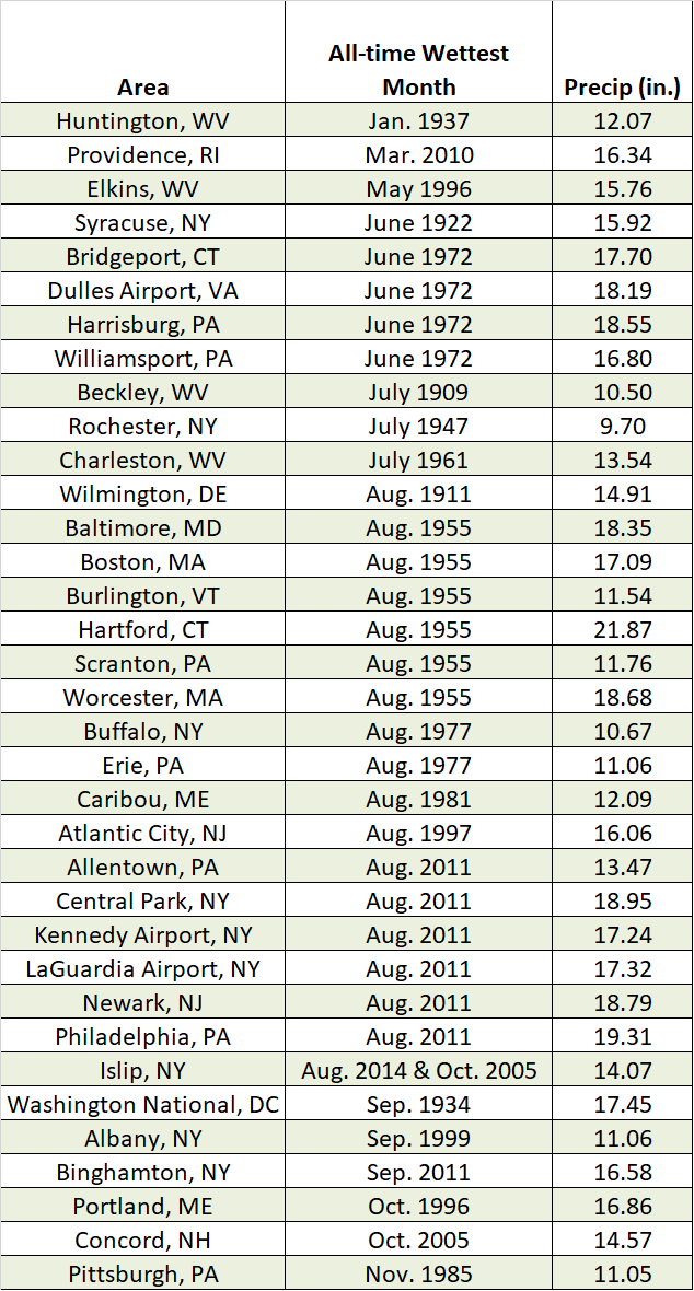 April 24, 2018 April Showers (2018) Do April Showers typically bring that much precipitation to the Northeast?
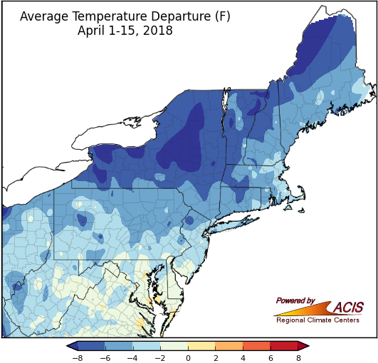 April 17, 2018 Cold Start to April The beginning of April has brought colder than normal weather to much of the Northeast.
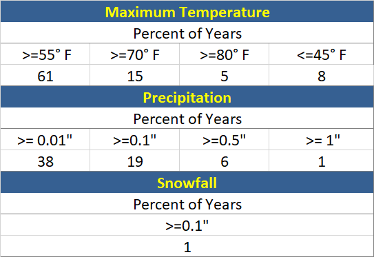 April 10, 2018 Climatology for the Boston Marathon Here's a look at weather conditions from past Boston Marathons.
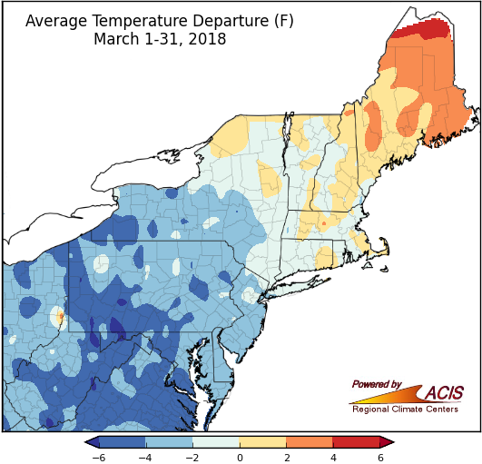 April 2, 2018 March - All Lion, No Lamb The month known for "coming in like a lion and going out like a lamb" was pretty much all lion.
 March 27, 2018 CoCoRaHS March Madness CoCoRaHS is looking for volunteers! What is CoCoRaHS, and why is it important?
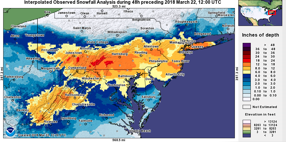 March 22, 2018 Nor'easter Number Four The fourth nor'easter in four weeks dumped heavy snow on parts of the Mid-Atlantic and New York over the past two days.
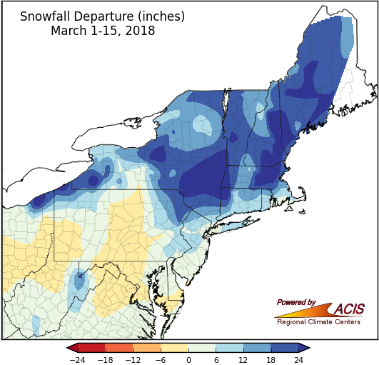 March 19, 2018 In Like a Lion An active weather pattern set the stage for the three major storms that moved through the region during the first half of March.
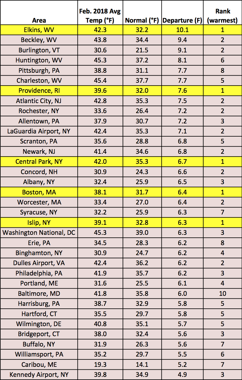 March 2, 2018 February and Winter - Cold Start, Warm Finish Several sites had a record warm or record wet February. Here's a recap of February and winter conditions, as well as a quick look ahead to March.
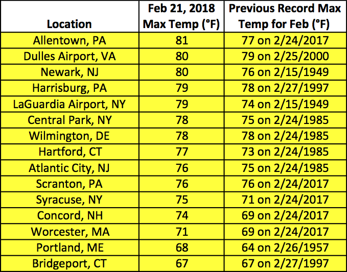 February 21, 2018 Feverish February Much of the Northeast experienced record-setting temperatures on February 20 and 21.
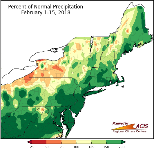 February 16, 2018 Wet and Mild Start to the Month The first half of February has been wet and mild for most of the Northeast.
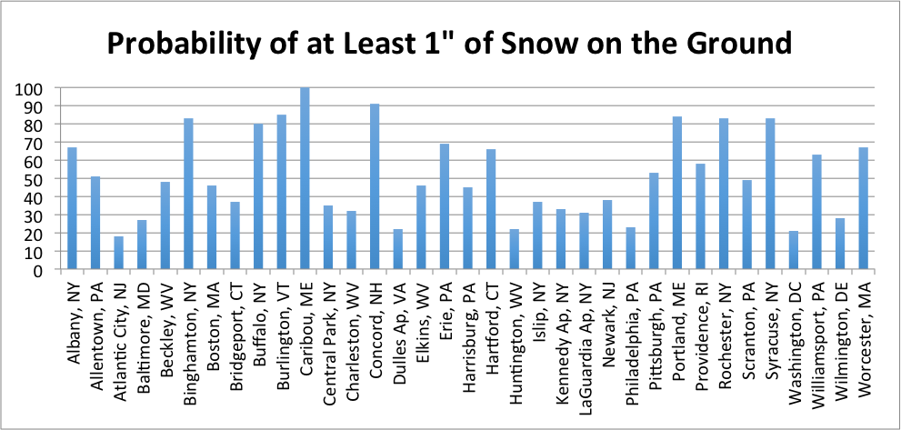 February 12, 2018 Love is in the (Cold) Air Here's a look at average conditions for Valentine's Day in the Northeast.
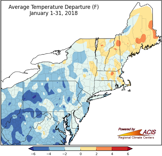 February 1, 2018 That's a Wrap, January January wrapped up on the cold side of normal for many areas, but precipitation and snowfall varied.
 January 24, 2018 What is a Snow Survey and Who Uses It? Have you heard of a snow survey? Here's what it is and why it's important.
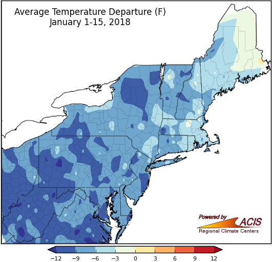 January 16, 2018 Ice Cold Start to January and Winter Temperatures have been below normal so far this January and winter, while precipitation and snowfall have varied.
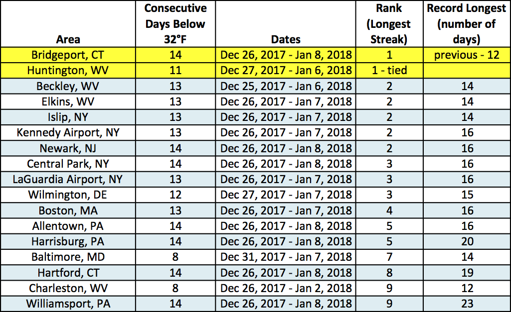 January 10, 2018 Frozen Memories and Warm Thoughts After wrapping up an extended period of colder-than-normal temperatures, we look ahead to a (brief) warm up.
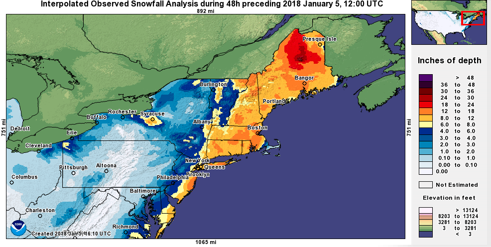 January 5, 2018 First Major Storm of 2018 A powerful nor'easter brought heavy snow, high winds, and coastal flooding to the region. Some sites could set record cold temperatures following the storm.
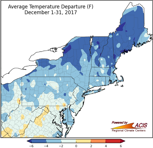 January 2, 2018 Record-Shattering Snowfall & A Frigid End to a Warm Year December was cold for most areas, but the year wrapped up on the warm side.
2017
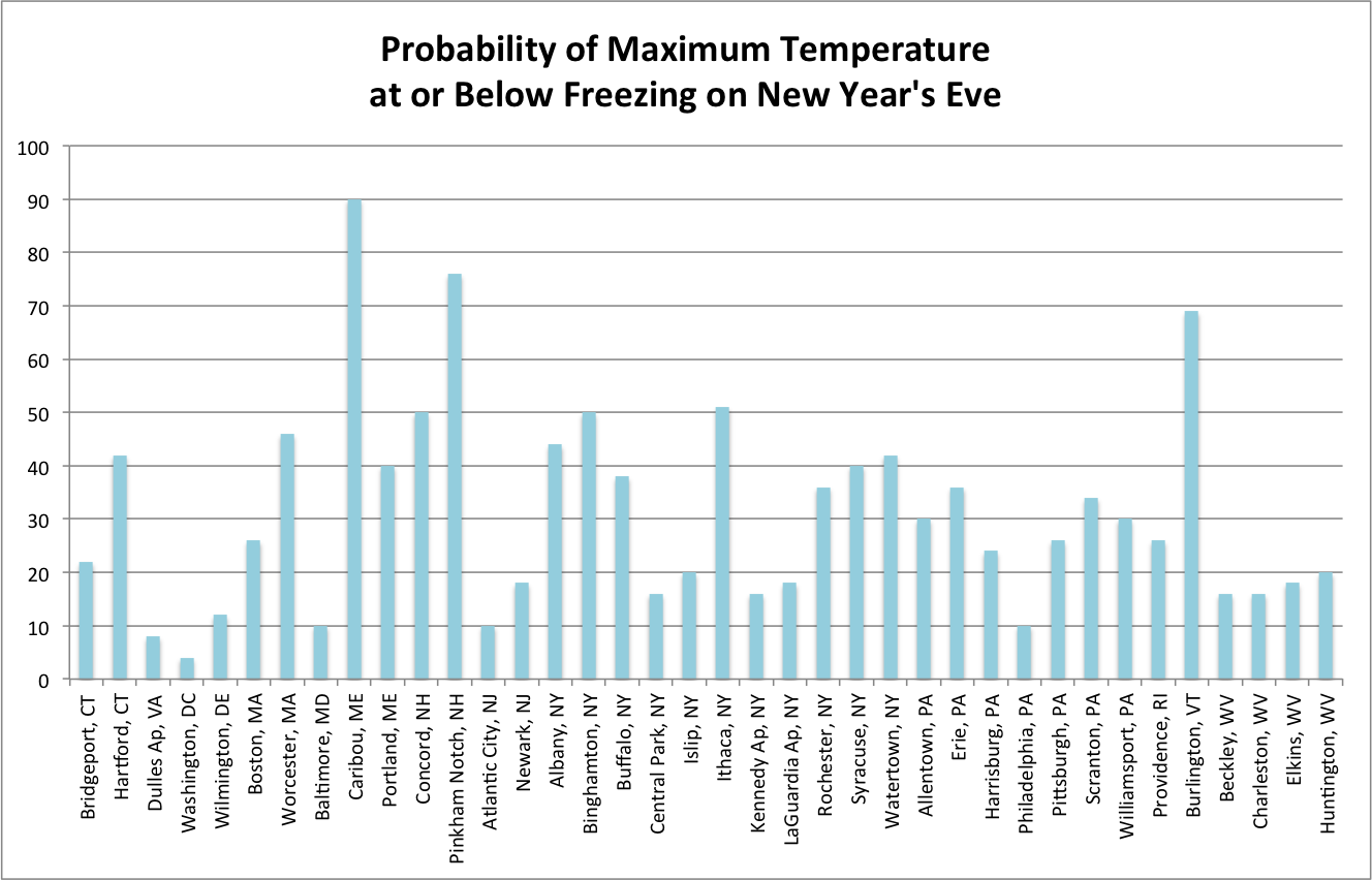 December 21, 2017 Frigid Festivities Will New Year's Eve be frigid?
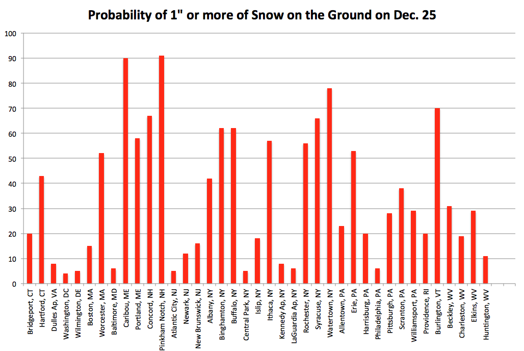 December 15, 2017 Dreaming of a White Christmas? (2017) White Christmas Probabilities
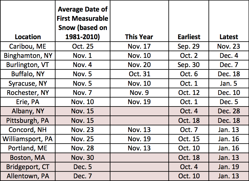 December 8, 2017 Let It Snow! Only a handful of major climate sites have seen snow so far this season, but more may see it this weekend.
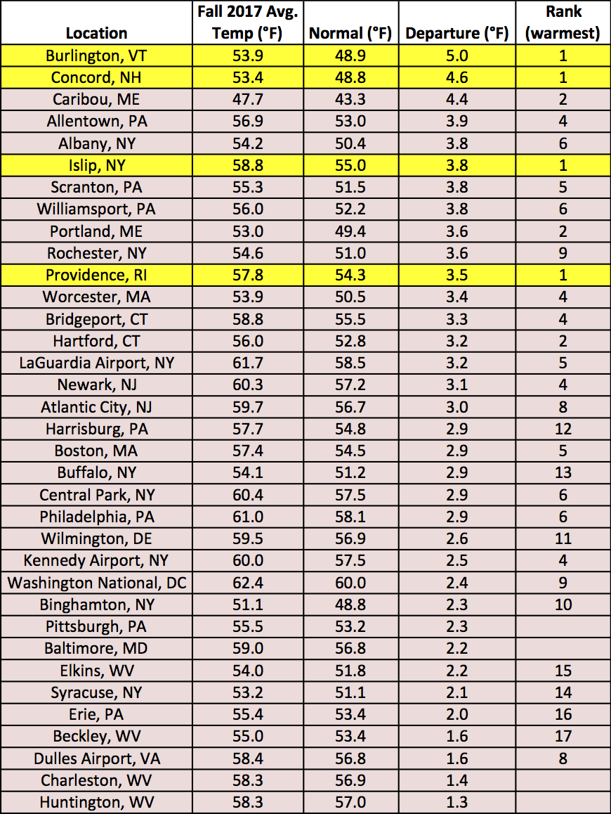 December 1, 2017 Changing Seasons Here's a wrap up of November and fall as we head in to December and winter.
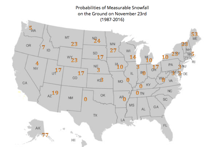 November 20, 2017 White Thanksgiving (2017) Will there be snow on the ground for this year’s Thanksgiving holiday?
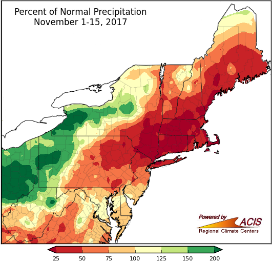 November 16, 2017 The ABCs of Mid-November Mid-November can be summed up by ABC - all over the place, below-normal, and cold.
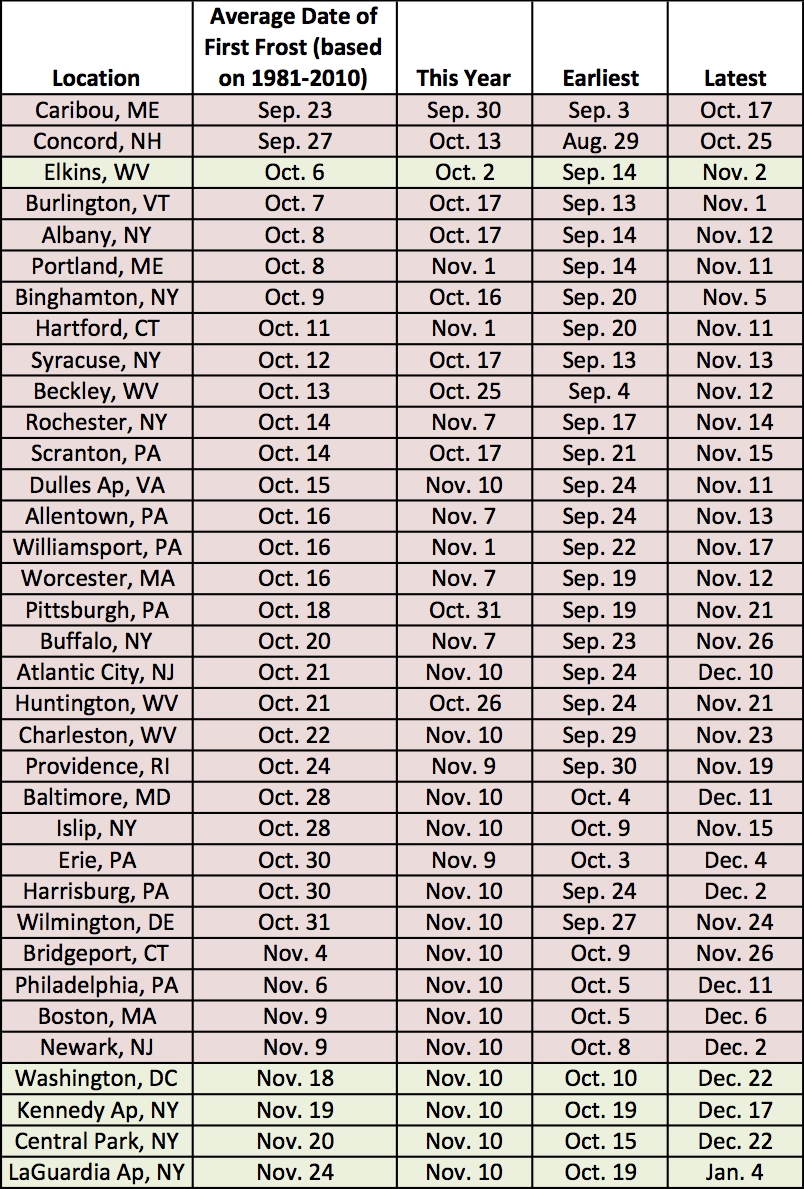 November 13, 2017 First Frost for All The rest of the major climate sites had their first frost on November 10.
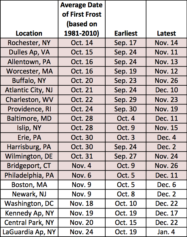 November 6, 2017 Late Frost and First Snow As of November 6, 21 major climate sites were still waiting for their first frost. In addition, the average date of the first snow is approaching. Some sites might see both this week.
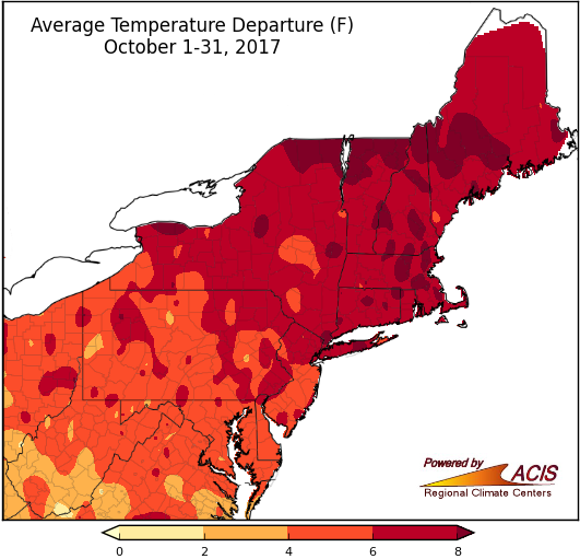 November 1, 2017 October - Record Hot & From Dry to Drenched October will go into the record books as the hottest on record for several sites. In addition, conditions went from dry to drenched in one week.
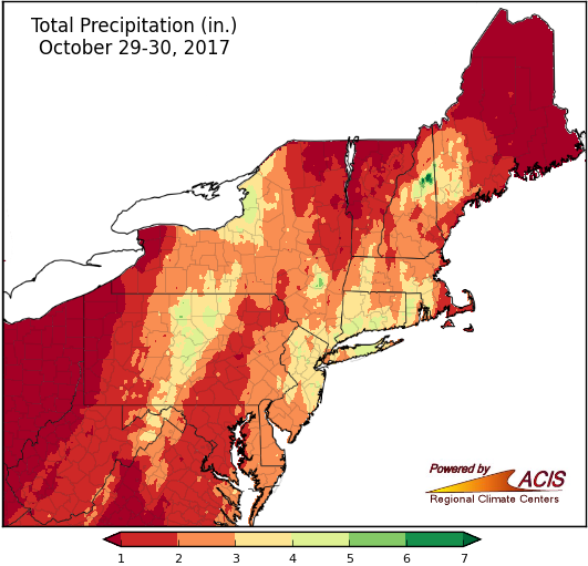 October 30, 2017 Heavy Rain & High Winds A strong storm continues to bring heavy rain, high winds, and even some snow to the Northeast.
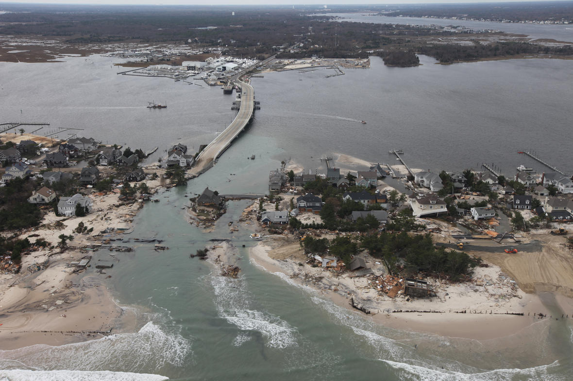 October 27, 2017 5th Anniversary of Sandy Here's a look back at the infamous "Superstorm" Sandy.
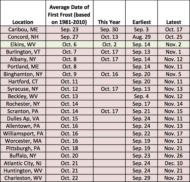 October 23, 2017 First Frost Falling Behind Mild conditions since late September have put the first frost behind schedule in some areas.
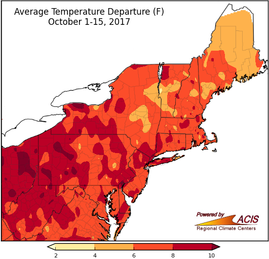 October 17, 2017 The Leaves Are Crisp, but the Weather is Not The calendar says mid-October, but the weather feels otherwise.
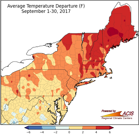 October 2, 2017 Turning Over a New Leaf The first month of autumn started off colder than normal but abruptly switched to warmer than normal.
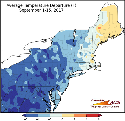 September 18, 2017 Cool Conditions Continue During the first two weeks of September, temperatures have been cool and precipitation has been variable.
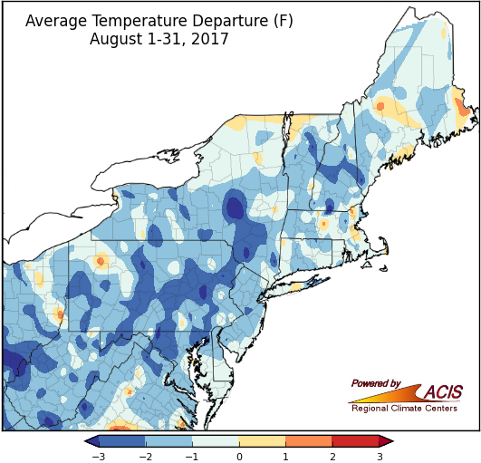 September 5, 2017 Summer Falls Into Autumn Here's a recap of August and summer, as well as a preview of September and autumn.
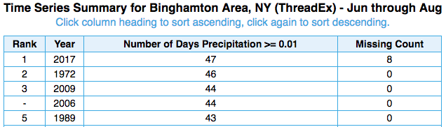 August 23, 2017 Summer Fun Facts Summer 2017 has been an interesting season for precipitation. Here are a few tidbits.
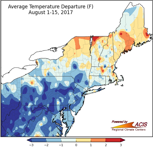 August 16, 2017 Chillin' in Mid-August Temperatures have been cool so far this August, while precipitation has been variable.
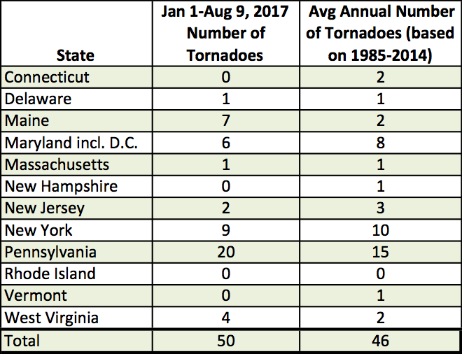 August 10, 2017 Tornado Count Up This Year The Northeast has seen more tornadoes than average this year, based on data from NOAA.
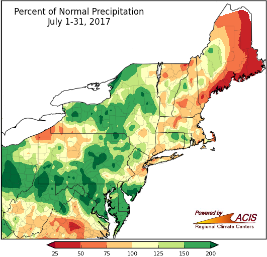 August 1, 2017 Raindrops Keep Falling…or Not Some areas saw more than double their normal July rainfall, while other areas got less than half of normal.
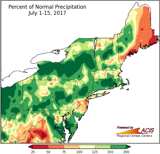 July 17, 2017 A Midsummer Recap So far, July and summer have been wet and warm for many areas.
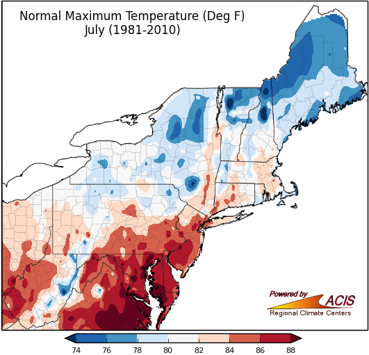 July 11, 2017 The Hottest Time of the Year July is the hottest month in the Northeast.
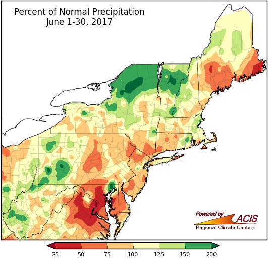 July 3, 2017 An Indecisive June June couldn't decide if it wanted to be wet or dry, cold or hot, so it was all of it!
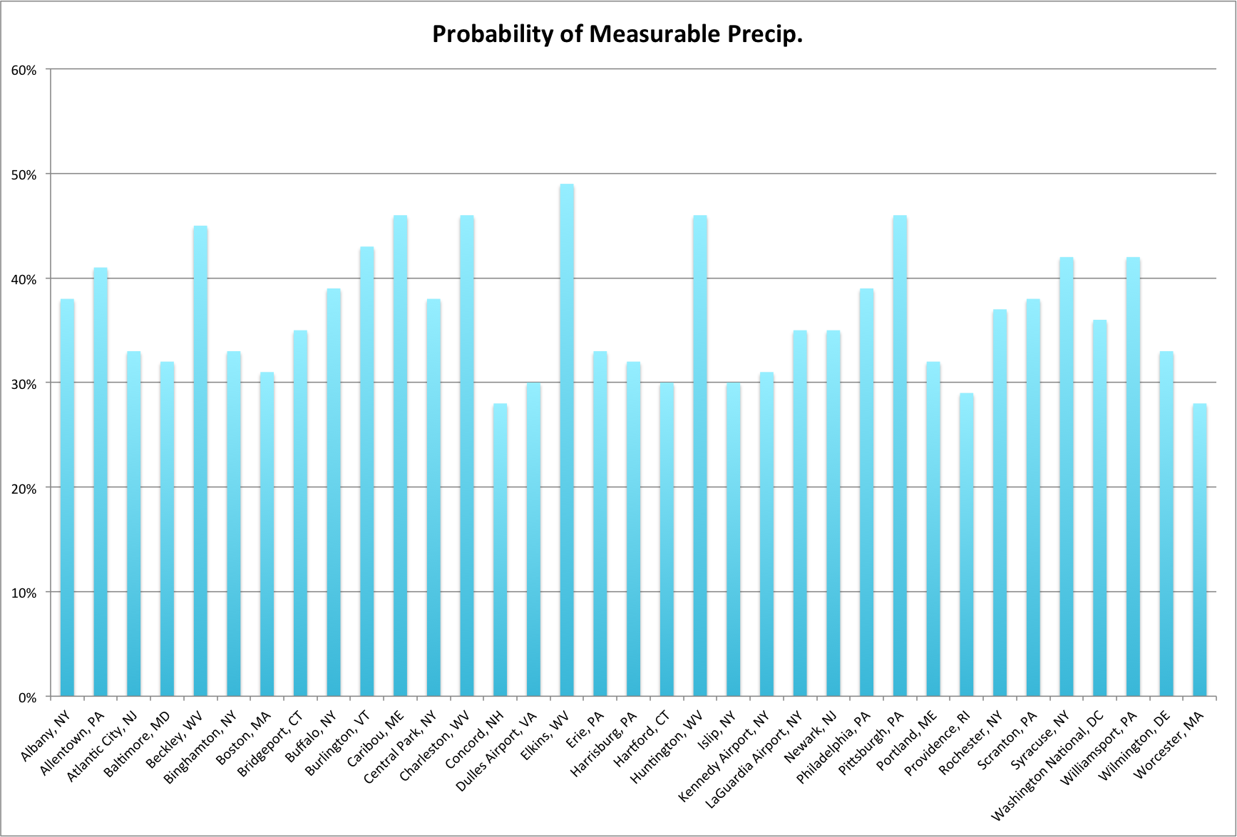 June 28, 2017 The Fourth of July Fireworks, food, and fun - the Fourth of July is almost here! Here's a look at average conditions on Independence Day at the 35 major climate sites.
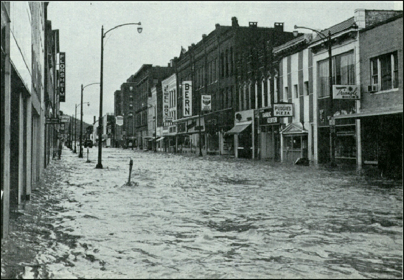 June 20, 2017 Hurricane Agnes - 45 Years Later In late June 1972, Hurricane Agnes caused some of the most devastating flooding the Northeast has experienced.
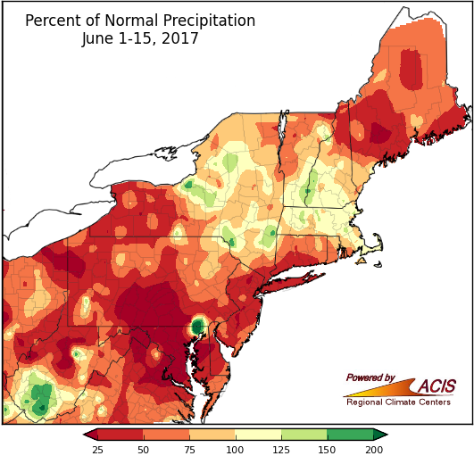 June 16, 2017 Flip-Flop After a soggy May, the first half of June was drier than normal for many areas. In addition, the first two weeks of the month featured well below normal and well above normal temperatures.
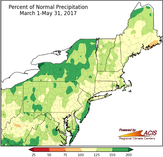 June 1, 2017 Springing into Summer As we head into summer, let's take a look back at spring, which featured a little bit of everything.
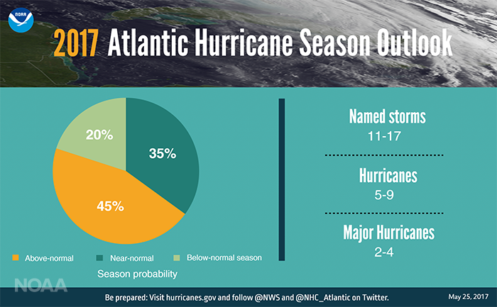 May 25, 2017 One Week Until Hurricane Season Hurricane season arrives June 1 and NOAA just released their outlook.
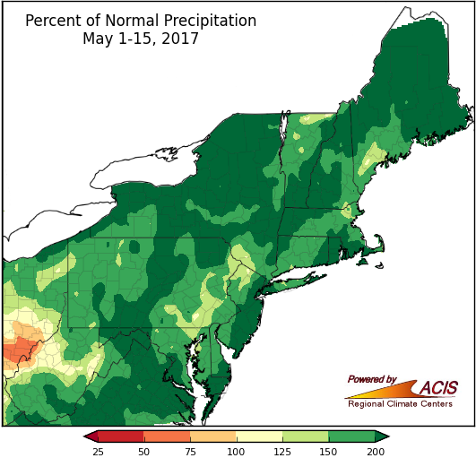 May 16, 2017 Mid-May - Rain Boots Required So far, May has been soggy and chilly.
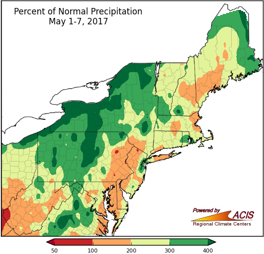 May 9, 2017 What a Week! The first week of May brought heavy rain and the threat of frost.
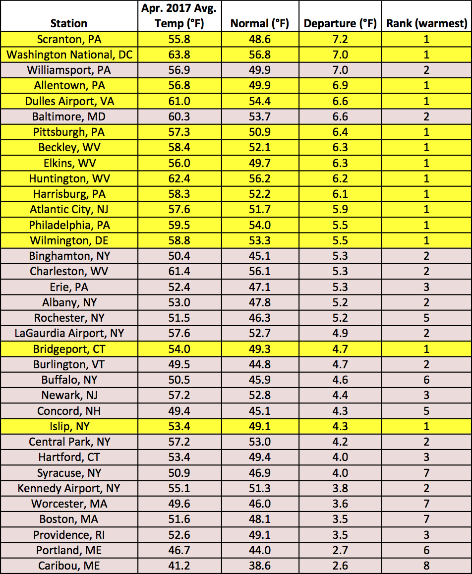 May 1, 2017 An A+ April April earned top marks for temperatures, precipitation, and snowfall. Here's why...
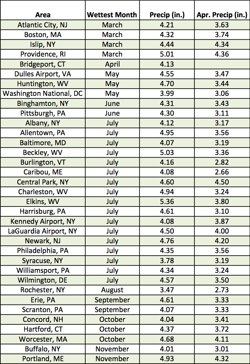 April 25, 2017 April Showers (2017) We all know the phrase "April showers bring May flowers", but how do April showers compare to other months?
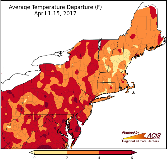 April 18, 2017 Midpoint of April April so far has generally been warm, wet, and not very snowy.
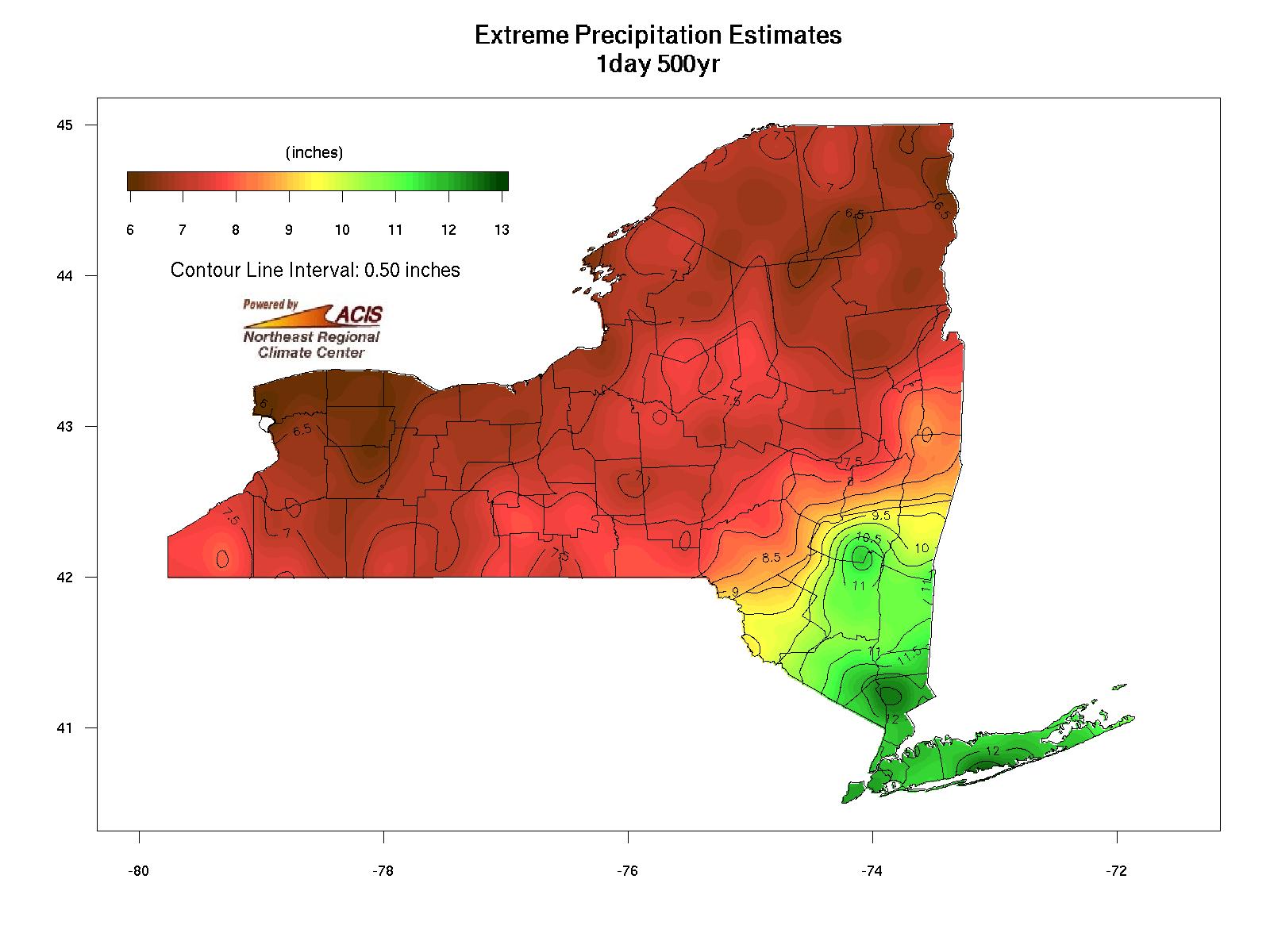 April 10, 2017 Easter Eggs Not the ones left by a bunny...
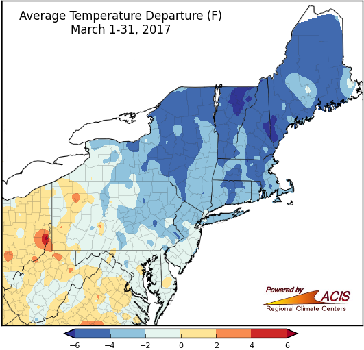 April 3, 2017 March Blues Colder, snowier conditions returned to much of the region in March.
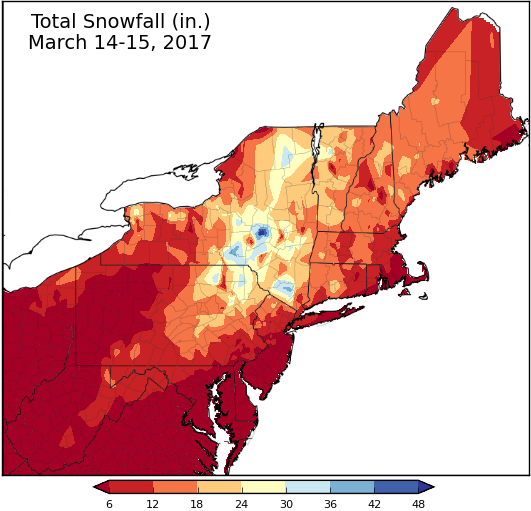 March 17, 2017 Record-Setting March Nor'easter March snowstorms aren't uncommon, but the snow amounts from the recent nor'easter were.
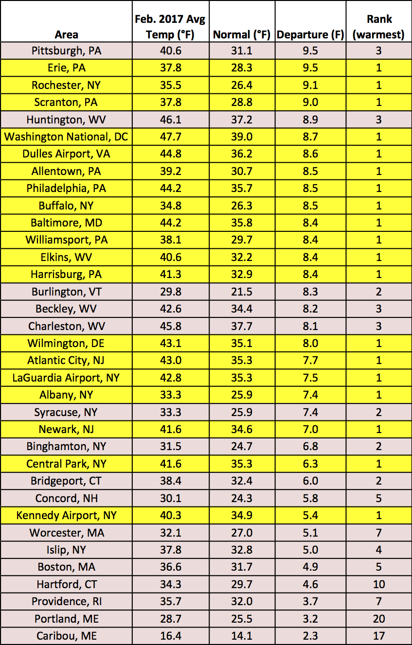 March 6, 2017 February - End of Winter or Beginning of Spring? It's hard to tell when winter ended and spring began. Here's a recap of February and winter conditions.
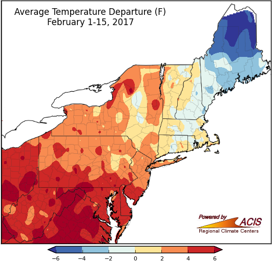 February 17, 2017 Spanning the Spectrum February so far has brought a wide range of conditions.
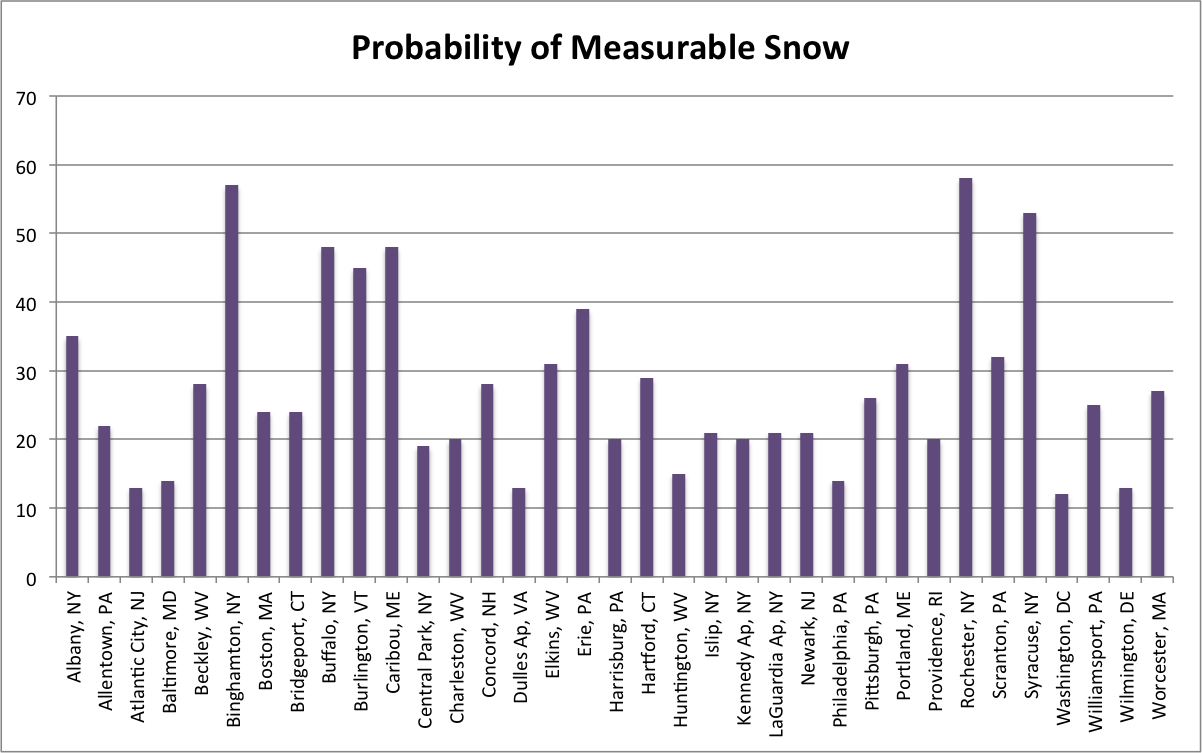 February 7, 2017 Valentine Time Pink-hued flowers and heart-shaped boxes of chocolate line the store shelves. Valentine’s Day is near!
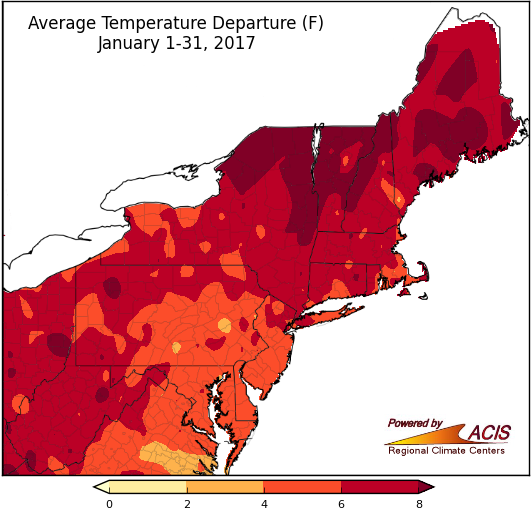 February 1, 2017 January - Warm and Wet, but Not Very White January was mild for all, wet for many, and not very snowy for most. What is February expected to bring?
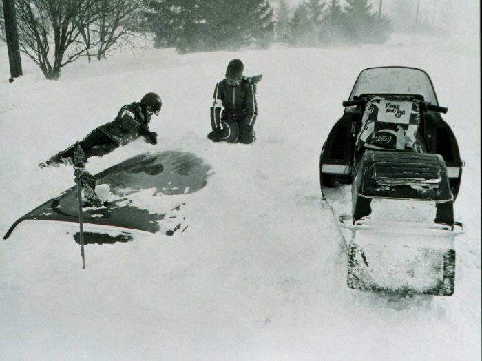 January 25, 2017 Blizzard of '77 Looking back at the Blizzard of '77, 40 years later.
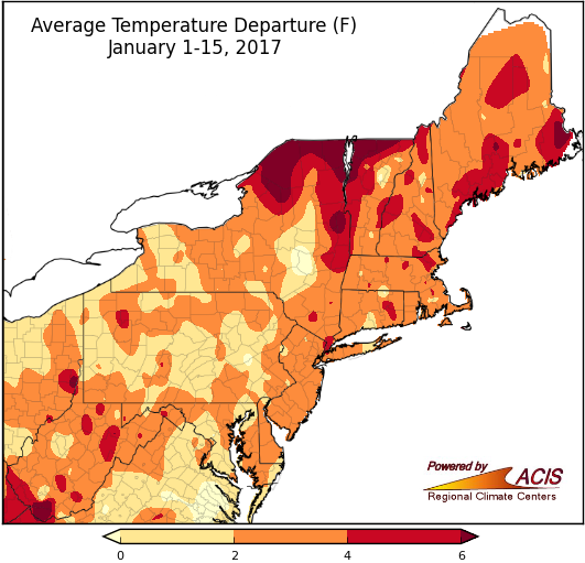 January 18, 2017 Middle of January and Winter We're halfway through January and winter. Here's how they have shaped up so far.
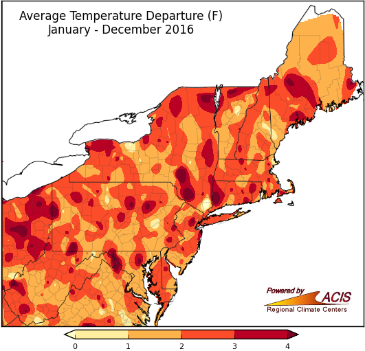 January 3, 2017 Goodbye, 2016! Here's a look back at December and 2016 conditions.
2016
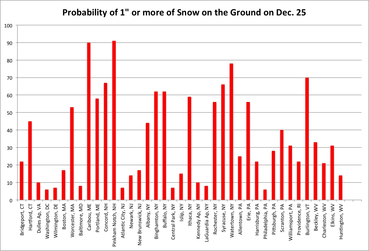 December 15, 2016 Dreaming of a White Christmas? (2016) White Christmas Probabilities
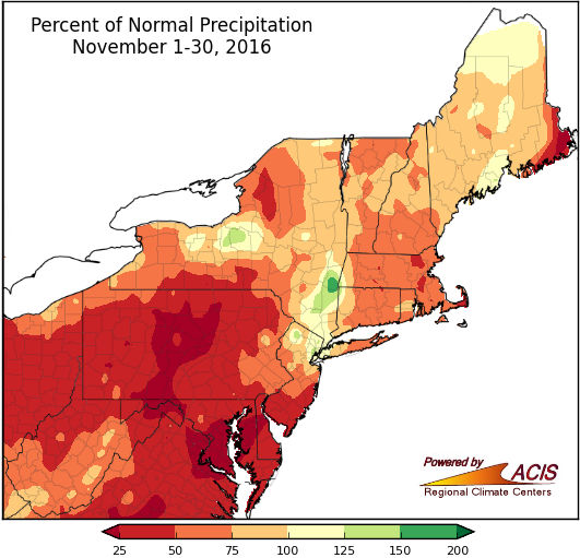 December 6, 2016 What is Long-Term Drought? What is long-term drought?
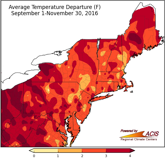 December 1, 2016 Falling into Winter Meteorological fall has come to a close. Here's a look at how it fared.
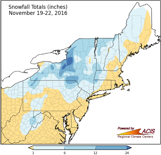 November 22, 2016 Will November Snow Storm Leave us a White Thanksgiving? November snow storm and white Thanksgiving probabilities.
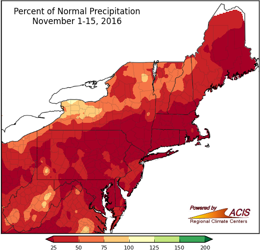 November 16, 2016 Mid-November - Lacking Precipitation, but Not Warmth So far, November has been dry and warm.
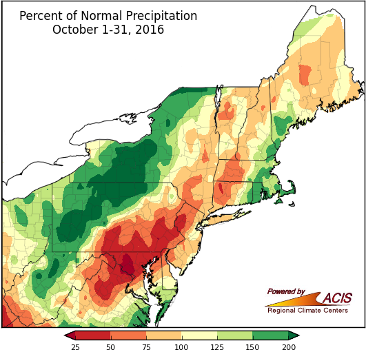 November 1, 2016 An Atypical October From variable precipitation to early snowfall to warm temperatures, October conditions tended to deviate from the norm.
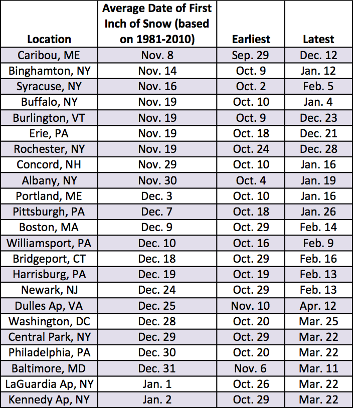 October 24, 2016 Snow Season Starts Parts of the Northeast saw heavy rain and others saw their first snow of the season. When can the rest of the region expect their first inch of snow?
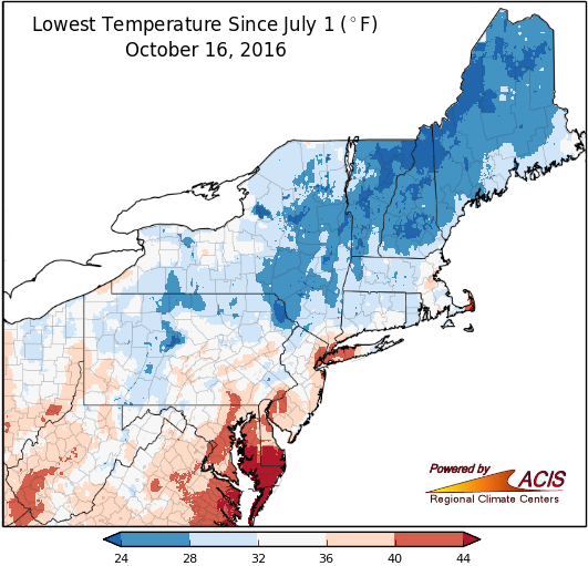 October 17, 2016 First Frost on Cue The first frost of the fall is arriving right on cue.
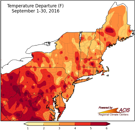 October 3, 2016 Warm September Comes to a Close Warm September comes to a close.
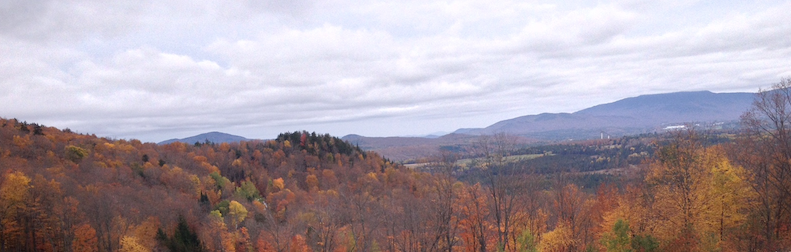 September 27, 2016 Foliage Season Many folks are wondering how the warm temperatures and drought will affect fall colors.
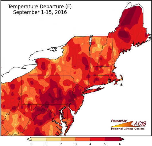 September 16, 2016 Summer Continues... It may be meteorological fall, but the first two weeks of September were similar to summer.
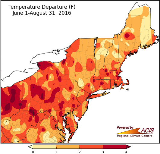 September 1, 2016 Broken Records Numerous temperature records were broken in August, with summer breaking a few, too.
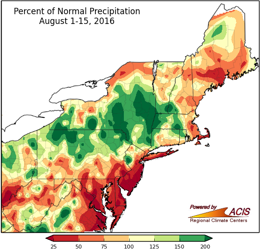 August 16, 2016 Mid-August - Some Rain, Still Dry Mid-August update.
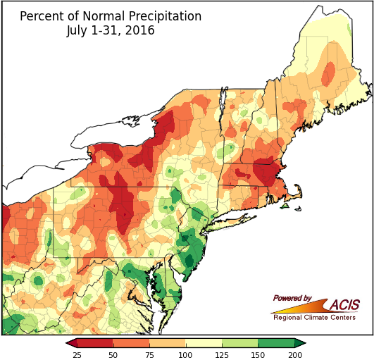 August 1, 2016 July - Extreme Rain, Drought, and the 90s What do extreme rainfall, drought, and the 90s have in common? They all happened this July.
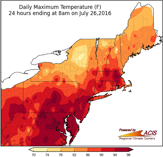 July 26, 2016 Feel the Heat The number of days with a high of 90°F or greater are adding up in the Northeast.
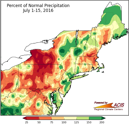 July 18, 2016 Wet or Dry Through Mid-July Precipitation during the first half of July and first half of summer was variable, but average temperatures were generally near to above normal.
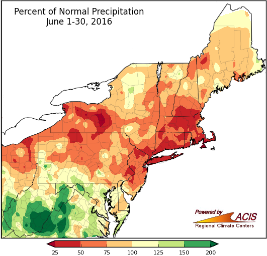 July 1, 2016 June Rainfall - From One Extreme to the Other June rainfall ranged from too little to too much, with both having impacts in the region.
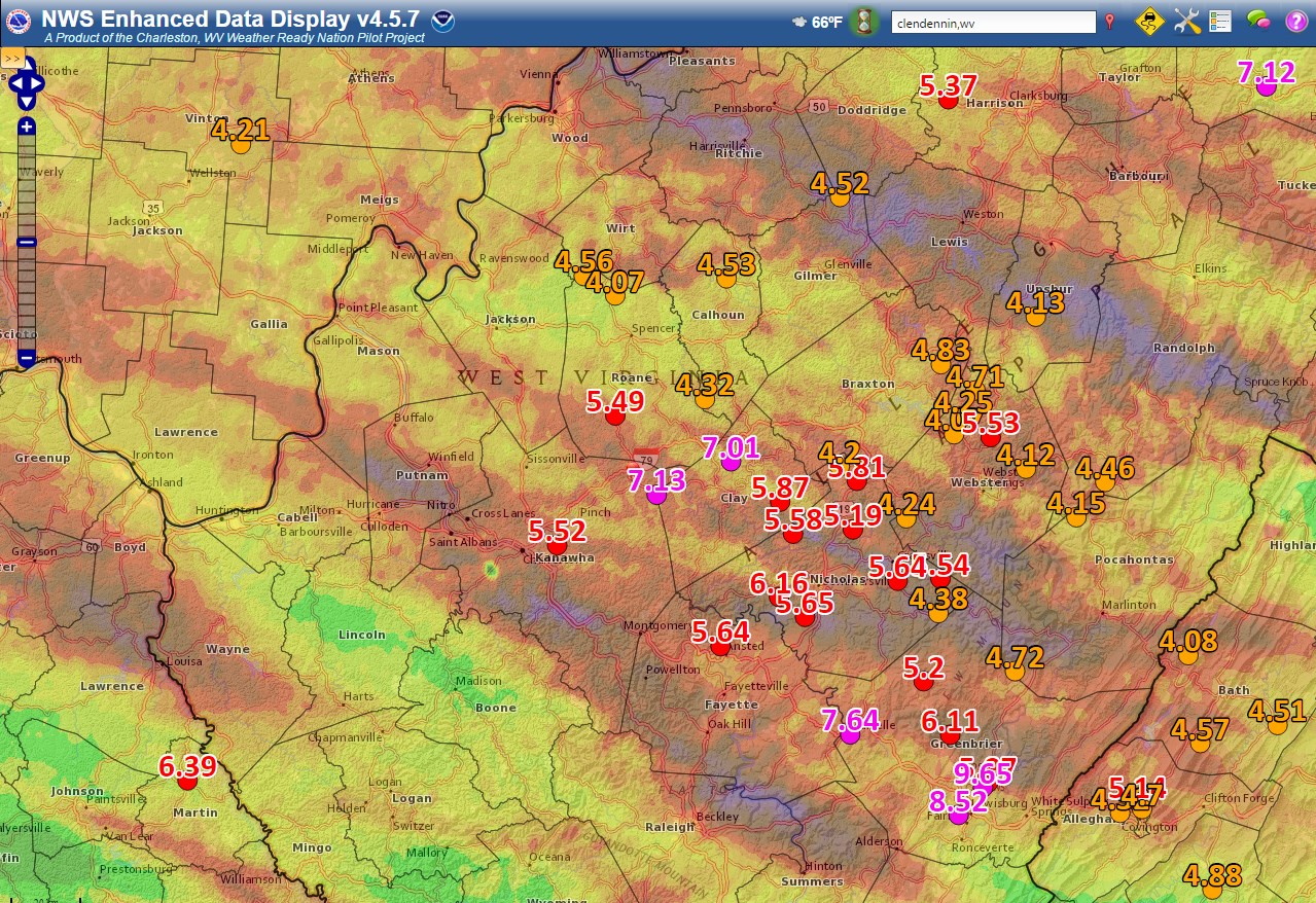 June 24, 2016 Extreme Precipitation and Flooding in West Virginia Extreme precipitation caused significant flash flooding and (preliminary) record flooding in southern West Virginia.
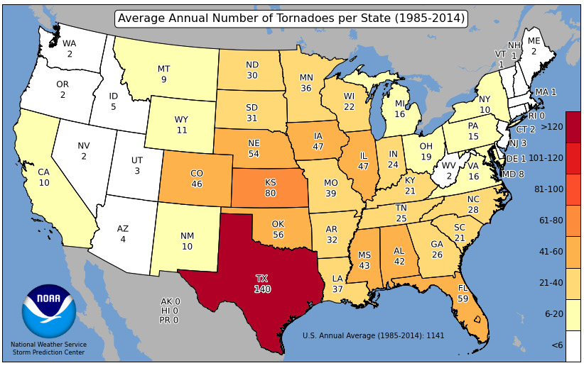 June 22, 2016 Severe Weather Climatology (2016) Severe weather can happen any time of the day or year, but historically there are certain times when the likelihood is greater.
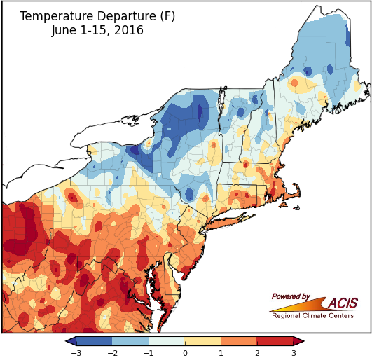 June 16, 2016 Mid-June - A Little Bit of Everything Temperature and precipitation have been variable across the region during the first half of June. There was even some snow.
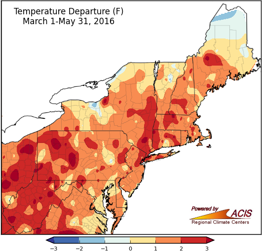 June 1, 2016 So Long, Spring! Time to say goodbye to spring as we head into summer.
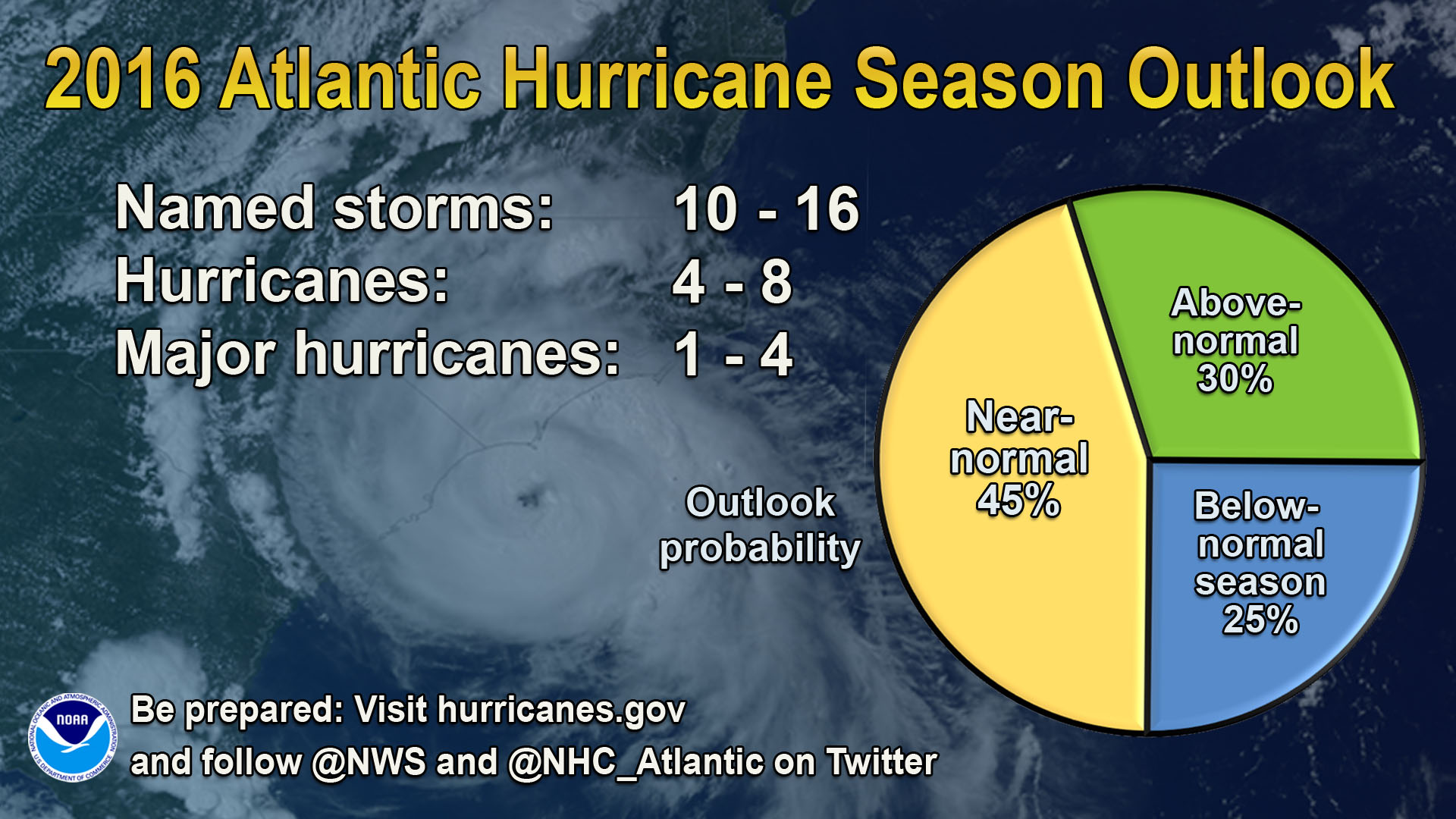 May 27, 2016 Caution - Hurricane Season Ahead Hurricane season arrives June 1 and NOAA just released their outlook.
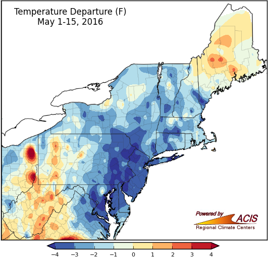 May 16, 2016 May Days May is halfway over and so far it's been a cool, wet one for many areas.
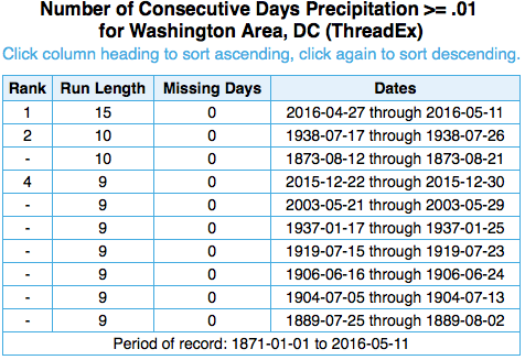 May 11, 2016 Groundhog Day? Mid-Atlantic residents may feel like they're repeating the same day over and over thanks to a persistent weather pattern.
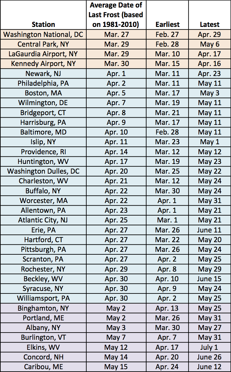 May 6, 2016 Spring Frost (2016) With the weather warming and days growing longer, many people are eager to start gardening. However, some areas still haven't made it past their average date of last frost.
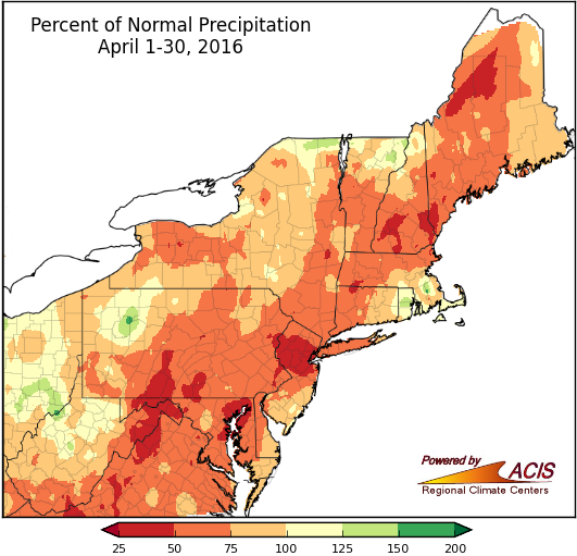 May 2, 2016 Not Many April Showers Showers were generally lacking this April as most of the region saw below-normal precipitation.
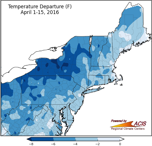 April 19, 2016 April 15 - Not Just Tax Day April 15 also marks the halfway point of April and spring. Here's how the month and season are shaping up so far.
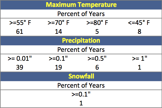 April 14, 2016 Boston Marathon Climatology A look at weather over the history of the Boston Marathon.
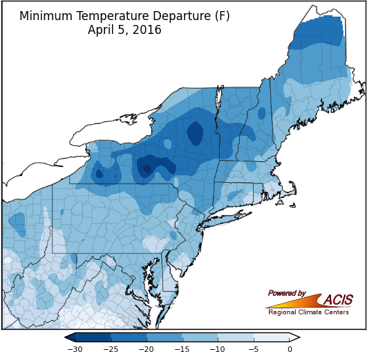 April 5, 2016 We Interrupt This Spring to Bring You Winter Winter-like temperatures settled into the region the past few days.
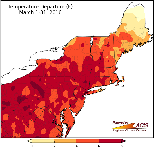 April 1, 2016 Marching Into Spring Spring started off with mild conditions. How did March rank and what will the middle month of the season bring?
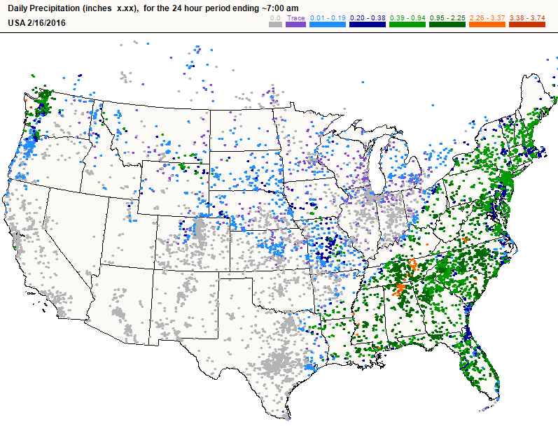 March 25, 2016 March Madness (2016) CoCoRaHS is looking for volunteers! What is CoCoRaHS, and why is it important?
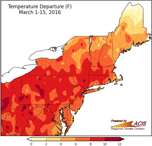 March 16, 2016 Spring Ahead Not only did we set our clocks ahead, but mild temperatures arrived ahead of schedule.
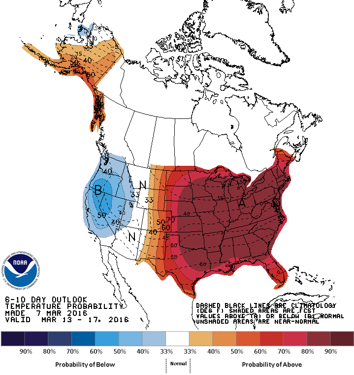 March 7, 2016 Record-Challenging Warmth Several sites could break their high temperature records mid-week.
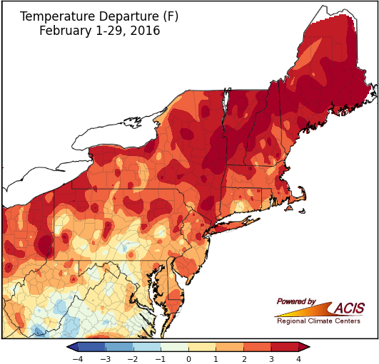 March 1, 2016 February - The Amusement Park Edition February was a bit like an amusement park - there were surprises around every corner. Winter also featured some extremes.
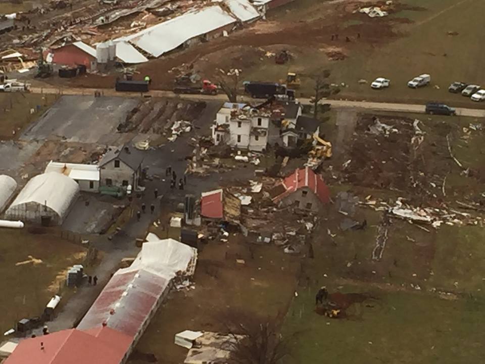 February 25, 2016 Pennsylvania Tornadoes When you think of severe weather in February you usually think of snow and ice, not tornadoes, but this hasn’t been a typical February.
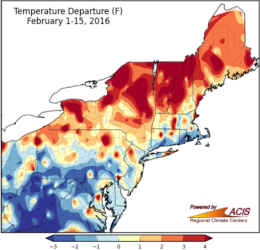 February 16, 2016 Variety is the Spice of...February (So Far) February so far had a bit of everything--record warm, record cold, a lack of snow, abundant snow, continued dryness, and wet conditions.
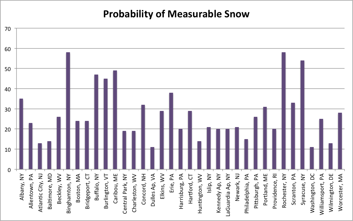 February 9, 2016 Valentine's Weather - Lovely or Heartbreaking? If you're taking your sweetheart out for a romantic night on the town for Valentine's Day, here's a look at average conditions for the region's 35 major airport sites.
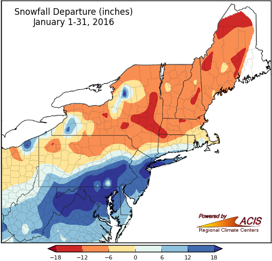 February 1, 2016 Role Reversal While northern parts of the Northeast saw below-normal snowfall and above-normal temperatures in January, southern parts received an abundance of snowfall and colder weather.
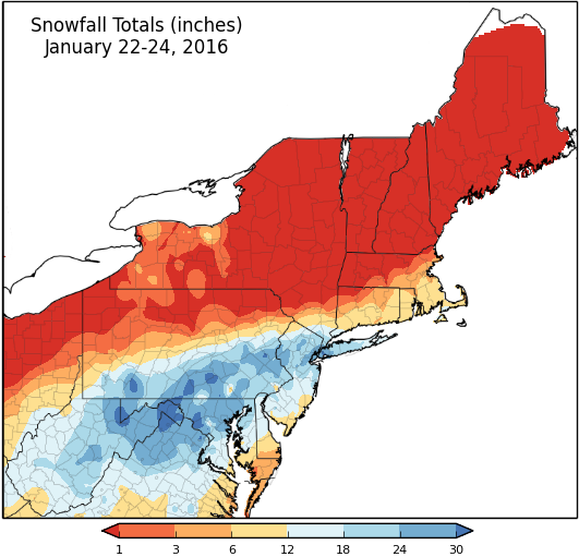 January 25, 2016 January 2016 Blizzard Snowfall map and 1-day and 2-day rankings.
 January 20, 2016 D.C. Snow Storms A look at the top 5 snow storms in Washington, D.C.
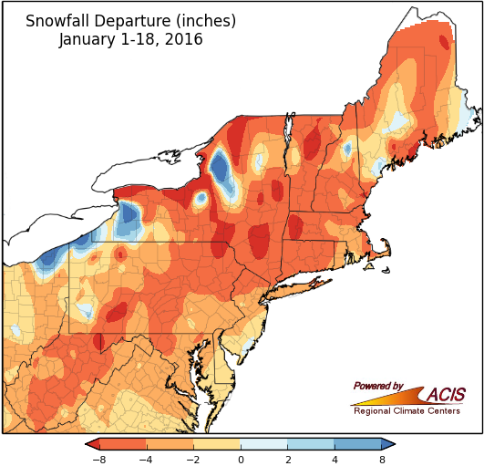 January 19, 2016 Mid-January January-to-date recap
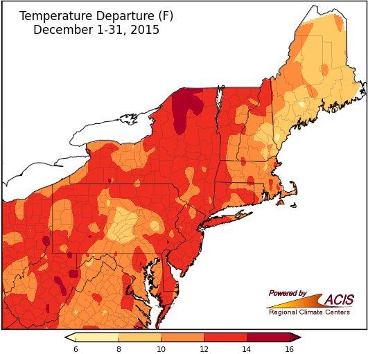 January 5, 2016 Into The Record Books December was record warm for many areas in the Northeast. Here's a look at December and 2015.
2015
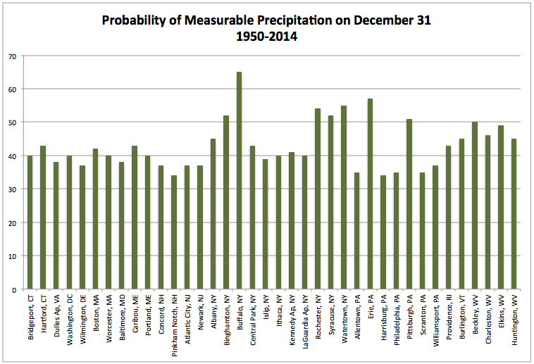 December 22, 2015 Soggy Celebrations? Wet New Year's Eve Probabilities
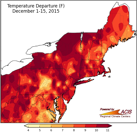 December 16, 2015 Where Are You, December? December has been warm and mostly snowless in the region. In fact, more than half of the airport climate sites have been record warm!
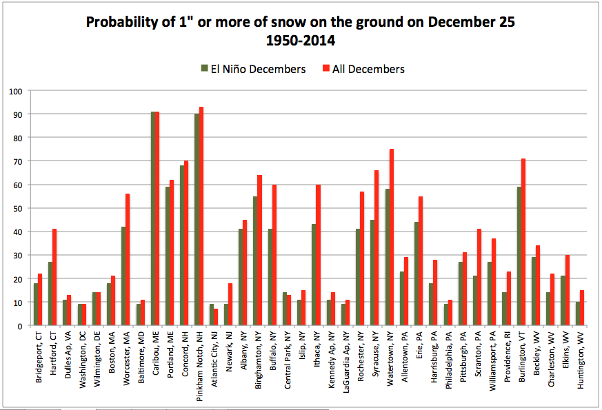 December 15, 2015 Not So White Christmas White Christmas Probabilities
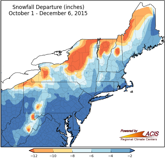 December 8, 2015 First Inch of Snow (2015) Lacking Snow in the Northeast
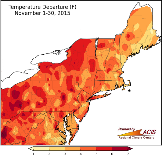 December 1, 2015 Fall Leaves (Us) Fall is over, so here is a recap of the past month and season.
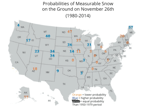 November 20, 2015 White Thanksgiving (2015) Will your city see a white Thanksgiving?
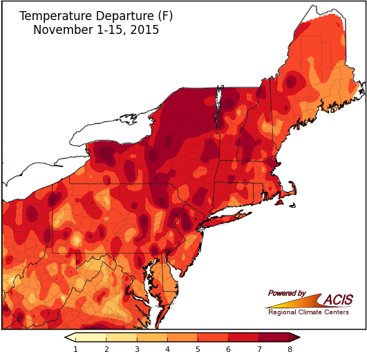 November 16, 2015 Orange You Glad It's Mid-November? November temperatures have been above normal for all, while precipitation and snowfall have been below normal for almost all.
 November 7, 2015 What Pies Tell Us About Seasonal Outlooks With Thanksgiving two weeks away, let's talk pies!
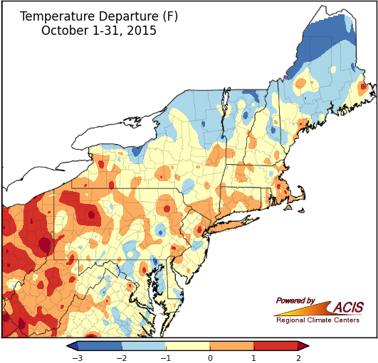 November 2, 2015 October's Over Temperatures tended to be near normal in October, while precipitation was near to below normal.
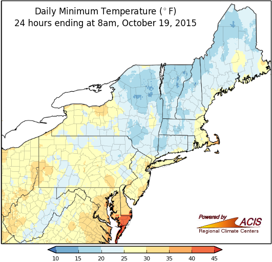 October 21, 2015 Frost and Flakes Last weekend brought the first fall frost and some snow to the Northeast. Here's a look at the average date of the first frost and inch of snow.
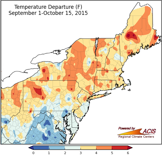 October 16, 2015 Mid-October - Looking Back and Thinking Ahead October and fall so far have been warm, but precipitation has been variable. With this season winding down, we'll preview the next one.
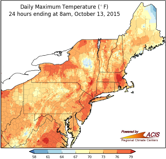 October 13, 2015 Warmth and Weather Watchers High temperatures were nearly 20 degrees above normal in parts of the Northeast on Columbus Day.
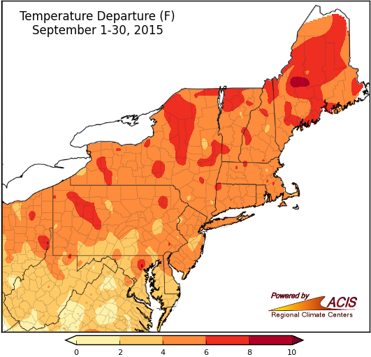 October 1, 2015 September - Consistent Temperatures, Inconsistent Rainfall September was warm for all of the Northeast, but precipitation totals varied.
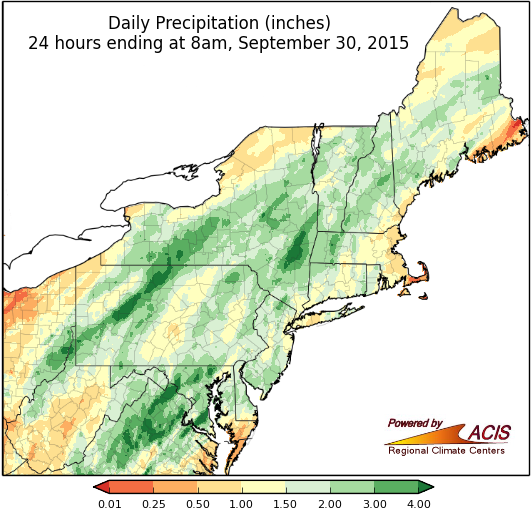 September 30, 2015 And Now for Something Completely Different - Heavy Rain! After weeks of mostly dry conditions, heavy rain returned to the region.
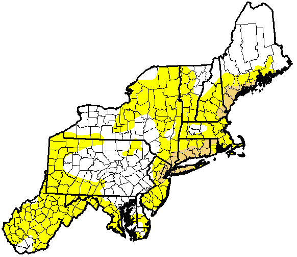 September 24, 2015 Drought with a Side of Leaf Peeping Much of the region has seen below-normal precipitation so far this September, with abnormal dryness and drought expanding. The weather could affect this year's fall foliage.
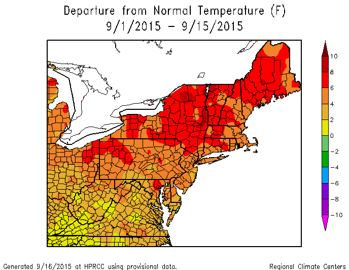 September 17, 2015 Mid-Summer...I Mean September The calendar says September but temperatures have felt more summer-like in many parts of the Northeast. Let's put it this way...the average temperatures at multiple sites for the first half of September were warmer than their normal temperatures for the first half of July!
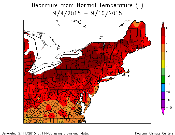 September 11, 2015 Summer Holds On September signals the start of meteorological fall, but someone forgot to tell the weather that. The region has been warm and dry recently.
 September 1, 2015 Record-Warm August Two of the Northeast's major airport climate sites were record-warm for August.
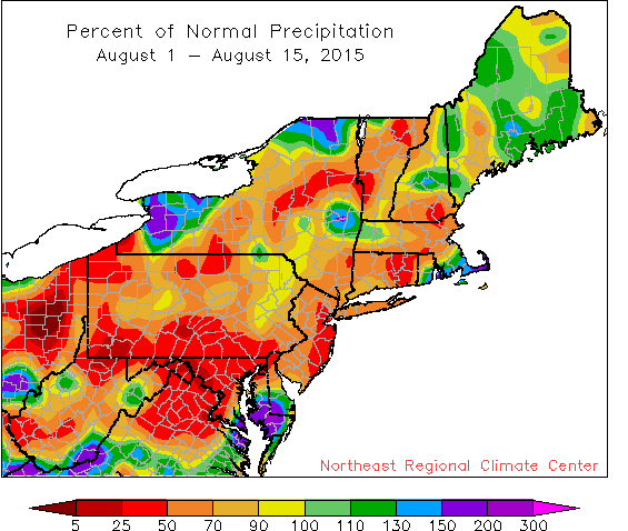 August 17, 2015 Dry Days Are Here Again Rainfall has been lacking across much of the Northeast during the first two weeks of August.
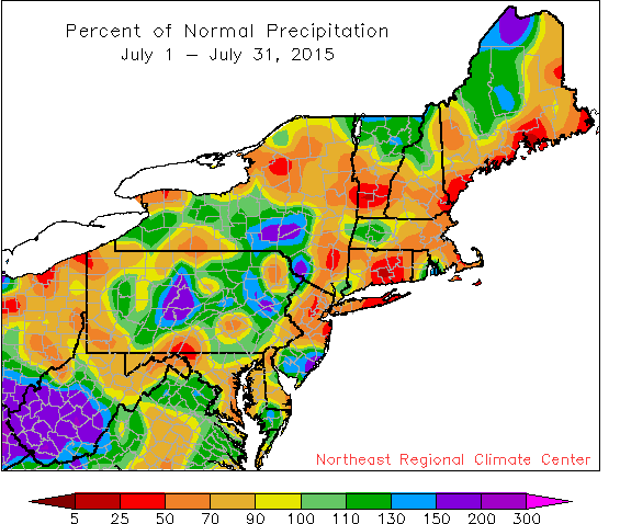 August 4, 2015 July Rain in Short & Abundant Supply July rainfall was hit-or-miss, with very dry areas and very wet areas scattered throughout the region. July 16, 2015 Checking in During Mid-July Precipitation during the first half of July was variable, with departures ranging from less than 25 percent of normal in parts of Maine to more than 300 percent of normal in parts of West Virginia and southern New Jersey. Due to a very wet June, the first half of summer ranked among the top 20 wettest at 29 of the 35 airport climate sites. In fact, Atlantic City, NJ, and Baltimore, MD, had their wettest start to summer on record. July 1, 2015 A Wet & Wild June June 16, 2015 Wet, But Still Dry… June 1, 2015 A Record-Setting May May 18, 2015 In the Red May 1, 2015 A Tale of Two Aprils April 15, 2015 Mid-April Opposites April 1, 2015 March - More Lion Than Lamb March 14, 2015 A Fine Line Between Wet & Dry March 2, 2015 A Record-Shattering February February 18, 2015 Frozen February February 11, 2015 Snow, Snow, and More Snow February 3, 2015 January Chill January 28, 2015 End of January Nor'easter January 16, 2015 In the Middle (of January and Winter) January 5, 2015 December - End of 2014, Beginning of Winter