
First Half of August - Heavy Rain and Hot Weather
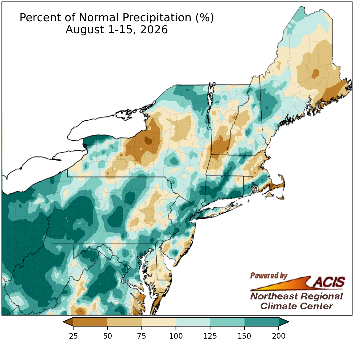
August 1-15 rainfall ranged from less than 50% of normal to over 200% of normal.
The first half of August featured near- to above-normal rainfall for a large portion of the Northeast, with the wettest locations seeing over 200% of normal. The region's southwestern corner including West Virginia and the western half of Pennsylvania was particularly wet. However, a few areas such as central New York, southern Vermont, and eastern Maine were much drier, seeing less than 50% of normal precipitation. At the region's 35 major sites, August 1-15 precipitation ranged from 29% of normal in Boston, MA, to 286% of normal in Williamsport, PA, with 25 of the sites being wetter than normal. This first half of August ranked among the 20 wettest on record for 11 major sites. The wet weather in the Mid-Atlantic, southeastern New York, and southern New England helped drought and abnormally dry conditions improve in those areas, but drier conditions in northern New England and central New York allowed drought and/or abnormal dryness to develop or expand.
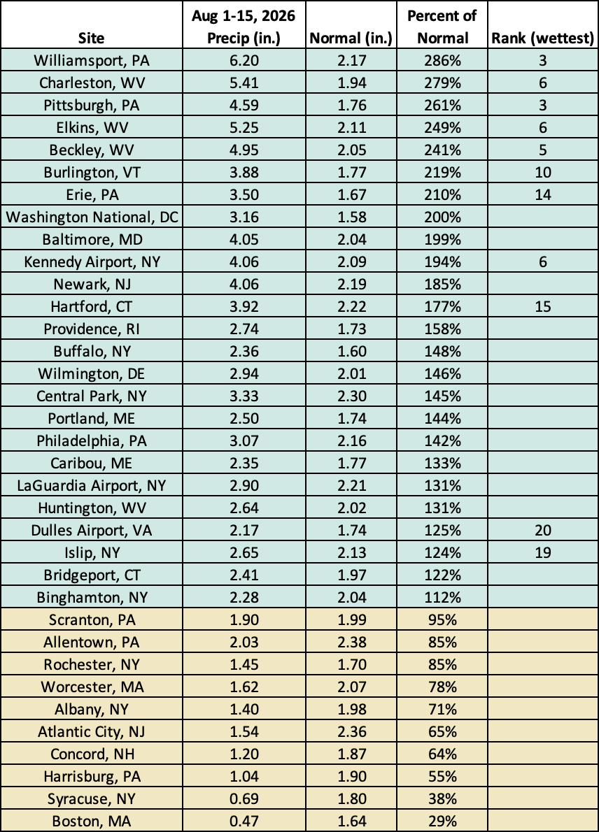
This August 1-15 period ranked among the 20 wettest on record for 11 major sites.
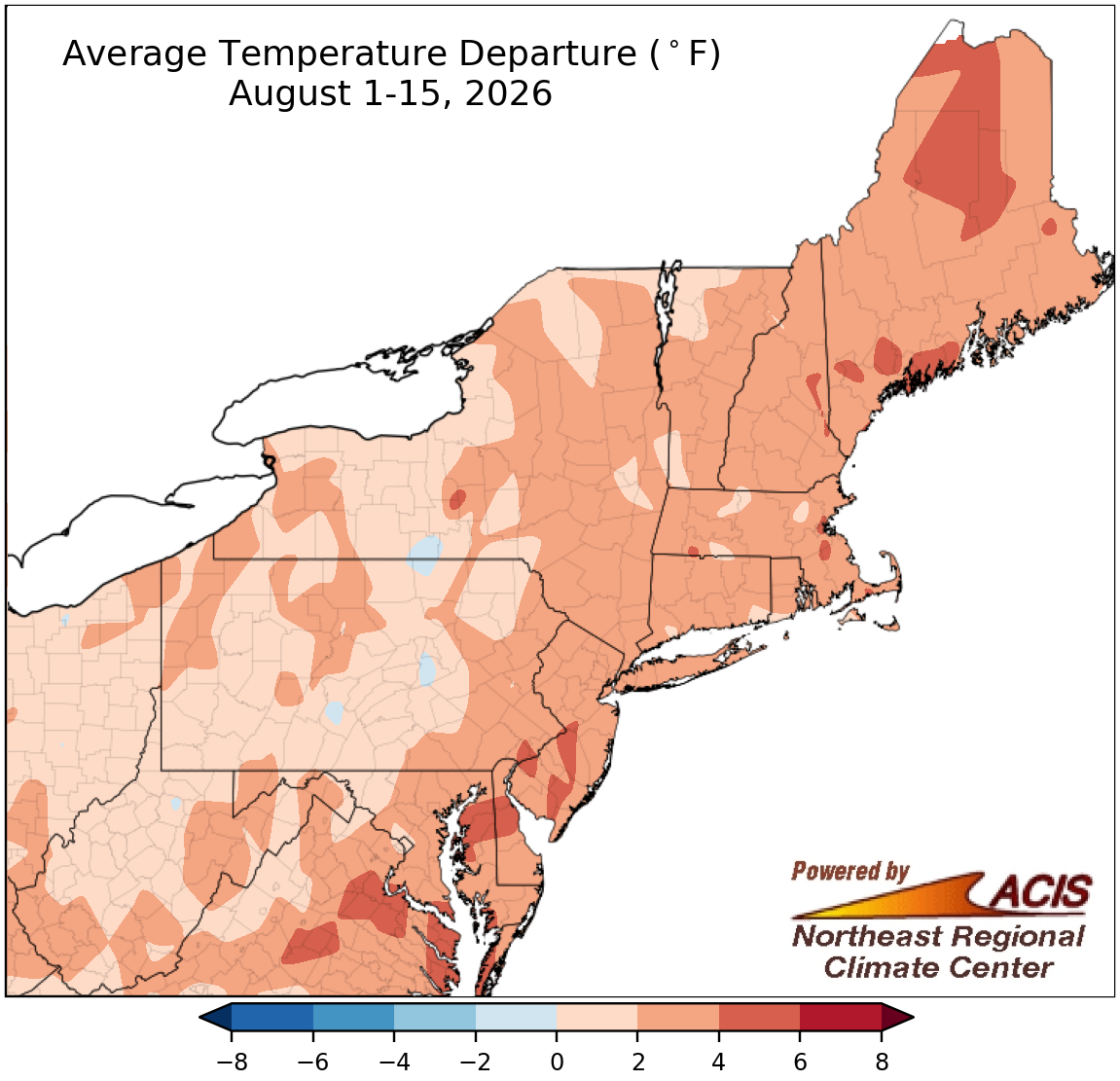
August 1-15 average temperatures ranged from near normal to 6°F warmer than normal.
The Northeast experienced above-normal temperatures during the first half of August, with the greatest departures above normal of over 4°F in areas closer to the coast. August 1-15 average temperatures at the region's 35 major sites ranged from 0.6°F above normal in Scranton, PA, to 4.7°F above normal in Boston, MA, with this first half of August ranking among the 20 hottest on record for 20 of the sites.
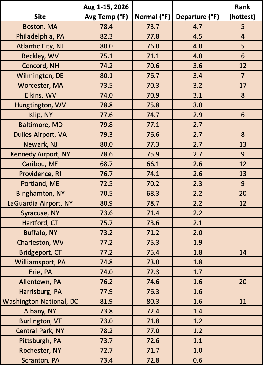
This August 1-15 period ranked among the 20 hottest on record for 20 major sites.