A Cool Start to Summer
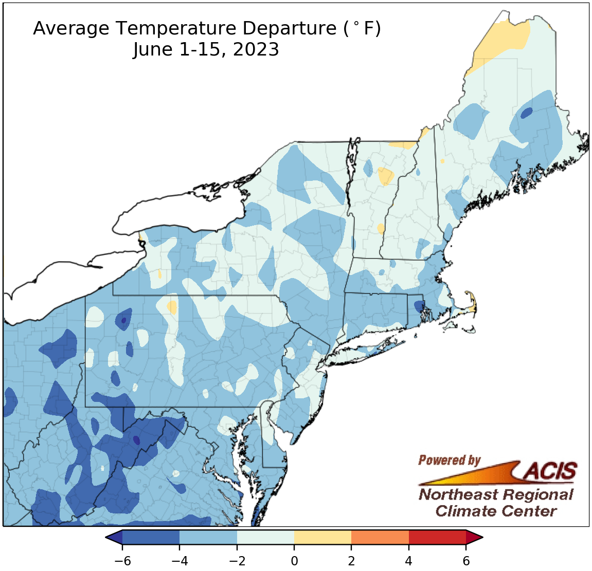
June 1-15 average temperatures ranged from 6°F below normal to near normal.
Summer started off on a cool note, with June 1-15 average temperatures ranging from 6°F below normal to near normal for much of the Northeast. Some of the largest departures below normal were found in portions of West Virginia, western Pennsylvania, and Rhode Island. At the 35 major climate sites, average temperatures ranged from 5.4°F below normal in Providence, RI, to 0.1°F below normal in Binghamton, NY. This June 1-15 period ranked among the 20 coolest on record for 10 major climate sites.
Why so cool? Much of it has to do with a stalled low pressure system from about June 3 to 10. With the low generally positioned near northern New England, much of the Northeast saw winds from the north or northwest which funneled cooler air into the region. This weather pattern also steered smoke from the Quebec wildfires into the Northeast, obscuring the sky and leading to poor air quality.
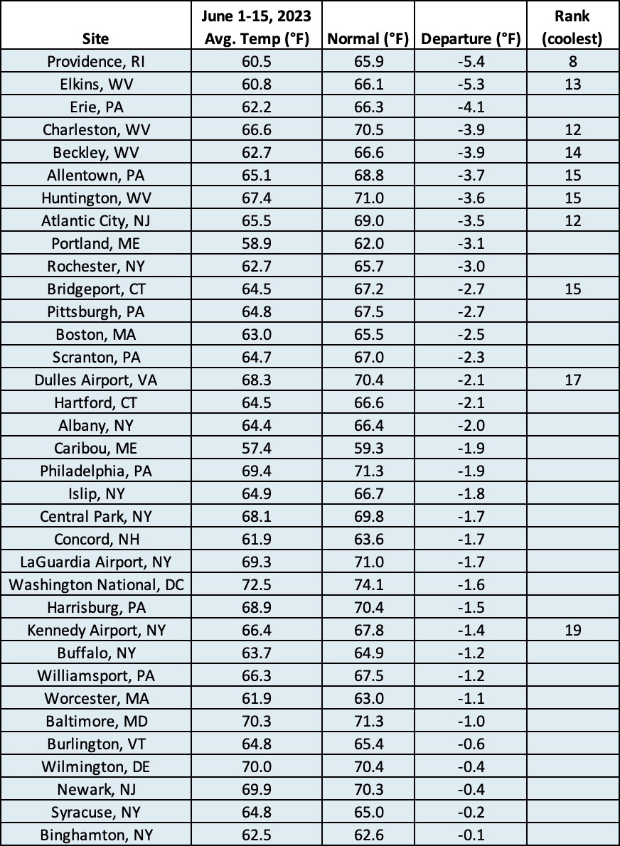
This June 1-15 period ranked among the 20 coolest on record for 10 major climate sites
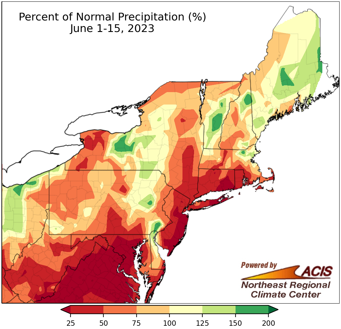
June 1-15 precipitation ranged from less than 25% of normal to 200% of normal.
Precipitation during the first half of June was variable, ranging from less than 25% of normal to 200% of normal. The driest locations were generally in parts of Maryland, New Jersey, southeastern New York, and Connecticut, while the wettest locations were sprinkled throughout the region including in northern Delaware, central New York, and parts of Vermont. At the 35 major climate sites, June 1-15 precipitation ranged from 5% of normal at Dulles Airport, VA, to 151% of normal in Wilmington, DE. This first half of June ranked among the 20 driest on record for 11 of the 26 drier-than-norrmal sites but among the 20 wettest for two of the seven wetter-than-normal sites. There was broad expansion of moderate drought and abnormal dryness in the Northeast during the period.
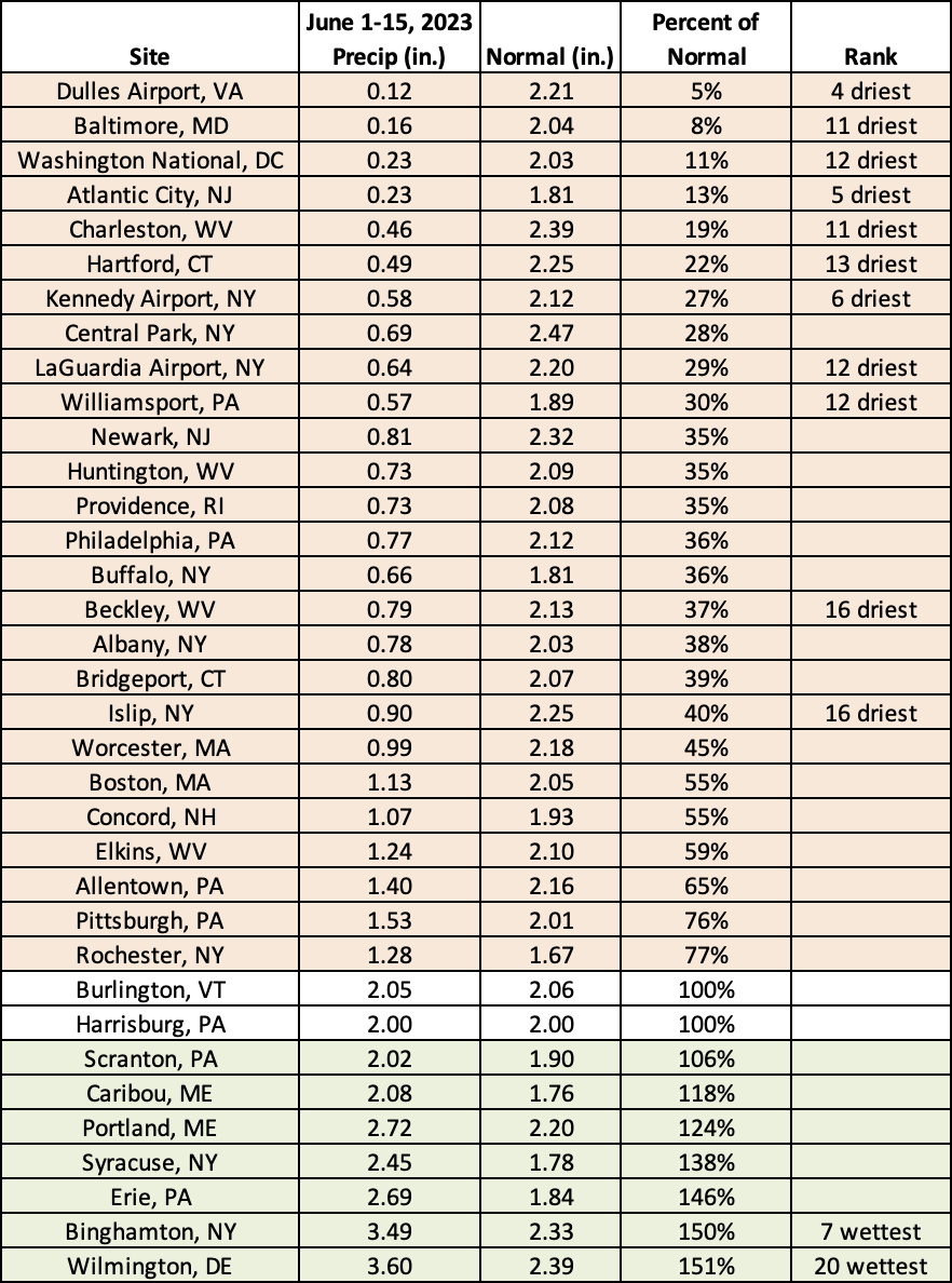
This June 1-15 period ranked among the 20 driest on record for 11 major climate sites but among the 20 wettest for two sites.
According to NOAA’s Climate Prediction Center, there’s an increased likelihood of July being warmer than normal for the entire Northeast. The Mid-Atlantic could see a wetter-than-normal July, with equal chances of below-, near-, or above-normal precipitation forecast for New York and New England.
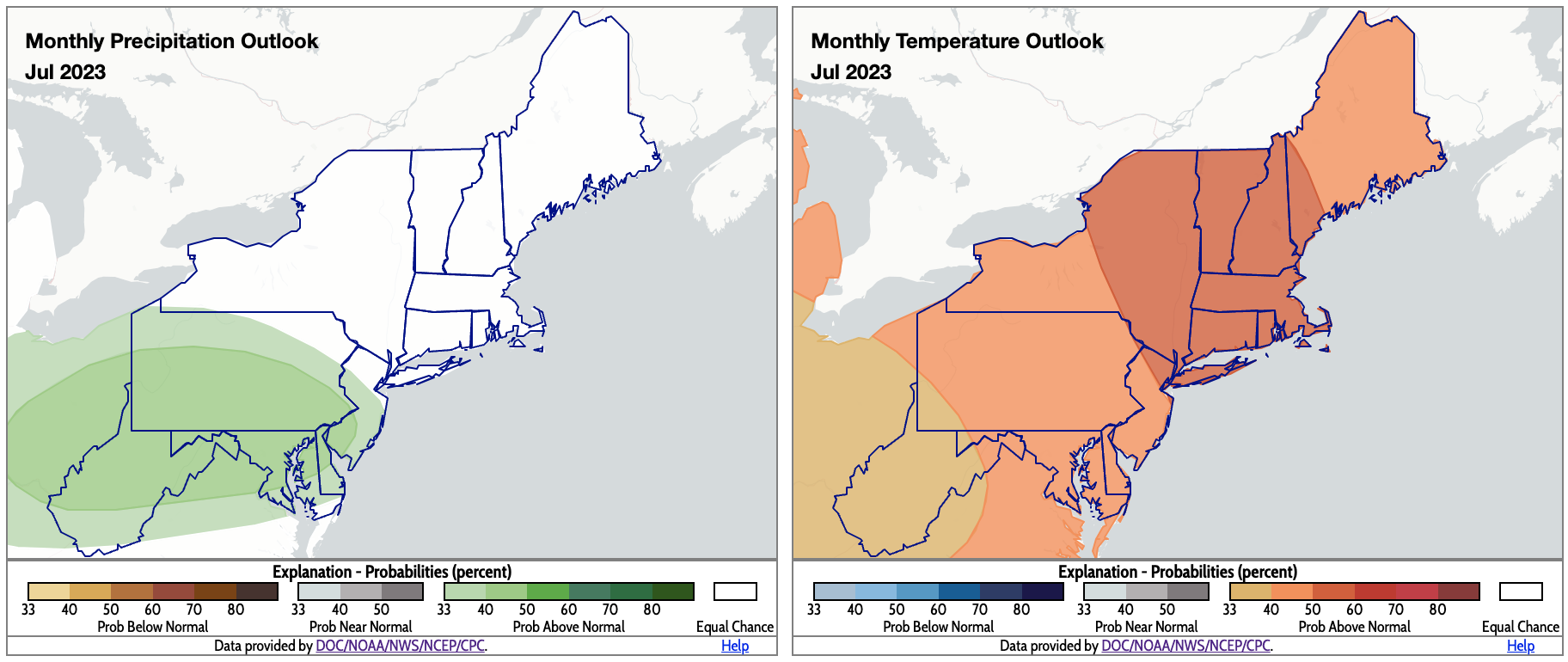
For July, the Mid-Atlantic could be wetter than normal, while the entire Northeast is expected to be warmer than normal. Click to enlarge.