Frost, but Waiting for Flakes
After a mild first half of the month, temperatures have been well below normal for the Northeast over the past week.
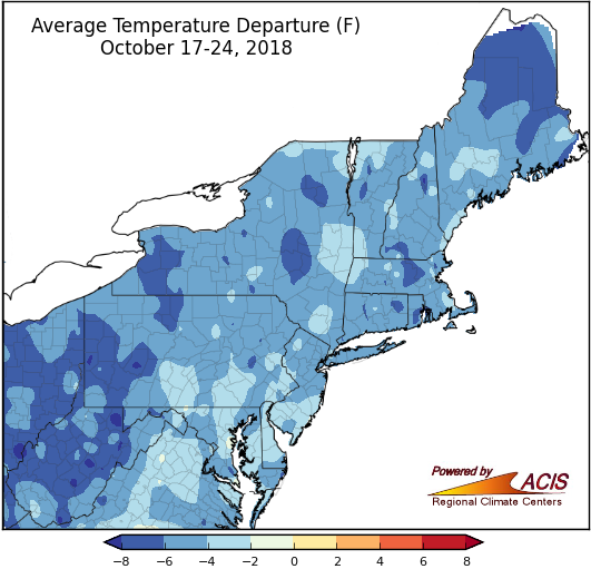
Average temperatures have been 2°F to 8°F colder than normal for most of the Northeast over the past week.
Since October 16, eighteen major climate sites experienced their first frost. For some sites, like Elkins, WV, the timing was a little later than usual, but for other sites, like Islip, NY, the timing was a bit early. A few sites, particularly Burlington, VT, are overdue, while some don’t routinely see their first frost until November.
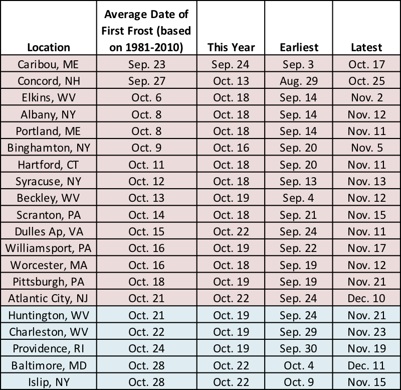
The first fall frost came early for a few sites (shaded blue) and late for others (shaded red).
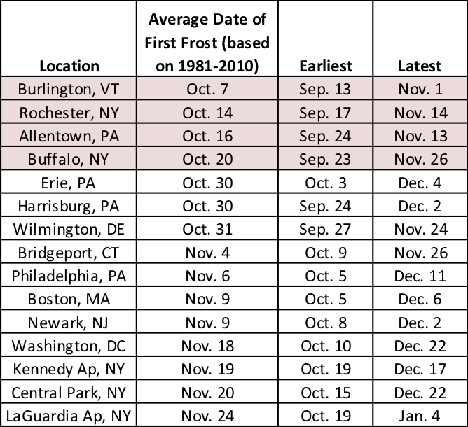
As of October 24, 15 sites hadn’t seen their first frost, but only four sites are past due (shaded red).
Three major climate sites have already seen their first measurable snow (0.1 inches). Binghamton, Buffalo, and Rochester, NY, all received measurable snow at least two weeks earlier than usual.
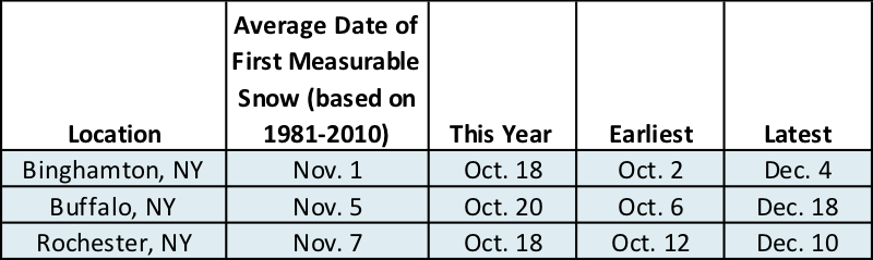
Three New York sites saw their first measurable snow early.
Wait a second! How is it that two of these sites haven’t dipped to 32°F but had measurable snow? It likely fell as graupel, which are snow pellets created when super-cooled water droplets coat a snowflake. Although, it can snow when air temperatures are above freezing. More on that another time. Continuing on…
Typically, the first measurable snow occurs for most of the major climates sites in November or December. Those months are also when the majority of sites receive their first inch of snow.
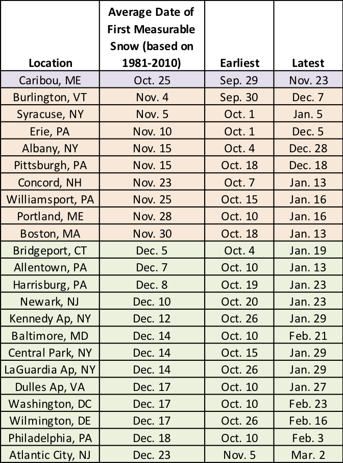
The average date of first measurable snow ranges from late October to late December.
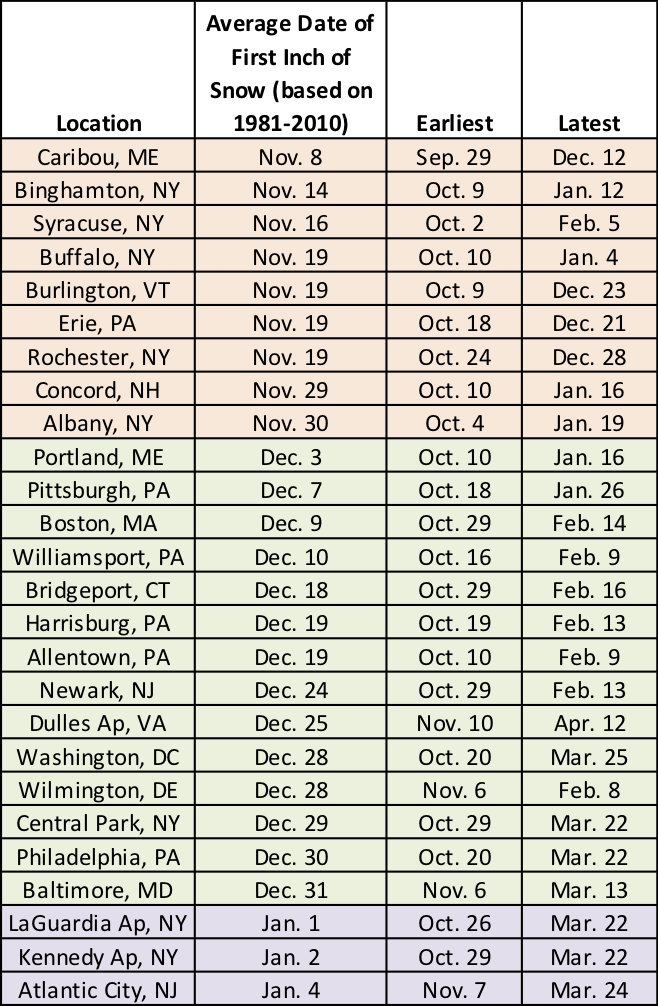
The average date of the first inch of snow ranges from early November to early January.