Climate Change Impacts in the Northeast
The Fifth National Climate Assessment was released in mid-November. This report evaluates climate change and its impacts across the U.S. and provides information on response efforts and projections of future conditions to help inform decision-making. The report is mandated by Congress, updated every four (or, in this case, five) years, and is created by multiple federal agencies with input from the public. Below are a few key details about climate change impacts and projections in the Northeast.
The Northeast is getting warmer.
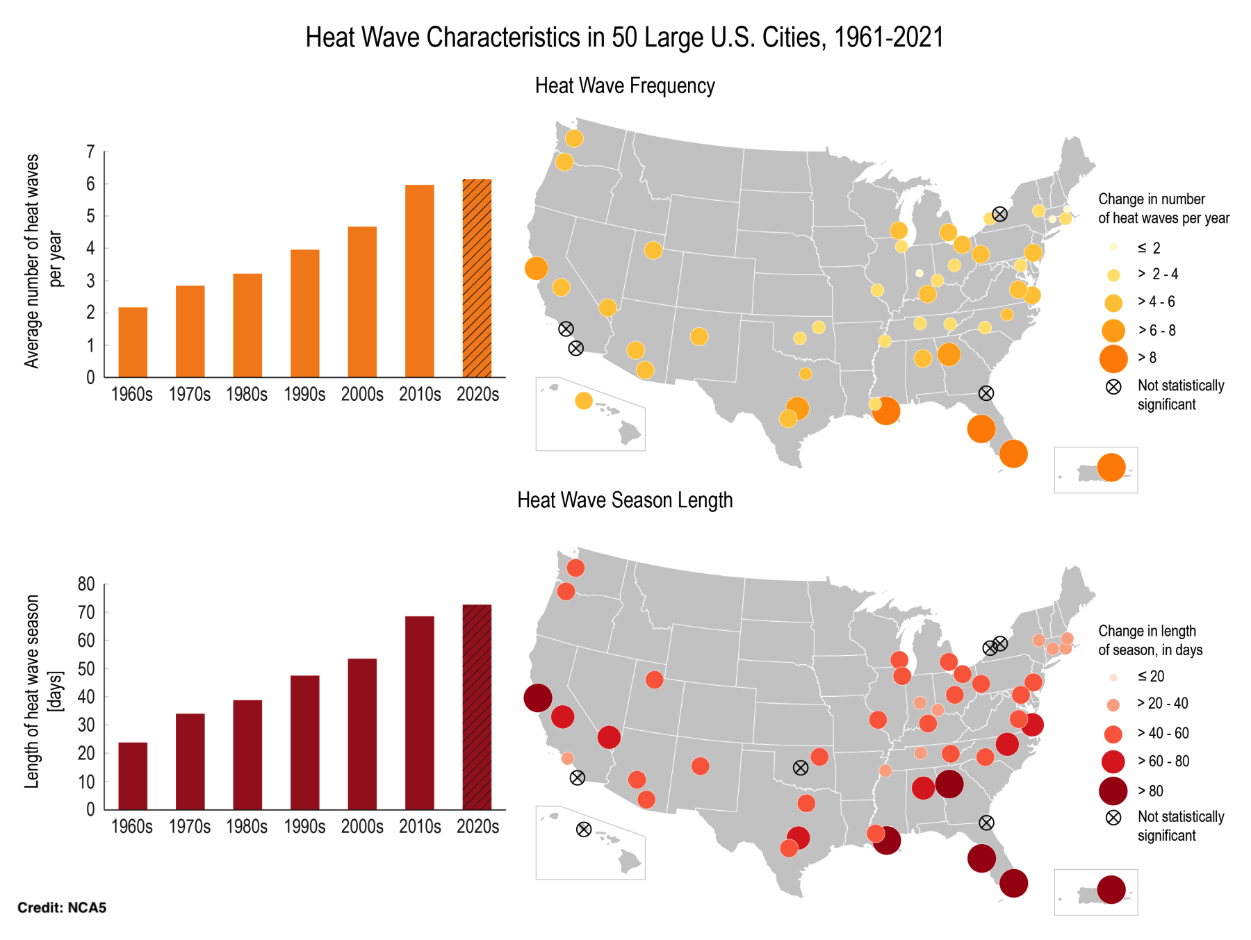
Heat waves are generally happening more frequently and lasting longer. Click to enlarge.
Heatwaves are happening more frequently, lasting longer, and becoming more intense. This trend is expected to continue, with heat-related deaths projected to increase in urban areas.
In some locations, average annual temperatures “are more than 2°F warmer than they were in the first half of the 20th century.” Winter is warming faster than other seasons. The Northeast is seeing more warmer nights and fewer cold days. Temperatures are projected to increase in the future.
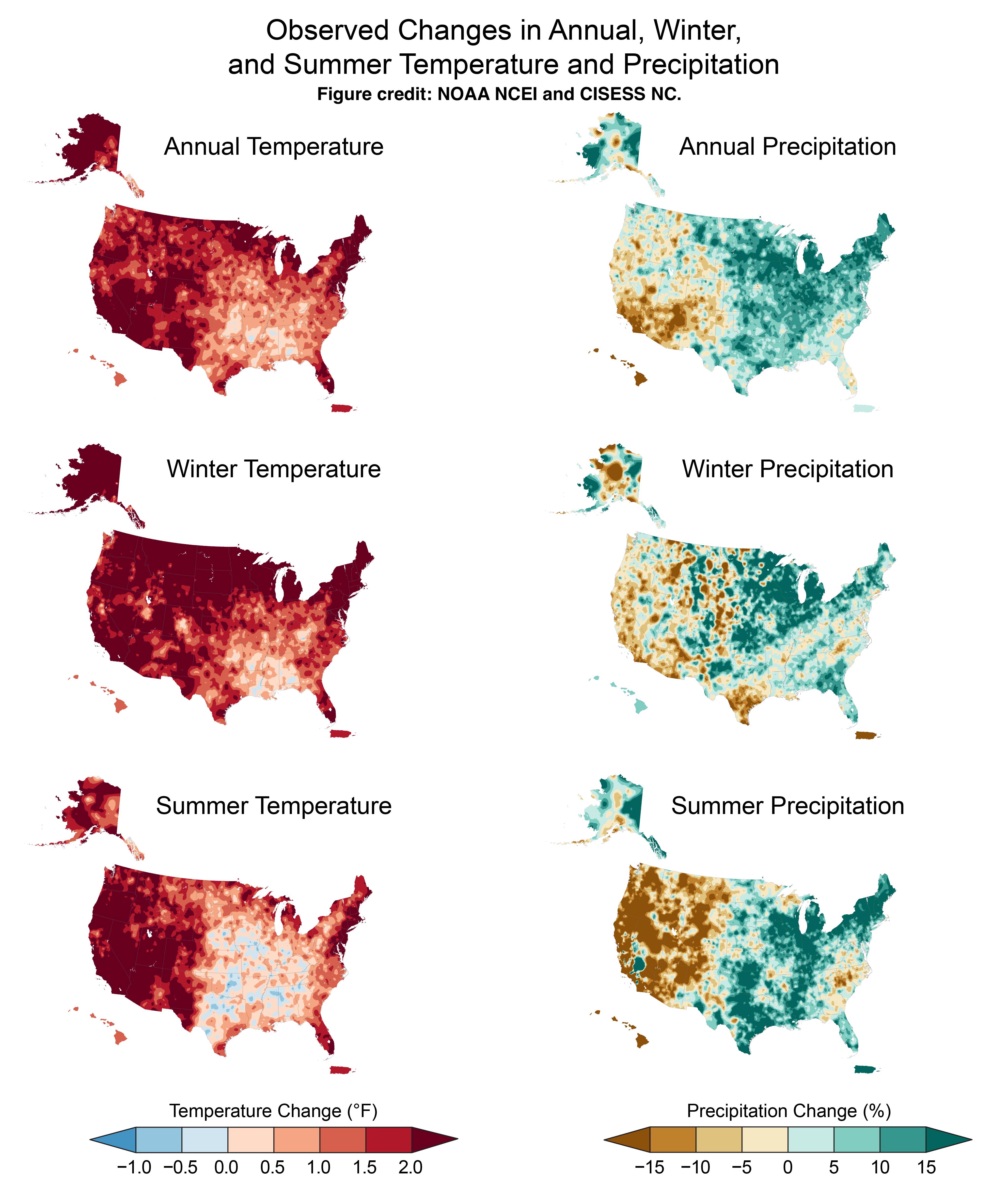
Much of the Northeast is getting warmer and wetter. These maps compare data for the 2002–2021 period to the average for the period of 1901–1960. Click to enlarge.
The Northeast is getting wetter.
Precipitation has increased annually and in all seasons (see figure above). The Northeast is expected to see more precipitation under all global warming scenarios.
The Northeast has seen a roughly 60% increase in the number of days with extreme precipitation, the largest increase of all the U.S. regions. The intensity of these events has also increased. This trend, along with an increased risk of flooding, is also expected to continue.
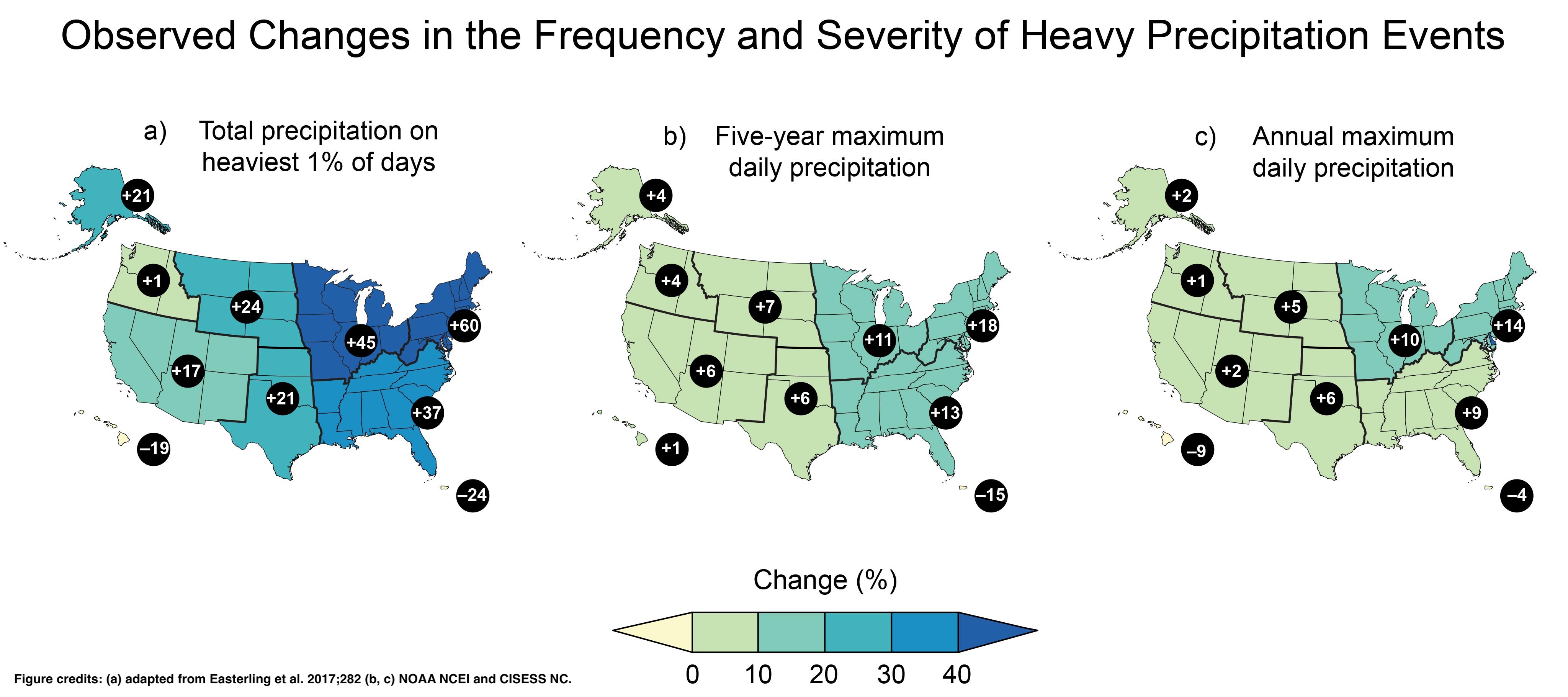
Extreme precipitation events have increased in frequency and intensity in the Northeast. Click to enlarge.
The ocean is getting warmer.
Climate change is affecting weather and ocean circulation patterns, which has led to surface waters along the Northeast coastline “warming faster than in most other regions.” Ocean warming is also contributing to higher rates of sea level rise, “with the highest rates between 1993 and 2020 observed along the Gulf and Mid-Atlantic Coasts (greater than 2.4 inches per decade of sea level rise).”
These ocean changes have been tied to numerous impacts such as an increased threat of flooding, more frequent heavy snowfalls, shifting distributions of ocean species, and more rapid intensification and slower decay of tropical cyclones. Under future scenarios, warmer ocean temperatures are expected to lead to stronger tropical cyclones, while increased sea level rise is expected to result in higher water levels during flooding from storms.
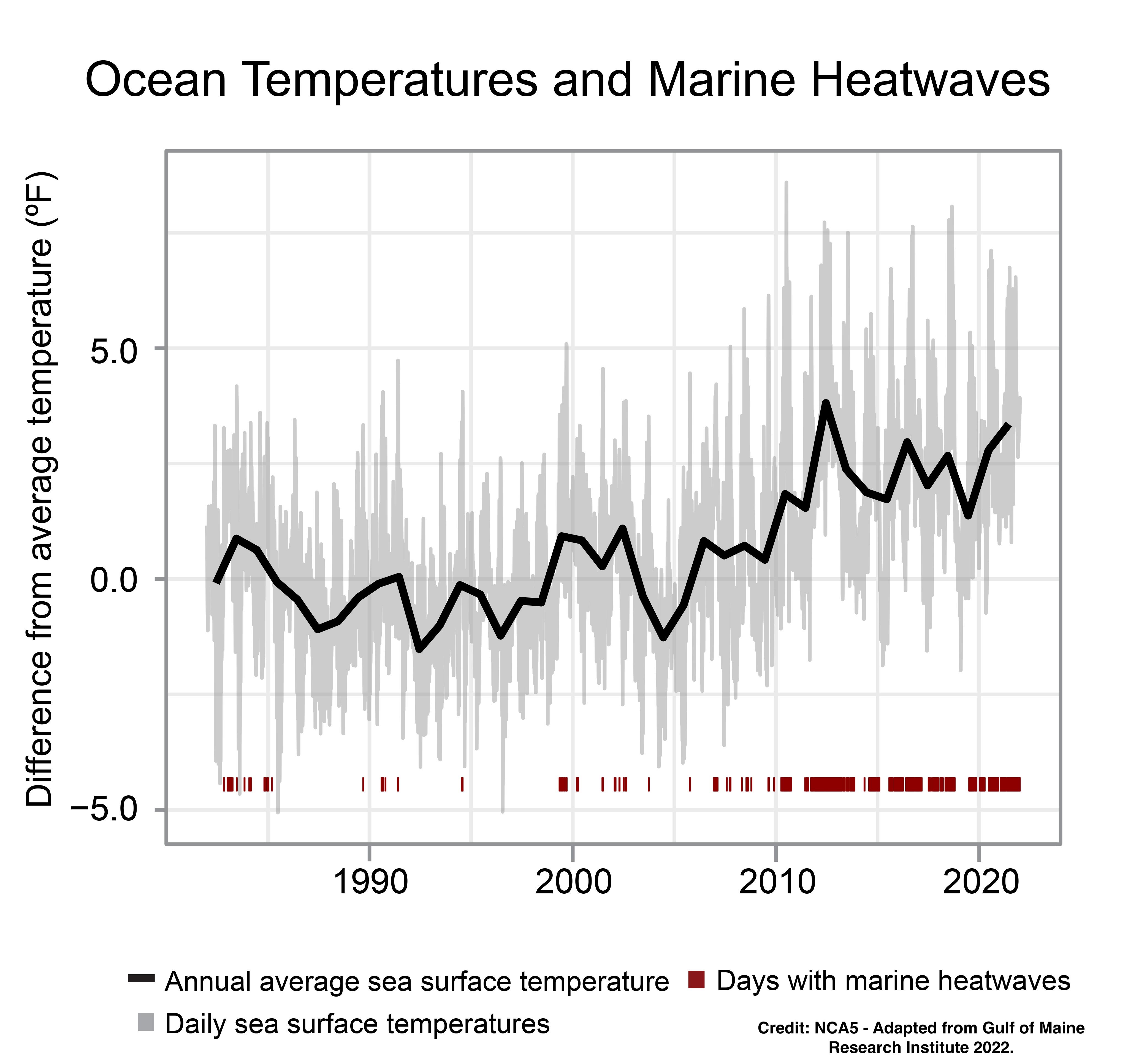
The Gulf of Maine is getting warmer and experiencing more frequent marine heat waves.