October - An Interesting Mix of Conditions
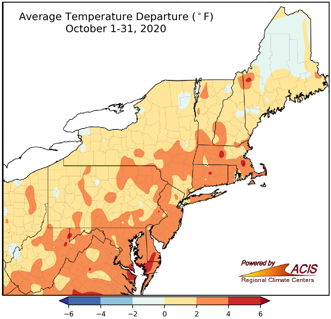
October temperatures ranged from near normal to 4°F above normal for much of the Northeast.
October temperatures ranged from 2°F below normal in parts of Maine to 6°F above normal in parts of Maryland and Delaware, with most of the region seeing temperatures range from near normal to 4°F above normal. Thirty-four major climate sites were warmer than normal, with four ranking this October among their 20 wettest on record.
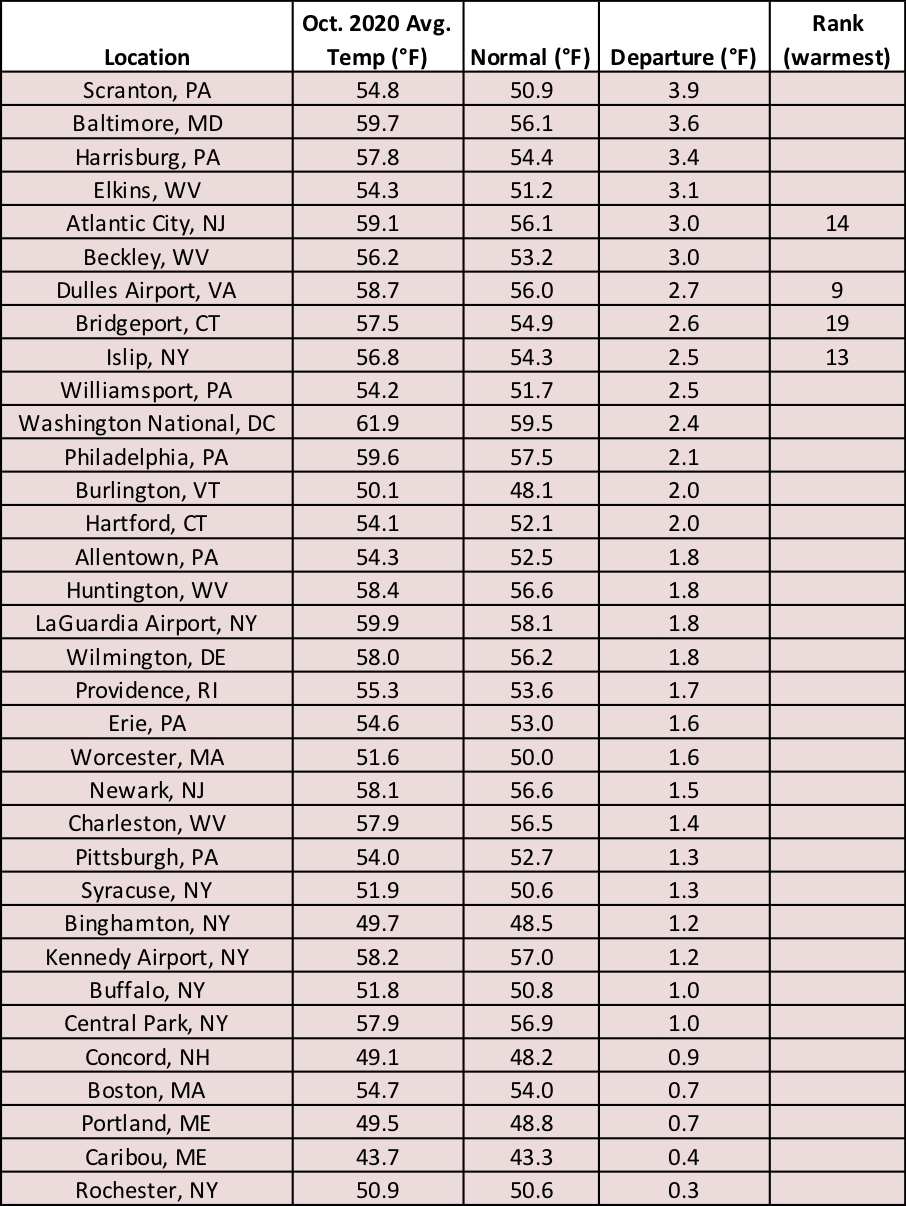
October temperatures at the major climate sites ranged from 0.3°F above normal in Rochester, NY, to 3.9°F above normal in Scranton, PA.
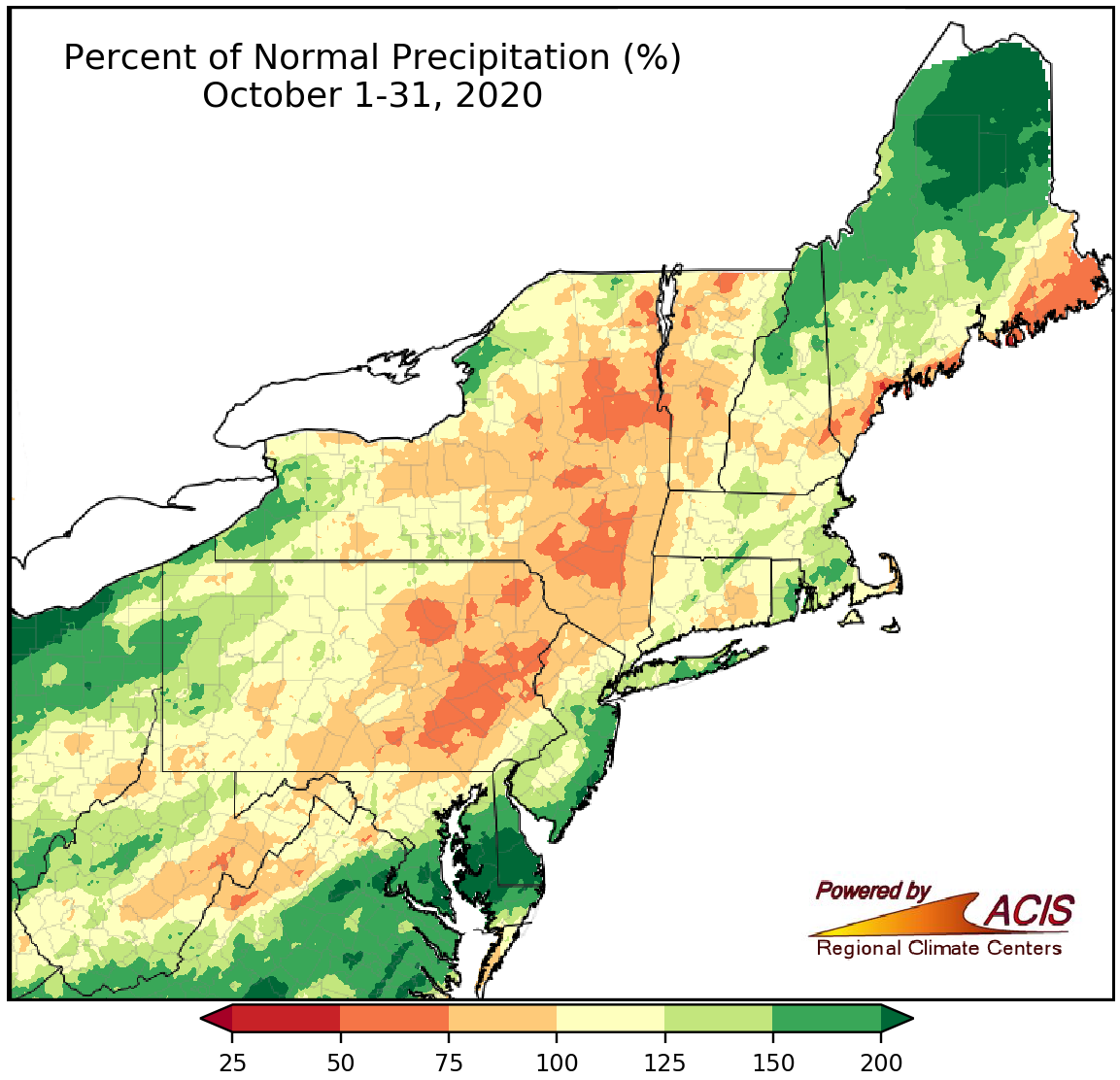
October precipitation ranged from 50% of normal to more than 200% of normal.
October precipitation ranged from 50% of normal in the eastern half of Pennsylvania, the eastern half of New York, portions of Vermont, and coastal Maine to more than 200% of normal in northern Maine, southern Delaware, and southern and eastern Maryland. Twenty-seven of the 35 major climate sites were wetter than normal, with nine of them having one of their 20 wettest Octobers on record. Above-normal precipitation allowed drought conditions to improve in some New England locations, particularly northern Maine. However, drier locations in such as Pennsylvania and northern West Virginia saw worsening conditions.
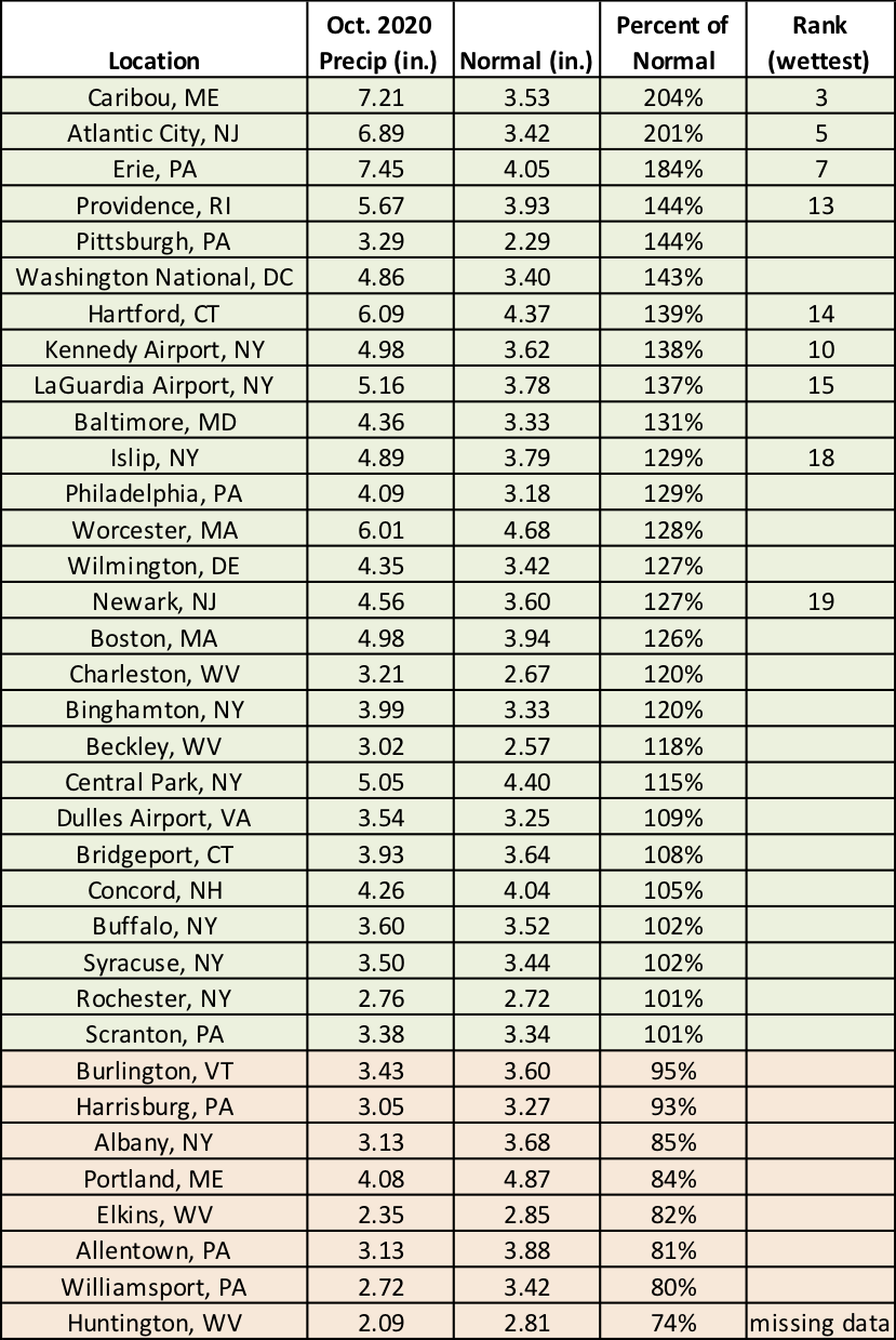
October precipitation at the major climate sites ranged from 74% of normal in Huntington, WV, to 204% of normal in Caribou, ME.
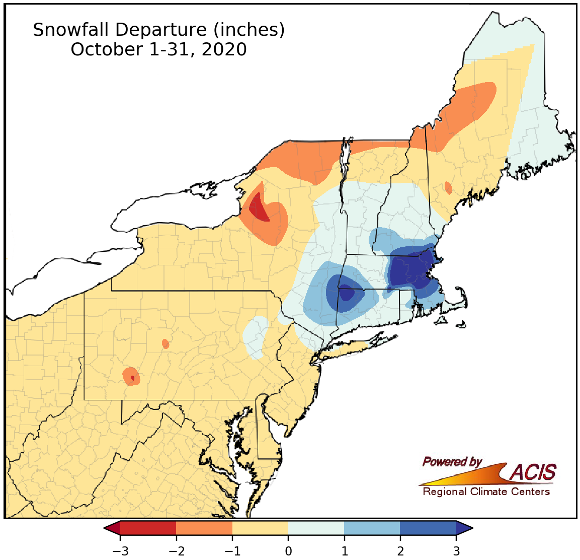
October snowfall ranged 3 inches below normal to more than 3 inches above normal.
October is not typically a snowy month in the Northeast. In fact, only 16 major climate sites typically experience snow during October, with most of those sites averaging less than an inch. However, the remnants of Tropical Storm Zeta helped portions of New York, Pennsylvania, New Jersey, and New England see their first snowfall of the year on October 30. The greatest snowfall totals of at least 6 inches were in central and eastern Massachusetts. Boston, MA, picked up 4.3 inches of snow, making it the site’s snowiest October and snowiest October day on record. It was also the site’s second earliest first inch of snow. Providence, RI, saw 1.6 inches of snow, tying as the site’s snowiest October day on record. Overall, snowfall across the Northeast for October ranged from 3 inches below normal in lake-effect areas of northern New York to more than 3 inches above normal in portions of southern New England.
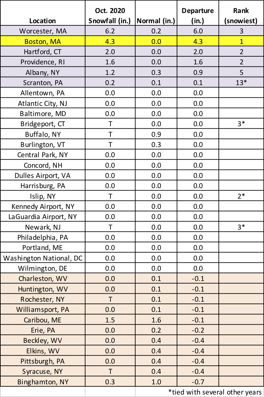
October snowfall at the major climate sites ranged from 0.7 inches below normal in Binghamton, NY, to 6.0 inches above normal in Worcester, MA, with Boston, MA, having its snowiest October on record.
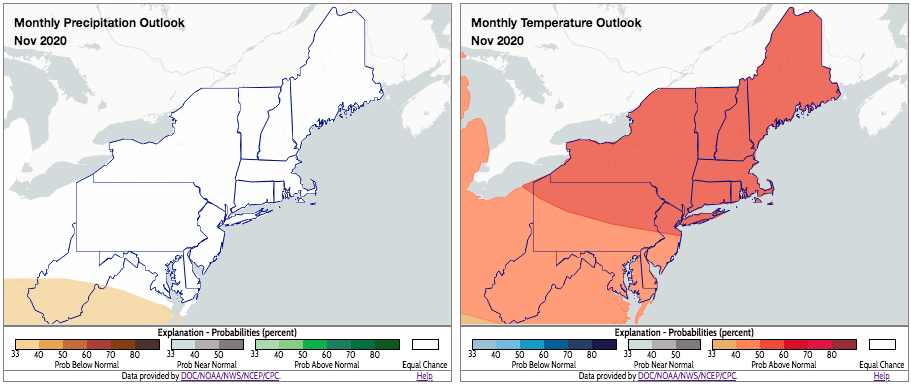
November is expected to average out to be warmer than normal for the Northeast. click to enlarge.
There’s a tilt toward above-normal temperatures for the entire Northeast for November, according to NOAA’s Climate Prediction Center. As for precipitation, equal chances for below-, near-, or above-normal precipitation are favored for most of the region, except the southern half of West Virginia where there is a slight tilt towards a drier-than-normal conditions.