The Curtain Comes Down on October
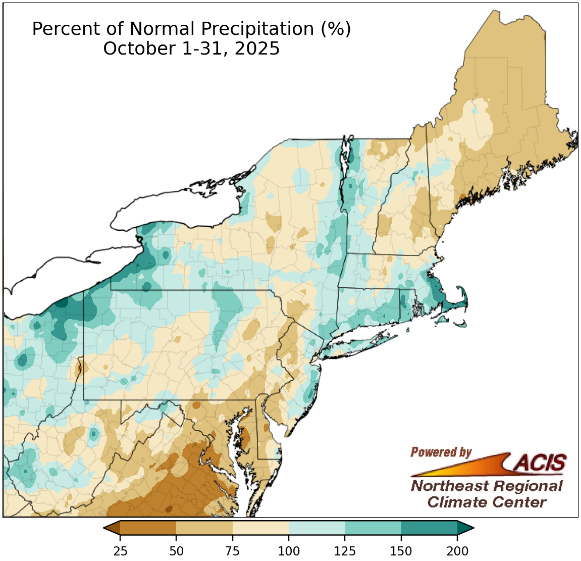
October precipitation generally ranged from 50% of normal to 200% of normal.
A large portion of the Northeast experienced drier-than-normal weather up until the last few days of the month when a storm brought notable precipitation that boosted monthly totals. Overall, October precipitation generally ranged from 50% of normal to 200% of normal. Some of the driest locations included much of Maine, most of Delaware, and a large portion of Maryland, with abnormal dryness and drought expanding or intensifying. Meanwhile, some of the wetter places like southeastern Massachusetts, western New York, and northwestern Pennsylvania saw drought and dryness improve. October precipitation at the region’s 35 major sites ranged from 52% of normal in Washington, D.C., to 206% of normal in Erie, PA, with 16 sites being drier than normal, one at normal, and 18 being wetter than normal. This October ranked among the 20 wettest Octobers for five major sites but as the 20th driest for Dulles Airport, VA.
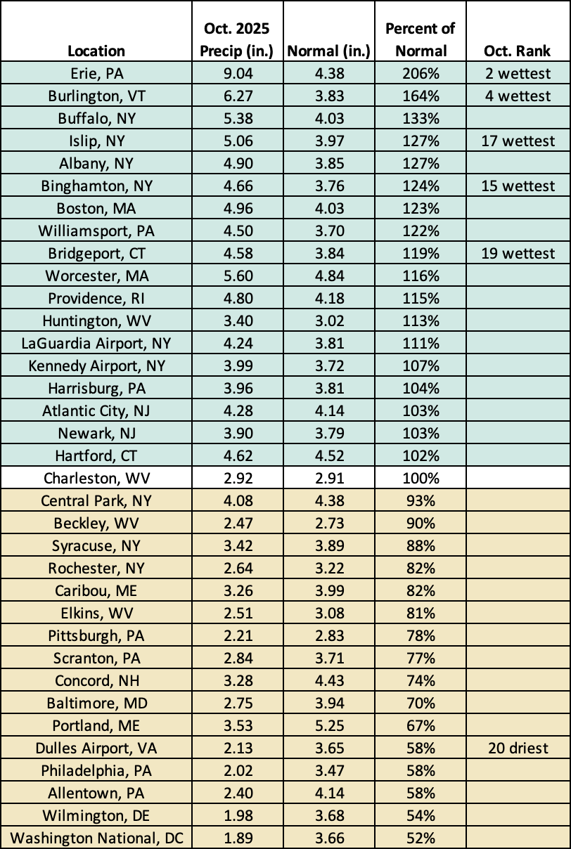
This October ranked among the 20 wettest Octobers for five major sites but as the 20th driest at Dulles Airport, VA.
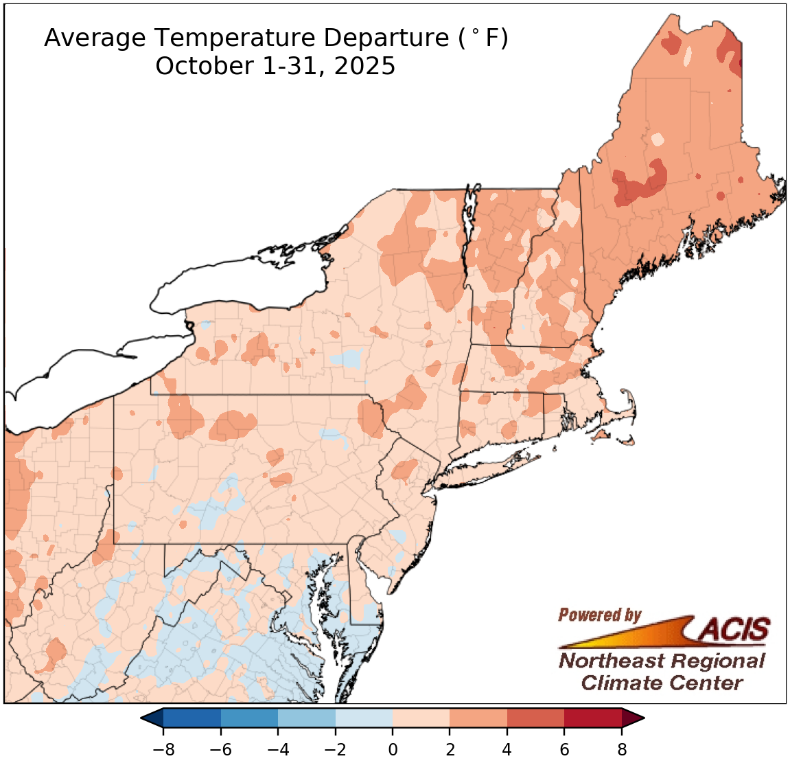
October temperatures ranged from 2°F below normal to 4°F above normal for most of the Northeast.
Much of the Northeast had a warmer-than-normal October, with average temperatures mostly up to 4°F above normal and the greatest departures particularly concentrated in northern New England. However, some locations, particularly in southern parts of the region, were as much as 2°F cooler than normal. October average temperatures at the region’s 35 major sites ranged from 0.7°F below normal in Scranton, PA, to 3.5°F above normal in Caribou, ME, with 28 of the sites wrapping up the month on the warm side of normal. This October ranked among the 20 warmest Octobers on record for four major sites.
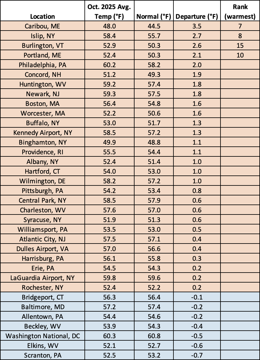
This October ranked among the 20 warmest Octobers for four major sites.
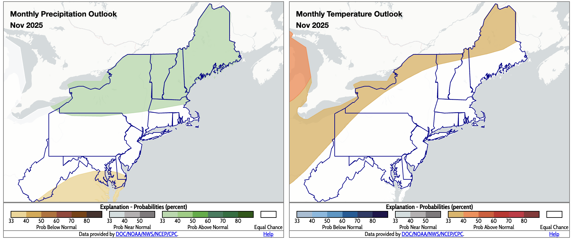
November is expected to be wetter than normal for northern areas (shaded green) but drier than normal for some southern spots (shaded tan). Above-normal temperatures are favored for some interior and northern locations (shaded orange). Click to enlarge.
November outlooks from NOAA’s Climate Prediction Center favor drier-than-normal conditions for southeastern West Virginia, southern and eastern Maryland, and southern Delaware, while wetter-than-normal weather was predicted for northern New England, portions of Massachusetts, and much of New York. Equal chances of below-, near-, or above-normal precipitation were forecast for the rest of the Northeast. Meanwhile, an area from northwestern Pennsylvania through western and northern New York and into northern parts of northern New England are expected to average out to be warmer than normal for November. The rest of the region falls into the equal chances category.