A Warm, Dry September-to-Date For Most
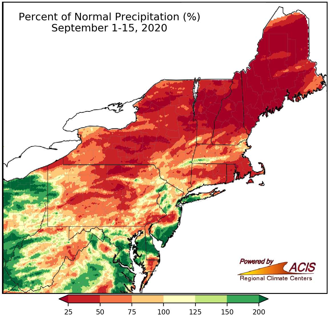
Precipitation during the first half of September ranged from less than 25% of normal to more than 200% of normal.
So far, September has been drier than normal for many parts of the Northeast. The driest locations, which saw less than 25% of normal precipitation, were in northern New England, northern and central New York, and northern Pennsylvania. Twenty-three of the 35 major climate sites were drier than normal, with eight ranking this first half of September among their 20 driest on record. With continued below-normal precipitation, drought conditions worsened in New England. However, a few locations, particularly western West Virginia, southern and eastern Maryland, central Delaware, southern New Jersey, and western Long Island, were wetter, seeing more than 200% of normal precipitation. Seven of the 12 wetter-than-normal major climate sites ranked this first half of September among their 20 wettest on record.
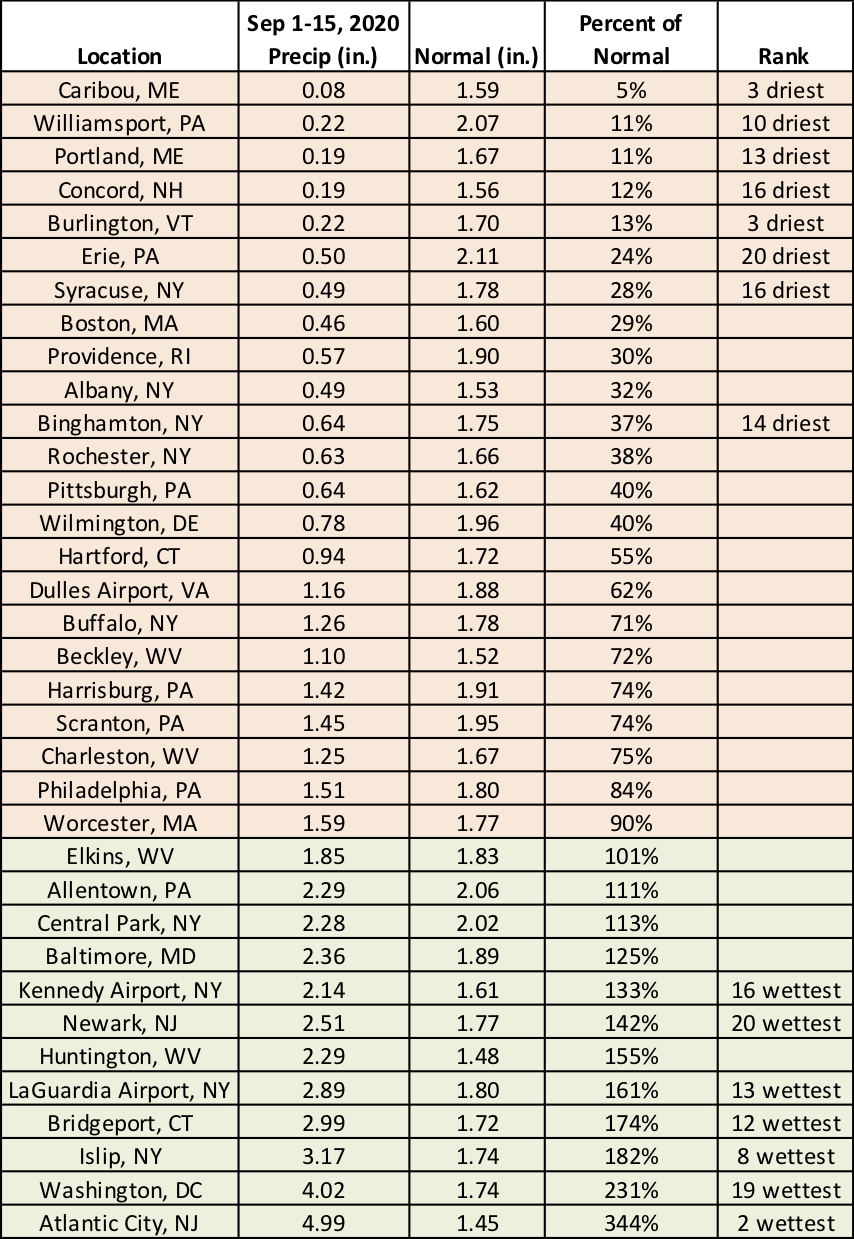
September 1-15 precipitation ranged from 5% of normal in Caribou, ME, to 344% of normal in Atlantic City, NJ.
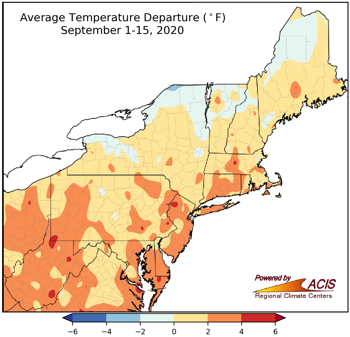
Average temperatures during the first half of September ranged from 2°F below normal to 4°F above normal for most of the Northeast.
While a few spots, mainly in northern New England and northern and western New York, were as much as 2°F colder than normal, a majority of the Northeast experienced a warmer-than-normal start to September, with the warmest locations as much as 4°F above normal. Overall, 33 major climate sites were warmer than normal, with seven ranking this first half of September among their 20 warmest on record.
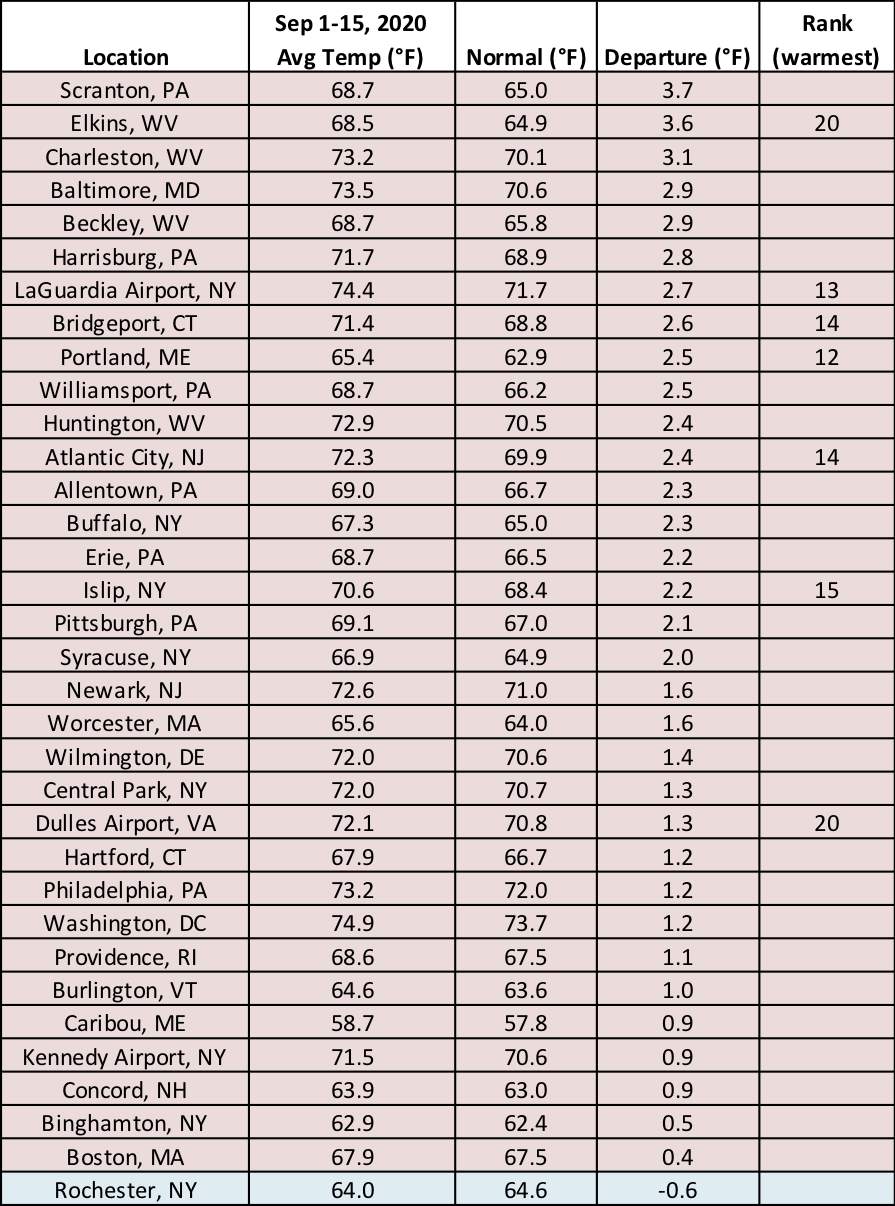
September 1-15 average temperatures ranged from 0.6°F below normal in Rochester, NY, to 3.7°F above normal in Scranton, PA.