A Fine Line Between Wet & Dry
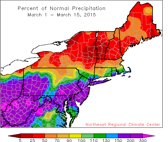
There was a sharp contrast between wet areas and dry areas during the first half of March.
A parade of storms marched across West Virginia and the Mid-Atlantic during the first half of March. Nineteen of the 35 Northeast airport climate sites ranked the period among their top 20 wettest starts to the month, with Atlantic City, NJ, and Kennedy Airport, NY, being record-wet. The wet areas also tended to be snowier than normal, with 16 sites ranking the period among their top 20 snowiest. Conversely, New York and New England were quite dry, with some sites seeing less than 25 percent of normal precipitation. These dry areas also tended to be less snowy.
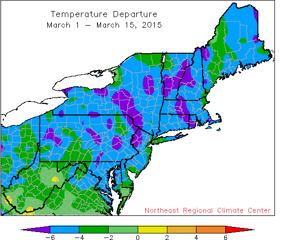
The entire region was colder than normal during the first two weeks of March.
The chill of winter lingered into the first two weeks of meteorological spring, with temperatures running 2 to 6 degrees F colder than normal for most of the region. Of the 34 airport climate sites that were colder than normal, 13 sites ranked the first half of March among their top 20 coldest.