A Temperature Switcheroo
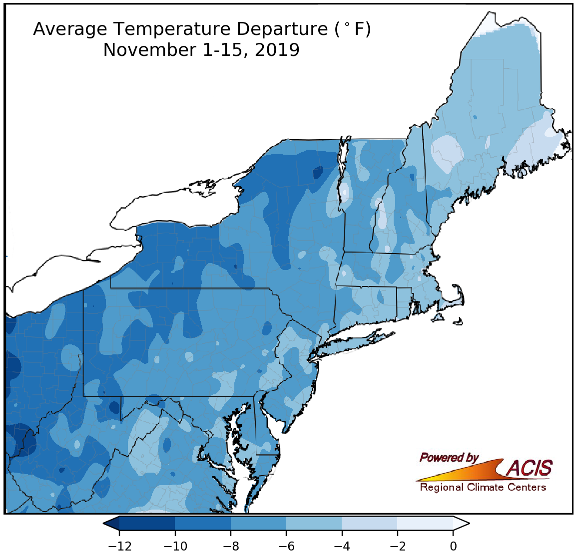
November 1-15 temperatures were as much as 12°F colder than normal.
After a mild September and October, November ushered in a new weather pattern that sent temperatures into a nosedive. The entire Northeast has been colder than normal so far this month, with average temperatures as much as 12°F below normal. Even though West Virginia had the largest departures from normal, it was two western New York sites, Rochester and Buffalo, that had their coldest first half of November on record. Another 28 major climate sites ranked this November 1-15 period among their ten coldest. Average temperature departures at the major climate sites ranged from 10.5°F below normal in Huntington, WV, to 3.5°F below normal in Boston, MA. In addition, the remainder of the Northeast saw their first frost. LaGuardia Airport, NY, had its frost on November 8, over two weeks earlier than usual and tying as the site’s eighth earliest.
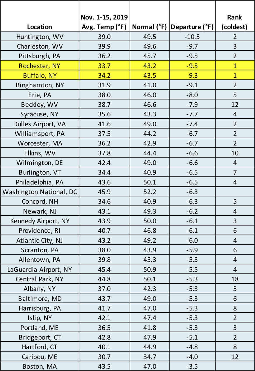
Rochester and Buffalo had their coldest first half of November, with another 31 sites ranking it among their 20 coldest.
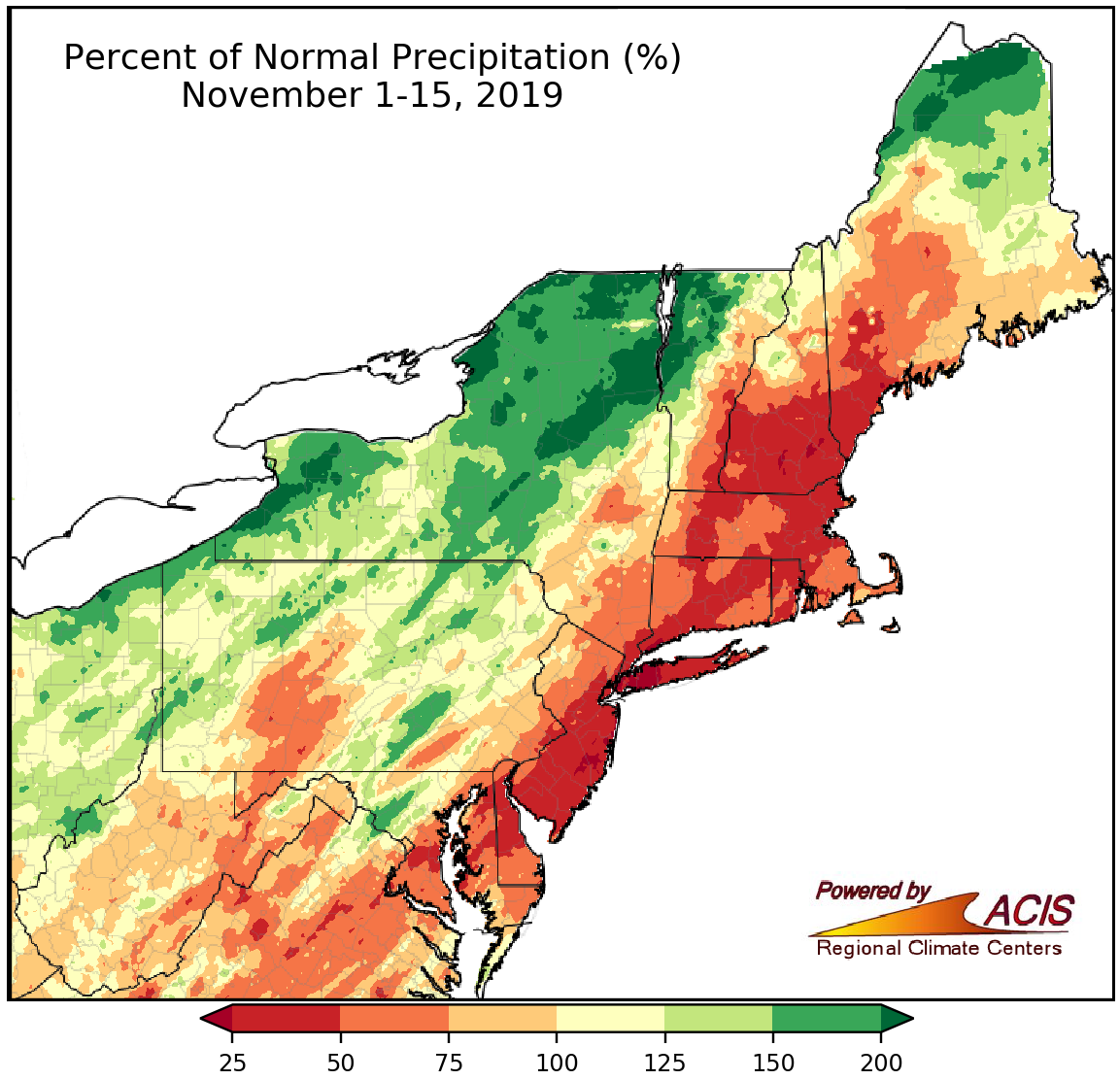
November 1-15 precipitation ranged from less than 25% of normal to more than 200% of normal.
Precipitation during the first two weeks of November varied, ranging from less than 25% of normal to more than 200% of normal. The driest conditions were generally found in an area extending from southern Maryland to southern Maine, while the wettest conditions tended to be in western and northern New York, western Vermont, and northern Maine. Precipitation at the major climate sites ranged from 6% of normal in Bridgeport, CT, and Kennedy Airport, NY, to 107% of normal in Burlington, VT, with 15 of them ranking this November 1-15 period among their 20 driest on record. Side note - since the major climate sites report at midnight, the heavy rain on Halloween became part of October’s precipitation total. However, at climate sites that report in the morning, the Halloween rainfall is part of November’s precipitation total. This means the major climate sites are quite dry for November but the precipitation map shows some very wet conditions in parts of the region.
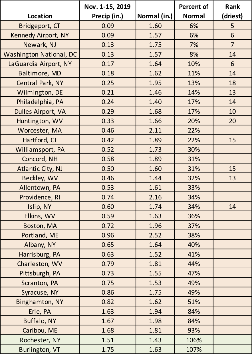
Fifteen major climate sites had one of their driest November 1-15 periods on record.
With cold air entrenched in the region, several additional locations saw their first measurable snow (at least 0.1 inches). For instance, Islip, NY, reported 0.1 inches of snow on November 12, almost a full month earlier than usual, which tied as the site’s fourth earliest measurable snow on record. Several sites even received their first inch of snow, and for all but Caribou, ME, it arrived earlier than average.
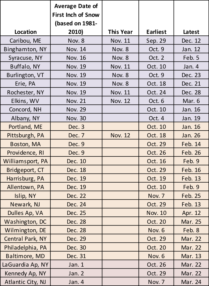
The first inch of snow arrived earlier than usual for several sites.
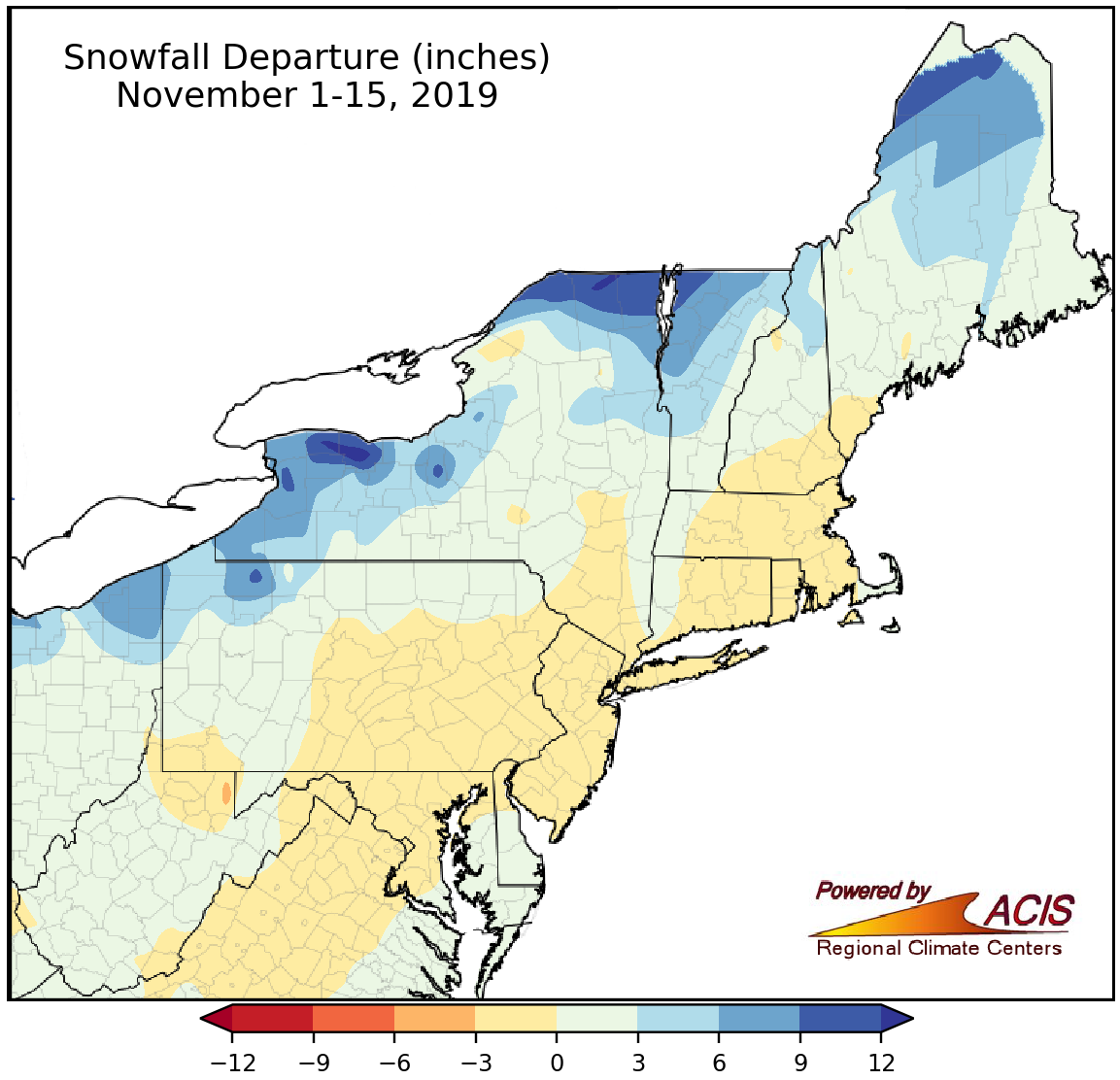
Portions of Pennsylvania, New York, and northern New England have seen a snow surplus of six or more inches so far this November.
The first half of November is typically not very snowy for a majority of the Northeast, with average snowfall ranging from none in Atlantic City, NJ, and the New York City area up to 3.6 inches in Caribou, ME. So far this November, snowfall has generally ranged from within an inch of normal up to 15.5 inches above normal in Rochester, NY. In fact, 12 major climate sites ranked this November 1-15 among their 20 snowiest on record.
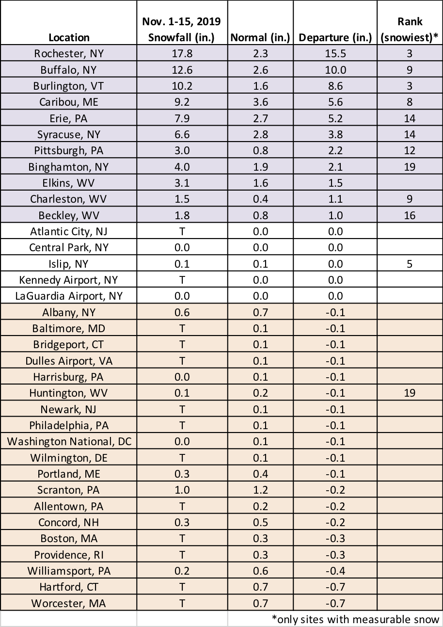
The first two weeks of November 2019 ranked among the 20 snowiest on record for 12 major climate sites.