Dreaming of a White Christmas?
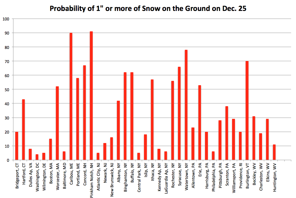
Probabilities of a white Christmas for select US and Northeast cities.
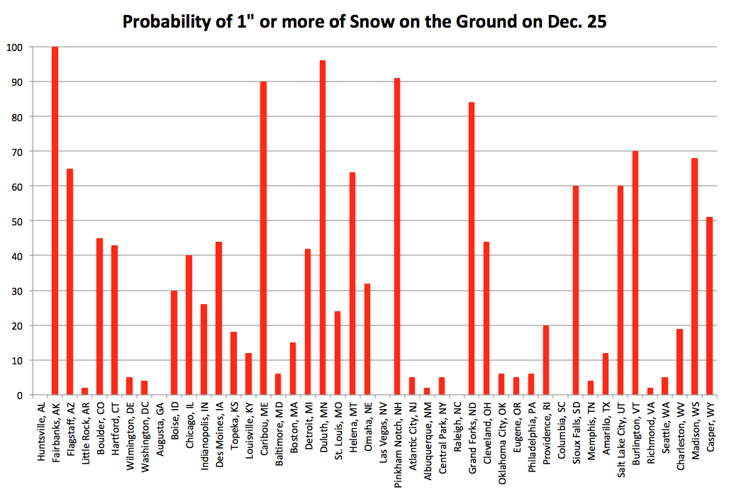
We’ve calculated the probabilities for an inch of snow on the ground on December 25th, based on data from 1967-2016, for select U.S. and Northeast cites. Does it seem like the same places are lucky enough to have a white Christmas year after year? Well, you’re right. Places like Caribou, ME and Pinkham Notch, NH have pretty high probabilities for snow on the ground each year at 90% and 91% respectively. So, when was the last time your city had a white Christmas??
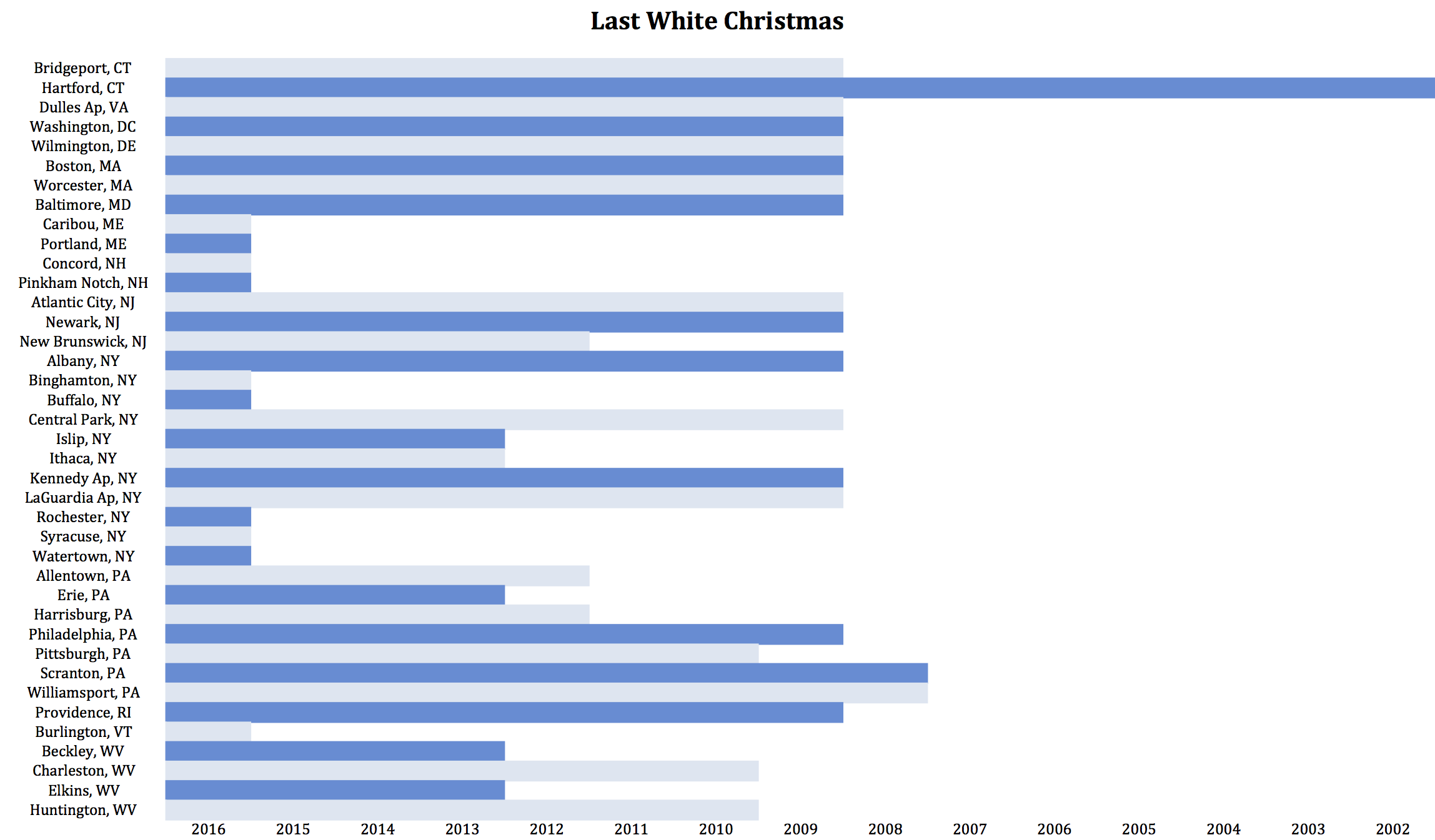
Year of last white Christmas.
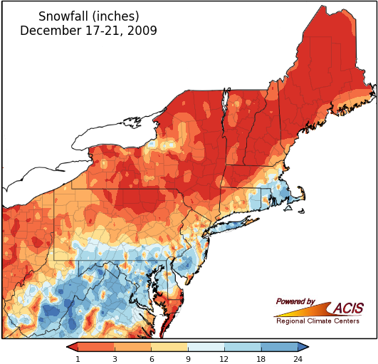
Poor Harford, CT hasn’t seen a white Christmas since 2002! Fifteen of the selected stations had their last white Christmas in 2009. What happened that year? There was a significant Nor’easter a few days before the holiday and parts of the Mid-Atlantic region saw almost as much snow in a weekend as they get in a typical winter season. The following days were cold enough for the white stuff to hang around for Christmas.
Snowfall totals for December 17-21, 2009.
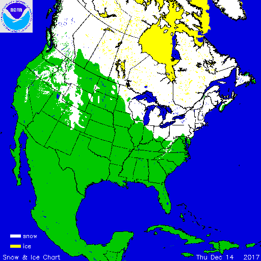
What about this year? Currently, snow does blanket part of the region thanks to lake effect snow, a storm system that brought the season’s first major snow to parts of the region on December 9th, and a winter weather pattern that has brought cold air and snow showers this week.
Snow cover as of December 14th, these maps were produced by the NOAA, National Operational Hydrologic Remote Sensing Center.
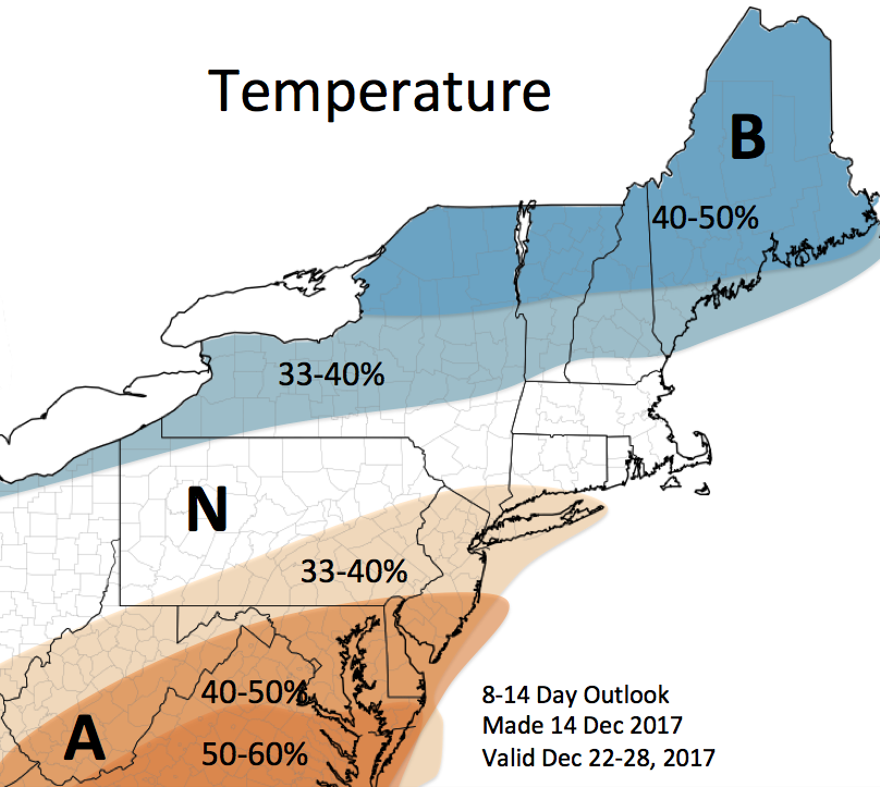
But will it last? NOAA’s Climate Prediction Center’s outlook for December 22-28 favors below-normal temperatures for northern New England and northern New York, but favors above-normal temperatures for the Mid Atlantic, southeast Pennsylvania, and West Virginia. Areas in between are expected to have near-normal temperatures. We’ll need below-freezing temperatures for the snow cover to last and our dreams of a white Christmas to come true!
Temperature outlook for December 22-28.

