July 4th Climatology
The Fourth of July has featured some interesting weather. Here’s a look at past conditions at the 35 major climate sites based on each site’s period of record.
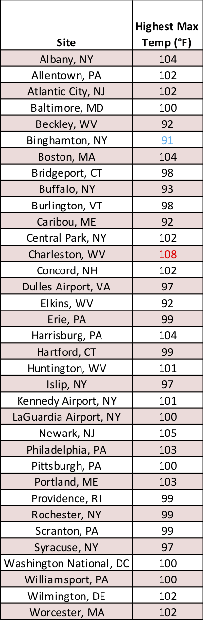
The highest temperatures recorded on July 4 at the major climate sites.
While the average high temperature on July 4th ranges from 75.0°F in Caribou, ME, to 86.5°F in Washington, D.C., the entire Northeast has seen scorching temperatures on Independence Day. All 35 major climate sites have topped 90°F. In fact, around a third of all Independence Days hit the 90°F mark in the Baltimore-Washington metro area and southwestern West Virginia. Even hotter temperatures of 100°F or higher have been reported at 19 of the major climate sites. The hottest spot - Charleston, WV, which soared to 108°F in 1931.
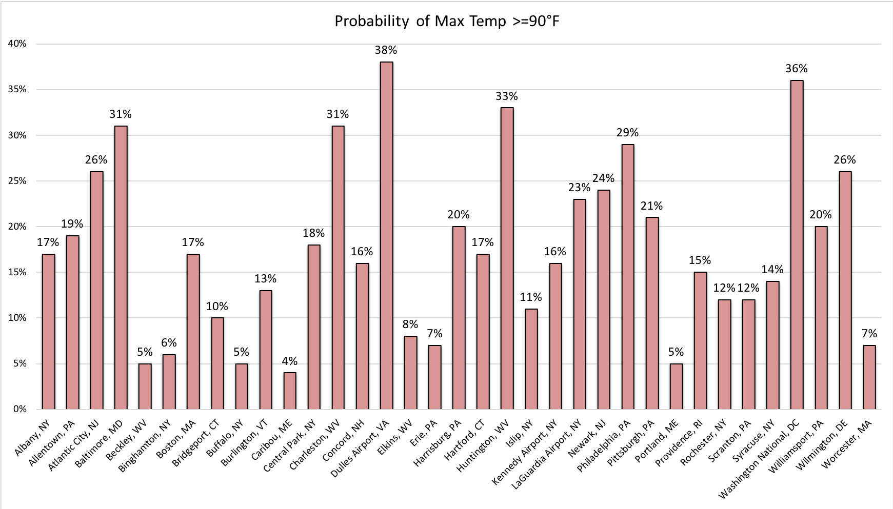
The probability of highs reaching 90°F or greater on July 4. Click to enlarge.
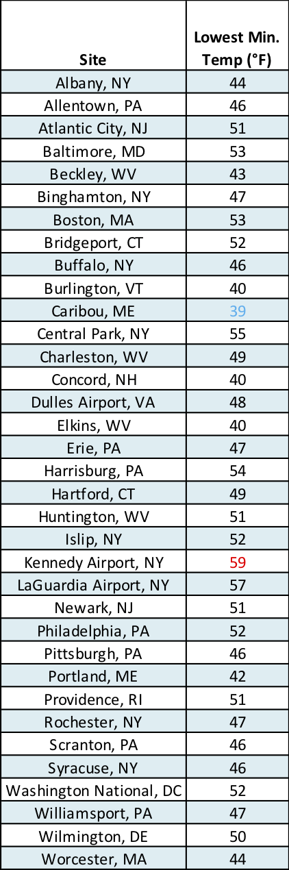
The lowest temperatures observed on July 4 at the major climate sites.
Average low temperatures on July 4th range from 53.9°F in Caribou, ME, to 68.2°F in Washington, D.C. However, temperatures at 20 of the major climate sites have dropped under 50°F, with the coldest location being Caribou at 39°F in 1982. That site is also one of only four locations that have failed to have a low temperature of 70°F or warmer on Independence Day. On the other hand, Washington, D.C.’s low stays at or above 70°F on nearly half of all Independence Days.
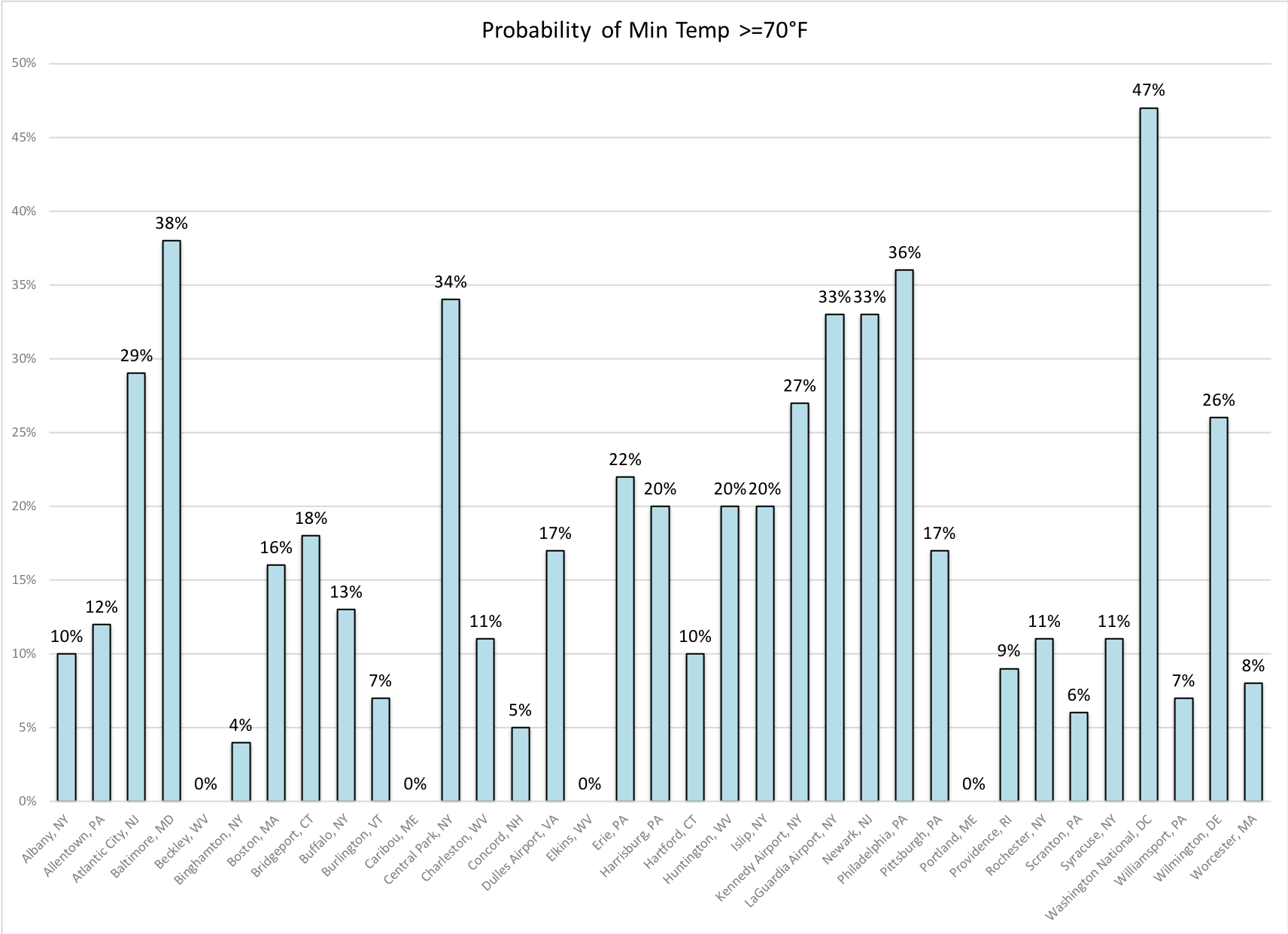
The probability of lows staying at or above 70°F on July 4 at the major climate sites. Click to enlarge.
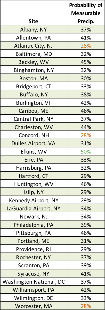
The probability of measurable precipitation (0.01 inches) on July 4 at the major climate sites.
The likelihood of measurable precipitation on July 4 ranges from 28% at Atlantic City, NJ; Concord, NH; and Worcester, MA, to 50% at Elkins, WV. However, the wettest locations on Independence Day were Huntington, WV, and Kennedy Airport, NY, each seeing around 3 inches of rain (in 1932 and 1981, respectively).
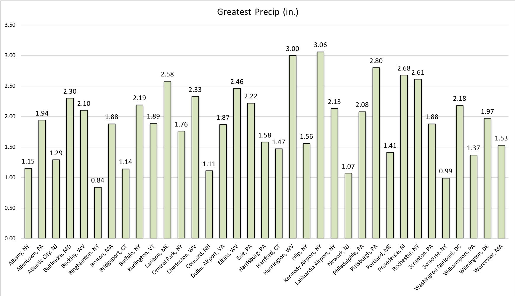
The greatest rainfall for each site on July 4 at the major climate sites. Click to enlarge.
There have been 10 tornadoes since 1950 on July 4th in the Northeast - three each in West Virginia and Pennsylvania and one each in Maryland, Massachusetts, Vermont, and Maine. The strongest of those was an EF-2, while the most recent occurred in 2016.
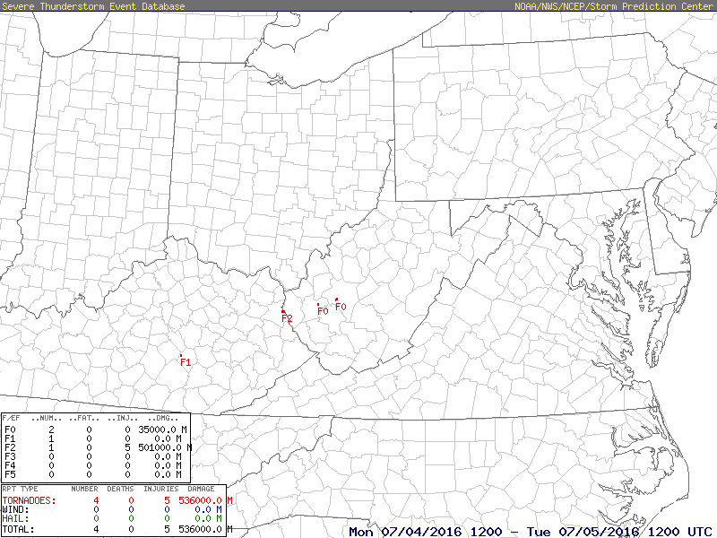
Three tornadoes moved through West Virginia on July 4, 2016. Click to enlarge.
The July 4th holiday in 2014 was impacted by Hurricane Arthur, which dumped heavy rain on New England. The greatest rain totals of 5 to 8 inches were in southeastern Massachusetts and eastern Maine, where flash flooding made roads impassable. In addition, wind gusts of over 60 mph downed trees and caused power outages. Some fireworks shows and holiday events were postponed or cancelled.
To see what this year’s July 4th has in store weather-wise, visit your local National Weather Service office website - https://www.weather.gov/
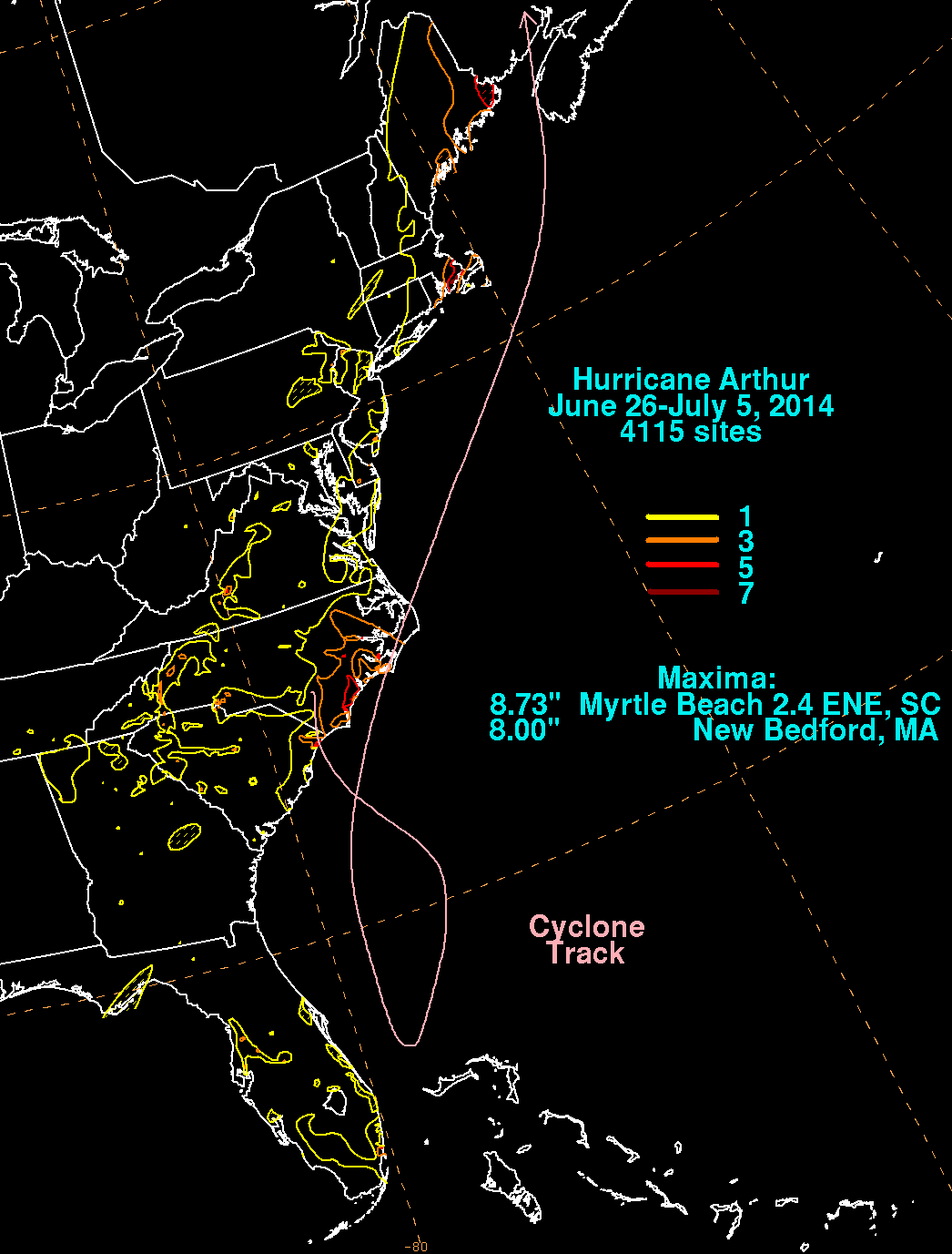
Hurricane Arthur’s track and rain totals. Image courtesy of NOAA.