Another June in the Record Books
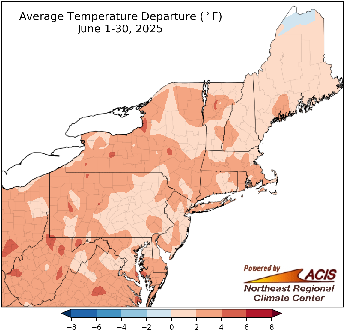
June average temperatures ranged from near normal to 6°F above normal.
After a somewhat sluggish start to summer temperature-wise, the second half of June featured a record-setting heat event in the Northeast. For example, several sites set or tied their record for hottest June temperature, with Providence, RI, and Islip and Kennedy Airport, NY, hitting 100°F or higher for the first time in June. This heat wave helped push the Northeast to be warmer than normal by as much as 6°F for the month. At the Northeast’s 35 major sites, June average temperatures ranged from 0.1°F above normal in Caribou, ME, to 4.0°F above normal in Huntington, WV. In fact, this June was the hottest on record for Islip, NY, and ranked among the 20 hottest for another 28 of the sites.
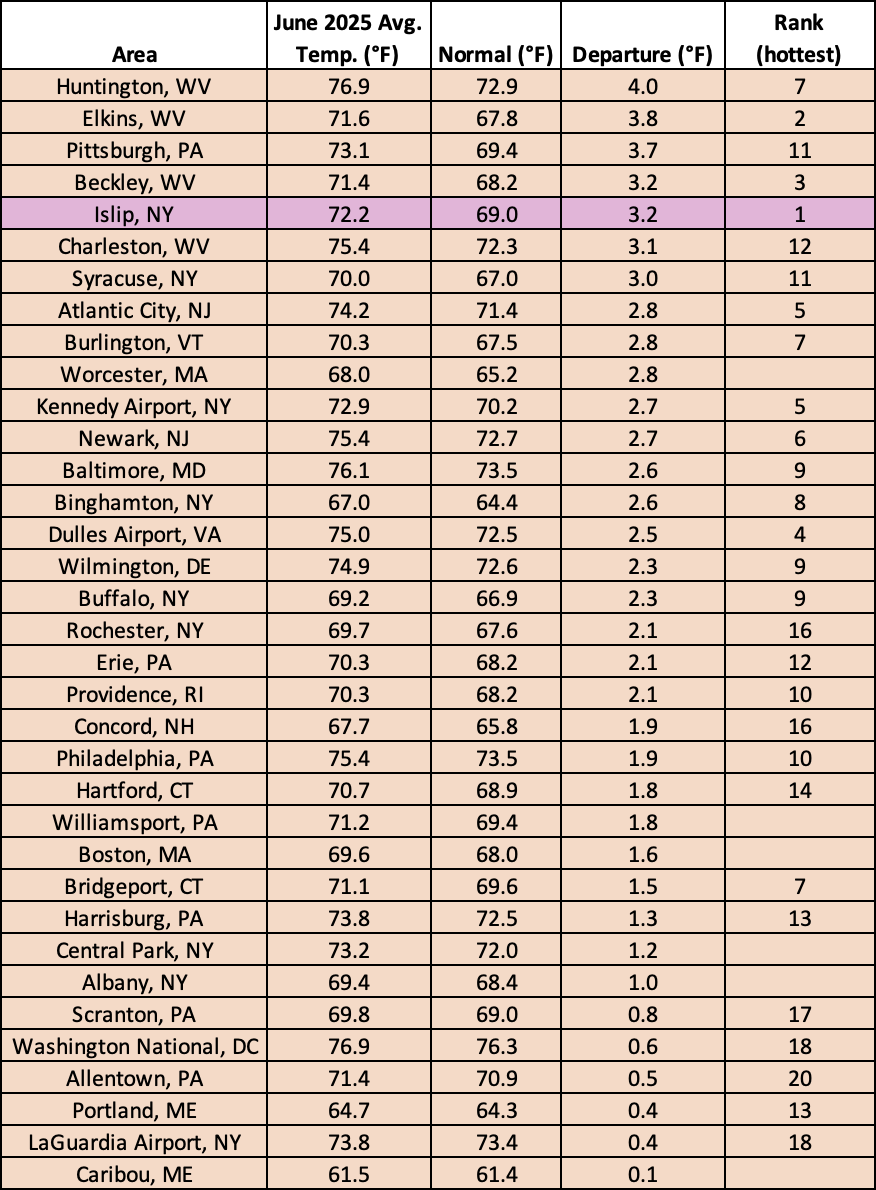
This June was record hot for Islip, NY, and among the 20 hottest for another 28 of the sites.
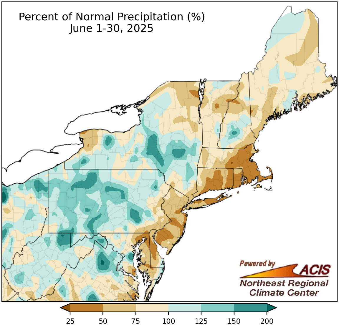
June precipitation ranged from less than 25% of normal to 200% of normal.
As is typical during the summer convective season, precipitation during June was variable, ranging from less than 25% of normal to 200% of normal. Some of the driest locations were found in an area from eastern Maryland to eastern Massachusetts, while some of the wettest sites were along a path from northern West Virginia to eastern New York. June precipitation at the Northeast’s 35 major sites ranged from 19% of normal in Worcester, MA, to 177% of normal in Rochester, NY, with 24 sites falling on the dry side of normal. This June ranked among the 20 driest for five sites but among the 20 wettest for three others.
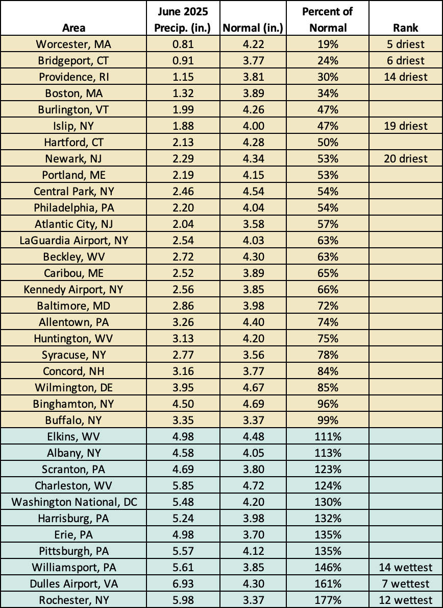
June 2025 was among the 20 driest Junes for five major sites but among the 20 wettest for three other major sites.
There have also been several notable significant weather events in the Northeast this June. This included devastating flash flooding that resulted in at least nine deaths in Ohio County, WV, and likely New York’s third deadliest tornado since records started in 1950. More details on severe weather and flash flooding events, as well as the June heat wave, will be included in our June summary to be published around July 8.
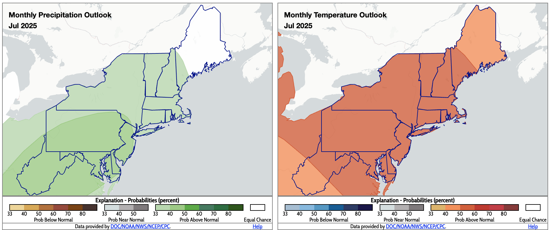
For July, NOAA’s Climate Prediction Center favors above-normal precipitation for much of the Northeast (shaded green) and above-normal temperatures for the entire region (shaded orange). Click to enlarge.
The July outlooks from NOAA’s Climate Prediction Center show an increased likelihood of above-normal precipitation for almost the entire Northeast, except a chunk of Maine. Meanwhile, the entire Northeast is expected to average to out be warmer than normal for July.