A Fascinating February-To-Date
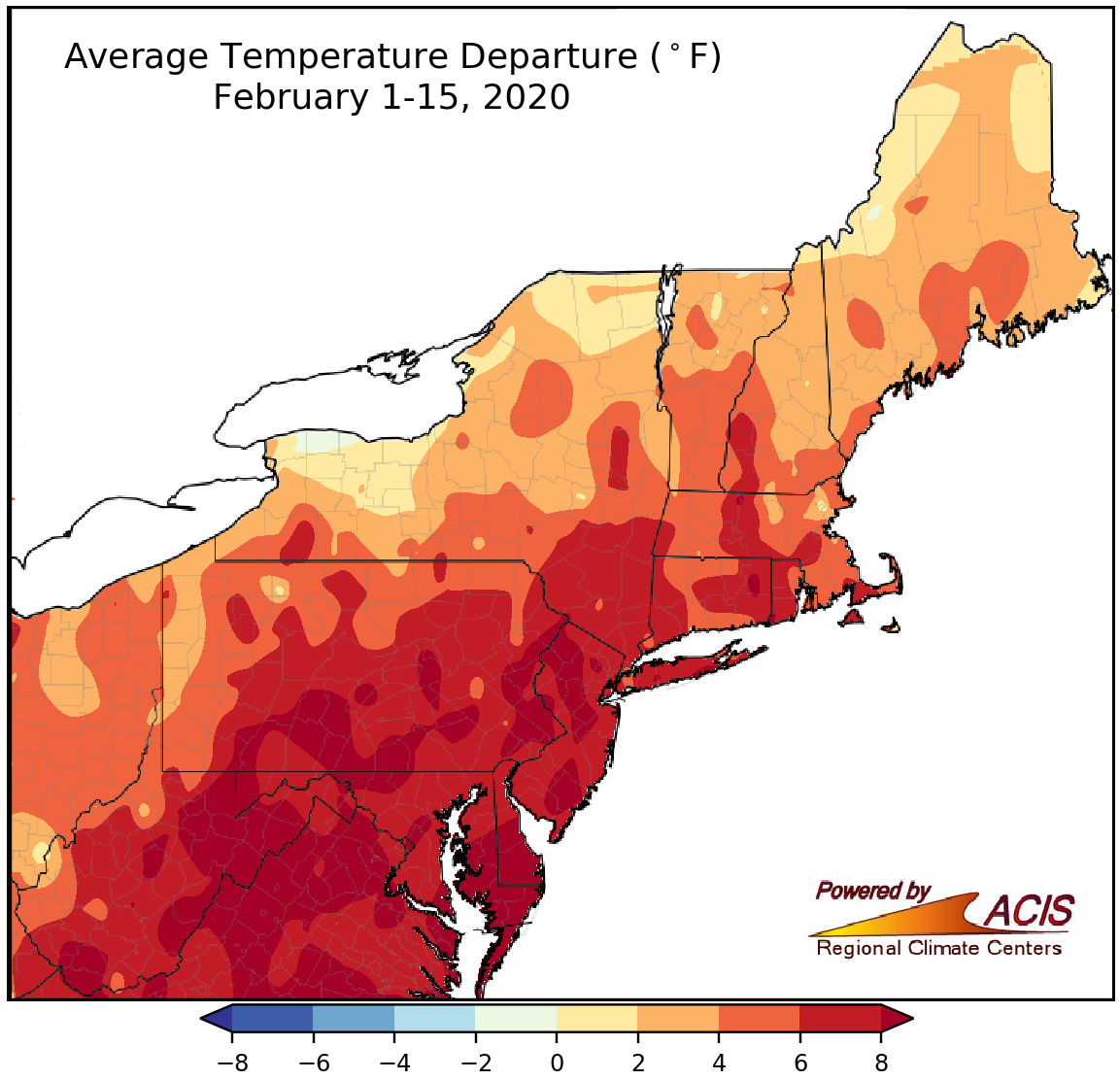
February 1-15 average temperatures ranged from near normal to more than 8°F above normal.
February has been much warmer than normal for Northeast, with average temperatures ranging from within 2°F of normal in parts of western/northern New York and Maine to more than 8°F above normal in parts of southern/eastern Pennsylvania, West Virginia, and the Mid-Atlantic. All 35 major climate sites were warmer than normal as average temperatures ranged from 1.6°F above normal in Caribou to 9.7°F above normal in Allentown. Twenty-six of the sites ranked this first half of February among their 20 warmest, with it being record warm for Allentown and Islip.
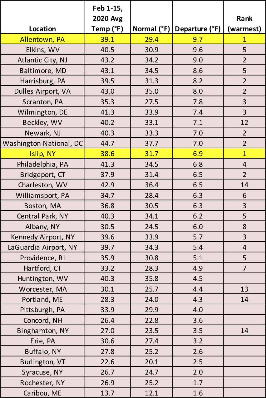
Allentown and Islip had their armest start to February on record, with another 24 major climate sites ranking the period among their 20 warmest.
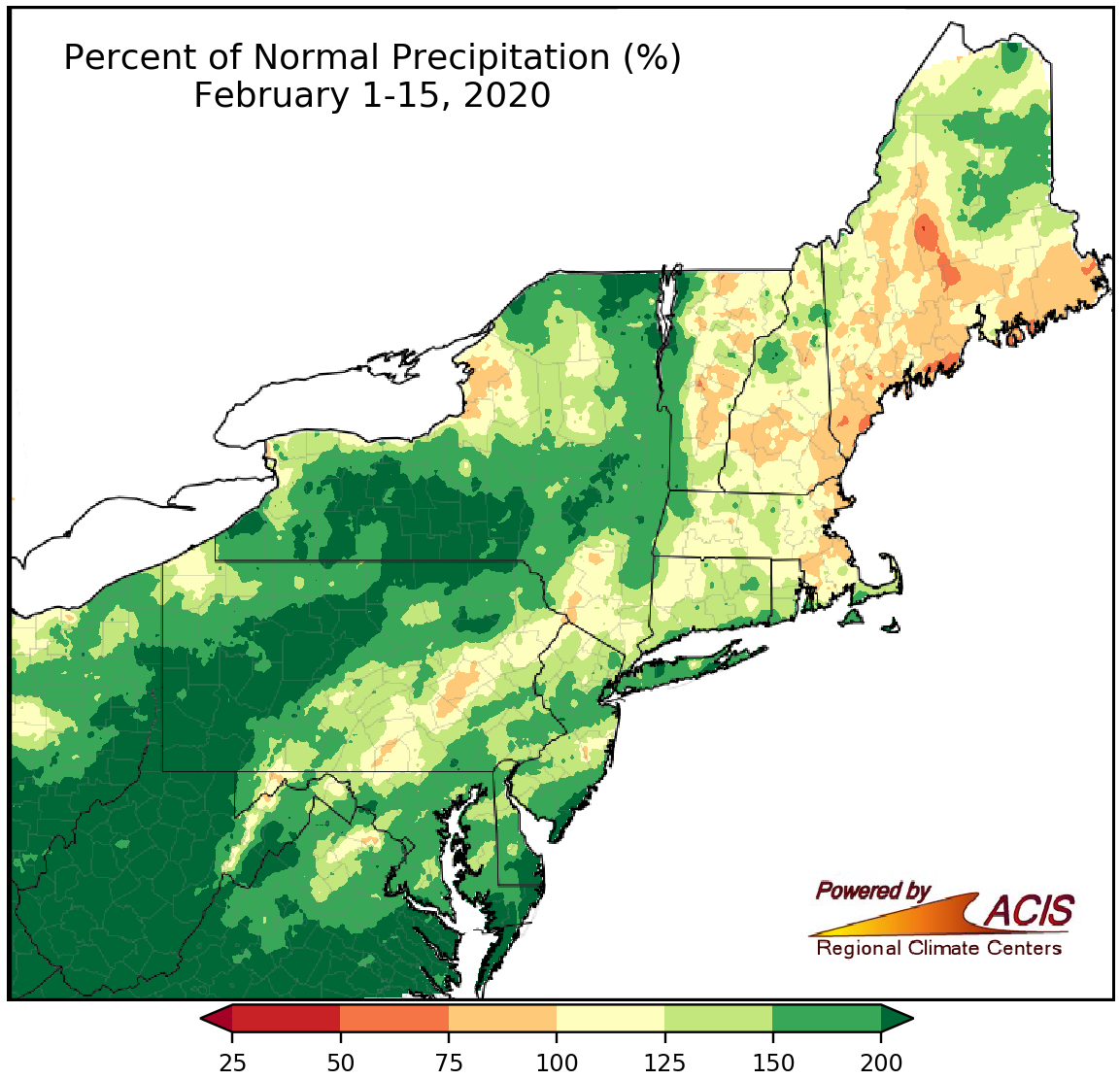
February 1-15 precipitation ranged from 50% of normal to more than 200% of normal, with most areas being wetter than normal.
While February-to-date precipitation across the Northeast ranged from 50% of normal in a few Maine locations to more than 200% of normal in parts of New York, Pennsylvania, the Mid-Atlantic, and much of West Virginia, a majority of the region was on the wet side of normal. Thirty-four of the 35 major climate sites received above-normal precipitation from February 1-15, with totals ranging from 91% of normal in Portland to 354% of normal in Beckley. In fact, it was Beckley’s wettest first half of February on record, and another 13 major climate sites ranked the period among their 20 wettest. The abundant precipitation allowed abnormal dryness to ease in the Northeast for the first time since July 2019.
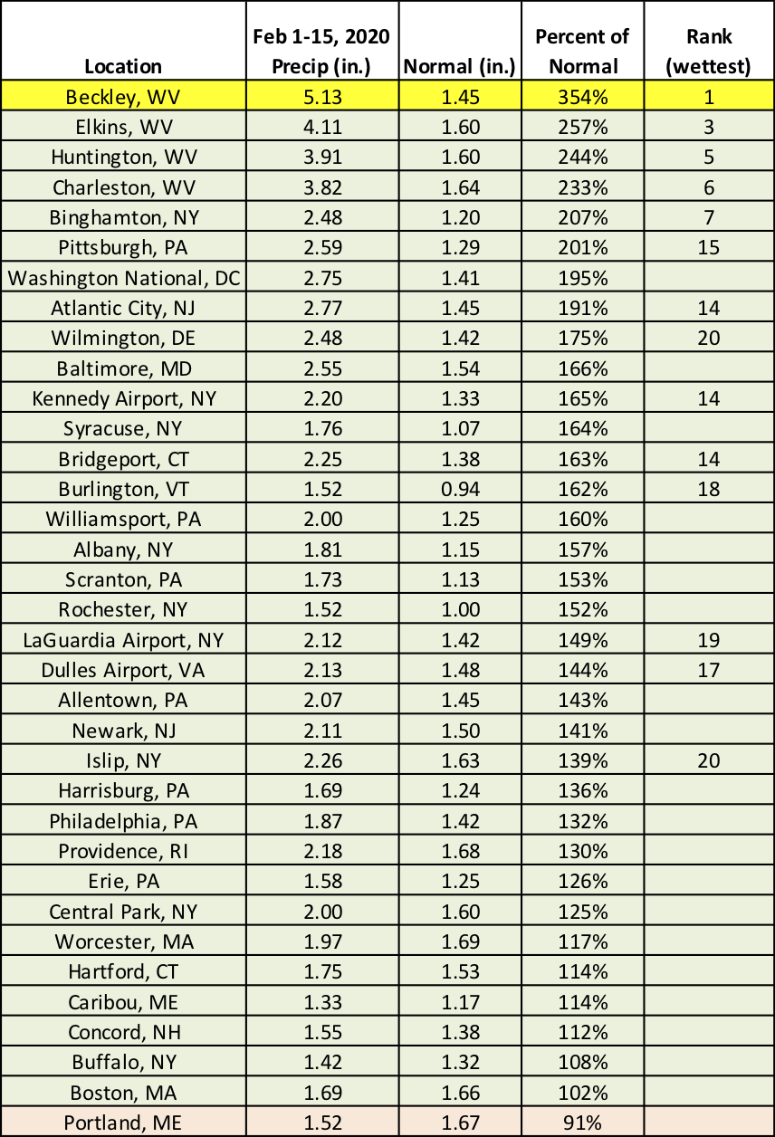
It was the wettest February 1-15 period on record for Beckley. The period ranked among the 20 wettest at 13 additional sites.
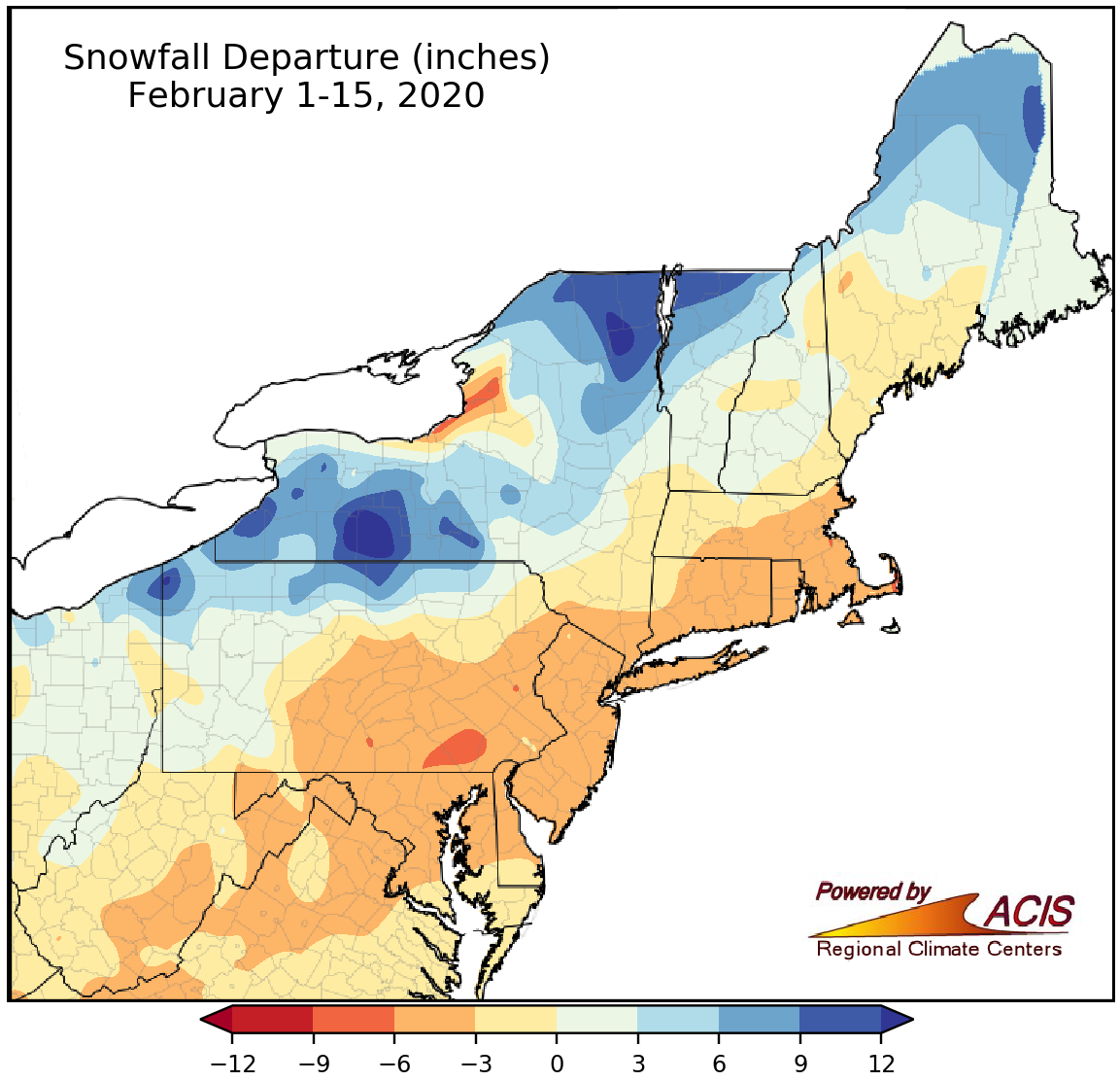
February 1-15 snowfall ranged from 9 inches below normal to more than 12 inches above normal.
Across the Northeast, February 1-15 snowfall ranged from 9 inches below normal in southeastern Pennsylvania and east of Lake Ontario in New York to more than 12 inches above normal in parts of western and northeastern New York. Snowfall at the major climate sites ranged from 6.2 inches below normal in Allentown to 10.0 inches above normal in Binghamton. Ten of the 35 major climate sites were snowier than normal, with four of those sites ranking this February 1-15 period among their 20 snowiest on record. Some of that snow came from a series of storms from February 5-8 (more on that below). For the 25 sites that saw below-normal snowfall, here are a few interesting stats -
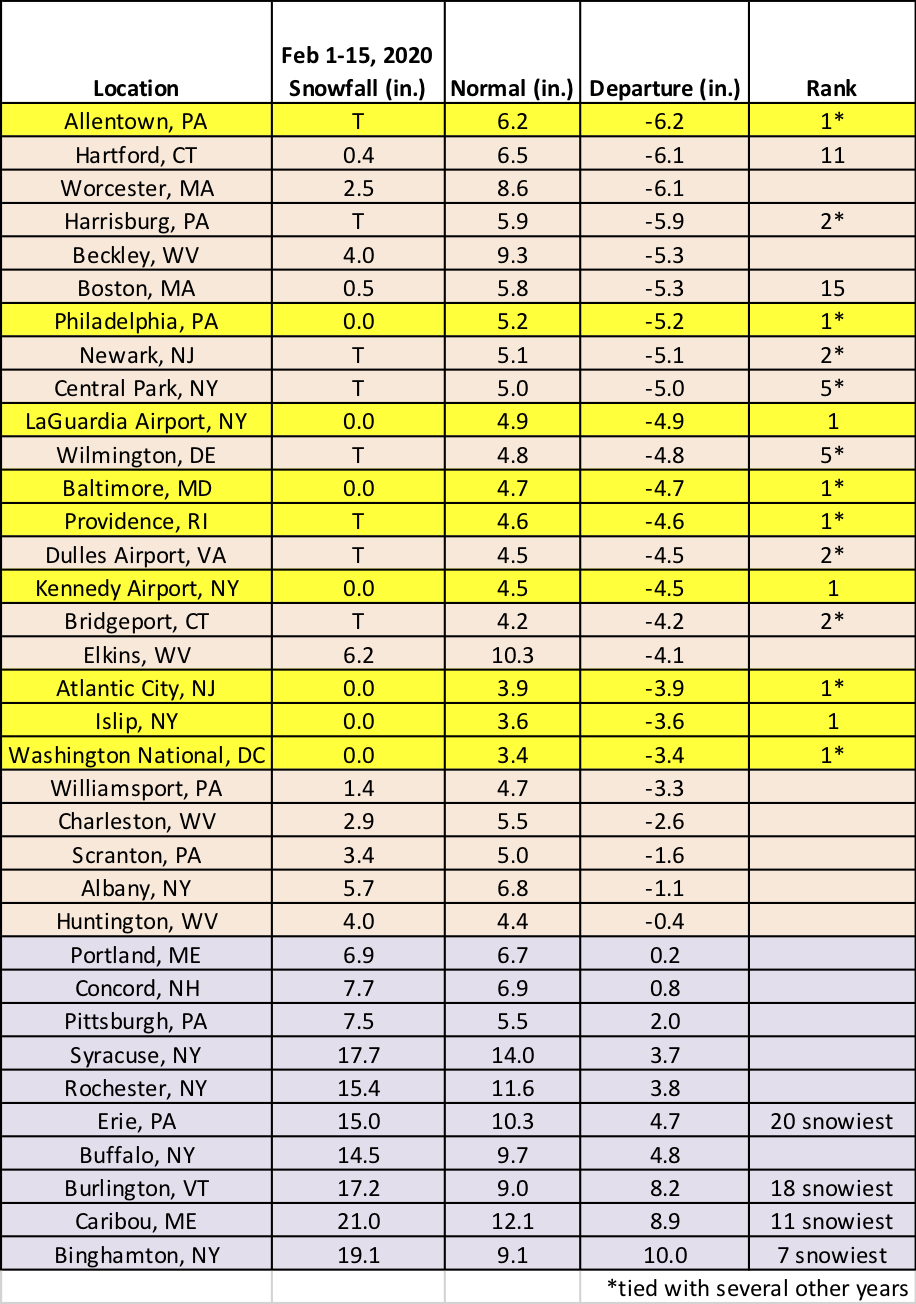
This February 1-15 period ranked as the least snowy on record for nine sites and among the 20 least snowy for another eight sites. However, it was among the 20 snowiest for four sites.
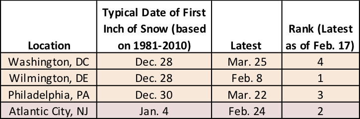
When (or if) it does fall, the first inch of snow will be the lastest on record for Wilmington and currently ranks among the four latest at three other sites.
Two storms moved through the region from February 5 to 8, producing a myriad of weather conditions. A rare tornado outbreak occurred on February 7 in Maryland where five tornadoes touched down - an EF-0 and four EF-1s. Prior to this, there had only been four February tornadoes in Maryland between 1950 and 2019. For Cecil, Montgomery, and Carroll counties, it was the first February tornado on record. Portions of Delaware, southeastern Pennsylvania, and New Jersey also saw damaging severe thunderstorms. To the west, West Virginia saw flood-inducing heavy rain, with the greatest totals approaching 4 inches. Meanwhile, as mentioned above, northern locations received heavy snow, with the greatest totals of more than 12 inches in New York and northern New England. Central New York experienced thundersnow and snowfall rates of 2-3 inches per hour. As the storm rapidly strengthened, it produced damaging wind gusts of up to 80 mph, particularly in coastal areas, and set the record for the lowest February air pressure in Hartford (preliminary data).
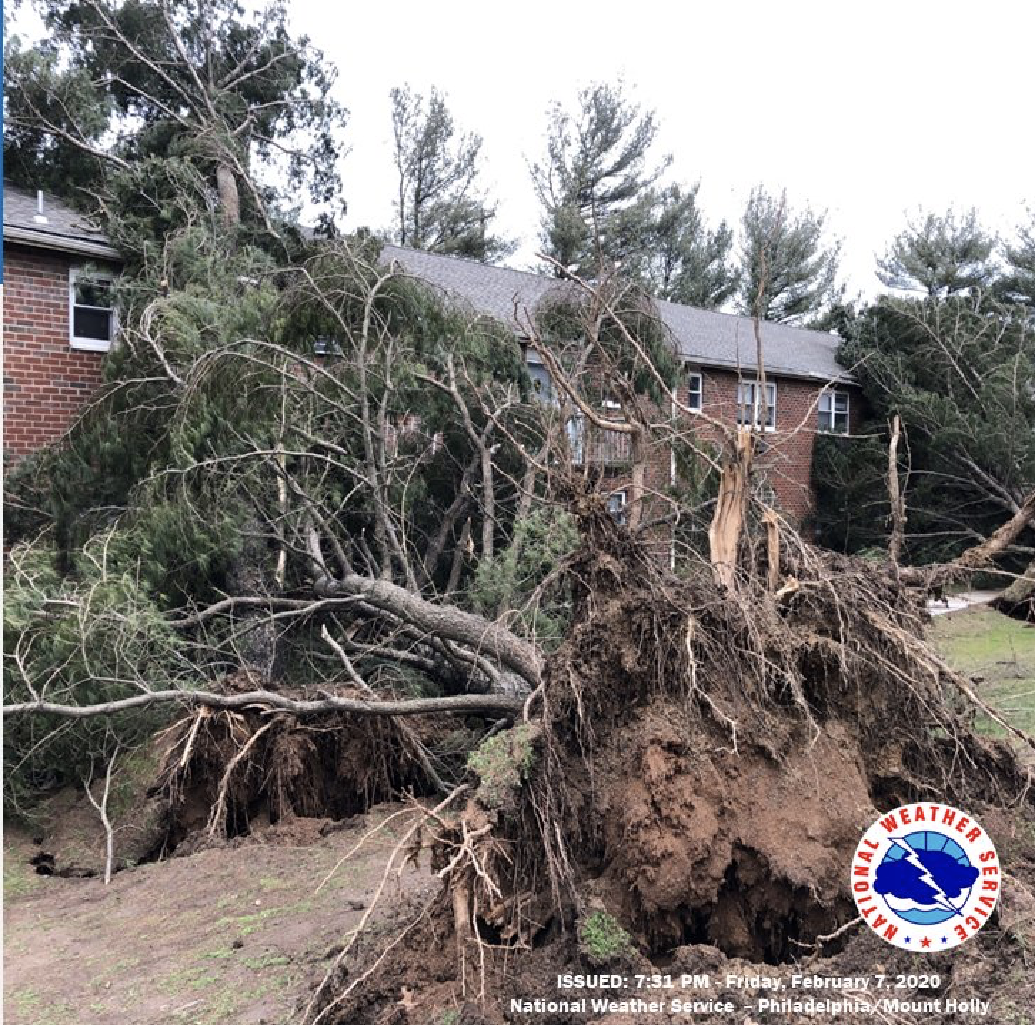
Damage from an EF-1 tornado in Cecil County, MD. Image courtesy of NWS Philadelphia/Mount Holly.