Waiting for the Rain
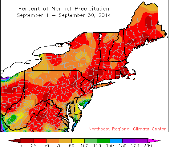
The region saw well-below-normal precipitation in September, with many areas seeing less than 50% of normal.
There was not much rain falling in the first month of fall. Almost all of the Northeast airport climate sites saw 80 percent or less of their normal September rainfall. In fact, 22 of the 35 sites ranked this September among their top 20 driest. The month started with 6 percent of the region seeing abnormally dry conditions, but by the end of September, that number had gone up to 25 percent. In addition, the U.S. Drought Monitor placed parts of southern New England in moderate drought. USGS preliminary data continued to indicate that streamflows on many waterways in that area were at record or near-record low levels.
September wrapped up on the warm side for much of the region, with temperatures running from near normal to 2 degrees above normal. According to the Climate Predication Center, there is a good chance these warmer-than-normal temperatures will stick around.