Mid-May - Rain Boots Required
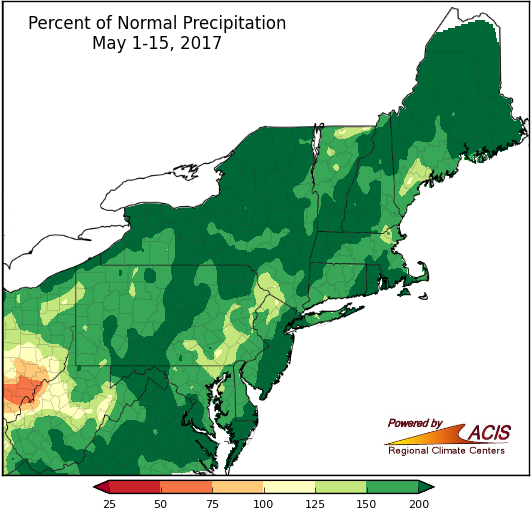
May 1-15 precipitation was above normal for a majority of the Northeast, with many areas seeing more than 150% of normal.
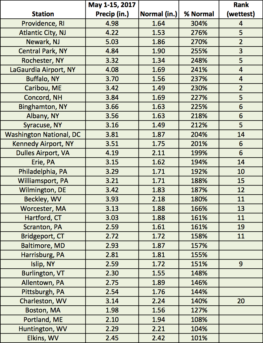
Almost the entire Northeast has seen above-normal precipitation during the first two weeks of May, generally ranging from near normal to more than 200% of normal. All 35 major climate sites were wetter than normal, with 26 sites ranking this first half of May among their top 20 wettest. In fact, Providence, RI, and Newark, NJ, have seen so much precipitation during the first two weeks of May that the entire month already ranks among their top 20 wettest Mays on record. The above-normal precipitation helped the Northeast become free of drought for the first time since mid-April 2016.
At the major climate sites, May 1-15 precipitation ranged from 101% of normal in Elkins, WV, to 304% of normal in Providence, RI.
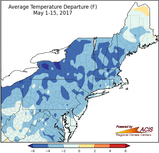
May 1-15 average temperatures have been colder than normal for most of the Northeast, with the coolest spots of more than 6°F below normal in western New York.
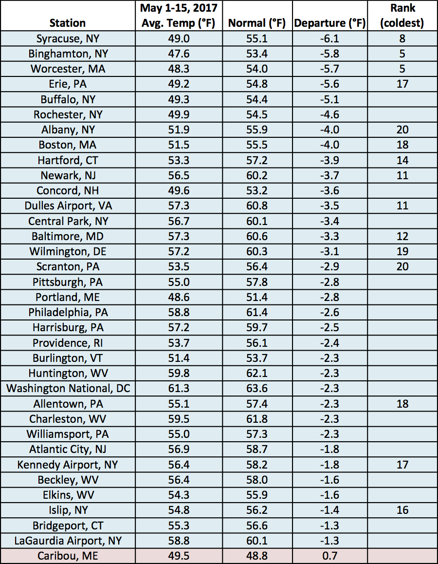
The first half of May has been chilly in the Northeast. Average temperatures ranged from near normal to more than 6°F below normal, with a large portion of the region being 2°F to 6°F below normal. All but one of the region’s 35 major climate sites were colder than normal, with 15 ranking this first half of May among their top 20 coldest.
At the major climate sites, May 1-15 average temperatures ranged from 6.1°F below normal in Syracuse, NY, to 0.7°F above normal in Caribou, ME, which was the only warmer-than-normal site.
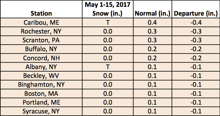
May is not a particularly snowy month and despite the cool and wet conditions, this one has been no exception. A few higher elevation locations in West Virginia, New York, and northern New England have seen less than 2 inches of snowfall; otherwise, much of the region has seen none.
During the first half of May, two sites (Albany, NY, and Caribou, ME) received a trace (less than 0.1") of snowfall, but normally, eleven sites see measurable snowfall (0.1").

