A Dry but Cool Start to September
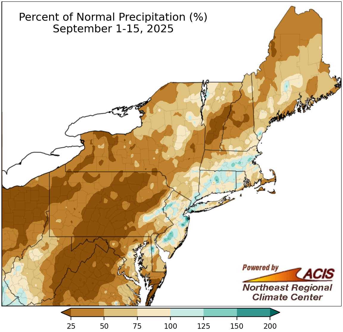
September 1-15 precipitation ranged from less than 25% of normal to near normal for most of the Northeast.
Most of the Northeast had a drier-than-normal first half of September, with the driest locations seeing less than 25% of normal precipitation. This lack of precipitation allowed drought to expand and intensify in multiple areas. However, a handful of locations, particularly closer to the coast, saw wetter conditions. September 1-15 precipitation at the region’s 35 major sites ranged from 4% of normal in Williamsport, PA, to 128% of normal in Washington, D.C, with 29 sites being drier than normal. This first half of September ranked among the 20 driest on record for eight major sites.
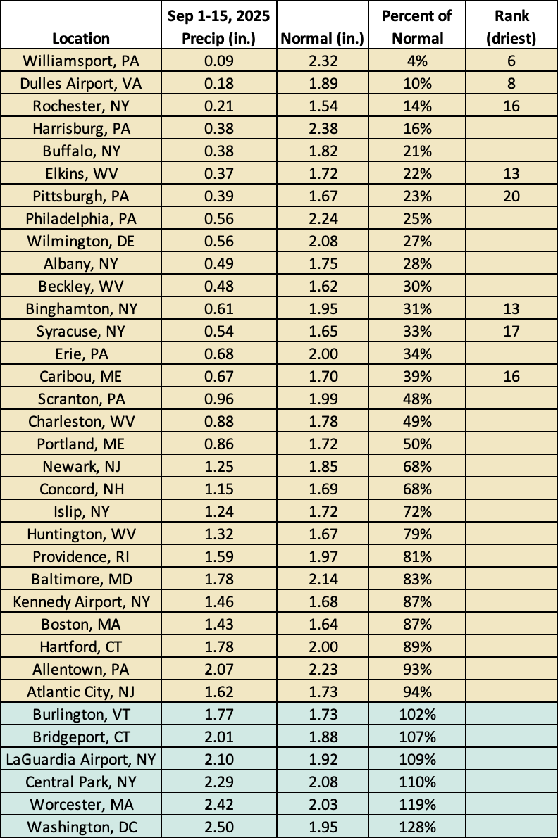
This September 1-15 period ranked among the 20 driest on record for eight major sites.

September 1-15 average temperatures ranged from 6°F below normal to 2°F above normal.
A large portion of the Northeast experienced below-normal temperatures during the first half of September, with some southern and interior locations being as much as 6°F cooler than normal. However, a few spots, especially in northern New England, were warmer. At the region’s 35 major sites, temperatures ranged from 5.2°F below normal in Elkins, WV, to 0.1°F above normal in Philadelphia, PA, the lone warmer-than-normal site. This September 1-15 period ranked among the 20 coolest for five major sites. The cooler temperatures helped to slightly temper drought deterioration as warmer-than-normal temperatures would have led to increased evapotranspiration rates that intensified already dry conditions. However, the short-term outlooks (as of September 15) from NOAA’s Climate Prediction Center indicate warmer-than-normal temperatures are expected for the rest of September.
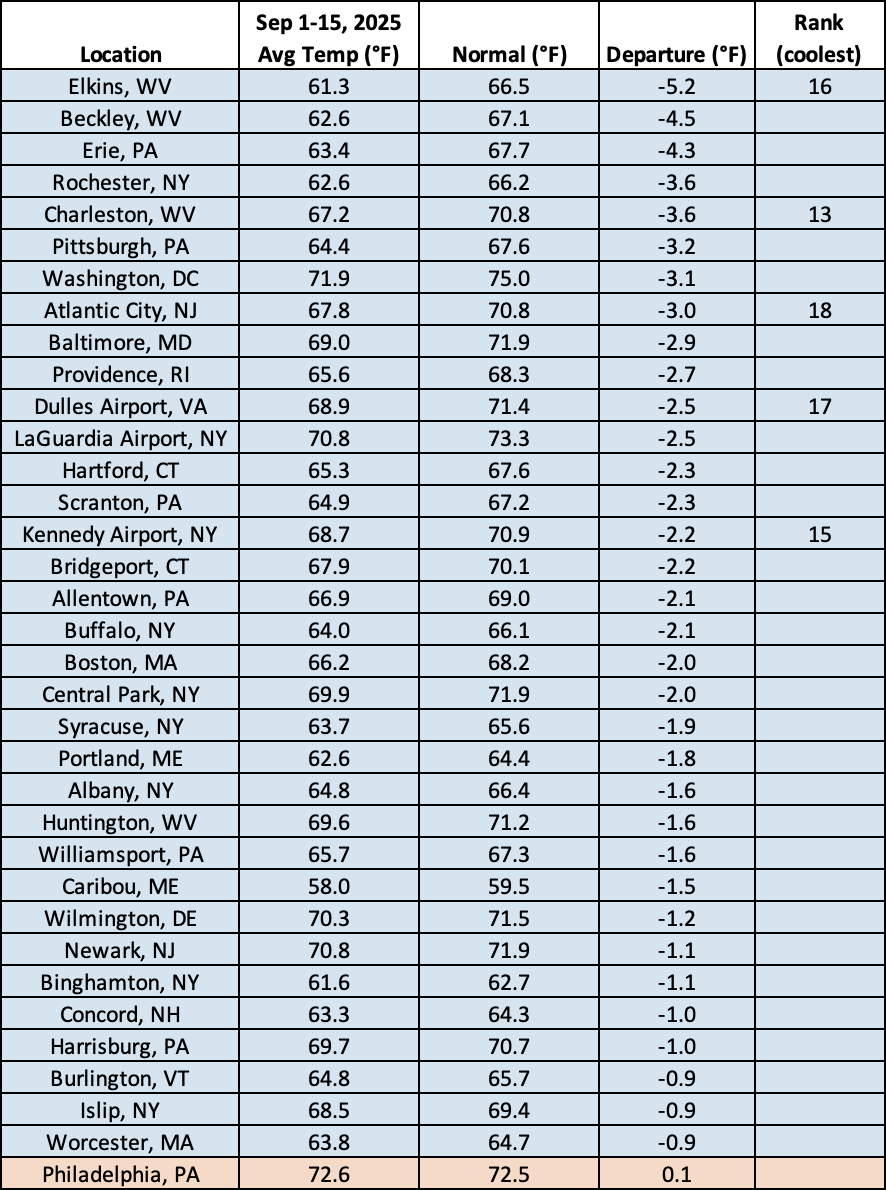
This September 1-15 period was among the 20 coolest for five major sites.