Mid-August - Too Little or Too Much Rainfall
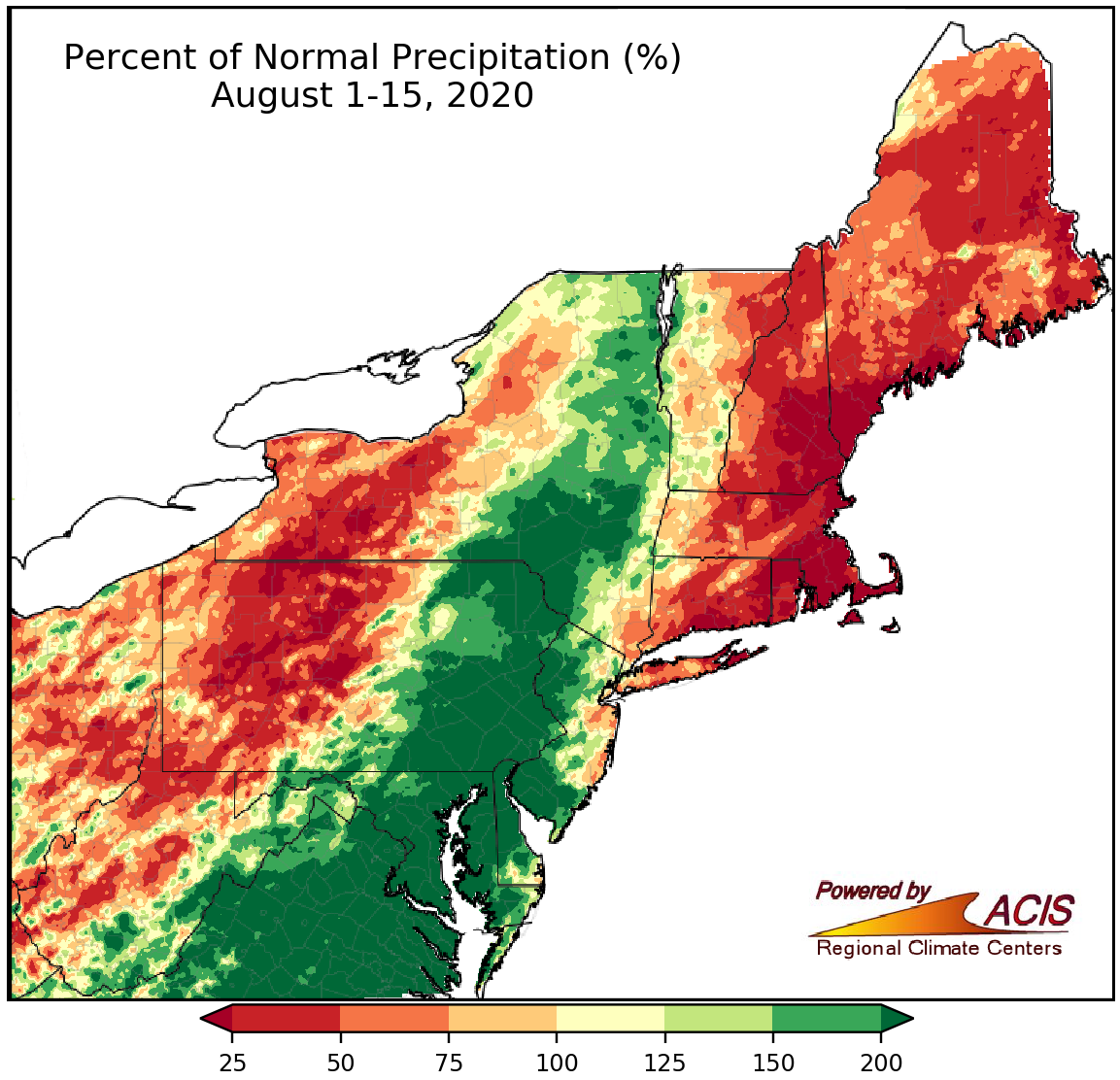
August 1-15 rainfall ranged from less than 25% of normal to more than 200% of normal.
Rainfall during the first half of August varied widely, from less than 25% of normal in New England to more than 200% of normal in southeastern parts of the Northeast. Of the 16 drier-than-normal major climate sites, eight ranked this first half of August among their 20 driest on record. Almost all of New England was either abnormally dry or in a drought. For more information see the weekly Northeast Drought Update and the Northeast DEWS Dashboard. Of the 19 wetter-than-normal major climate sites, 11 ranked this first half of August among their 20 wettest on record.
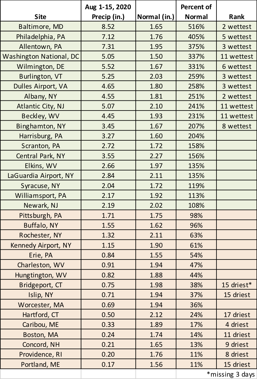
August 1-15 rainfall ranged from 11% of normal in Portland, ME, and Providence, RI, to 516% of normal in Baltimore, MD.
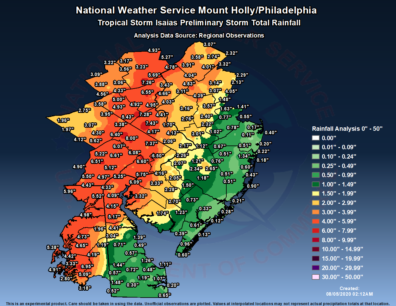
Rainfall totals from Tropical Storm Isaias in the Philadelphia/Mt. Holly National Weather Service forecast area. Click to enlarge. Credit: NWS PHI
A major source of rainfall for wetter-than-normal areas was Tropical Storm Isaias on August 4. The greatest rain totals ranged from 4–9 inches, with Allentown, PA, having its wettest August day with 4.92" of rain. Significant flooding occurred, particularly in southeastern Pennsylvania where several waterways recorded their highest water levels on record. Isaias also produced at least 16 tornadoes in the region, including one that trekked more than 35 miles across Delaware, the state’s longest tornado track on record. Some of the same areas that received excessive rainfall from Isaias saw more heavy rain and flash flooding from August 6-7 and August 12-13.
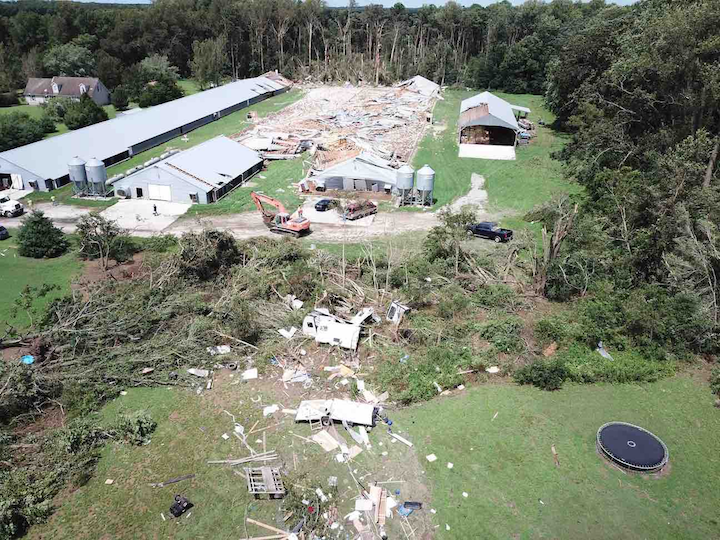
Damage from a tornado associated with Tropical Storm Isaias in Stockton, MD. Credit: NWS AKQ
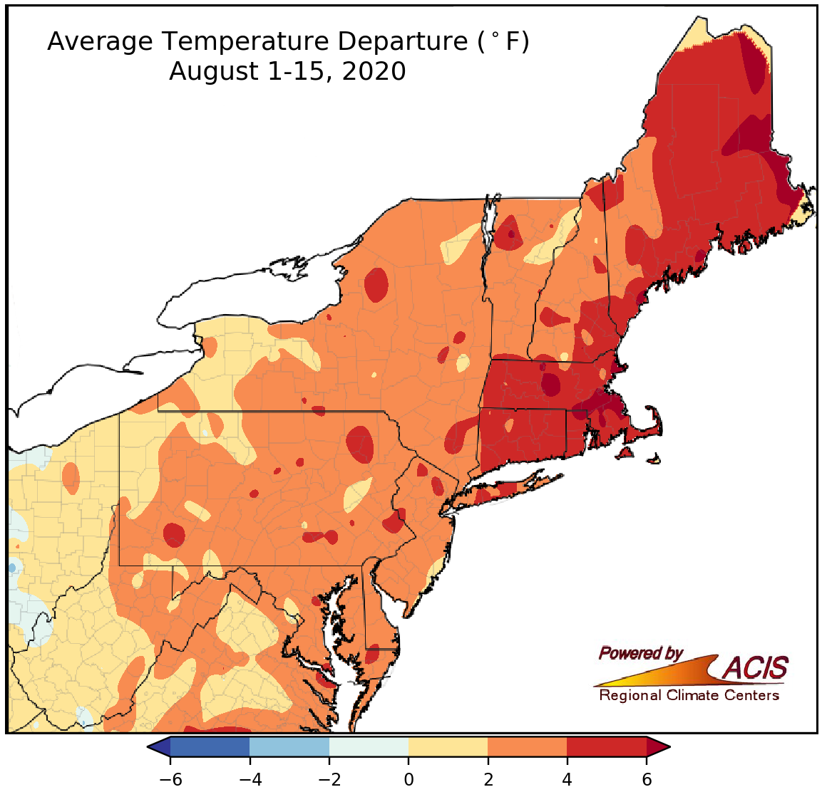
August 1-15 average temperatures ranged from near normal to more than 6°F above normal.
Temperatures continued to be above-normal during the first half of August for most areas, ranging from near normal in western parts of the Northeast to more than 6°F above normal in parts of New England. All 35 major climate sites had a warmer-than-normal first half of August, with 26 ranking this August 1-15 period among their 20 warmest on record.
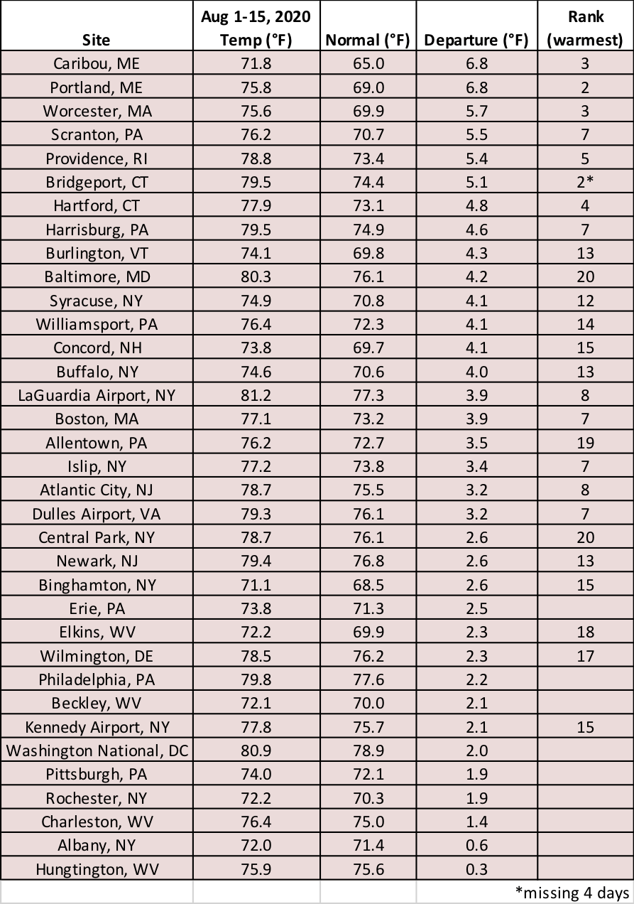
August 1-15 average temperatures ranged from 0.3°F above normal in Huntington, WV, to 6.8°F above normal in Caribou and Portland, ME.