Hurricane Irene
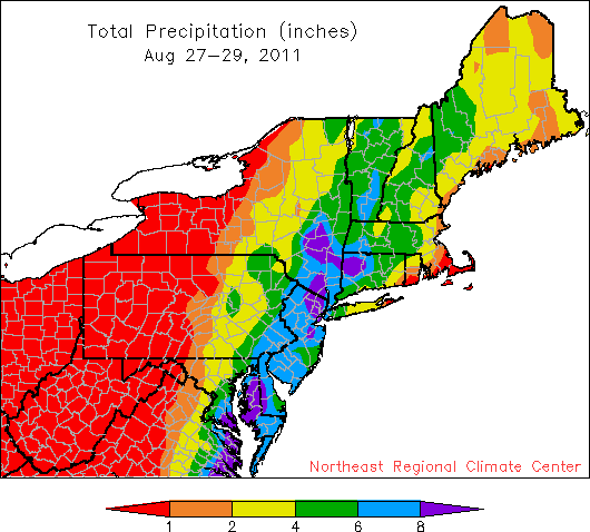
Based on station data, Irene dropped from less than 1 inch of rain to more than 8 inches.
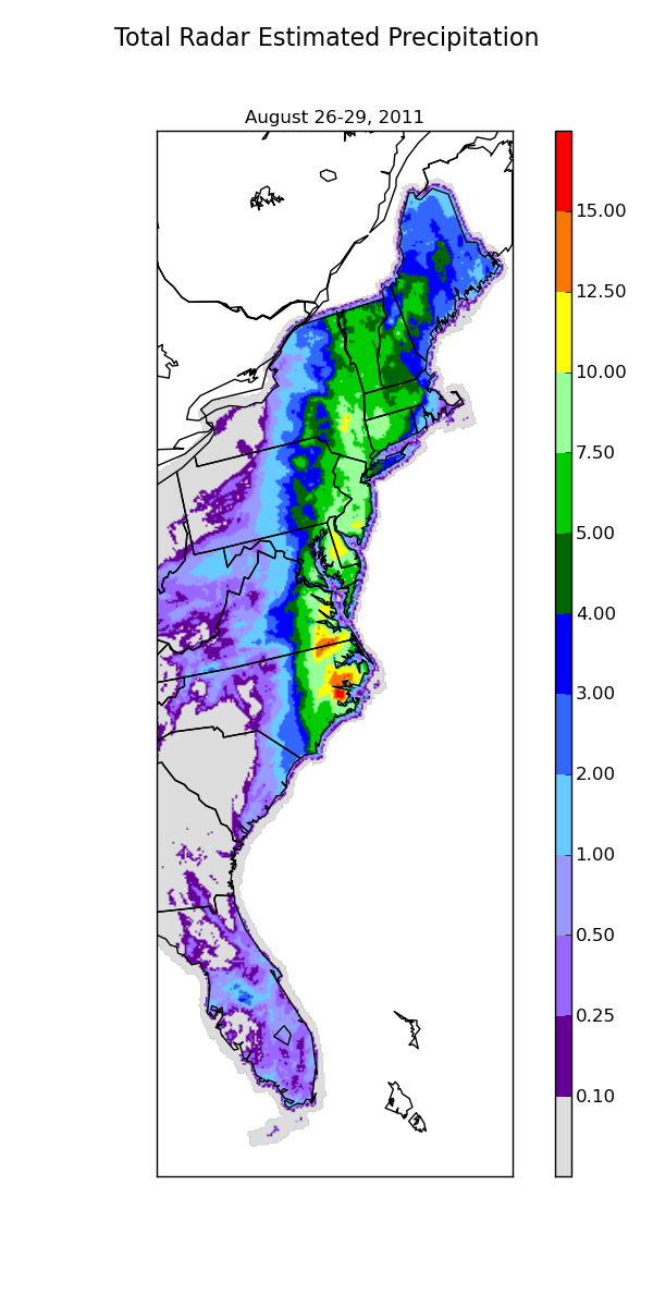
This shows Irene’s rainfall totals based on radar estimations.
The heaviest rain totals from Hurricane Irene were concentrated in the most vulnerable areas of the Northeast. Eastern Pennsylvania, New Jersey and southern New York had already seen record-breaking rainfall totals this month. The additional 6-plus inches from the storm put streams and rivers well over their banks as the ground could not absorb any more water. Heavy rain in the Delaware, Hudson, and Connecticut River watersheds, lead to immediate local flooding, but will also prolong flooding in areas downstream as the runoff drains to the sea.