January - Warm and Wet, but Not Very White
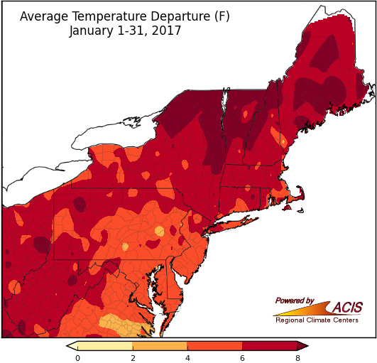
January 2017 was warmer than normal for the entire Northeast.
Average temperatures for January ranged from 4°F to more than 8°F above normal. Northern New York and northern New England generally had the largest departures above normal. All 35 major climate sites experienced above-normal temperatures, with 33 ranking this January among their top 20 warmest. In fact, Bridgeport, CT had its warmest January on record.
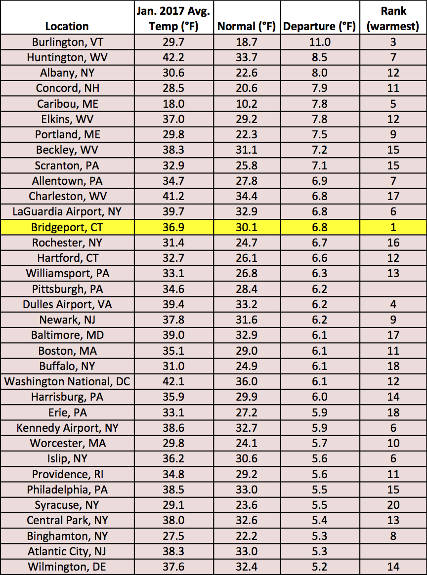
January average temperatures at the major climate sites ranged from 5.2°F above normal in Wilmington, DE to 11.0°F above normal in Burlington, VT. Bridgeport, CT was record warm.
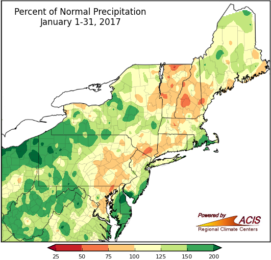
Most areas received between 75% and 200% of normal January precipitation.
January precipitation ranged from less than 75% of normal to more than 200% of normal. The driest spots were generally in Vermont, New Hampshire, and southeastern New York, while the wettest areas were in northwestern Pennsylvania, central Delaware, and southern New Jersey. Twenty-seven of the region’s 35 major climate sites were wetter than normal, with 10 ranking this January among their top 20 wettest. The region has seen lingering, but slowly-improving drought conditions.
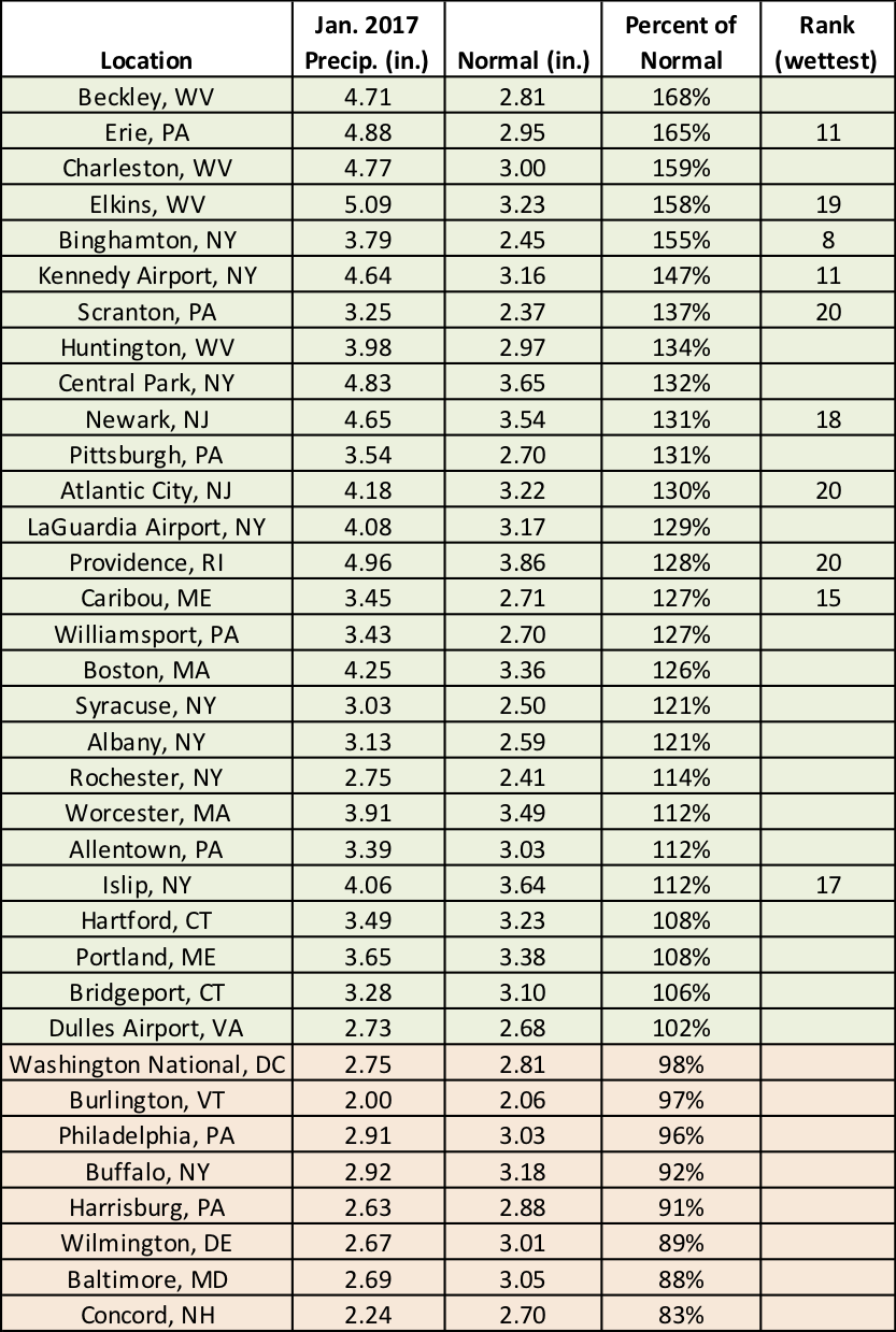
At the major climate sites, January precipitation ranged from 83% of normal in Concord, NH to 168% of normal in Beckley, WV.
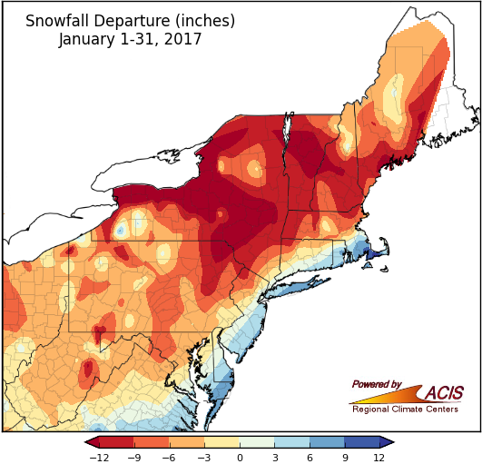
Snowfall was below normal for much of the Northeast in January.
While precipitation was above-normal in many areas, the warmer-than-normal temperatures meant much of that precipitation did not fall as snow. January snowfall ranged from 3 inches to more than 12 inches below normal for a large portion of the region. The largest deficits were found in upstate New York, northeastern Pennsylvania, and portions of northern New England. However, a nor’easter early in the month helped push snow totals above normal for some coastal areas. The greatest snowfall surplus of more than 9 inches was in southeastern Massachusetts. Twenty-six of the region’s 35 major climate sites received below-normal snowfall, with ten ranking this January among their top 20 least snowy. Conversely, of the nine snowier-than-normal sites, five ranked this January among their top 20 snowiest.
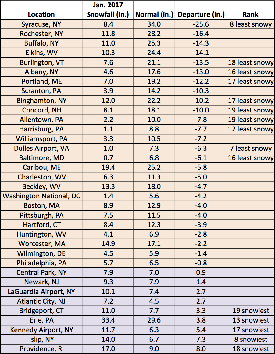
January snowfall at the major climate sites ranged from 25.6 inches below normal in Syracuse, NY to 8.0 inches above normal in Providence, RI.
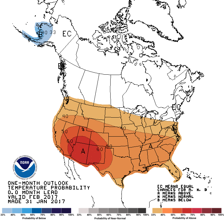
February temperature outlook from the Climate Prediction Center.
On January 31, the Climate Prediction Center released their latest temperature and precipitation outlooks for February. The temperature outlook calls for an increased chance of above-normal temperatures for southern portions of the Northeast, with equal chances of below-, near, or above-normal temperatures for the rest of the region. The precipitation outlook indicates an increased chance of above-normal precipitation for most of West Virginia, far western Maryland, western and north-central Pennsylvania, and much of upstate New York. Equal chances of below-, near, or above-normal precipitation were forecast for the rest of the Northeast.
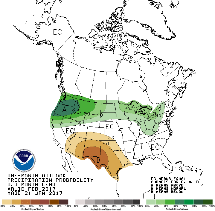
February precipitation outlook from the Climate Prediction Center.