August Starts Off Wet and Cool
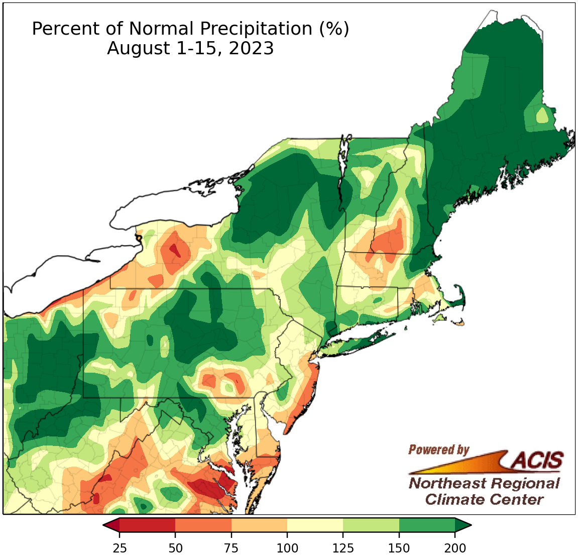
August 1-15 rainfall ranged from 50% of normal to more than 200% of normal.
Much of the Northeast saw near or above-normal rainfall during the first half of August, with multiple areas including western West Virginia, central Pennsylvania, northern New York, and most of Maine seeing more than double their normal amount. However, there were a few areas such as southwestern New Hampshire, western New York, coastal New Jersey, and southeastern Maryland that were drier, receiving 50% to 75% of normal. August 1-15 precipitation at the 35 major climate sites ranged from 61% of normal in Atlantic City, NJ, to 233% of normal in Syracuse, NY, with 29 of the sites being wetter than normal. This first half of August ranked among the 20 wettest on record for nine major climate sites.
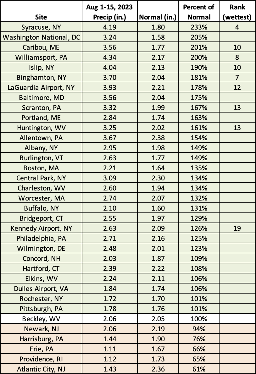
This August 1-15 period was among the 20 wettest on record for nine major climate sites.
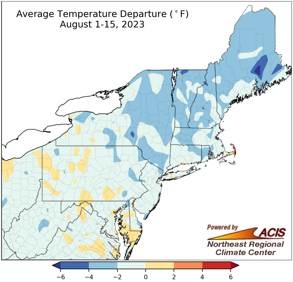
August 1-15 average temperatures ranged 4°F below normal to 1°F above normal.
The first half of August featured below- or near-normal temperatures in the Northeast, ranging from 4°F below normal to 1°F above normal. The greatest departures below normal were found throughout the region but particularly New York and New England. At the 35 major climate sites, August 1-15 average temperatures ranged from 3.0°F below normal in Concord, NH, to 0.8°F above normal in Pittsburgh, PA, with 29 of the sites being cooler than normal. This first half of August did not rank among the 20 coolest or warmest at any of the major climate sites.
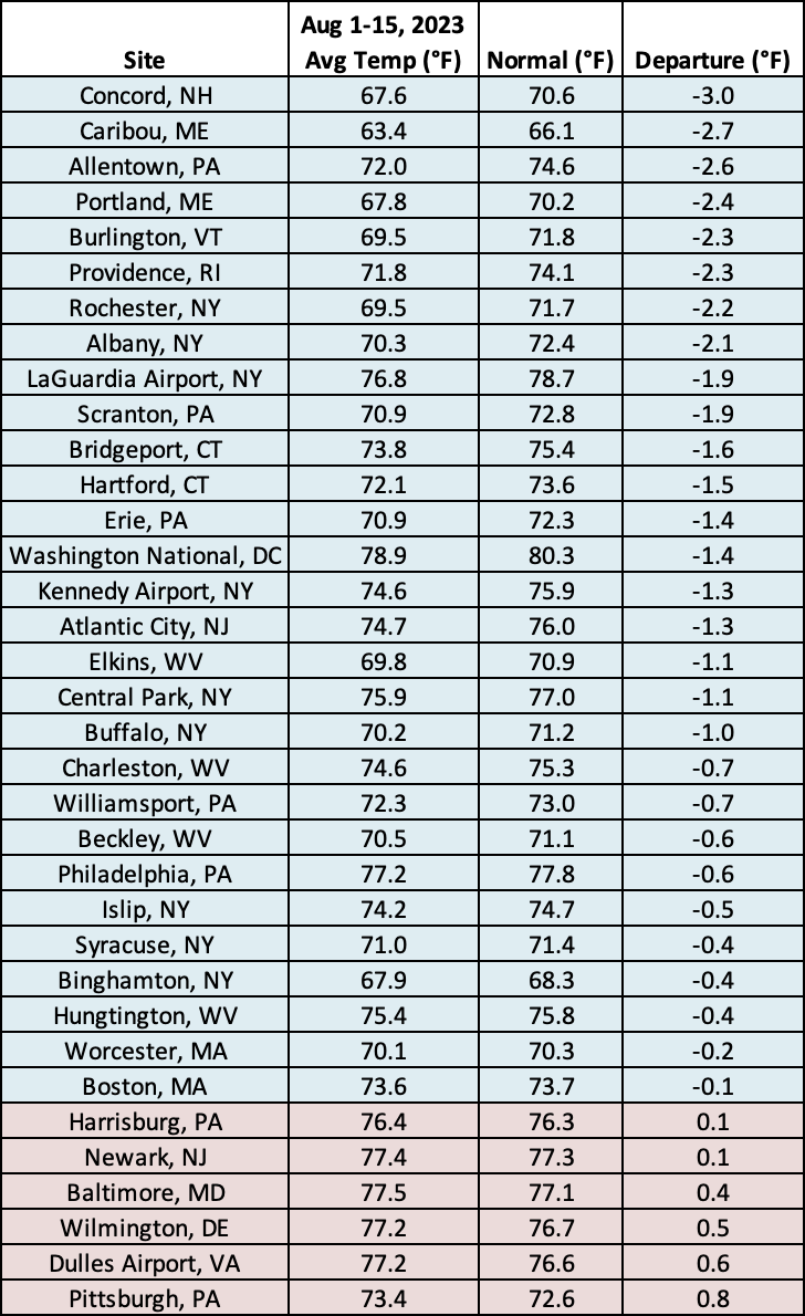
Twenty-nine of the 35 major climate sites were cooler than normal during the first half of August.