A Record-Setting Start to March
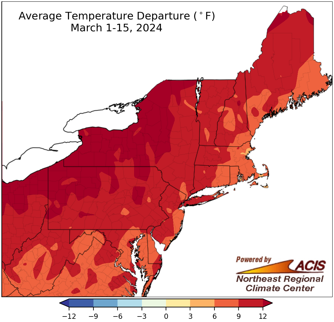
March 1-15 average temperatures ranged from 3°F to more than 12°F above normal.
The first half of March followed in the footsteps of winter, featuring unusual warmth across the Northeast. March 1-15 average temperatures ranged from 3°F to more than 12°F warmer than normal, with the greatest departures above normal in interior parts of the region. At the 35 major climate sites, average temperatures during the first half of March ranged from 5.9°F above normal in Boston, MA, to 14.7°F above normal in Buffalo, NY. This March 1-15 period was record warm for 17 major climate sites and ranked among the five warmest for another 15 of the sites.
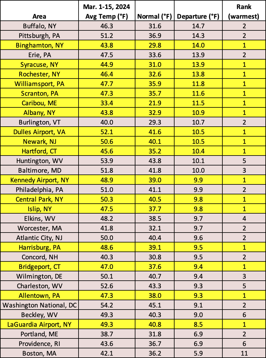
This March 1-15 period was record warm for 17 major climate sites and ranked among the five warmest for another 15 of the sites.
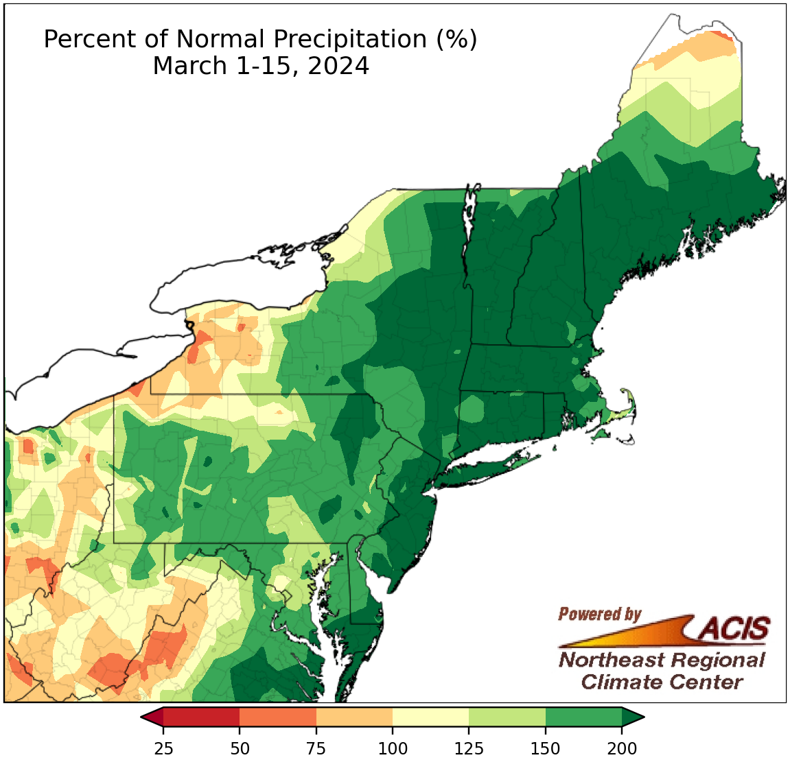
March 1-15 precipitation ranged from 50% of normal to more than 200% of normal.
Most of the Northeast was wetter than normal during the first half of March, with precipitation ranging from near normal to more than 200% of normal, particularly in areas closer to the coast. However, a few interior areas such as western New York, northwestern Pennsylvania, and parts of West Virginia, as well as northern Maine, were drier, seeing between 50% and 100% of normal precipitation. March 1-15 precipitation at the region’s 35 major climate sites ranged from 65% of normal in Erie, PA, to 341% of normal in Portland, ME, with 30 of the sites being wetter than normal. This first half of March was record wet for five major climate sites and ranked among the 20 wettest for another 18 of the sites.
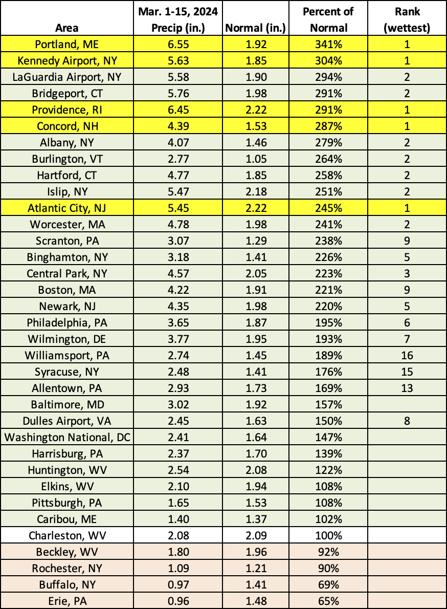
This March 1-15 period was record wet for five major climate sites and ranked among the 20 wettest for another 18 of the sites.
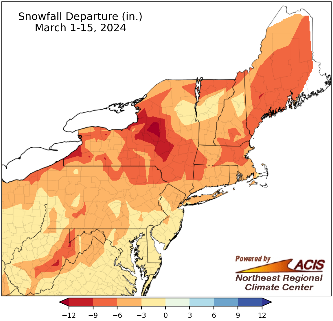
March 1-15 snowfall ranged from 12 inches below normal to near normal.
The trend of below-normal snowfall continued into the first half of March, with the entire Northeast seeing snowfall deficits. The largest deficits of 9 to 12 inches below normal were in central and western New York. March 1-15 snowfall at the 35 major climate sites ranged from 10.2 inches below normal in Syracuse, NY, to 1.4 inches below normal in Washington, D.C. This first half of March featured record low snowfall at five major climate sites and ranked among the 20 least snowy for another 26 of the sites. For many sites, these rankings tied with multiple other years, but for Portland, ME, it was only the second time since its records began in 1882 that it saw no snow during the first half of March.
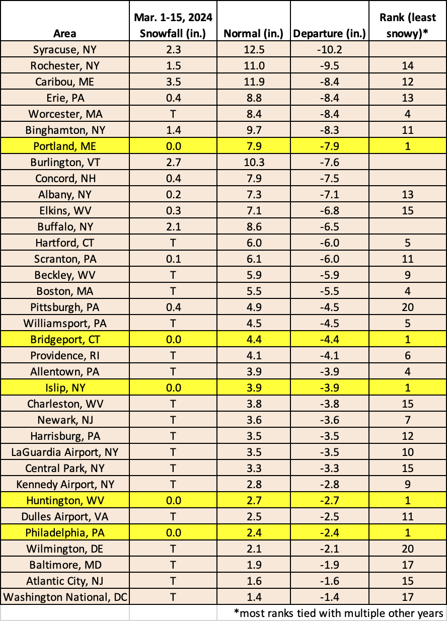
This March 1-15 period featured record low snowfall at five major climate sites and ranked among the 20 least snowy for another 26 of the sites.