February and Winter - Cold Start, Warm Finish
February closed out meteorological winter with record warm temperatures in parts of the Northeast, with all of the 35 major climate sites registering above-normal temperatures for the month. Five of those climate sites had their warmest February on record, and some areas even had their warmest daily high temperature for the month of February. This warm month was similar to last February when many sites also set quite a few record high temperatures.
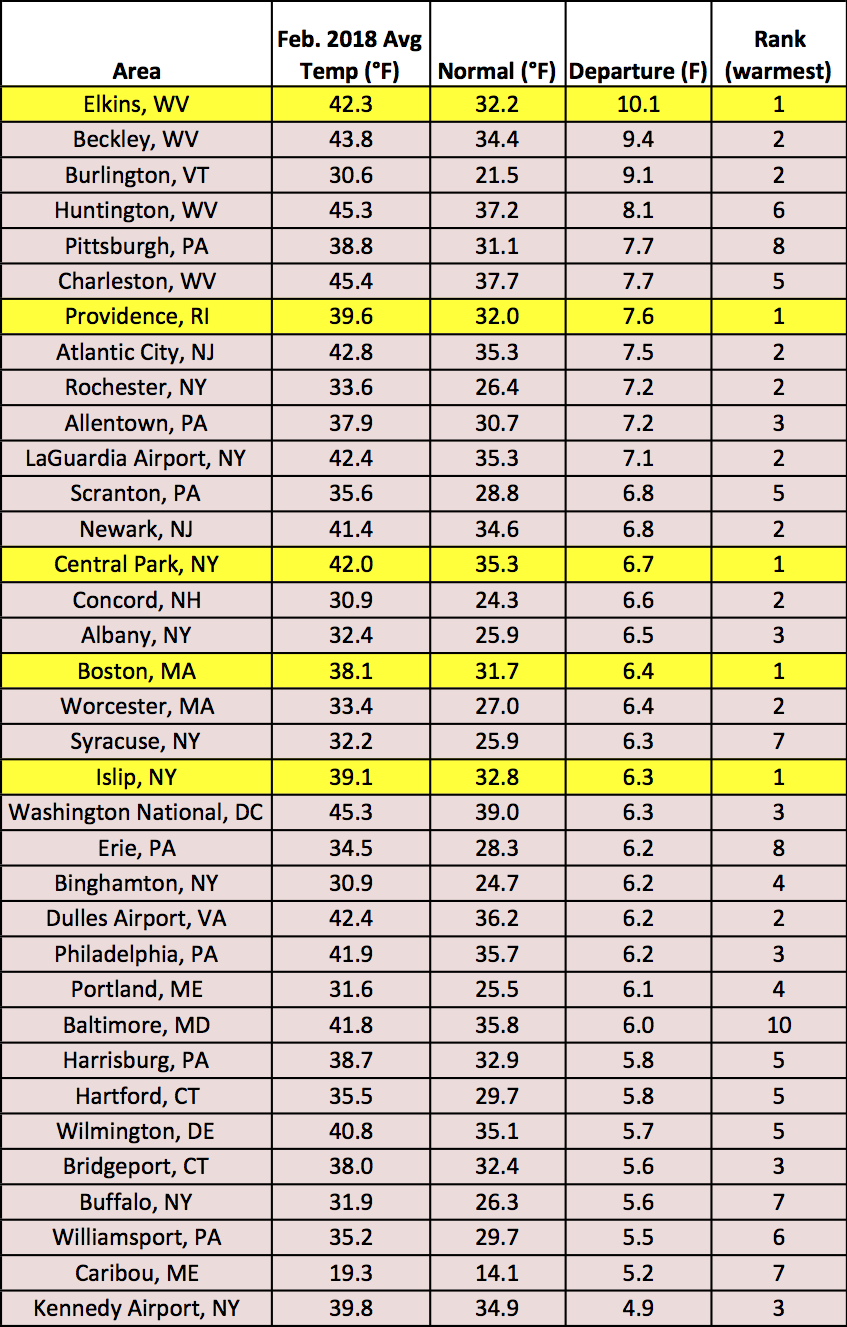
All of the major climate sites experienced warmer than normal temperatures this past month, with five being record warm.
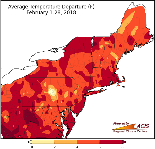
Warmer-than-normal temperatures encompassed the entire Northeast during February.
During the winter, temperatures fluctuated between being colder than normal for many areas towards the end of 2017, and warmer than normal, particularly during this past month. That led to a variety in temperature departures throughout the Northeast, especially for areas in Pennsylvania and Maine which had locations that were on both sides of the temperature spectrum. During the winter, both record cold and warm temperatures were set at various points in the season.
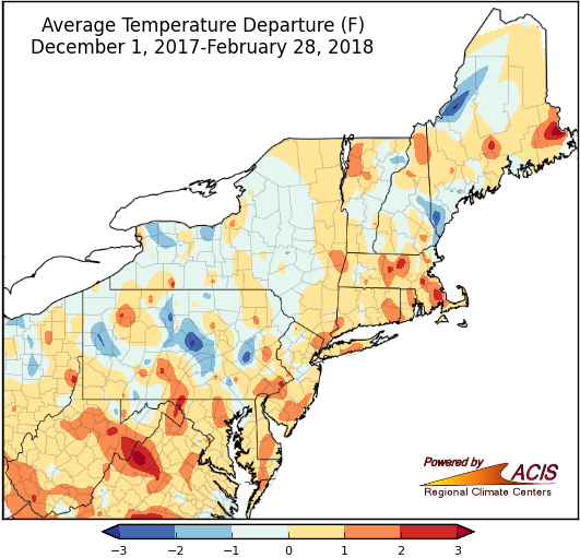
With the temperature fluctuations throughout winter, many areas wrapped up the season within 1°F of normal.
The warmer temperatures led to below-normal snowfall totals for a large part of the region, with many climate sites experiencing a large departure from normal snowfall amounts. An early February storm brought accumulating snow and icy conditions to much of the interior Northeast. Partly thanks to that storm and another one that followed about a week later, most of the areas that received above-normal amounts of snow were in New York and northern New England.
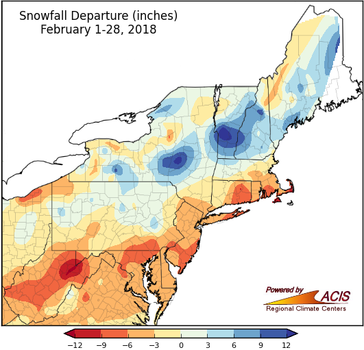
Snowfall totals were below normal for most of the climate sites this past month, except for pockets of New York and northern New England.
Below-normal snowfall totals were recorded at 20 of the major climate sites this winter, mainly in locations south of New York. This past season, much of northern New England and western New York received more snow than normal, particularly in regions near the Great Lakes.
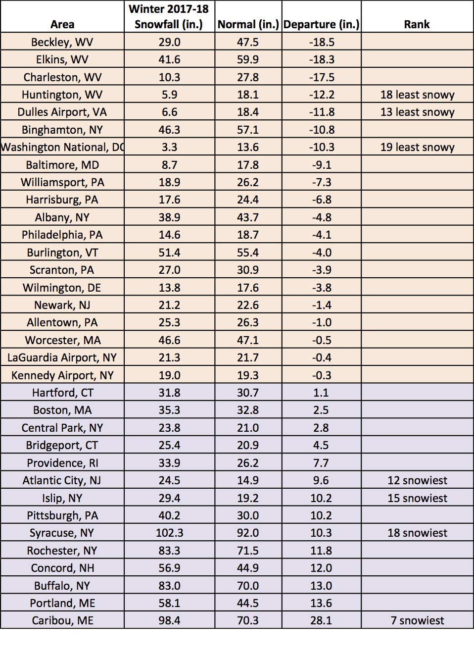
Snowfall totals varied throughout the winter in the Northeast.
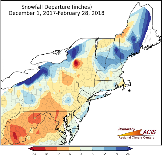
There was a range in snowfall departures from normal throughout the winter, from 24 inches below normal to more than 24 inches above normal.
Although there was a notable lack of snow in many areas for the month of February, almost all of the 35 major climate sites received above-normal amounts of precipitation. Seven major climate sites in the Northeast experienced record wet conditions during the month, receiving anywhere from 190% to 295% of their normal precipitation. Much of the mid-Atlantic region, including Elkins and Charleston, WV, along with Pittsburgh, PA received over seven inches of rain throughout the month, with Huntington, WV getting 8.13 inches.
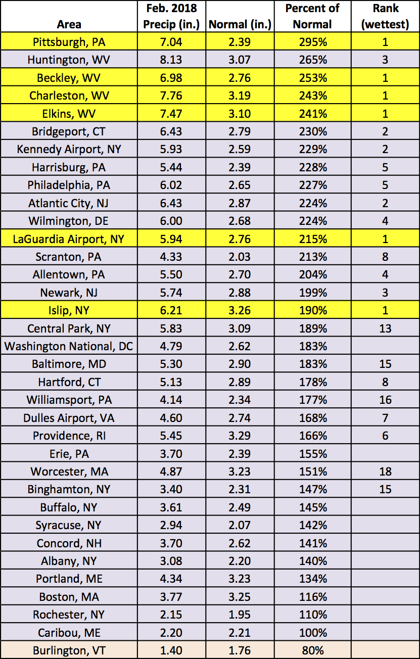
Six locations received record amounts of precipitation this past month.
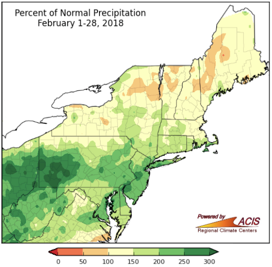
Most areas received above-normal amounts of precipitation in February.
During the winter, many of the 35 major climate sites recorded above-normal amounts of precipitation for the season. Some areas ranked within the top 20 wettest winter season. In the Northeast, Caribou, ME and Pittsburgh, PA both experienced their third wettest winter on record.
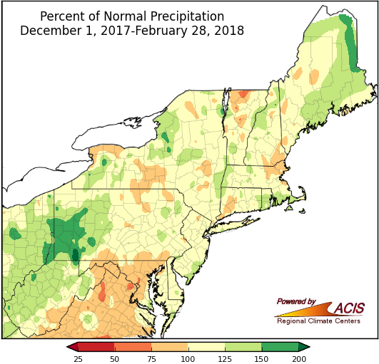
Many areas in the Northeast saw slightly above-normal precipitation during the winter.
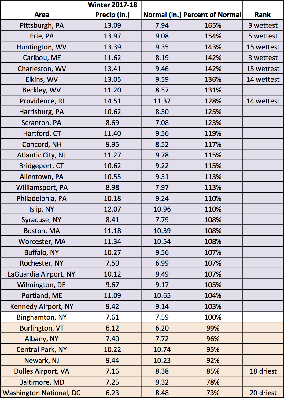
A majority of the major climate sites had a wetter-than-normal winter season.
March kicked off with a major nor’easter, which brought heavy snow, heavy rain, strong winds, and flooding to the region from March 2 and 3. The greatest snow totals of up to 40 inches were generally in central and eastern New York, while up to 5 inches of rain was reported in parts of southern New England and Long Island. Wind gusts from 50 to 75 mph brought down trees, which contributed to power outages and several fatalities. Coastal areas also experienced flooding.
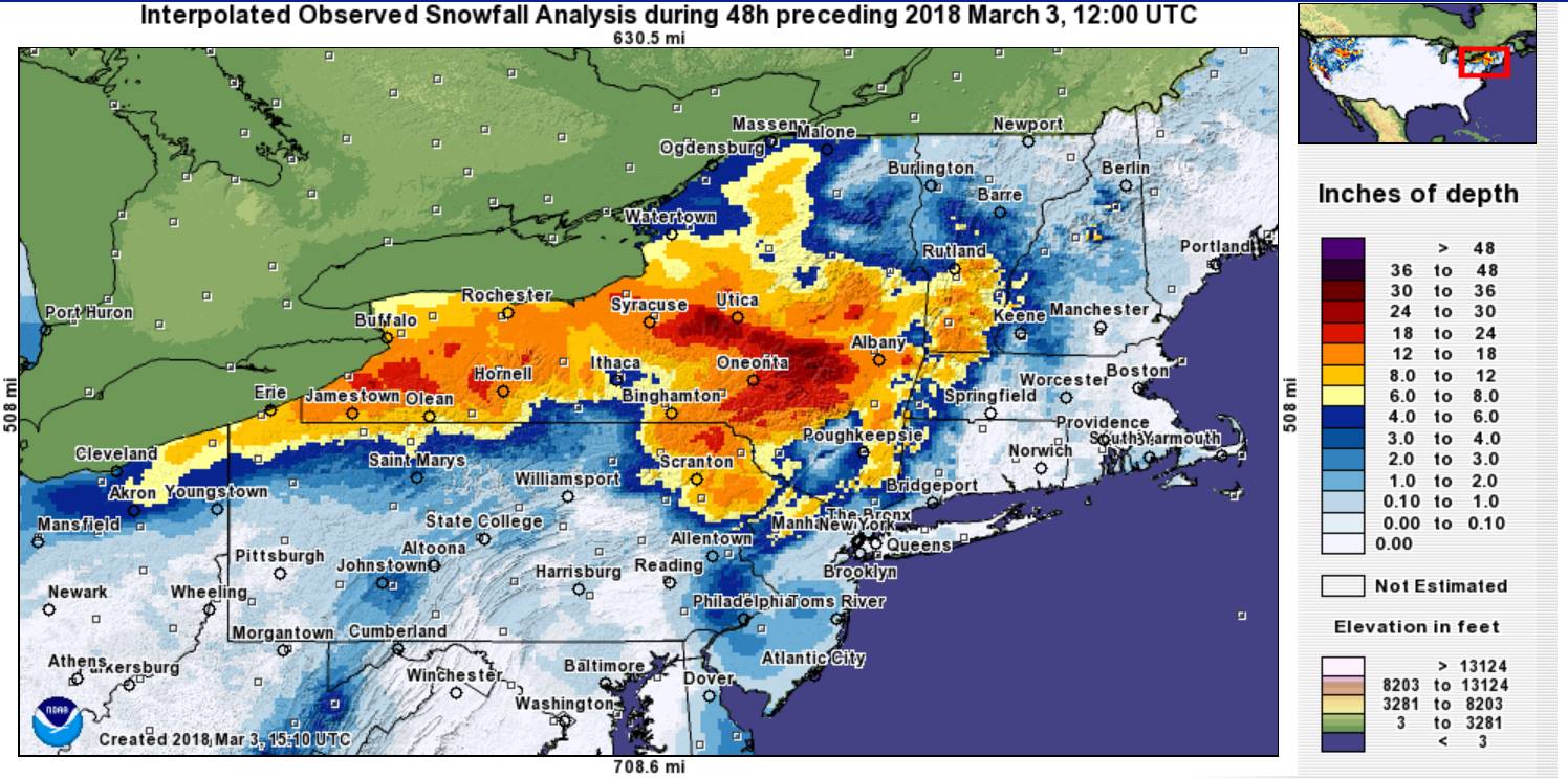
Storm snow totals, with the greatest amounts in parts of eastern and central New York. Image courtesy NOHRSC. Click to enlarge.
What can we expect for the rest of March? The Climate Prediction Center (CPC) released their outlooks for the month ahead suggesting for there to be an increased likelihood of above-normal temperatures for much of the Northeast, especially in New England. The CPC is also predicting there to be increased chances of above-normal precipitation for most areas in the region, except for Maine and West Virginia.
The CPC outlook suggests warmer-than-normal temperatures for the northern states in the region.
The CPC outlook predicts there is an increased chance of above-normal precipitation for most of the region.