September - Consistent Temperatures, Inconsistent Rainfall
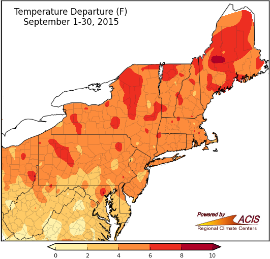
September average temperatures were generally 2°F to 8°F above normal in the Northeast.
This September will go down in the record books as one of the warmest in the Northeast. With temperatures consistently above normal, seven of the region’s 35 major airport climate sites were record-warm. Those sites were Central Park, Kennedy Airport, Bridgeport, Islip, Scranton, Burlington, and Portland. In fact, Burlington bested its old record by two full degrees. The rest of the airport climate sites also saw above-normal temperatures. Departures ranged from 1.7°F to 6.9°F above normal, with most of the sites ranking the month among their top 10 warmest Septembers on record.
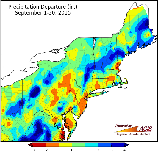
September precipitation ranged from 2 inches below normal to more than 4 inches above normal.
Precipitation, however, was inconsistent. Some areas saw a mid-month downpour. For instance, Philadelphia had its 8th all-time wettest day on the 10th. Other areas were very dry the whole way through the first 28 days of the month. Binghamton, for example, was record-dry for that time period. Even the rain on the last two days of September was inconsistent in coverage, with some areas seeing around an inch and other areas seeing upwards of 6 inches. With that, September precipitation totals at the major airport climate sites ended up varying quite a bit, from 51% of normal in Atlantic City to 209% of normal in Albany.