A Warm and Dry April-to-Date
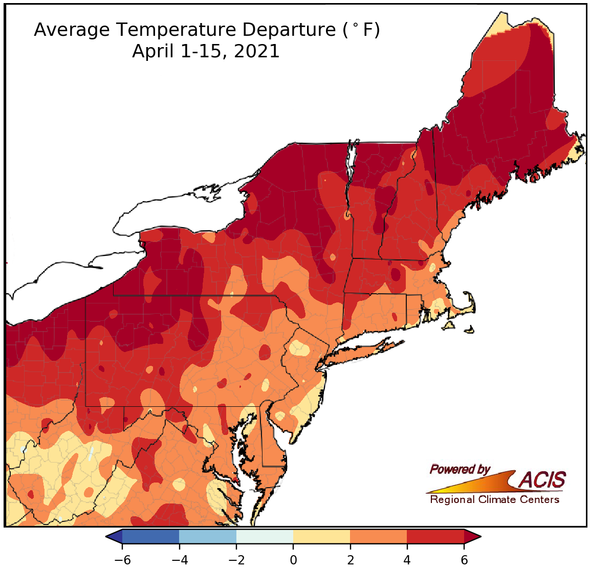
April 1-15 average temperatures ranged from near normal to more than 6°F above normal.
The first half of April was warmer than normal in the Northeast, with average temperatures ranging from near normal to more than 6°F above normal. The largest departures were found in portions of northern New England, New York, and northern Pennsylvania. At the major climate sites, average temperature departures for April 1-15 ranged from 1.3°F above normal in Charleston, WV, to 8.5°F above normal in Erie, PA. Thirty of the 35 sites ranked this April 1-15 period among their 20 warmest on record.
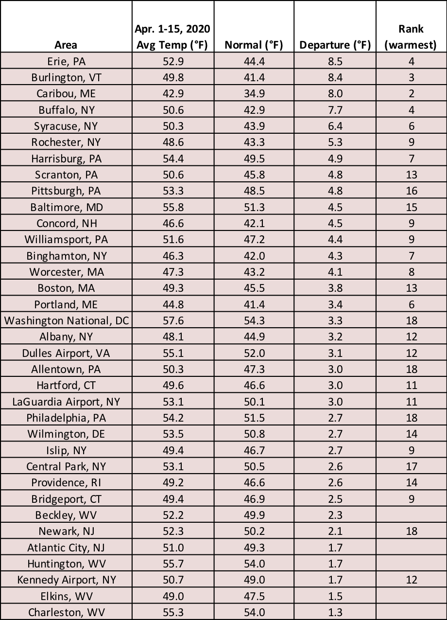
Thirty major climate sites ranked this first half of April among their 20 warmest.
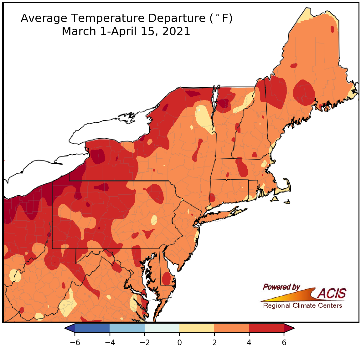
March 1-April 15 average temperatures ranged from near normal to more than 6°F above normal.
The first half of spring was also warmer than normal for the Northeast, with average temperatures ranging from near normal to more than 6°F above normal. The largest departures were in western Vermont, northern and western New York, and northern Pennsylvania. Average temperature departures for the March 1-April 15 period at the major climate sites ranged from 2.0°F above normal in Portland, ME, and Albany, NY, to 7.8°F above normal in Erie, PA. Thirty-three of the 35 major climate sites ranked this first half of spring among their 20 warmest on record.
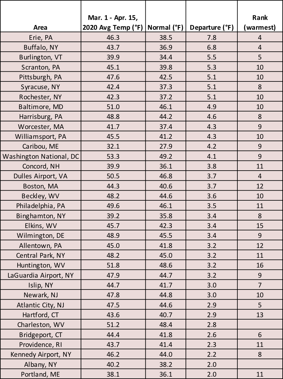
This March 1-April 15 period ranked among the 20 warmest at 33 major climate sites.
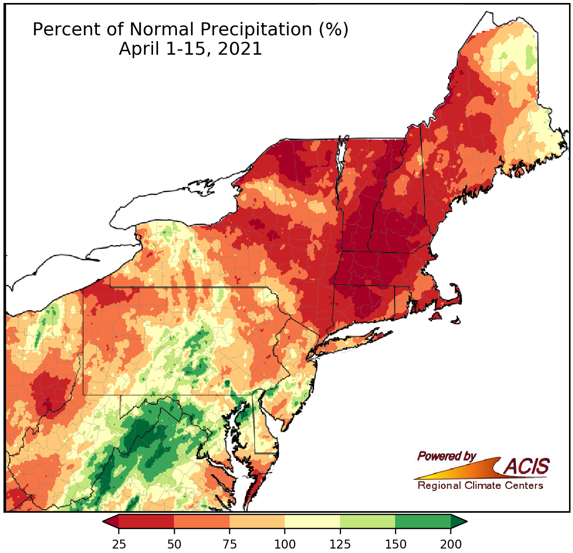
Precipitation during the first two weeks of April ranged from less than 25% of normal to more than 200% of normal.
While April 1-15 precipitation ranged from less than 25% of normal to more than 200% of normal, a majority of the Northeast was drier than normal. The driest locations included northern New York, much of Vermont, southern New Hampshire, and portions of Massachusetts and Connecticut. In fact, abnormal dryness and moderate drought conditions expanded in several of these areas. Meanwhile, the wettest locations were in portions of Maryland and eastern West Virginia, where abnormally dry conditions improved. April 1-15 precipitation at the major climate sites ranged from 32% of normal in Concord, NH, to 136% of normal in Rochester, NY. Overall, 31 of the 35 sites were drier than normal with seven of them having one of their 20 driest starts to April. On the other hand, Islip, NY, had its 14th wettest first half of April.
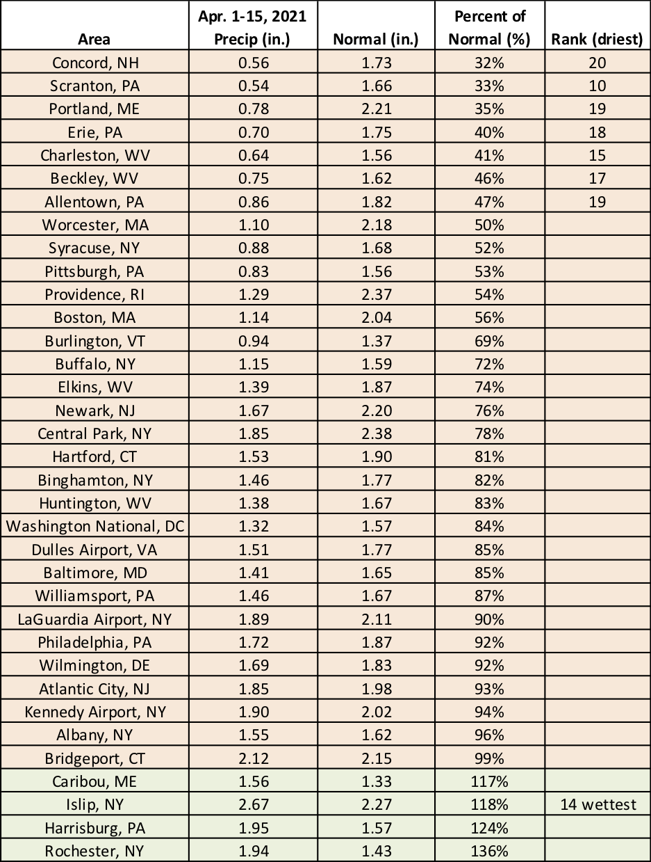
Seven major climate sites had one of their 20 driest starts to April, while Islip, NY, had its 14th wettest.
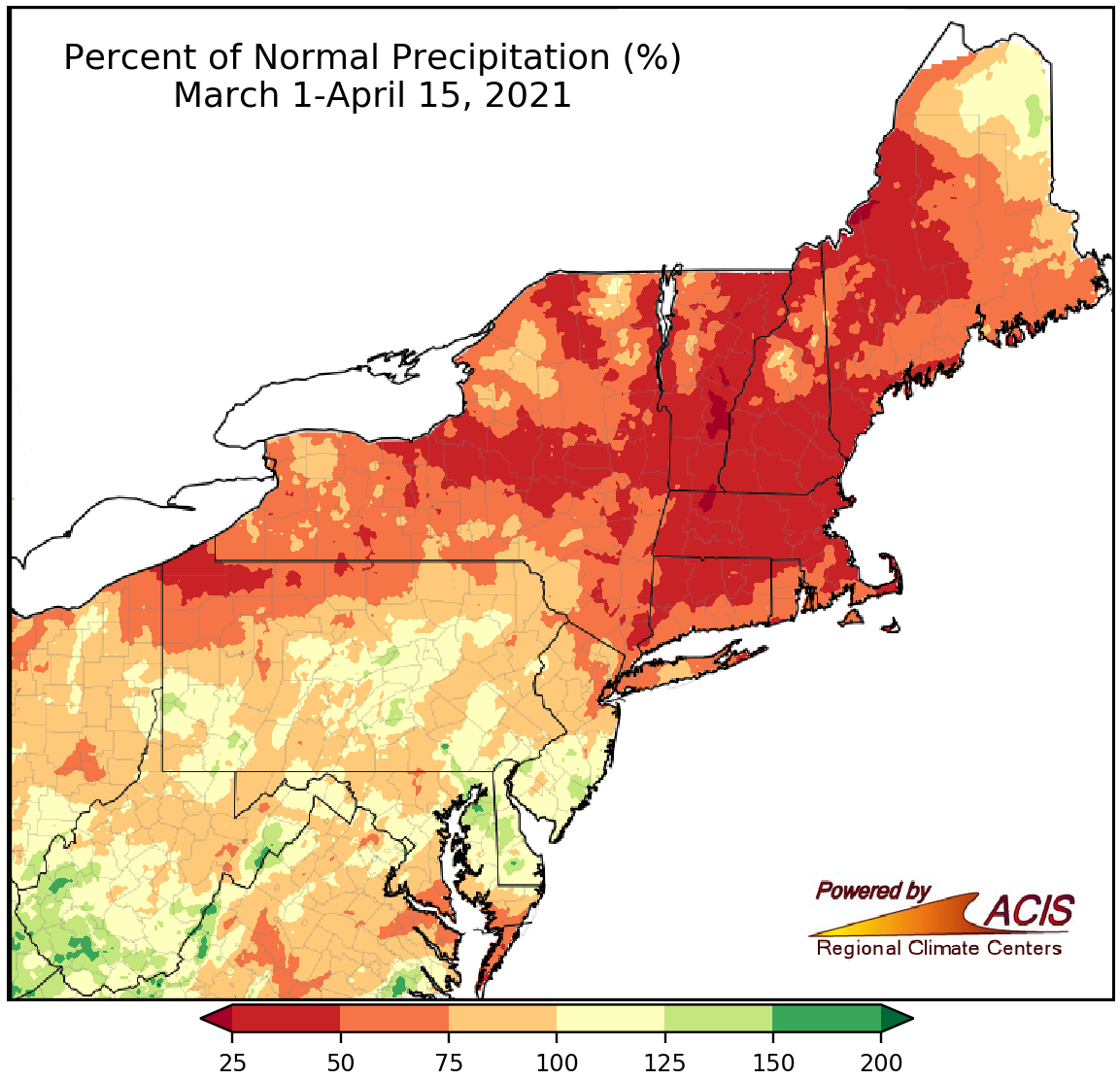
March 1-April 15 precipitation ranged from 25% of normal to 150% of normal.
The first half of spring was drier than normal for a majority of the Northeast but overall precipitation ranged from 25% of normal in parts of New England, New York, and northwestern Pennsylvania to 150% of normal in parts of West Virginia and the Delmarva Peninsula. At the 35 major climate sites, precipitation ranged from 36% of normal in Erie, PA, to 125% of normal in Atlantic City, NJ, with 28 of the sites being drier than normal. Nine major climate sites ranked this first half of spring among their 20 driest, while Atlantic City had its 13th wettest.
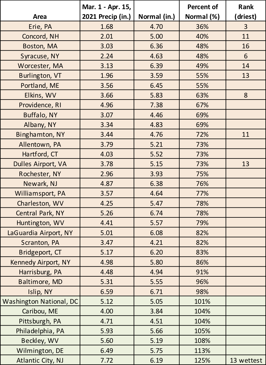
This first half of spring ranked among the 20 driest for nine sites and as the 13th wettest at Atlantic City, NJ.
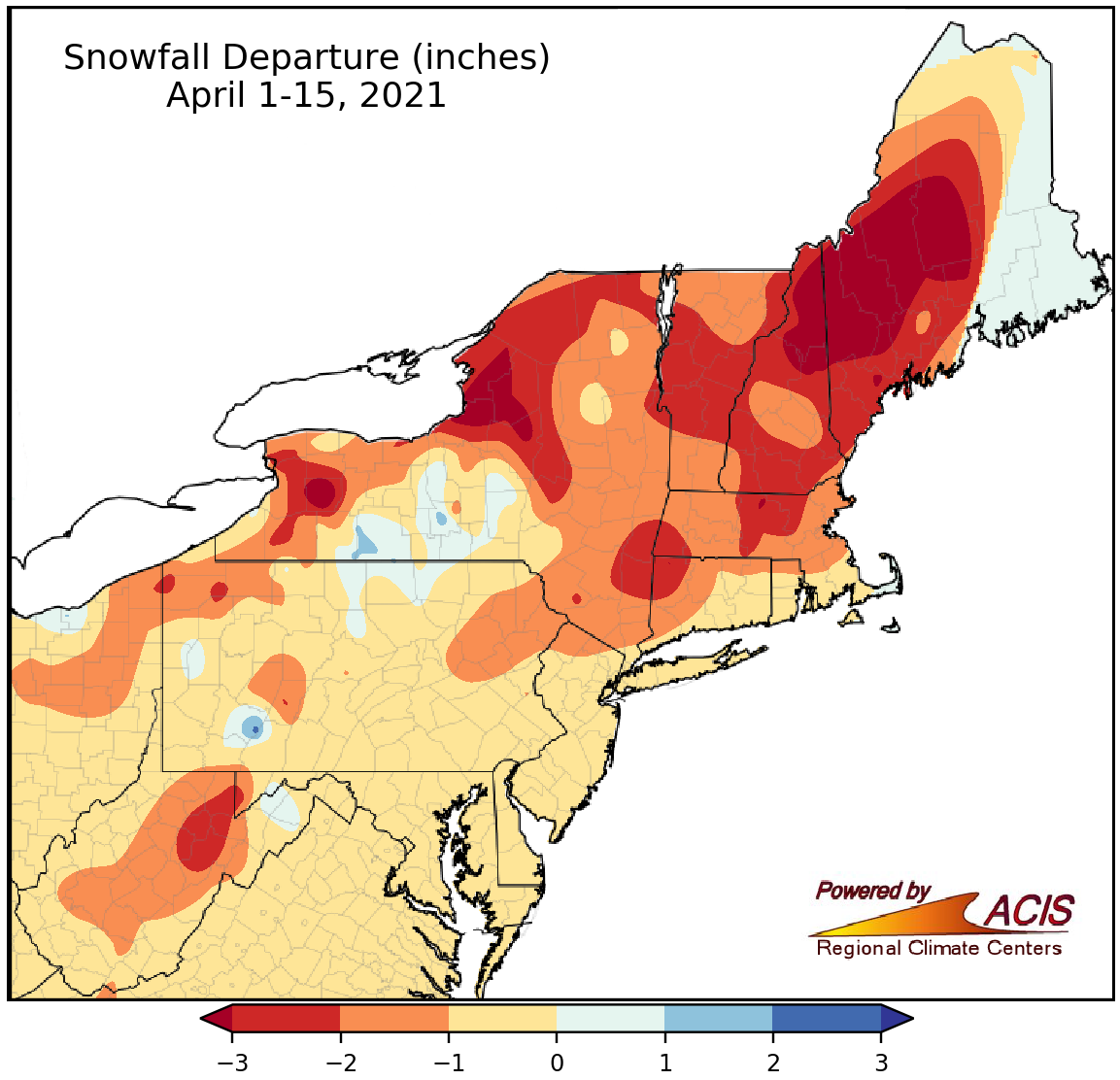
Snowfall from April 1-15 ranged from more than 3 inches below normal to 1 inch above normal.
During the first two weeks of April, snowfall ranged from more than 3 inches below normal to within 1 inch of normal for most of the Northeast. The largest deficits were in western Maine, northern New Hampshire, and northern and western New York. April 1-15 snowfall at the major climate sites ranged from 3.1 inches below normal in Elkins, WV, to 0.4 inches above normal in Caribou, ME, with most sites seeing below-normal snowfall.
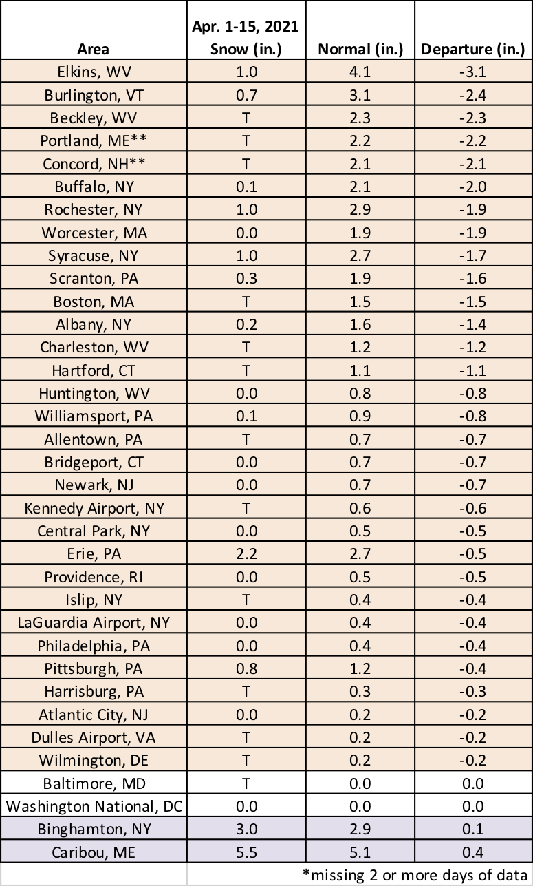
Most major climate sites received below-normal snowfall during the first half of April.
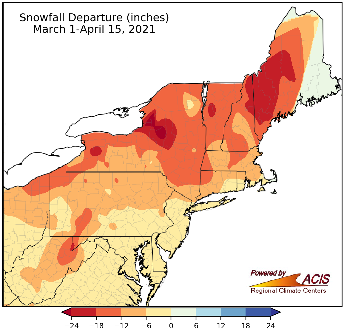
During the first half of spring, snowfall ranged from more than 24 inches below normal to near normal.
The entire Northeast saw below-normal snowfall during the first half of spring, with the largest deficits of more than 24 inches in northern New York. Snowfall at the 35 major climate sites ranged from 16.8 inches below normal in Rochester, NY, and Burlington, VT, to 1.3 inches below normal in Washington, D.C., and Atlantic City, NJ. This first half of spring was the least snowy on record (tying several other years in many cases) at nine major climate sites and ranked among the 20 least snowy at another 25 major climate sites.
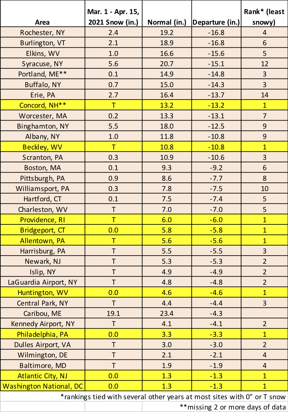
Nine major climate sites had their least snowy March 1-April 15 period on record, while another 25 sites had one of their 20 least snowy.
For May, NOAA’s Climate Prediction Center favors above-normal temperatures for most of the Northeast. There’s a tilt toward wetter-than-normal conditions for West Virginia and portions of Pennsylvania and Maryland. Equal chances of below-, near-, or above-normal precipitation was predicted for the rest of the region.
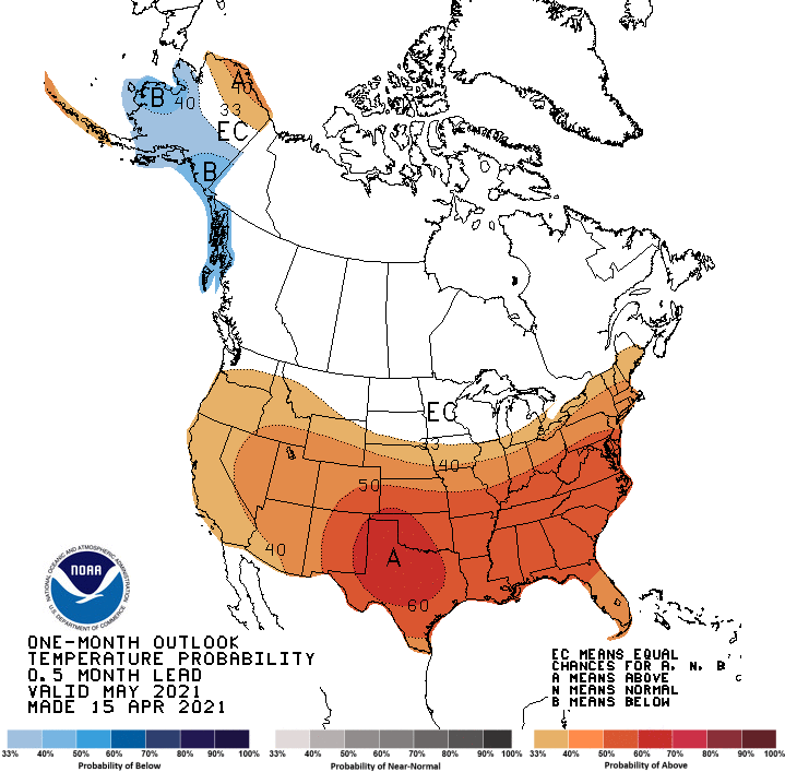
May is expected to average out to be warmer than normal in areas shaded orange.
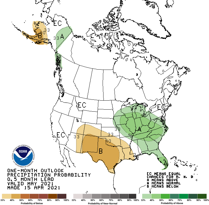
Some southern parts of the Northeast could be wetter than normal in May.