How are Drought Conditions Classified?
The U.S. Drought Monitor, in partnership with the National Oceanic and Atmospheric Administration (NOAA), the National Drought Mitigation Center at the University of Nebraska-Lincoln, and the U.S. Department of Agriculture, releases a weekly report detailing drought conditions that are currently impacting any part of the country. Observations are gathered from over 350 contributors around the nation and the weekly maps are based on those reports, as well as current soil and climatological conditions. The analysis from those observations leads to the creation of the U.S. Drought Monitor maps and reports, which depict the location and intensity of dry conditions anywhere in the country.
Drought conditions are classified on a system based on current soil moisture content, streamflow, and recent precipitation. Photo from the U.S. Drought Monitor.
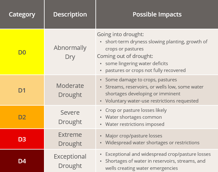
On the scale used by the U.S. Drought Monitor, conditions can range from D0 to D4. A rating of D0 indicates an area is abnormally dry (meaning drought conditions are not yet present, although they could later develop) and a rating of D4 categorizes areas in exceptional drought. Short-term droughts are typically defined when conditions last less than six months, while long-term droughts are defined as lasting over half a year. The U.S. Drought Monitor’s data are available to anyone, and can also show comparisons of how drought conditions have changed over time for a particular state or region.
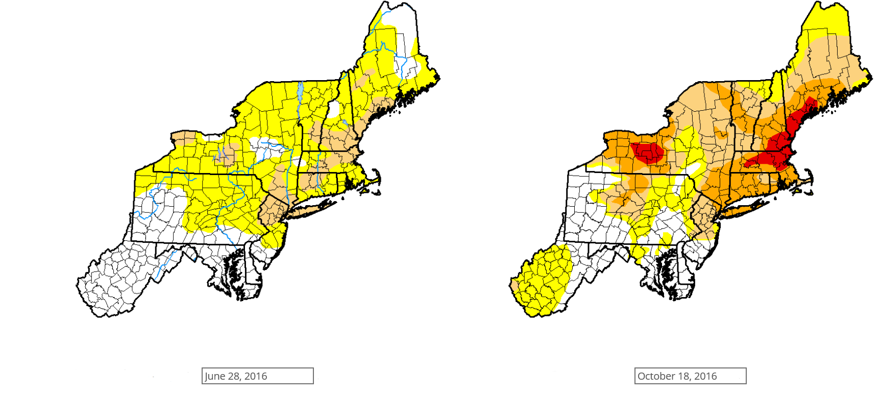
About 21% of the Northeast experienced severe drought (D2) with 5% of the area under extreme drought conditions (D3) during the Fall of 2016 (right) compared to the beginning of the summer that same year (left). Photo from the U.S. Drought Monitor.
As of June 28, abnormally dry conditions were impacting 25% of the entire Northeast, whereas two weeks beforehand, only 6% of the region was abnormally dry. In addition, 6% of the region was experiencing moderate drought (D1) throughout parts of southern Vermont, New Hampshire, and Maine.
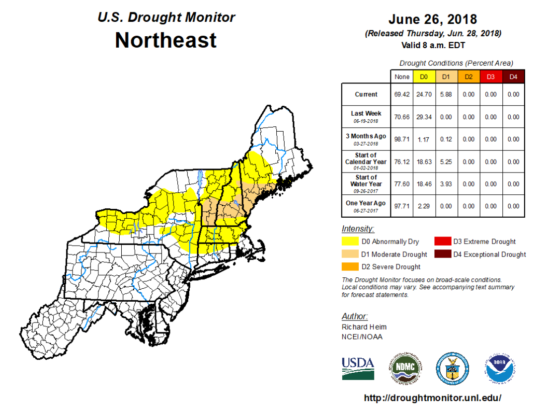
Abnormal dryness (D0) as well as moderate drought (D1) conditions are currently present in the northern part of the region. Photo from the U.S. Drought Monitor.