What a Week!
The first week of May was quite wet across the Northeast, with some areas receiving more than four times their normal May 1-7 precipitation. In fact, Rochester and Buffalo, NY received an entire May’s worth of rain in just the first week and Providence, RI and Syracuse, NY have seen more than 90% of their normal May precipitation already.
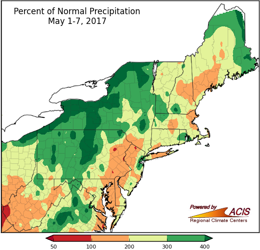
During the first seven days of May, precipitation generally ranged from near normal to more than 400% of normal.
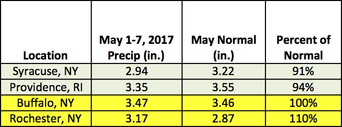
Four sites have seen 90-110% of their normal May precipitation during the first seven days of the month.
Based on data from 1981-2010, the average date of the last spring frost ranges from late April in Washington, D.C. and New York City to mid-May in Elkins, WV and parts of northern New England. While the average date has passed for a majority of the Northeast’s major climate sites, the recent low temperatures in the 20s and 30s are a good reminder that frost and freezes can occur in May. In fact, the latest frost occurred in May (or later!) for all but four major climate sites. For the latest frost and freeze watch/warning information, visit your local National Weather Service webpage.
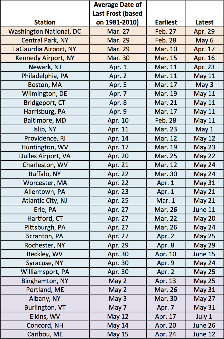
The average, earliest, and latest dates of the last spring frost at the region’s major climate sites.