May Plays It Cool…So Far
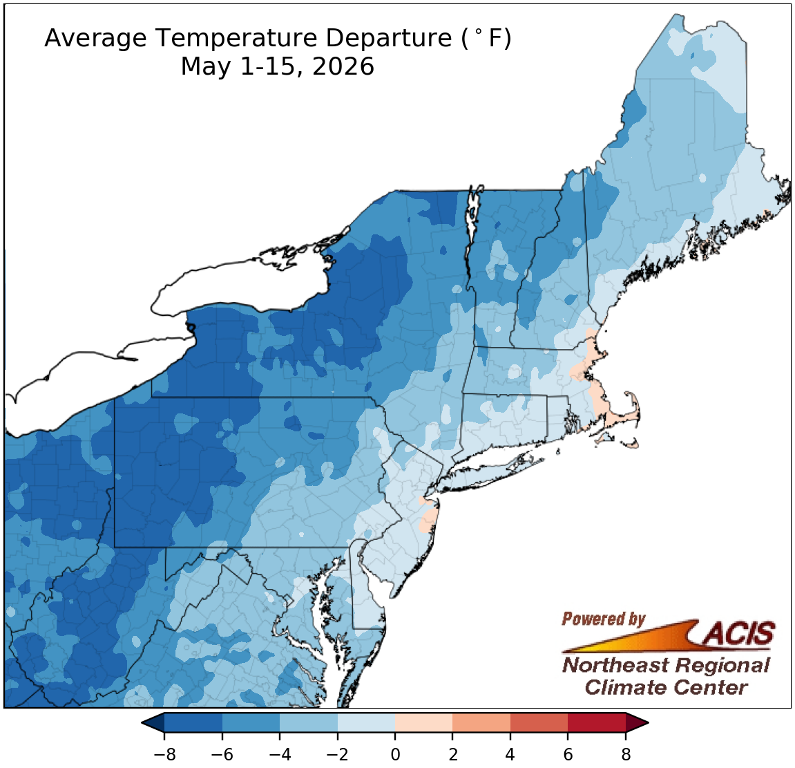
May 1-15 average temperatures ranged from 8°F below normal to near normal for most of the Northeast.
Most of the Northeast experienced a cool first half of May, with interior locations from West Virginia to northern New York being more than 6°F cooler than normal. Only a few coastal spots like eastern Massachusetts were slightly warmer than normal. At the Northeast’s 35 major sites, May 1-15 average temperatures ranged from 7.1°F below normal in Rochester, NY, to 0.1°F above normal in Boston, MA, the only warmer-than-normal site. This first half of May ranked among the 20 coolest such periods for nine major sites.
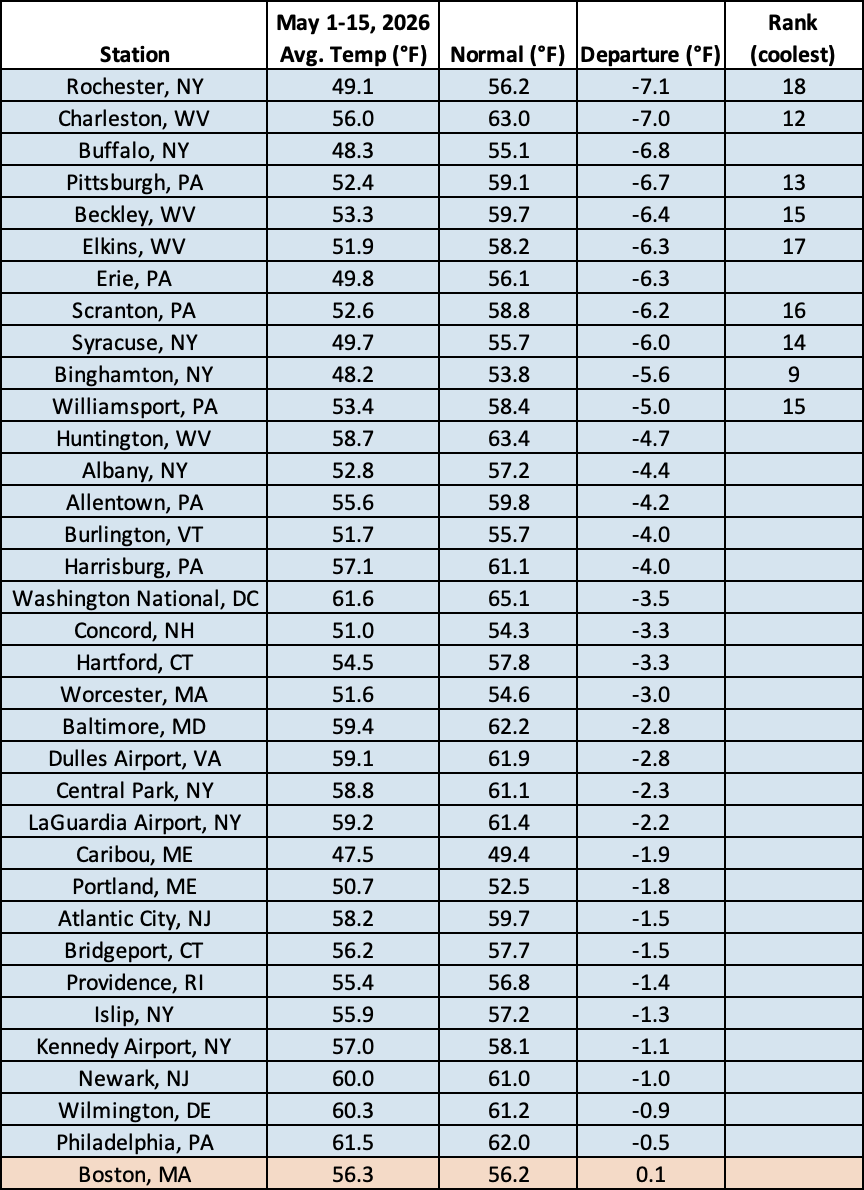
This May 1-15 period was among the 20 coolest such periods for nine major sites.
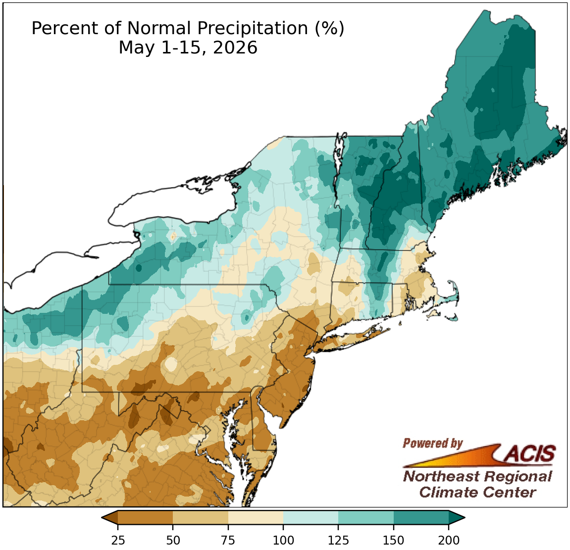
May 1-15 precipitation ranged from less than 25% of normal to more than 200% of normal.
Precipitation during the first half of May ranged from less than 25% of normal in places like eastern West Virginia, western Maryland, and coastal New Jersey to over 200% of normal in spots like coastal Maine, central New Hampshire, and northern Vermont. May 1-15 precipitation at the 35 major sites ranged from 17% of normal in Atlantic City, NJ, to 230% of normal in Portland, ME, with 24 of the sites being drier than normal. This first half of May ranked among the 20 driest such periods for nine major sites but was among the 20 wettest for four others. Drought conditions persisted or intensified in places like the Mid-Atlantic and southern New England but improved in Maine.
No major climate sites saw measurable snow during the first half of May. Only five major sites average snowfall for the May 1-15 period with amounts being 0.6 inches or less.
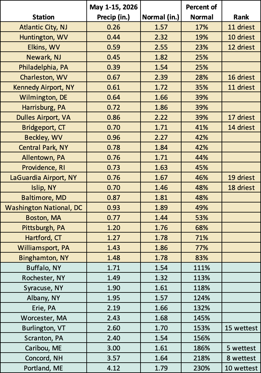
This May 1-15 period was among the 20 driest such periods for nine major sites but was among the 20 wettest for four others.