March Nor’easter Batters the Region
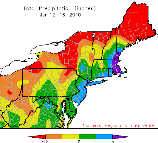
Precipitation from the recent Nor’easter ranged from less than half-inch to more than 6 inches.
Once again, portions of the Northeast were pummeled by a nor’easter, but this time the precipitation fell as rain, not snow. The sluggish, but intense, low pressure system approached the region on the 12th and didn’t clear out until late on the 15th. Most heavily impacted were portions of New Jersey, New York, and New England - the same areas that saw heavy snow and rain in late February. Ground already saturated couldn’t absorb the 3-10 inches of rain that fell, resulting in extensive flooding of roads, homes and businesses. Sustained winds in the 25-35 mph range combined with gusts of 40-60 mph to topple trees and power lines, cutting power to over 900,000 customers. High pressure is expected to keep things dry for a few days, allowing floodwaters to recede and clean-up to continue unimpeded.