January - Warm and Wet
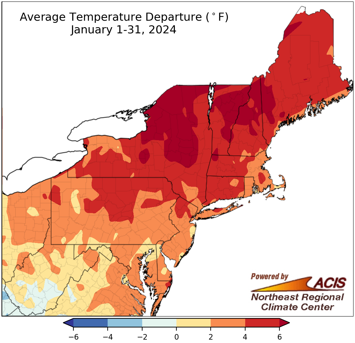
January average temperatures ranged from 2°F below normal to more than 6°F above normal.
January was warmer than normal for a majority of the Northeast, with average temperatures ranging from near normal in parts of the Mid-Atlantic to more than 6°F above normal in parts of New York and New England. However, portions of West Virginia were as much as 2°F cooler than normal. At the Northeast’s major climate sites, January average temperatures ranged from 0.2°F below normal in Beckley, WV, the only cooler-than-normal site, to 6.1°F above normal in Burlington, VT. January 2024 ranked among the 20 warmest Januarys on record for 15 major climate sites.
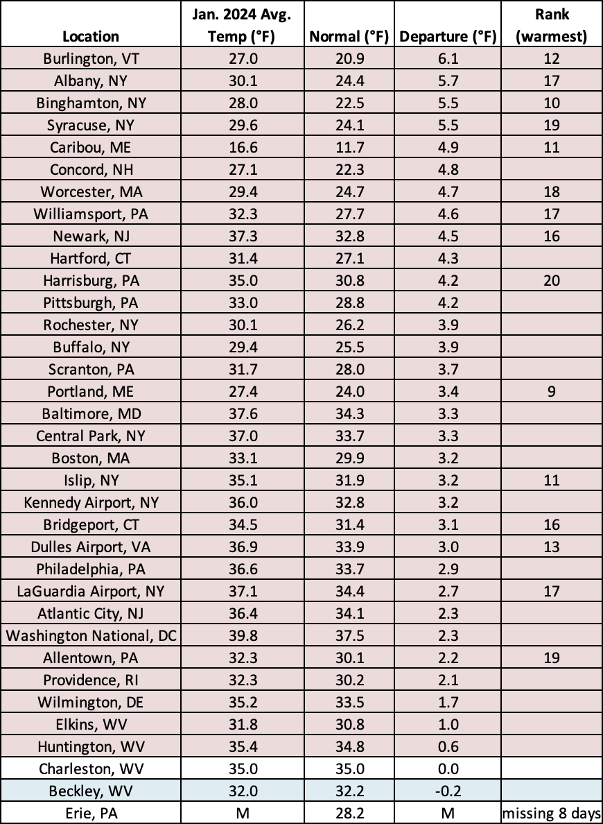
January 2024 was among the 20 warmest Januarys on record for 15 major climate sites.
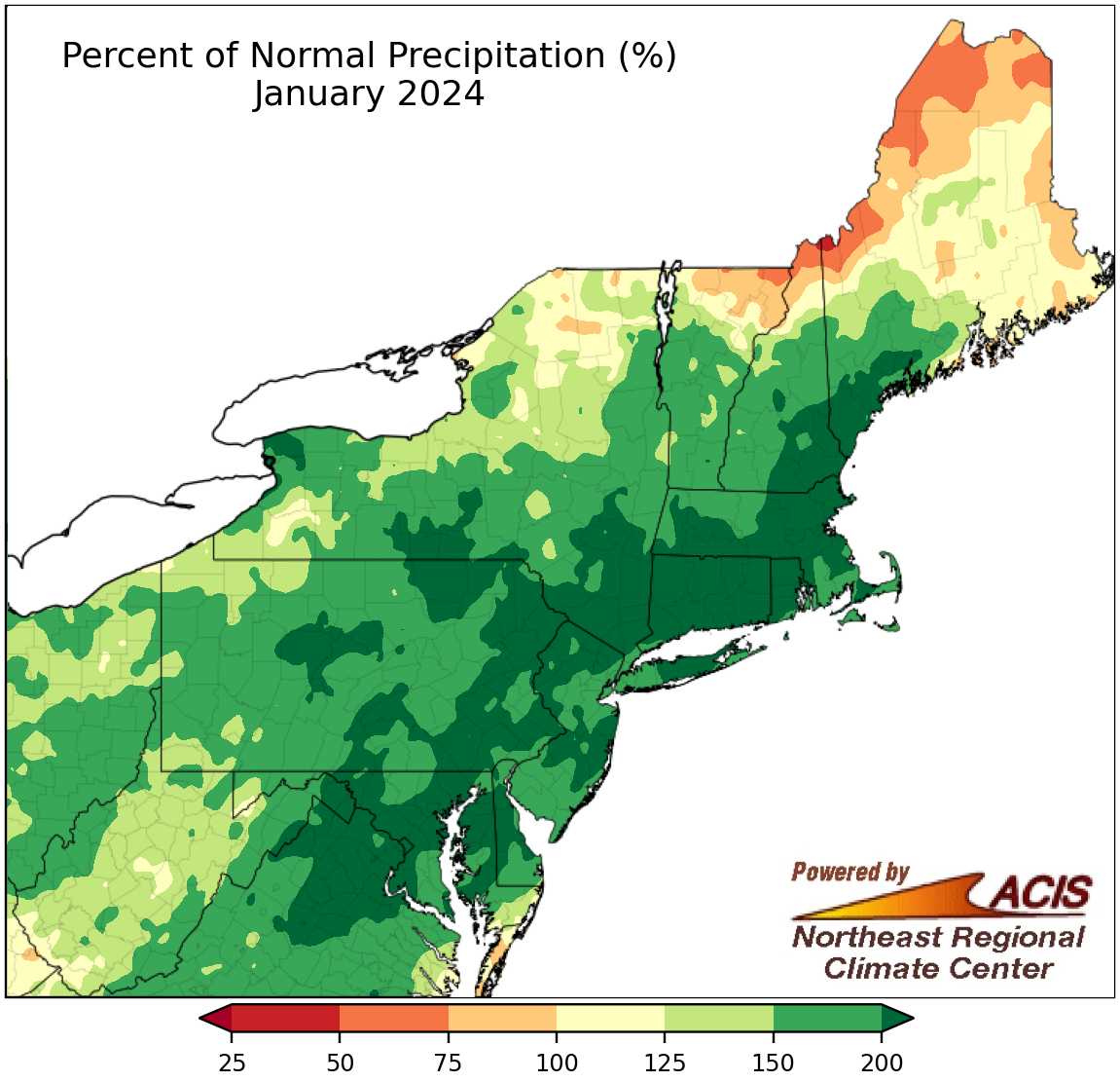
January precipitation ranged from 50% of normal to more than 200% of normal.
While far northern parts of northern New England were drier than normal, the rest of the Northeast experienced a wetter-than-normal January. The wettest locations, which included an area from eastern West Virginia through southern Maine, saw over 200% of normal precipitation. January precipitation at the region’s 35 major climate sites ranged from 76% of normal in Caribou, ME, the sole drier-than-normal site, to 255% of normal in Hartford, CT. This January was among the 20 wettest Januarys on record for 29 of the major climate sites. The wet conditions helped alleviate much of the drought and dryness in the Northeast.
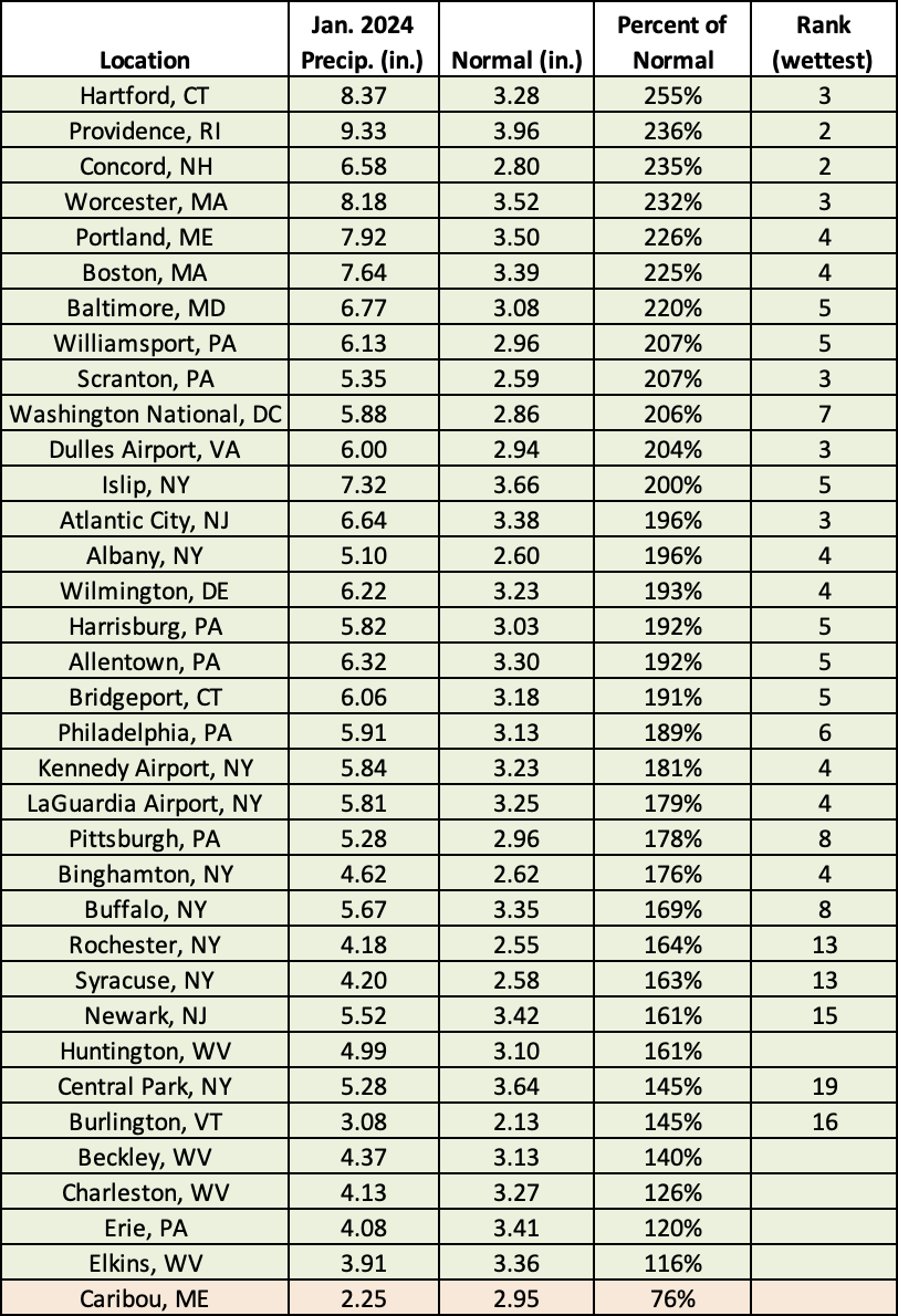
This January ranked among the 20 wettest Januarys on record for 29 of the major climate sites.
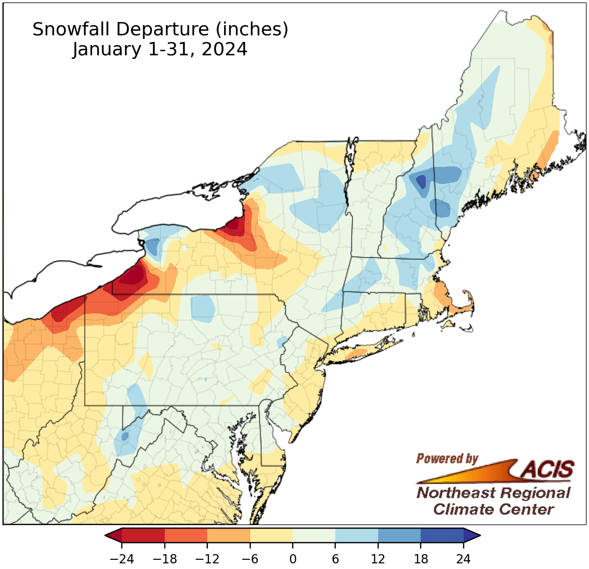
January snowfall ranged from more than 24 inches below normal to 24 inches above normal.
Precipitation was plentiful in January, but above-normal temperatures contributed to variable amounts of snowfall. While snowfall for much of the region was within 6 inches of normal, it ranged from more than 24 inches below normal to 24 inches above normal. At the region’s 35 major climate sites, January snowfall ranged from 17.1 inches below normal in Erie, PA, to 18.9 inches above normal in Buffalo, NY, with 20 of the sites falling on the snowy side of normal. January 2024 ranked as the 20th least snowy January on record for Islip, NY, but among the 20 snowiest for four other major climate sites.
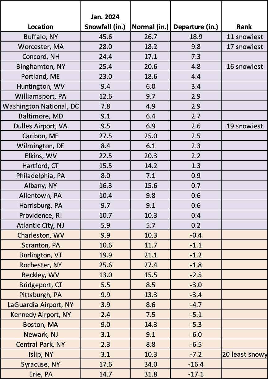
This January ranked as the 20th least snowy January on record for Islip, NY, but among the 20 snowiest for four other major climate sites.
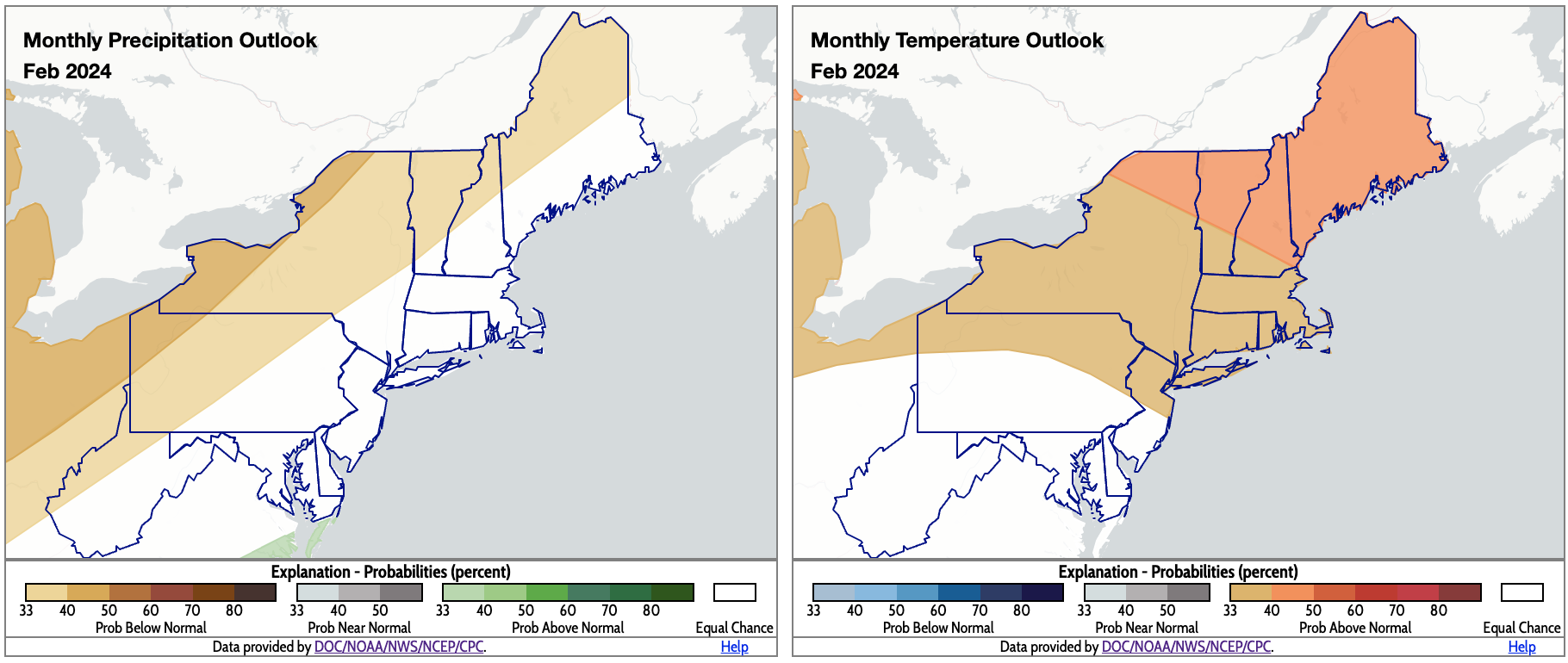
For February, NOAA’s Climate Prediction Center favors below-normal precipitation for interior parts of the region and above-normal temperatures for northern areas. Click to enlarge.
There’s an increased likelihood that interior parts of the Northeast, particularly northwestern Pennsylvania and portions of New York, will be drier than normal for February, according to NOAA’s Climate Prediction Center. Equal chances of below-, near-, or above-normal precipitation was forecast for the remainder of the region. The February temperature outlook favors above-normal temperatures for northern parts of the Northeast, as well as northern Pennsylvania and northern New Jersey, with the highest chance in northern New York and parts of northern New England. The rest of the region falls into the equal chances category.