Mid-April - Mostly More of the Same

April 1-15 average temperatures ranged from near normal to more than 6°F above normal.
Average temperatures during the first half of April ranged from near normal, particularly in areas closer to the coast, to more than 6°F above normal, mostly in interior and northern locations. At the Northeast’s 35 major climate sites, April 1-15 average temperatures ranged from 0.6°F above normal in Providence, RI, to 6.4°F above normal in Buffalo, NY, with this first half of April ranking among the 20 warmest on record for 28 of the sites.
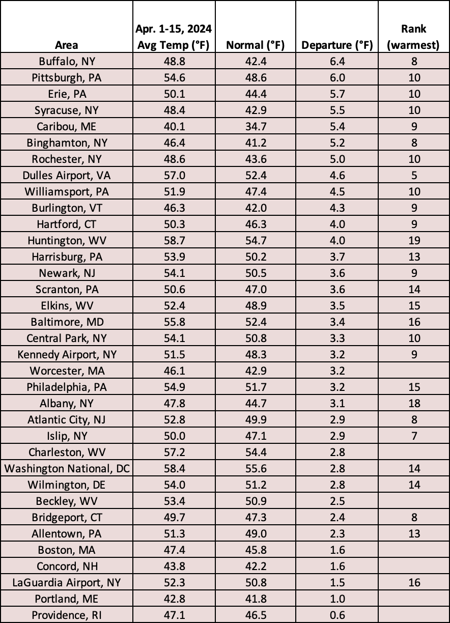
This first half of April ranked among the 20 warmest on record for 28 major climate sites.
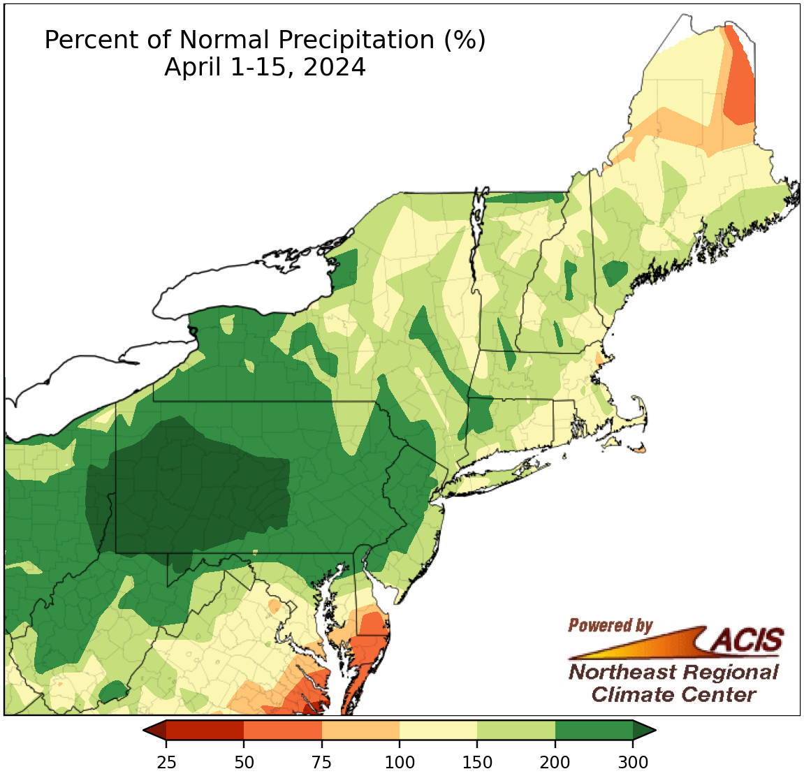
April 1-15 precipitation ranged from 50% of normal to more than 300% of normal. Note: map scale has been shifted to account for extremely wet conditions.
The first half of April was wetter than normal for most of the Northeast, with the wettest locations in Pennsylvania, northern West Virginia, and western Maryland seeing more than 300% of normal precipitation. The exceptions were generally in the far northern and far southern parts of the region such as northern Maine and on the Delmarva Peninsula. April 1-15 precipitation at the region’s 35 major climate sites ranged from 48% of normal in Caribou, ME, one of only two drier-than-normal sites, to 468% of normal in Pittsburgh, PA. This April 1-15 period was record wet for four major climate sites - Pittsburgh, PA; Williamsport, PA; Elkins, WV; and Rochester, NY - and among the 20 wettest for another 22 of the sites. Meanwhile, Caribou, ME, experienced its 15th driest start to April.
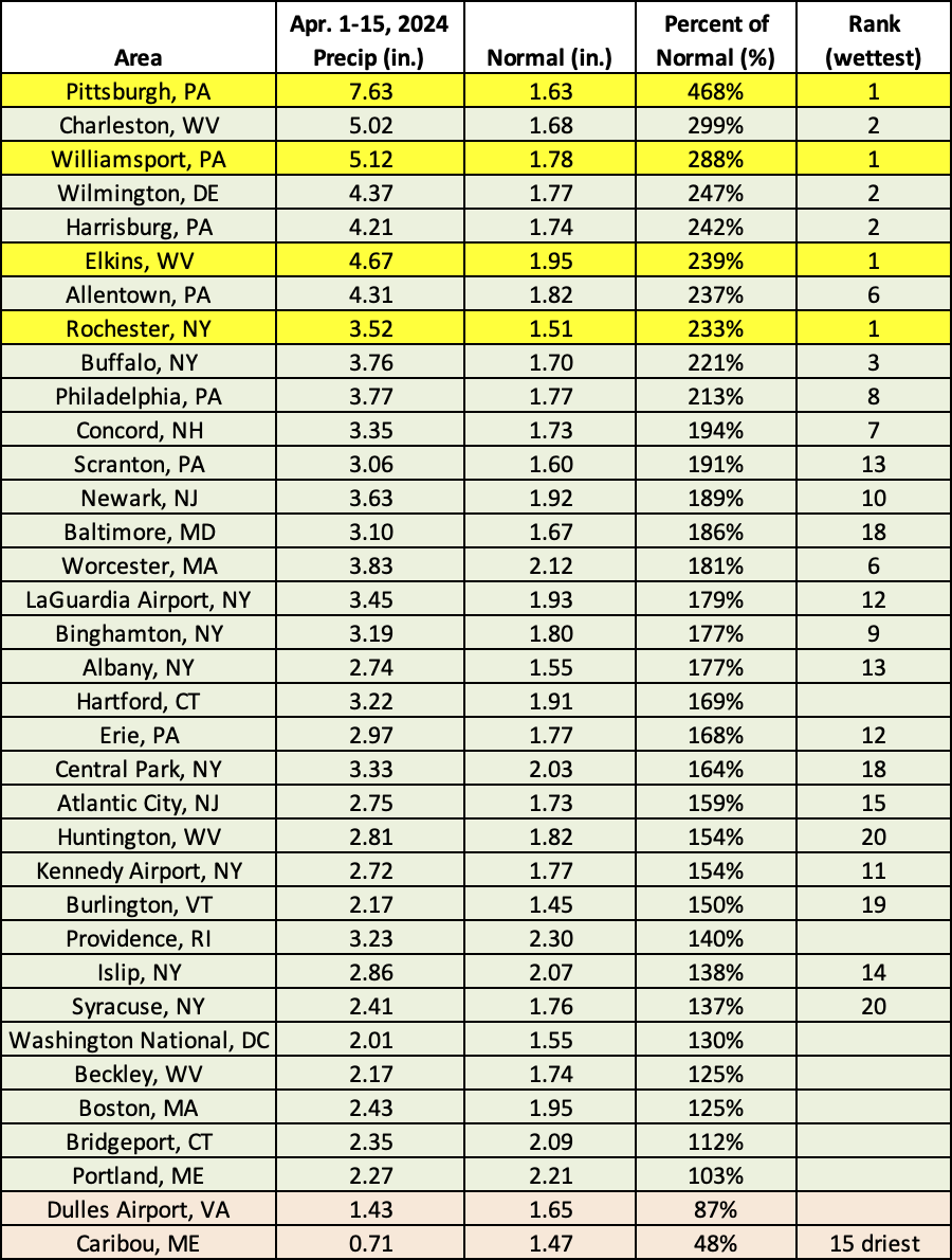
This April 1-15 period was record wet for four major climate sites and among the 20 wettest for another 22 of the sites but was the 15th driest for Caribou, ME.
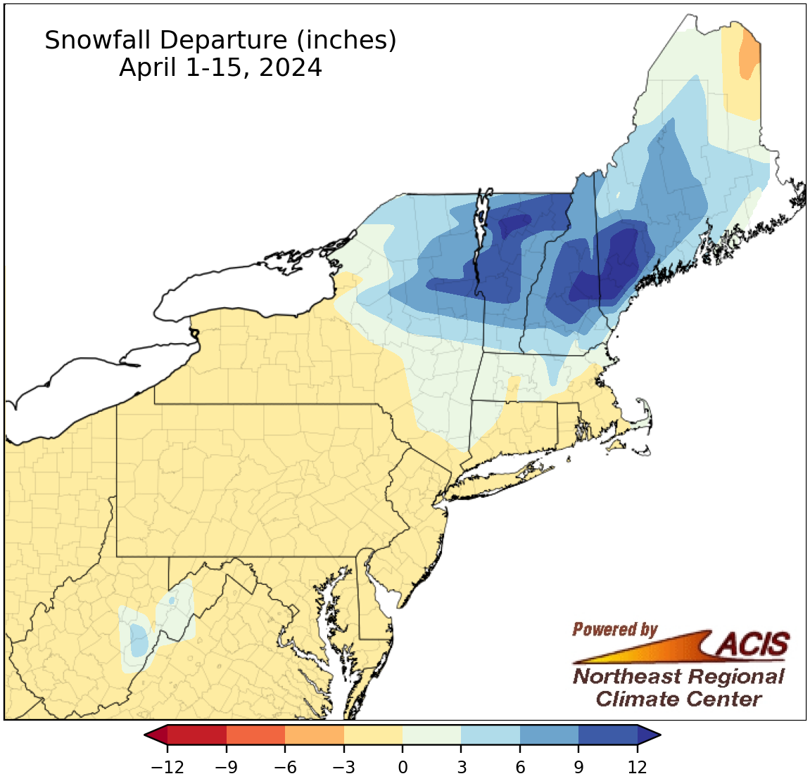
April 1-15 snowfall ranged from more than 3 inches below normal to more than 12 inches above normal.
Snowfall during the first half of April generally ranged from more than 3 inches below normal in northern Maine to more than 12 inches above normal in parts of northern Vermont, central New Hampshire, and western Maine, with a large portion of the region seeing near-normal snowfall. April 1-15 snowfall at the 35 major climate sites ranged from 4.6 inches below normal in Caribou, ME, its 17th least snowy start to April, to 11.3 inches above normal in Concord, NH, with 28 sites seeing below-normal snowfall. Despite that, this first half of April ranked among the 20 snowiest for three major climate sites.
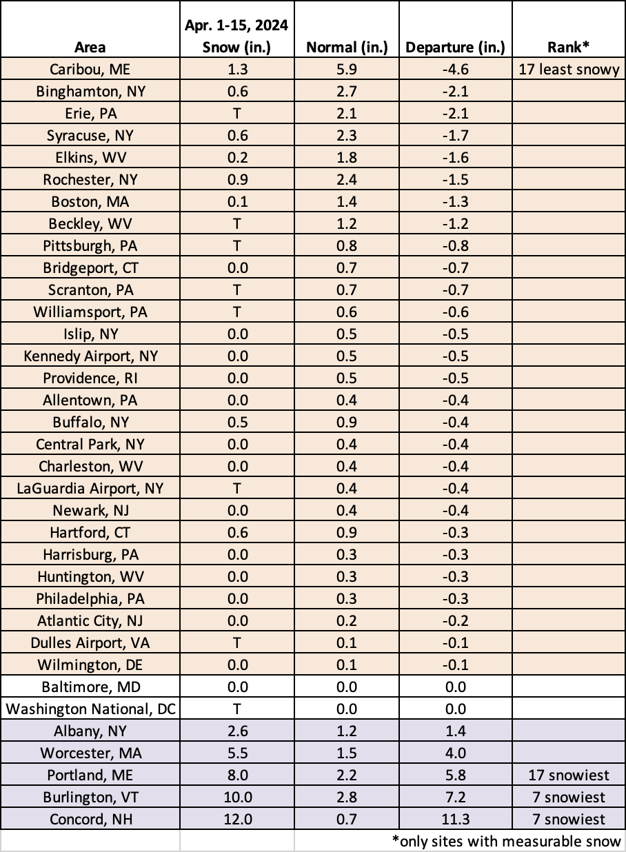
This April 1-15 period ranked as the 17th least snowy in Caribou, ME, but among the 20 snowiest for three major climate sites.