In the Red
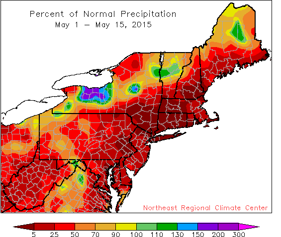
May has been an extremely dry month, with several areas seeing less than 5% of normal precipitation.
Most of the Northeast saw below-normal precipitation during the first half of May. In fact, some sites saw no measurable precipitation at all. Twenty of the 35 major airport climate sites saw less than 10% of normal precipitation, with 6 sites having record-dry starts to May. Around 62% of the Northeast was experiencing abnormally dry conditions as of May 14.
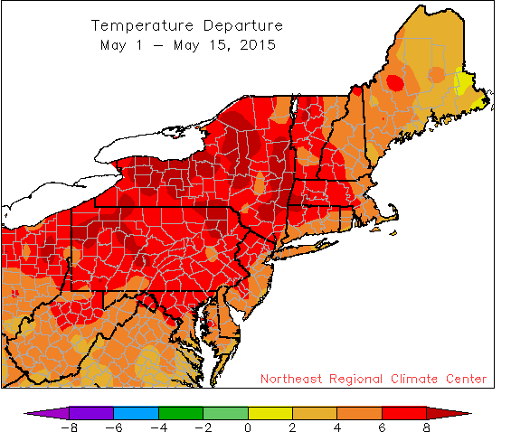
Average temperatures during May so far have ranged from 2°F above normal to more than 8°F above normal.
Temperatures were generally 3 degrees F to 10 degrees F warmer than normal. All 35 sites ranked the first half of this May among their top 15 warmest. In fact, 3 New York sites (Albany, Binghamton, and Buffalo) had record-warm starts to the month. The last time all 35 sites were warmer than normal was December 2014.