Heavy Rain & High Winds
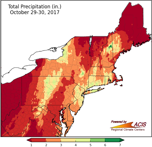
Precipitation totals as of Monday morning.
A strong storm continues to bring heavy rain, high winds, and even some snow to the Northeast. From Saturday (Oct. 28) through Monday (Oct. 30) morning, a wide swath of the region had received more than 2 inches of rain, with the highest rainfall total (as of Monday morning) of 6.38 inches in southern Vermont. Newark, NJ, received 3.86 inches of rain on the 29th, more than their normal precipitation for the entire month of October, which is 3.60 inches. The heavy rain caused flooding, which resulted in closed roads and flooded basements. For New England, this is the second major rain storm in a week. From October 24-27, parts of the region received up to 8.42 inches of rain (reported in northern New Hampshire).
Snow totals of up to 8.4 inches were reported in higher elevations of northern West Virginia and western Maryland. Wind gusts of up to 78 mph downed trees and wires. News reports indicated more than 1 million customers lost power in the Northeast. Flights were delayed for several hours at some major East Coast airports. In addition, dozens of schools were closed. We’ll have a complete recap of October conditions on Wednesday.
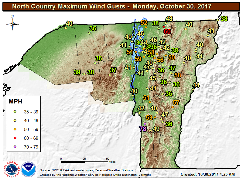
Wind gusts from the Burlington, VT, National Weather Service area. Imaged credit - NWS BTV.
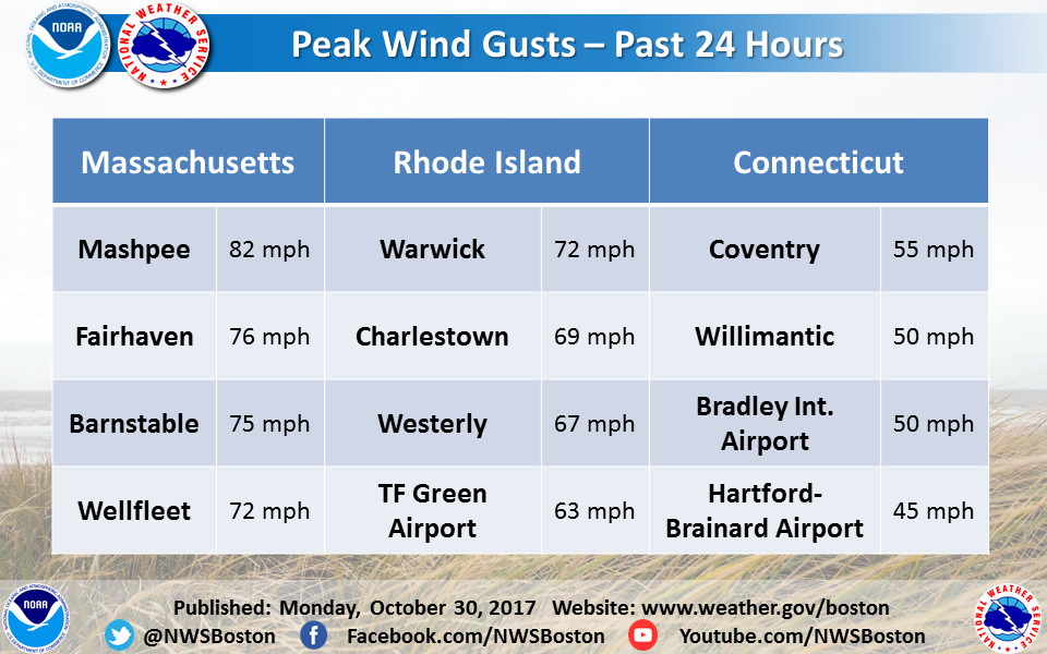
Wind gusts from the Taunton, MA, National Weather Service area. Image credit - NWS BOX.