Frost and Flakes
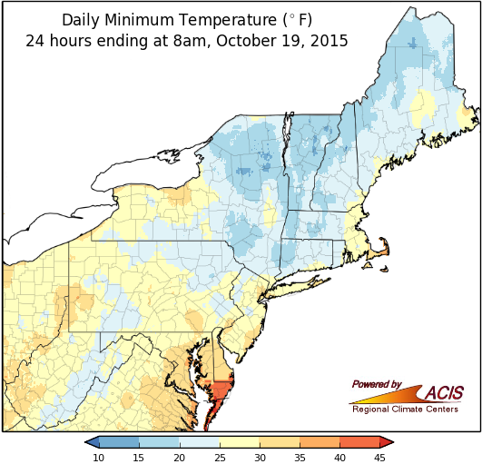
Low temperatures ranged from the teens to the low 30s at many sites on the 17th, 18th, or 19th.
Much of the Northeast saw below-freezing temperatures during the weekend, marking the first fall frost/freeze and the end of the growing season. The average date of the first frost varies across the region, with northern Maine usually having its first frost in late September and the New York City area having it in late November. Only three of the 35 major airport climate sites had a frost prior to this weekend, but by Monday morning, only six sites hadn’t had a frost. For some sites the frost came later than usual, while for other sites it was earlier than usual.
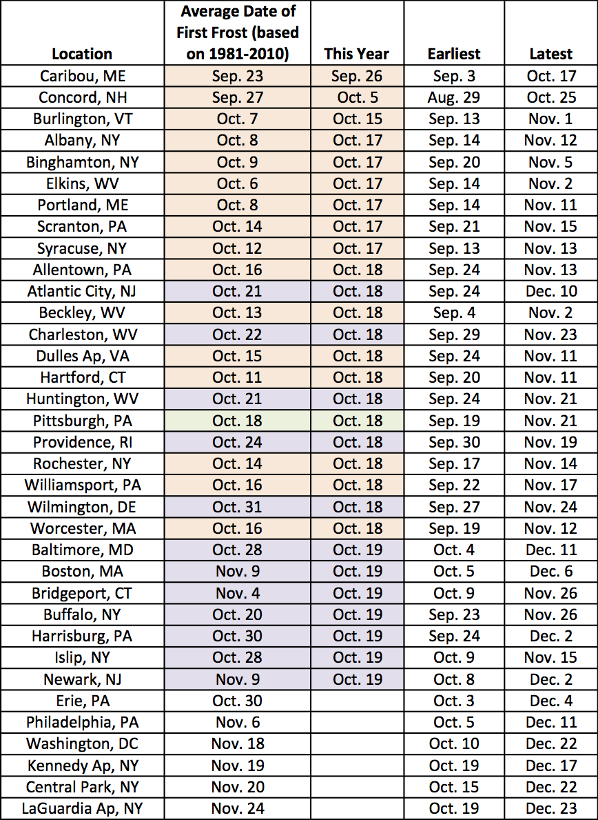
The first fall frost came early (shaded purple) or late (shaded orange) depending on the location.
The weekend also brought the first flakes of the season. A few lake-effect prone spots and higher elevations picked up 6 to 9 inches of snow. Other areas only saw a trace, but it was enough to tie daily records. The average date of the first inch of snow is right around the corner for parts of northern New England and upstate New York. Folks in the major Northeast cities have to wait a little longer. Of course, the first measurable snow (0.1 inches) is likely to come earlier.
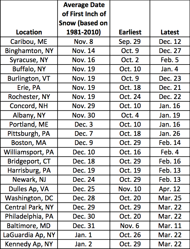
The average date of the first inch of snow ranges from early to mid-November to the start of the new year.