Mid-November - Lacking Precipitation, but Not Warmth
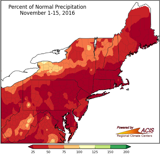
November 1-15 precipitation ranged from less than 25% of normal to near normal.
The first half of November was generally drier than normal, with most of the Northeast receiving less than 75% of normal precipitation. Thirty-three of the region’s 35 major climate sites were drier than normal, with twelve ranking this first half of November among their top 20 driest. Several sites including Bridgeport, CT; Kennedy Airport, NY; and Providence, RI had received 0.05 inches or less of precipitation until rain arrived on the 15th. Drought conditions and impacts continued across the region.
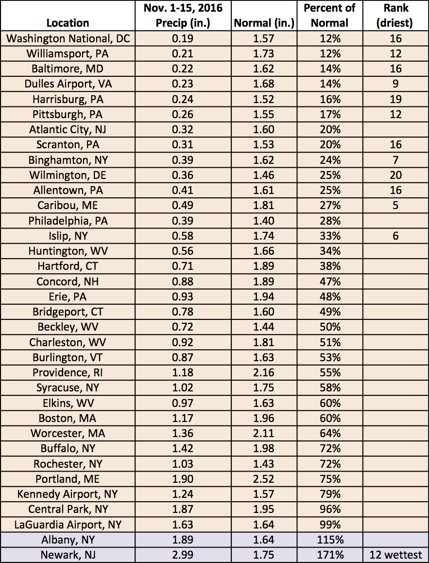
While most of the major climate sites were drier than normal, Newark, NJ had its 12th wettest start to November.
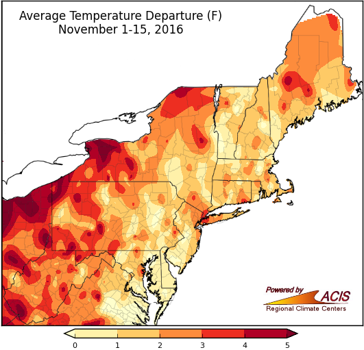
November 1-15 average temperatures ranged from near normal to more than 5°F above normal.
The Northeast saw above-normal temperatures during the first half of November. The largest departures from normal of more than 5°F above normal were in western New York, northwestern Pennsylvania, and southern West Virginia. All 35 major climate sites were warmer than normal, with fourteen having a top 20 warm start to November.
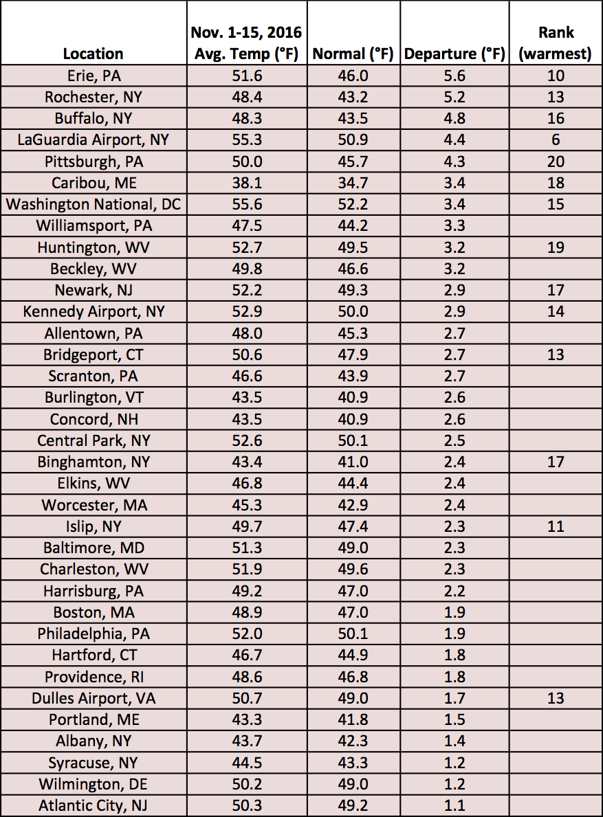
Average temperatures at the major climate sites ranged from 1.1°F above normal in Atlantic City, NJ to 5.6°F above normal in Erie, PA.
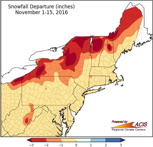
November 1-15 snowfall ranged from more than 3 inches below normal to near normal.
During the first half of November, snowfall was near to below normal. The largest departures from normal were in lake-effect prone areas of New York and Pennsylvania and portions of northern New York and northern New England, especially higher elevations. Thirty-one of the 35 major climate sites typically see measurable snow (0.1 inches) during the first two weeks of November, but this year none did.
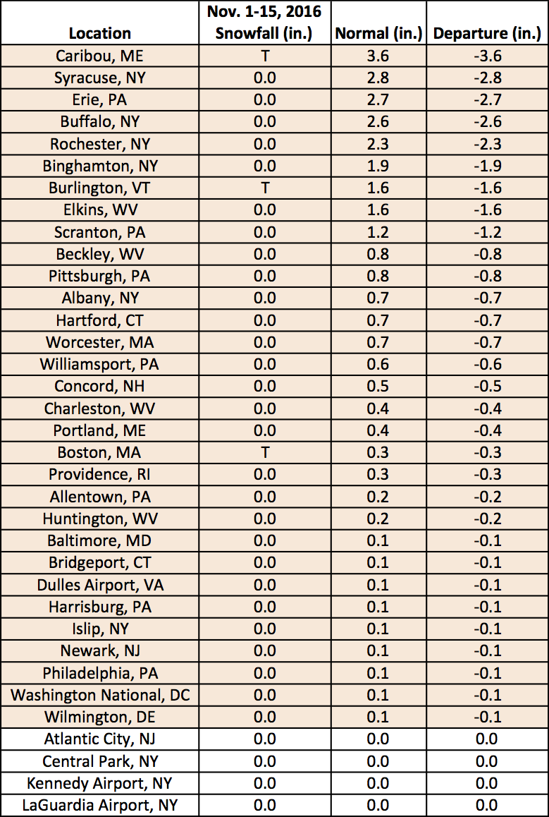
Of the major climate sites, Caribou, ME had the greatest snowfall deficit at 3.6 inches below normal.