Summer Continues…
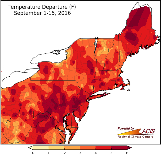
September 1-15 average temperatures ranged from 2°F to more than 6°F above normal.
The warmth of summer spilled into the first half of September, with temperatures running 3°F or more above normal for most of the region. The warmest spots were over 6°F above normal. Thirty-two of the 35 major Northeast climate sites ranked this September 1-15 period among their top 20 warmest, with Dulles Airport, VA being record warm. Both high and low temperatures were generally above normal. The average high temperature for the first half of September ranked among the top 20 warmest for 32 sites, while the average low temperature ranked among the top 20 warmest for 16 sites, with Dulles Airport, VA and Islip, NY being record warm. Twenty-five high temperatures records and 38 warm low temperature records have been set at these sites during the first two weeks of September.
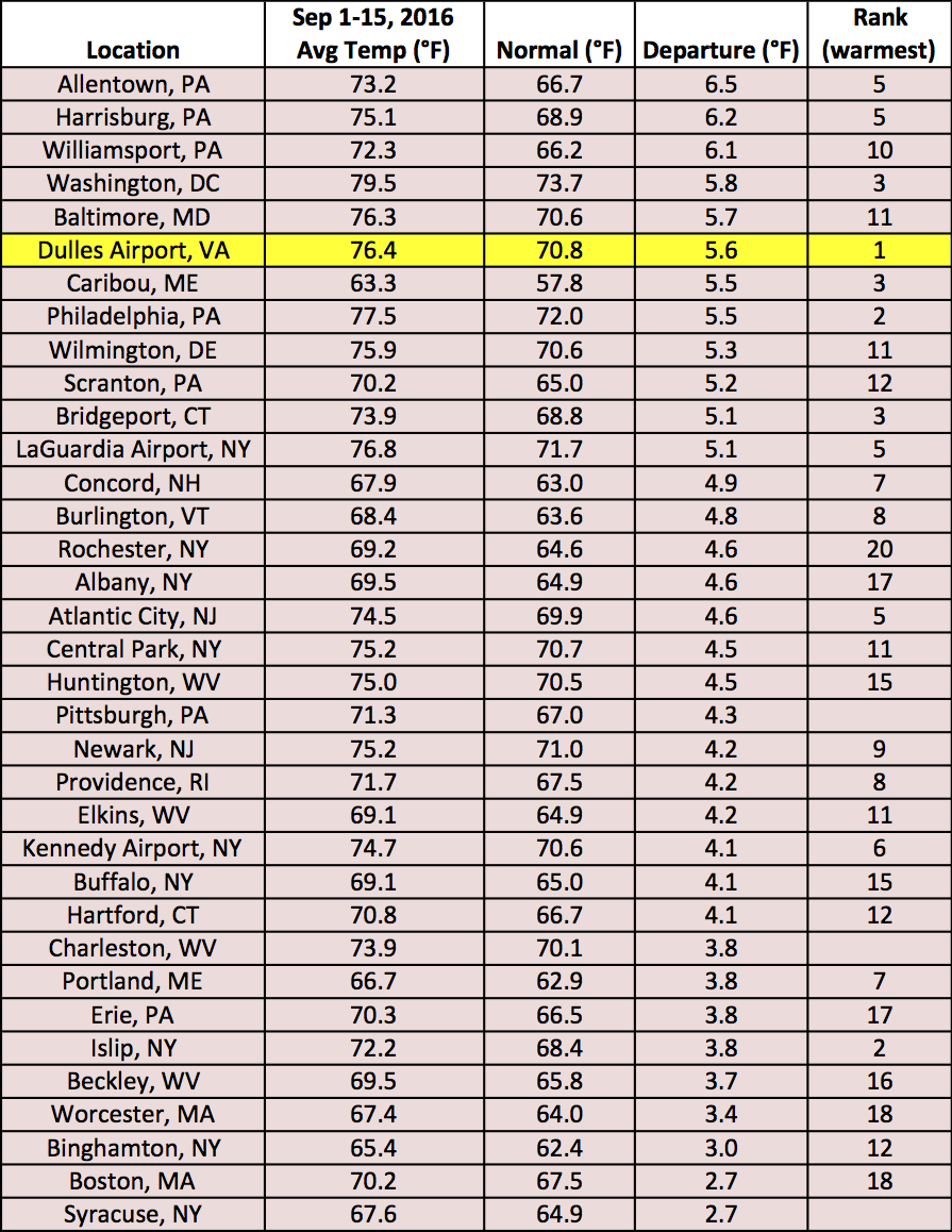
Average temperatures at the major climate sites ranged from 2.7°F above normal to 6.5°F above normal.
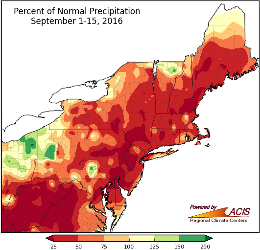
September 1-15 precipitation ranged from less than 25% of normal to 200% of normal.
For some areas, the dry conditions of summer continued into September. In fact, much of the region saw below-normal precipitation during the first half of the month, generally 75% of normal or less. The driest areas saw less than 25% of normal. All but one of the 35 major climate sites were drier than normal, with 15 ranking this September 1-15 period among their top 20 driest. The below-normal precipitation and above-normal temperatures led to intensifying drought conditions. For more information, go to the Northeast Drought Update.
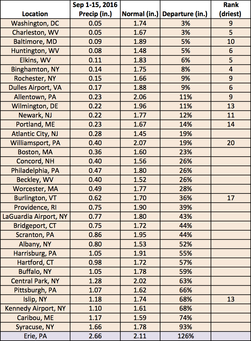
Precipitation at the major climate sites ranged from 3% of normal to 126% of normal.