Wrapping Up 2025
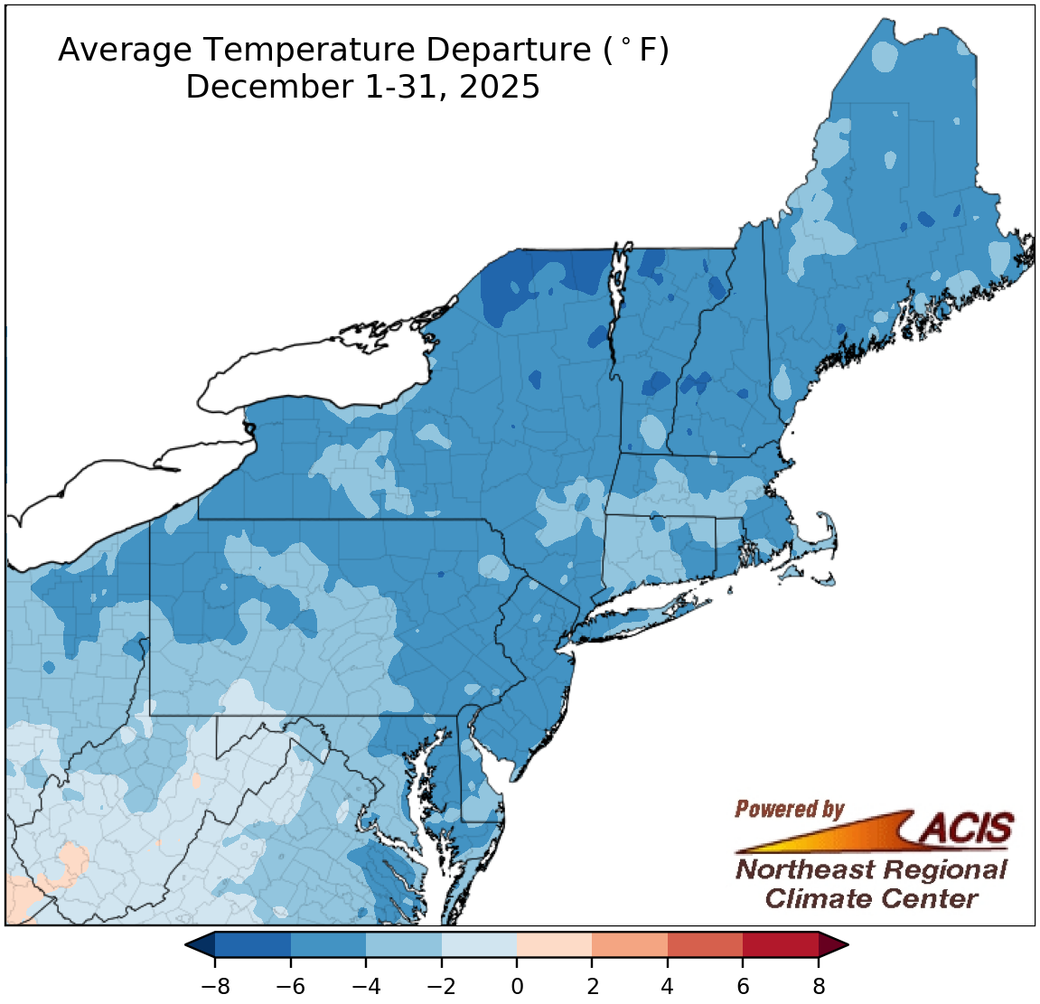
December average temperatures ranged from 8°F below normal to 2°F above normal.
Average temperatures for December ranged from 8°F below normal in northern New York and parts of northern New England to 2°F above normal in southwestern West Virginia. A large portion of the Northeast, though, was in the 2°F to 6°F below-normal range. At the region’s 35 major sites, December average temperatures ranged from 6.5°F below normal in Scranton, PA, to 0.1°F below normal in Huntington, WV. The month ranked among the 20 coldest Decembers on record for eight of the sites. This was the coldest December in 15 years for nearly half the sites and in 25 years for LaGuardia Airport, NY, and Providence, RI.
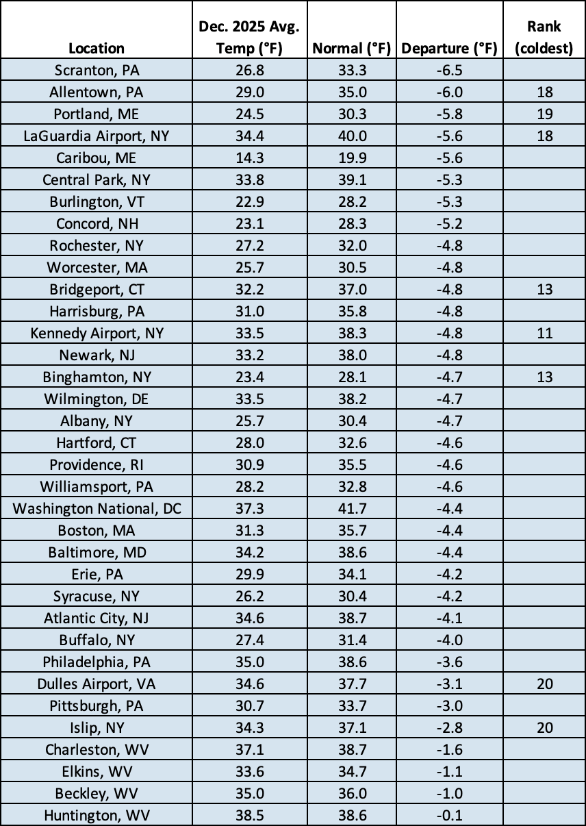
This December ranked among the 20 coldest Decembers on record for eight major sites.
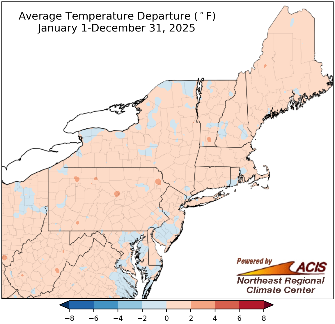
Average temperatures for 2025 were generally within 2°F of normal.
Average temperatures for 2025 generally averaged out to be within 2°F of normal, with a majority of the region on the warm side. Annual average temperatures at the region’s 35 major sites ranged from 0.9°F below normal in Scranton and Allentown, PA, to 1.6°F above normal in Islip, NY. Twenty-five of the sites were warmer than normal, with 14 of them experiencing one of their 20 warmest years on record.
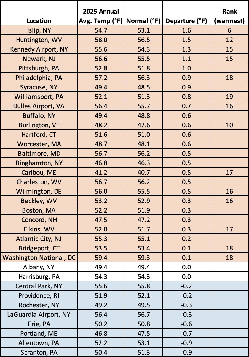
2025 was among the 20 warmest years on record for 14 major sites.

December precipitation generally ranged from 25% of normal to 150% of normal.
December precipitation generally ranged from less than 50% of normal in places like eastern West Virginia, south-central Pennsylvania, and parts of Maryland up to 150% of normal in spots such as western, central, and northern New York. However, most of the Northeast was drier than normal. December precipitation at the region’s 35 major sites ranged from 39% of normal in Baltimore, MD, and Dulles Airport, VA, to 146% of normal in Syracuse, NY. This December was the 10th driest on record for Dulles Airport and the 20th driest for Baltimore but was the 11th wettest for Syracuse. During the month, drought expanded in some areas that were notably dry such as Massachusetts and central parts of the Mid-Atlantic but slightly improved in some wetter areas like western New York and southeastern West Virginia.
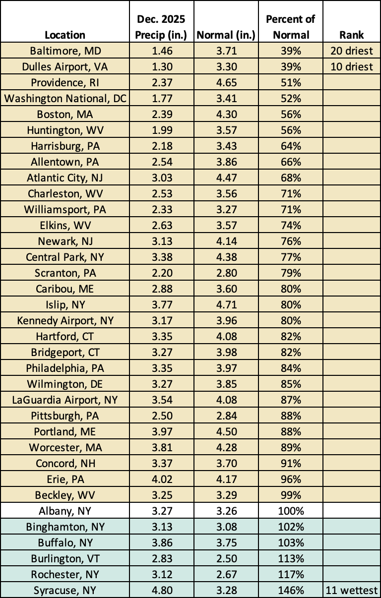
This December was among the 20 driest Decembers on record for two major sites but was the 11th wettest for Syracuse, NY.
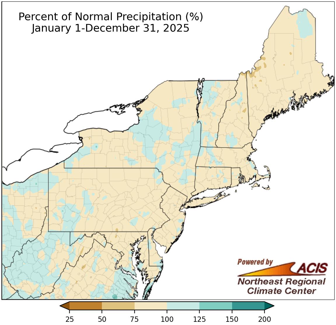
2025 precipitation ranged from 75% of normal to 125% of normal for most areas.
Annual precipitation for 2025 was in the 75% to 125% of normal range for a majority of the Northeast. For the region’s 35 major sites, annual precipitation ranged from 63% of normal in Bridgeport, CT, (missing five days) to 112% of normal in Huntington, WV, which had its 14th wettest year. Twenty-eight of the sites wrapped up the year on the dry side of normal, with 2025 among the 20 driest years on record for seven sites. It was the driest year since 1964 for Buffalo, NY, and since 2001 for Portland, ME, and a few New York City metro area sites.
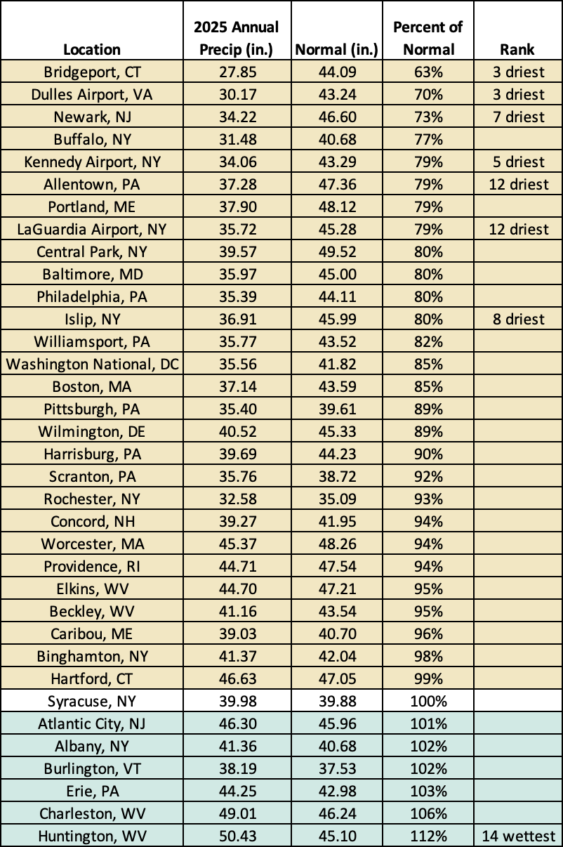
2025 ranked among the 20 driest years on record for seven major sites but was the 14th wettest for Huntington, WV.

December snowfall ranged from 6 inches below normal to more than 12 inches above normal.
Snowfall during December ranged from as much as 6 inches below normal in spots like eastern West Virginia, western Maryland, south-central Pennsylvania, and northeastern Massachusetts to more than 12 inches above normal in multiple locations including central Maine and northern, central, and western New York. Overall, a large portion of the Northeast saw near- or above-normal snowfall. December snowfall at the region’s 35 major sites ranged from 4.7 inches below normal in Boston, MA, to 30.2 inches above normal in Syracuse, NY. Twenty-two major sites saw a snowfall surplus. This December ranked among the 20 snowiest Decembers for 13 major sites and was the snowiest December in 15 years for several sites including Rochester, NY; Bridgeport, CT; Huntington, WV; and Islip, NY. In addition, Syracuse had its snowiest December day (and second all-time snowiest day) since 1902 with 24.2 inches of snow on December 30.
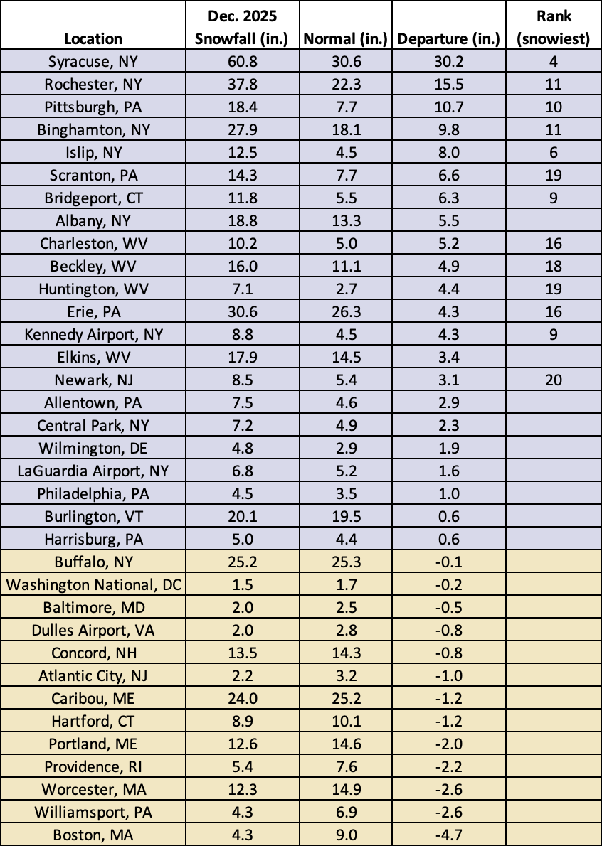
This December was among the 20 snowiest Decembers on record for 13 major sites.
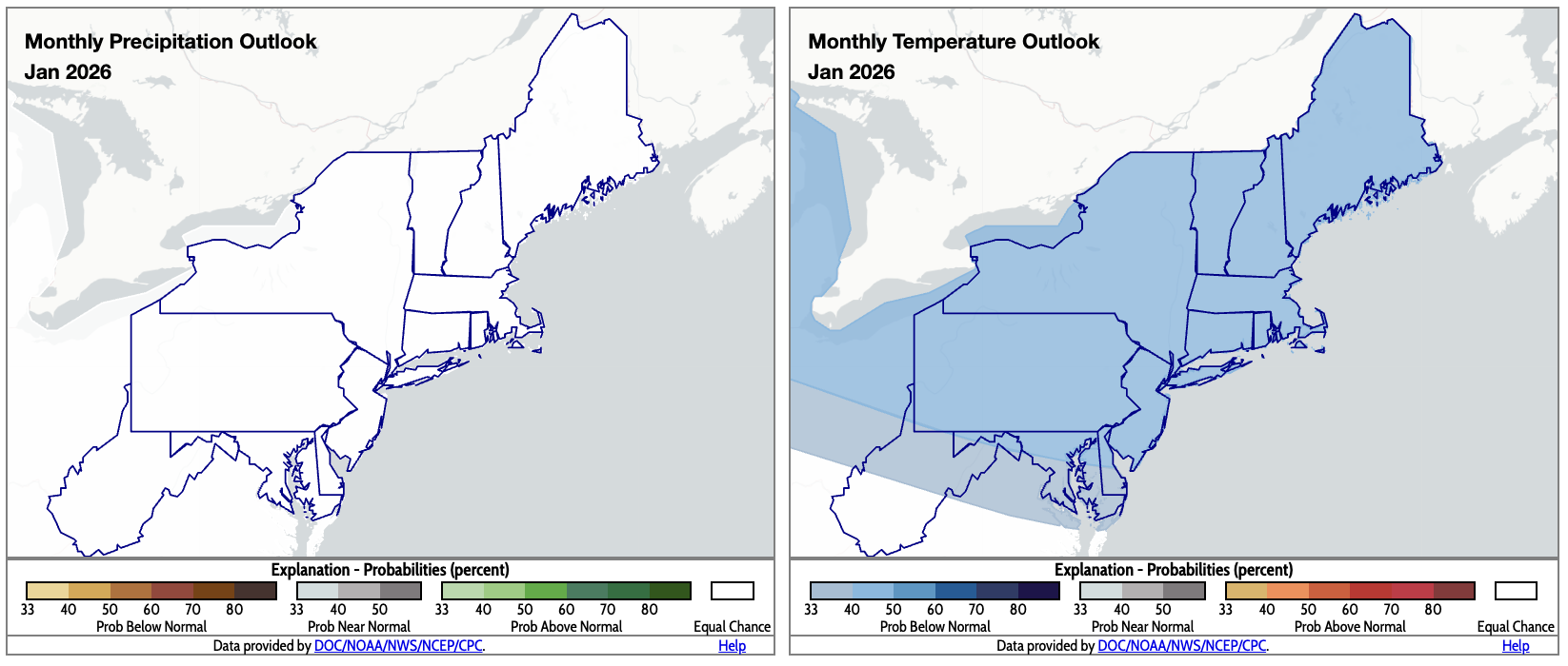
January is predicted to be colder than normal for most of the Northeast (map right). Click to enlarge.
The precipitation outlook for January from NOAA’s Climate Prediction Center shows equal chances of below-, near-, or above-normal precipitation for the Northeast. This means there were no clear signals to sway the outlook one way or the other. However, the temperature outlook for January indicates that a majority of the region is expected to average out to be colder than normal.