A Medley of Conditions in September
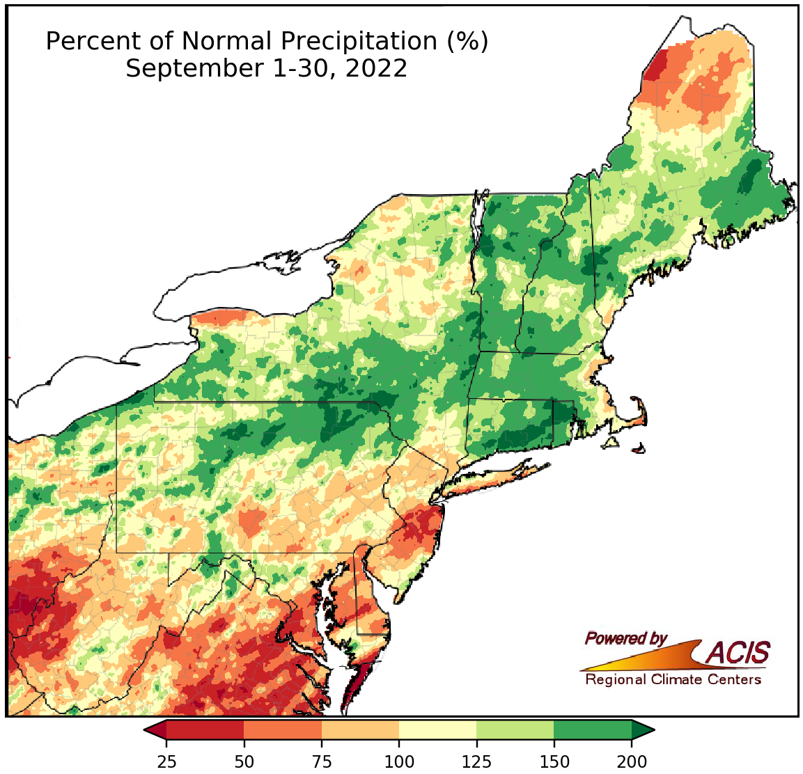
September precipitation ranged from 25% of normal to more than 200% of normal.
September precipitation varied, ranging from 25% of normal in areas such as western West Virginia and central New Jersey to more than 200% of normal in spots such as northern Rhode Island and southern Connecticut. September precipitation at the Northeast’s 35 major climate sites ranged from 40% of normal in Charleston, WV, to 192% of normal in Erie, PA, with 20 sites being drier than normal. This September ranked among the 20 driest on record for two major climate sites but among the 20 wettest for nine of the sites. Wetter-than-normal weather chipped away at the drought and abnormally dry conditions in New England.
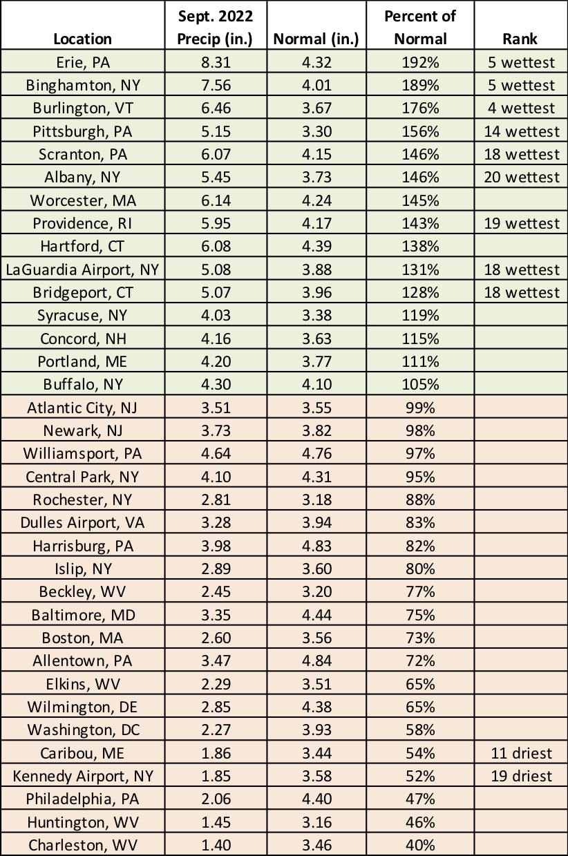
This September was among the 20 driest on record for two major climate sites but among the 20 wettest for nine of the sites.
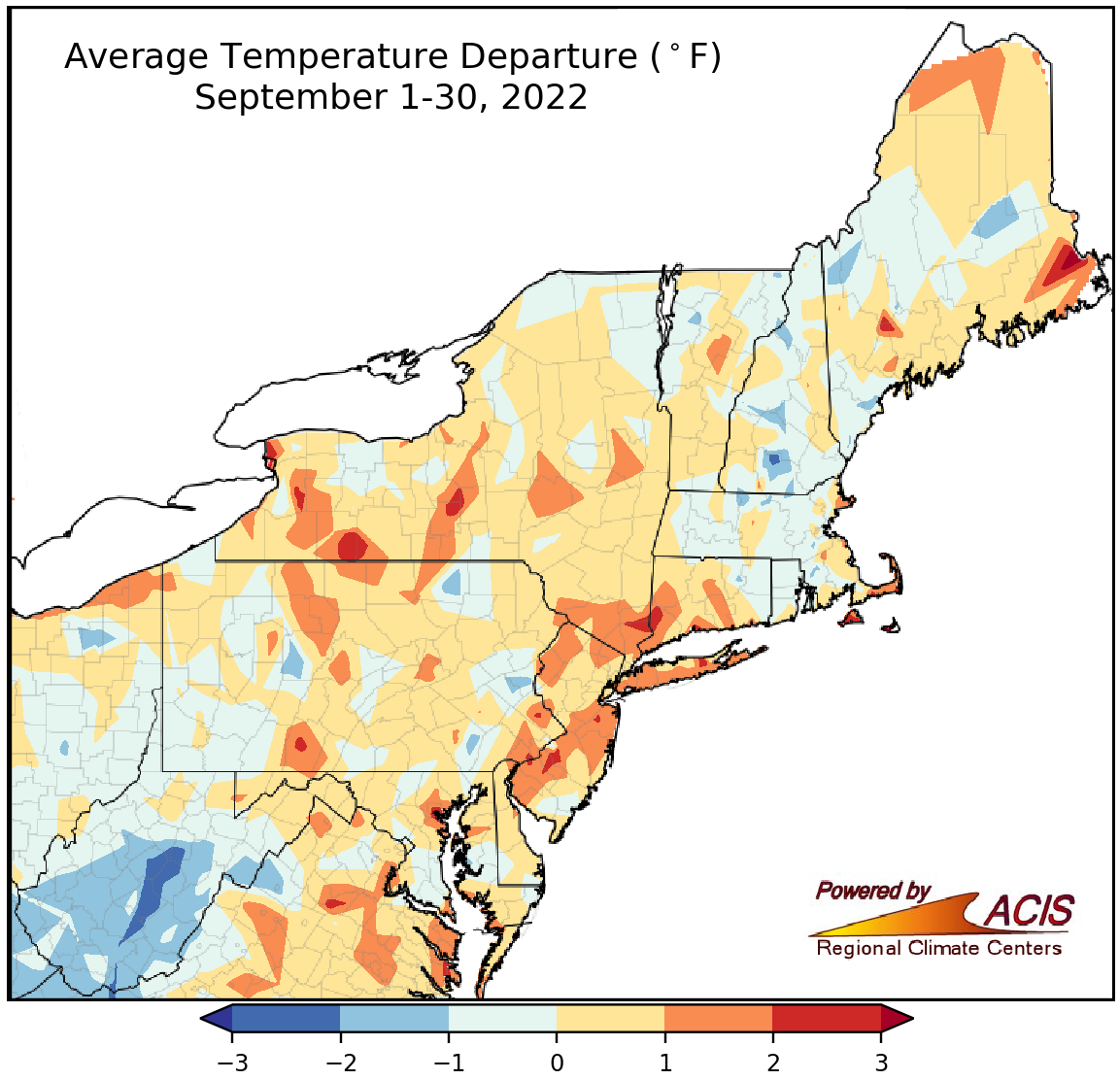
September temperatures ranged from 3°F below normal to 3°F above normal.
September average temperatures also varied, ranging from 3°F below normal in central West Virginia to 3°F above normal in a few New York locations. September average temperatures at the Northeast’s 35 major climate sites ranged from 2.0°F below normal in Beckley, WV, to 2.2°F above normal in Philadelphia, PA, with 17 sites being cooler than normal. However, this September ranked among the 20 warmest on record for six major climate sites.
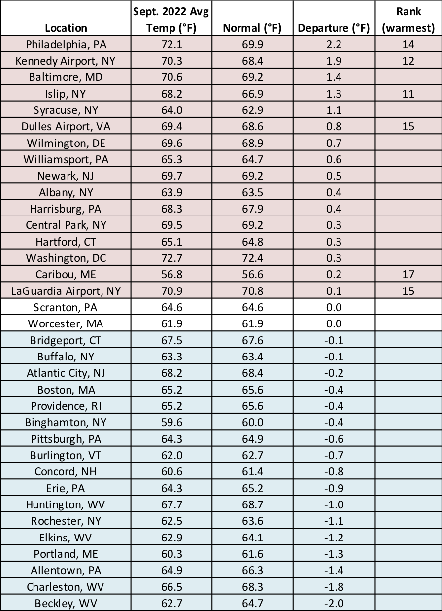
This September ranked among the 20 warmest on record for six major climate sites.
NOAA’s Climate Prediction Center favors below-normal temperatures for much of the Northeast, with the greatest likelihood in the southeastern portion of the region, and is primarily driven by expected cooler-than-normal conditions during the first week or so of October. For precipitation, there’s a tilt toward drier-than-normal conditions for much of northern New England, portions of New York, and northwestern Pennsylvania; however, there’s a tilt toward wetter-than-normal conditions for southern parts of the region due to rainfall from the remnants of Hurricane Ian in early October.
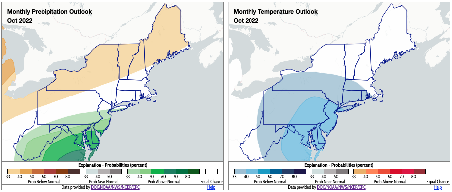
October could be drier than normal (shaded tan) for some northern areas but wetter than normal for some southern areas (shaded green). Below-normal temperatures (shaded blue) are favored for multiple parts of the Northeast. Click to enlarge.