An Interesting October!
October started off mild, with average temperatures ranging from near normal to more than 10°F above normal and some sites setting all-time October records. But, a pattern shift mid-month brought colder air to the region. Average temperatures during the second half of the month ranged from 2°F to more than 6°F below normal.
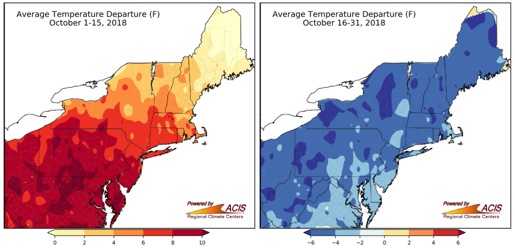
The first half of October was mild but the second half was cold. Click to enlarge.
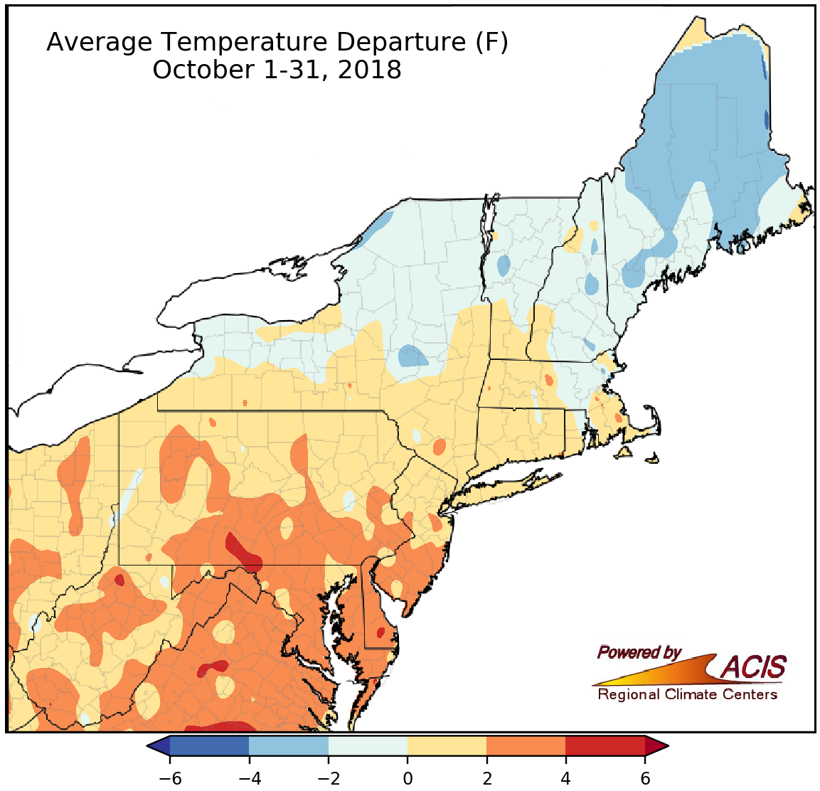
Average temperatures for October ranged from 4°F below normal to 4°F above normal.
With a warm start and cold end, October averaged out to be 4°F below normal to 4°F above normal for the region. The coldest areas were generally in Maine, while the warmest areas were generally found from the southern half of Pennsylvania into parts of southern New Jersey, Maryland, Delaware, and West Virginia. Twenty-seven of the 35 major climate sites wrapped up October on the warm side of normal. Five sites ranked this October among their 20 warmest, while two sites ranked it among their 20 coldest.
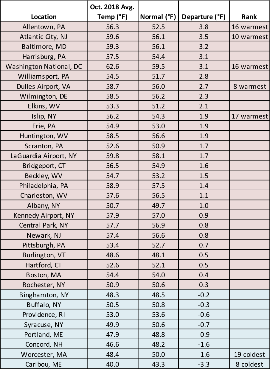
At the major climate sites October average temperatures ranged from 3.3°F below normal in Caribou, ME, to 3.8°F above normal in Allentown, PA.
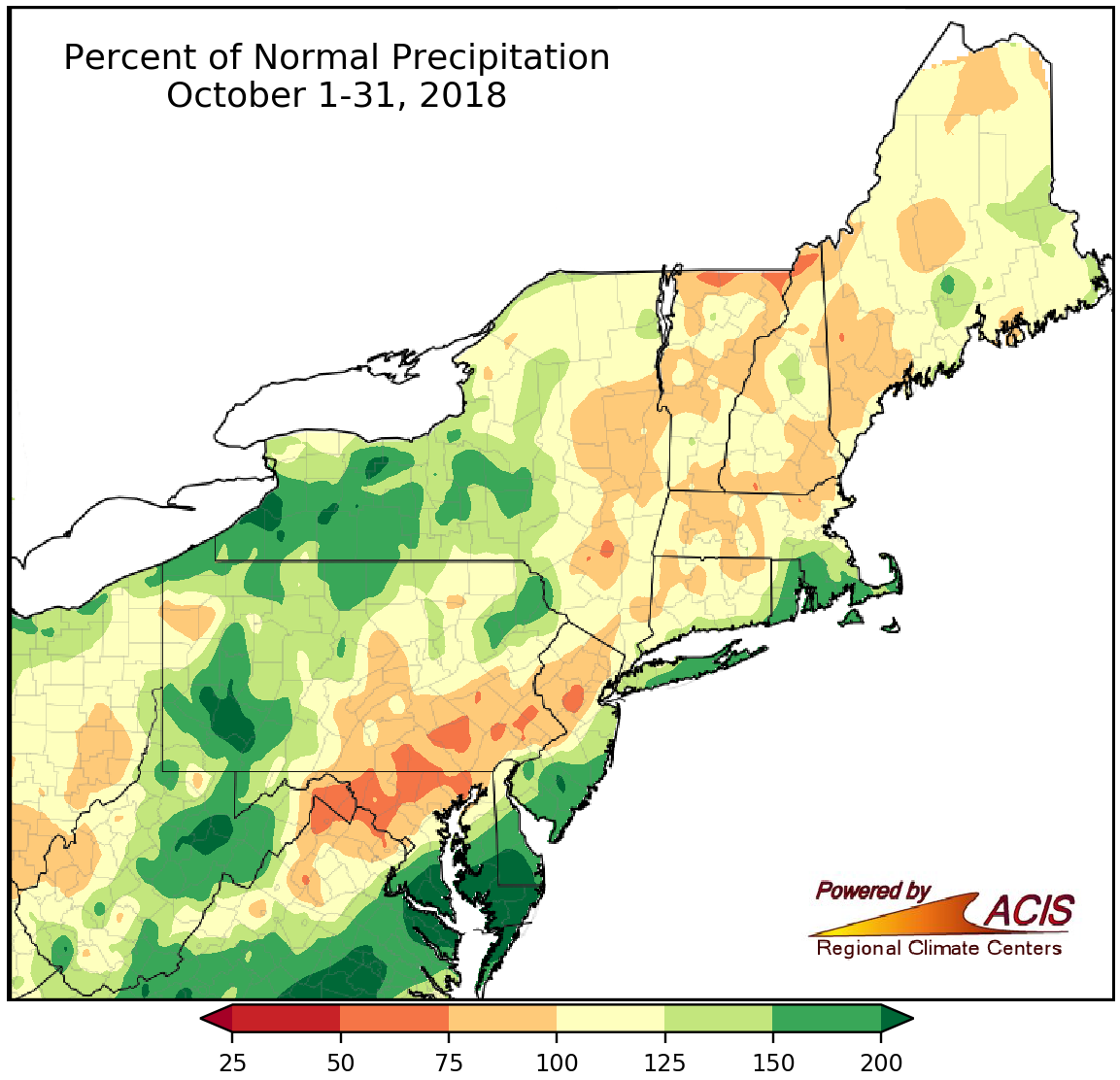
October precipitation ranged from 50% of normal to more than 200% of normal.
Precipitation during October varied, ranging from 50% of normal to more than 200% of normal. The driest areas were found in parts of northern Vermont and New Hampshire, central New Jersey, southeastern Pennsylvania, northern Maryland, and the Eastern Panhandle of West Virginia, while the wettest areas were located in parts of western New York and Pennsylvania, central West Virginia, southern and eastern Maryland, and southern New Jersey. The major climate sites were nearly split, with 19 sites being wetter than normal and 15 sites being drier than normal (and one at normal). Seven major climate sites ranked this October among their 20 wettest on record. Drought and abnormally dry conditions continued to improve in New York and New England.
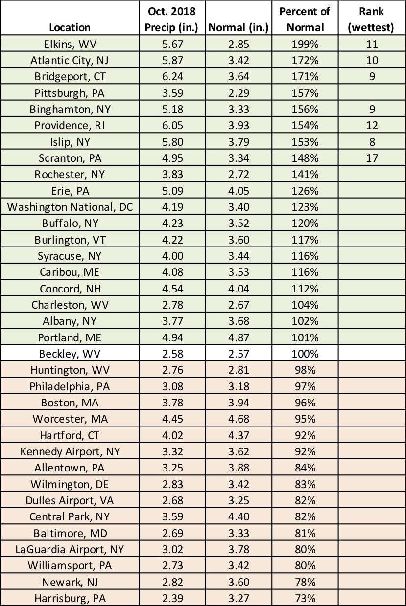
October precipitation for the major climate sites ranged from 73% of normal in Harrisburg, PA, to 199% of normal in Elkins, WV.
A rare tornado outbreak occurred early in the month, and even more tornadoes touched down in the region later in the month. On October 23, four tornadoes touched down in southern New England—-an EF-1 in Rhode Island and two EF-1s and an EF-0 in Massachusetts. According to data from the Storm Prediction Center, both states average zero tornadoes in October. Annually, Rhode Island averages zero tornadoes while Massachusetts averages one. NCEI’s Storm Event Database shows that in Rhode Island there had only been 11 tornadoes reported since 1950, with only one of those being an October tornado. The tornado on the 23rd is the latest tornado in the calendar year for the state. For Massachusetts, there have only been seven other October tornadoes, with the last one occurring in 1970. Severe weather struck again on October 29. An EF-0 tornado touched down in southern Connecticut and an EF-1 tornado touched down in southeastern New York, adding to the October tornado count in those states.
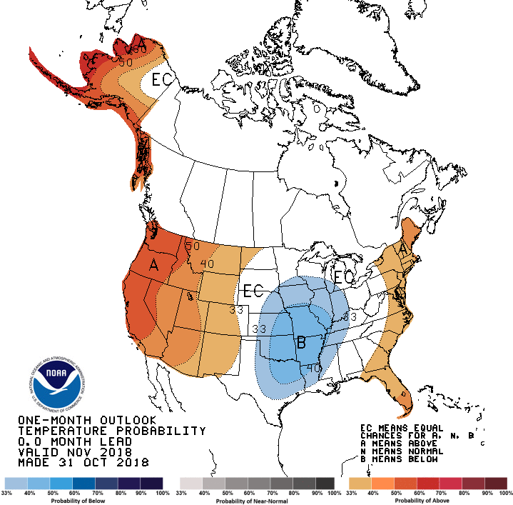
The Climate Prediction Center’s temperature outlook for November, which indicates above-normal temperatures are favored in areas shaded orange.
Now looking ahead, November is predicted to be wetter than normal for the entire Northeast, according to the Climate Prediction Center. A large portion of the region also has an increased chance of above-normal temperatures, especially Maine.
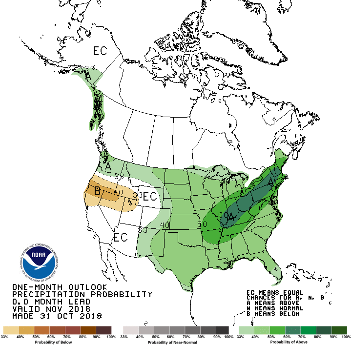
For November, above-normal precipitation is favored for the entire Northeast.
As for winter, New England, New York, northern New Jersey, and the northern half of Pennsylvania have an increased likelihood of above-normal temperatures, with equal chances of below-, near-, or above-normal temperatures predicted for the rest of the region. The winter precipitation outlook indicates much of the region falls into the equal chances category, except southeastern parts of the region where there’s an increased chance of above-normal precipitation. El Niño is expected to develop over the next few months, and the winter outlooks are similar to weather patterns typically seen during El Niño winters and those seen during some other El Niño winters. For more information, see our special El Niño report released at the end of October and tune in for our November webinar, which will focus on El Niño and the winter outlooks. A registration link will be available on our webinar page around mid-November.
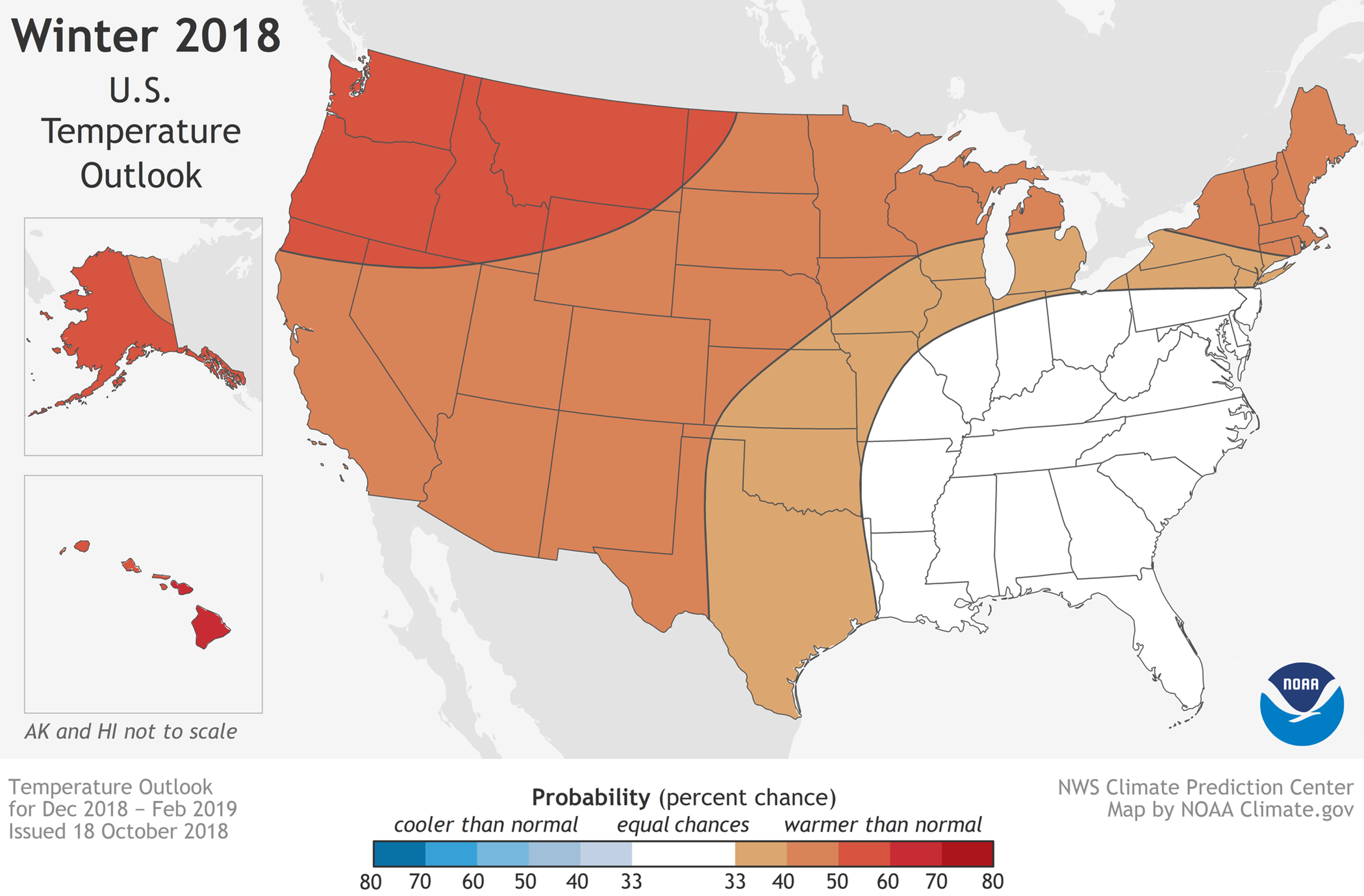
The Climate Prediction Center’s temperature outlook for winter shows above-normal temperatures are favored for areas shaded orange.
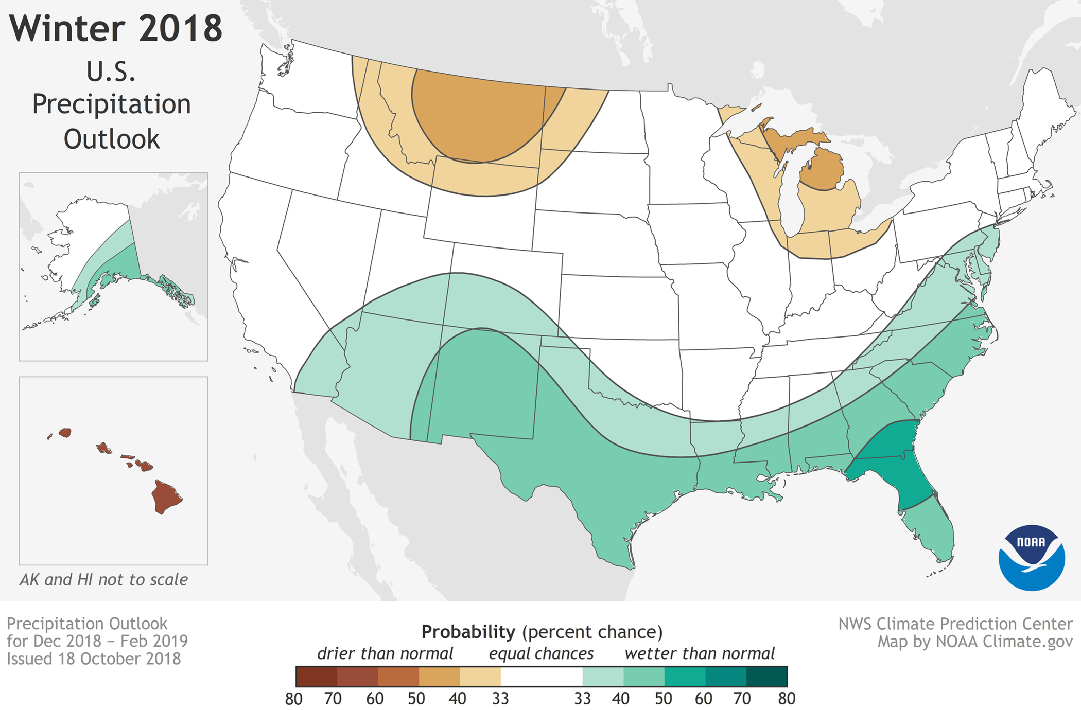
For winter, above-normal precipitation is predicted in areas shaded green, while equal chances are forecast for areas shaded white.