A Slight Shift in the Pattern
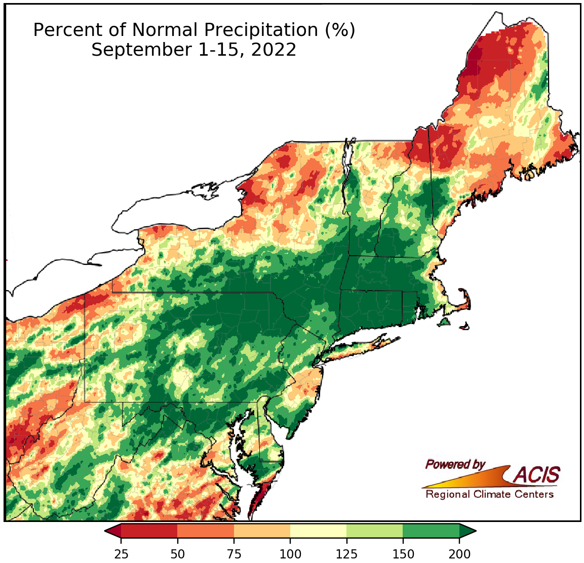
September 1-15 rainfall ranged from 25% of normal to more than 200% of normal.
Precipitation during the first half of September ranged from 25% of normal to more than 200% of normal. In a change from the past two months, some previously dry areas, such as most of southern New England, were quite wet while a few previously wet areas, such as western West Virginia and northern Maine, were much drier. For instance, Bridgeport, CT, had its third driest August but its fifth wettest September 1-15 period. Meanwhile, Charleston, WV, had its fifth wettest July and third wettest August but only saw 65% of normal rainfall during the first half of September.
September 1-15 precipitation at the 35 major climate sites ranged from 31% of normal in Caribou, ME, its 10th driest first half of September, to 289% of normal in Binghamton, NY, already its ninth wettest September with half the month left. Overall, 20 major climate sites were wetter than normal with 12 ranking this September 1-15 period among their 20 wettest on record. The wet weather helped reduce the intensity of drought conditions and eased pockets of abnormal dryness in the region.
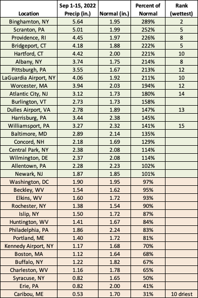
This September 1-15 period ranked the 20 wettest on record for 12 major climate sites but as the 10th driest for Caribou, ME.
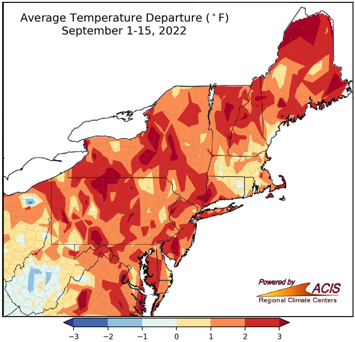
September 1-15 average temperatures ranged from 2°F below normal to more than 3°F above normal.
Average temperatures during the first half of September mostly continued where August left off - warmer than normal. For example, Philadelphia, PA, had a record hot August followed by its 12th warmest September 1-15 period. The main exception was the southern half of West Virginia which was cooler. September 1-15 average temperatures at the 35 major climate sites ranged from 0.9°F below normal in Charleston, WV, to 3.1°F above normal in Philadelphia, PA, with 31 of the sites being warmer than normal. This first half of September ranked among the 20 warmest on record at nine of the sites.
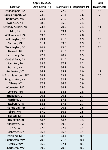
This September 1-15 period ranked among the 20 warmest on record for nine major climate sites.
The warmer-than-normal conditions may spill over into October, according to NOAA’s Climate Prediction Center. The most recent October temperature outlook favors above-normal temperatures for the entire Northeast. However, for October precipitation, there were no clear climate signals, with equal chances of below-, near-, or above-normal precipitation forecast for the region.
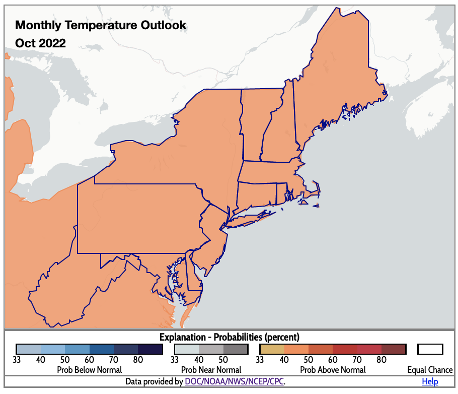
October is expected to be warmer than normal for the Northeast.