Record-Breaking 2012
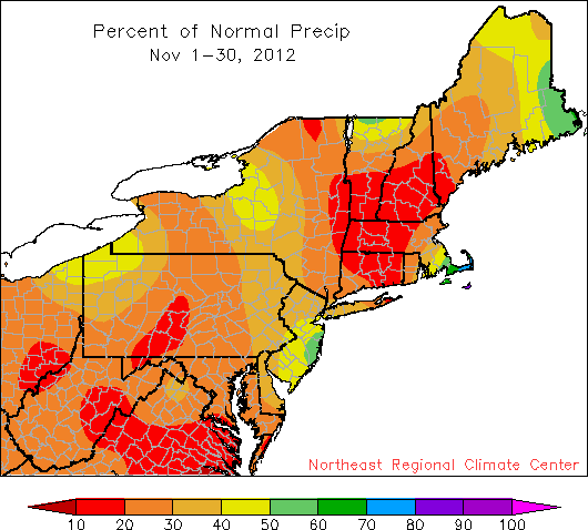
November was quite dry, with most of the region seeing less than 50% of normal precipitation.
November 2012 went into the record books as the 2nd driest since 1895, with the region receiving only 1.04 inches of precipitation (27 percent of normal). The record driest November was 1917 when the Northeast received only 0.88 inches of precipitation. All states and First-Order Stations were drier than normal. For the first time since October 2009, all states reported below average temperatures, as did most of the First-Order Stations. With an average temperature of 37.2°, the Northeast was 2.5° cooler than normal and the coolest November since 1997. November’s coolness did not linger into December, though. On December 4th, southerly air in advance of a cold front pushed temperatures to near-record warmth or, for a few New York cities, record warmth.