A Warm Winter-to-Date
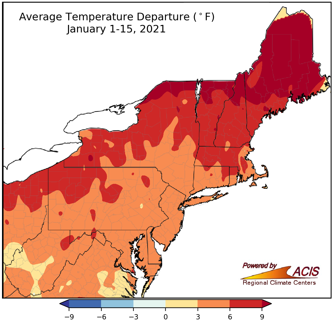
January 1-15 average temperatures ranged from near normal to more than 9°F above normal.
The first half of January featured above-normal temperatures for the entire region, ranging from near normal in parts of West Virginia to more than 9°F above normal in much of Maine and northern parts of New York, Vermont, and New Hampshire. All 35 major climate sites were warmer than normal, with departures ranging from 2.0°F above normal in Charleston, WV, to 12.3°F above normal in Caribou, ME. This first half of January ranked among the 20 warmest on record for 11 major climate sites.
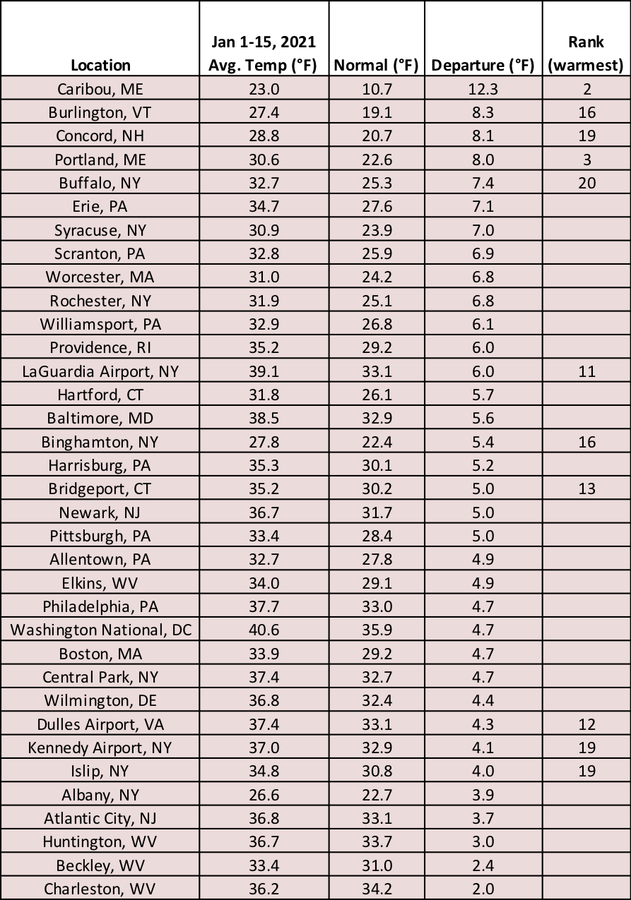
This January 1-15 period was among the 20 warmest on record for 11 major climate sites.
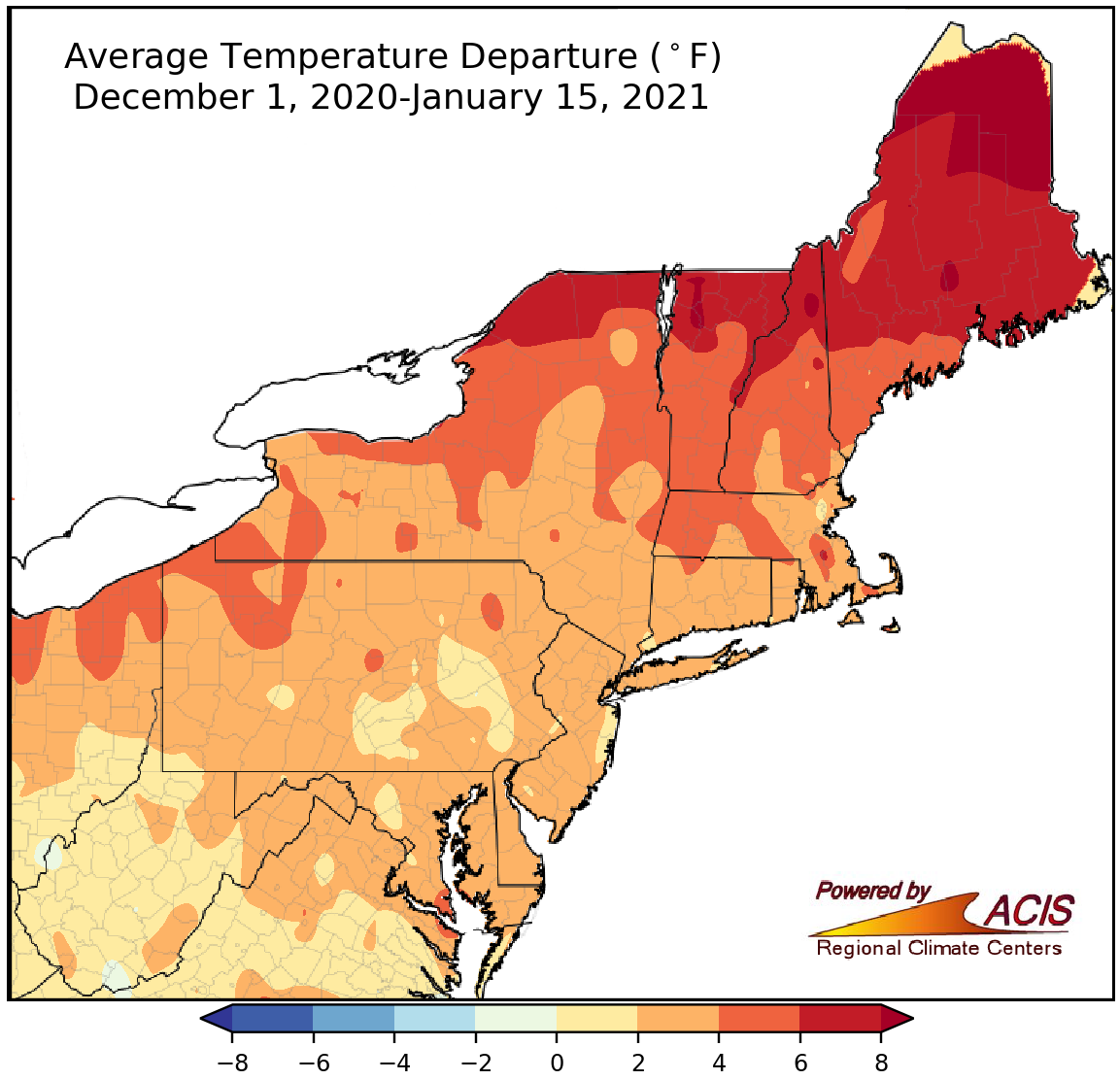
December 1-January 15 average temperatures ranged from near normal to more than 8°F above normal.
The first half of winter, from December 1-January 15, was also warmer than normal. Average temperatures ranged from near normal to more than 8°F above normal, with the greatest departures in northern Maine. In fact, it was Caribou, ME’s warmest first half of winter on record at 9.2°F above normal. All 35 major climate sites were warmer than normal, with 16 sites, including Caribou, ranking this first half of winter among their 20 warmest on record.
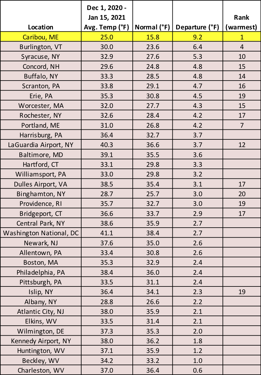
Sixteen major sites ranked this first half of winter among their 20 warmest on record, including Caribou, ME, which was record warm for the period.
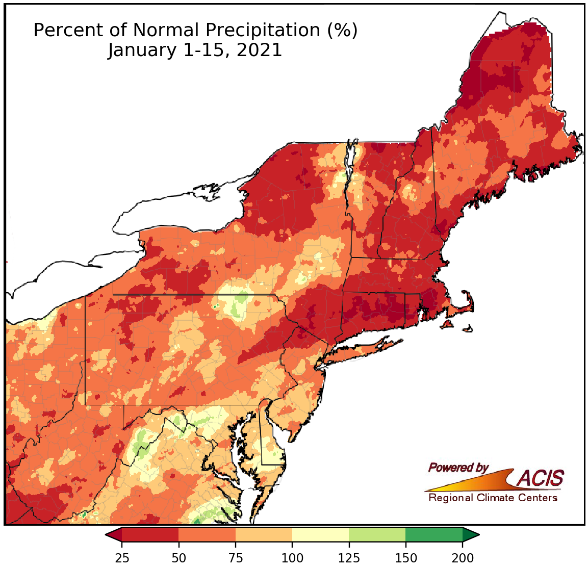
January 1-15 precipitation ranged from less than 25% of normal to 150% of normal.
The first half of January has been drier than normal for a majority of the Northeast, with the driest spots, mostly in New England, seeing less than 25% of normal precipitation. Thirty of the 35 major climate sites were drier than normal, with 10 of them ranking this January 1-15 period among their 20 driest on record.
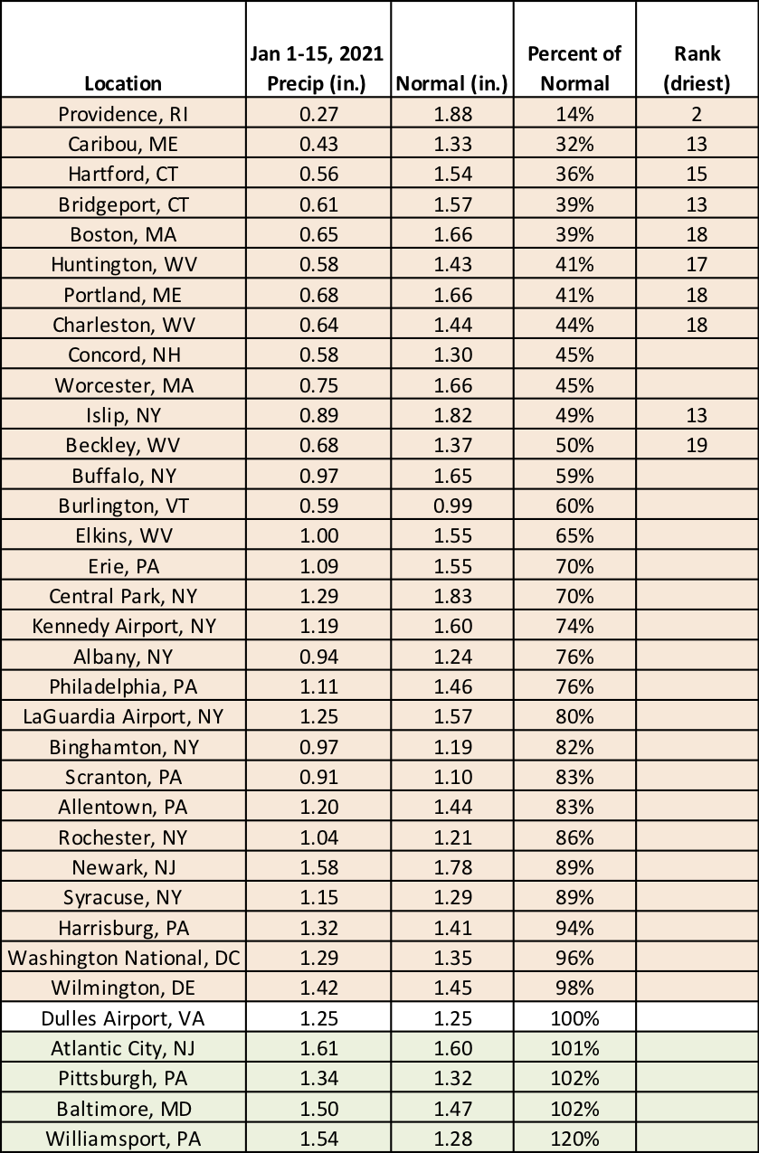
Ten major climate sites ranked this January 1-15 period among their 20 driest on record.
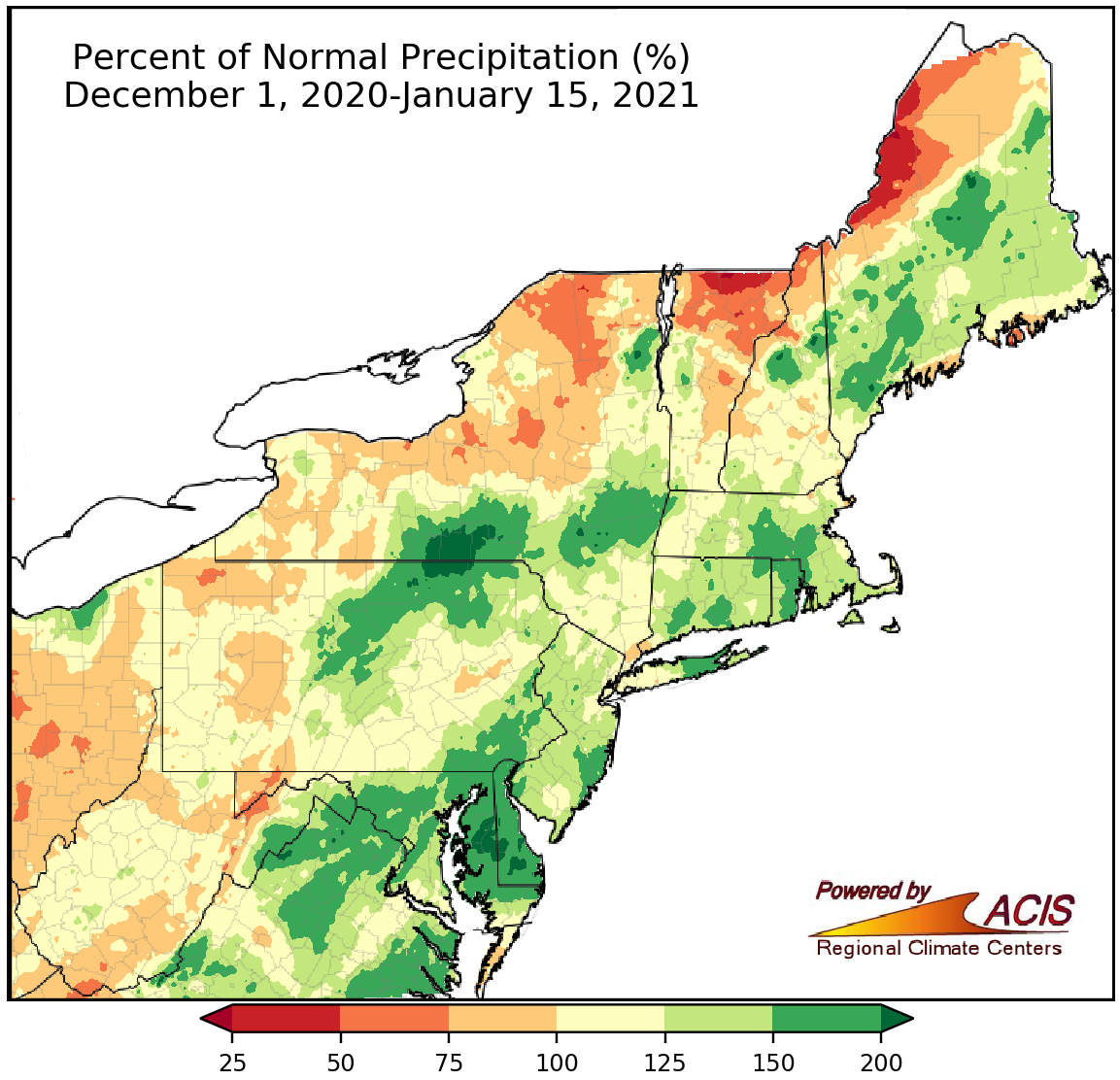
December 1-January 15 precipitation ranged from 50% of normal to more than 200% of normal.
Looking at the first half of winter, December was wetter than normal for many areas while January has been drier than normal. With that, December 1-January 15 precipitation ranged from 50% of normal in western Maine and northern parts of New York, Vermont, and New Hampshire to more than 200% of normal along the New York-Pennsylvania border and on the Delmarva Peninsula. Twenty-three of the 35 major climate sites were wetter than normal, with six of them ranking this first half of winter among their 20 wettest on record.
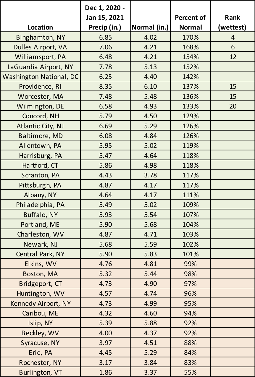
Precipitation during the first half of winter at the major climate sites ranged from 55% of normal in Burlington, VT, to 170% of normal in Binghamton, NY.
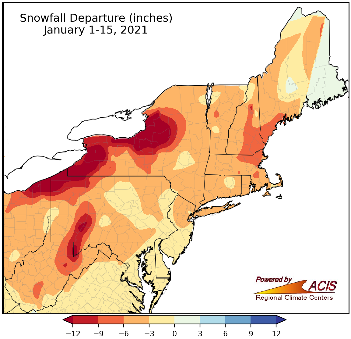
January 1-15 snowfall ranged from more than 12 inches below normal to within 3 inches of normal.
Warm temperatures and little precipitation also meant a lack of snow during the first half of January, with the greatest snowfall departures of more than 12 inches generally in lake effect areas of New York and Pennsylvania. All 35 major climate sites saw less snow than usual, with 19 of them ranking this January 1-15 period among their 20 least snowy on record. Some sites that recorded a trace or no snowfall tied their least snowy first half of January on record but this has occurred several other years. For instance, Washington, D.C., saw no snow from January 1-15, which has happened 14 other times.
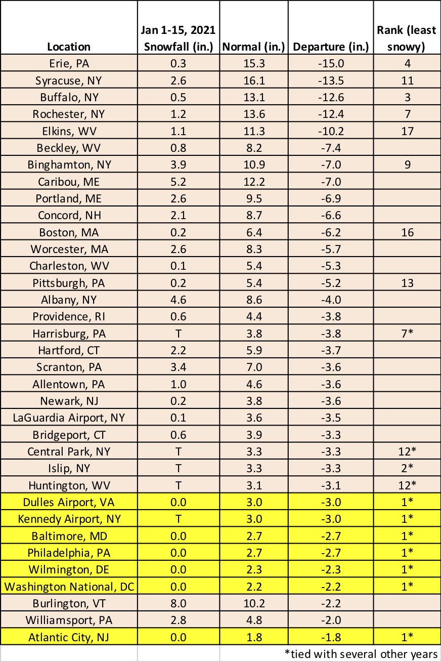
Nineteen major climate sites ranked this January 1-15 period among their 20 least snowy on record.
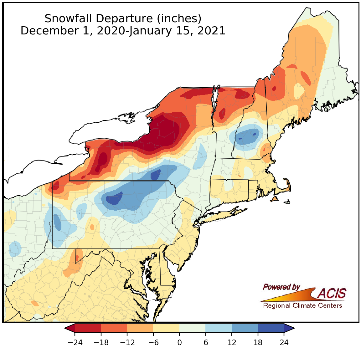
Snowfall during the first half of winter ranged from more than 24 inches below normal to 24 inches above normal.
Snowfall during the first half of winter varied widely, ranging from more than 24 inches below normal in lake-effect areas of New York to 24 inches above normal near the Pennsylvania border in central New York and in central Pennsylvania. In general, areas that were snowier than normal saw a surplus because of a historic snowstorm in mid-December. Snowfall at the major climate sites ranged from 33.0 inches below normal in Syracuse, NY, to 23.4 inches above normal in Binghamton, NY. While five sites ranked this first half of winter among their 20 least snowy, three sites ranked it among their 20 snowiest.
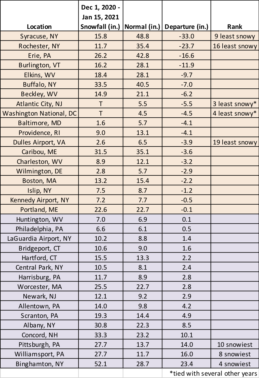
Five major climate sites ranked this first half of winter among their 20 least snowy, while three sites ranked it among their 20 snowiest.