The Leaves Are Crisp, but the Weather is Not
Low temperatures on October 8 and 9 were particularly warm (in the upper 60s to mid 70s). At least 51 hottest minimum temperature records were set or tied at the major climate sites on those dates. Ten sites had their hottest minimum temperature for October, while another 14 sites ranked their minimum temperatures among their top 5 hottest for October.
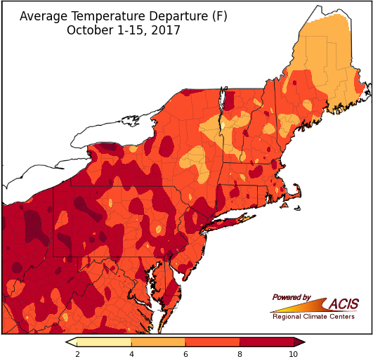
So far, October has been warmer than normal for the entire Northeast, with most areas 4°F to 10°F above normal.
Average temperatures during the first two weeks of October ranged from 4°F above normal to more than 10°F above normal. All 35 major climate sites experienced above-normal temperatures during the first half of October, with three sites (Allentown, PA; Williamsport, PA; and Beckley, WV) being record warm for the period. The other 32 sites all ranked this first half of October among their top 10 warmest on record.
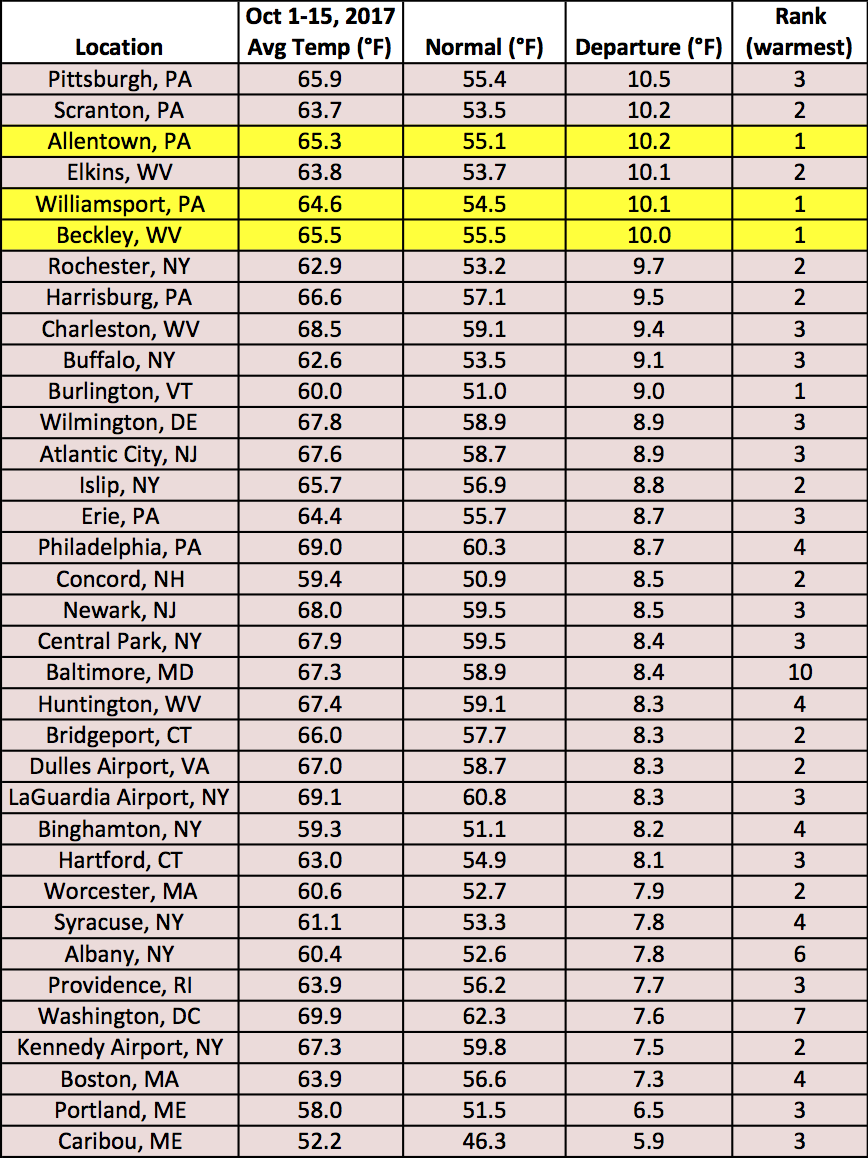
Three major climate sites were record warm for October 1-15, with average temperature departures for all 35 sites up to 10.5°F above normal.
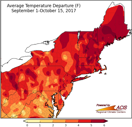
The first half of fall was also warmer than normal in the region, with most areas between 2°F and 6°F above normal.
Average temperatures during the first half of fall ranged from 1°F above normal to more than 6°F above normal, with the warmest areas generally in New England. Seven major climate sites had their warmest first half of fall on record, while another 25 sites ranked it among their top 20 warmest.
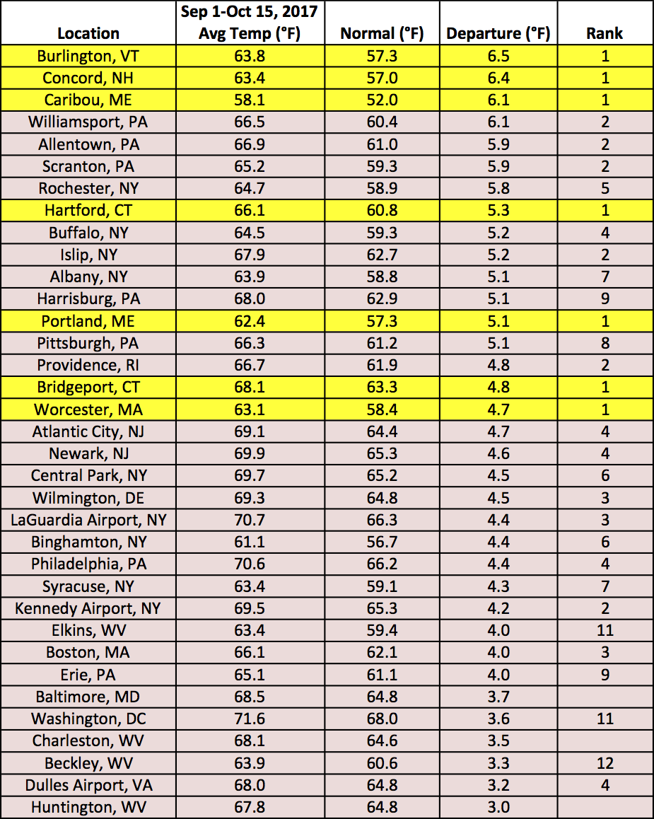
All 35 stations were warmer than normal for the September 1 to October 15 period, with seven being record warm. Departures were up to 6.5°F above normal.
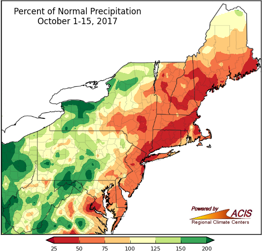
Precipitation has been variable so far this October.
During the first two weeks of October, precipitation ranged from 25% of normal in areas close to the coast to more than 200% of normal in some western portions of the region. Twenty-four major climate sites were drier than normal for October 1-15, with two sites ranking the period among their top 15 driest. Of the 11 wetter-than-normal sites, three ranked the period among their top 15 wettest. Abnormally dry and moderate drought conditions persisted across the region.
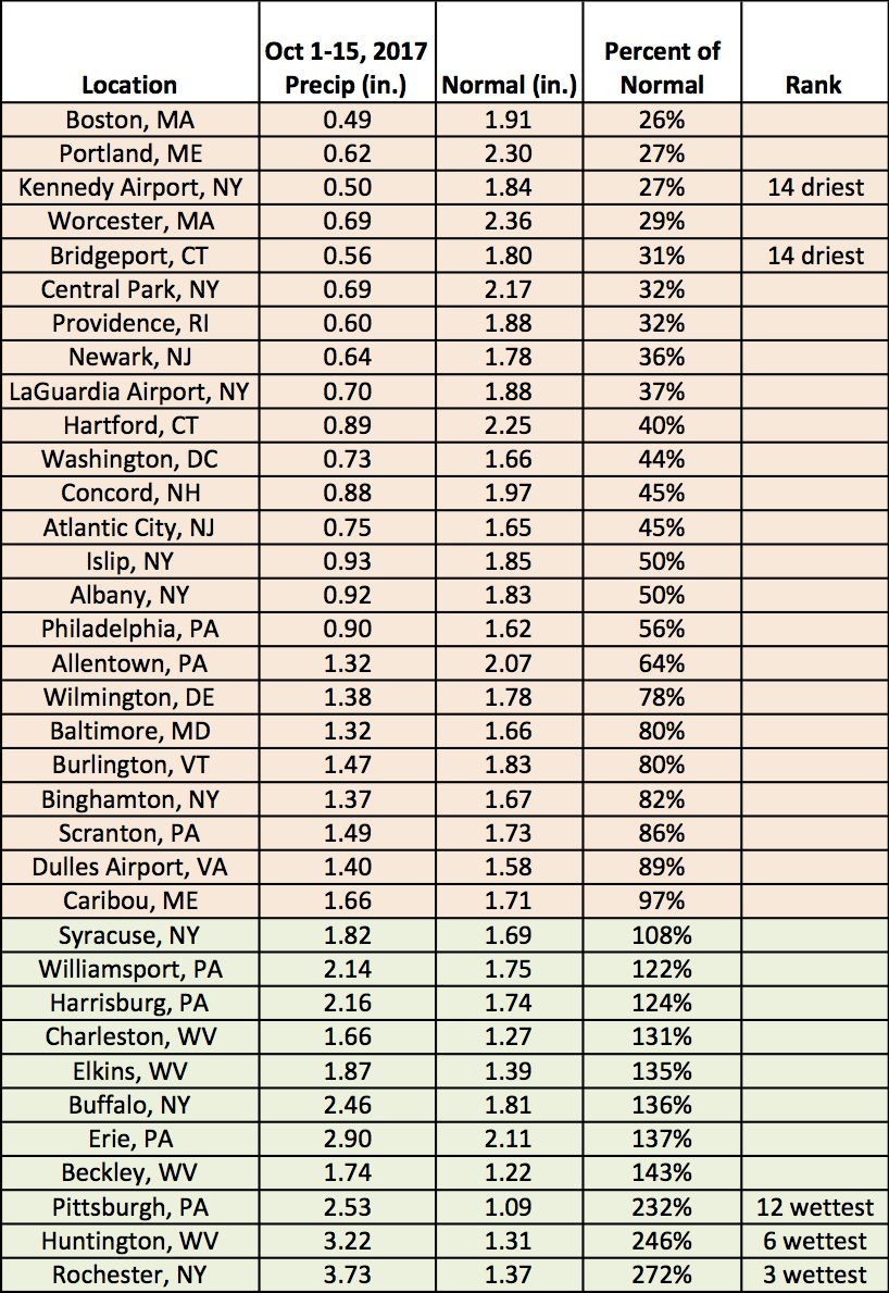
October 1-15 precipitation ranged from 26% of normal at Boston, MA, to 272% of normal in Rochester, NY.
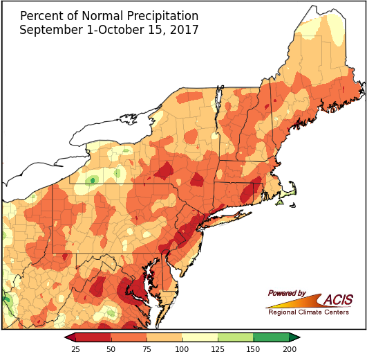
Most of the Northeast has been drier than normal for the September 1 to October 15 period, with most areas seeing 50% to 100% of normal precipitation.
For the first half of fall, precipitation ranged from 25% of normal to 150% of normal, with most areas being on the dry side of normal. Thirty-one of the major climate sites were drier than normal, with nine ranking this first half of fall among their top 20 driest. Conversely, Huntington, WV, had its 20th wettest first half of fall.
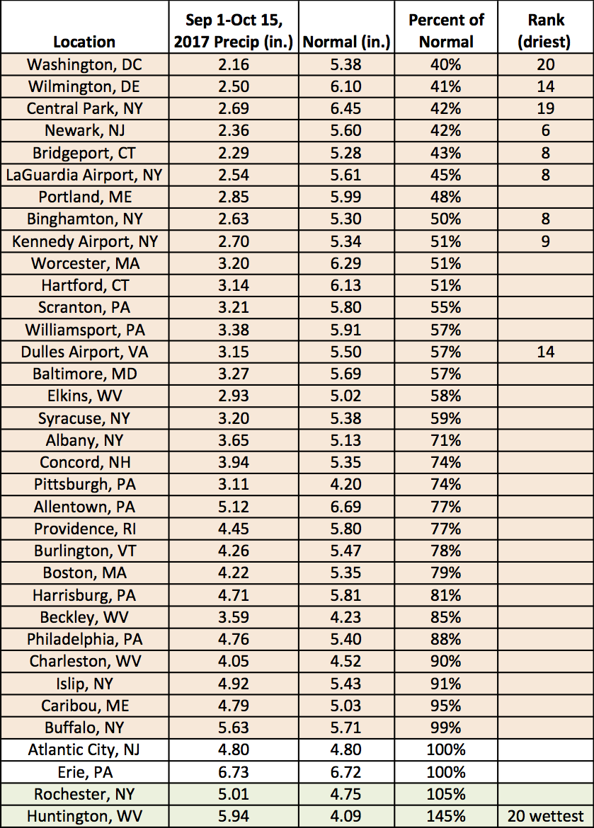
September 1 to October 15 precipitation ranged from 40% of normal in Washington, DC, to 145% of normal in Huntington, WV.