Record Precipitation in Mid-February
February 1-15 precipitation ranged from 50% of normal to more than 200% of normal.
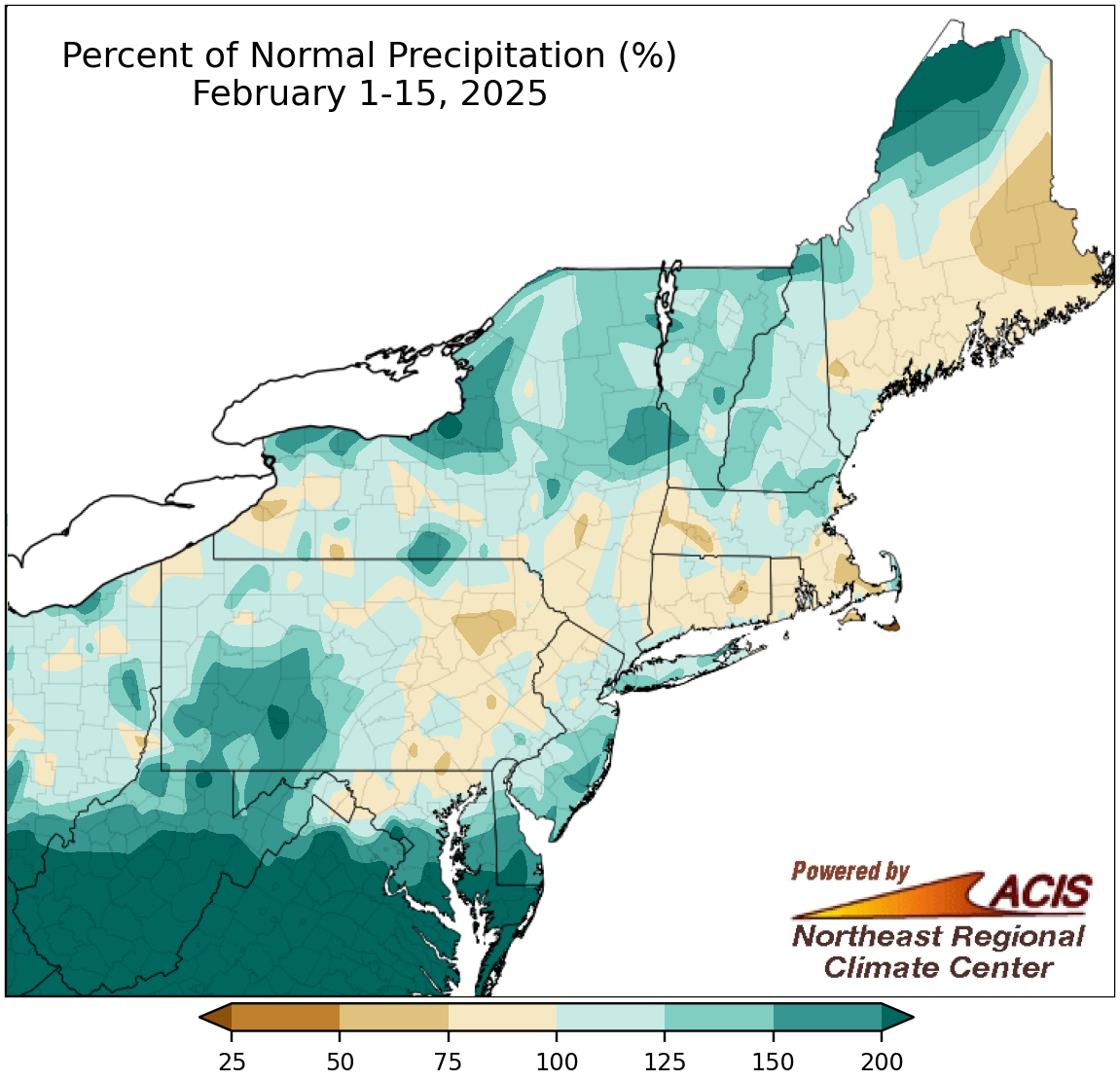
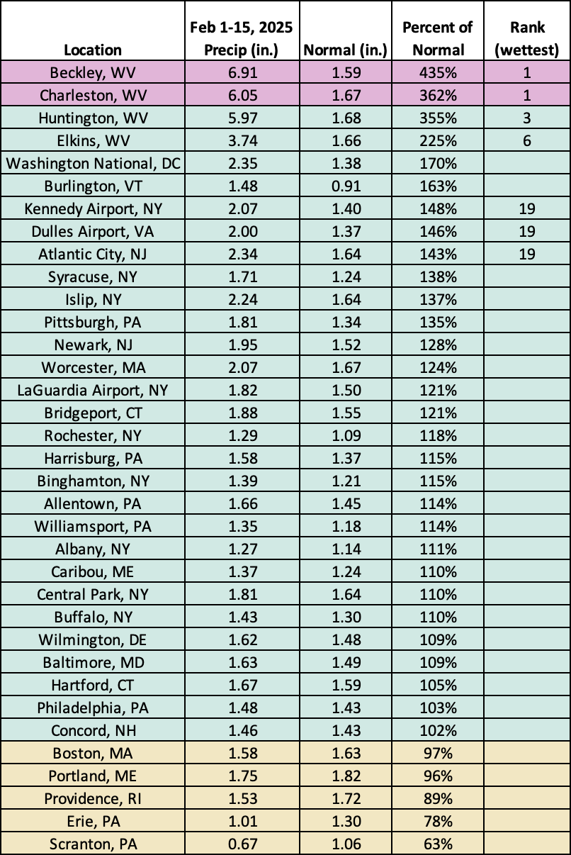
Precipitation for the February 1-15 period ranged from 50% of normal to more than 200% of normal, with most areas seeing near or above-normal precipitation. The wettest locations were generally in far southern parts of the region including a large portion of West Virginia. At the region’s 35 major sites, February 1-15 precipitation ranged from 63% of normal in Scranton, PA, to 435% of normal in Beckley, WV, with 30 of the sites being wetter than normal. This first half of February was record wet for Beckley and Charleston, WV, and among the 20 wettest for another five sites. Through February 15, this February was already among the 10 wettest on record for three of the major sites in West Virginia. But, sneak peak, when February 16 is included in the monthly total, this February becomes the wettest February on record for Beckley.
This first half of February now features Beckley’s wettest, seventh-wettest, and eighth-wettest February days since records began there in 1893. Beckley’s wettest February day, with 2.31 inches of precipitation, occurred this weekend (February 15 to 16) as a storm dumped heavy precipitation on parts of West Virginia. This precipitation, which fell mostly in the form of rain, contributed to record- or near-record water levels on some waterways in southern West Virginia that produced devastating flash flooding. The National Weather Service issued a rare Flash Flood Emergency, signifying a dangerous, life-threatening situation, for a few locations. This event will be discussed in further detail in the February monthly summary released in early March.
This February 1-15 period was record wet for Beckley and Charleston, WV, and among the 20 wettest for another five of the major sites.
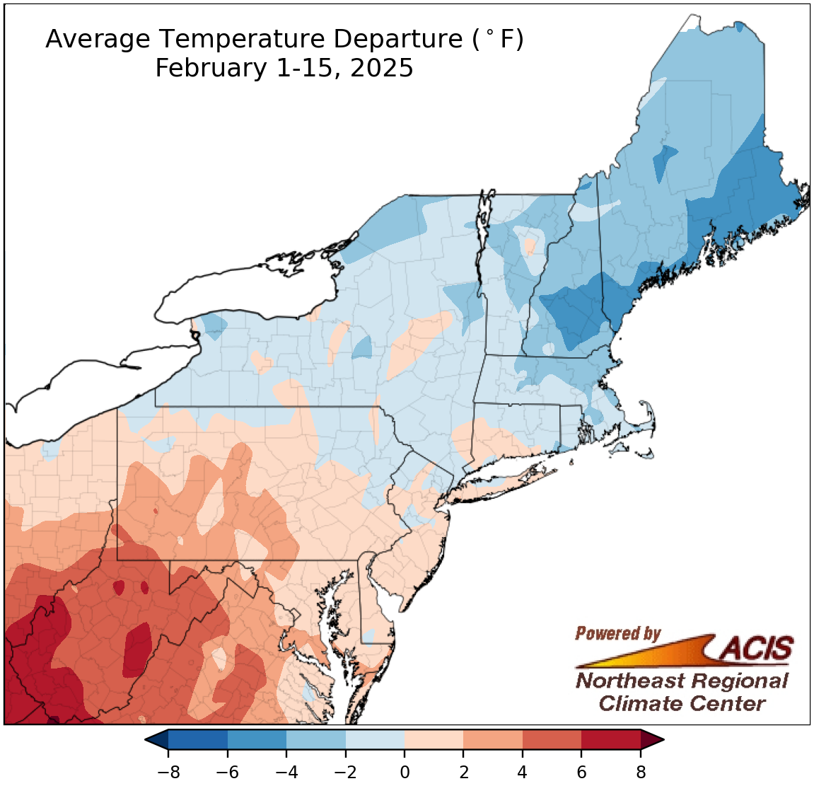
February 1-15 average temperatures ranged from 6°F below normal to 8°F above normal.
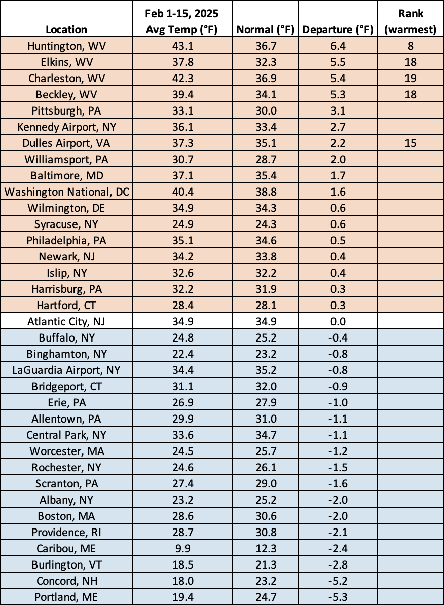
During the first half of February, New York and New England were generally colder than normal, with places like coastal Maine and the southern half of New Hampshire being as much as 6°F below normal. Meanwhile, the rest of the Northeast was generally warmer than normal, with parts of West Virginia being up to 8°F above normal. The Northeast’s 35 major sites were split, with 17 being colder than normal, 17 being warmer than normal, and one exactly at normal. Temperature departures for the sites ranged from 5.3°F below normal in Portland, ME, to 6.4°F above normal in Huntington, WV. This first half of February ranked among the 10 warmest for the four major West Virginia sites and Dulles Airport, VA.
This February 1-15 period was among the 20 warmest for five major sites.
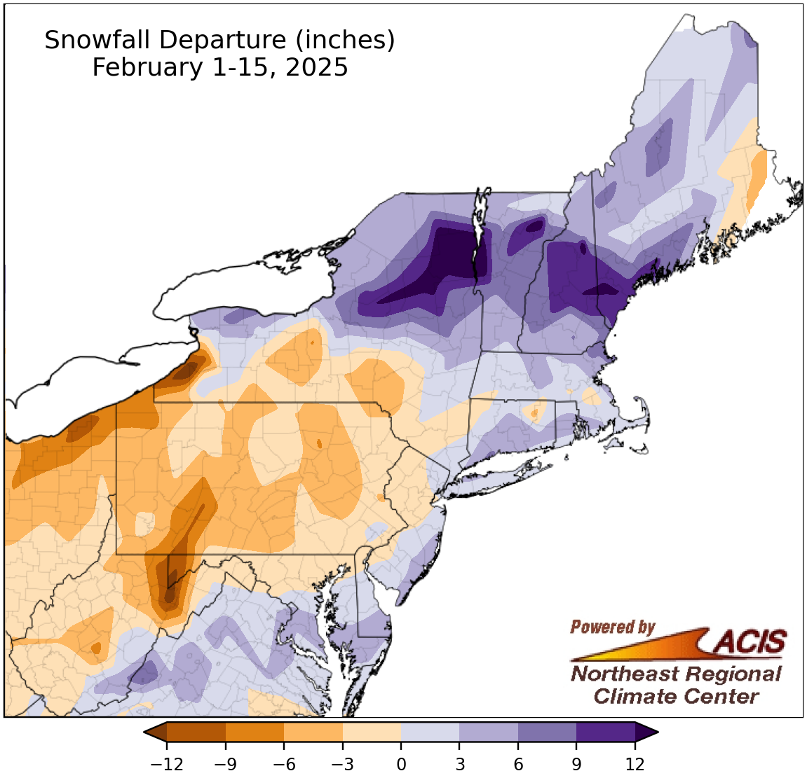
February 1-15 snowfall ranged from more than 12 inches below normal to more than 12 inches above normal.
Snowfall during the first half of February ranged from more than 12 inches below normal in places like eastern West Virginia and western New York to more 12 inches above normal places like northern New York and southern Maine. February 1-15 snowfall for the 35 major sites ranged from 7.1 inches below normal in Erie, PA, to 12.1 inches above normal in Portland, ME, with 21 sites being snowier than normal. This February 1-15 period ranked among the 20 snowiest for seven of the sites but tied several other years as the eighth least snowy for Huntington, WV.
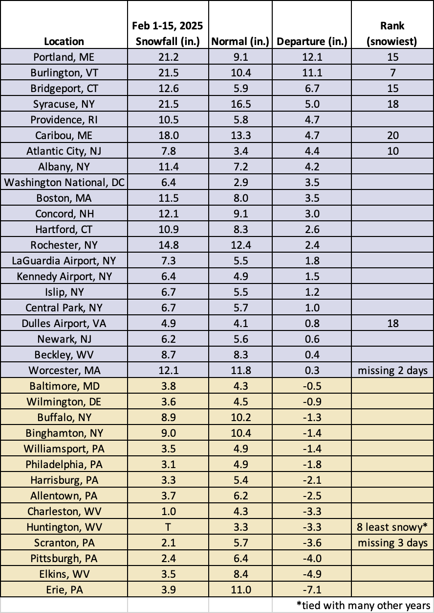
This February 1-15 period ranked among the 20 snowiest for seven major sites but tied several other years as the eighth least snowy for Huntington, WV.