Role Reversal
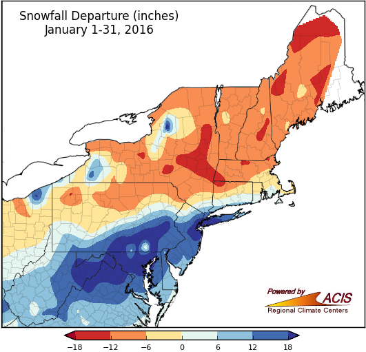
January snowfall varied widely, from more than 12 inches below normal to more than 18 inches above normal.
Northern and southern parts of the region swapped their “typical” weather patterns during January, with the south being snowier and colder than usual and the north being less snowy and warmer. Thanks to the January 22-24 blizzard, snowfall for the month ranged from 6 inches above normal to more than 18 inches above normal in parts of West Virginia, the Mid-Atlantic, southern Pennsylvania, and southeastern New York. In fact, it was Kennedy Airport’s snowiest January on record. The site received 30.3 inches of snow on January 23, more than it normally sees in an entire snow season! With little ice on Lakes Erie and Ontario, some lake-effect areas also saw above-normal snowfall. Twenty-one of the Northeast’s 35 major airport climate sites were snowier than normal, with 17 of them having a top 20 snowy January. However, January snowfall was 6 to 18 inches below normal for parts of upstate New York, northern Pennsylvania, and New England. Six sites ranked this January among their top 15 least snowy.
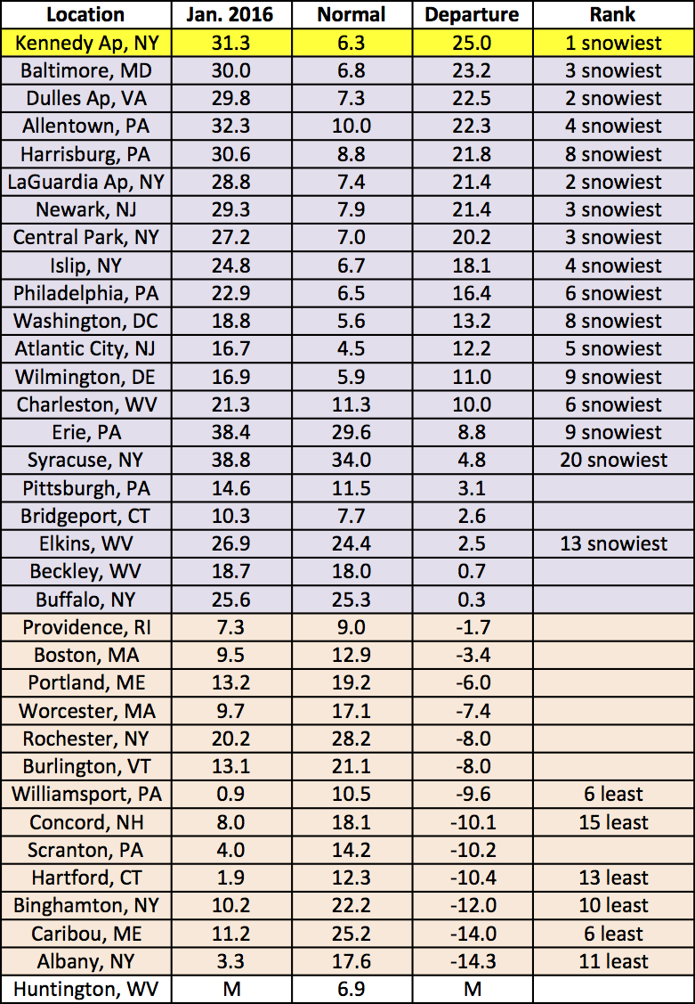
Snowfall ranged from 14 inches below normal to 25 inches above normal at the 35 airport climate sites.
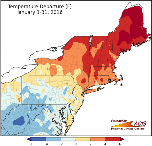
January average temperatures ranged from 6°F below normal to more than 6°F above normal.
In southern areas, average temperatures ranged from near normal to 6°F below normal. The largest below-normal departures were in West Virginia, where Elkins had its 20th coldest January on record. Conversely, northern areas were warmer, from near normal to more than 6°F above normal. Maine had the largest above-normal departures, with Caribou having its 5th warmest January. Overall, twenty-five airport climate sites were warmer than normal, with six sites having a top 20 warm January.
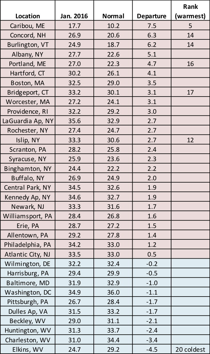
At the airport climate sites, average temperatures ranged from 4.5°F below normal to 7.5°F above normal.
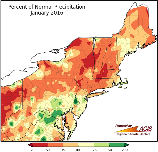
January precipitation ranged from 25% of normal to more than 200% of normal.
A large portion of the region received between 50% and 100% of normal precipitation in January. Some drier areas in western Pennsylvania, upstate New York, and New England saw less than 50% of normal, while some wetter areas in southern Pennsylvania, Maryland, and West Virginia saw more than 150% of normal. As for the airport climate sites, 25 sites were drier than normal, with four of them ranking this January among their top 20 driest. Of the wet sites, five ranked it among their top 20 wettest.
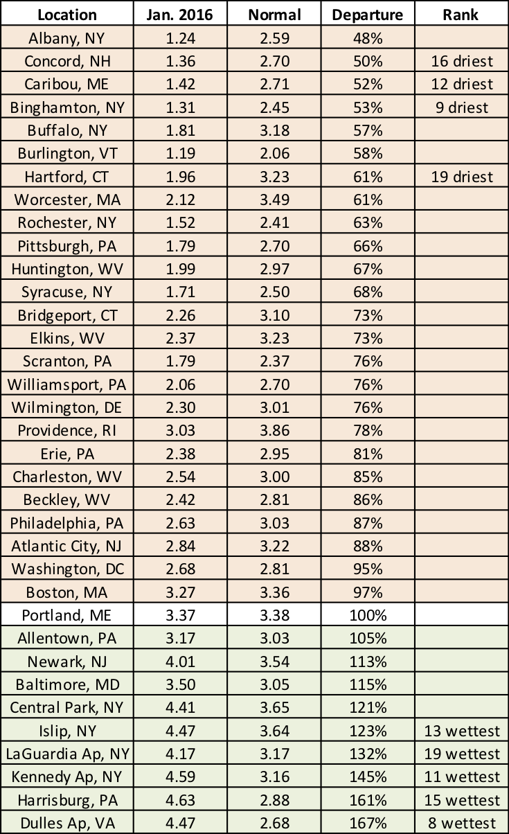
Precipitation ranged from 48% of normal to 167% of normal at the airport climate sites.