Cool Conditions Continue
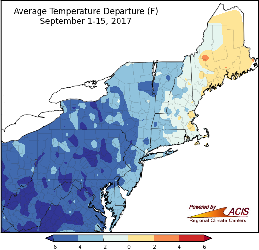
September 1-15 average temperatures ranged from more than 6°F below normal to 2°F above normal.
So far, September has been colder than normal for most of the Northeast. Average temperatures generally have ranged from more than 6°F below normal to normal, with the coldest areas have been in West Virginia, Maryland, Pennsylvania, and New York. Thirty-three of the region’s 35 major climate sites have been colder than normal, with 21 of those sites ranking this first half of September among their top 20 coldest on record. Conversely, portions of Maine and eastern Massachusetts have been up to 2°F warmer than normal. Of the three warmer-than-normal major climate sites, Caribou, ME, had its 13th warmest start to September.
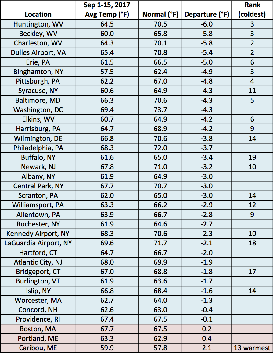
September 1-15 average temperatures at the major climate sites ranged from 6.0°F below normal in Huntington, WV, to 2.1°F above normal in Caribou, ME.
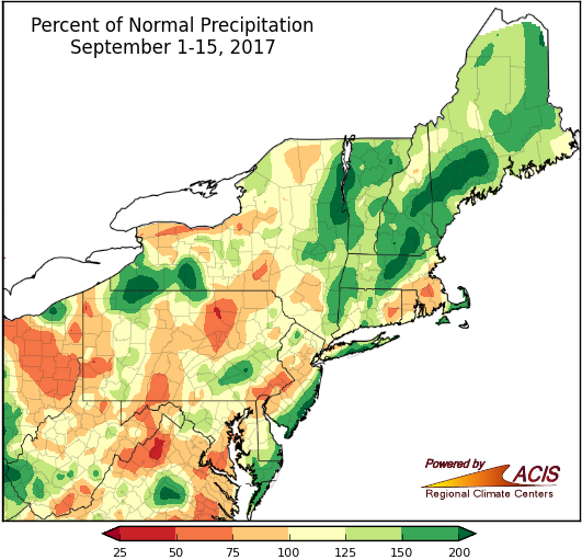
September 1-15 precipitation ranged from 50% of normal to more than 200% of normal.
Precipitation continued to be variable during the first two weeks of September. The driest areas received 50% to 75% of normal precipitation, while the wettest areas received more than 200% of normal. The major climate sites were nearly split, with 19 drier-than-normal sites and 16 wetter-than-normal sites. Ten major climate sites ranked this first half of September among their top 20 driest on record. While abnormal dryness and moderate drought remained in Maine, wetter-than-normal conditions slightly eased the dry conditions.
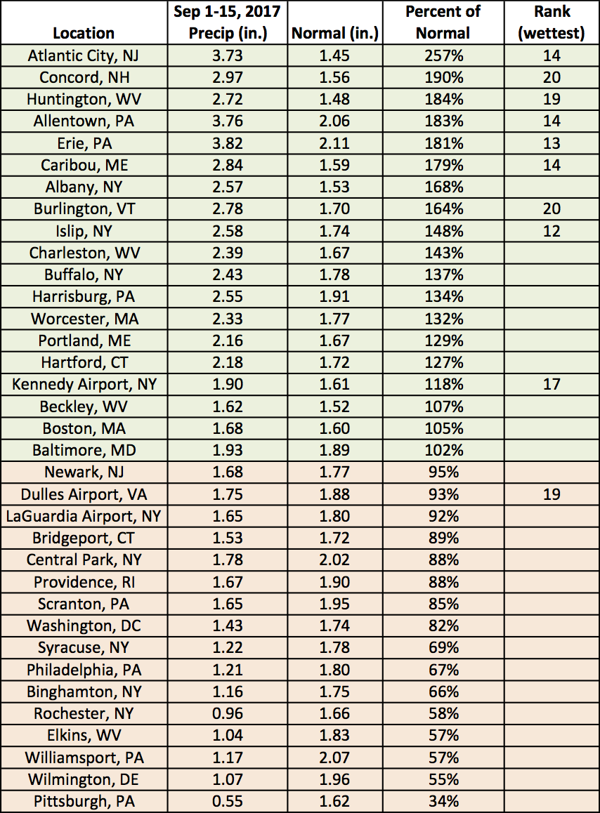
September 1-15 precipitation ranged from 34% of normal in Pittsburgh, PA, to 257% of normal in Atlantic City, NJ.