Extreme Weather in the Northeast
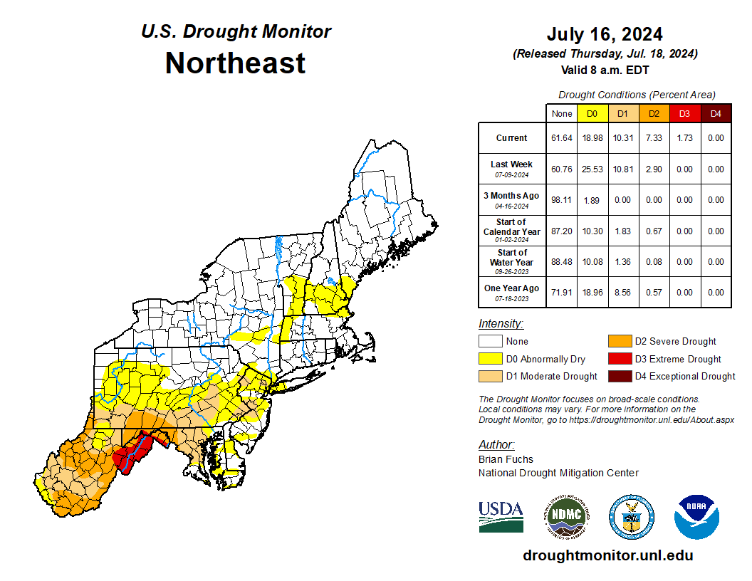
The July 16 U.S. Drought Monitor map shows areas of extreme and severe drought in the Mid-Atlantic. Click to enlarge.
In the July 16 U.S. Drought Monitor, extreme drought was introduced in eastern West Virginia and western Maryland. This is the first time since September 2010 that either state has experienced extreme drought, while the Northeast’s most recent experience with extreme drought was October 2022. Additionally, there was notable expansion of severe drought in those two states plus parts of Pennsylvania. Drought impacts include record-low water levels, failing crops, and burn bans. For more information on drought conditions in the Northeast, see the NRCC’s weekly drought update.
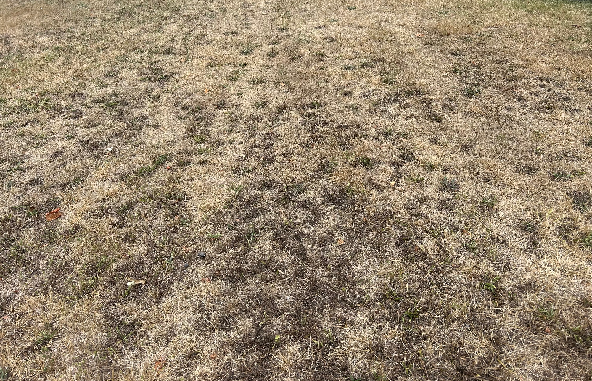
A lawn that has turned brown due to drought in the Mid-Atlantic. Image courtesy of K. Hensell.
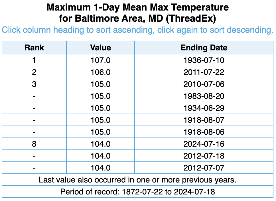
The high of 104°F in Baltimore, MD, on July 16 ranked among the site’s 10 all-time hottest temperatures on record.
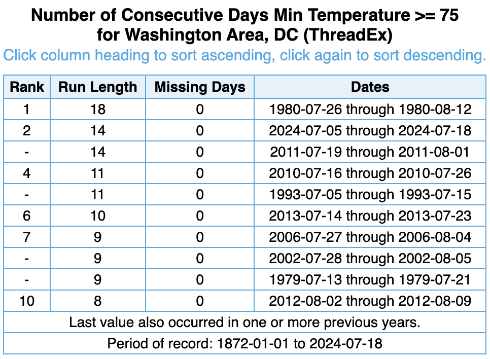
Playing into the drought conditions has been unusually hot weather. For instance, Washington, D.C., and Baltimore, MD, reached 104°F, among their 10 all-time hottest temperatures on record. Meanwhile, low temperatures at multiple sites have ranked among the 10 all-time hottest on record. The heat has also been persistent in some locations. For example, through July 18, Washington, D.C., has seen 14 straight days with a low of at least 75°F, tying as its second-longest such streak. The heat has affected train service in places like the New York City metro area, and there have been several heat-related deaths in Maryland.
Washington, D.C., has seen 14 straight days (July 5 to 18) with a low of at least 75°F, tying as its second-longest such streak.
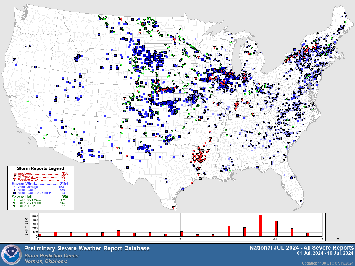
Preliminary map of severe storm reports this July. Tornadoes are indicated by red triangles. Click to enlarge.
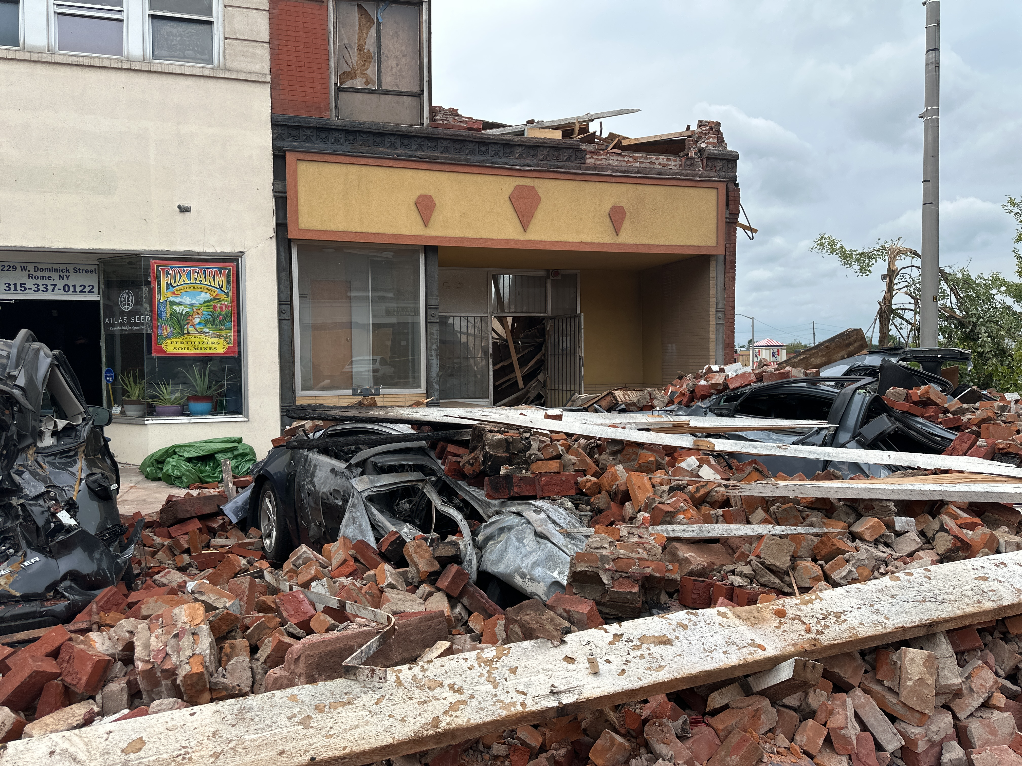
Meanwhile, New York has seen a preliminary total of 15 tornadoes this July, likely more tornadoes than any other month since records began in 1950. The state averages two tornadoes in July and nine annually. Based on preliminary, unofficial data through July 17, 57 tornado warnings have been issued this July, more than any other month since records began in 1986 and more than any other state in the U.S. In addition, New York, along with Pennsylvania, have seen multiple instances of damaging straight-line winds of up to this July. Several people suffered injuries and at least one person was killed in relation to the storms.
Damage from an EF-2 tornado in Rome, NY. Image courtesy of NWS Binghamton.
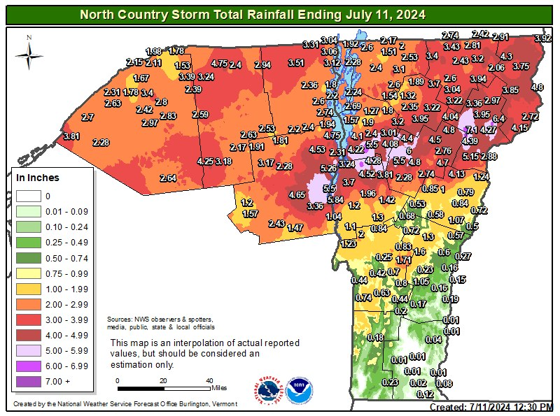
Map from NWS Burlington showing rainfall totals from the remnants of Hurricane Beryl, with the light purple color representing at least 5 inches. Click to enlarge.
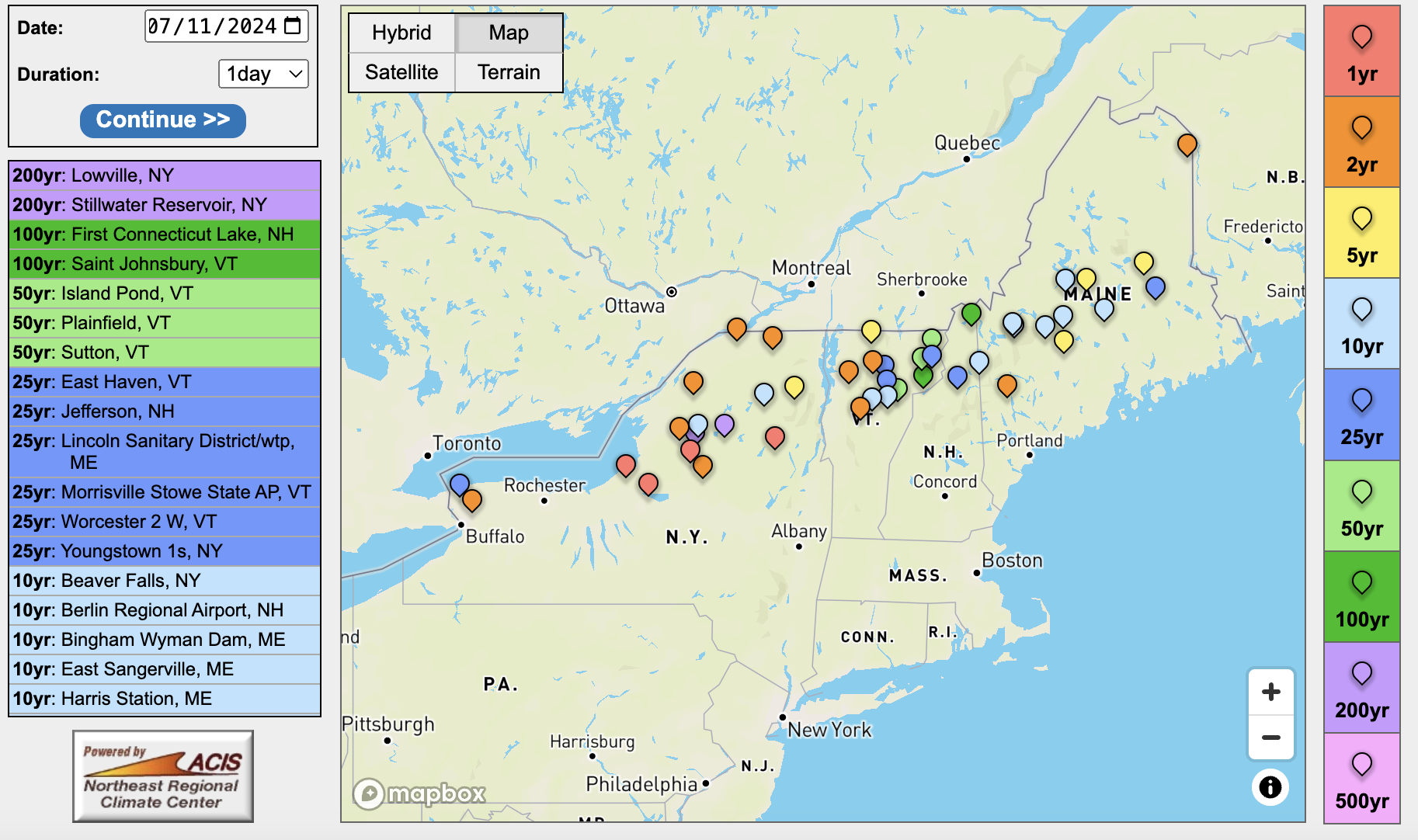
In northern New York, Vermont, and northern New Hampshire, the remnants of Hurricane Beryl produced extreme rainfall that led to significant flooding. Some locations saw between 3 and 7 inches of rain, qualifying as 50-, 100-, or 200-year storm events. A few waterways reached one of their five highest levels on record. The flooding washed away roads and bridges, led to evacuations and dozens of water rescues, impacted public water supplies, and contributed to at least two deaths.
Daily rainfall totals from the remnants of Beryl qualified as 50-, 100-, or 200-year storms events at several sites.

