Record-Warm August
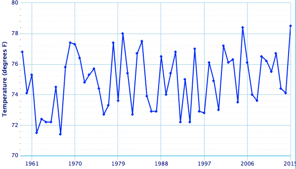
Kennedy Airport had its warmest August on record (with records back to 1959).
With an average temperature of 78.5°F, Kennedy Airport was 3.6°F above normal during August, which is record-warm. The site’s average max temperature was also record-warm. The site did not have a max temperature below 81°F during August, which is the first time on record.
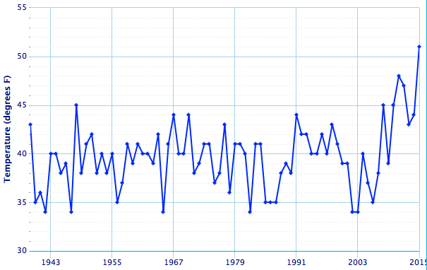
Caribou did not have a min temperature below 51°F during August, which is the first time on record.
Caribou’s average temperature of 68.2°F was 4.6°F above normal, making it the warmest August on record. During the month, the site set a record for greatest number of consecutive days with a max temperature of 80°F or higher with 10 such days from August 14-23. In addition, the site had a low of 68°F three times in August, which has only happened three other times.
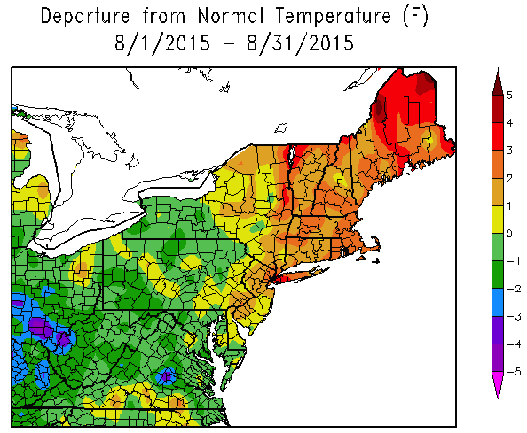
There was quite a contrast in temperatures from northeastern parts of the region to southwestern parts.
While New England and nearby areas saw temperatures that were 1°F to 4°F above normal, West Virginia and nearby areas saw temperatures that were up to 3°F below normal. As for summer, most of the region wrapped up the season within a degree of normal. As for precipitation, August was a drier than normal month for much of the region, while summer was generally wetter than normal, primarily due to the extremely wet June.